
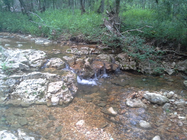
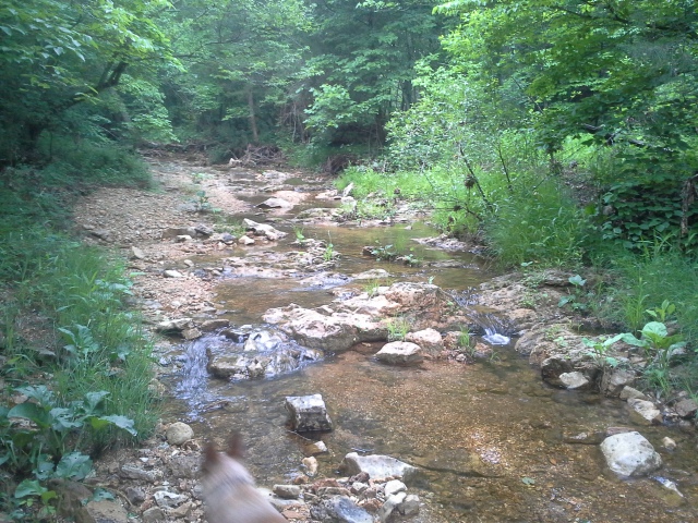
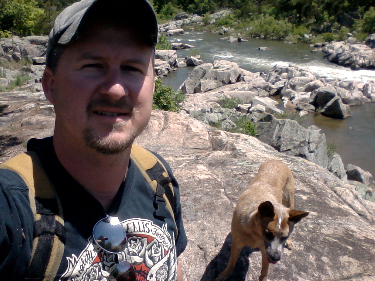
 I am always interested in seeing a new place to hike or camp, at least new to me, and a week and a half ago as I was rambling around Meramec State Park, taking pictures and getting a feel for the place as I was thinking about my review of it, I came across a natural area that I was not previously aware of. It is called the Meramec Mosaic Natural Area, located kind of in the west-central section of the park, and it is 831 acres of bottomland forest that border the Meramec River at one end, and is somewhat cut through the center by the spring fed rippling of Beaver Creek.
 Now, a little information about what a “Natural Area” is. The Missouri Department of Conservation defines Natural Areas as “Missouri’s Original Landscapes”. These are places in the woods around us that are still somewhat untouched by modern progress that generally remain in the same state that they have held for decades, maybe even centuries. Forests and wetlands and prairies and caves and waterways that contain rare native plants and animals, and possibly have geological and archaeological significance. Glimpses into the flora and fauna of the landscapes that were home to the natives of the past, if home to people at all. Places where the ecological balance has been allowed to govern itself, relatively, that are preserved in order to protect the beauty and examples of nature that they possess. Or maybe I’m interjecting my own definition because I’m a fan.
Anyway, a place is designated a Natural Area by the state of Missouri and protected by various organizations, including the MDC, the Missouri Department of Natural Resources, and the National Park Service. We have around 170 spots in our state that are on the list, and they include favorites like Pickle Springs, Elephant Rocks, Johnson’s Shut-Ins, and the Current and Jacks Fork rivers. The complete list can be found here.
A glade, in the Meramec Upland Forest.
The Meramec Mosaic Natural Area is actually one of two natural areas in Meramec State Park. The other one is the Meramec Upland Forest, which is a bit more remotely located, along the northeast section of the Wilderness Trail. Back in the 1970s, the Army Corps of Engineers was in the process of damming the Meramec River at Meramec State Park in order to create a recreational impoundment, that would have created a lake where the Upper Meramec exists today. Favorite campgrounds like Ozark Outdoors and Onondaga Cave State Park would likely be under water, had this not been stopped by citizen’s groups in the late 70s. The land that had been purchased by the Army Corps from private owners in the beginning of the project was then sold to the Missouri Department of Natural Resources, which manages all our state parks. It was added to the acreage of Meramec State Park, and was designated a Missouri Natural Area in 2002.
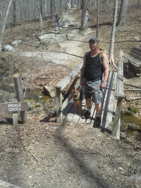
So this past Saturday, with the threat of thunderstorms on the way, a friend of mine and I loaded our dogs and day packs in the car, to head down there to see if we could find Beaver Creek, and the springs that feed into it.
How to get there:
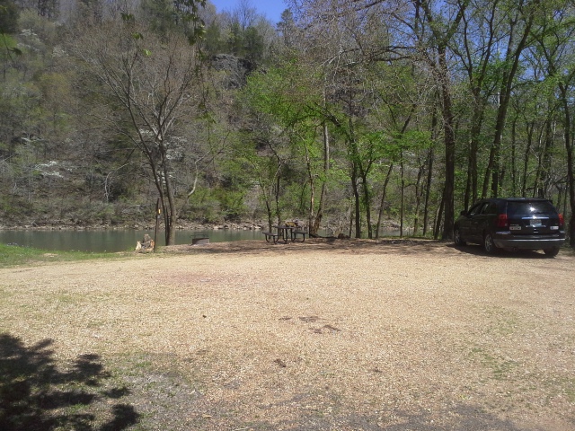
From the St. Louis area at the interchange of Interstate 44 and 270, take 44 west for about 50 miles, to Sullivan, MO. Get off at exit 226 and make a left (south) on MO-185, cross over 44, and continue on 185 south for about 3 miles until you reach the park entrance, which will be on your right side. After passing the Visitor Center, make a right when the road comes to a fork. The road curves around to the right, and then you want to turn left into the boat ramp area. Park in the parking lot, and the trail into the Meramec Mosaic Natural Area is unmarked but visible along the southern side of the parking lot.
 It must also be noted that access to this natural area is also possible along the Natural Wonders Trail, and its trailhead is located at the Visitor Center parking lot.
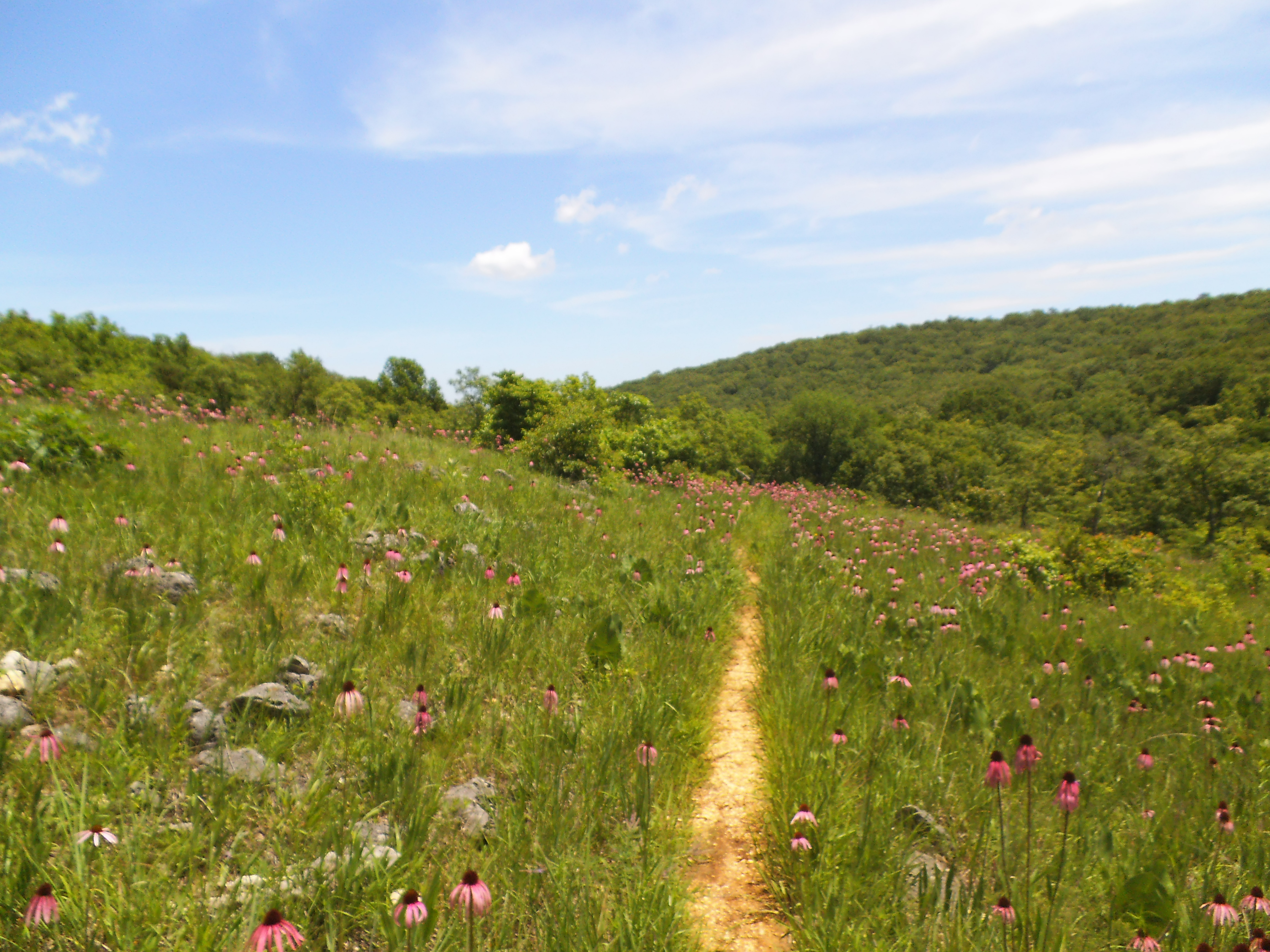
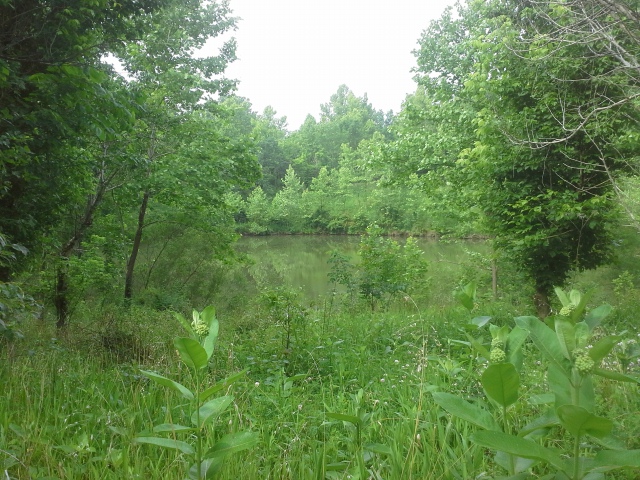
I’m just estimating here, due to a lack of GPS and a more thorough map, but the trail is about half a mile to Beaver Creek. It traverses through some tall grassy areas, past a good sized pond, and to an old concrete bridge that crosses the creek, close to where it joins the Meramec River. It was at this point that we climbed down into the creek bed itself, thankful to get away from the ticks and chiggers residing in the underbrush.
 We hiked up the creek about a mile and a half, crossing here and there where the depth of the water flowing over the carved stone bottom dictated, past a section of small bluffs, and through the forest along flood plain areas and rises that opened up into glades on the hills just above us. At one point we took a break, using small trees hanging over the creek as a temporary canopy while the thunderstorm passed overhead. That is until the deluge was too much and the leaves gave way to the torrent of rain saturating the forest, and the four of us.
We eventually made our way back out toward the Meramec River, stopping to eat the sandwiches we packed, and give the dogs a bit of riverbank play time. Another half mile back through the forest to the parking lot, and our adventure was done for the day.
 What I like about this place:
One of my favorite places to hike is along Coonville Creek, on the Mooner’s Hollow Trail in St. Francois State Park. This area reminded me very much of that creek and the forest surrounding it, which is also a designated Natural Area. A little bit thicker when it came to underbrush, a little darker under the tree canopy, but a very similar place in my opinion.
Who doesn’t like hiking along a creek?!? It reminded me of back when I was a kid, playing along creeks in some of the parks near where we lived. There is a lot of wildlife and opportunities to strengthen your connection with nature along these simple, secluded waterways.
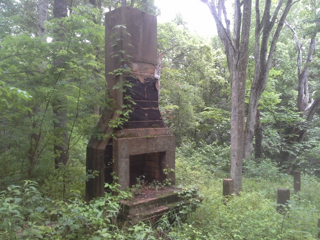 It seems very untouched, most likely due to the limited access and amount of people that spend time in this area. There is however, along the half mile trail to the creek, an old chimney and fireplace, along with some concrete stairs and foundation piers that must be from the people that lived there before the land was purchased for the lake project. You can even see at the top of the stairs where the driveway probably once was.
What you need to know:
 The trail is unmarked and overgrown. Do not go into this area without a compass and a map, and the knowledge of how to use them. It isn’t a huge amount of land that you couldn’t easily walk out of, but the forest can be dark and misleading, and it would be a shame to be walking in circles for hours because you couldn’t determine the direction of the sun.
 As the underbrush is overgrown on this unmarked, unofficial trail…expect ticks and chiggers. I am currently doing research on Permethrin, because even saturated in Deet, the moisture and ticks coming off of the plants as we brushed our way through there was the perfect combination for an itchy and skin crawling experience.
And of course, watch out for Poison Ivy.
 There was something that really compelled me to want to go into this area, and I have to say that I was not disappointed at all. We got rained on and had to pick off creepy crawlies, but it is a really neat place, full of a lot of life along this creek just off in the woods. I would love to see (and even be involved with) a trail developed that would give other people a chance to experience the nature hiding back in the forest, here in the Meramec Mosaic Natural Area. Relatively untouched for years, this is a wonderful example of a Meramec tributary, and the woods that surround it, along a river we all know and love.
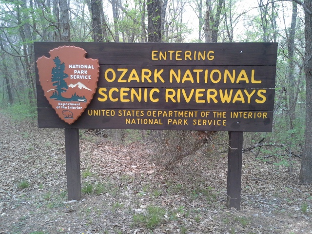
 On a weekend last year in the Ozark National Scenic Riverways, we spent a lot of time looking at rivers and creeks and springs. The multitude of waterways that flow across the face of the earth in this beautiful area, sparkling in the sunlight as they travel along their paths is pretty astounding, and even kind of magical. There are so many inspiring natural places to see, and most of them involve water in some form. However, we discovered one that was not so sparkling and shiny. This was more of the sort to raise a person’s heart rate and work the lungs to gasping…as though a sinister danger loomed ahead. As the sky was darkening with clouds, and the forest thickened on our way down the hill, we braved a trip into the hollow to visit Devil’s Well.
How to get there:
 (Eminence, MO is about 3 hours from St. Louis, and you can take various routes to get there. The directions here are from the intersection of Highway 19 and Highway 106, in the middle of Eminence.)
From the intersection of Highway 19 and Highway 106, take 19 north for about 27 miles, to Route KK. Turn left on KK and stay on it for about 2 miles. The road for Devil’s Well will eventually be on the left. Take that road, with its twists and turns and ups and downs for a couple miles, and you will arrive at a parking lot with a bathroom, next to a pond.
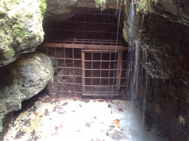
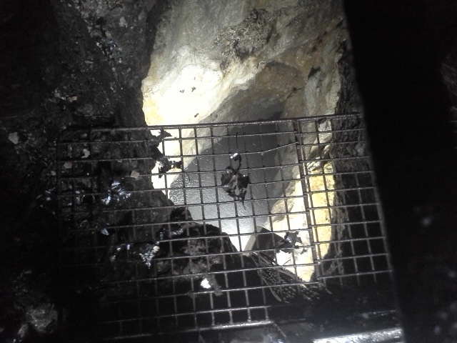 Devil’s Well is actually a surface opening above a massive underground lake. At some point years ago, part of the roof over the lake collapsed, and on the surface above a sinkhole formed. Through the opening of this sinkhole, about 100 feet down, is the 80 feet deep, 22 million gallons of water that make up this impressive (and a little palm-sweat inducing) look into the inner workings of the earth’s plumbing. The water in Devil’s well is naturally collected from the rainfall in the surrounding area, as it flows down through the dolomite and sandstone that make up the nearby hills, and is then deposited into the Current River from the outflow of Cave Spring.
What I like about this area:
 How neat is it really to get to see an example of the part of the natural water cycle that we rarely get a glimpse of?!? I think this is fascinating, and it makes me wonder how many underground chambers and caves full of water are below us everyday. For every spring evacuating water from the ground into a river, there are places like this that we will never get to see, where that water collects and adds to the powerful life-sustaining flow that greets the sun eventually on its way through the valleys between the hills we inhabit.
 There are informational displays there that explain the function of the waterways, the cycle of everything, and the people that have explored this particular one. Really fascinating and worth the time to read. You can also see them in digital form on the ONSR website.
It has an isolated backwoods feel to it, but also a warmth that makes you want to bring a picnic lunch. And maybe a fishing rod, just in case that nearby pond might be holding your dinner for you.
There is a trail that goes from here to Cave Spring, so you can see where the water joins the Current River. It is 4.6 miles roundtrip, and had I done better planning that day, I would have made sure to have time to hike it. I will definitely make it a point to hike it next time!
What you need to know:
 The road to get into there is not for driving your camper down. My Pacifica did just fine, but there are a couple narrow spots and a couple steep spots. Consider your chosen mode of transportation.
As I took pictures, it occurred to me that if I dropped my phone…I would never see it again. Leave anything that you don’t want to potentially lose forever, in your pockets.
The stairway down into it is very convenient, but kind of steep and probably wet. Take small children by the hand.
 It was a frighteningly thrilling sensation to look down into this hole in the earth, as you stand above on what is essentially a slab of rock, that has caved in before to create this opening. But the really amazing part was to get to see this step in the cycle that maintains life on this planet, and creates so much joy in the Ozark National Scenic Riverways. Do yourself a favor and go visit Devil’s Well, and as you peer down at the surface of the water deep below, remember what you saw, because there is a pretty likely chance that you may be in a canoe cutting through that very same water out on the river the next day.
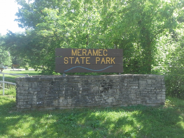
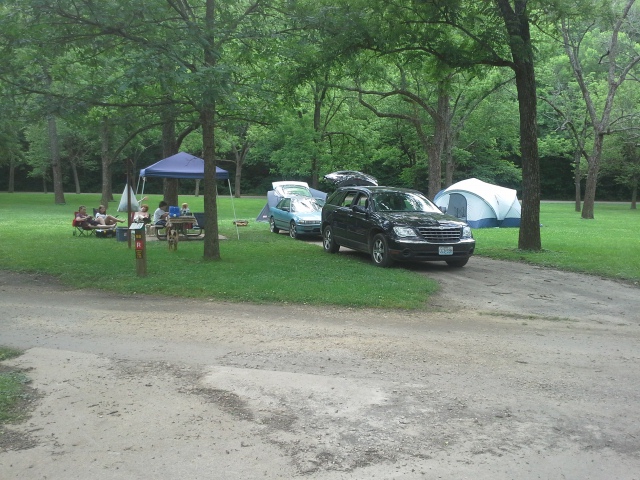
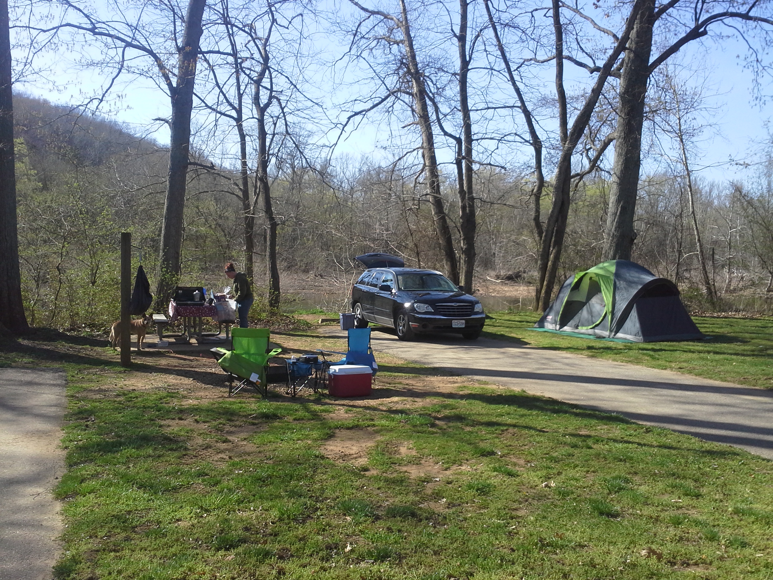
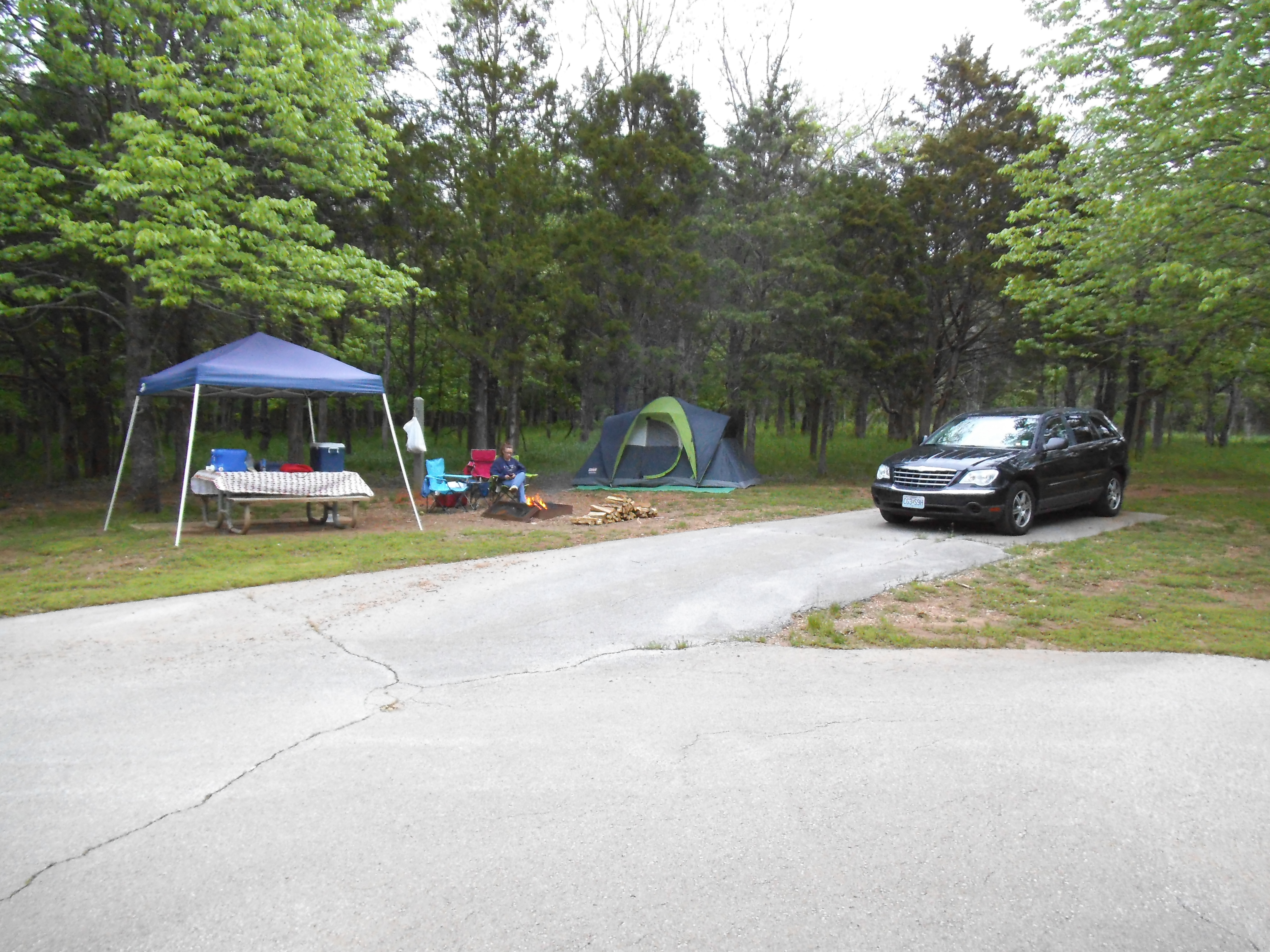
 So it was way past due to go on a long weekend camping trip with all four of our kids, and when asked where they wanted to go, they requested a campground by a river. It had been a handful of years since we had camped at Meramec State Park, so I made the reservation, and we started counting the days until we hit the road. When the day finally came, we packed up all our gear, loaded up the dogs, and headed down Interstate 44 to what I believe to be just about the most popular park in the Missouri State Park system.
How to get there:
From the St. Louis area at the interchange of Interstate 44 and 270, take 44 west for about 50 miles, to Sullivan, MO. Get off at exit 226 and make a left (south) on MO-185, cross over 44, and continue on 185 south for about 3 miles until you reach the park entrance, which will be on your right side.
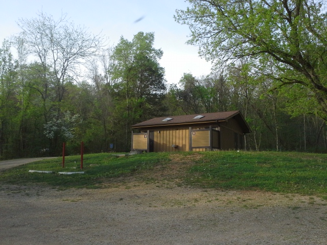
Meramec State Park is an almost 7,000 acre forested area surrounding (in my estimation) almost 6 miles of the Meramec River. It was established by 9 years of dedicated work by the Civilian Conservation Corps, starting in 1933. It has two designated Missouri Natural Areas. The Meramec Upland Forest is 461 acres of mature and second growth trees, featuring Copper Hollow Spring, located around the northeast section of the Wilderness Trail. And then located behind the Visitor Center, part of which can be experienced along the Natural Wonders Trail in the west/central section of the park, is 831 acres of bottomland and slope forest which make up the Meramec Mosaic Natural Area.
Without the CCC, this park wouldn’t be what it is.
For those of you that enjoy the hiking experience (like myself), this park features nearly 14 miles of established trails, including the 8.5 mile Wilderness Trail, which has 8 backpacking campsites along its route for those who want to make an overnight out of it.
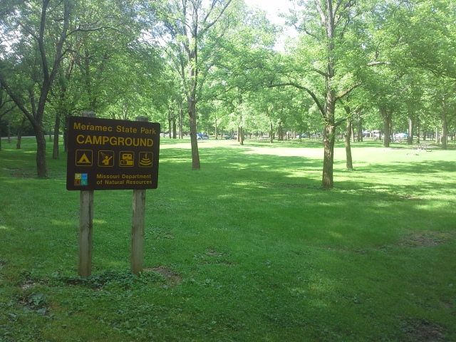
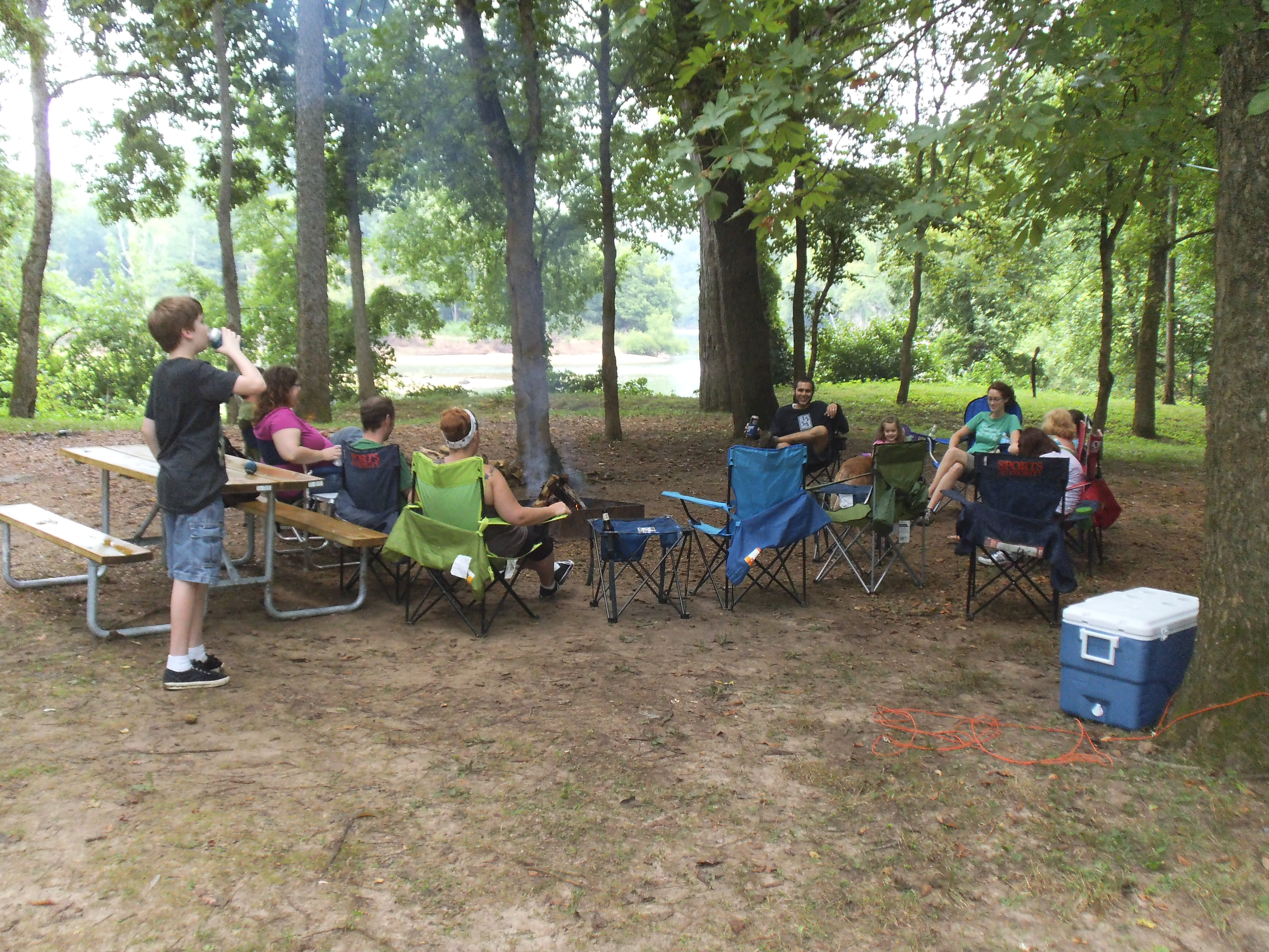
The campground on its own could be a park unto itself. With over 200 campsites, 3 group sites, and all the facilities you could need, it is a favorite summer destination for many families. Along one edge is just over half a mile of the Meramec River, allowing for all sorts of opportunities for fishing, floating, and playing in its lively current.
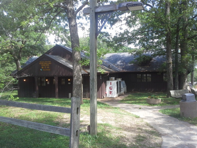 About halfway through the park on the main road is the Fireside Store and Grill, which is located in the Meramec Lodge, built in 1933. They have a small museum about the Civilian Conservation Corps in the entrance, and just about any camp supplies or memorabilia you might want, to remember your trip when you are back at home. Through there, they run the Hickory Ridge Motel and the 19 little cabins that are tucked away in the hills in the park, for those who would like a more civilized version of “roughing it” on their weekend in the woods. They also offer a five mile float on the Meramec River, with your choice of a canoe, raft, or kayak. Check their website for pricing information.
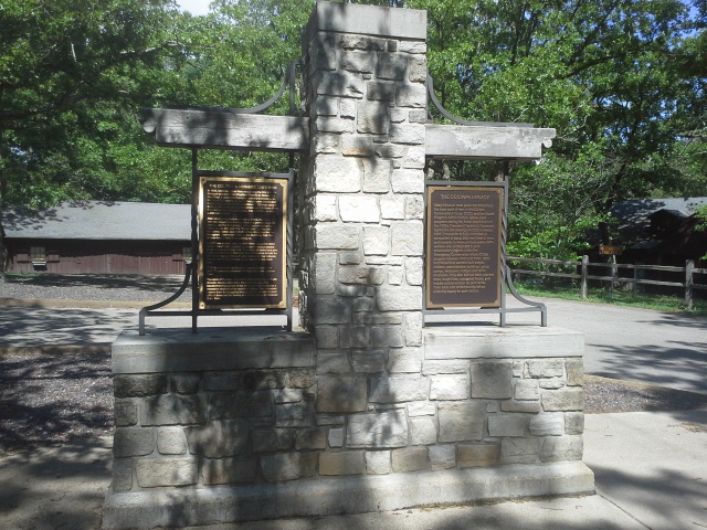
 At the entrance to the park is the Visitor Center. Within it there are displays and pictures and information about the animals that live within the park, and the history of the area (did you know that at one point they were going to dam up the Meramec River AT Meramec State Park, in order to make it a 23,000 acre lake?!?) I can’t emphasize it enough when I say, DO NOT visit this park without spending some time in there. I always learn something new, and that to me, is an important part of the whole experience.
What I like about this park:
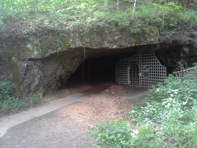
Fisher Cave
All the things there that you can spend your time doing! You can hike. You can float. You can lounge at the beach or play in the water. You can find a quiet spot to cast a line and spend your day pursuing something to fry up for dinner. You can hike another trail. You can have a picnic or a party or even a wedding at one of their many picnic areas and facilities. You can go on a tour of Fisher Cave. You can enjoy a scenic dinner up on top of the hill at the Fireside Grill. You can hike some more. You can check out the Visitor Center and learn stuff about the park and the Meramec River. You can sit by a campfire with your friends and family and pass the evening enjoying life in the woods.
And maybe that about covers it. Oh, and I like it because it is just about exactly an hour from my front door.
What you need to know:
 Even though the campground is enormous, I would highly recommend using the State Park Reservation System, either online or over the phone, especially for a weekend trip.
This is not a “party it up” campground. It seemed like everyone for the most part was keeping it relaxed and comfortable into the evening, and as we sat by the fire with a cooler of beer past the quiet hours (remembering to respect the rules), I enjoyed a pleasant ambiance that floated on the breeze through the campground, with the smell of smoldering fires and moisture rising from the earth.
 I remember camping at this park with friends as a teenager, and making a trip there every few years for the past twenty as my life expanded to include other relationships and my own children. As of late, I have been visiting to hike the trails every couple of months, because there is so much ground to cover and so much beauty to see. I can’t get enough of this park, and I would speculate that most of the people that camp there feel the same way. It has so much to offer for anyone that has an appreciation for the outdoors, and I am inspired by the thought that twenty years from now, my own teenage son will be sitting by a campfire there, maybe with a cooler of beer and his kids sleeping in a tent behind him, and he will look up at the same stars that I was gazing at just this past weekend.
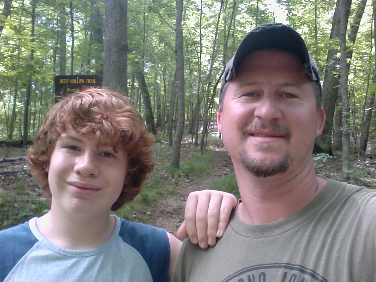
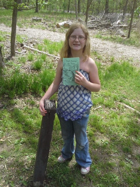
 If there is one place that I have been hiking at for more than half my life, it is Rockwoods Reservation out in Wildwood, MO. My son is thirteen years old, and I was just about his age when I first went there with mom and my sisters. The trail that we probably hiked the most, way back when, was the “Trail Among The Trees”, and on a warm spring Saturday, the kids and I figured it was time to revisit it. So we packed up the dog, filled the water bottles, and headed down the road.
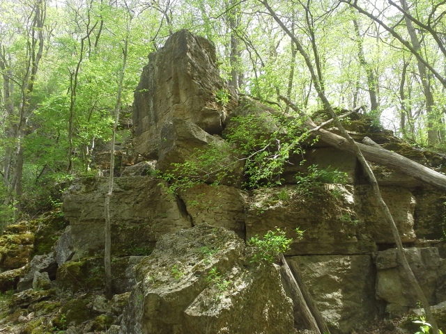
 The Trail Among The Trees is a 1.5 mile hike, starting out across from the north end of the main parking lot. It goes straight back into the forest, following a dry creek bed, and then turns to the left and goes up a lengthy set of stairs. At the top of the stairs you can go left to see the entrance to a cave and some tall bluffs above you. Go right, and you continue on the trail deeper into the woods, hiking over a rise, and down into an open, almost glade-like area, between the surrounding hills. The trail turns to the right, passes a massive boulder, and crosses a bridge to begin the ascent to the top of the main hill on this hike. It switches back and forth, and you eventually get to the top, following the ridge toward the south. The trail comes to a fenced overlook, and then curves to the left and makes its way down and around to the road. Cross the road, and follow the trail back to the Visitor’s Center where you parked.
How to get there:
 From 44 and 270, head West on 44 about 15 minutes to Eureka, and get off at 109. Make a right (north) on 109 and take that about 4 miles to Woods Rd. You will know you are getting close when you pass LaSalle Springs Middle School on the right. When you see the Smoky the Bear fire danger sign, make a left on Woods Rd, cross the creek bridge, and then turn right on Glencoe Rd and into the park. Take Glencoe way into the park to the Visitor’s Center parking lot. The trailhead is across the road, at the north end.
Why I like this trail:
 One of the things that this trail offers which I find to be rare, is that it is an “Interpretive” trail. That means there are things to see and learn about. At the trailhead, the Missouri Department of Conservation supplies an informational pamphlet that lists and describes the points of interest along the way. This whole area was once the site of some pretty intensive quarrying operations, and though nature has taken back the place, there are still remnants here and there of the human influence in the area. Grab one of the pamphlets at the beginning, and as you walk through, make sure to stop and look for all the stuff it points out. Especially if you have kids.
Most of the trail is paved, so if it has been a rainy night you probably won’t encounter any mud to slog through on this one.
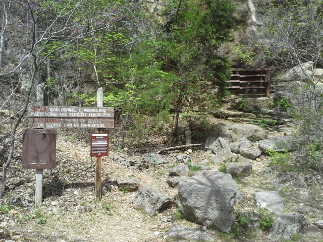 The cave near the beginning has been closed off, but I remember being led into it by a park employee in an educational group more than 20 years ago. I don’t know if they still do that, but it was remarkable. Crawling into holes just big enough to wriggle through, to enter a room that the entire group could gather in, to enjoy the experience of momentarily turning off all the flashlights so that we could see the total darkness that happens underground. That image of not being able to see my hand in front of my face is till vivid in my mind. Spooky and exciting. That was also when I learned that caves are perpetually around 58 degrees, so if you are stranded in the wilderness in the heat of the summer or the freezing cold of the winter, a cave can be a fortunate discovery.
What you need to know:
 I would consider this trail a little challenging. It has some steep and sustained inclines. Take your time and enjoy the triumph when you finally get to the top!
This is the shortest trail at Rockwoods, other than the ADA accessible Wildlife Habitat Trail. If you are looking for a longer hike, check out the Lime Kiln Trail or the Rock Quarry Trail, two of the six trails in this conservation area.
The trail crosses the road twice, and traffic through there is usually very slow and careful. Just make sure the dog is leashed and the little one isn’t running full steam ahead. Maybe, take this as an opportunity to practice looking both ways?
 I think of all the trails in the St. Louis area, this is a great one to hike with kids. They can carry the interpretive pamphlet and lead the pack. It creates a great way for them to establish a connection for themselves with the place, and the people in your group. I saw it happen with my daughter, who still to this day deflates a little bit with a “huff” when I tell her that we are going hiking. She walked along and enjoyed reading aloud the scavenger hunt, and we spent the trail learning together. A trail I have been hiking on since I was young myself.
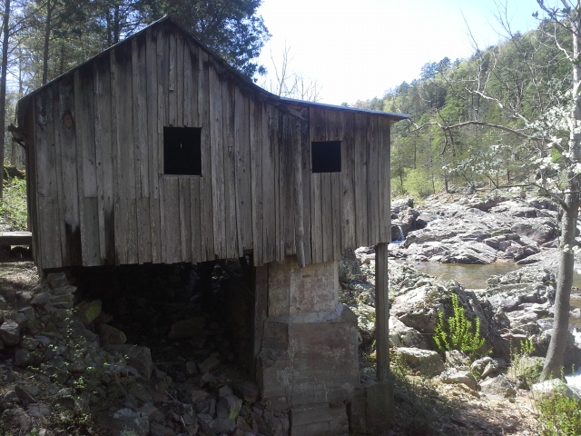
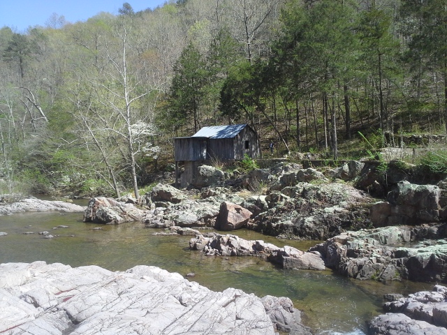 It was the weekend of my birthday, and we had made plans to head to Eminence, MO to see all that we had the time to see in the Ozark National Scenic Riverways. The ONSR is a National Park in southern Missouri, that is home to, and protects the Current River and the Jacks Fork River. Among the sights to see within it, there are a lot of remnants of time gone by. The rich, rugged hills surrounding these gorgeous spring fed rivers have been lived in for a couple centuries at this point by European settlers, and I’m sure by native people before that. I knew there had to be some things tucked away in the woods that were worth seeing, that weren’t the bigger attractions, like the main springs and Alley Mill, and I knew just who to ask.
 The Missouri Scenic Rivers Facebook Group is the first place you should go when you have an inquiry along the lines of “I’m heading to the Ozark National Scenic Riverways in a week or two. What should we make it a point to see?” Among all the great responses I got, from all the helpful and knowledgeable people in that group, one of the names that kept consistently coming up was a place called Klepzig Mill. I knew that we were going to have to check it out.
How to get there:
From the St. Louis area, we took Highway 21 south all the way down to Ellington, MO (around 120 miles), and then right (west) on 106 for about 20 miles or so to Route H. Turn left on Route H, and take it for about 5 miles to another left turn on Route NN. After probably another 5 miles on NN, you will come to a fork in the road. There is a sign there for Klepzig Mill, so turn to the left and head onto County Road 522. After about a mile of “I wish I had a Jeep”, you will come to the lively Rocky Creek, an Ozark Trail crossing, and the mill on your right. There is a little open area to pull off to on the left that could probably fit just a couple of cars.
 Why I like this place:
After the drive in, experiencing the ruggedness of the surrounding forest, I couldn’t help but wonder how unforgiving, yet completely satisfying life in a place like this would be for the people who used to live here. The story behind the mill is that it was built by Walter Klepzig, the son of a Prussian-German immigrant, in 1928. He was a local farmer who saw an opportunity, and helping to supplement his agricultural income, constructed the mill to cut the local forest to usable planks, and grind the grain that the surrounding community needed. This spot along Rocky Creek, back here in the woods, turned out to be the perfect place for such a useful structure. And I sure do love a story of the history behind places like this!
 It is certainly secluded. I’m sure it gets its fair share of visitors throughout the year, but it seems like a hidden gem, and it is definitely worth seeing. I would imagine that it has been a favorite place of every hiker that traverses the Current River section of the Ozark Trail, as it passes by there.
It is just…so…scenic. The water flowing around, over, and through the rocks. The mill structure, off to the side. The forest, the hills…everything. It is hard to describe. This is a really neat spot.
 What you need to know:
The parking spot is listed as being for day use only, so I suppose that if you were wanting to camp in the woods nearby off of the Ozark Trail, it would be more appropriate to park at a designated Ozark Trail lot, and hike in however far it might be.
As usual, there are creatures in the forest. We stumbled across a couple snakes, sunning themselves on some rocks, when we showed up. Be aware, and respect the area and the animals in it.
 The road in was a bit wet and sloppy and I drive a Chrysler Pacifica, but even WE made it in there and back, with just a couple splashes of mud. Just don’t drive your camper back in that exaggerated jeep trail, and you will be fine.
Of all the places I have seen in Missouri so far, this is now on my list of favorites. When I go to a place, I really try to absorb the feeling that an area emanates…really just soak it in…and this one felt familiar and warm. A sense of the history there, back in these rugged forests, that holds itself as an example of the resilience and determination of the human experience. The stories of the people that lived along Rocky Creek, their struggles and triumphs, and the connections that they had to this place…they are retold through the movement of the water, the silence of the stone creek bed…and the weathered planks of Klepzig Mill, standing there among the trees. I am glad that I got to see it, and I look forward to when I have another chance to get back there.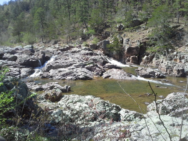
 It was a nice Sunday, weather-wise, and I wanted to go to a place that we had never been to before. Some place that wasn’t going to involve a long hike, but with some scenery that was worth checking out. The place at the top my list was Millstream Gardens Conservation Area. I have passed by it now and again, and I thought it was about time that we stopped there and saw what it had to offer. We were not disappointed!
How to get there:
 From south St. Louis County at the 55/270 interchange, take Interstate 55 south around 20 miles to Highway 67 south at exit 174B. Then stay on 67 south for about another 52 miles, to Highway 72 at Fredericktown, MO. Go right (west) on 72 for about 8 miles, and it will be on the left (south) side of the road.
From the entrance at 72, take the road back until it forks at the Millstream Gardens Conservation Area sign. If you turn to the right, it will take you to the archery range and the access points to the St. Francis River. If you turn to the left, it takes you to the parking lot for the trail to the river and beyond.
 The mile long trail is a series of paved switchbacks, with a couple boardwalk watershed crossings, that takes you out to the observation deck and bluff area above the St. Francis River. Once you reach the river, the trail then turns and heads (unpaved) another mile and a half to the Turkey Creek Picnic Area, which is part of the Silver Mines Recreation Area.
What I like about this area:
 Once again, ANOTHER waterway near Fredericktown, MO that is just absolutely gorgeous. This section of the St. Francis River contains the Tiemann Shut-Ins, which is a striking collection of granite obstacles within the river, creating a series of rapids that would be a fun challenge for even the experienced kayaker.
Along with all the rocks in the river, the boulders along the river bank are a lot of fun to climb and scramble around and over. It definitely stirred a desire I remember from being a kid, and Max and I spent a little bit of time exploring this natural playground.
 This is one of the few Americans with Disabilities Act trails that I have come across so far, and the level paved path to the observation deck would be quite an easy stroll for anybody.
What you need to know:
There were some shortcut trails between the switchbacks on the trail in, and along these shortcuts (and the trail itself) there was a good amount of noticeable Poison Ivy. Be warned, and stay on the path.
 I didn’t see any directly (just movement in the grass), but I would imagine that there are quite a few snakes in the area, especially among the boulder areas. Don’t go stickin’ your hand into places you can’t see into.
Every year they have the Missouri Whitewater Championships here because there are some challenging spots on this section of the St. Francis. Just from my riverside observation, I don’t know that I would be willing to take a canoe through it, and I think I would definitely find a different spot to take the family to if we were wanting to play IN the river.
 So there you have it…yet ANOTHER waterway near Fredericktown that is ridiculously scenic. I would start getting jealous if I didn’t feel so lucky to live within a couple hours of it. This really is a place that you have got to see. We were only there for a short time, and I am already devising a plan to go camping at Silver Mines so that I can spend more time climbing around on the boulders along the riverbank with Max, the adventure dog.
 So if you are checking out this blog, it is probably a likely fact that you HAVE spent a weekend out in the woods. And it is also likely that you probably spent that weekend in an area with a lot of other people around, at their own campsites right next to yours. Now I really enjoy the chilly peace of off-season camping, the quiet isolation of backwoods backpacking, or finding a Conservation Area that isn’t too frequented, but for most of us the typical camping experience is usually filled with the noise and life of other people sharing the campground, and the banter and revelry and family fun that comes with it. Don’t get me wrong, most of the time it is a good thing and is filled with good people. People, who just like you, have an appreciation for the outdoors. People, who just like you, want to spend a weekend enjoying life with their families. And people, who just like you, are sometimes more focused on their own moment than the neighbors in the next site over. Spending a weekend in a campground is a lot like having temporary roommates. You are usually far enough apart that you have your own space, but not far enough that you don’t affect the experience of each other.
 As the know-it-all that some people might like to tell you that I can be, I wanted to cover a couple of things that I think are important about camping etiquette. Things to think about when you are somebody’s campground neighbor. I’m sure that all of you are the best at it already…so think of this as a refresher. Maybe this is one that we need to just have all our kids read?
Walking through other people’s sites.
Your typical campground usually consists of one or multiple loops, with campsites in the middle and around the edges…and the bathrooms can be sparse. Most of the time you will find a well worn path between the sites that will lead you to the toilet, but if you can’t find one, respect your neighbor’s space and make it a point to give them and their site a wide berth as you head off to the bathroom. You aren’t encouraging the old guy who yells at the kids to get off of his lawn, you are just being courteous.
 Observe the quiet hours.
Man, I love the birds in the morning and the revelry around a fire at night, but not all people share the same sleep schedules. During one trip we went on with the kids, the people across from us consisted of a group of preteen girls and some parents. For the two mornings that we shared with them, those girls were up and giggling and talking loudly and tromping around before the sun was. We were so happy when they left and we were staying another night, as we knew we would get to sleep in after dawn the next morning. And stay up by the fire and have another beer, for sure…but when the sun goes down, adopt a softer voice and an easier demeanor. Your neighbor may be planning on taking his little kids on an early morning hike, and it would be rude to preemptively ruin it for them. Maybe stay in a campground that has a late night section. Ultimately, pay attention to the noise you make, especially the kids you are responsible for, and be considerate of those at the next site over.
 Curb your dog.
Now my dog is not a social dog, but he is usually either right next to me or tied to a lead. Sometimes we will have a dog from another site wander over to say hello, and I do my best to put Max where he won’t be aggressive, because he (is a big scaredy-cat) doesn’t take to kindly to strangers. Please observe campground rules and keep your dog leashed, as is necessary. For other camping with your dog thoughts, check out my earlier post about it here.
 Bathroom thoughts.
Don’t pee on the seat. It isn’t hard, just lift the seat. Other than the occasional gross shower, that is probably the biggest problem I regularly notice. And that is only in the men’s room, as it would be inappropriate for me to have any knowledge beyond that.
And don’t forget to turn off the water after you have washed your hands or taken a shower. You know that timed shower button that doesn’t give you enough water to rinse your hair? That was installed because people didn’t turn off the water.
 Don’t leave trash everywhere.
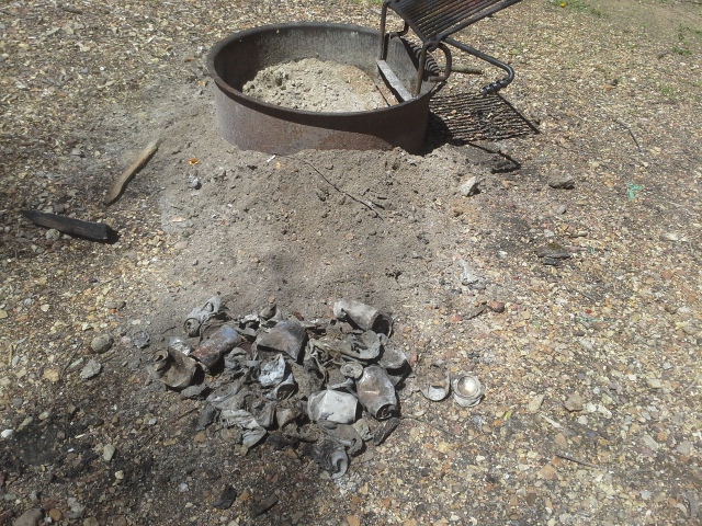
If there is one thing that I can’t stand, it is garbage in nature. It just doesn’t belong. The edge of the forest, the side of a trail, the campfire ring…are not nature’s garbage cans. The only thing that I will throw in the fire, that doesn’t get put in a trash bag, are paper products. Please, please, please dispose of your trash in the proper receptacle. It is not only good for the ecology of an area, it is also good manners. Don’t be that guy that leaves his trash bag full of cans and dirty baby diapers at your site for the next family looking to spend a weekend of fun in the forest. Take it to the dumpster in the park, or if you have to pack it out, double or triple bag it (if you are like me) and put it on top of a tarp or something in the back of the car that can be easily washed if the worst case scenario happens.
 I try to approach every trip to the woods with a sense that I am a guest at someone else’s house. It would be rude of me to trash the place and pee all over the seat and keep them up all hours with my partying, and I don’t think it would help the experience for anyone. Go to nature and soak in the life of it. Stay up a little later and have another beer. But respect it, and respect the other people around you by practicing good campground etiquette.
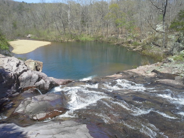
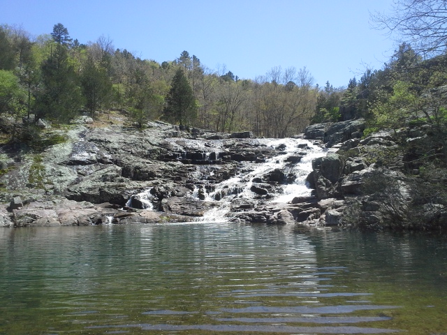 On the weekend trip that we recently took down to the Ozark National Scenic Riverways, we did our best to get out and see some of the scenery in the area. One of the places that we stopped by was Rocky Falls. It is a scenic picnic area southeast of Eminence, MO, near the northern border of the Peck Ranch Conservation Area. The creek that flows though the area is coincidentally named Rocky Creek, and in this spot it cascades down ancient exposed rock and into a pool below.
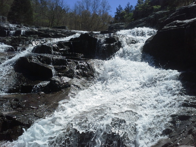 Now I am no geologist, but the rock it washes over is apparently called rhyolite. In most areas in Missouri (as far as my uneducated self knows), the creeks and streams make their way over and through sedimentary dolomite limestone, which is softer so it tends to erode over time, changing the course and depth of the waterways. Rhyolite is volcanic, as it was pushed as molten rock to the surface about 1.5 billion years ago, and is much harder so it stands up better to the forces of water. When the creek had washed away all the dirt and softer materials from the area over time, the harder rock remained and formed into the cascading beauty that is Rocky Falls.
 How to get there:
From the St. Louis area, we took Highway 21 south all the way down to Ellington, MO (around 120 miles), and then right (west) on 106 for about 20 miles or so to Route H. Turn left on Route H, and take it for about 5 miles to another left turn on Route NN. After just a couple miles on NN, you will come to a right turn that is the entrance to the area.
 What I like about this area:
There are some places that you just want to spend time in. Maybe you want some peaceful contemplation, a hike through the woods, a picnic with the family, or a good place to find a spot for a nap in the sun. Rocky Falls is one of those spots that would be perfect for all of the above.
One thing that I like to say is that a trail or a campground needs a water feature. A part of it that has a creek flowing through, or a lake to take a walk around. Something recreational and full of life and that smooth way the water moves that is fun to watch. This is one of the more memorable ones that I have seen so far.
 What you need to know:
The area facilities include bathrooms (I did not check to see if they had running water. Doh!), picnic tables, and fire grills.
As far as I know, camping is NOT allowed (It sure would be a neat place to spend the night next to).
There is a walking trail apparently, but I think I was so focused on the falls that I totally missed it. I also could not find any details online about it. Maybe it is just in reference to the trail from the parking lot to the water’s edge?
 There are SO MANY things to see in the Ozark National Scenic Riverways, and this is definitely one of the cooler ones. Max (the explorer dog) and I climbed up the rocks for a bit and surveyed the area below. In a future trip to this part of Missouri, we are going to have to make it a point to visit again. It is just too pretty to pass up. If YOU haven’t seen it yet, put this one on your list.
 It was the weekend of my 36th birthday, and I knew that I had to do something a little bigger than my normal pack up the car and go to the woods for the weekend camping trip. Head out a little farther than usual. Get to a place that I really needed to spend some time in. A couple months earlier, as I was trying to figure out where I wanted to go, it dawned on me that I really needed to get down to Eminence, MO and spend some days around there, checking out the natural and historical beauty of the Ozark National Scenic Riverways. The last time that I had floated on the Current River was about to be half my lifetime ago, so I knew it was way past due, and I had to get back there.
The Ozark National Scenic Riverways is a National Park established to protect the Current River and the Jacks Fork River. Most places (but not all) to go and see within the park can be reached from somewhere along either Highway 19 or Highway 106. Eminence, MO is at the intersection of the two, making it somewhat at the center area of the park. Among ALL the cool things to do and see within the park, camping is one of the primary activities. The ONSR, as it winds along the boundaries of these two gorgeous rivers, offers an incredible amount of opportunities to set up a tent and stay for the night. There are six main campgrounds, offering electric and non-electric sites, with typical bathroom, shower, and trash facilities. Along with those, there are ten backcountry areas that offer a more primitive experience, and probably have at most a vault toilet. Some sites throughout the campgrounds can be reserved online at www.recreation.gov, which I would imagine is the way to go for a trip in the heart of the summer. Beyond that, most sites are first come/first served.
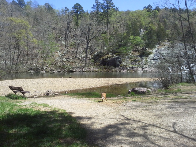
 Now like I said, it had been a long time since I had spent a full weekend around that area, so as I was trying to determine where we would stay for this trip, I figured that Two Rivers Campground was probably the place to head to. Where the Jacks Fork and Current come together, just a handful of miles to the east of Eminence, this was probably going to be the best option for a good home base. It was close enough to get out and about to see the sights, and it also had the Two Rivers Canoe Rental right there in the campground, with their general store for whatever you may need, and floating services because you HAVE to spend some time ON the river. Not to mention some of the nicest people you could meet at a campground, working there.
 How to get there:
From the St. Louis area, we took Highway 21 south all the way down to Ellington, MO (around 120 miles), and then right (west) on 106 for about 20 or so miles to highway V. Make a right (north) on V, and the campground is about 3 miles, where the road ends.
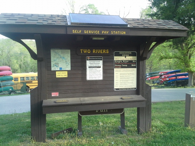
Two Rivers Campground has 19 standard non-electric sites ($14 per night), 2 group sites ($100 per night), and then 3 sites ($5 per night) tucked away down by the river. There is a shower house and water spigots and dumpsters. There is also river access throughout, with two boat access areas as well.
 What I like about this campground:
We got lucky as it wasn’t a busy weekend and we had arrived early on Friday, so we got our pick from the best spots. We chose #22, right on the river. In my opinion, the best in the place. Can’t beat sitting by a fire watching the river go by. Waking up to it flowing past, covered in mist as the sun breaks out over the trees. Awesome.
When we signed up for a canoe trip along the Jacks Fork for Saturday, the nice young lady working at the general store told us that they could pick us up from our camp site to take us to the drop off at Alley Spring, and that we can float all the way back to our camp site and they will come by and get the canoe eventually. I’m sure in the busier months, that sort of flexibility and personal touch might be understandably a bit more difficult to achieve, but I thought that was really nice on their part. A 14 mile canoe trip, beginning and ending at our camp site. You can’t beat that.
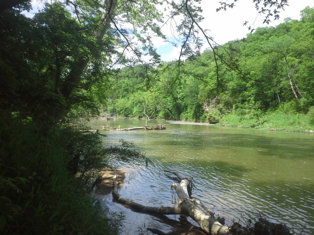
The confluence of the Current and Jacks Fork Rivers is something that everyone should see. Sure, it isn’t vast and dramatic and super-sized like one would usually expect two waterways coming together to be, but like everything about these two rivers, the natural beauty of it is something that can only be truly realized floating through it, or standing on the hillside above it. And it IS a striking natural beauty.
What you need to know:
Again, we were there in late April and we got there early on a Friday. It was peaceful and serene and we were really lucky to get that. I would imagine on the busier weekends that it is a bit more hectic around there. Don’t let that deter you. Just reserve a campsite in advance and get your float trip lined up with the good people at Two Rivers Canoe Rental before you head out that way.
 We floated on the Jacks Fork from Alley Spring to Two Rivers. It was a 14 mile trip, and with short stops here and there, it took us about six hours. Something that I thought, coming from my recent experiences floating on the Meramec River the last couple of years, is that the water is colder (spring fed), deeper, and faster than what I was used to. Nothing to be alarmed about, but it seemed a bit more wild than what I personally am familiar with. We didn’t tip, and for the most part never felt like we would, but I would make sure my kids wore their life jackets whenever the canoe is in motion.
As I am sure happens along all rivers everywhere, the little black flies around the campsites were annoying. They didn’t bother us as much though, after spraying a bit of bug spray and getting a campfire going. Sunday morning though, after I took a shower…well I guess I must have really fancy smelling shampoo.
 This was an incredible weekend that was filled with exploring, relaxing, and taking in all of the natural beauty of these two rivers for my birthday. We didn’t get to see anywhere near all that is in the Ozark National Scenic Riverways to see, but we will definitely be back when the next opportunity arises. For a first trip there in a long time, at the confluence of the Current and Jacks Fork Rivers, Two Rivers Campground was the perfect place to stay.
 It was Easter Sunday and it was going to be gorgeous out, so I knew we had to go spend some time in the woods, or what I sincerely refer to as “my church”. There is a place down by Farmington, MO that in some areas almost reflects the grandeur and awe that can be inspired by visiting a cathedral, and we hadn’t been there in a couple years, as a family. It was the perfect day to go visit Pickle Springs Natural Area, and hike the “Trail Through Time”.
 Pickle Springs Natural Area is a block of 180 acres of land managed by the Missouri Department of Conservation. It has a 2 mile loop trail and features quite a bit of cool geological formations to hike around, over, and through. The primary rock that forms the different features is sandstone, and through the course of time and wind and water, it has been carved into different shapes. There is a short canyon to pass through that feels like a cave with the lid removed. There is a set of double arches that is a popular picture spot. There are little waterfalls here and there, and towering walls of exposed rock looming throughout.
How to get there:
 Pickle Springs is off of Highway 32 between St. Genevieve and Farmington. I find that taking Interstate 55 south tends to get me to 32 faster, but it is closer to the Farmington end of it, so you could take Highway 67 and probably get there in about the same amount of time.
From the interchange of 270 and 55, take Interstate 55 south for about 50 miles, until you reach MO-32. Go right (west) on 32 for about 18 miles or so to AA. It will be a left turn (east) onto AA, and after probably not even 2 miles, you make a left turn (north) onto Dorlac Road. About half a mile up on the right is the parking lot and trailhead.
What I like about this trail:
 There is a lot to look at! I think for the relatively short length of trail, with all the rock formations and streams trickling through, that this is probably one of the best in Missouri to check out. A lot of bang for the effort invested.
It has a multitude of different plant species that apparently are uncommon in other parts of the state. Plants that are referred to as “Glacial Relict Species”, thanks to the micro-climates throughout this area that mimic what the climate was like thousands of years ago. A lot I don’t know about, but pretty cool nonetheless.
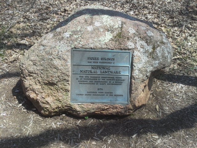 Pickle Springs Natural Area is registered as a National Natural Landmark, and deserves every bit of recognition it receives for its diversity and beauty.
What you need to know:
This is a bit of a rugged trail, so be warned. There are some good, healthy ups and downs, and some of the rocky areas can have some tall steps. Take some water with you and take the time to see everything.
 The name Pickle Springs inspires in me some fun place akin to a water park or river resort. As it is a fun place, take care to not disrupt or injure the rock formations or plant life. They are precious and we are lucky to get to see them.
This can be a pretty popular trail, so be patient and allow the people in front of you to snap their pictures, and be mindful of those behind you that want to take pictures too. Also, there is a trash can near the beginning of the trail, so please dispose of your garbage in it, instead of along the trail.
 I first hiked at Pickle Springs Natural Area a number of years ago, and it will forever remain one of my favorite trails in Missouri. Every time we camp at Hawn State Park for a weekend, we make it a point to visit this beautiful area. If you haven’t been there yet, put it at the top of your list. This is one place, that for the amount of trail to hike, you definitely get an overabundance of neat stuff to see.
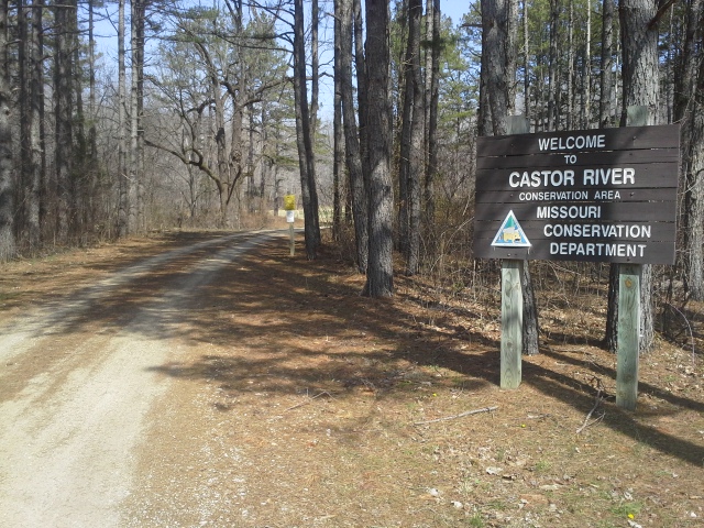 Well it had been a couple of weekends of camping on my own and with the kids, and for once my gal was going to get to go with me. As it happens sometimes, I have the motivation and energy, but no plan…and I really didn’t know where I wanted to go. After asking the question on the Facebook Page, Missouri Camper Mostreamteam Thomas suggested the Castor River Conservation Area. I had heard the name before, but had never gone to check it out, so I made the decision to head in that direction for the weekend.
We got kind of a late start Friday evening, so we stayed at Hawn State Park, which for a weekend in March was already pretty crowded. It is a favorite for quite a few people! After a rainy night, Saturday morning we packed up the tent and continued on our way, as we were about halfway there.
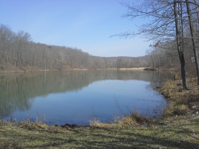 The Castor River Conservation Area is mainly made up of four sections that run in a north/south line off of Highway 34, between Highway 67 and Marble Hill, MO. There are two designated campground areas, one in the northernmost section and one in the southernmost, which also has a horse camping area as well. In one of the sections just north of Highway 34 is an 8 acre lake, which has Bass, Catfish, and of course your typical variety of Sunfish. In the southernmost section lies the Blue Pond Natural Area, which is apparently the deepest natural pond in Missouri. Unfortunately the gate to its parking lot was closed, so that was one thing we didn’t get around to seeing this time (we could have hiked it if we had wanted to, but this was a weekend to relax). There are also almost 20 miles of hiking trails to explore, either by mountain bike, horseback, or good ol’ hiking shoes (again…reeeelaxing). Primitive camping is allowed in most areas as well, as long as you are at least 100 yards from all public access roads, open fields, parking lots, or where otherwise designated. In the southernmost section you will also find the shooting range, and the only vault toilet in the area. And if you hunt, well, then there is even more for you to do, as this is conservation land. Check the MDC Website for all rules and regulations.
How to get there:
 Coming from the St. Louis area, you have two options, but they both involve Interstate 55 south. The route we took was 55 south about 70 miles to Perryville and Highway 51. Take Highway 51 right (southwest) about 35 miles to Marble Hill. In Marble Hill you want to make a right (west) on Highway 34. After about 12 miles on 34, you will come to the junction of Route MM (on your right) and Route Y (on your left). Turn left onto Y to head to the southern two sections, or right on MM to go toward the northern sections. For the record, this route tends to be pretty curvy, so if you feel like some active, exciting driving…this might be the option you should choose.
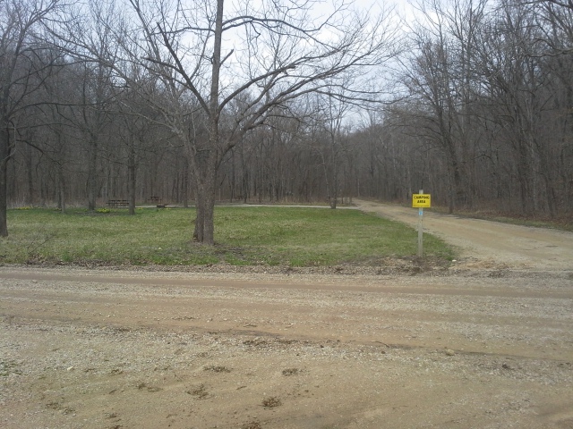 To get to the designated camping and horse camping areas in the southern section, make a left (south) on Y. Follow that for about 5 miles, until you come to County Road 708. Continue on 708 for another couple miles, and you will eventually see the horse camping area on your right and just after that on the left are the regular camp sites.
To get to the designated camping area in the northern section, make a right (north) on MM. Take MM a couple of miles until you come to County Road 822. Make a right on 822, and after a couple more miles the campground will be on your left.
If you want more of a straightforward route, take Interstate 55 south about 22 miles to Highway 67. Go south on 67 for just over 80 miles until you get to Highway 34. Make a left (east) on 34, and follow that for probably about 12 miles until you hit the junction of Y and MM. Just remember that this is the reverse direction from the rest of these instructions, so some lefts will be rights, and vice versa. Luckily Y and MM each only go in one direction from 34.
What I like about this area:
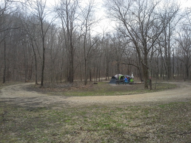 The isolation. Yeah, it was early spring so you wouldn’t expect a crowd, and there were people over in the horse campground and one of the sites down from us, but the site we were on was a nice spot back in a hollow between two hills. Secluded and quiet for the most part.
We were only in there for about 24 hours, most of which was spent sitting by the fire, and then sleeping, but it seems like there is a lot of forest to explore. With a good amount of hiking trails, and a lot of opportunities for hunting and fishing, this is a conservation area rich in things to do.
Two of my favorite things about primitive camping on public ground are that there are usually no camping fees or firewood fees. A cheaper way to spend a weekend!
What you need to know:
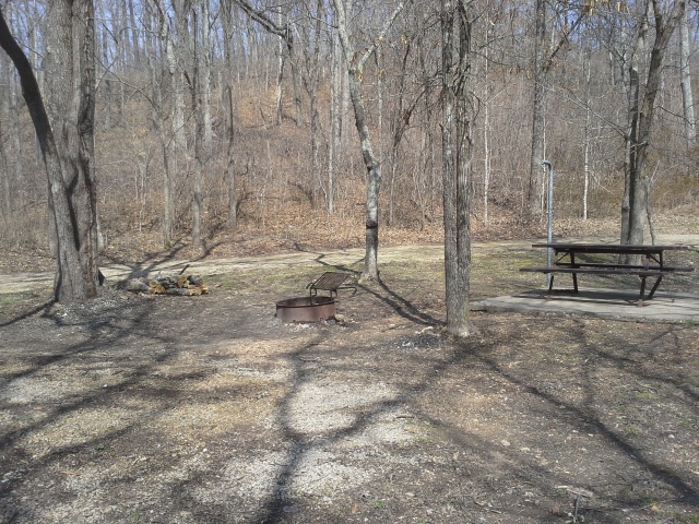 As with most primitive camping situations, there is no running water and there is no trash dumpster. Make sure to treat/filter/purify any water that you haven’t brought from home. And take your trash home with you, please. When we showed up, there was broken glass around the fire ring, and that just creates an irritating hazard for the four legged members of your group. Plus, burning anything that isn’t paper (or paper based) is just lazy and it smells awful, besides releasing harmful chemicals into the air you are breathing.
The only toilet is a vault toilet at the shooting range in the southernmost section, and there are no shower houses. Again, primitive. Make sure you have a roll of toilet paper in your gear.
 The Castor River Shut-Ins are NOT in this conservation area. In fact, the Castor River itself does not go through any of the sections. It is nearby however. And the Shut-Ins, which everybody needs to visit, is in the Amidon Memorial Conservation Area, a bit farther north of here, east of Fredericktown, MO.
As with all conservation land, check the list of hunting seasons. It would be a shame to go into the woods to spend a peaceful evening, only to be awoken to the sound of nearby gunfire as the sun comes up (unless you are into that sort of thing). Also, consider getting your dog a bright colored vest if you let them hang around off leash.
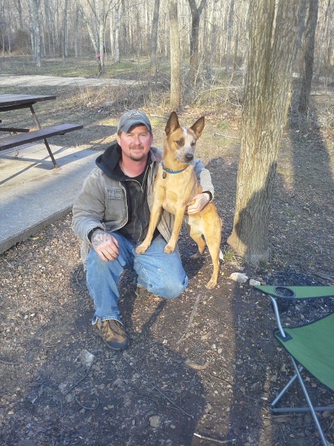 Something that always tends to strike me about conservation land is that it is typically just forest, streams, and gravel roads for the most part. It seems that usually most of the really scenic places in Missouri are already in a State Park or Federal Land or privately run areas. The conservation areas are a bit less notable when it comes to the fun natural attractions a lot of the time. But what they do have to offer is so much forest in which to enjoy a lot of the more refined and traditional activities that people go to the woods for. Camping, hunting, fishing, foraging. Some peace and quiet, and a place to go to strengthen your connection with the land and the creatures that live in it. That is the beauty of conservation land, and the Castor River Conservation Area is a shining example. “God’s Country”, as they say. Go spend some time in it!
 We were getting out to the forest for the weekend, and I wanted to get back to a place that I hadn’t fully checked out yet. The first time that I had been to the Brazil Creek Recreation Area was just about a month earlier with both of my kids and Max, the adventure dog. We hadn’t had a lot of time to check out the place, and I wanted to go back and stay there a night or two. Due to some ill-timed social events, I gave my teenage son the opportunity to back out of this trip, and spend time with his friends at the movies that Friday evening. I was a little disappointed, but I am focusing on letting him have enriching experiences that don’t have to involve me and the forest (all the time), as in when something like the “Divergent” movie is opening and all his friends are going. The silver lining was that I was going to get to camp with my daughter Sophia, and we would get to have some important one on one time, hanging out in the woods.
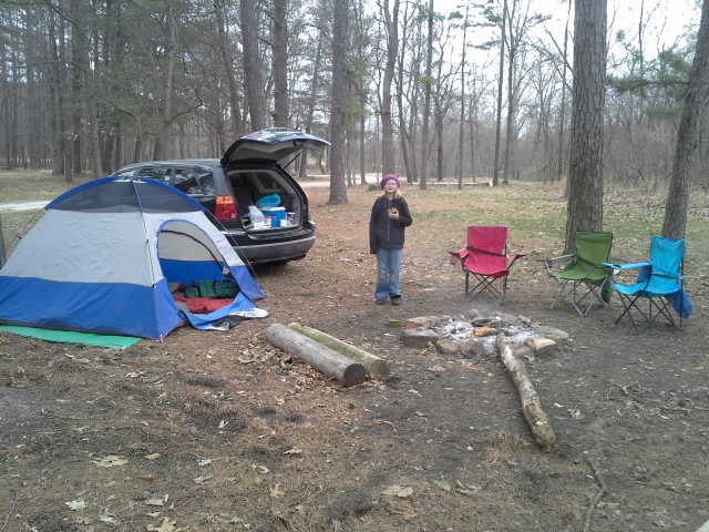 The Brazil Creek Recreation Area is located in the Potosi District of the Mark Twain National Forest. It is one of the trailheads for the Berryman Trail, and is what seems to be basically a little roadside park off of Hwy W, in the northwest corner of the district. It is flanked along one edge by Brazil Creek, which must be crossed in order to get to the trail. The Berryman Trail is a 24 mile hiking loop, which also passes through the Berryman Recreation Area, and shares some of its length with the Courtois Section of the Ozark Trail. Turns out it is a popular trail for mountain bikers, horse enthusiasts, as well as backpackers.
 How to get there:
From St. Louis, take Highway 21 south about 60 miles, to Potosi. Turn right (west) on Highway 8, and travel for about 16 miles until you hit Forest Road 2266. Now, the directions on their website will tell you that it is also known as County Road 207, but you may find that there is no road sign easily seen. The biggest indicator that you need to make a right, after your 16 miles on Highway 8, is that on the left side of the road is a sign for the Berryman Recreation Area. This is your turn. So make a right on Forest Road 2266, and stay on that for about 4 miles. You will come to a wide fork in the road. This is Forest Road 2265, however I don’t remember a sign stating that. The one sign that you will see in front of you, on the opposite side of the fork, says Floyd Tower. Make a left onto Floyd Tower (2265). After another 3 miles of twisty gravel road, you will come to an intersection which is the most prominent so far, that is sort of at the top of a hill. This is Highway W, and you want to turn right (east) and head down the hill and around the curve to the left. Just after you cross the bridge, the Brazil Creek Recreation Area is on your left.
 Why I like this area:
There are no designated campsites, and there are NO camping or firewood FEES. Pull into the park, pick a spot, and spend the weekend! Sure, there are no bathroom facilities or running water, but what you pay for in primitiveness is made up for in freedom and self reliance.
Brazil Creek right nearby has stock water for drinking (use a filtration system or boil it, obviously), and I bet it is a fun spot to play in the warmer months.
The Berryman Trail nearby is a great opportunity to get some hiking in and experience some pine covered Ozark hills and countryside.
 What you need to know:
Again, there are no bathroom facilities or running water. If you don’t have a way of filtering your water, make sure to bring what you need with you. The closest gas station isn’t just a drive down the block. And if you haven’t yet reached the point where it is a pleasant, natural experience to poop outside in the forest, there are vault toilets over at the Berryman Recreation Area, which you most likely passed on your way here.
 There are also no trash cans or dumpster. Make sure to bring an extra trash bag so that you can double bag your garbage for the ride home.
The directions can seem a little sketchy, but as long as you don’t turn off onto some jeep trail, you should make it pretty easily. Bring a map just in case.
Turns out that this is apparently a popular trail with a lot of outdoor enthusiasts, and it might get to be a busy spot on the weekends. When we were there it was getting close to freezing for the overnight lows, so it definitely wasn’t a peak season, but be prepared for neighbors, and be neighborly.
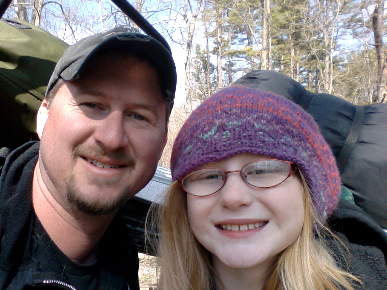 I’m putting this place in my mental file of “Great Finds”. In the middle of March, we got the isolation of a backwoods camping trip (excluding the occasional vehicle on Highway W), and I can imagine that it will be a fun spot in the summer when we can spend time playing in the creek. All in all, the most special thing about this trip was getting to be there with Sophia, who is now a pro at starting a campfire with a wooden match AND flint and magnesium! (It’s all about the training and task delegation.)
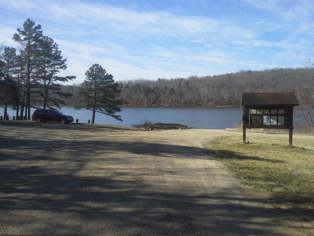 Saturday morning was an early one, waking up as the sun started to peek over the mountains and into the valley of the John J. Audubon Trail, where Max and I had spent the night camped out next to Bidwell Creek. The plan was to get there Friday evening, camp out at the trailhead, and then hike one of the two six mile loops that make up the Audubon Trail, with full backpacking gear, and probably set up for the night a mile or so away from the car. Weather was supposed to be moving in Saturday evening, with rain forecasted all night which would eventually be turning into snow. Winter was on its way out, but not without a last, messy gasp. With that in mind and where we were at, five miles in, down a curvy, steep, dirt and gravel forest service road, I felt that it might be a good idea to get out while my station-wagon-that-is-not-jeep could still make it safely to solid roads. It was a moment for change of plans, due to an overactive sense of danger avoidance.

Gorgeous day!
So I decided that we would drive through Fredericktown, past the turnoff for Lower Rock Creek, around the bend from Marble Creek, and over to the Crane Lake Recreation Area, to hike a trail that I hadn’t done yet but had heard good things about. The sun was already warming the air on this early March morning, and we were gonna take advantage of it before we were reminded that it wasn’t yet spring.
How to get there:
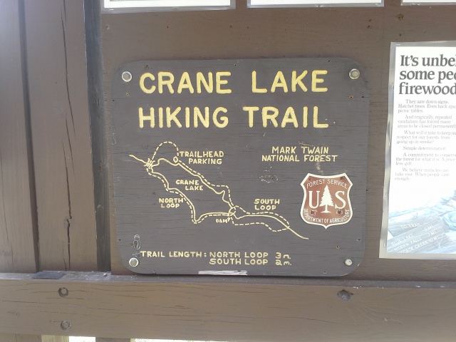 You can approach this one heading south out of St. Louis from either Highway 21 or Interstate 55. I prefer the 55 route because it makes you go through and past some of my favorite scenic areas on the way out of Fredericktown, so that is the one I will describe here.
So you take Interstate 55 south, about 22 miles, to exit 174B which is US-67 south toward Bonne Terre/Farmington (my most-driven outdoor excursion route at this point). Stay on US-67 south, through Bonne Terre, through Farmington, and all the way to MO-E just south of Fredericktown. Turn right (west) on MO-E and take that about 19 miles to County Road 124, on the left side of the road very soon AFTER County Road 134. Make a left (the only option) onto County Road 124, and take that about three miles to County Road 131. Make a left onto County Road 131, and after about two miles it ends in the Crane Lake Recreation Area.
 Mapquest and Google Maps and all those will give you great scenic directions to get here as well, but in my opinion the section of MO-E from Fredericktown to County Road 124 is one of the prettiest drives in the area, especially the part along and just after the St. Francis River. Totally worth whatever handful of miles you have to add to your route.
The Crane Lake Trail consists of two loops. The northern loop is about three miles, and goes right around the lake. The south loop is at the southern end of the lake, via the north loop, and adds two miles to your hike if you want to make it a five mile hike. The east side of these loops also shares about two miles its path with the Marble Creek Section of the Ozark Trail, which goes from Crane Lake to the Marble Creek campground.
Why I like this trail:
 Who doesn’t like hiking around a lake?!? It really is a pretty area, and with the addition of the lake next to you for most of the trip (especially the north loop), it allows for a lot of scenic hiking.
The dam at the south end of the lake is cool to see, and the lively creek that springs from it is a great water feature. If you’ve got the energy, you need to hike both loops, as the south loop follows the creek here and there.

Crane Pond Creek
Up on the hills on either side of the dam, there are a couple campsites that would be an awesome place to spend a calm, late spring night. Up over the lake with the sound of falling water below you, with the expanse of sky and horizon out in front of and above you, sitting next to a warm fire, would be a really memorable experience. Definitely on my list of things to do this year, and probably every year from here on out.
With the two loops, giving you the option of a three mile or five mile hike, it really is a great place for a day hike. Just enough to get some good exercise, but not too much to have to spend a night out there if you don’t want to.
What you need to know:
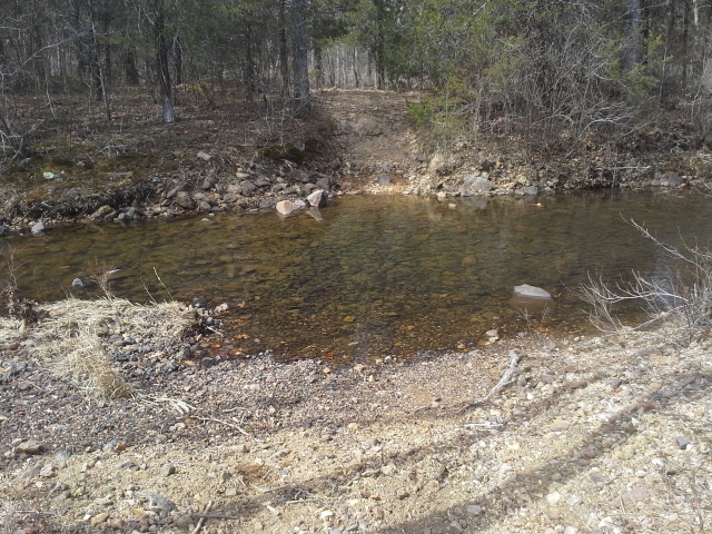 Take a trail map with you. The couple of miles that are also Ozark Trail are clearly marked due to the diligence of the group that maintains that section, but once you get to just the National Forest part of the trail, there are a couple transitions involving local ATV trails that that can be a little confusing and you might find yourself trying to find your way back to the Crane Lake trail. Having a map will help you to stay in the correct direction.
At the southernmost part of the southern loop, you will have to cross the creek. Your shoes might get wet, with a few miles left to hike still. I took the time to find a shallow part, and threw some rocks in to step on. Be mentally prepared, and maybe make a lunch break out of it!

After four miles with full backpacks, level hiking was very welcome!
The two steepest parts of the trail are just south of the lake, and they are pretty rugged and sustained. Take your time, allowing yourself to take a break and catch your breath, and remember to step carefully. (Max and I did it with full backpacks! Phew!)
We took the trail clockwise, and the last two or so miles on the west side of the lake were pretty flat and relaxing. In my opinion, this would be the best direction to hike it.
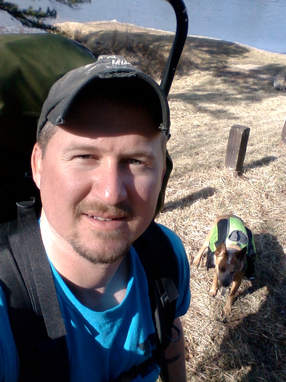 I had not been planning on even checking out the Crane Lake Recreation Area on this trip, but I always try to approach an outdoor excursion with the ability to improvise and change plans if conditions dictate, and a willingness to go to unfamiliar places. This just wasn’t the weekend for backpacking on the John J. Audubon Trail. But it turns out it WAS the weekend for hiking the scenic trail around the beautiful Crane Lake. Just goes to show that there are great opportunities to get out in the woods around almost every corner, especially in the Mark Twain National Forest here in Missouri.
 I love Missouri State Parks. I have been camping in them for years and I am familiar with their rules and policies and reservation system, and I think they each have something unique to them that showcases the natural beauty of Missouri. I also feel that our State Park system is important as part of the ongoing goal to preserve the natural areas around us.
I also like privately owned campgrounds. I like their facilities and their more relaxed rules and policies. I think they typically tend to offer a more “resort” experience, and they are usually located near a natural place in Missouri that is a can’t-miss location. They can be a lot of fun, during the day AND into the night hours, if one is so inclined.
These are not the only places to go camping in our beautiful state however.
 One of the places that I have recently been giving a lot more focus to, in my own personal research, is the Mark Twain National Forest. Yes, NATIONAL Forest. The U.S. Forest Service, under the Department of Agriculture, manages over 193 million acres of forests and grasslands in America. 1.5 million of those acres (making up 5% of the land here in our own backyard) is the largest amount of publicly protected ground we have in our beautiful state of Missouri.
The areas that are designated as National Forest are broken up into six districts, all of which are in the south, southeast, and central parts of Missouri. Within each of those districts there are many outdoor recreational opportunities for camping, hiking, hunting, fishing, bird watching, and more. Within the Potosi/Fredericktown district’s 280,000+ acres alone, there are a good handful of campgrounds, and a lot of miles of trail, in which you can find a place to spend a day exploring the woods and creeks, or a spot to set up a tent and sleep under the stars for a night. We just had a recent adventure involving the Berryman Recreation Area and the Brazil Creek Recreation Area, which really opened my eyes to what is really in these National Forest areas. And those are just two spots! The way I see it, from Marble Creek to Silver Mines to sections of the Ozark Trail, the list of places to camp in just these two districts alone is limited only by your willingness to get out there and check out someplace new!
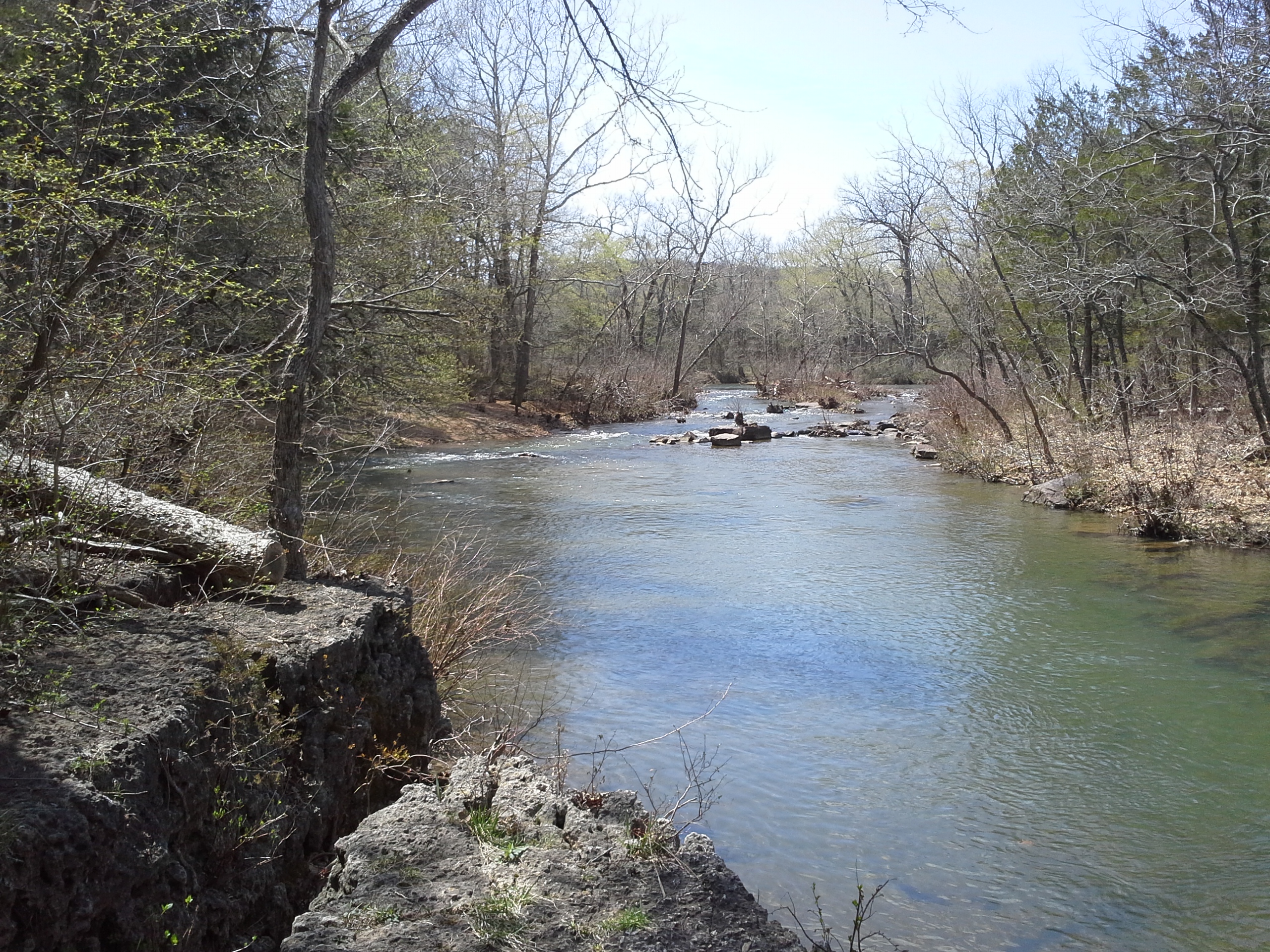 The funding to protect all these areas comes from a couple places, beyond just federal taxes. They receive funding from the (minor, if any) campground fees, map sales, and timber sales, among other various sources. One of the cool things is that 25% of the revenue generated goes right back to the counties in which the forest is located, to go toward public schools and county roads. Local reinvestment from a federal preservation program.
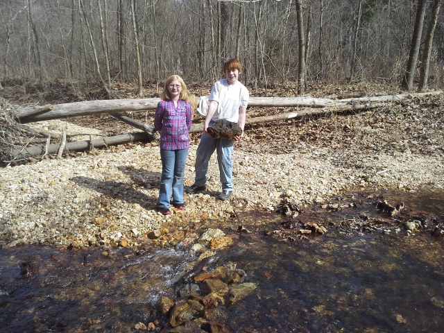 There really is a lot to explore, and the website has a ton of information to get you going, so I encourage all of you to check out what is out there. The one striking thing that keeps occurring to me as I conduct my own research about the Mark Twain National Forest, is that I am coming to the realization that I may never have enough weekends to go and check out all the places to experience within them. We are very fortunate to have all the protected land that we have in Missouri. I hope you get out there to see it! I know that I am going to be, as much as I can, as soon as possible.
Continued from Part One.
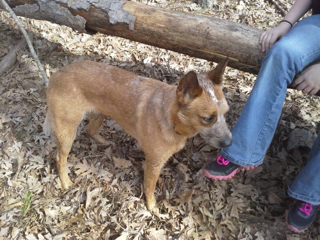 So we hadn’t made it to the place we had been trying to get to that evening, but it was late and we had made it somewhere. The Berryman Recreation Area was going to have to do for the night. This recreation area is a former Civilian Conservation Corp camp from the 1930s, and just a small part of the almost 1.5 million acre Mark Twain National Forest. One of the foundations to a CCC building actually still exists just behind one of the campsites, right next to a little pond. It is also the main trailhead to the Berryman Trail, a 24 mile loop trail that shares some of its western section with the Ozark Trail.
 We drove around the little deserted campground and looked at each of the 8 spots available, getting out a couple of times to survey it closer, and eventually deciding on one of the spots near the entrance. Each site has a fire ring and a picnic table, and from what we could see with our handful of flashlights, quite a bit of open space to erect one or two or a dozen tents, depending on the size of your group. There are no fees to camp there or use the picnic pavilion, but it is listed that donations are welcome. We didn’t see it, but there is probably a box attached to a sign somewhere for that. I will be making it a point to put something in it, plus a little extra, next time we get out that way. A couple other things to point out is that there are vault toilets, but no drinking water or dumpster available. If you are going to camp here make sure that you have all the water you will need, and please please please…plan on taking your trash home with you (or at least to the first available dumpster you come across). The stories I could tell of found smoldering fire ring garbage…
As we got to setting up camp, the kids and I discussed the fact that had it been in the summer, we would still have light in the sky…but arriving at the campground in the dark just took me back to my teenage adventures, taking off for a night in the woods after work on some random day. We were gonna be just fine, and the kids started setting up the tent and getting the sleeping bags and bedrolls out while I started walking around in search of firewood.
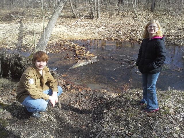 The end of winter in a quieter campground is usually pretty good for gathering wood, as it has been hitting the ground with nobody around to need it, and I had a decent pile going in a short amount of time. After the kids had gotten the tent set up and the bedding spread out, they joined me on the hunt for firewood. The site right across from us had a couple good pieces, and after a short walk down to the end, around the loop, and back to our site, we had gathered even more than we would need to sit by the fire for a bit before bed. Because that is one of my favorite things to do, especially when it is chilly.
The next morning was pleasantly not-completely-freezing, and the kids and I got up and had our donuts (quick, prepared camp food) and enjoyed the morning air by a little fire I had rejuvenated, just for the ambiance of it. We got the bedding packed up, put the tent away, and cleaned up what little evidence there was of our being there. After a good splash of water to put out the fire, we headed north out of there on the road we weren’t allowed to travel the previous night. Turns out that it WAS County Road 207/FR 2266, and after a bit of this way and that, we got to Highway W, and then to the Brazil Creek Recreation Area on the left side of the road. Make sure you bring a map with you. It isn’t hard to find your way out of the forest…but it can be even easier find yourself temporarily lost. And for those of you with GPS on your phone…you might not get a signal.

Brazil Creek Recreation Area
The Brazil Creek Recreation Area is another access to the Berryman Trail, and it can be likened to a more primitive version of the already primitive campground of the Berryman Recreation Area. There were no obvious campsites, and remnants of fires were here and there from people pretty much choosing where they wanted to stay nights before. No vault toilet, no picnic tables, no running water. The creek bordering one side of the main area is the only water available, so bring what you will need with you in the car, or something to filter or treat the water from Brazil Creek. This is bare bones camping, and I have an appreciation for the freedom it allows.
Those are the smiles you get after making your kids hike UP the hill.
We found a nice spot off the driveway through the little park, and got out to explore. The spur trail that takes you to the Berryman Trail crosses the creek, and as Max the creek dog dug up rocks in the water, the three of us spent a little bit fortifying the clearly battered rock bridge that had probably been constructed at some point last summer. It was a fun moment, playing in the creek together and building what was essentially a dam to walk across. The sun was in the sky, and with the project completed (enough), we made our way to the right on the other side of the creek, switch-backed up the hill, and headed about a mile up the trail into the woods. Eventually I had us veer off, and we bushwhacked (not that many bushes to whack in the winter) up the hill to our right, and all the way to the top. There was a slight summit, with a mildly less dramatic view than I was expecting, and after enjoying a short break, we headed down the ridge line back toward the creek and trail in the direction of the car. However given the option, once we got back to the creek, we turned to the left and followed it to the opposite end of the recreation area, and set about building another rock bridge further down the creek from the first one. It was really neat, and Sophia and I both observed how the water was rising where we were standing, as we blocked the main channel passing through in front of us.
Having accomplished that task, we walked back over to the car, ate what was left of the donuts, and spent just a little bit more time in the area before getting in the car and heading home.
I was curious to see how long it would take us to get to Interstate 44 from here, so I checked the road atlas and realized that we could head to Sullivan, MO, and pass Meramec State Park on the way. Turns out it was a longer and windier drive than I had expected, but we eventually got to the Interstate, and on our way back to the St. Louis area.
 It was a very short and simple camping trip, in a couple places that were new to me, and given more time we would have spent a night there at Brazil Creek. The scarcity of people made it a great time, without the distractions of the typical campground experience, the noise and the revelry and potential for mild commotion (which I do enjoy as well). I found the isolation we experienced together along with the impulsiveness of taking the journey exactly as it came to us…just me and my kids on an adventure reminiscent of my own youthful excursions…to be one of the most positively memorable experiences I have had in a while. I will definitely be heading back that direction for another adventure, just as soon as I can.
First of all, it has been too long since I have sat down to write about my excursions. I have been busy with a lot of other things going on in real life, and as I HAVE been getting out into the woods now and again, I haven’t been making the time to sit down and record my thoughts and pictures. I also feel that the format of “reviewing” a campground or park or trail is helpful as an information source and I will continue to do that, but I have to allow myself to write more about my adventures too, and not limit myself by a self imposed structure. It is what I enjoy the most, sharing the adventure, and this is my latest one.

For the record, the car was NOT in motion.
So…this past weekend with all the beautiful weather that has been rolling through the midwest, temporarily, I have been feeling the urge to go out and spend a night in the woods, which hasn’t happened in too long of a time span. I had my kids this weekend also, and I felt that it would be an added bonus to drag them out on an adventure since we were going to have just another day or two of relatively tolerable temperatures.

One of the best copilots I know.
Lately I have been looking at all the gear that I typically go camping with and have been trying to approach running off to the forest in more of “lighter gear” mindset. Now I don’t want to be out there with a can of soup and no can opener or spoon, so we usually bring all sorts of stuff that we might need given current and changing circumstances…but I have been thinking a lot more about “What would I need if I had to carry it all a couple of miles from the car?” This wasn’t gonna be a camping trip quite as stripped down as that…but it was a one-nighter of stealing away into the woods with the kids, right after work on a Friday. We weren’t gonna be hiking off into the forest, but we weren’t going to be needing a full weekend’s worth of gear either. This was gonna be a “Heading down highway 67 at 10 pm before a day off” kinda trip.
When I was in my late teens, a good friend of mine and I had a habit of just heading off to the woods after dark and finding a place to camp for the night. This sort of behavior led to some of the more memorable trips of my life, and it very much illustrated to me the simplicity with which camping can be done. When we would pack up our gear, it was usually a duffel bag with a couple pairs of clean socks, a package of hot dogs, a flashlight, some container filled with water, whatever booze we had left over from the last time we had convinced a non-minor to buy us some booze, and then a sleeping bag and tent. This time I was old enough to buy my own booze, but given the short length of this trip, we weren’t going to need much else.
So we packed up a handful of spare clothes, sleeping bags, chairs, tent, thermarest bedrolls, and various snacks and drinks, and headed out. Since by the time we were hitting the road it was going to be dinner time anyway, we just got something on our way down.
Recently during a Stream Team cleanup, I had a conversation that inspired me in the direction of focusing my personal camping spot research on the Mark Twain National Forest Recreation Areas we have here in Missouri…and let me tell you, there are a LOT of opportunities to get out there into the woods. The spot that I had been planning on going to this time is the Brazil Creek Recreation Area. There is no direct route from the St. Louis area, and it is somewhere sort of between Potosi, MO and Bourbon, MO, and can be reached in just about the same time frame (seemingly) from either town. It is in the northeast corner of the Potosi Ranger District, and we took highway 21 south as our direction of attack.
After you get to Potosi, you want to head about 16 miles west on Highway 8, to County Road 207. Now, true to my past, it was dark and the road signs were NOT clearly marked. After getting out as far as we figured the turnoff was, we spent the better part of an hour dodging traffic, pulling into gravel driveways to turn around, and taking short, horror-movie-esque trips down progressively worsening dirt roads into the forest. At one point we pulled off the road where the crossing for the Ozark Trail is, and I put it up for a vote that we just set up camp there for the night, as I was ready to get the tent set up and get a warming fire going. I was quickly outvoted, 2 to 1. Too bad Max the adventure dog didn’t get a say in it. He was just glad to get out of the car for a couple minutes.
So we finally, through the preceding process of elimination, found the correct turnoff onto County Road 207, and headed north with an increased confidence that we were back on track. After a mile or so, just after we passed the Berryman Recreation Area on our left, we were stopped in the road by two polite gentlemen who informed us that the road was closed due to running of the “Rally in the 100 Acre Wood”. This was a mildly frustrating development, as I knew through recent experience that no other northbound road nearby other than this one went through, safely, to where we were trying to get to, but given the timing of things I took it in stride and just chalked it up to being another part of the adventure. So we turned around and I pulled into the Berryman Recreation Area, to give us a couple minutes to reevaluate our plans.
The Berryman Recreation Area is a picnic area and campground that is on the same spot as a Civilian Conservation Corps camp was back in 1937, and is an access point to the Berryman Trail, a 24 mile loop trail through some mildly rugged hills (from the looks of it). There was a lone car in the parking lot, whose owner was mostly likely hiking the trail, and we got out to take a look at the map that was posted on the little information hut there. I had never been to this spot, and it looked like the campground was just to the south. Well…there was a jeep trail at the southwest corner of the parking lot, so I figured that it HAD to be the route to the “8 campsites, each with table, lantern post, and fire ring”. We headed into the woods on this narrow road, and it started to head in a bit of a downhill direction. Now, the woods this whole time had been dark and mildly imposing, but as we rolled deeper into the forest it didn’t seem like we were arriving at any regularly traveled area, and these tables and fire rings we had read about weren’t exposing themselves to us either. After about a quarter of a mile of overbearing pines and progressively choking and scraping leafless underbrush, we came to a dip in the “road” that was full of water. I pulled off into a slightly open spot to the side, and the kids and dog and I got out with our flashlights to take a group survey of the area. This did NOT look like the road to the campground.
After a group vote, deciding whether to just set up camp right where we were or head back and through Potosi to pull into Washington State Park and call it a night in a more civilized area, I was voted down 2 to 1…AGAIN. So we got back into the car and drove back up what now looked more like a road to nowhere than a road to the campground, and back out to the parking lot. Heading toward the exit and back the way we came, considering the failures of the night’s adventure so far, we came to an intersection with a road to the south I hadn’t noticed on the way into the recreation area. As I slowed down and turned the car slightly to the right, having had my high beams on permanently for a while now, I saw just a bit off into the woods the silhouette of a picnic table, and across the road from that what looked to be the faded yellow block walls of the vault toilets of the campground. Turns out it wasn’t at all down that last turn we had made. Right then I made the executive decision to camp there, and with a renewed happiness, the kids and I slowly drove through this little campground and surveyed our options for where we were going to set up our tent for the night.
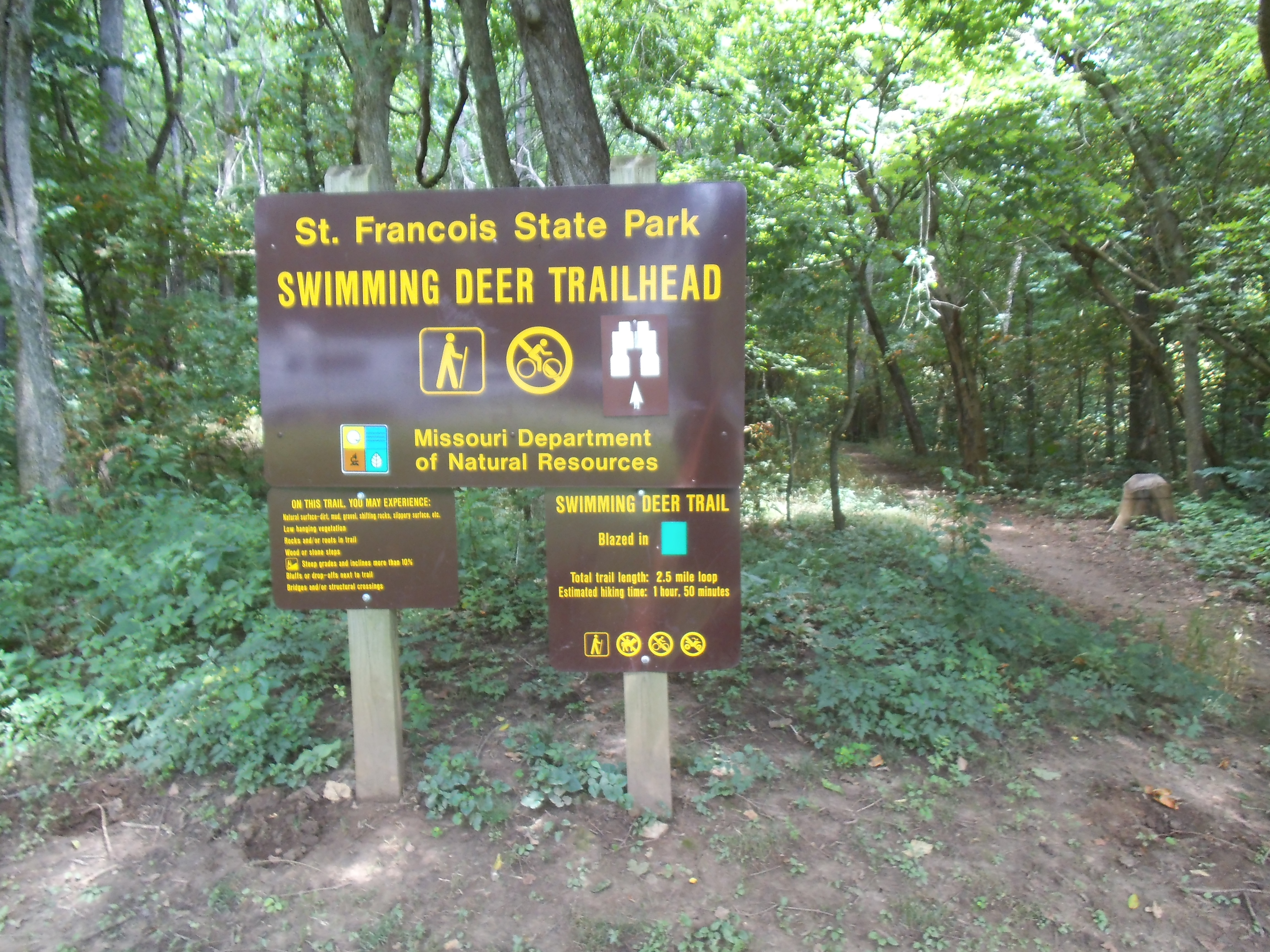 Well, if you are familiar with one of my FAVORITE trails, the Mooner’s Hollow Trail at St. Francois State Park, then you know that there is a lot of natural beauty and backwoods history to the Cooneville Creek Natural Area. If you haven’t hiked it already, then you need to check out the two and a half mile Swimming Deer Trail, at the far end of the campground.
How to get there:
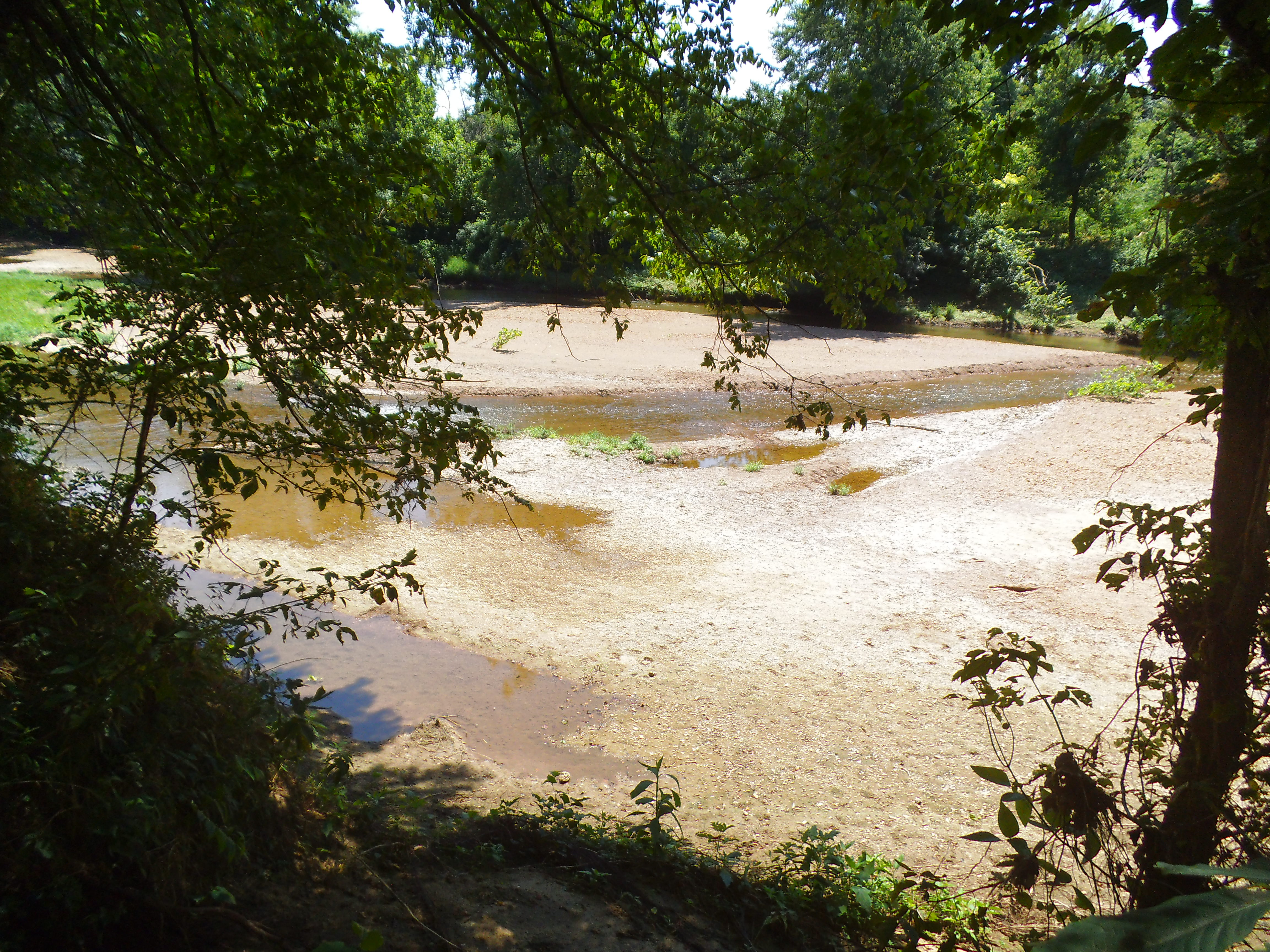 From south St. Louis County at the 55/270 interchange, take 55 south around 20 miles to 67 south at exit 174B. Then stay on 67 south for about another 20 miles. It will be a left turn across the divided highway to get into St. Francois State Park, probably 5 miles before you hit Bonne Terre, MO. Once you’re in the park, just follow the main road down through the valley, past the river, up the hill and turn left into the campground. After the entrance shack, make a right and follow the road to the back end of that campground loop. The trailhead is between the two farthest campsites.
 The first section of the trail heads straight back into the woods, somewhat parallel with the Big River, and you should keep an eye out for blazes (trail markers) so that you don’t head off on one of the handful of trails that cross it, most of which head to the river. You will pass a small cave opening up the hill to your left, and then at about a third of a mile, the trail turns to the left and climbs a rocky outcropping. You then start another section up the hill in your original direction, with the incline tapering off the higher you get. This is the most challenging part of the trail, and after this most of the up and down parts aren’t as steep.
 So it continues to follow the river for about a mile in total, and at just before a mile is a bluff where you can overlook the river below. It is a neat little secluded spot, and if you are there on a summer weekend you will very likely see people below you, floating down the river on inner-tubes or rafts.
Soon after this bluff, the trail starts to turn to the left and head into the deeper, more isolated part of the forest. Along this section there are a couple of creek crossings and there is actually an old shack that still stands from a time when the woods here were a place of industry and commodity (It probably was from the local logging industry, but I like to think that it was left there by the moonshiners in the area). Unfortunately it has become dilapidated and is overrun with the modern vandalism of people scrawling their names on the the planks with some of the damaged plaster. Too bad. Something like this from our regional history ought to be restored and respected.
 The trail makes its way back into its counter-clockwise curve toward the the river, passing through some of the shadiest forest in the park, including a couple of the more distinctive (and possibly creepier) trees in the area. You also pass an opening to a cave (or a mine!) that has been covered up for safety reasons, as it goes directly down into the earth below (and is filled with poison ivy vines near the opening).
As you get closer to the end of the trail, you can hear the sounds of the campground through the trees, as it passes not too far away from the amphitheater and shower house. It eventually meets up with its beginning section, and it is a short straight shot back out to the campground.
 What I like about this trail:
After you hike past the first part of it that is along the river somewhat, the traffic dies down and you get to experience a more isolated sense of the forest. It doesn’t seem as though a lot of people hike this trail, what with the more popularized Mooner’s Hollow along Coonville Creek, and the Big River itself being such a draw for patrons of the park.
I haven’t hiked it in the winter, but this is one of the shadiest trails I have been on. Very cool, even in the heat of July that Max and I hiked it in.
The shack, and the other places in the forest that you come across (there is a rocky area that I swear looks like a big, old, decaying building foundation) that speak to the past, when there were logging and mining operations in the area (and moonshiners!), allow for mental images of American history and industry that were from not too long ago. They say that some parts of this forest were so heavily logged that most of the trees were gone at one point.
 The overlook, just before the one mile point, is a neat spot to stop and take in the view of the river and the surrounding forest.
What you need to know:
This was the second time that I had hiked this trail, and I think the thing that bothers me is that there is no established parking for it. You either have to park in the grass or find an unoccupied campsite nearby.
A lot of the water features are dried up watersheds, and I’m sure this trail would be lot livelier after a recent storm, as well as muddier.
 It had been a hot July day off, as I had recently started working full time again, but Max and I were grateful for the cooling shade of this quiet and isolated trail that we seemingly had to ourselves. A trail in a forest that echoed whispers through it, of times not too long ago when we were more closely connected to the gifts of commodity and materials that the local woods and ground provide.
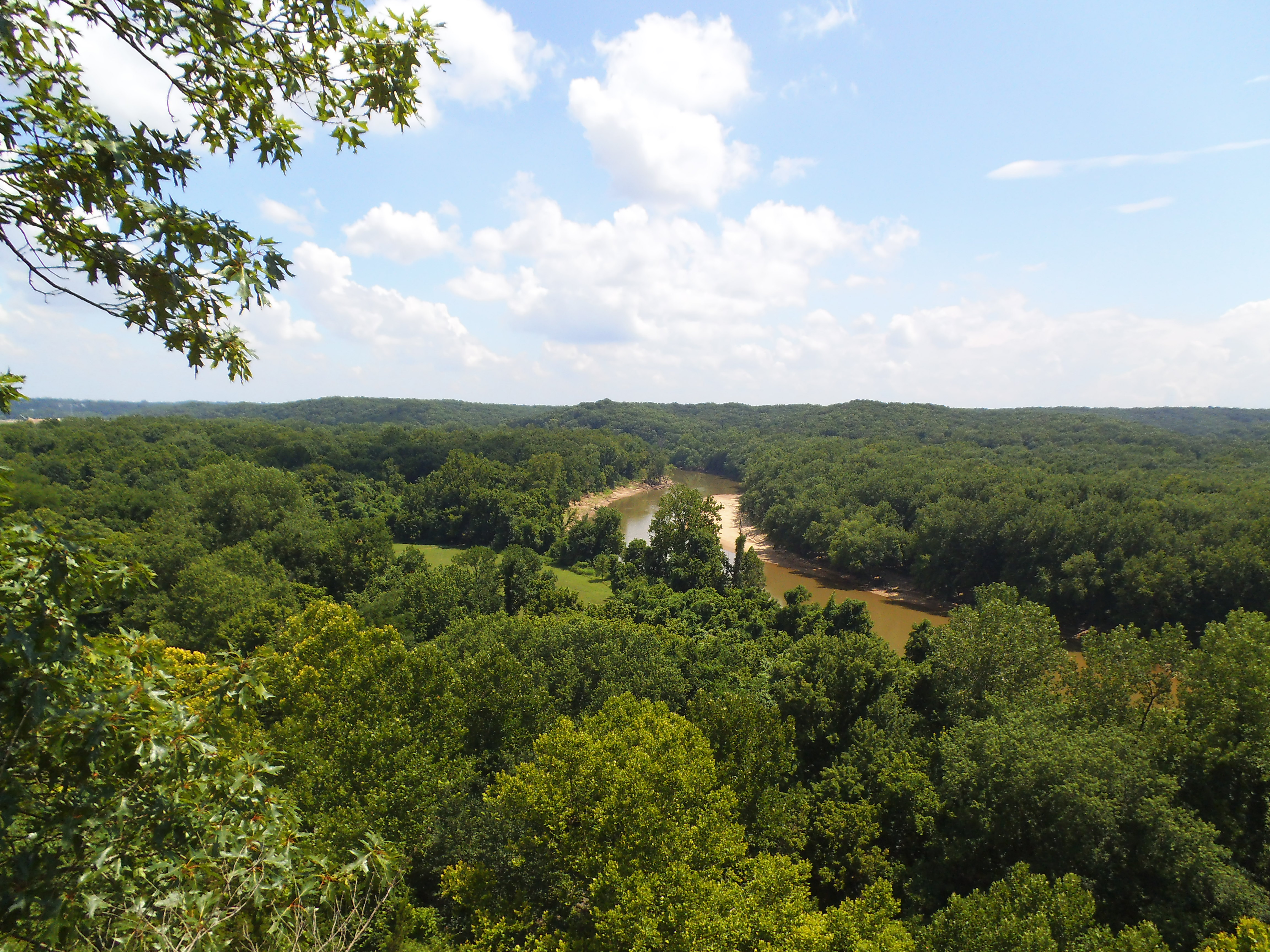 If there is one trail within the general St. Louis area that you MUST hike at least once, it is the River Scene Trail at Castlewood State Park, in Ballwin, MO. At just over three miles long, it shows off some of the best views close to home, overlooking the Meramec River and surrounding forest from bluffs way up above the flood plain. On this particular summer Monday, it was already moving into the warm part of the day, but I hadn’t hiked it in a couple of months and I needed some good exercise to ease some anxiety and get myself centered, so I filled up the water bottles and Max and I headed out. This was going to get sweaty.
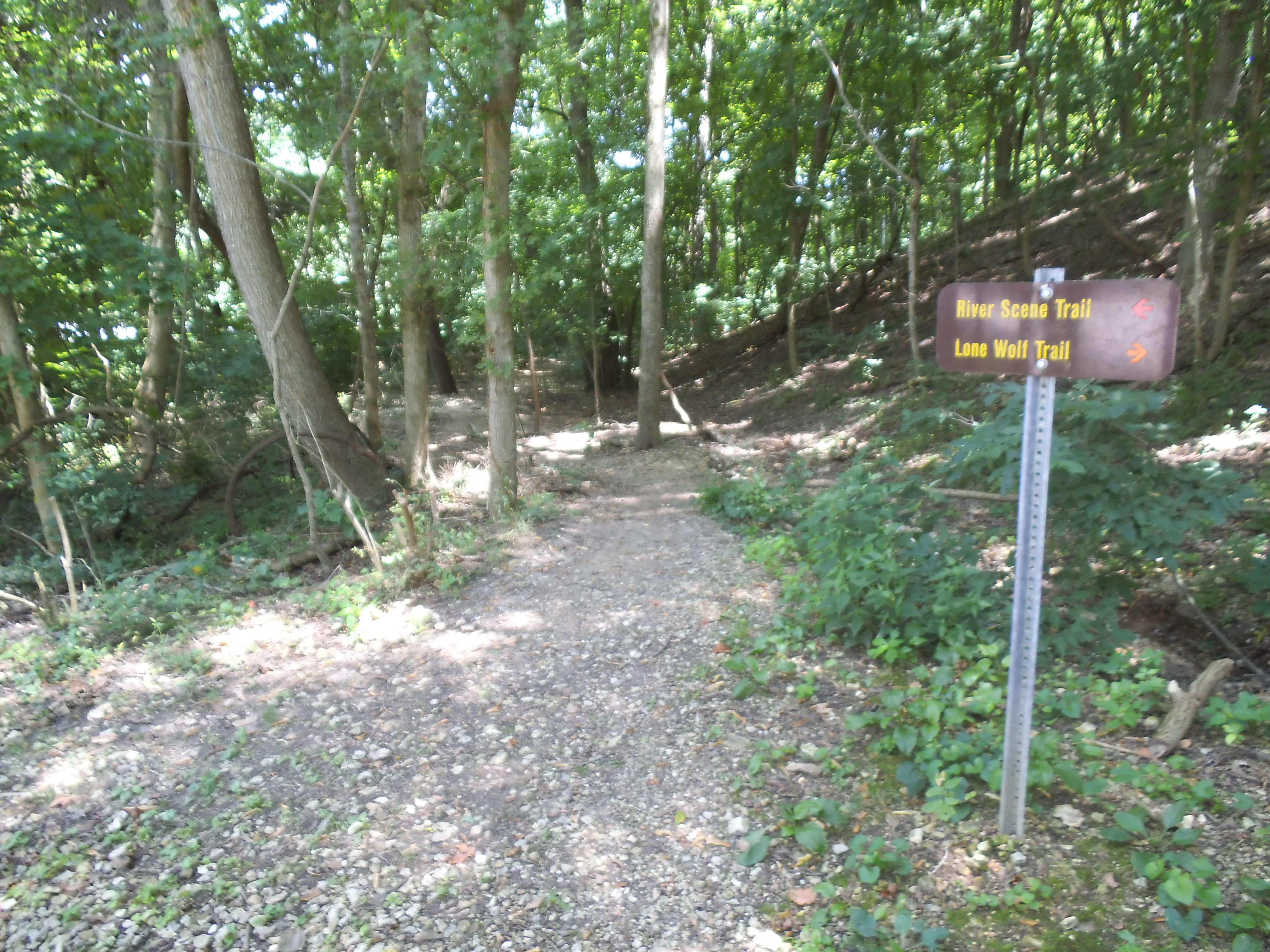 How to get there:
There are multiple ways to get to the general area, but the way I take from the 44 and 270 interchange is 44 west to 141 north (right). From there you take 141 a couple of miles to Big Bend Boulevard. Go west (left) on Big Bend. After another couple miles you will come to Ries Road. Make a left on Ries Road. Please use caution on this section, as a trail crosses the road right when you get into the woods. After a mile, at the bottom of a hill the road will end at a “T” intersection. Castlewood will be on your left. Take the park road to the first parking lot on the right AFTER you cross the bridge that goes over the creek. The trailhead is here.
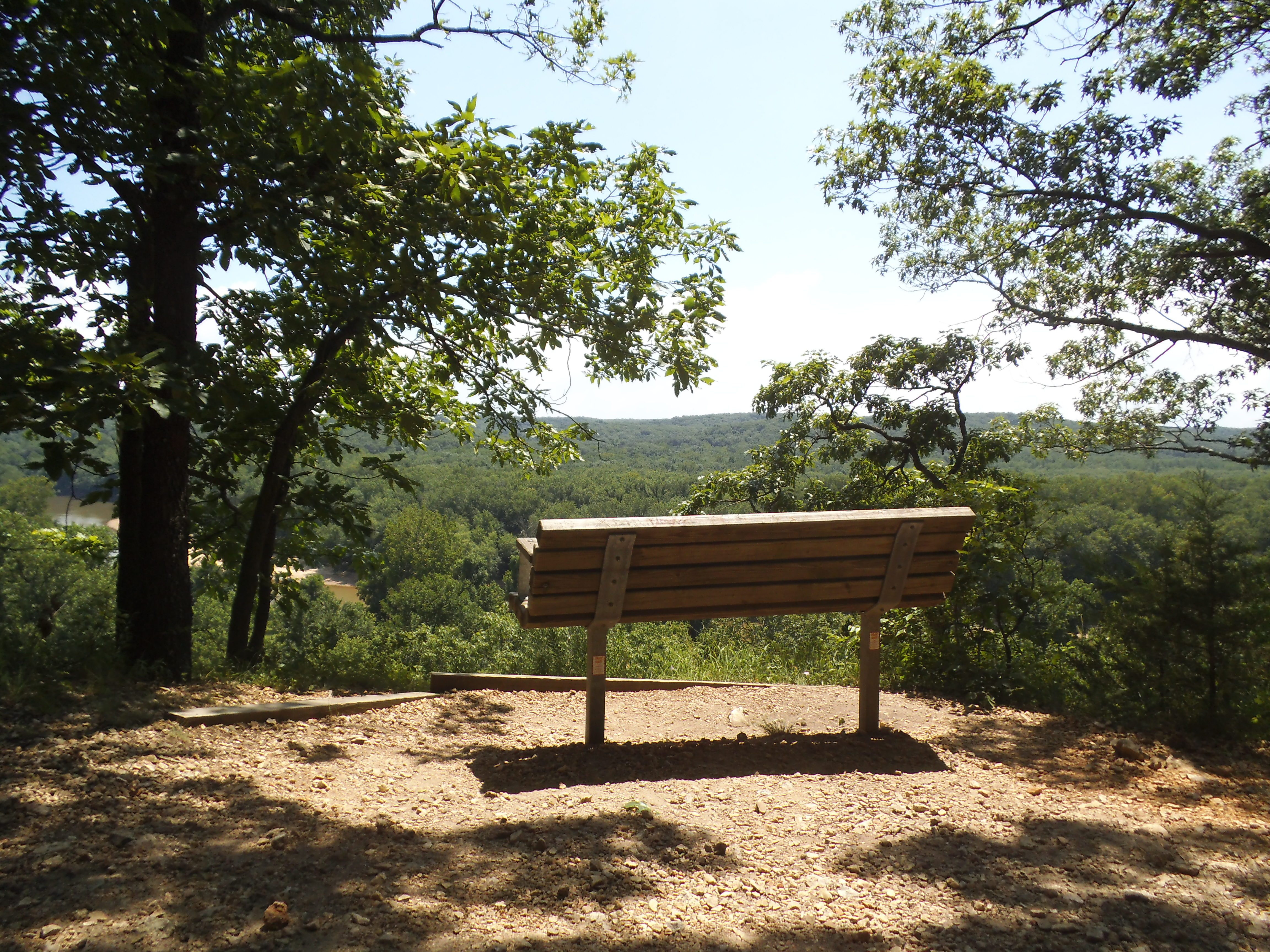 So you have a couple of options, to either go up the hill to your right (Don’t go this way. It is the Lone Wolf Trail, and you will miss some of the scenery from the bluffs), head straight along the hill and THEN up, or walk along the road and get the first couple miles out of the way on level ground. I prefer to walk into the woods along the side of the hill and then head up to the bluffs.
This first section, when you start climbing, is pretty rugged and strenuous and you will be amazed at how it doesn’t seem to end, so take your time and enjoy the views as you ascend above the trees in the floodplain below. There are a couple of great spots along here to take a break, some with benches and observation decks, and at around 0.7 miles it levels out for a bit. At almost a mile into the hike, it starts to head back down the hill, and you eventually come to the longest set of stairs I have ever walked up or down outside. When you eventually get to the bottom you will cross through a tunnel under the train tracks, and emerge right next to the Meramec River.
 At this point the trail starts to head back in the direction of the road, though the vine covered cottonwoods and sycamores of the river bottom. I noticed a bit of Stinging Nettle and Poison Ivy in the underbrush during this section, so it is a good idea to stay on the trail if you can help it. At just about two miles into the hike, you make a right turn and cross a big open field and then back into the woods and next to the river again. However, before you turn right and cross the field, if the climbing wore you out and you are ready to quit, you can maintain the direction you were on and the trail will take you to the park road. You make a left on the road and it will take you back to your car.
So after crossing the field, the trail follows the Meramec around in a long loop, passing the beach area and the lower parking lot, back into the woods again and eventually turning left to go back to the road. You then make a right turn onto the road and follow it back to the parking lot you started out at.
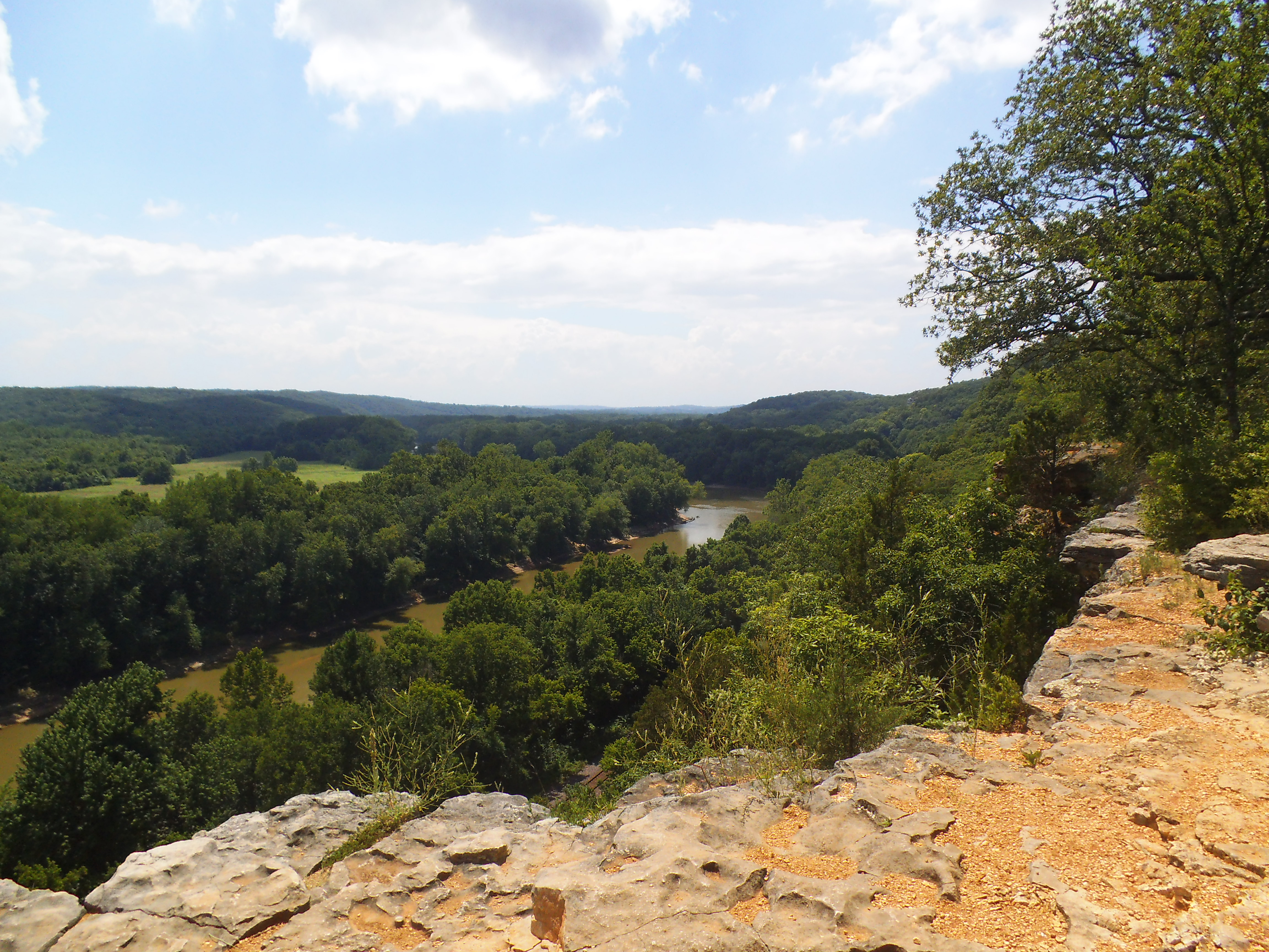 Why I like this trail:
The views from the bluffs are the thing that have always stuck with me since I first hiked this trail years ago. Bring a camera. Make it a point to sit down and take in the breeze and the sunlight and the forest and river below. It can be a meditative experience, if you allow it to.
It is a good, satisfying, rugged hike, with lots of up and down at the beginning if you go in the direction I take it. What that means though is that the last two miles or so are on level ground and very leisurely.
 There are lots of animals in the area, and if you go on a less busy day you will surely see something frolicking around. I don’t think there is a time I’ve gone to Castlewood that I HAVEN’T seen a deer just off the trail a little ways.
It is a very gorgeous area, and it is so close to my neck of the woods.
What you need to know:
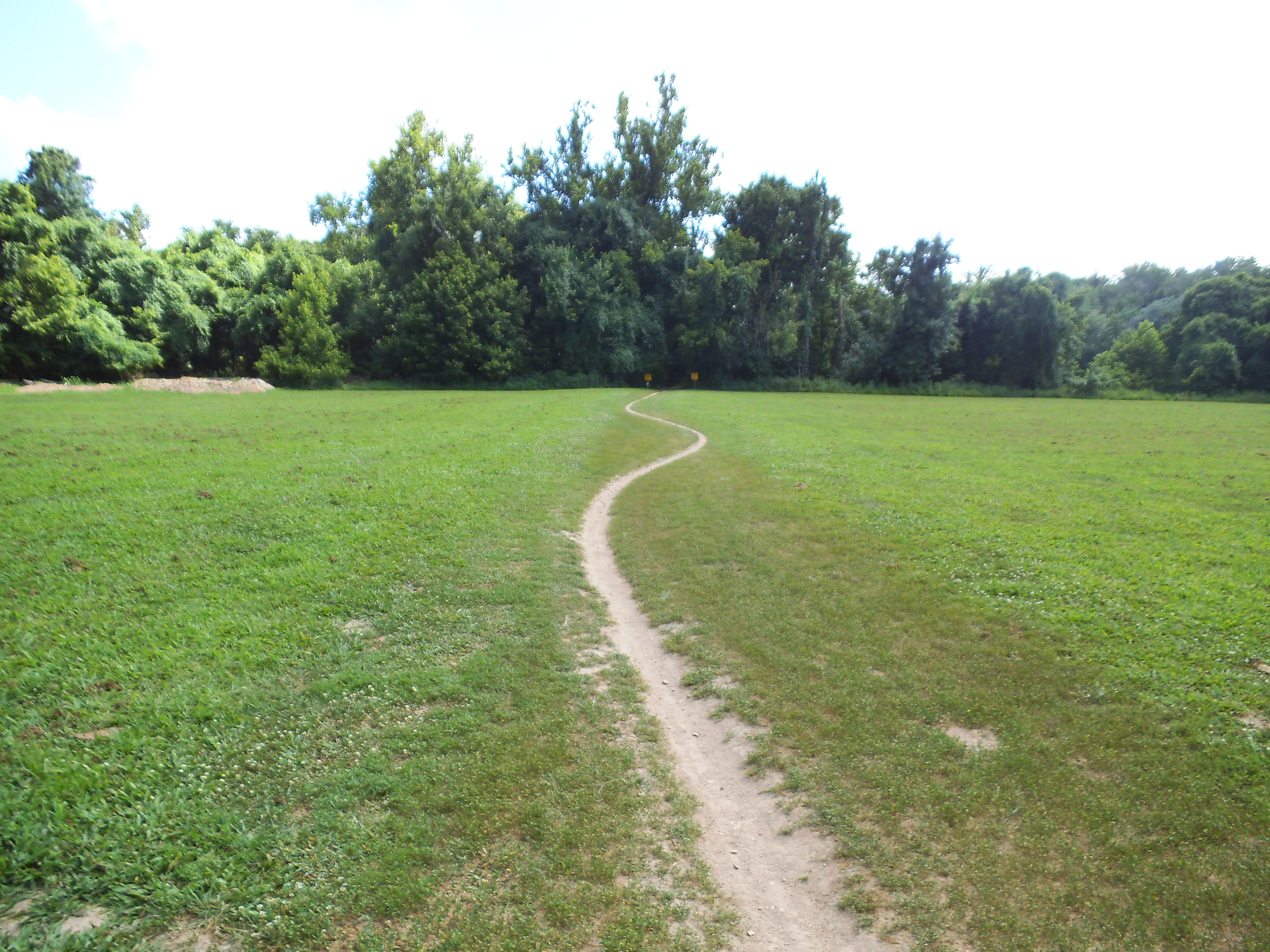 As Castlewood State Park is just south of some of West County’s (St. Louis County) suburban areas, it is one of the busier State Parks in Missouri. On the weekends it can be difficult to find a place to park. As this is a good thing (people being outside and active in nature), if you are looking for solitude this may not be the park for you.
Traffic on the trail, especially in the lower areas can be a bit sudden. Pay attention in front and behind you, as bike riders can show up really quickly.
 Keep your dog on a leash. The Missouri State Park policy states that ALL dogs must be leashed…but sometimes I let Max have special privileges when nobody else is around. I do NOT let him off the leash here though, as there are always people and bikes and dogs around.
Please, please, PLEASE be careful while on the bluffs. I can recall news reports of people slipping off the edge and down, down, down, to the tracks below. I can’t imagine that was pleasant in any way. Keep an eye on your kids and dogs too.
Also, if you happen to go to the park to play in the river, be aware that at least one person per year drowns here. I don’t know if that is due to strange river currents or lack of ability to swim. Again, keep an eye on your kids and dogs.
 All in all, Castlewood is probably my favorite State Park close to home, and I have been going there for years. The views are beautiful, the forest is deep, the river is alive, and it is a place that many people get to enjoy throughout the year. I try to hike there at least once a season, and it is the perfect place to spend the day.

The view from my table saw.
So as though my desperate prayers had been temporarily answered, a week ago I was hired on for at least a couple of weeks with a company that I used to work for. Thank you, God. Hopefully this lasts.
It has, however, put a serious cramp in any time that I have had to hike or write, so I am attempting to evaluate my schedule and make time for these things. I am not complaining though. As much as getting out into the woods is important for me, and writing is something that is a sort of meditative therapy…it is really good to be working. Again, hopefully this lasts.

Poor Max has been forced to stay home while I am at work.
Patience is key, as I learn to keep up this thing that I have come to love. I will definitely be spending at least the weekends out in the woods, but I would love to hear what other people do to make time to write, while one’s schedule is full. Thank you for reading, and I will have a more “regular” post up as soon as I can.
-Gabe
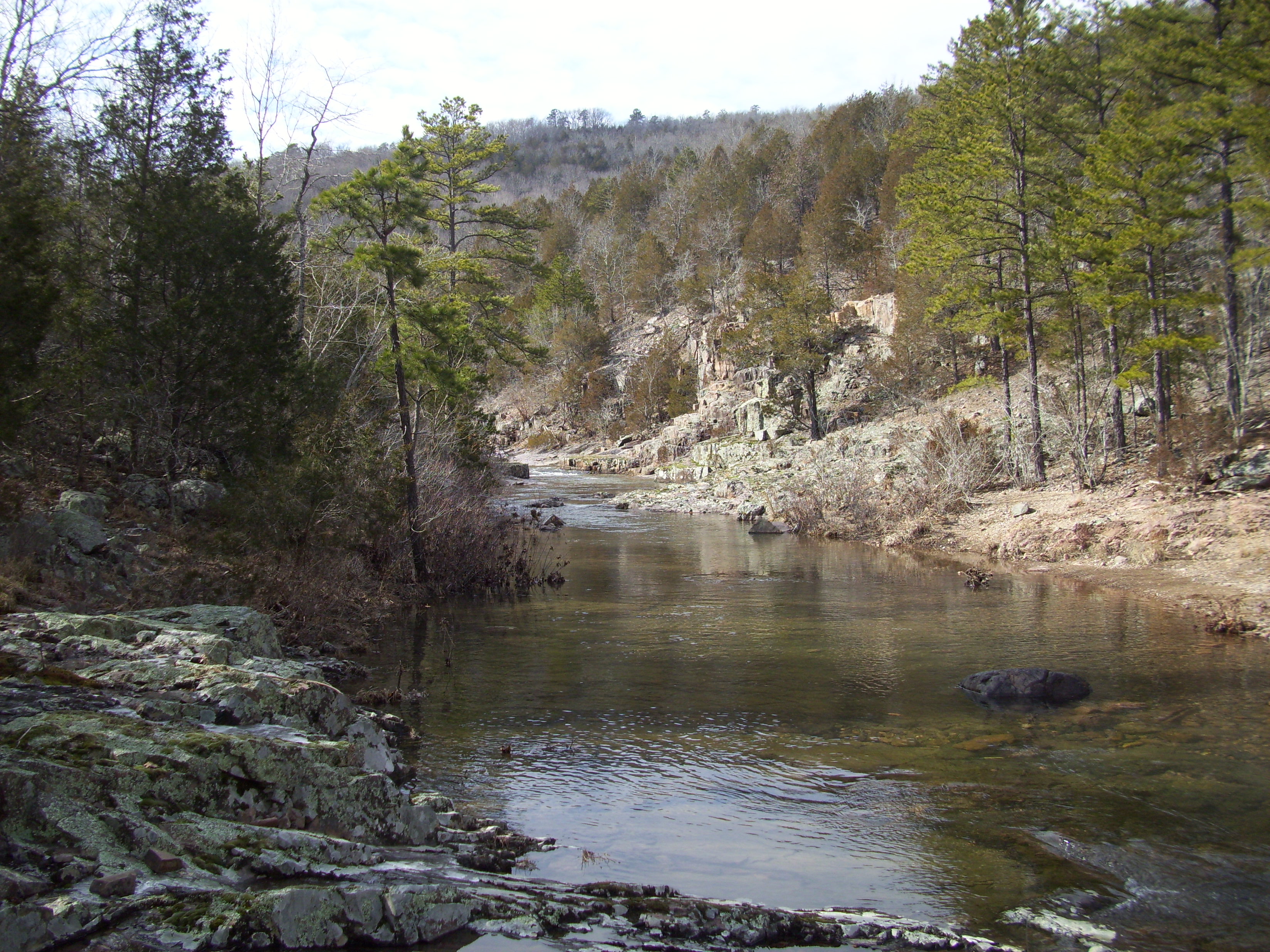
Lower Rock Creek
(A “Looking back down the Trail” side-route)
So I wanted to share some things with you that maybe aren’t exactly about the forests and campgrounds and trails of Missouri, directly. I wanted to take a few moments to explain myself and where I am in my life. Why is this important? Why would I blog about this? Well, most of my motivation for writing this post is because I don’t have the answers I’m looking for, and I am searching for some insight. I also know that a portion of the motivation is fueled by the thought that if I was following a blog by a guy who was camping and hiking all the time, I would eventually ask “What the heck does this guy do for a living?!?”
What do I do for a living?
At the moment…nothing, but not for a lack of trying.
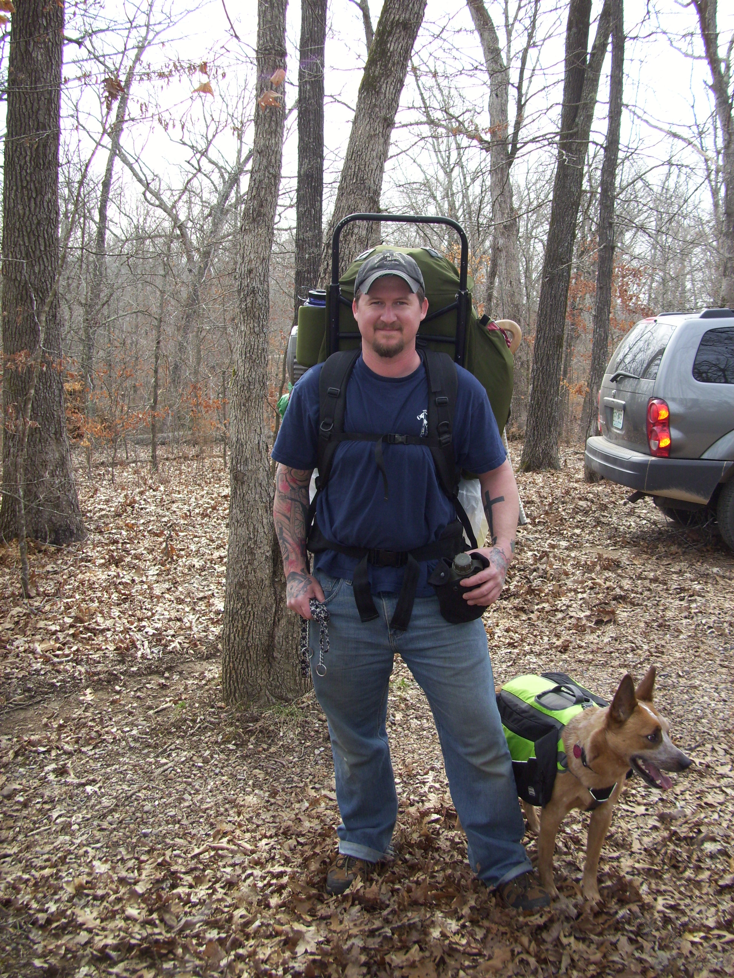
In about 8 hours from this moment, I would severely sprain my left ankle. 4 months later it still isn’t back to normal.
I have been a member of the Carpenters Union here in St. Louis since September of 2002. It has been a rewarding career…at least in the beginning before everything screeched to a halt. Back in December of 2008 I was laid off by a company that I had been working for very steadily for five good, plentiful years. Since that point, just around four and a half years ago, I have probably been on the job for only around 24-30 months. I have been employed half the time. Imagine what a 50% cut to your funds would do to your economic situation…
Now, I AM a good carpenter and I do enjoy the work. I show up on time, and I am a smart guy that has the ability to grasp and pull off whatever product the plans call for. I know what I’m doing and I work hard. But the downturn in the economy with its snail’s-pace recovery, and some badly timed opportunities, have made it difficult to find steady employment. This continual happening of “Nobody’s Hiring”, combined with working for only a few of weeks or months at a time (and then having to find a company with work again, who needs guys and isn’t just putting their own people back on) is a process that I am past becoming fatigued from, more emotionally than anything. Those aspects, coupled with too many moments where I have felt an unearthly and serendipitous manipulation from a higher power to spend my time writing and being surrounded by nature, has lead me to a line of thinking that maybe building houses isn’t what I want to do with my life.
So maybe I don’t want to be a carpenter anymore.
It is a frustrating realization to think that this career that I have invested time and walked through occasional embers to pursue is the wrong path. I have enjoyed my work, when it was happening, and all the benefits that came from it. The pay is good. My family had health insurance. Turns out that I am surprisingly mechanically inclined. And it kept me in shape and allowed me to sleep peacefully at night. I love all those aspects of it. But as of late, I have not had any chance to prove myself and my abilities so that I can gain steady, full time, reliable employment (which is what I truly need). And that has been wearing me down, among a few other aspects of the construction industry that I feel are more negativity than I want to have to tolerate.
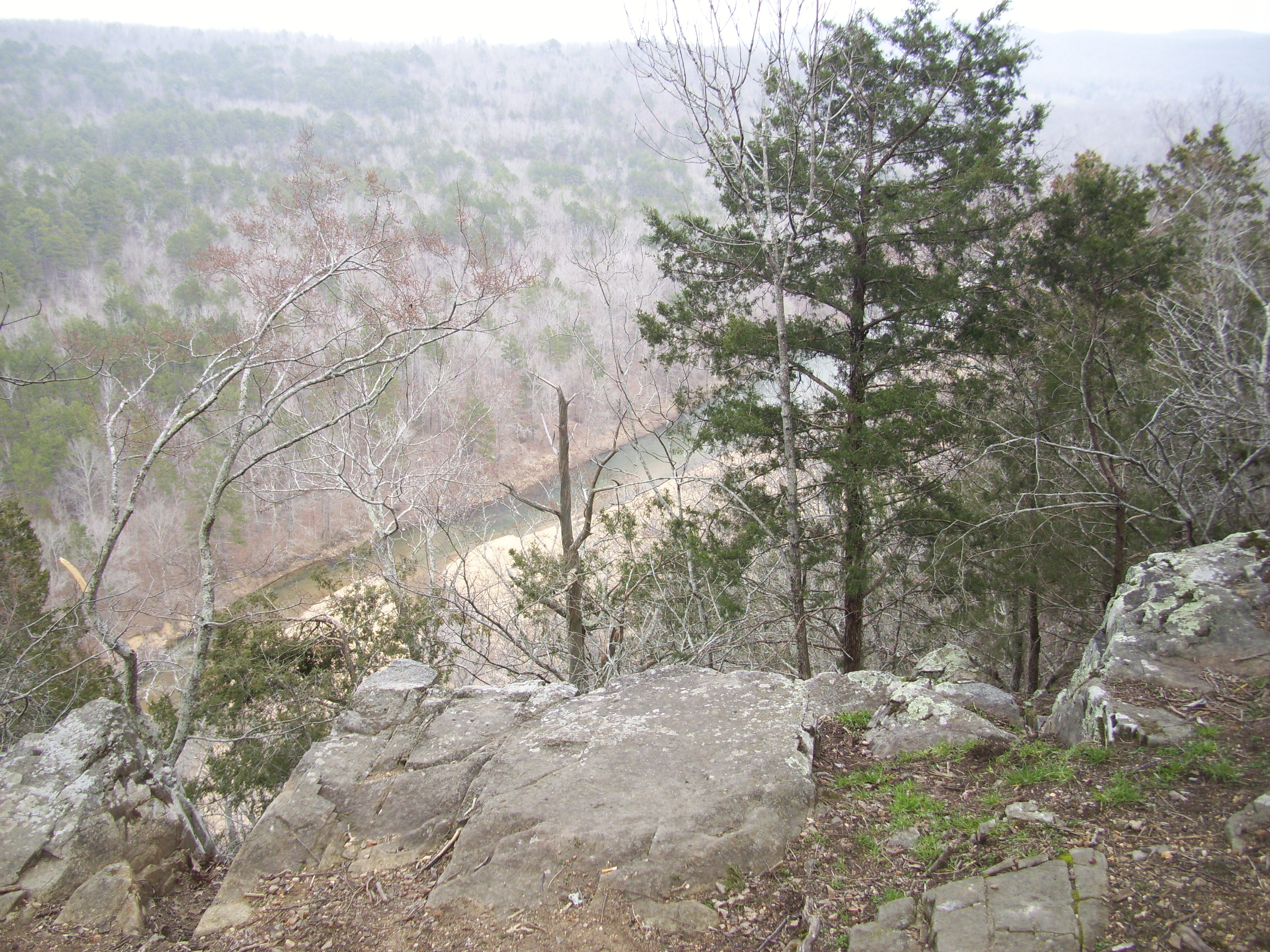 At the suggestion of a friend, and the thoughtful support of some of the people in my life, I started this blog at the end of March this year. I needed to feel like I was being productive somehow, against all the similarly ended phone calls of “No, sorry…we’re just not hiring right now”.
And it has helped to distract me. It has also given me an exterior motivation to head to the woods and spend time in nature with God and this beautiful environment. Additionally it has brought me back to my love of writing (boy, if I could just learn to type!!!). Through the ability to be creative these past four months, it has helped me to see that there are things beyond what I have been trying to be in my life. That there are things that I love spending my time doing, that take no struggle for motivation whatsoever.
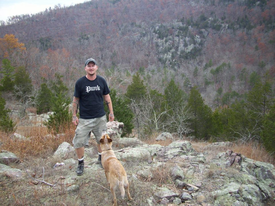 So do what you love, right? I would love to have a job spending time in the forest. A career where I can be involved in conservation and the outdoors. Something that is connected to these places I love to be in. I have been saying lately that what I want to do for a living is just hike through the woods with my dog and write about it. As nobody pays anybody to do that, I do know that being in the forest and writing are two very internally satisfying pursuits for me, and regardless of income I will continue to do them both.
So how do I do something along those lines for a living? I believe I would enjoy working for the Conservation Department or the Department of Natural Resources. But to have any type of career with either of them where you can provide for your family and not have to relocate takes an educational background that I do not possess, and opportunities that rarely exist. I do not have a degree, and at the moment I do not have the economic capabilities and freedom to pursue that. I have kids that need food and clothes, and utilities to be paid. But if I could just see the path that would take me to where I could make a decent living doing these things I love, I would run down it.
 I don’t really know for sure what the next step is…but I have obviously discovered something that I love to do, and I believe in my heart that the universe keeps pushing me away from what I used to do. But I have to be a provider, so what I WANT right now doesn’t seem like the thing that I NEED right now. What I need is a job and a paycheck. And I am continuing to spend a good portion of most of my mornings in the search of those two things, no matter the lack of positions or amount of rejection. Because it isn’t something that I can just stop doing.
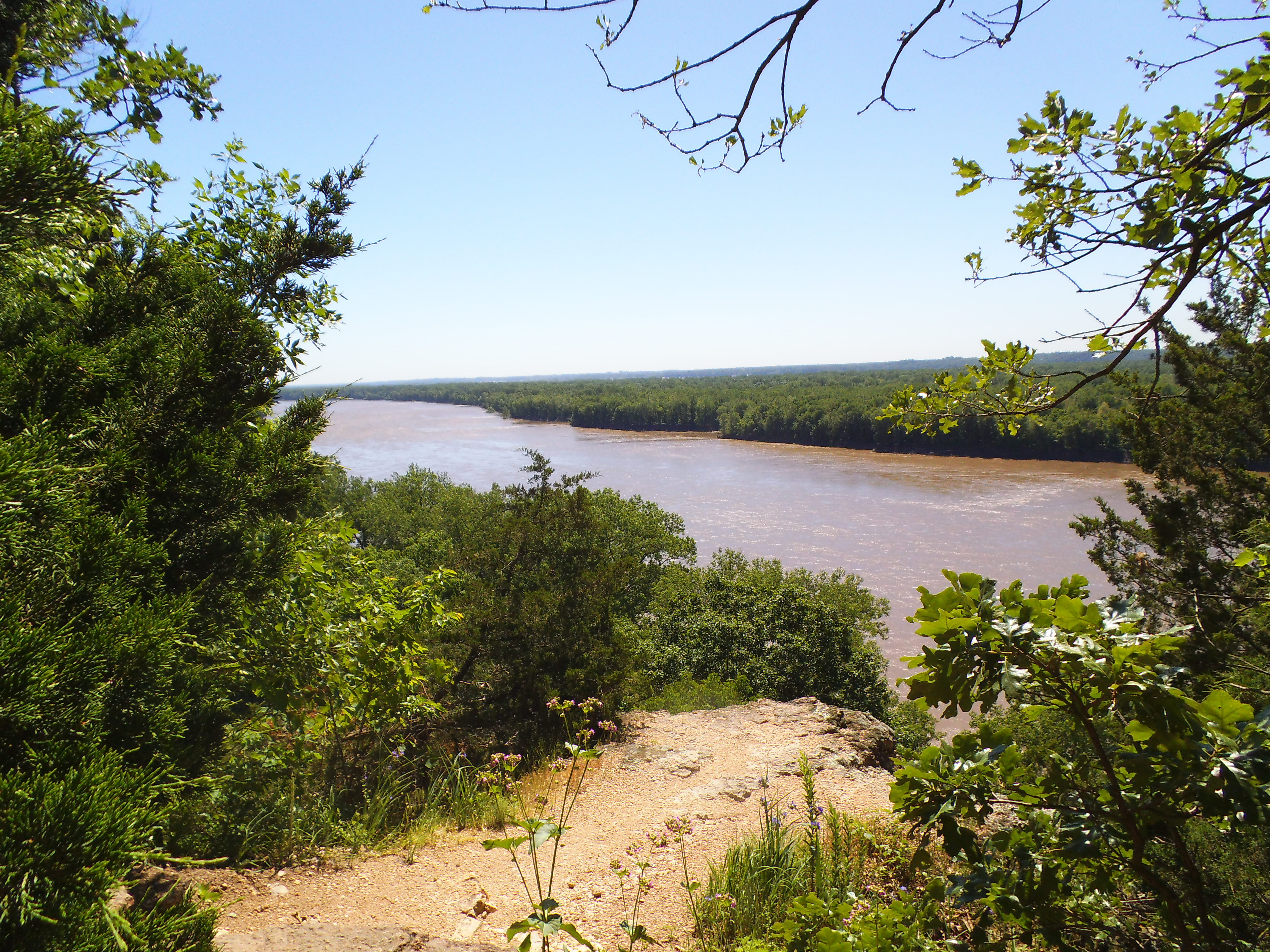 So I don’t know what you will get from this, but I just felt the need to explain myself. To confess. To let you in on the secret of what a guy who hikes all the time and blogs about it does for a living. To throw it out there to the universe and the internet and other people what I want to be when I grow up, to see where it lands. And if you have any insight on finding the trail that I WANT to be on…or know of anyone who is hiring carpenters…don’t hesitate to share.
Please know that I am also not telling you all this for pity or handouts. Sure, things are very tough financially right now and the horizon doesn’t look that bright at the moment, but the silver lining is that I get to spend a lot more time with my kids and a lot more time in the woods. I don’t have an awful life right now, and there are people out there who have it much worse. I am very thankful for the blessings in my life and for the opportunity to wake up every single new day.
 And I am thankful for you and for your following this exercise of mine that is this blog. I get a lot out of it and I hope you do too. I know that a lot of blogs on the internet are out there to provide income, but I can’t imagine that it’s a lot of money, and I can’t imagine that advertisements throughout THIS blog could improve things for you or I (do you see ads on here when you check out a post? I would imagine that WordPress adds a couple, but I can’t ever see them). I don’t ever want someone following my blog here to get that sense that I am trying to sell you something, because that isn’t me. If I am selling anything, it’s the Missouri outdoors, and nature in general…and I don’t impose any fees. I know that this is along the lines of how I would like to spend my days, and if I could find the path to make it a career I would…but…I’ve already made that very clear.
 And until that door-to-open presents itself, I will continue to look for work every chance I get, as I have been.
Thank you for your time and attention, and have a great day. Get out in the woods, please. It is good for you in ways you won’t even recognize.
(See where this trail began, here)
