
Scenes from our Recent Natural History. The Swimming Deer Trail, St. Francois State Park 7/20/2013
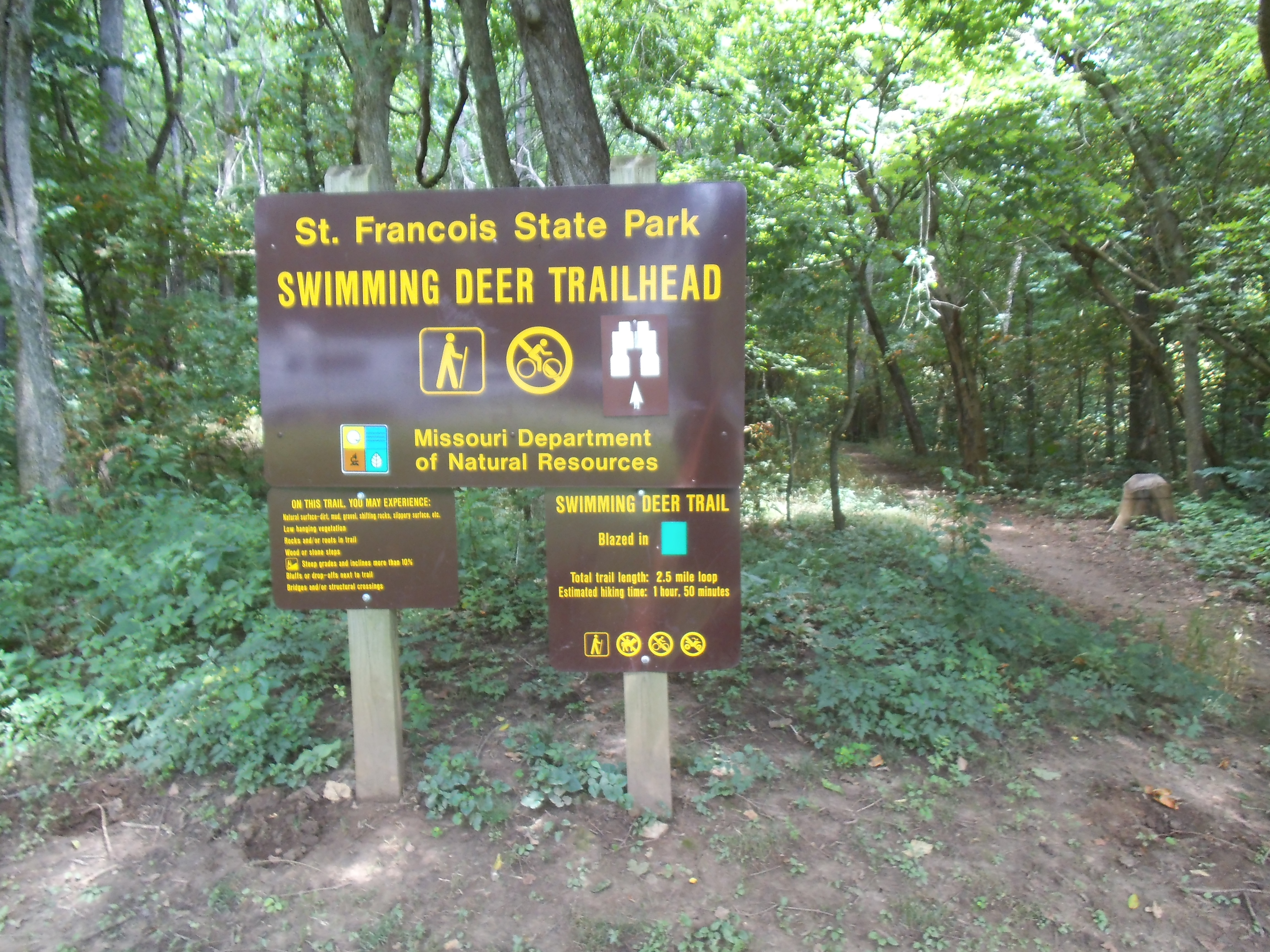 Well, if you are familiar with one of my FAVORITE trails, the Mooner’s Hollow Trail at St. Francois State Park, then you know that there is a lot of natural beauty and backwoods history to the Cooneville Creek Natural Area. If you haven’t hiked it already, then you need to check out the two and a half mile Swimming Deer Trail, at the far end of the campground.
How to get there:
 From south St. Louis County at the 55/270 interchange, take 55 south around 20 miles to 67 south at exit 174B. Then stay on 67 south for about another 20 miles. It will be a left turn across the divided highway to get into St. Francois State Park, probably 5 miles before you hit Bonne Terre, MO. Once you’re in the park, just follow the main road down through the valley, past the river, up the hill and turn left into the campground. After the entrance shack, make a right and follow the road to the back end of that campground loop. The trailhead is between the two farthest campsites.
 The first section of the trail heads straight back into the woods, somewhat parallel with the Big River, and you should keep an eye out for blazes (trail markers) so that you don’t head off on one of the handful of trails that cross it, most of which head to the river. You will pass a small cave opening up the hill to your left, and then at about a third of a mile, the trail turns to the left and climbs a rocky outcropping. You then start another section up the hill in your original direction, with the incline tapering off the higher you get. This is the most challenging part of the trail, and after this most of the up and down parts aren’t as steep.
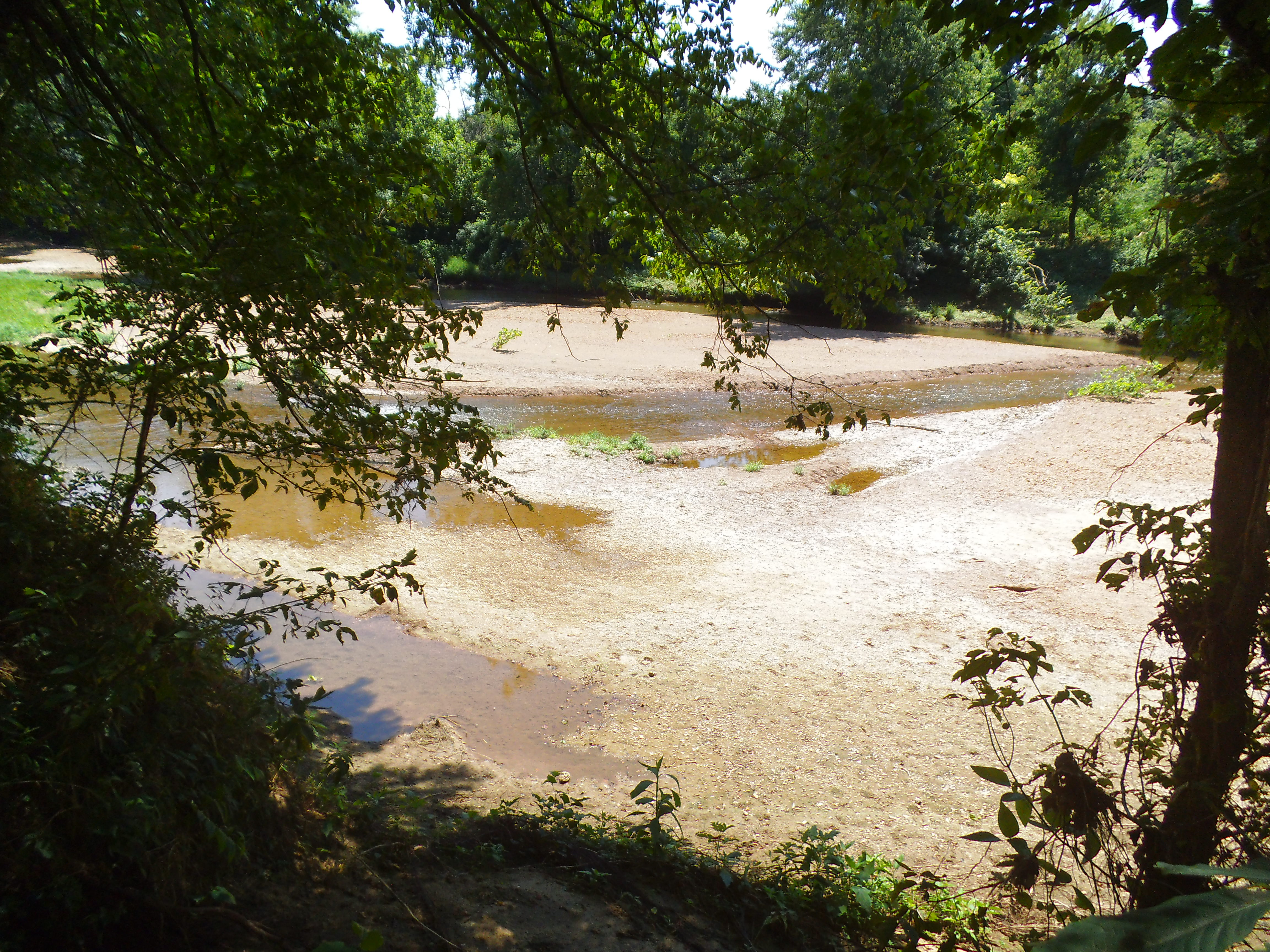
 So it continues to follow the river for about a mile in total, and at just before a mile is a bluff where you can overlook the river below. It is a neat little secluded spot, and if you are there on a summer weekend you will very likely see people below you, floating down the river on inner-tubes or rafts.
Soon after this bluff, the trail starts to turn to the left and head into the deeper, more isolated part of the forest. Along this section there are a couple of creek crossings and there is actually an old shack that still stands from a time when the woods here were a place of industry and commodity (It probably was from the local logging industry, but I like to think that it was left there by the moonshiners in the area). Unfortunately it has become dilapidated and is overrun with the modern vandalism of people scrawling their names on the the planks with some of the damaged plaster. Too bad. Something like this from our regional history ought to be restored and respected.
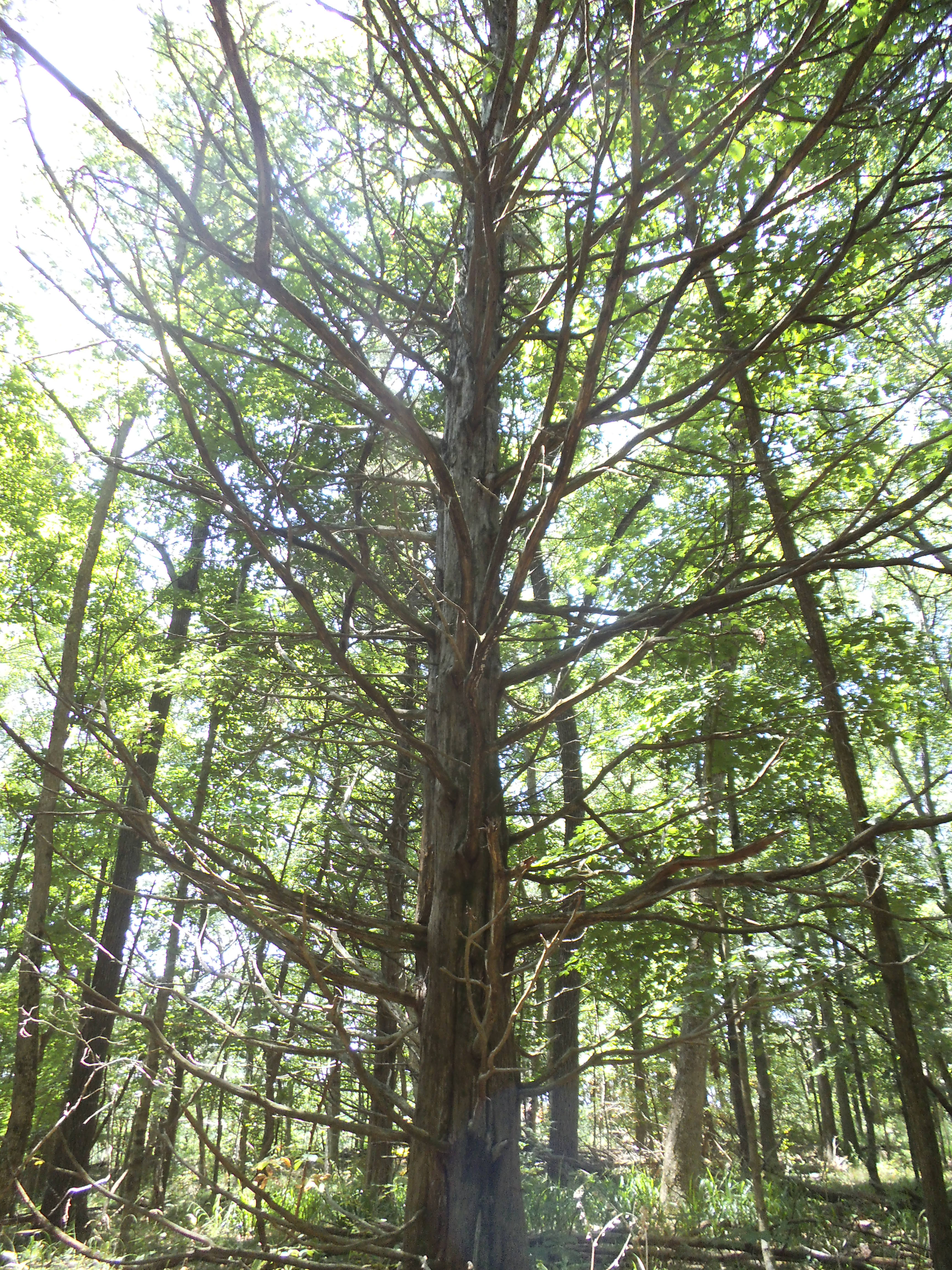
 The trail makes its way back into its counter-clockwise curve toward the the river, passing through some of the shadiest forest in the park, including a couple of the more distinctive (and possibly creepier) trees in the area. You also pass an opening to a cave (or a mine!) that has been covered up for safety reasons, as it goes directly down into the earth below (and is filled with poison ivy vines near the opening).
As you get closer to the end of the trail, you can hear the sounds of the campground through the trees, as it passes not too far away from the amphitheater and shower house. It eventually meets up with its beginning section, and it is a short straight shot back out to the campground.
 What I like about this trail:
After you hike past the first part of it that is along the river somewhat, the traffic dies down and you get to experience a more isolated sense of the forest. It doesn’t seem as though a lot of people hike this trail, what with the more popularized Mooner’s Hollow along Coonville Creek, and the Big River itself being such a draw for patrons of the park.
I haven’t hiked it in the winter, but this is one of the shadiest trails I have been on. Very cool, even in the heat of July that Max and I hiked it in.
The shack, and the other places in the forest that you come across (there is a rocky area that I swear looks like a big, old, decaying building foundation) that speak to the past, when there were logging and mining operations in the area (and moonshiners!), allow for mental images of American history and industry that were from not too long ago. They say that some parts of this forest were so heavily logged that most of the trees were gone at one point.
 The overlook, just before the one mile point, is a neat spot to stop and take in the view of the river and the surrounding forest.
What you need to know:
This was the second time that I had hiked this trail, and I think the thing that bothers me is that there is no established parking for it. You either have to park in the grass or find an unoccupied campsite nearby.
A lot of the water features are dried up watersheds, and I’m sure this trail would be lot livelier after a recent storm, as well as muddier.
 It had been a hot July day off, as I had recently started working full time again, but Max and I were grateful for the cooling shade of this quiet and isolated trail that we seemingly had to ourselves. A trail in a forest that echoed whispers through it, of times not too long ago when we were more closely connected to the gifts of commodity and materials that the local woods and ground provide.
