
The Hidden Overlook! Vilander Bluff Natural Area 9/14/2015
 It was a Monday morning off, after a weekend of camping and hiking in Madison County down at Marble Creek Recreation Area. The weather was going to be perfect, and Max and I had to take advantage of that and spend just a little more time out into nature. A trail that I had hiked with a group a couple weeks back was the Vilander Bluff Trail, but I hadn’t taken a lot of pictures or really allowed myself to get a good observant feel for the trail and the woods. I knew we had to get back there, and this day off would be the perfect opportunity. So I grabbed my day-hiking backpack, got my best hiking buddy in the car, and we headed down the road to Vilander Bluff Natural Area.
 How to get there:
From the interchange of Interstate 44 and 270, take 44 west almost 56 miles to Bourbon, MO. Get off of 44 at exit 218. Make a left onto Pine St. and take it about half a mile as it curves to the left and goes straight through downtown Bourbon. You then make a right onto Route N, and follow it around and out of town for about 8 miles. Soon after you pass Riverview Ranch on your left and cross the Meramec River, you will go up the hill to Thickety Ford Rd. Make a left on Thickety Ford Rd. and take that about a mile and a half where there will be a gravel parking lot on your left.
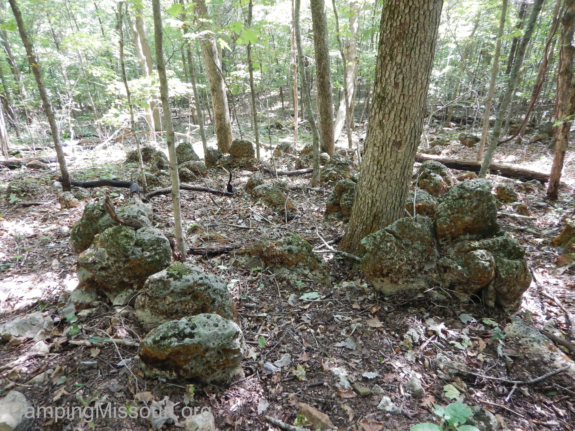
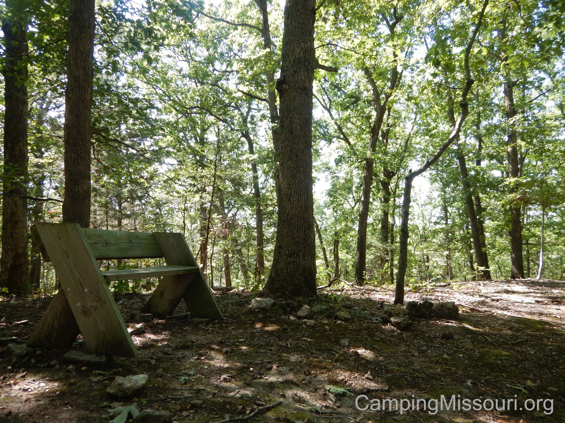 The trail is listed as 1.25 miles, and it heads out from the parking lot through some flat woods, across a power line clearing, and then starts up the hill. It then comes to the loop, where you can go right or left. Max and I turned to the right, and the trail works its way slowly along the hill, rising steadily as it takes you past some interesting rock formations. It then switch-backs and continues to work upward through a steeper section, eventually leveling out somewhat as you near the crest of the hill. At the top there is an Aldo Leopold memorial bench put there by the Missouri Master Naturalists. From here the trail goes back down the other side of the hill, switching back and forth as it moves into the deeper woods, and joins up again with the trail back to the parking lot.
 Why I like this trail:
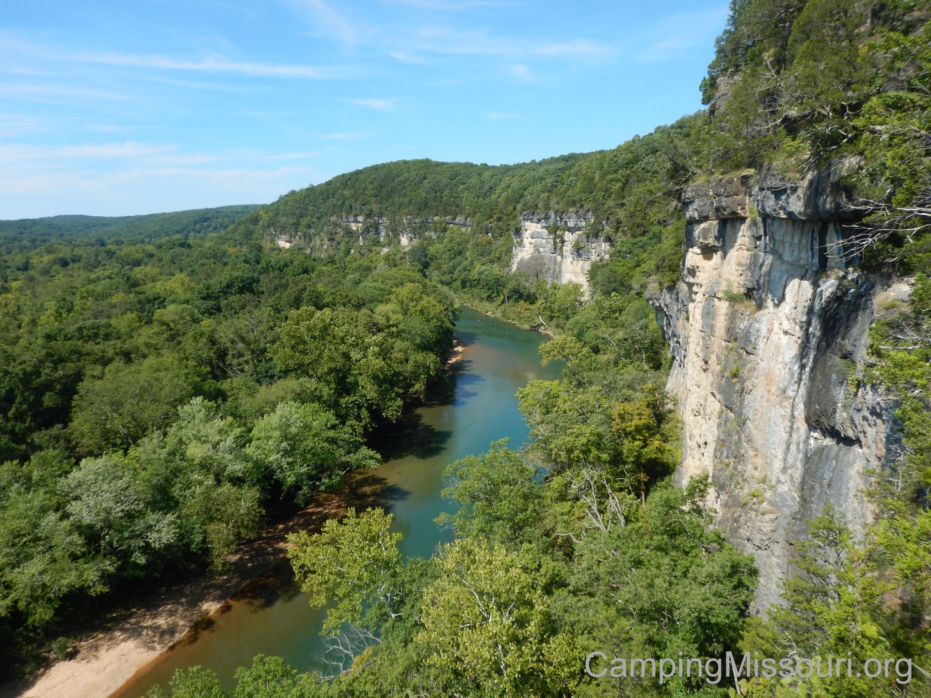
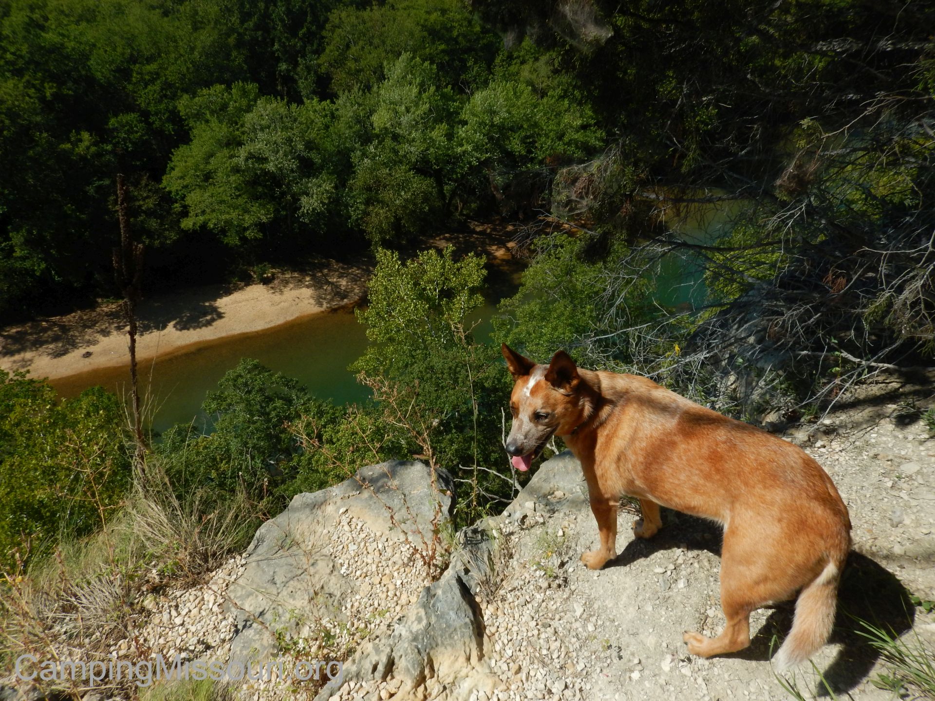
The biggest draw of this trail is Vilander Bluff, over the Meramec River. Rising up 200 feet, it is the tallest section of bluffs along this popular waterway, and is certainly an impressive sight to see from either above or below. Looking at a map of the area and the path of the river, it is a pretty tight curve that swings around. I appreciate imagining how over centuries the Meramec has been wearing away at the hillside, carving the rock face into the stoic vertical plane that it is today. Imagine a tall hill, missing one half, and that is what you will find at Vilander Bluff.
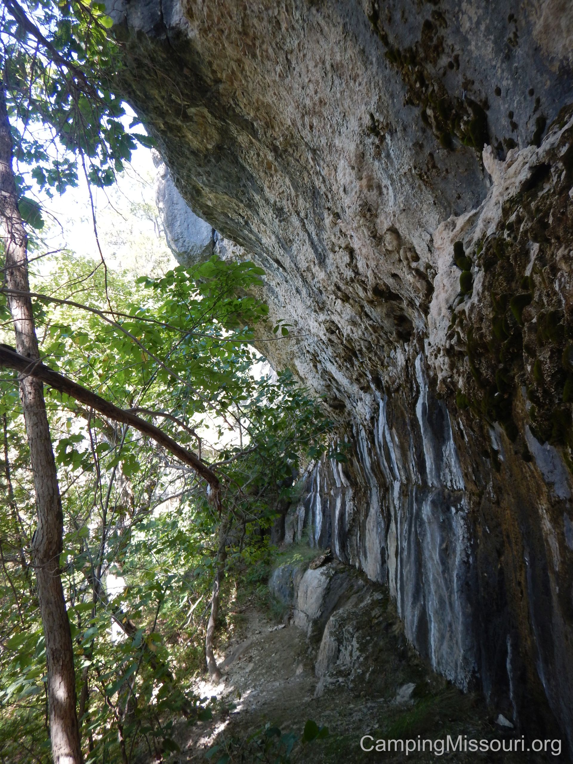 Up the hill just slightly from the primary overlook is what I can only describe as a mountain pass that goes along the face of the bluff. Curving around against the exposed rock, it takes you on a short and sweat inducing narrow path to a couple other scenic overlooks. Not for those without sure footing or anyone with a fear of heights, as it will really remind you that you are hiking against the face the tallest bluffs around, but worth the view if you can traverse it.
This area is actually under the jurisdiction of the Missouri State Parks system, and is a part of Onondaga Cave State Park. Situated between Onondaga and Meramec State Park (approximately), it is a worthwhile day trip for anyone visiting the area. This trail is also maintained by a group of Missouri Master Naturalists, an organization filled with people who take pride and care learning about and tending to the plants and ecosystems across our state. Certainly a group that I appreciate for what they do and inspire in the outdoors of Missouri.
 What you need to know:
The loop trail does NOT take you to the bluff! It takes you near the bluff, up the hill from the bluff…but it doesn’t take you to it. My suggestion should you like to see it is to have a good map and a compass (and know how to use them) so that you can find your way out if you are off the loop trail for a while, wandering around the hillside. Either that, or go with someone who has been there before and knows where it is in relation to the trail. The first time I hiked this trail just recently, a friend of mine who came along with us knew where it was from previous experience, so he was able to show the rest of us. I would not recommend going down the hill from the bench without knowing your destination AND knowing how to get back to the trail.
 It isn’t a long trail, but just about the entire thing is pretty rugged. Taking you along a path naturally embedded with rocks and tree roots, it certainly reminds you that you are traversing a hill that has seen the wear and tear of the elements, washing away some of its layers of soil over time as it stands above the other nearby topography. Just think of it as “getting your money’s worth” in a short distance.
I would be foolish to not mention that in this area, as well as any overlooks, use EXTREME CAUTION when near the edge of any drop-off. The distance to the ground and river below is something that a person would not walk away from, where the worst to happen. Please be careful when hiking and exploring in this area.
 It had been a pretty adventurous weekend, but Max and I needed to spend more time out in the forest. Vilander Bluff was a great choice, and a place that I will have to return to in the later months, as I am sure the spectacular view that exists there will be even more amazing when the leaves are changing and the canopy that shrouds the hillside is opening up to allow an even more impressive panorama. Put this one on your list, learn what you need to know about the area, and make a trip out to the tallest bluffs over the beautiful Meramec River!


This is indeed one of my favorite places. Glad you finally got to it not once, but twice this year!
I am keeping it in mind for a winter hike. I want to see the area with no leaves!
First came across this site last winter and it’s now one of my favorite areas in the Meramec region. Everyone will always talk about the beautiful bluffs, but honestly the old hardwood forest it’s surrounded by is just as impressive. If you’re a fan of big open forests, you’ll find yourself right at home. Plenty of old ashes as well to sate your morel fever in the spring. Matched with an endless view, plenty of nooks and crannies to explore, a large gravel bar on the downstream side, and a handful of caves, you could spend days here and still find more to love. Two muddy thumbs up.
Hello my name is Sharon Potts I would love to photograph the bluffs today. Would you recommend leaving from the benches and heading west with a compass. I have never tried anything like this( going off the path). I will be with 2 other people.