
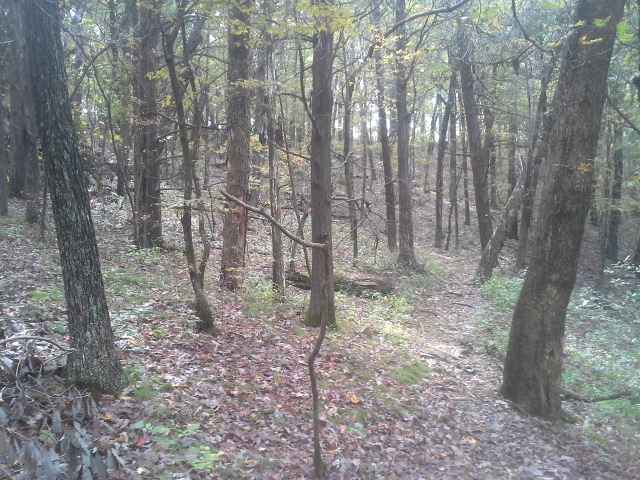
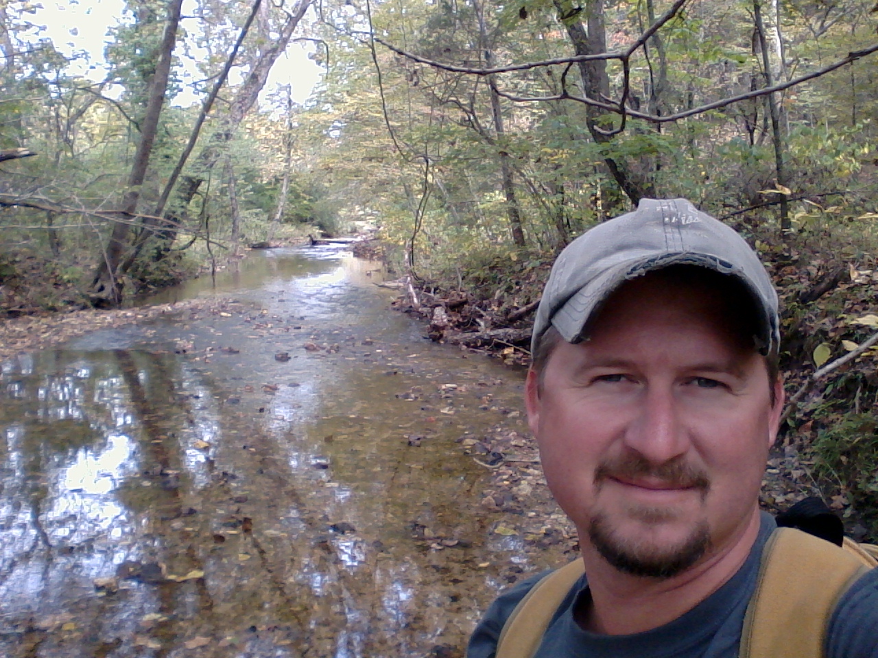
 It is a cold Saturday morning at the start of November, and I am following Bernie Arnold and Brian Waldrop down Highway 19, out of Cuba, MO and into the woods along the Upper Meramec River. I am in a line of vehicles driven by Stream Teamers, and we are on a mission today. We turn on Route O and head into the forest and downhill for about four miles, winding through some of the prettiest countryside a person could be lucky enough to travel through. Little homes and hollows, along the worn paved road, down into the river bottom. We cross a bridge, follow the river on one side, and soon enough our convoy turns left into the Riverview Access Conservation Area.
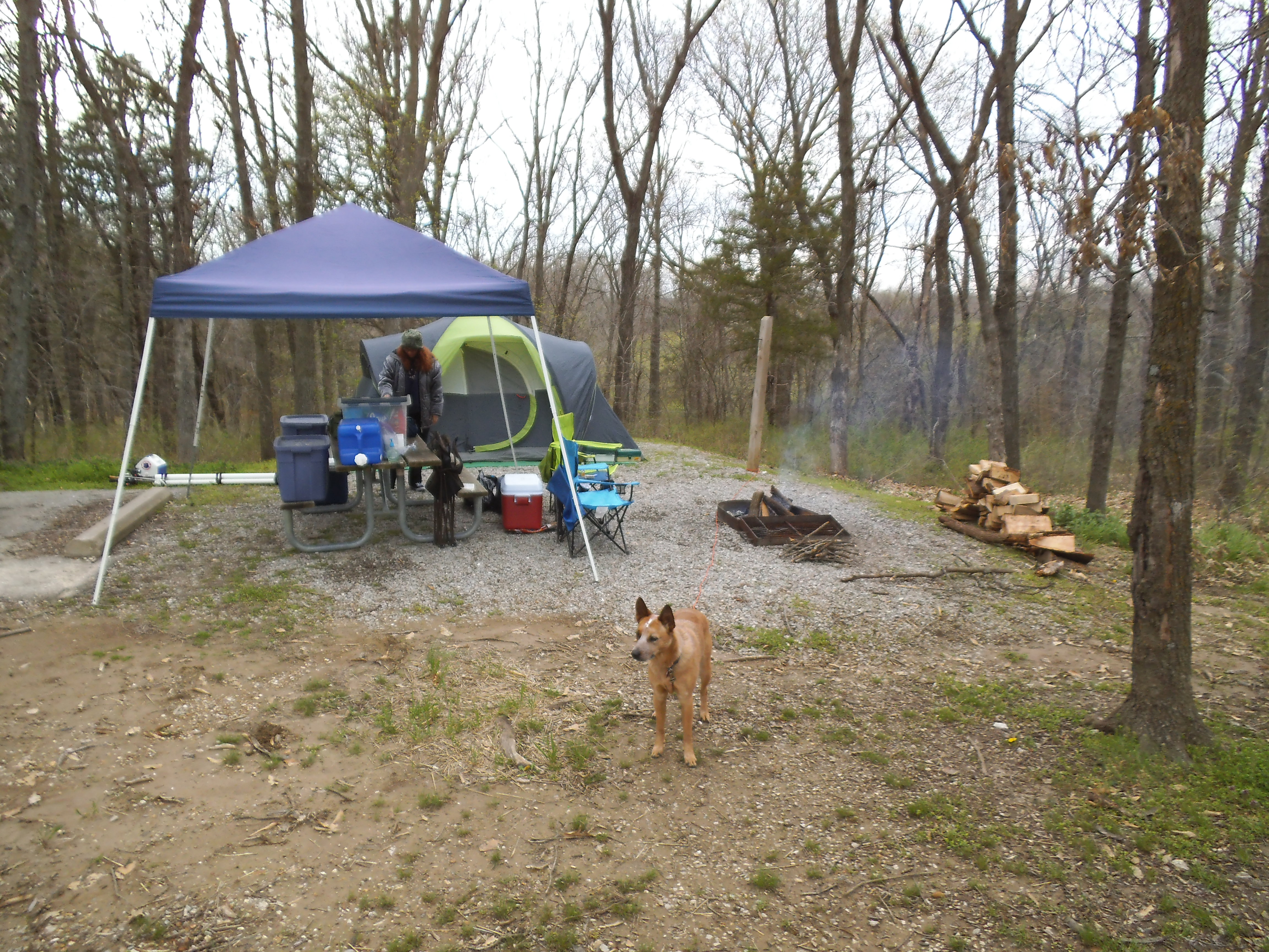
 We all head to the boat ramp and start to unload the canoes and gear. It is a small band of river advocates on this frosty morning, and we are patiently eager to get to the adventure before us, with a cautious consideration of the lack of warmth in the air. Jay, Fred, Ken, Christine, Bernie, Brian, and myself, along with Mike who is to be our shuttle ride. The trip today is from Riverview Access downstream to Bird’s Nest Access. An estimated eight miles (if I remember correctly), according to our fearless leaders. We plan on picking up garbage that we find along the way, but the main target over all others is an old convenience store ICE chest that has been sitting abandoned in the Zahorsky Woods Nature Preserve for the past fifteen years. With the help of some dedicated people from The Nature Conservancy, and of course Bernie and his mean reciprocating saw, the ICE chest is stacked in pieces on the river bank, waiting for our canoes to arrive to float it out, as an actual road to its location is non existent.
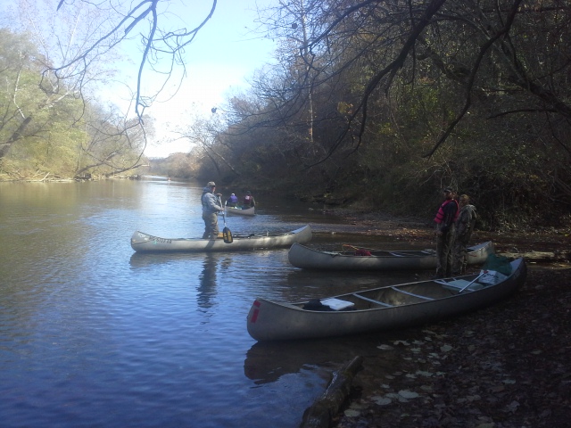 So we don our hats and gloves and extra jackets and waders and rubber boots, and we put off from Riverview Access and head down the Meramec. The air is cold, with the bright sun low in the sky, angling a deficient warmth through the undressing trees on our right side. It is one of those mornings where the air has a bite, and the sunlight is misleading. But the water is clear and the wind is weak, and we have the entire river to ourselves. This isolation is a rare thing in my experience as I am usually floating only on some of the warmer Saturdays when all the other recreationists are there too…but summer is over…so says the thermometer.
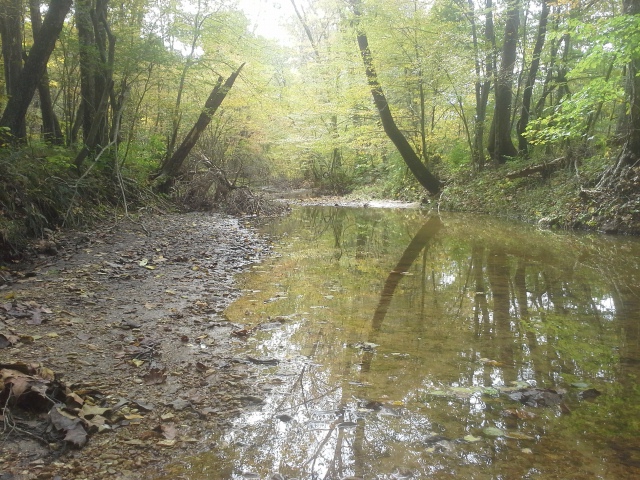
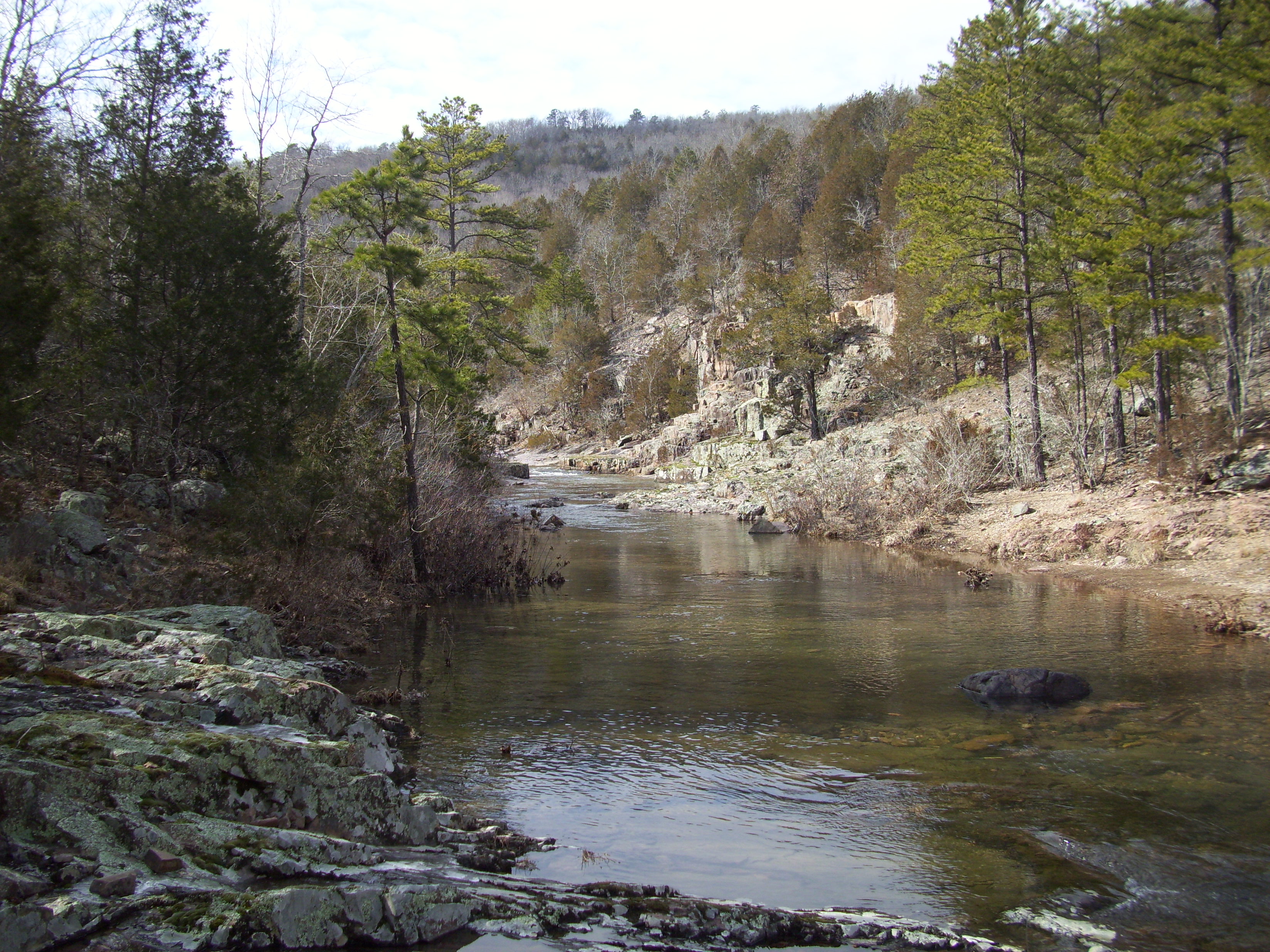
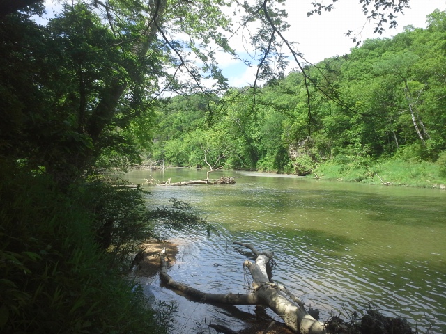
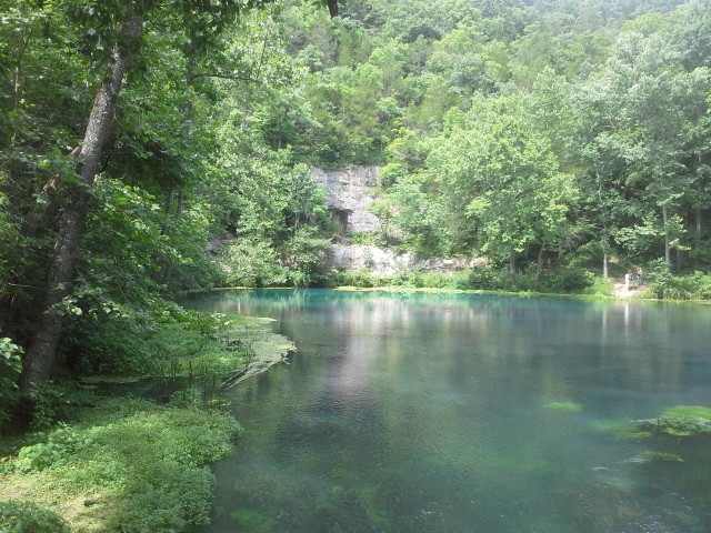
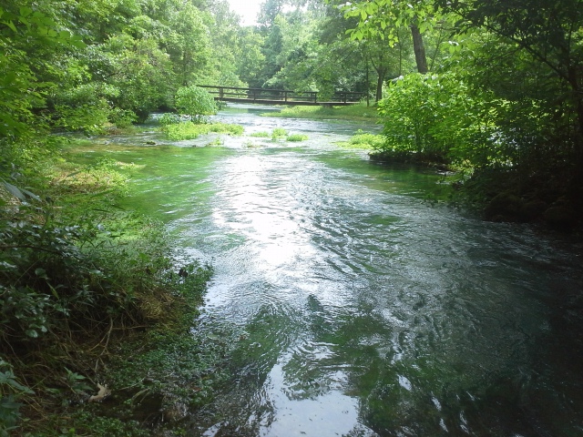
 As we floated down the river, stopping here and there to remove a random beer can or piece of plastic “something-or-other”, I was taken aback by how clear the Meramec River was. This is the closest toward its headwaters I have floated it, and even closer to Leasburg it is still pretty transparent, but I am more familiar with the mud filled behemoth that it is, in and around the St. Louis area. This was clear, like glass. A plane of shimmering crystal surrounding me, to the point that I wanted to avoid dipping my paddle, as if it would somehow break whatever spell of tranquility possessed the water I was floating in. As though I should keep still, and just let the current move me along. It was truly beautiful, and as we traveled to our destination appreciating the now warming of the sun and the soft descent of autumn leaves in the scene before us, a bald eagle broke over the tree line and followed the river in front of us, landing in the trees just ahead. Yeah, there is magic here.
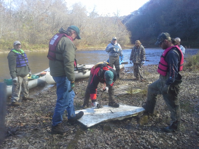
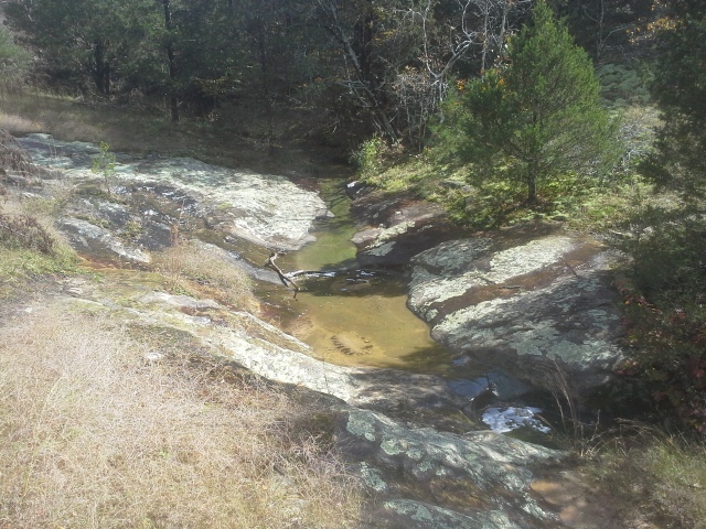
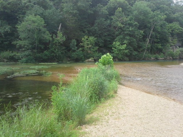
 And that’s how it was most of the day. We came to a spring feeding into the river, bubbling up from below a bluff. We stopped to check it out, take some pictures, and made sure to grab the beer cans that had been left on the hill next to it. Garbage has no determination when it comes to the sanctity of special places. Arriving at our primary destination, we took a couple minutes loading the trash bags and panels from the ICE chest, and chatted with the people from The Nature Conservancy. Then it was back off on the river for the last couple of miles. About a half mile before our take out at Bird’s Nest Access, Ken and Christine spotted some tires up on the bank, which was about six feet up from the water. A ledge of soil, dried out tree roots, and thorny vines. But it was no match for the climbing skills of Bernie and Jay, who spent the next fifteen minutes tossing tires, an old TV, and an abandoned cooler down to us in the water. We added them to our collection, shuffling and settling our trash how we needed it to keep the boats righted, and we headed into the last leg of our trip.
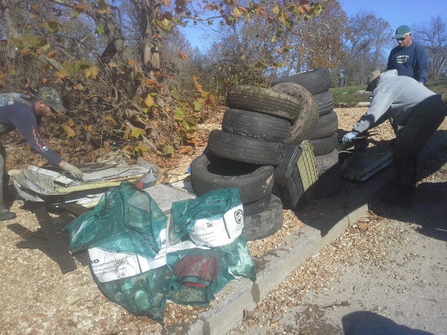 We got to the boat ramp at Bird’s Nest around 3 pm, and unloaded all the canoes. All the scrap and tires went in the back of Bernie’s truck, and we loaded all the trash bags into the canoe trailer, finally hanging and strapping the canoes above them all on the rack. It had been a good haul. The stack of scrap that used to be an ICE chest, twelve tires, five or six big blue Stream Team bags of trash, and various other dumped pieces of households gone by. Turns out that where we found the tires, people have been dumping on the side of the roadway up the hill above it. It all makes its way into the watershed, and it ruins it for all living things. Please dispose of your trash where it properly belongs.
 I love going on these adventures, to float down a river somewhere, cleaning it up as we go and making a natural place even more beautiful. It would be really awesome to not find any trash, and maybe one day that will happen if we can all be more mindful outdoors enthusiasts. But what I really enjoy is getting to travel the river with these great people that have been doing it for years, who dedicate so much of their free time to preserving the forests and waterways. Brian, Bernie, Ken, Christine, Jay, Fred, and Mike…you are the salt of the earth. All Stream Teamers are. I am glad to be counted in that group, and that I get to be a part of days like this.
 For more pictures from this float, click on this link.
Check out the “Mighty” Arnold 211 Stream Team (that I am a member of) at their Facebook page here.
And to find out more about Missouri Stream Teams, go to their website here.
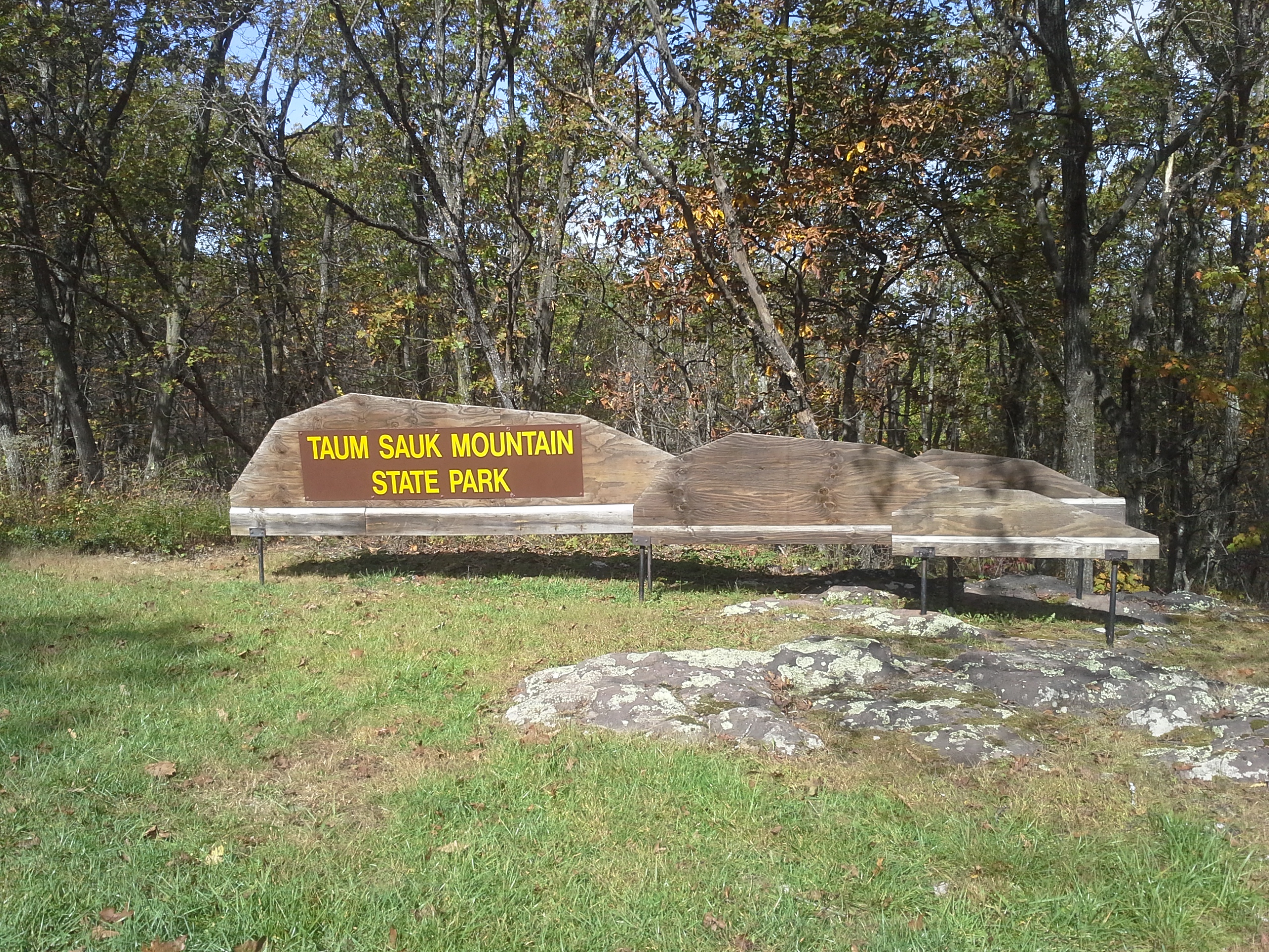
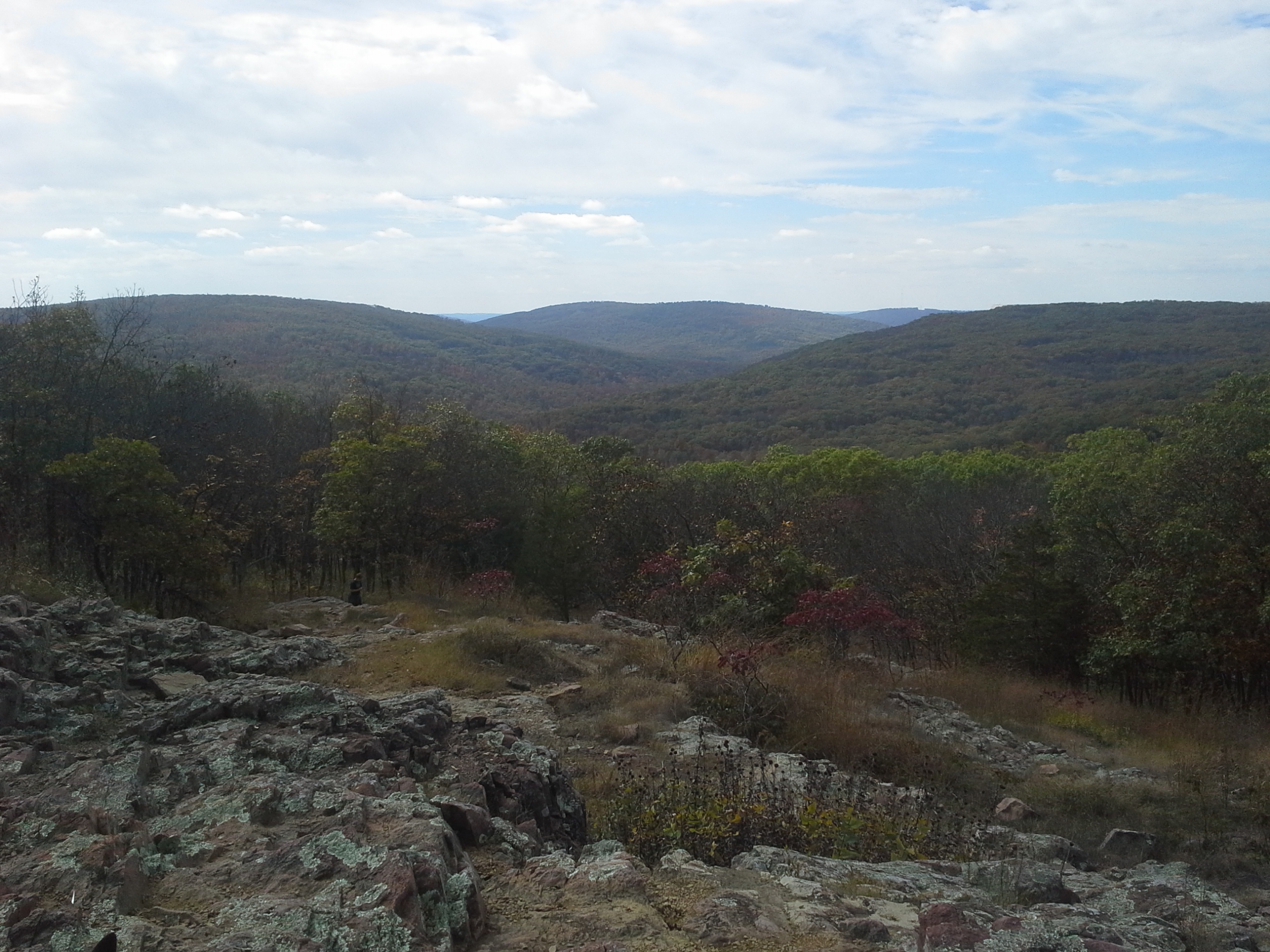
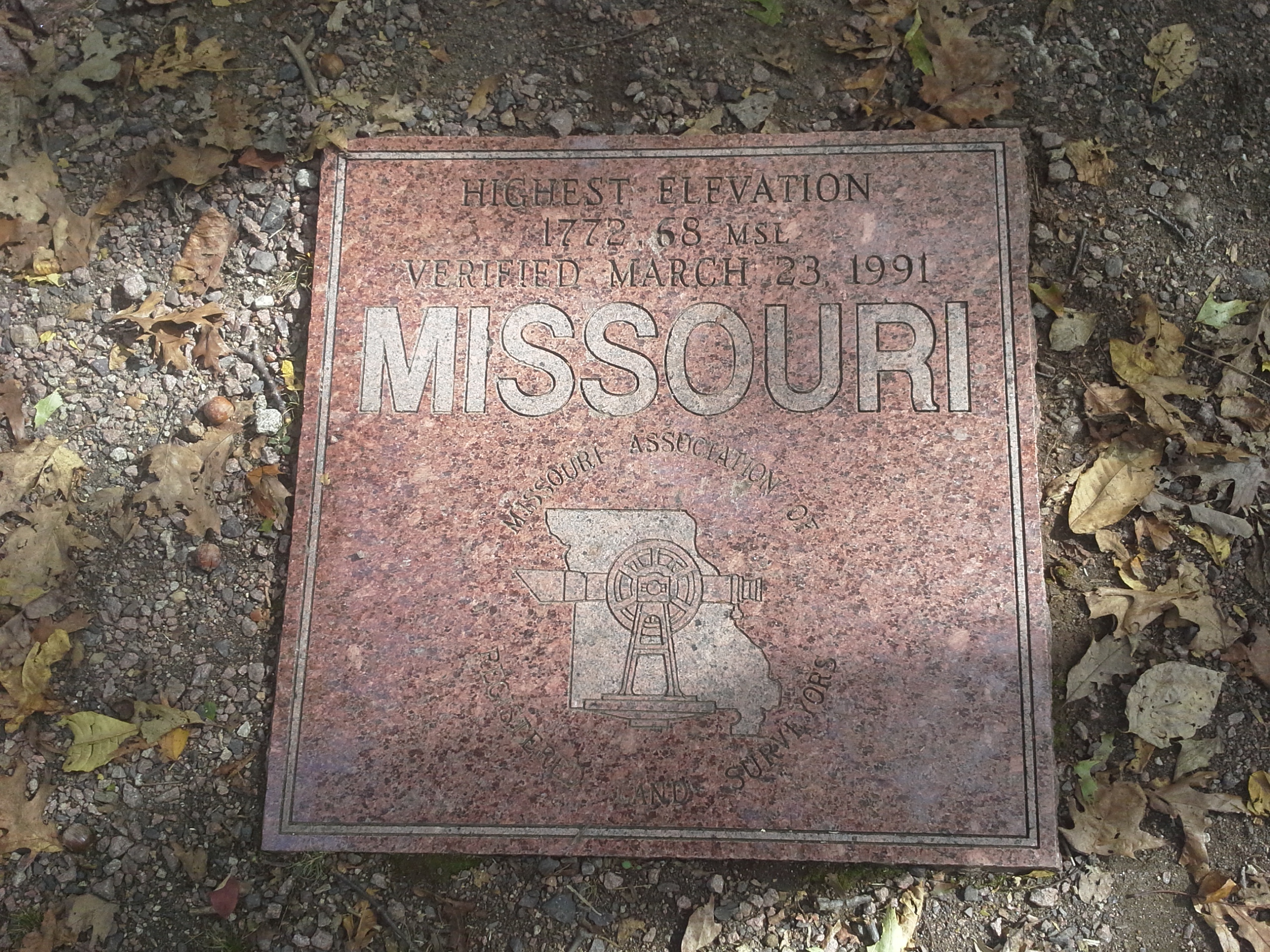
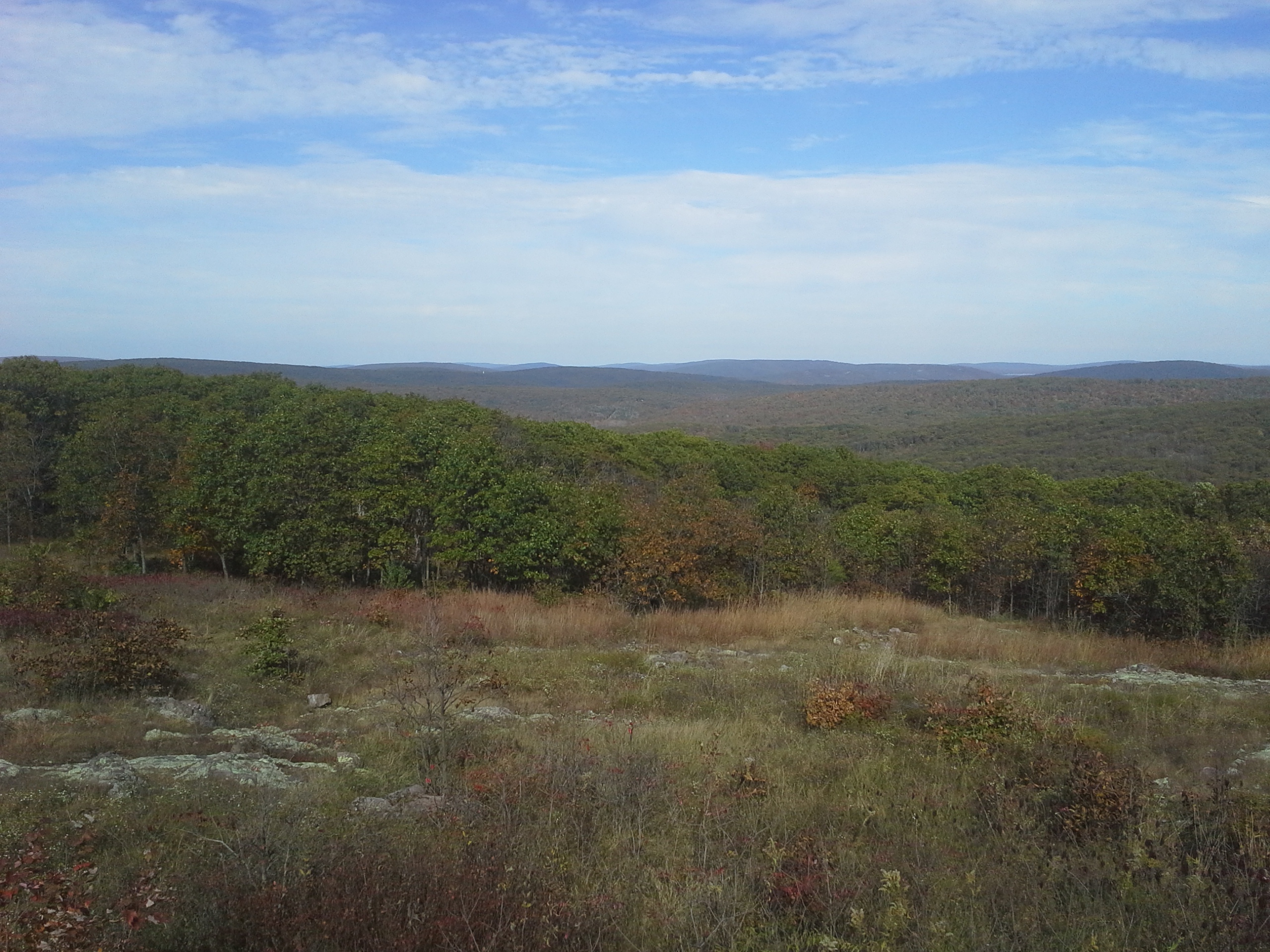
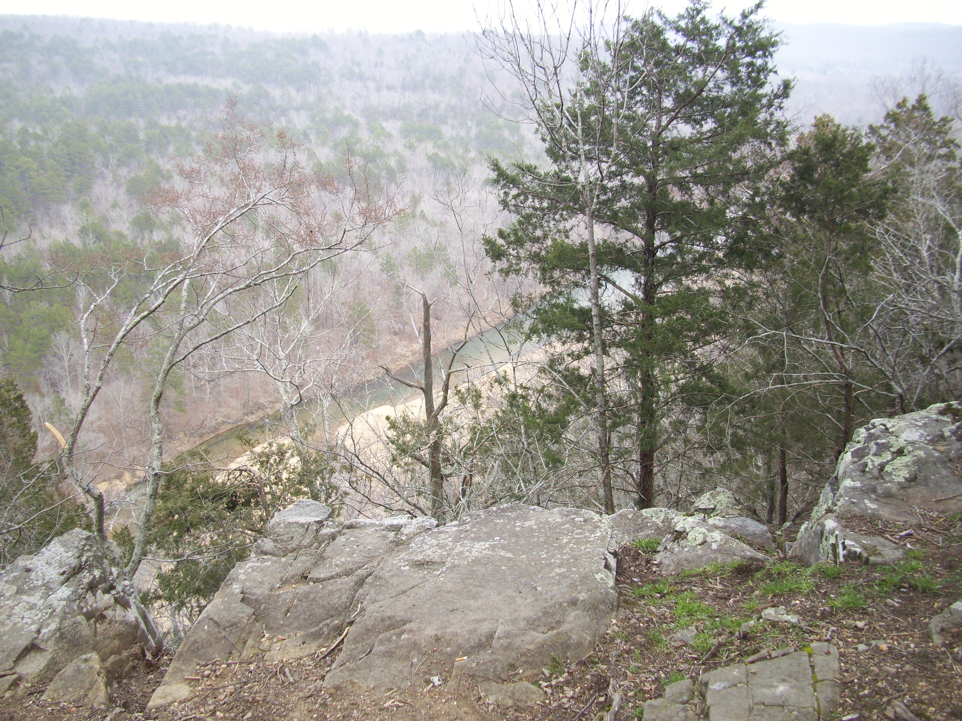
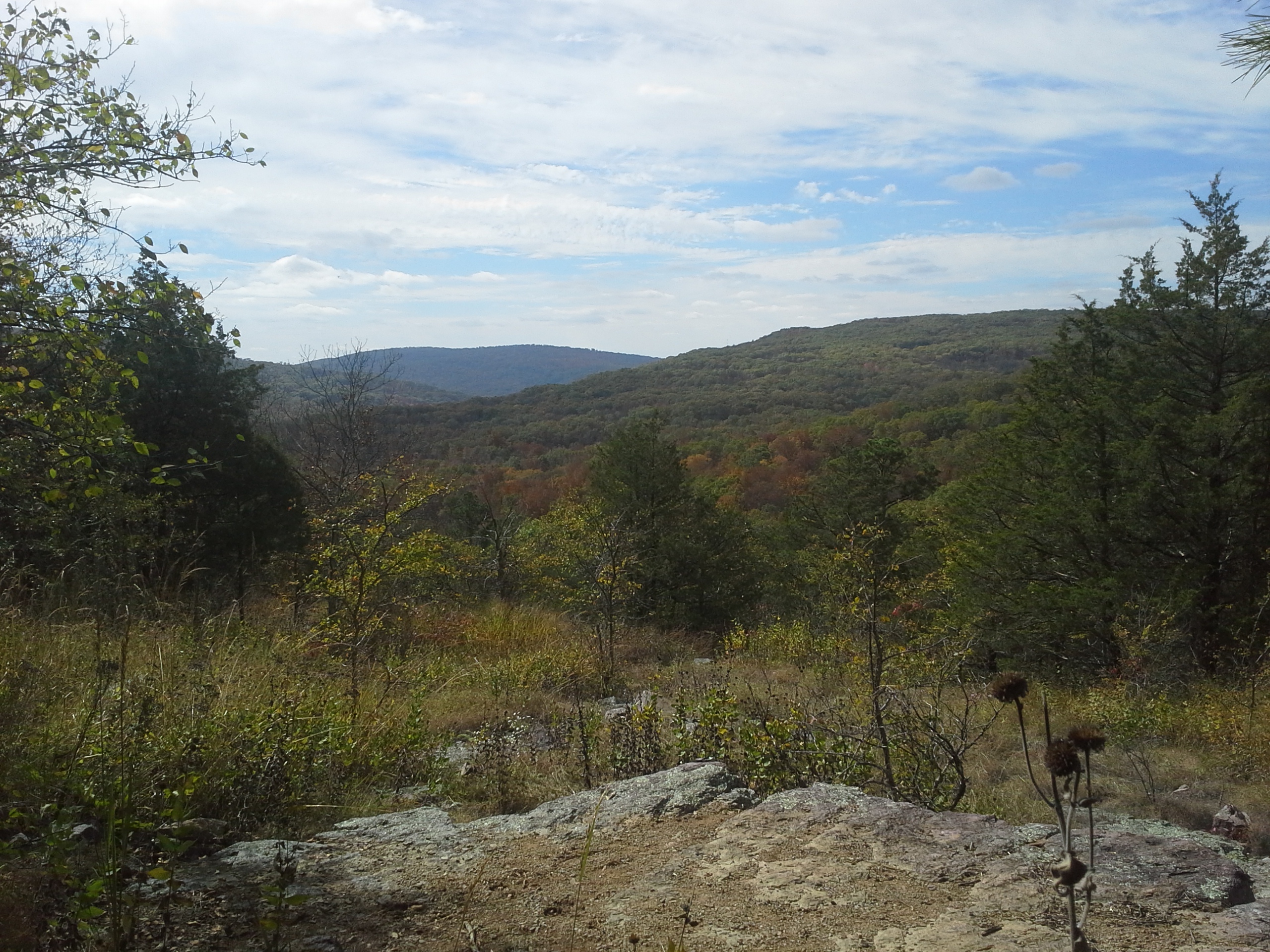 The days were getting cooler and the leaves were on their way to changing color as our side of the equator started getting ready for its winter nap. The sun hung lower in the sky, dipping below the horizon earlier than I ever want it to, and I knew that we had to get out to see the countryside before the trees were bare. One of the best places for epic, sprawling views in Missouri is around the top of Taum Sauk Mountain, toward the west-central edge of the St. Francois Mountains in the south-eastern part of the state. At the top is also the highest point above sea level in Missouri, and a hike along the loop trail to Mina Sauk Falls was exactly what we needed on a Sunday afternoon. So we loaded up the car and headed down to check out the view.
 How to get there:
From the St. Louis area, you have two main route options. One is to head south along Highway 21, which is more scenic, but a bit over 2 hours. The other is to take Interstate 55 to Highway 67, which is about an hour and 40 minutes. If you have the time, take the longer route on 21. It is curvy and scenic, and travels through and near a lot of neat places. On this day however, we headed down Interstate 55.
 From 270 and 55, take Interstate 55 south for about 23 miles, and get off at exit 174B, which is Highway 67 south. Take 67 south to Farmington (about 36 miles), and get off at Highway 221. Take 221 west (right) for about 7 miles out of Farmington, and then turn left and follow it south for about another 9 miles into Pilot Knob, and Highway 21. Turn left on 21, and take it south for almost 7 miles to State Route CC. Make a right on CC and head up the mountain for probably 3 miles, to the top. The observation deck will be on your right as you drive in on your way to the Mina Sauk Falls trailhead.
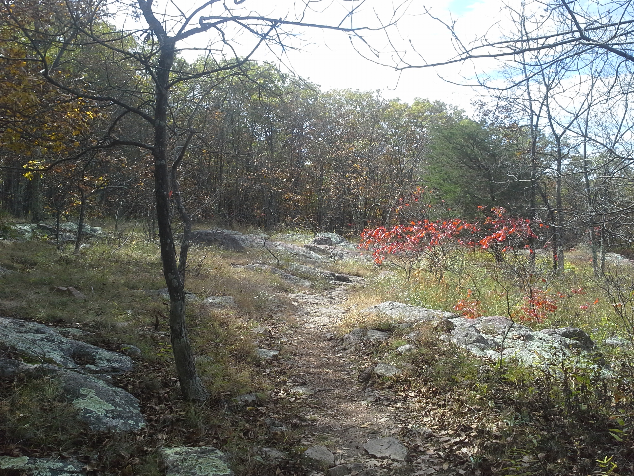
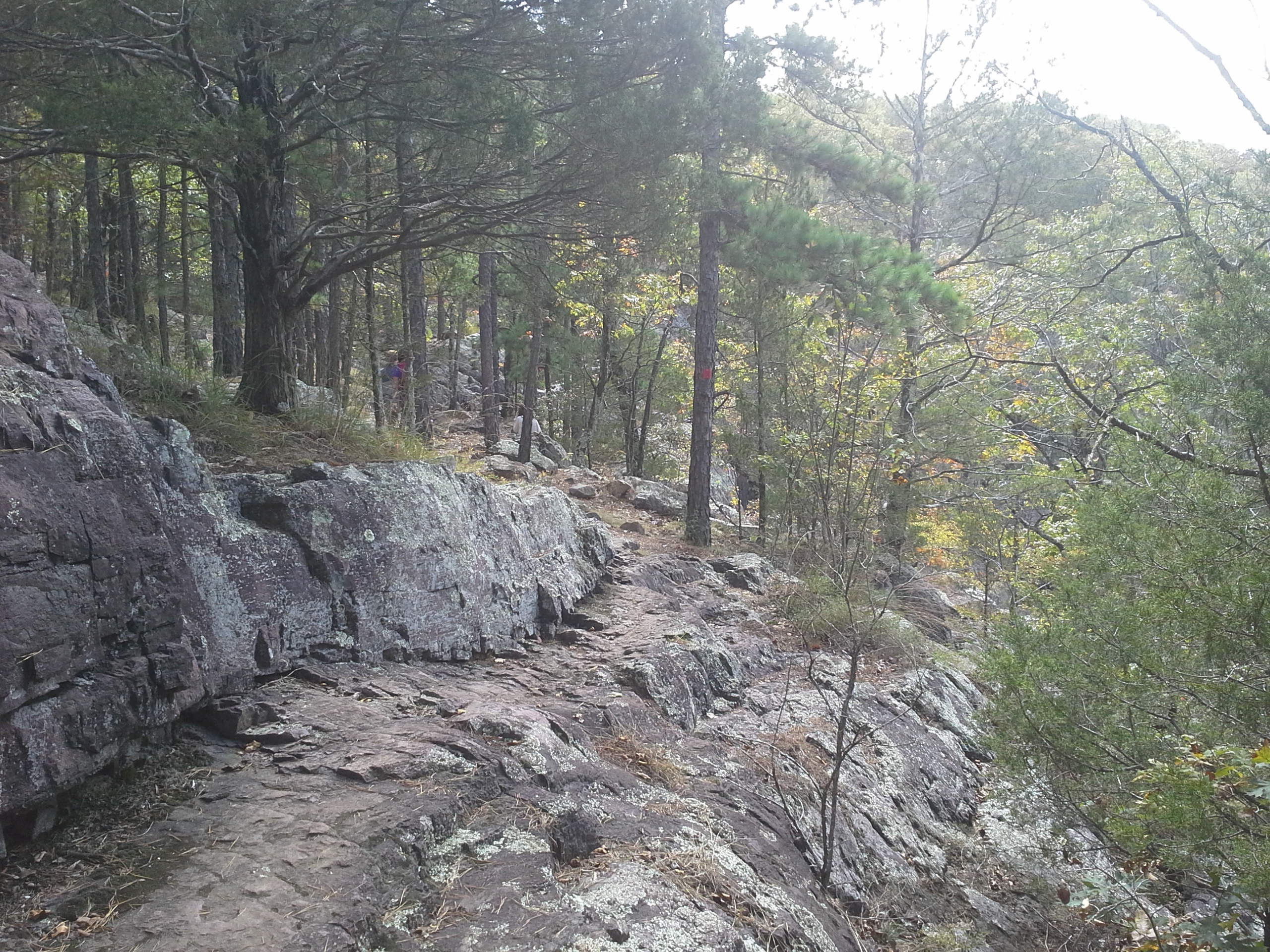
 The Mina Sauk Falls trail is a rugged 3 mile loop, which takes you out around the mountain to Mina Sauk Falls and back. It also shares about a mile with the Taum Sauk section of the Ozark Trail. On this day, we followed the arrows and took it counter-clockwise.
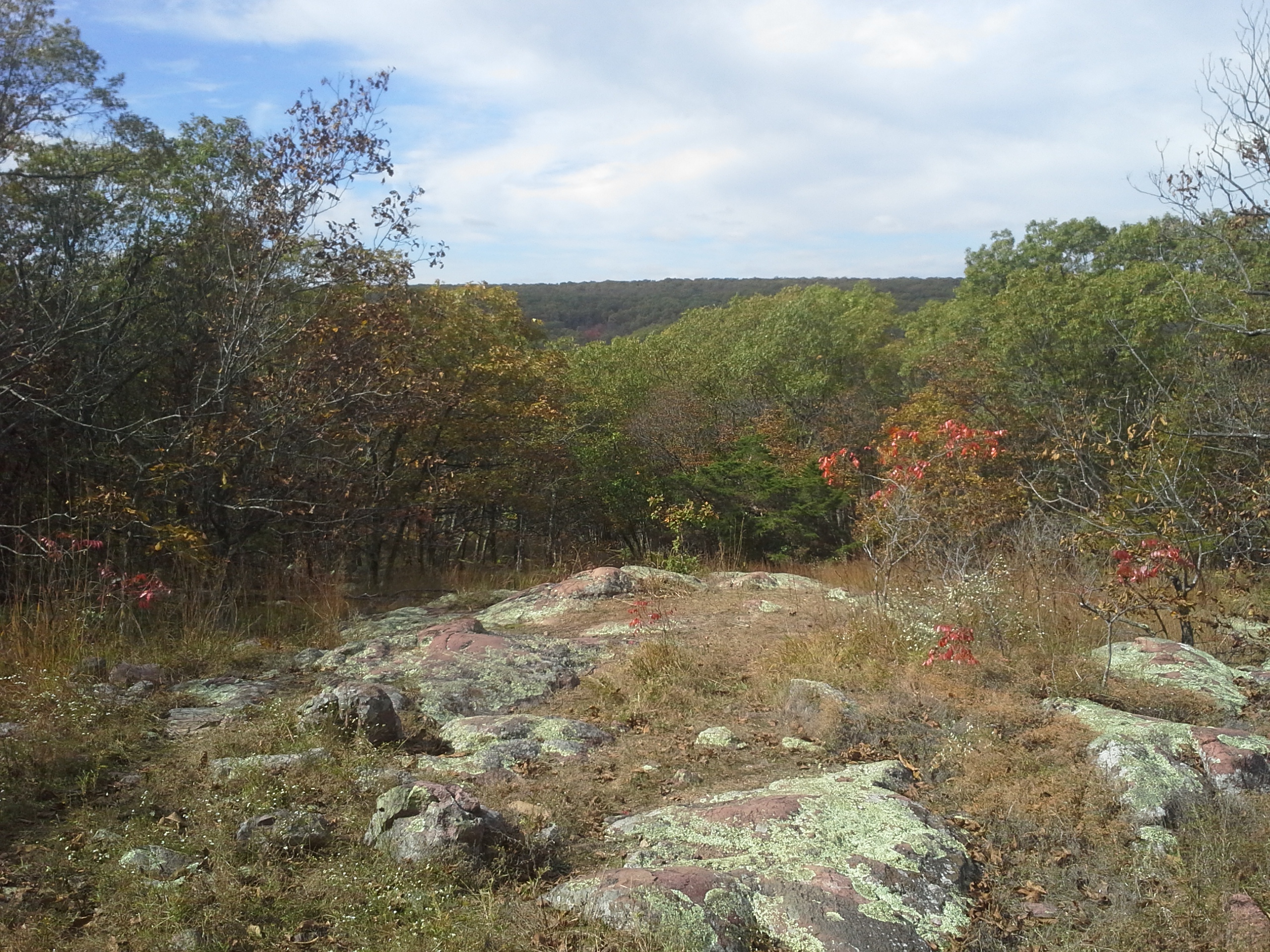
From the trailhead at the parking lot, the paved section of the path (accessible to adventurers of every capacity) curves around for about a quarter of a mile, and takes you to the highest point in Missouri. Just before the highest point, a branch off to the right where the path turns to forest floor takes you to the loop part of the trail. We turned right at the loop, and the path starts to descend in a wide curve along a pretty rocky section of trail, with many loose, ankle twisting stones along its length, eventually coming to a section of glades and overlooks. It continues to descend, with just about the steepest parts of the hike in this section, continuing to curve around and finally emerging at Mina Sauk Falls. Here is where the Ozark Trail branches off and continues down the mountain toward Johnson’s Shut-Ins State Park. The Mina Sauk Falls trail then turns a sharp left and heads up through glades and bigger exposed rock areas, making its way back into the forest, gradually ascending before leveling off near the start of the trail.
 Why I like this trail:
The views along this trail are pretty awesome. From the open glades to the deep, rocky, forested waterfall to all the steep hillsides that make up the area, this is definitely a scenic hike. A lot to see, from every opening in the trees. At one point along the trail, looking west in somewhat the direction of Johnson’s Shut-Ins State Park, you can see the silver glint of the edge of the Taum Sauk Reservoir, high atop Proffit Mountain. Make it a point to visit that park on another trip, and hike the Scour Trail, which takes you through the area that was washed away when the reservoir burst almost 9 years ago.
 The St. Francois Mountain Range is actually a personal point of Missouri pride for me. They were formed by ancient volcanic activity almost one and a half BILLION years ago. They are considered to be the oldest mountain range in North America, and out date the Appalachian Mountains by more than a billion years. They have rounded tops due to so many millennia of exposure to the elements and changing of the environment, and have been the source of mining operations for all sorts of minerals and metals for nearly 300 years. Little known facts, and I think it’s pretty cool that we have them here in Missouri.
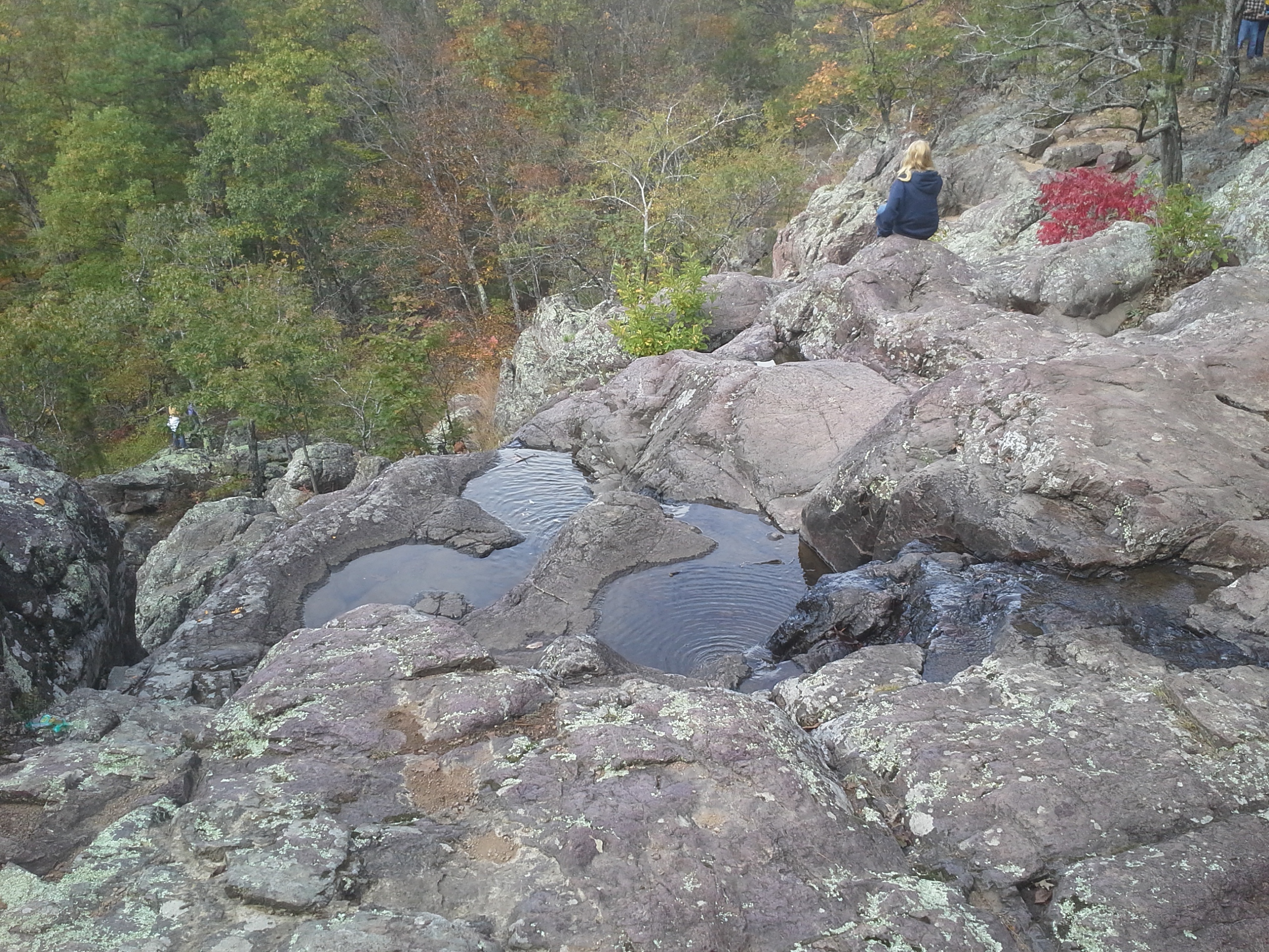 Besides the fact that it is the tallest waterfall in Missouri, the story that I have heard about the name of Mina Sauk Falls is one about two young Native Americans who lived in the region many years ago. Mina Sauk was the daughter of Chief Sauk-ton-qua. She had fallen in love with a warrior from a tribe of Osage, who were their enemies at the time. When she left to be with him, her father and his tribe tracked them down and threw the Osage warrior from the top of the bluff, to his death. In her sadness, she followed him over the cliff, to die alongside him. The Great Spirit was so angry at Sauk-ton-qua and his people for destroying the love between these two that he struck the mountainside with lightning, tearing open the rock face, from which a stream of water burst forth. The water that flows over the edge of Mina Sauk Falls is said to be the tears of this young princess, mourning the love that she shared so long ago.
 What you need to know:
The highest point in Missouri is a pretty exciting prospect, but as you stroll down the paved path up a barely noticeable slope, don’t be let down by the anti-climactic quality that you may feel when you get to the boulder and the etched Missouri Red Granite marker just in front of you in the woods. Yes, it isn’t some sharp peak or mile high bluff…but really afford it some contemplation, snap a couple pictures of your group, and appreciate where this puts you in relation to everything else in Missouri.
 This is a rugged 3 miles of trail. These are some of the steepest areas in eastern Missouri, and there are a lot of loose and slippery rock areas to travel over and through. Don’t let that deter you from this glorious hike, just be aware and take your time.
Don’t expect a lot of solitude on this loop, especially in prime hiking season in the spring and fall. This is a popular trail for good reason, and a weekend afternoon can welcome you with a packed parking lot. Practice good hiking manners, and travel patiently when there is traffic, especially when you get to the falls and there are people in front of you that are enjoying the view, and there are people behind you waiting for their turn as well.
 Any pictures that I share on here cannot convey what it is actually like to be there. To be able to stand in a glade and look out across to the steep inclines of the nearby mountains is a pretty spectacular view, especially for Missouri. This is one of the most notable trails that we have to hike in our state, and you should definitely visit it if you haven’t yet. Besides the trail, the observation deck that looks out across the northern spectrum of the St. Francois Mountains is probably my favorite spot in the whole area. It is vast and wide, and you can see for miles. Truly an amazing view, it inspires a sense of immense scale in an adventurer’s soul, and ignites a wonder of what might await on the path to the furthest peaks one can see from there.
 Gravois Creek is a tributary of the River des Peres (Deh Pear) in South St. Louis County, here in eastern Missouri. It is filled with water that is collected by many little gulleys and waterways that span from Interstate 55 and Lindbergh Boulevard to north of Interstate 44 up into Kirkwood. It ultimately dumps into the River des Peres in Lemay, about a mile before the Mississippi River. It winds its way through mostly residential areas, with sparse forest and wetlands surrounding it here and there on its journey. It also spends some of its length passing through industrial parks and commercial zones, with all the exposure and pollution that major roadways and manufacturers tend to create. It is not a healthy creek that you would catch fish in, or could imagine spending your childhood days splashing in. It is polluted and gross, and though there is aquatic life in it, it is not very healthy.
It is about 9:30 am, on a 55 degree Saturday morning in mid-October, and I am up to my shoulders in Gravois Creek. I have a rope wrapped around a gloved hand, with a paddle in my other hand, pulling a recently submerged canoe, half filled with dumped tires. Welcome to the River des Peres Trash Bash!
It all started out so harmless. Today was the day for the River des Peres Trash Bash. An annual event put on by the River des Peres Watershed Coalition, an organization whose mission is “to improve, protect, and maintain the River des Peres, its tributaries, and its watershed as a vital natural and cultural resource in the St. Louis metropolitan area”. A group of people who have an interest in making this big drainage ditch in the St. Louis area just a little more likable with some tender loving care that it so desperately needs. They are fighting a struggle that is faced by every waterway in Missouri, but this one in particular has the bigger challenge of being in a concentrated metropolitan area. The struggle to keep it healthy is practically a losing battle.
 So partnering with Missouri Stream Teams, the RdPWC organizes cleanups periodically, and gathers volunteers to hit the woods around specific areas in St. Louis County to pick up trash and debris and dumped tires and appliances that happen to be littering the waterways that wind out of and through so many neighborhoods, and ultimately out to the Mississippi. This was one of those cleanups, and as a person who only just this year started volunteering at Stream Team events, I am just one in the large group at Fultz Field who is waiting to head out to our designated site and get to work pulling all the crap out of the forest that people with a lazy sense of judgement decided to put there.
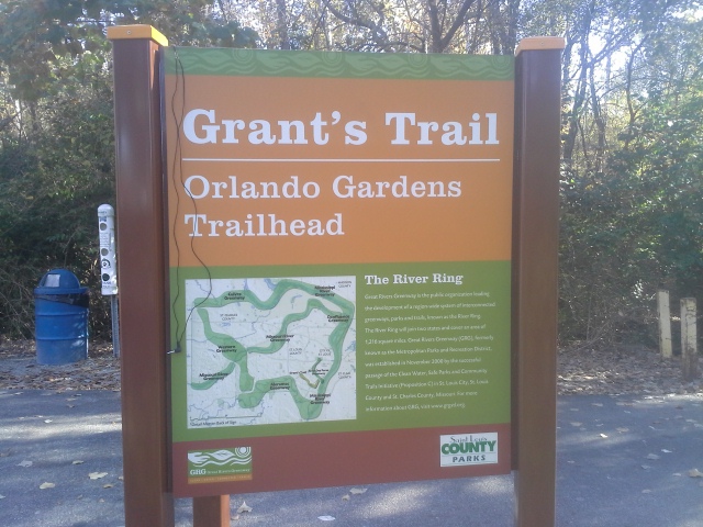
We all sign in, sign a liability waiver, get our supplies (free gloves and trash bags), hear the “be safe and work together” speeches, and then head to our cleanup sites. On this particular cleanup we are going to be working along Grant’s Trail, a paved biking and walking trail that extends through South St. Louis County, at the trailhead for it that is along Interstate 55 near Orlando Gardens, off of Union Rd. This is a frequently used trail for bikers and joggers and walkers, and it takes people through hidden natural areas that you would never have known were there. Little sections of forest with a creek and birds and wildlife habitat, among the many subdivisions that fill our corner of the county.
We are here to improve the health of this particular little section of forest today.
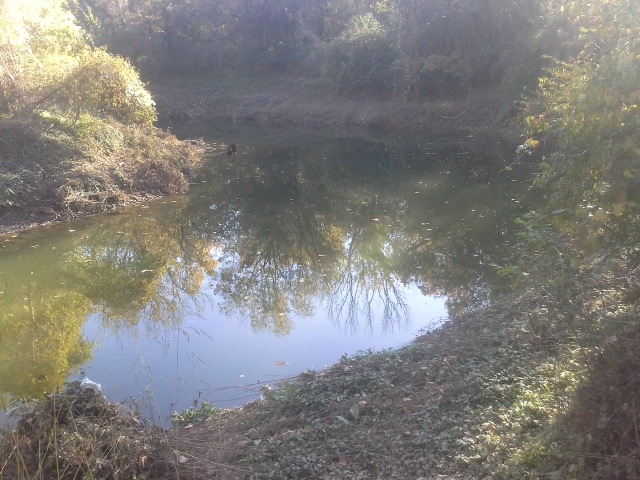
 We all park, and start heading down the trail, eventually turning into the forest to start looking for trash. The trip leaders and organizers had scouted out this area the day before to determine the spots where we could make the most impact, and they discovered that the section of Gravois Creek that flows through here is filled with dumped tires. Bordering a BMX area that is adjacent to the trail just behind local bed and breakfast “The Lodge”, is a bend in Gravois Creek in which lies the abandoned footwear of cars gone past. Unfortunate headaches for drivers, that ultimately ended with some jerk depositing what seems like a truckload of them into the nearby creek…instead of properly disposing of them. This is not where old tires are supposed to go, and one of our missions today is to collect as many as possible and take them to the local tire shredders.
So people start to make their way slowly through the surrounding forest, with their gloved hands and mesh bags, picking up plastic bottles, aluminum cans, grocery store sacks, and whatever else they come across on the leaf litter that doesn’t belong there. This is the typical Stream Team cleanup experience; walking through a natural area near a waterway, and making it prettier by gathering all the litter and properly disposing of it. My mission today however was more specific. I was going after the tires.
 Walking next to a canoe in the slow moving creek, I was making my way through the water, looking for that unmistakable round silhouette. Reaching down to pull out a tire, then taking a few steps to discover another one. It is a process of popping it loose from the mud, scraping the lodged dirt out from inside it, and then dumping as much water out before setting the tire in the canoe to be taken, after it is filled, downstream to where a group of volunteers was waiting to help load them into a trailer. I had pulled out about 14 tires from a 50 foot stretch of Gravois Creek, decided that was enough for a load, hopped in the canoe and started paddling my way to the people on the bank that were going to do the hard part. It wasn’t 30 seconds on my way that I heard the sound of rushing water. Had I thought about it, I should have stayed out of the canoe, guiding it to our landing point…but I thought that it might be nice to ride my way there, take a minute to sit and be out of the filthy water, and pull in triumphantly with my bounty of rubber and tread. Yeah, one side of the canoe had dipped below the surface due to all the weight in it, and my boat was taking on water.
At that point there is nothing you can do to stop it. It will continue to fill, and I felt that if I could pull it submerged with the air trapped in the upright tires to keep them afloat within its gunwales, I could probably get them all to where I was heading with just a bit more effort than I was planning. And that’s when I hit the deep part.
 So there I was, paddle in one hand, rope in the other, swimming through the mucky water of Gravois Creek while pulling a submerged canoe with a trail of floating tires behind me. I had bitten off more tires than I could chew, and learned an embarrassing yet valuable lesson about capacity and enthusiasm that I wasn’t going to forget. Luckily I had a more seasoned veteran than myself by the name of Jay in another canoe following behind me, grabbing all the tires that had escaped. I made it to shore, unloaded the four tires I had left, and then pulled the canoe out and dumped the water, so that I could head right back in to go collect more.
This was my Saturday morning float trip on Gravois Creek in South St. Louis County, and disgusting as it was, it was one of the most satisfying adventures I have had that involved a canoe. All in all, I estimate that Jay and I pulled probably 40 tires out of about a tenth of a mile of Gravois Creek. And there are still so many tires left.
 Now this isn’t typical of what is expected from a Stream Team volunteer. The usual cleanup is what I described above: a group of people walking through the woods picking up litter, thereby beautifying a natural area and improving its overall health. Getting in a canoe in a polluted, mucky creek to dig tires out of the filth is the kind of a role that the crazy-enough-to-do-it volunteers take on. I enjoy being included in both groups. There is a strange switch in my head that clicks on (as I’m sure it does for a lot of volunteers and team leaders that I have come to know) that allows for this to happen. Typically I would see these filthy, disgusting waterways as something I wouldn’t think twice about NOT getting in…but you put that canoe in the water and tell me that there are tires to go find, I can’t wait to get splashing. It is a perverse and irresponsible satisfaction, that exposes one to bacteria and chemicals that we should all stay away from. The hook that gets you is when you see that pile of tires you removed heading down the road in a trailer on their way to their proper resting place, and not in the creek anymore. It makes you really see and feel the impact you can have on the health of a natural place.
I really enjoy being a Missouri Stream Team volunteer. There is a lot that a determined group of people can accomplish together. Walking into a forested flood plain along the Meramec River to spend a couple hours picking up litter, I love taking a moment to look back and see where we have just come through. Nothing in it but leaves and wood and things that belong there. It is a pretty awesome feeling.
 You should be a part of this too. Go to the Missouri Stream Team website, and get involved. They can get you in touch with established teams nearby, give you information on starting your own team if you want to, and have a calendar of events so that you know when and where to go to volunteer for a cleanup or water quality monitoring event. If you like spending time in nature (and I’m pretty sure you do), be a part of this. Make a difference. Give a few hours on a Saturday morning with other great people, and improve the health of a natural place. Look back and see a litter free forest floor. It is not only good for that area; you will find that it is good for you as well. And I promise, they won’t make you swim in the mucky water…unless you really want to.
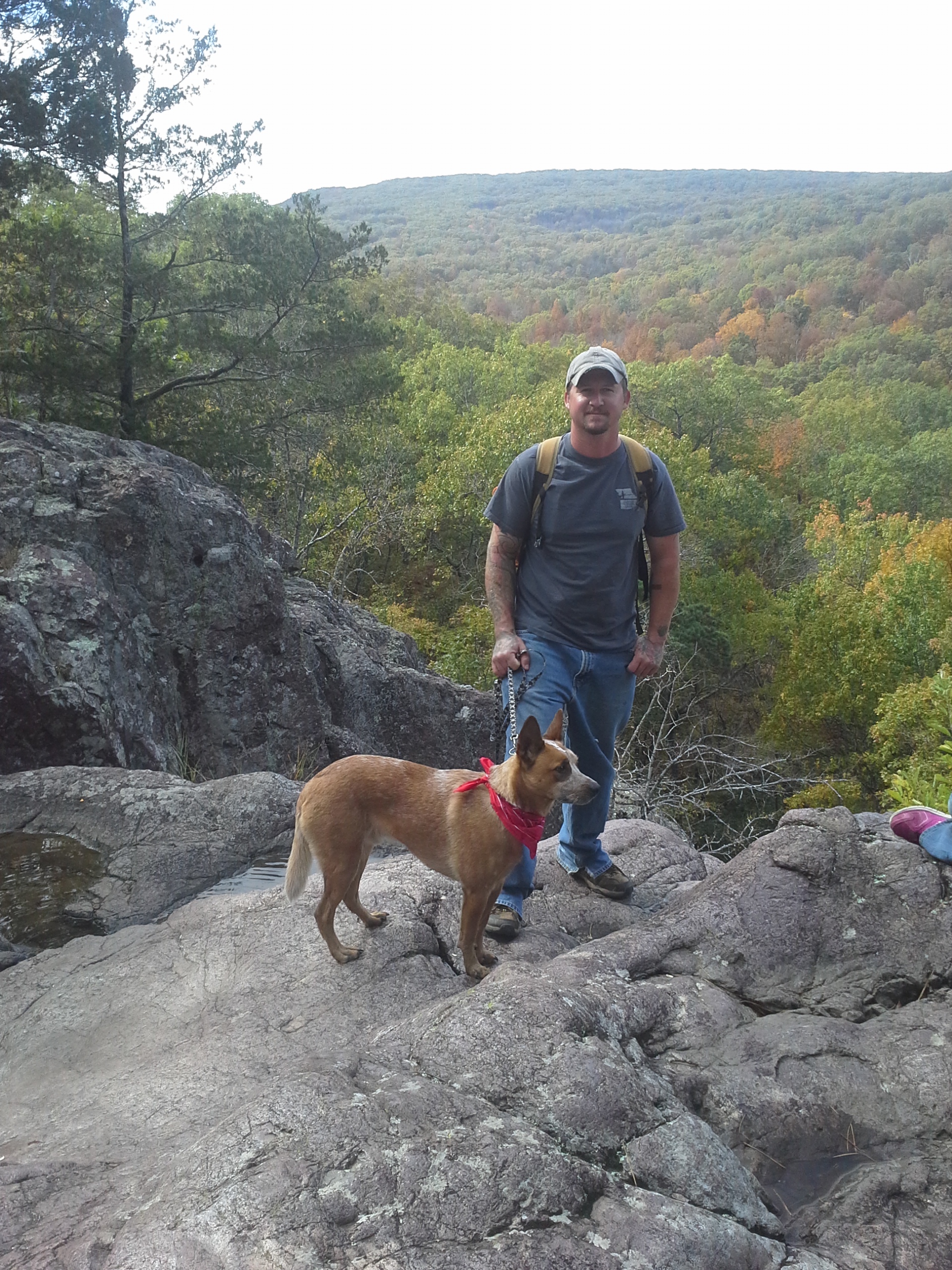
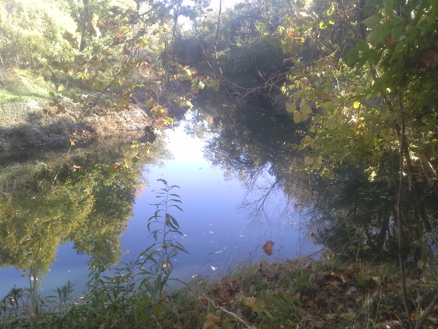
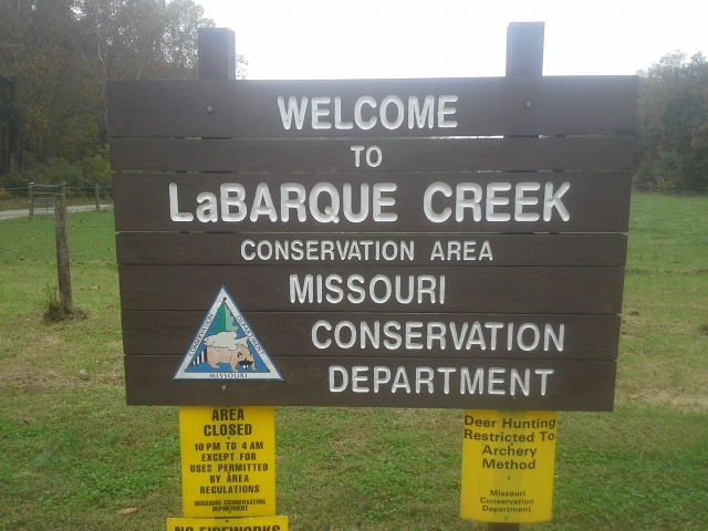
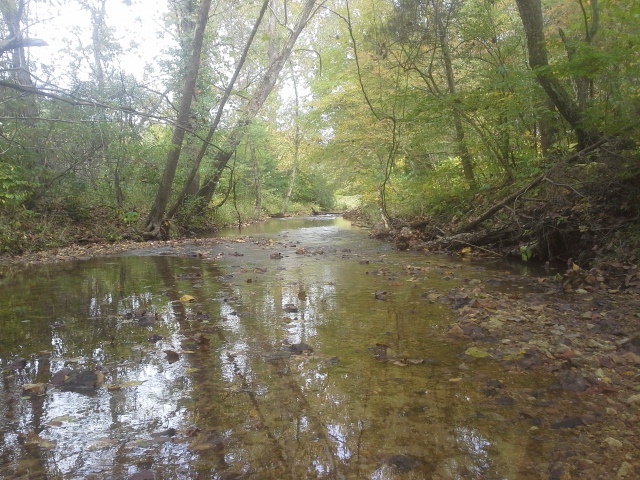 It had been a rainy week here in Missouri, but with a Saturday without any previous obligations, I knew that I had to pack up the dog and head out for some trail time. I didn’t want to have to go too far, but I wanted to hike somewhere new. It would be a great opportunity to experience the liveliness of a forest full of trickling water, but it would also probably be a hike through a lot of mud. I had a trail in mind, and the one thing I knew for sure was that any time I had heard mention of this place, no one ever had a negative thing to say. So after a nice breakfast and some coffee, we filled up our water bottles, checked the supplies in the day hiking backpack, and headed out to the LaBarque Creek Conservation Area, southwest of Eureka, MO.
 How to get there:
From the interchange of Interstate 44 and 270, take 44 west for about 12 miles to Highway 109 in Eureka. Make a left and take 109 south for about 2 miles to Route FF. Make a right on FF, and stay on that for almost 5 miles. You will come to Route F (only one F), and you want to make a left turn followed by an almost immediate right turn onto Doc Sargent Road. Stay on Doc Sargent for nearly a mile, until you reach Valley Dr. Make a left on Valley Dr., and the parking lot for the LaBarque Creek Conservation Area will be just up ahead.
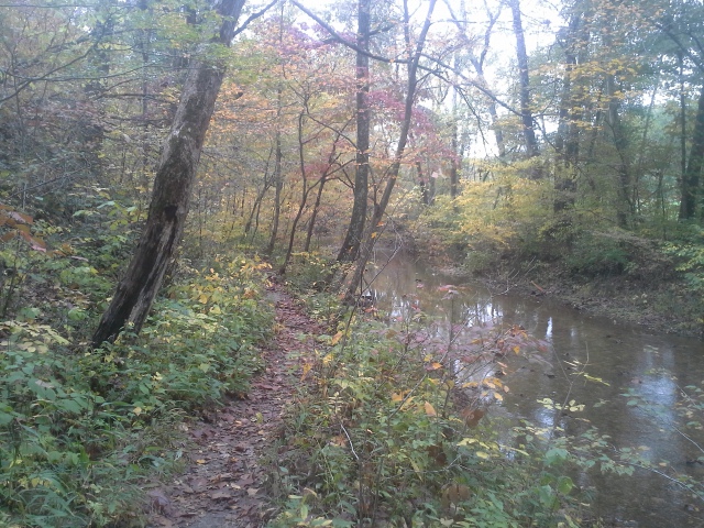 The trailhead is across Valley Dr. from the parking lot, and it starts with crossing a bridge over LaBarque Creek. It then turns to the right and follows the creek for just a bit until it heads up the hill to the left and into the woods to a fork in the trail. It is a 3 mile loop trail, and we took the fork to the left. It meanders up and into the forest of the LaBarque Creek Natural Area, following the curve of the hills as you slowly climb toward the highest point, about halfway along the trail. It then heads steadily down back toward the creek, following a little tributary down in a ravine, crossing a glade with a pleasant little wet weather trickle over exposed rock, and eventually back to the edge of LaBarque Creek itself. Then it is back through the woods to the fork, out to the creek again, and along it to cross the bridge to the parking lot.
 What I like about this area:
It has a “Big Woods” feel to it. What I mean by that is, as you head back into the forest, even though maybe you can hear the far off sound of cars on Route F as you ascend the hills, there is a solid sense of wilderness isolation and time spent growing in the trees that surround you. From elderly Cedars to the canopy of Walnuts and Oaks, this feels like a forest that has spent a good amount of years being allowed to flourish and grow. Sure, there are signs of recent conservation management activity, but when you get back in there, it really has an ancient energy to it.
 The trail itself was in great condition. A good packed surface that wasn’t too muddy or slick after all the rain we have had, and just a handful of fallen trees along the entire 3 miles. When we have had wet weather, it can turn a hike on your favorite path into a torture session. This one turned out to be a pretty good choice overall.
We got lucky that it had rained over the past few days. There were noticeable trickles moving downward along the sharpness of the ravines. A very lively experience, hearing the splashing and dripping of saturated hills sending their collected rainwater down to LaBarque Creek, to eventually join the Meramec River before adding to the immensity of the Mississippi, miles away. Flowing water in the woods always adds a positive aspect to any hike, as far as I am concerned.
 What you need to know:
This is a rugged trail. 3 miles of climbing and descending, with exposed rock that can be slick and uneven, to muddy patches hidden by the drooping trail-side grasses. Be prepared for a good hike, and bring along enough water and watch your step.
This is a conservation area that is surrounded by private property. Be aware that hunters may be waiting silently in the forest for dinner that evening, and the property line of somebody’s yard may be just over the rise of your left. Be mindful that other people may be nearby, and they are enjoying the forest the same as you are, but from different viewpoints. And in the interest of safety, keep your dog under control and don’t allow it to run off into the woods without you.
 There were sections along the trail where a lot of work had been done to cut down the growth of some invasive trees. For those of us that are sensitive to the influence of man over nature, people who are concerned for the plight of our natural places, be assured that the graveyards of Eastern Red Cedars created by the Missouri Department of Conservation is a good thing, and it is work that is done to assure a rich biodiversity in these woods, thereby making it a healthier environment.
 I had never been to this place before, though I have explored farther down LaBarque Creek in the Young Conservation Area. It turned out to be a special area, from the steep gullies and upper hardwood forests, through the glades and into the lower hills along the creek. Truly a lot going on here, nature-wise, and I know that it will be a place I will return to soon. A trail that has been added to the list of natural places that pull me to them. Go see for yourself, and let your own experience there create a connection in you to the forest that stands back in the hills beyond LaBarque Creek.
 Of the once-in-a-while messages that I get on the Camping Missouri Facebook Page, that is the consistent question.
“My wife and I are new to Missouri…”
“I want to introduce my kids to camping…”
“Our kids are grown and my husband and I want to spend more time in nature…”.
 Where can I go camping in Missouri?
This question is asked by people who are looking for opportunities to get out to the woods and spend some quality time with their friends and family, while enjoying nature. It is asked by those of you who follow this blog, when you get a free weekend. And I ask it myself, every time I am figuring out where the next adventure is going to happen. Where can I go camping in Missouri?
A couple important points first.
 I am in no way an expert or representative for any particular group, organization, company, club, campground, association, or official entity. I am just a guy who decided that I wanted to write about and share my experiences and adventures camping and hiking in Missouri, so I started this blog and just went from there. The pictures in it are from my own camera and the opinions expressed are my own.
 Secondly, this post is about places to camp on mostly public land. Places that are owned by either the State of Missouri, or Federally managed, or tied to the public domain in some way. Beyond what I list here, there are quite a few privately owned campgrounds across the state, that have great facilities, near really cool places to be in, and run by some of the kindest and hardest working people out there. I encourage you all to do internet searches for camping in whatever town or area you are wanting to visit so that you can see what campgrounds are there. Some of my favorite places to set up a tent and sit by a fire are privately run campgrounds, and that will have to be another blog post down the road.
 And a point that I cannot stress enough: Find out how to reserve a site where you are going (if that is available), and take the time to do it. Unless you are camping during the week when most people are stuck at work, you will probably be leaving town Friday evening with a plan to come back Sunday, like everyone else. A lot of campgrounds have first come/first serve sites, but they usually fill up quick on summer weekends. Reserve a site, a month or two in advance if possible, and be assured that you will have a place to set up your tent when you arrive that Friday. It can be the difference between a great weekend and a wasted car trip.
Where to start:
 Missouri State Parks:
My first suggestion is usually always the Missouri State Parks. We are very fortunate to have a such a great state park system here, with so many opportunities to get out into the woods, spend a night by a fire, and usually see some of the unique and interesting natural places that the forests and rivers of Missouri have in them. From the fun and excitement of Johnson’s Shut-Ins to the regional history of Ha Ha Tonka, we have an impressive 87 state parks and historic sites. With 1,000 miles of trails and 3,500 campsites (with some of the consistently nicest facilities), you could spend years visiting them and find a new adventure every time. Check out their website for everything you need to know, and if you are on Facebook go like their page!
Mostly trail reviews with a couple of campground reviews, these are my posts from recent experiences in Missouri State Parks. Check them out if you are looking for some adventure!
Ozark National Scenic Riverways:
 My next suggestion, and probably the area of Missouri that I am most in love with is the Ozark National Scenic Riverways. Spanning the length of the Current and Jacks Fork rivers, the ONSR is a National Park, and the first one in the United States to be centered around riverways. It is located in the central/southern part of Missouri, centered mainly around Eminence and over toward Ellington, and stretching down to Van Buren. Spring fed and crystal clear, with 134 miles of river surrounded by over 80,000 acres of protected National Park land, the ONSR has 7 Main Campgrounds and 10 “Backcountry” Campgrounds along its length, with multiple campsites at each one. Go to their website to see all the places to go and all the things to do, and if you’re on Facebook go like their page!
 Also, check out my past blog posts about some of the neat places to visit in the Ozark National Scenic Riverways. So much regional history and natural beauty. This collection of places there that I have seen have been my most popular and most shared posts. Make the ONSR your next trip. You will fall in love with these rivers, guaranteed, just like I have.
Missouri Department of Conservation:
 One of the most valuable resources we have here in Missouri are all the natural places owned and managed by the Missouri Department of Conservation. Set aside and protected so that we can preserve historic outdoor traditions here in our state, the MDC land that is available to hunt, fish, and hike on also has a lot of places that are available to camp at as well. It is usually primitive camping (no shower house) but it is also usually free to camp. That is a difficult price to beat.
 Check out this listing in their MDC Atlas for all the places that they have for camping. Please note that as far as I know, they only allow camping from September 15th to May 15th, but with no campsite fees and free firewood, it sounds like the perfect place to spend a fall, winter, or spring weekend. Also, take a look at this list of hunting seasons in Missouri. Camping during deer firearms season might be a little busy and noisy, if you aren’t participating. Check out their website to see what all there is to do in the forests of Missouri, and if you are on Facebook go like their page!
These are my posts about excursions on MDC land. They have so much acreage in our state to explore, and it makes the perfect destination for a place to pack up and head to for a weekend!
 Mark Twain National Forest:
With just around 1.5 MILLION acres of land in Missouri, the Mark Twain National Forest is managed by the US Forest Service, and has so many places to explore! Spread into 4 zones with 10 districts, located in central and southern Missouri, the MTNF has a huge amount of places to go and camp at. For a great outdoor experience in some of the lesser known places to go, check out their website, pick a district, and see what opportunities there are. Truly a relatively unknown resource, the Mark Twain National Forest is one of Missouri’s best kept wilderness secrets.
Also, check out my posts on places I’ve gone in the MTNF. Miles of forest to explore!
 I have spent a lot of time in Missouri forests, camping and hiking and exploring. I have my favorite campgrounds and trails, but I also try to regularly check out areas that I haven’t yet been to. One thing that struck me as incredible when I started really researching all the places that are available in Missouri for going camping, is that there are so many opportunities that no one would ever be able to see them all. There are so many campsites out there, waiting for your visit. So, bookmark this post, use these links above, find a spot you have never been to, and make arrangements to camp there next chance you get. And then come back here when you are trying to figure out where your next adventure will be. We are so blessed to have all the natural places to visit in our beautiful state that we do. Don’t let it exist without being a part of it. It is calling out for you to come see it!
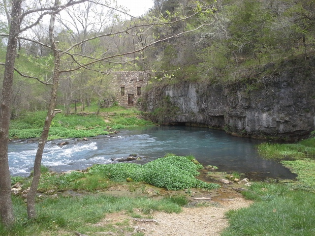
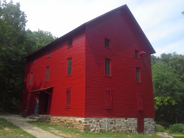
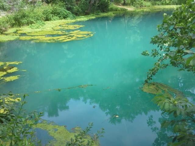
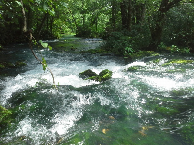
 If you have only been to ONE place in the Ozark National Scenic Riverways, it is very likely Alley Spring and Mill. The chilly blue-green water coming to the surface of the earth, guarded by the stoic and impressive Alley Mill next to it, flows rapidly down the spring branch and off into the Jacks Fork River. This location is probably the most visited spot in the ONSR, and for good reason. The history of the mill and the surrounding area, centered on this lively spring, captures the story of the industriousness and determined heart of the people who lived in this area over a hundred years ago, and the community that came from their hard work and thoughtful use of the natural resources at hand. We were lucky enough to visit this past July, right after the mill had been reopened after a recent face lift, and as always when I have been in these parts, it was a wonderful and enlightening experience. Welcome to Alley, Missouri.
 How to get there:
(Eminence, MO in the heart of the Ozark National Scenic Riverways is about 3 hours from St. Louis, and you can take various routes to get there. The directions here are from the intersection of Highway 19 and Highway 106, in the middle of Eminence.)
From the intersection of 19 and 106, take 106 West for about 6 miles, cross the bridge over the Jacks Fork River, and make a right into the parking lot. Above the parking lot is a picnic pavilion and bathrooms. Follow the sidewalk away from the parking lot on the north end. This will take you past the one room Story Creek School, and on your right will be a bridge that crosses over a backwater slough. Cross the bridge, and before you will be Alley Mill. Just beyond the mill lies Alley Spring.
 Why I like this place:
Alley Spring has an average daily flow of 81 million gallons of water and is considered to be Missouri’s 7th largest spring. Its chilly discharge tumbles and winds through the trees and rocks, into a central channel, and eventually into the lively Jacks Fork River. Of all the springs that I have been blessed to visit in the Ozark National Scenic Riverways, this one, along with its spring branch, is probably the prettiest and most picturesque.
 The community of Alley originally had a different name, but when a request was put in to the United States Postal Service to have an office there, they went with the name of one of the more prominent farmers in the area, John Alley. The town that had been established is an example of why people chose to live their lives in places like this. The water flowing from Alley Spring offered not only the life giving, thirst quenching solution to field work on a farmer’s miserably hot summer day, along with all the other people in the community, but it also allowed for the ingenuity of the residents there to create mechanisms that could simplify, relatively, the day to day labor that had to be done in order to live. Alley Mill was the focal point of a community that brought its grain from the fields to be milled in order to make the breads and cereals that sustained the lives of these hardworking Ozark homesteaders. Drawn to the rivers, harnessing the power of the water, and using it to their advantage mechanically, is how many communities across our country were started and maintained. Some towns, though probably not reliant on a mill anymore, that I’m sure still exist to this day.
 Alley Mill is an impressive structure. Tall, solid, monolithic, and brilliantly red, one might never suspect that a spring exists just behind it. People who visit this area are drawn to it, as they have been throughout its history, only these days we visit it to learn about our cultural roots and to take a glimpse at how things used to be for the people of Alley, Missouri over a hundred years ago. Completed in 1894 by George McCaskill, it was a “Wheel-less” mill. It used a turbine system, with belts and a drive shaft almost as long as the building, and was relatively modern as water wheel mills where old fashioned at that point in history. The turbine system allowed the millers to control the speed of the machinery, changing it to better suit conditions, instead of relying on the movement of the water to dictate what speed everything happened at. It was the center of the community until 1925 when the property was sold to the Missouri State Park system. With its natural beauty and historical significance, it was put on the big stage as part of a National Park when the Ozark National Scenic Riverways was established and dedicated in 1972. It is the most photographed mill in the Ozarks, and I would bet that it is in the top ten of photographed places in all of Missouri.
 What you need to know:
As with all springs, due to their nature of being unique and precious ecosystems, please refrain from swimming, fishing, wading, or generally disrupting them in any way. They tend to be home to plants and animals that are sometimes not found in most other places, and as custodians of the forest, we need to give them the respect and care that they deserve. Keep your toes on dry land.
The Confluence. Alley Spring branch on the left. Jacks Fork on the right.
One trip where I had visited, when there were just a few other people around in the late morning on a day with impending rain, we spied a couple of snakes along the spring branch, very likely looking for their lunch. Be aware, as with all healthy waterways, that you will possibly run into some of the creatures that live in the area. Watch your step and appreciate the chances you get to see animals doing their thing out in nature.
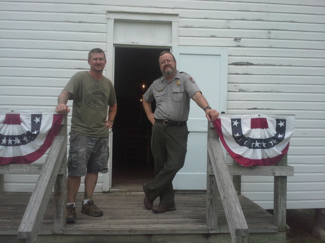
Me, along with one of the coolest people I have the pleasure of knowing, National Park Service Ranger Bill O’Donnell, on the steps of the relocated Storys Creek School.
I love the Ozark National Scenic Riverways. I cannot deny it, and I will tell anyone who will listen of the beauty and history of that region of Missouri (what little I actually do know) given the chance. Alley Mill and Alley Spring are some of its most vibrant jewels, and they are at the center of a place where we can directly see our connection through history to these natural wonders in the rugged mountains of the Ozark region. One day I will seriously consider moving there as my own history progresses, and the children branch out from under my roof and find homes of their own. I look forward to that day when maybe I will be sitting on the porch of my own cabin, possibly near a creek that runs into one of the beautiful, crystal clear rivers there, with images in my mind of what it must have been like to live down by the mill in the spring valley, along the banks of the Jacks Fork River, in Alley, Missouri.
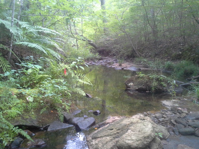
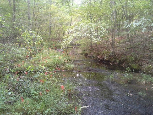
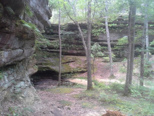
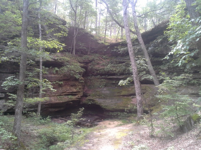 It was supposed to be a rainy Saturday, with a chance of thunderstorms rolling through for most of the day. That wasn’t going to stop us from getting out to the woods however, and with a bit of rainfall it might even enhance the experience of hiking through the place we were headed to. Our destination was Hickory Canyons Natural Area, and with all the steep, exposed rock faces of the ravines and canyons, including a wet weather waterfall in one spot and Hickory Creek in another, a thunderstorm might just be the right prescription to turn an already beautiful natural place into an even livelier and more memorable excursion.
 How to get there:
From the interchange of Interstates 270 and 55, in south St. Louis County, take 55 south for almost 50 miles to MO Highway 32. Make a right (west) on 32, toward Farmington, and take that for about 8 miles to Route C. Make a right on Route C, and at around 3 miles Sprott Road will be on your left. Turn onto Sprott Road and take that about a mile and a half to the parking lot on the left side of the road. There are two trails to hike here. The one on the parking lot side of the road is a 1/4 mile point to point. The one across the road is a one mile loop. Hike them both.
 The one mile trail that starts across the road splits shortly into the woods, and we took the trail to the right (counter-clockwise). It heads directly through the upper woods into the canyons area, heading downward into the hollow along the right side of a ravine. At the bottom, the trail meets up with Hickory Creek, crossing over it a few times as the trail loops in a wide arc to the left. It eventually leaves the creek, and makes its way up to a plateau above one of the more scenic canyons in the area, and then through the woods and back out to the trailhead.
The 1/4 mile trail goes down into a wider box canyon, and traverses along it until you eventually meet the end where a wet weather waterfall lies within the canyon walls.
 What I like about this area:
There is so much to see! Exposed rock faces, steep canyon walls, ferns, trees, mushrooms, water trickling all over the place and so many little nooks and crannies within the sandstone cliffs that you can’t help but appreciate the way that the natural forces shape the forest through the passing of the years.
Because of the sandstone, and the rather sparse soil and exposed rocks along most of the trail, I can’t imagine that this path ever really gets muddy. Sure, the rocks might get a little slippery, but this would be a fine trail for hiking in most conditions.
 I love a water feature, and following Hickory Creek back through the hollow was a treat. Filled with rather large minnows in some of the deeper pools, frogs jumping in for safety at every turn, and the occasional wildflowers along its bank, this was a very lively little waterway to hike next to for as long as we did. You just can’t beat a little creek hidden back in the woods, showing off the life and meditative beauty of a place, that undoubtedly through the course of history had quite a bit of involvement in the shaping of this canyon area.
 What you need to know:
This is a short trail, but it has some steep spots and some rocky spots. Watch your step, and stop every chance you get to look around and take in all that there is to see.
Maybe because there wasn’t a trash can in the parking lot, or that a small percentage of people make the rest of us look bad, there were enough bottles and cans and little pieces of litter along the trail and around the parking lot to fill a bag that is now deposited in my trash can at home. Be mindful and respectful of the ecosystem, and keep your garbage with you until you come across a proper place to dispose of it.
 Like some of the places I have visited, I didn’t know about this gem of a Natural Area until just recently, but from the pictures I had seen and other people’s accounts of it, I knew I had to get down there to check it out. I was very impressed with the landscape and the life within it, and I can’t believe that after years of visiting nearby Hawn State Park and Pickle Springs Natural Area, that this was my first time here. Make it a point next time you are around Farmington and Saint Genevieve, to bypass the more frequented places that people like to hike, and head over to the sandstone walls and forested hollows of Hickory Canyons Natural Area.
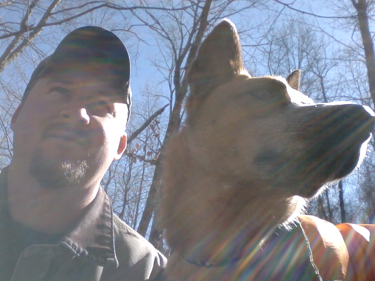
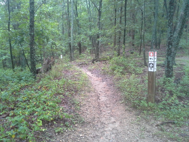
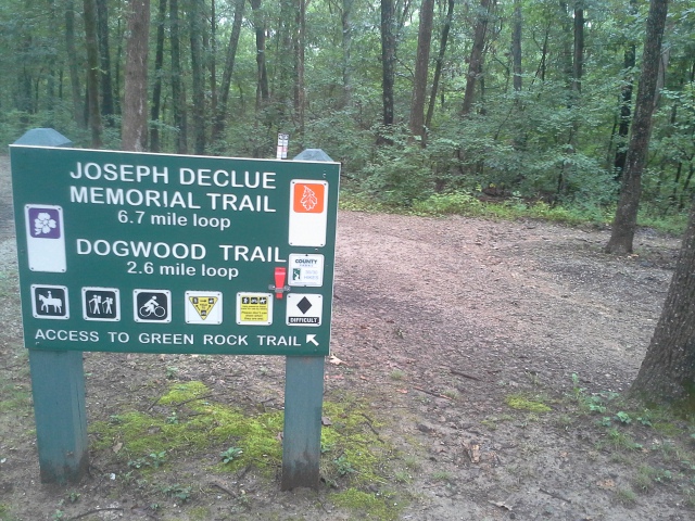 It had been kind of a gloomy weekend, with drizzle here and there, and adventure already…but when Sunday morning came around, I knew that I had to get Max in the car and go head out for some time on a trail in the woods someplace. In the St. Louis County area, my favorite place to hike is undoubtedly Greensfelder Park. I have hiked there many times, and all the loops but one. I knew that today I needed to conquer the 6.7 (NOW 8.2) mile Joseph Declue Memorial Trail.
 How to get there:
From the interchange of Interstate 44 and 270, take 44 west for about 14 miles, to exit 261 (Allenton Road/Six Flags). Make a right onto Allenton Road, and follow it past Six Flags and into Greensfelder Park. As you reach the top of the hill, there will be a long parking lot on the left side of the road, before you reach the visitors center which is a bit farther down Allenton. This is the trailhead to the Declue trail, as well as the Dogwood Trail and the spur that will take you to the Round House Memorial and access to the Round House Loop Trail.
 The trail starts out in the direction of the Round House Memorial, before branching off to the left and down a bit. It follows Allenton Road toward the direction of Interstate 44, and eventually crosses the road and heads into the woods behind Six Flags. It switches back and forth, slowly making its way up the hill to the ridge top, and then follows the southeast edge of the ridge before curving around the end and heading back in the opposite direction on the other side. It then drops down into a deep, expansive ravine, finally crossing a small wet weather creek before climbing back up toward the center of the park. As it rises it starts to turn to parallel the park’s loop road, and then crosses the road and goes back into the woods.
 At this point you have an option. According to the older maps, once it crosses the road here, it hooks up with the Deer Run Trail and heads back out to Allenton Road (that is the route I took). However, (and the signs might confuse you) it has been changed recently to follow the Deer Run Trail down into Eagle Valley, and back up and out following the Eagle Valley Trail. This is the difference between 6.7 (turn left and follow the road) and 8.2 miles (head down into the valley).
 What I like about this trail:
It is a good workout, and I am not ashamed to admit that after 6.7 miles, I was ready to be sitting on my couch watching some preseason football. This is the longest loop trail in Greensfelder, and it should be hiked with ample water and a snack.
The trail itself, for the most part, was in very good condition. Other than the occasional muddy patch, it didn’t seem like it gets a lot of disruptive traffic, like the more popular trails in this park. Very pleasant path for a longer hike.
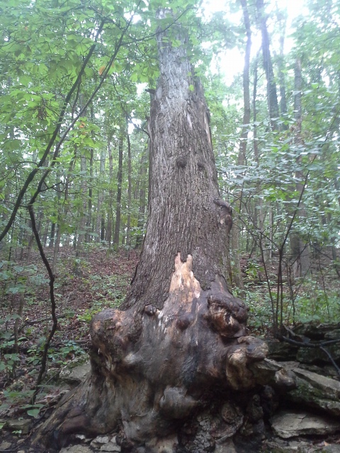 At times it felt like we were in the deep woods. When you get to the backside of the ridge from Six Flags, the hill gets a lot taller feel than it did on the way up, and you get a sense that maybe you are hiking in a more mountainous area than you were at the beginning of the trail.
What you need to know:
I took it counter-clockwise, and be aware that once you cross the park loop road, it is now marked to go down into Eagle Valley and then back out, which adds an additional mile and a half to what some maps still in circulation will tell you. The map I had with me, that I had gotten THAT DAY over at the bathrooms by the campground, showed it following the Deer Run Trail back out to Allenton Road and to the parking lot (6.7 miles). Pay attention to this, as you might be end up hiking farther than you were planning if you follow the trail markers once you cross the park loop road (8.2 miles).
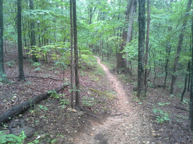 There was something fascinatingly spooky about the screams of joy and terror that drifted up the hill from Six Flags. Take that into account if you would prefer a quieter hike, as the sounds will be with you for quite a while until you get to the other side of the hill and head down into the ravine.
This is a rugged trail, and the length of it is notable, for the beginning hiker. It is a lot of fun, but don’t make it your first trail to hike in Greensfelder.
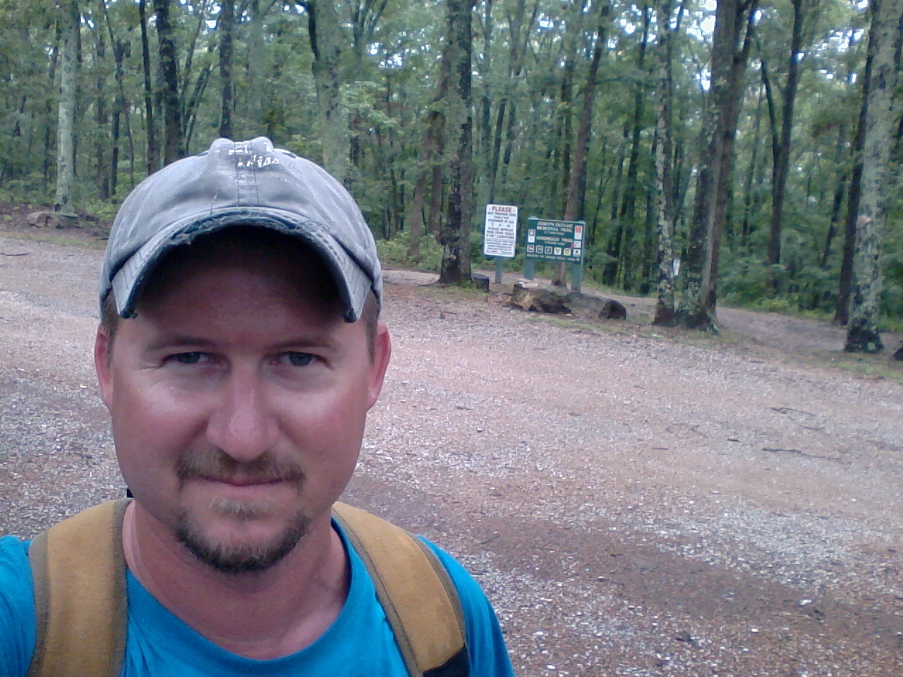 All in all it was a nice, healthy excursion for Max and I, pushing just a little farther and harder than we usually do on a Sunday afternoon trip through the forest. The sky was cloudy with sporadic drizzle here and there, and it was a fun hike on a relatively cool August day, exploring what seemed to me like the seldom traveled backcountry of a park that we were already so familiar with.
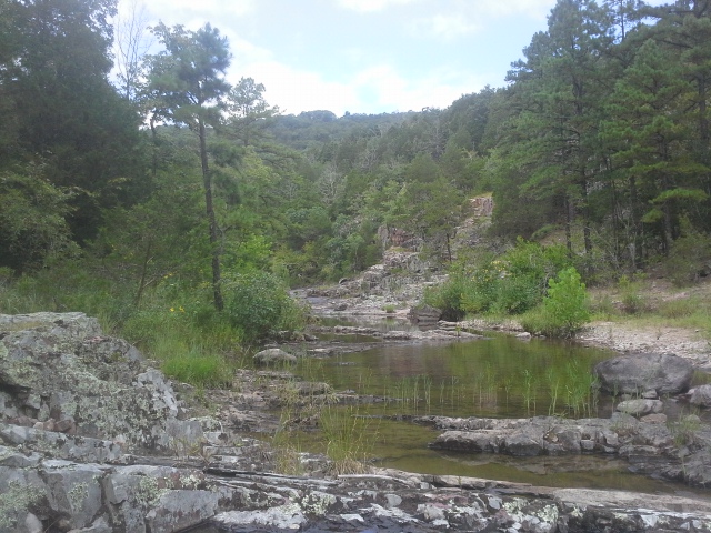 There is a place that I have reviewed before, but hadn’t been back to since around the time that I started this blog, a year and a half ago. It is one of the most gorgeous and wild and beautiful places in Missouri, as far as I am concerned, and it really isn’t too far away (at least for me). It is a natural place where I feel a definite connection to the wilderness while I am in it. A place that lends itself to inspiring that rugged fantasy of living in the woods, finding a harmonic balance with the plants and animals dwelling there, and making my home and life in the topography of the sharp peaks and rock filled waterways. A place where for miles of surrounding trees and hills, the only human sound is the one made by the occasional jet flying way overhead. Welcome to Lower Rock Creek, flowing through Cathedral Canyon, below the scenic glades of Trackler Mountain.
 How to get there:
From St. Louis you get on Interstate 55 south to Highway 67 south. Take that all the way to Fredericktown until you get to MO E. Go west (right) on E for about 8 miles, and pretty soon after you cross the bridge over the St. Francois River, you will come to County Road 511, on your right hand side. Turn right on CR 511 and take that past the fields on either side about half a mile. The road will incline down and there is a little concrete bridge that goes over a creek (it was bone dry this past trip). Almost immediately past the bridge on the left is a gravel jeep trail. It looks like an opening in the forest for ATVs, but this is where you want to turn. That is the road to the parking area and trailhead.
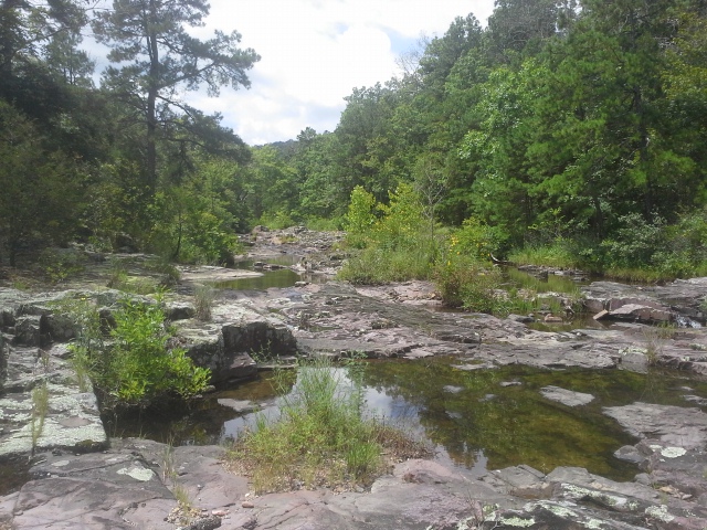 Take that for probably half a mile until you get to an old gate on the left, with the same stream you crossed over just beyond it. This is where you park. Beyond the gate and across the creek is the trail. There is another trail that heads out from the parking area parallel with the creek and up the hill, but I have no idea where that one goes, yet. If you don’t feel that your vehicle can make it all the way down this uneven and narrow jeep path, there are a couple spots on the way that you can park at.
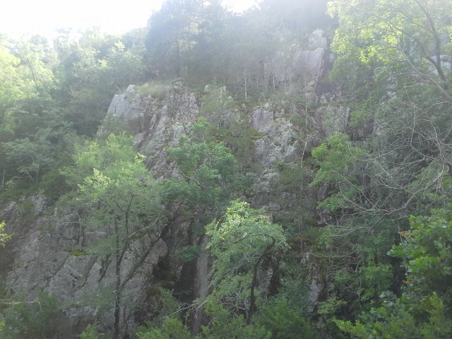 So you cross the creek, and follow the trail for just a short length to where it splits off in a fork. Take the left fork (there is probably a rock arrow on the ground pointing the way), and head through Wolf Hollow for about a mile until you emerge from the forest at Lower Rock Creek. Turn to your right and follow the creek upstream, over the rocks, through the trees, around the bends and over all the logs, until after about another mile you come to the vertical rock face of Cathedral Canyon, beyond the trees and across the creek from you. In this bend of the creek is an established backpacking site, and you will know you are there when you find the two fire rings and the central “Table Rock”. This is where I like to spend the night when I am visiting.
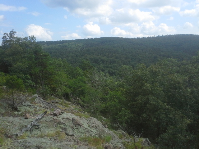 Why I like this place:
The isolation. Deep in this canyon, next to the creek, you feel as if all other human beings are so far away. That you are in the wilderness, and you can unplug from the stresses that plague and control our lives. Time is spent gathering firewood, playing in the creek, climbing the surrounding mountains, communing by the fire. There is nothing to do in that place that isn’t about strengthening yourself and your connection to nature. Some people might even say that they have experienced moments of authentic spiritual energy, sitting on one of the rock outcroppings in a glade near the top of Trackler mountain above the backpacking site, looking off into the distance at the nearby mountains and clouds and birds…but maybe you would just think I was crazy.
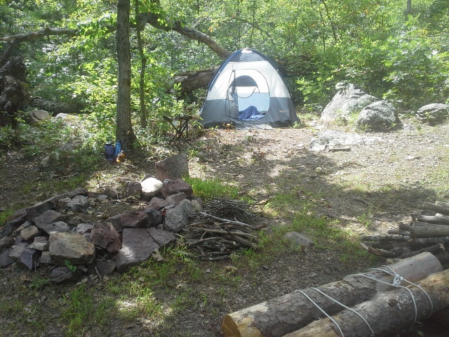 The established backpacking site. In the interest of leaving no trace, a site that is already there allows a person to feel as if they are not being as disruptive as they could have been, had they needed to build their own fire ring and clear a space for their tent. I would love for there to be spots like this all over in the wilderness areas throughout Missouri.
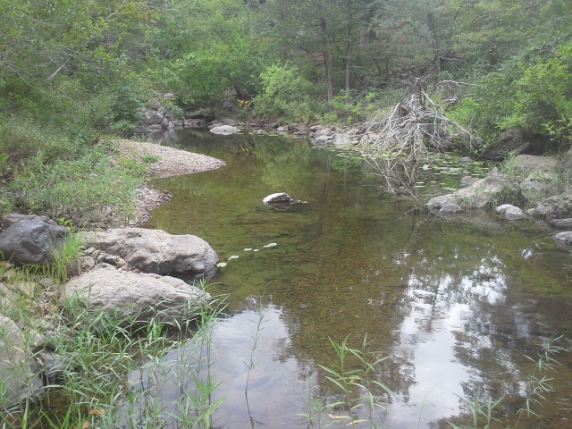 What you need to know:
The jeep trail in is the kind of road that you need to take slowly. It isn’t impassable, as I can get my Pacifica down it, but there are a lot of big rocks and roots in its surface between the mud and dirt. And the branches and sticks on either side of it that want to scratch your paint job will make you cry by the time you are just a little ways down it, if you are of the persuasion to care about that sort of thing. Don’t take your Mercedes on this excursion.
 The first part of the trail, from the parking lot through Wolf Hollow to the creek is an exercise in deception compared to the stretch along the creek and into Cathedral Canyon. Sure, you have to step over a fallen log here and there, duck under one (to the point of crawling if you have a full pack on), and maybe deal with a spider web or two. This is the EASY section of the trail. The second section along Rock Creek is very rugged and will take you into spots where you must scramble across or up extended loose rock piles, duck under or push out of your way branches that are clearly trying to stop you from advancing, and more often than not playing “find the trail” as the one you were on just kinda vanished. It is not for the beginning or out of shape backpacker, as it requires maneuvering of weight that isn’t typical of just hiking down a trail. Consider yourself lucky if you don’t stumble or fall at least once. Watch your step.
 I love this place…and it is a place that I must also confess, part of me doesn’t feel inspired to share with anyone, due to my own selfishness. I have come to realize that a lot of the places I visit that I end up sharing on this blog comes with a cost. The cost of OTHER people knowing about it. The cost of the loss of a little bit of the isolation. The cost of the chance that I will likely show up one late morning, and the parking area will be full (TWO cars?!? Dang it!) and the backpack site occupied. The cost of the trail being widened and paved, and billboards being raised alongside it.
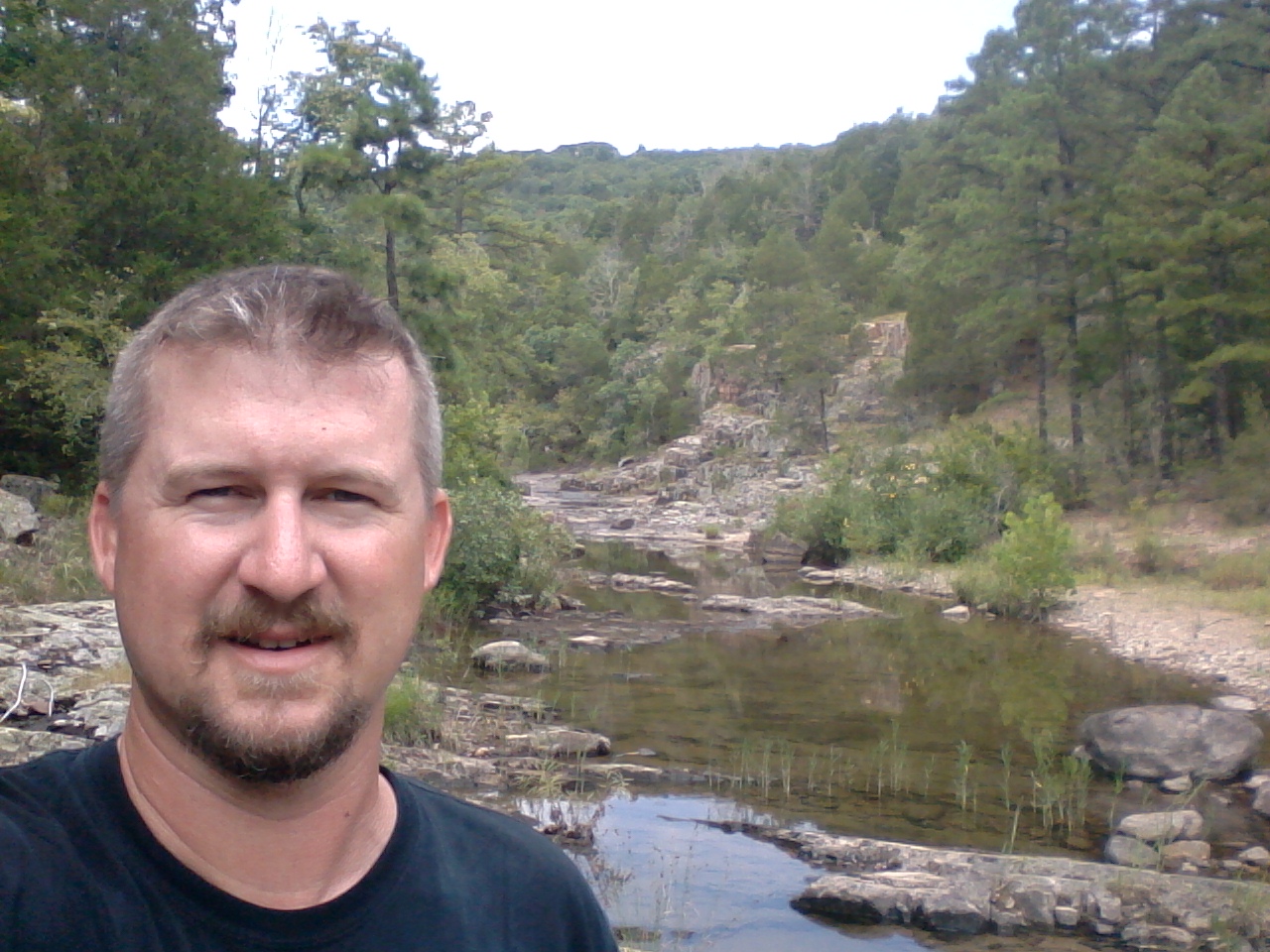 …Surely this is an exaggeration, but a cost that comes with the realization that other people may visit it too, diminishing somewhat the wildness through unintended exposure to the things that come with foot traffic. That one person out of one hundred that tosses their Gatorade bottle into the woods next to the trail. That is the guy we all need to not be, when we head into the woods. Because let’s face it, these places are so neat and amazing and enriching that they need to be shared. They hold a natural beauty that within it lies an energy that is good for a person, and we all should go there at least once in our lifetime. So let’s visit them with respect and care. Not just for our own experience, but for everyone else we share it with, so they can have their moment in a glade on the side of Trackler Mountain too.
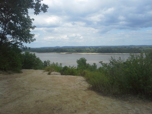 It had already been a weekend full of outdoor experiences, having camped at Meramec State Park for the Meramec Watershed Celebration picnic put on by the Open Space Council for the St. Louis Region. We had been planning on staying an extra night and coming back Monday, but plans were altered and we found ourselves with a Monday morning trip to our awesome St. Louis Zoo (hadn’t been there in a while). As if THAT wasn’t enough walking around, that afternoon I felt Max had been cheated (dogs aren’t allowed at the Zoo) from an outdoor excursion, so I put him in the car and we headed down the road to a park I am very familiar with, but a trail I had not known about until just recently (Thanks, Tom!). We were on our way to Cliff Cave Park to check out the River Bluff Trail.
 How to get there:
Cliff Cave Park is in the South St. Louis County area, off of Telegraph Road. From the 55/270(255) interchange, take 255 south toward the Mississippi River to Telegraph Road. Make a right (south) onto Telegraph, and take that about 2 miles to Cliff Cave Road. Make a left onto Cliff Cave Road. After about a mile and a half of winding your way through the neighborhood, you will come to the park entrance, go down the long hill, and around the curve to the left. The parking lot for the River Bluff Trail and Spring Valley Trail will be in front of you on your right.
 So that long hill you drove down? The trailhead for the River Bluff Trail is halfway up on your right, where the guard rail ends. Carefully, keeping dogs and children close, walk up the hill making sure to be in full view of oncoming traffic, and make a right into the woods when you see the trailhead. After getting off the road, I turned left and went through what seemed like a series of wide curving switchbacks up the gentle slope to the top of the hill, eventually coming around back toward what seemed like it might be the trailhead, and then out left in the direction of the river.
Once at the bluffs over the train tracks and the river, it curves wide to the right and descends just slightly before getting back to the trail head at the road. Carefully back down the road to the parking lot, and you are all done.
 What I like about this trail:
It is a quick have-to-get-into-the-woods trail. It is relatively nearby my house. It is just over a mile long. When I am pressed for time but I am feeling that need to spend some time in the forest, this would be a great destination.
It gives you an impressive overlook of the Mississippi River. Something that is not so easy to find in the St. Louis area that isn’t in somebody’s backyard.
 What you need to know:
Like most bluffs over rivers, there are no guardrails. Keep your kids and dogs close. (Palms sweating just thinking about it.)
I ended up picking up a grocery bag and a half of cups, cans, and bottles while hiking this trail. Seems like it gets a lot of traffic, but please carry your trash out.
The trail markers were sparse, so take a look at a map beforehand so that you have an idea of the path you should take. Sure, you’re between a river and a residential area, but one wrong turn and you might find yourself down in a quarry next to a barge.
 It was cool little walk through the woods out to the bluff, with a great view, and what I think I like most about it was that after having hiked the other trails in this park for probably ten years, I had no idea that this trail was here. One of my favorite things is to find new places to spend time in the woods, especially when they are so close.
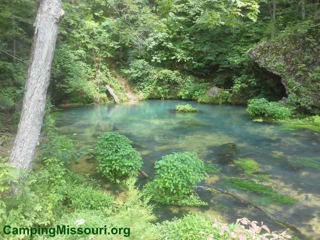 Along the Current River, across from the Pulltite Campground in the Ozark National Scenic Riverways, is a natural wonder that is hidden up a lively spring branch that feeds narrowly between two imposing hills. On our last trip to the ONSR, we took a float trip from Pulltite to Round Spring, and soon after we started our canoe voyage down river, we pulled off on a gravel bar on the right to hike up the short trail against the bluff, past the spooky old cabin, and over to see the light blue gem that is Pulltite Spring.
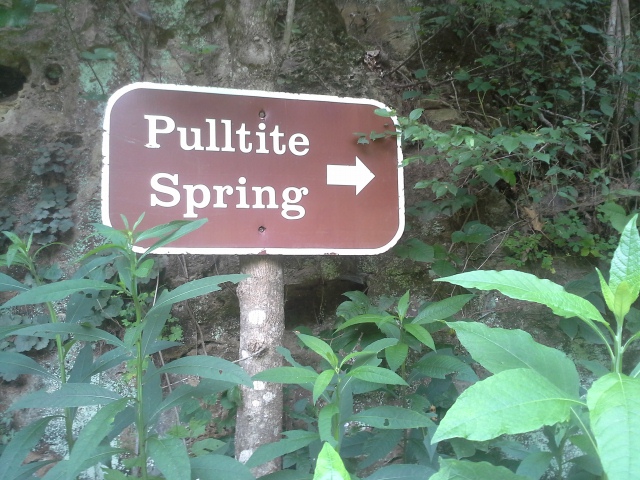 How to get there:
(Eminence, MO in the heart of the Ozark National Scenic Riverways is about 3 hours from St. Louis, and you can take various routes to get there. The directions here are from the intersection of Highway 19 and Highway 106, in the middle of Eminence.)
From the intersection of Highway 19 and Highway 106, take 19 north for about 20 miles to Route EE. Turn left (west) on EE, and go another 4 miles to the Pulltite Campground. From this point you have 2 options, and both of them involve getting in the river (I KNOW, you’ll just HAVE to suffer through it). From the gravel bar beach at the campground, you can set off downriver in your watercraft of choice, soon enough coming to the spring branch where it feeds into the Current. Or your other option, which is to head to the end of the campground to the group sites, and find the trail that takes you to the river across from this little confluence. So are you floating or just dipping the toes? Once you get to the other side, it is probably an eighth of a mile hike back between the hills to where Pulltite Spring comes out of the foot of the hill.
 What I like about this place:
Pulltite Spring is one of the smaller springs (that I have visited) in the ONSR, with a daily flow of about 30 million gallons of water (hardly a trickle, right?). Apparently it is named for the way in which the locals had to closely and carefully control their horses as they pulled wagons through the steep nearby terrain when visiting Watson Mill on the spring branch to have their grain crushed. And it turns out that back in the late 1800s and early 1900s, there had actually been three mills built at different times that used the rushing water from this little spring. Not bad for a place that you can only reach by boat or foot these days.
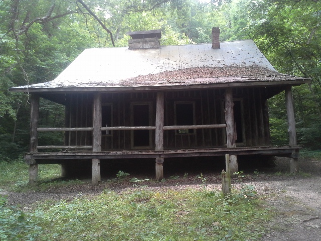 The nearby Pulltite Cabin was built back in 1913 by a group of six men who had visited the area on a float trip. It was intended to be a vacation spot, and is built with its logs in an upright position. This is considered to be a French style log cabin, which allows for less notching of the timbers during construction. It is open and you are allowed to walk inside, so remember to be respectful and take care not to damage this hearty and historic structure.
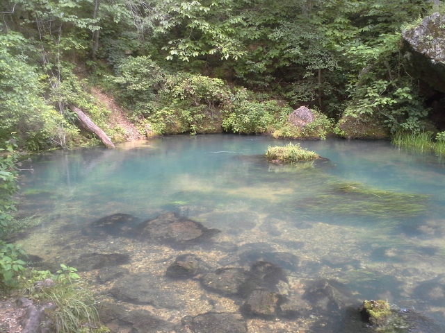 What you need to know:
This is an area that does not get regular maintenance, due to its remoteness, so please visit it with the respect and attentiveness it deserves. Take any trash you create back out with you on your trip, and do your part by bagging any trash left by other, less compliant visitors.
As with all springs, avoid the urge to jump in the water. Because of their lower temperatures and mineral content, along with the general cleanliness of water filtered through the ground, they are home to plants and animals that don’t often live anywhere else. Please do to not disrupt the gentle balance of this little ecosystem, and enjoy the scenery from dry land.
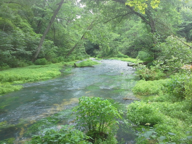 Along the trail going in, I didn’t really notice any Poison Ivy, but back by the spring and the cabin I did see some. Lurking in the underbrush and around a fallen tree, keep your eyes open to avoid this irritating plant. The last thing you want is to come back with itchy souvenirs to remember your trip by.
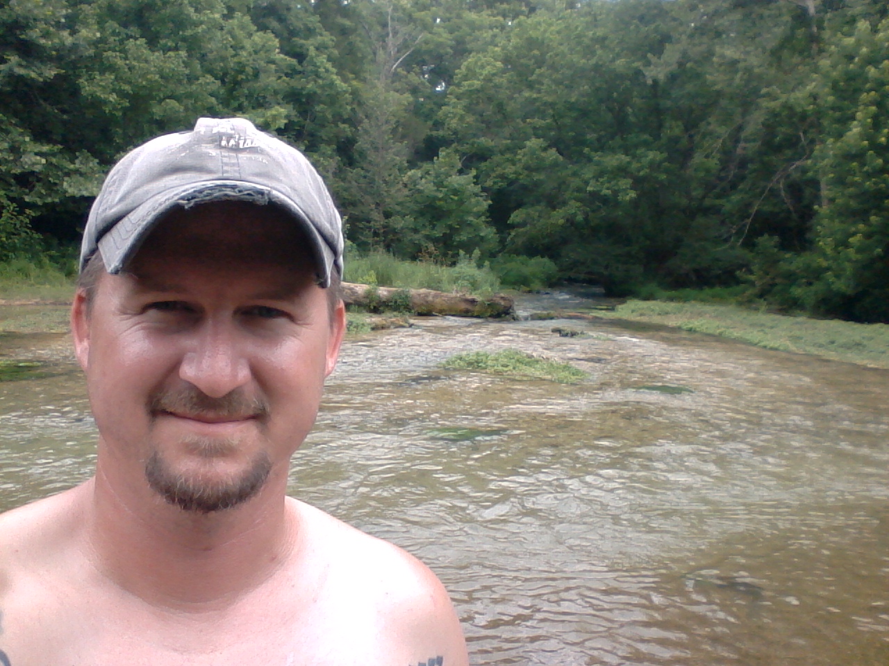
It was just the beginning of our canoe trip that day, and it was a great place to start it out with. It is kind of amazing to think that this spring fed little creek back within these sharp hills was at one point the industrious center of the local people, but I think it speaks to the resilient heartiness and ingenuity of those who called it home. Truly a hidden gem, I like to imagine how fun it would be to spend your summers at this vacation home, next to the pretty and underestimated Pulltite Spring, back a little ways in the forest off of the gorgeous Current River.
 So I want to get a little deep here, and share some thoughts that have been brewing in my mind and my gut for some time now, probably the majority of my life, and I feel the inspiration to attempt to put it into words. Bear with me, if you are willing.
I love to hike. I love to walk. My mom tells a story of when I was probably five or six years old and having a bad day. Who knows what the reason was exactly, but I’m sure that it had something to do with at least one of my three sisters (it was usually THEIR fault!). She said that after some initial grumbling and pouting, that I got up and went out the front door of our house, telling her behind me that “I just need to take a walk.” I went around the block of our south St. Louis neighborhood, and I haven’t stopped doing it since. The need to walk has been in me a long time.
 A friend of mine, who does the blog North American Educational Explorers shared a saying with me a while back that has stuck in my mind since. “Solvitur Ambulando” It is Latin, and it means “It is solved by walking”. In my own searching, it seems that it is usually translated to mean: in order to solve a problem you are facing you need to put in the leg work, the research and experimentation, to figure out the solution. I can agree with that because we all know that is true in life. That problems aren’t solved out of thin air, and that any conflict we face usually requires some work to get through it.
 But I think in my own context, how I define it, is in a more literal sense. That negative energy, either from stresses with work or relationships or even my own inquisitiveness and passions, can be eliminated by the experience of walking or hiking. That any conflict I face and the bad things it brings into my life can be alleviated somewhat by walking. In the least, it puts me into a calmer sense and mental place, to be able to constructively approach whatever the problem is.
 Health and fitness professionals for the most part unanimously agree that exercise has a lot of benefits, and what I have come to believe is that those benefits go beyond a person’s physical state of being. That it improves mental and emotional health as well, in ways we may not even notice directly. Walking through the forest, surrounded by the life that exists there, working the muscles that suffer too much from routines of inactivity, and giving ourselves the opportunity for clarity in our thoughts, is something that I believe to be a positive addiction we all need to have.
 Hiking along the Eagle Valley Trail in Greensfelder County Park today, there is a spot that is probably halfway along the trail, just before it turns to the left and the Green Rock Trail splits off and heads toward Rockwoods Reservation. There is a picnic bench there that I usually stop to take a short break at, to enjoy the sounds of the forest surrounding me, maybe have a snack, give Max some water. This time I had been hiking with a couple dialogues going on in my head, and in a moment of clarity and inspiration, I typed this into the memo app on my phone:
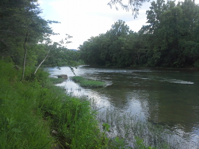 “The only stress that I experience are the stresses of physical strain. All other faculties are in a heightened state of peaceful awareness. Ultimately, if I choose to deeply enough, I can be stronger than my fatigue and overuse. It can be ignored and overcome by a focus on the movement through the forest. With that victory, compounded upon my current perception and mental calm, the satisfaction of the experience as a whole is magnified to a level of spiritual and real connection with my physical self and the environment I am immersed in. Thank God for the forest.”
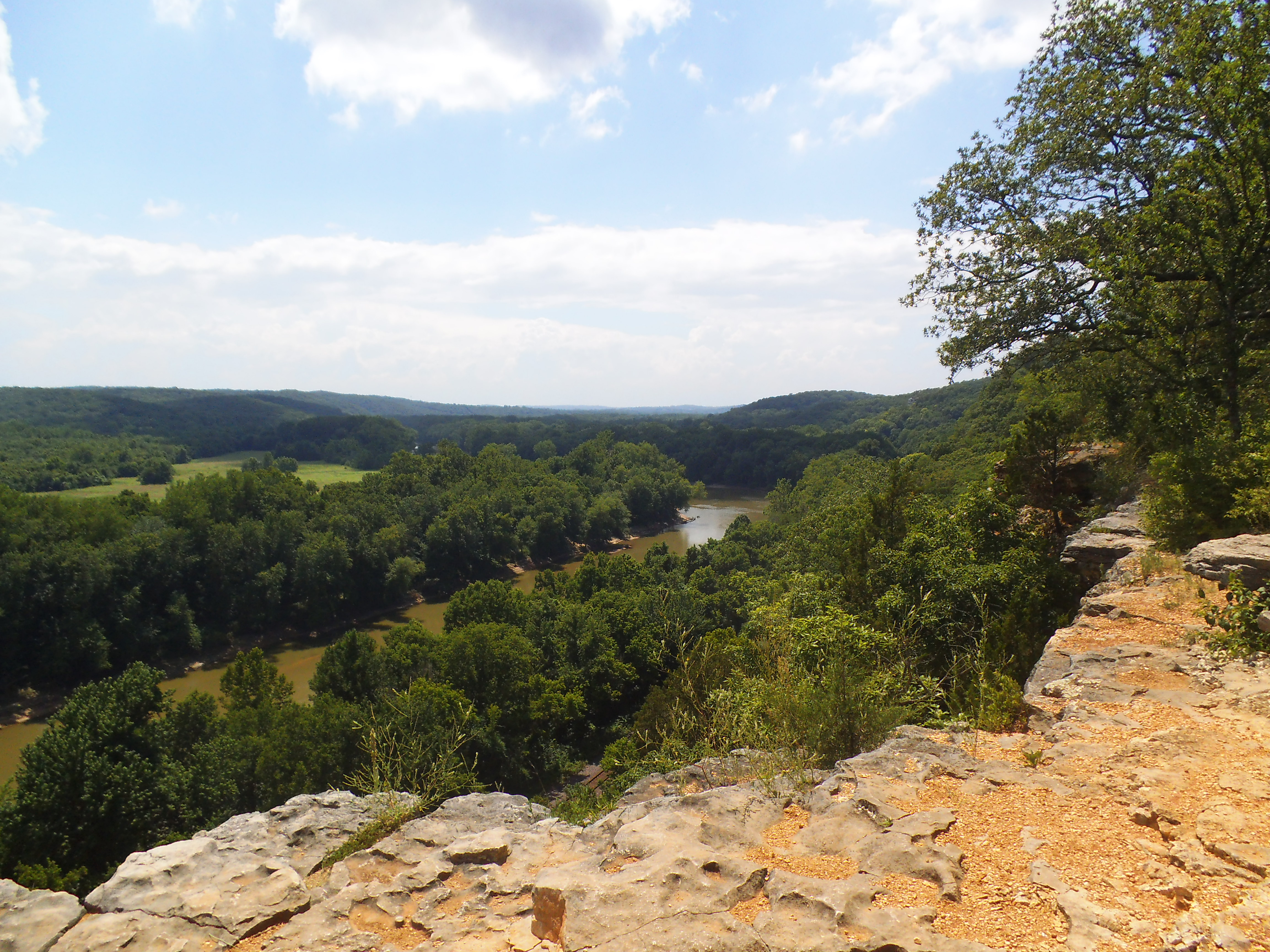 From my own experience, I truly feel like hiking, walking through the forest, is a meditation for me. That it is something I do to center myself. A way for me to find an internal peace. To step away from the stresses that may be plaguing me lately. To give my mind a chance to breathe and get heading back in a productive direction of thought. The distraction of the natural beauty there is also a part of the whole process. To be witness to the variety of the natural world helps me to bring things into an authentic perspective. Like looking up at the stars on a camping trip, it helps me to see the actual size, how small and unimportant it really is, of whatever negativity I am dealing with.
 Hiking is also something I do to connect with the life force of this universe and the environment we are a part of. There is an energy in the forest and waterways. Sure, we see it in the animals, the living breathing creatures that sometimes cross our path. But I am talking about beyond these things that run and jump and live and die in the woods. There is an energy in the trees and the rocks. The hills and valleys. The wind and the blades of grass and the streams of water flowing down the subtle hills along the trail. It is an experience that I have difficulty describing, especially to people who may not be receptive to it, but I know for sure that it exists there and that I can feel it when I am in the forest. Part of my experience, the real reason that I am drawn to these places, is to absorb that energy and really connect with it as I move through it. To attempt to match the vibration of what exists there, with the vibration that resonates from within myself. I would even go as far to theorize that it is along the lines of communing with what I personally believe created all of this.
 Whatever the reason for doing it, you like to exercise, you enjoy being in nature, you have a spiritual connection, it is a beneficial activity that I think can be good for just about anyone. Because it has been on my mind, I just felt that I needed to take the time here to share these thoughts and why I like to hike. I know I’m hooked, and maybe a little nuts, and I will continue to find myself out on a trail somewhere just about any chance I get. Maybe one day I will see you out there too. Thanks for reading.
-Gabe
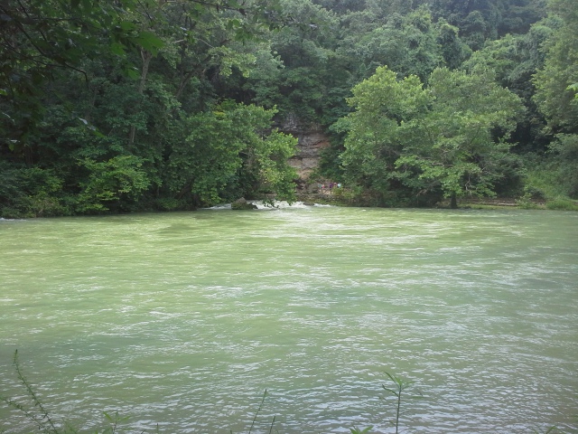 This past July 4th weekend, we were camping at Round Spring, in the Ozark National Scenic Riverways. It was a great trip, and as there is a lot to see right around that beautiful area, it was on my list to go visit something south east of where we were that was really impressive, in just the relative power and force involved. There are a lot of springs in Missouri, but only one is considered to be in the top three concerning output, in the entire United States. We HAD to take a trip down to Van Buren, MO to visit Big Spring.
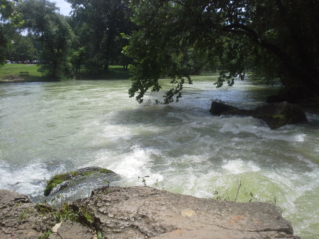 How to get there:
(Eminence, MO, in the heart of the ONSR is about 3 hours from St. Louis, and you can take various routes to get there. Round Spring, where we were staying, is north of Eminence on 19. The directions here are from the intersection of Highway 19 and Highway 106, in the middle of Eminence.)
Take 19 south for about 12 miles to Winona, MO. From there, head east (left) on Highway 60 for about 21 miles to Van Buren, MO. Once in Van Buren, and before you cross the bridge over the Current River, make a right on 103. Another 4 miles on 103, and you will find yourself entering the Big Spring area.
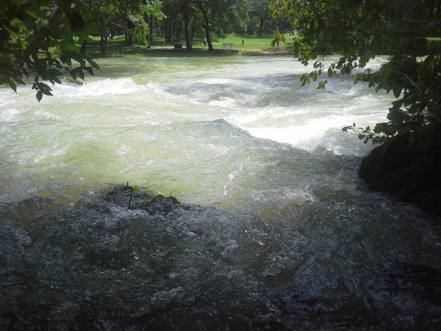 To get there directly from the St. Louis area, you can take a number of routes, but for a scenic and adventurous drive, head south on 21 for around 120 miles, through Desoto, Potosi, Lesterville, Ellington, and all points in between to Highway 60. Head west (right) on 60 for about 10 miles, cross the Current River bridge in Van Buren, MO and make a left onto 103. Four miles on 103 puts you in the Big Spring area.
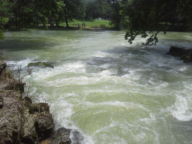 Why I like this area:
Big Spring was actually a Missouri State Park in the mid 1900s, until it was taken over by the National Park Service as part of the Ozark National Scenic Riverways. It is one of the 3 biggest springs in the United States, along with a spring in Florida and a spring in Idaho. It’s average daily outflow is 288 million gallons (!!!), and I was told by NPS Supervisor Bill O’Donnell that it could fill up Busch Stadium in St. Louis in just a little over a day! Along with all that water, it apparently ejects about 70 tons of dissolved limestone EVERY DAY! 70 TONS!!! That means it is constantly carving out it’s path underground every moment that it continues to flow. (I have been told by a few people that it is usually much bluer water, so it must have been carrying a bit more sediment than usual the day I visited it.)
 The park area was established by the Civilian Conservation Corp back in the 1930s, and many of the original structures are still there and operational today, including the Big Spring Lodge, which sits on the hillside next to the confluence of the spring branch and the Current River. An army of young men taking natural materials from the surrounding area, developed this recreational destination that to this day 80 years later, is still enjoyed and cherished by so many lovers of the outdoors.
With the campground and cabins, you can spend your entire trip in this area, learning the local history, exploring the nearby hills, and spending your afternoons playing in and on the Current River. Big Spring itself, and the surrounding 17 acres of forest, are a designated Missouri Natural Area, and are truly a sight to preserve and protect for future generations.
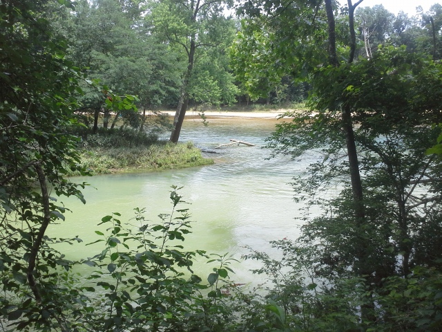 What you need to know:
I’m sure that people take their canoes out on this part of the Current River, but it seemed that this section is more appropriately sized for those with bigger watercraft. If you are looking for the typical ONSR float trip excursion, without a motor, this might not be the park for you.
As this is quite a significant natural attraction, it gets more traffic than some other scenic destinations. Take care to be considerate to everyone visiting, and give the people around you an ample amount of time to take their pictures and soak in the energy of this powerful place.
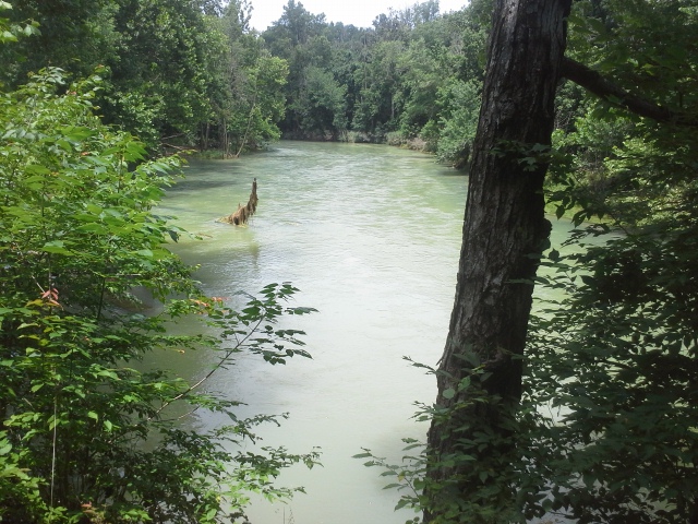 As always with springs, because of their temperature and mineral content, they tend to be home to plants and animals that do not exist beyond their boundaries. Avoid the urge to enter the freezing water of the spring and its branch to the river. Respect the natural beauty, and do your best to not disrupt the balance that lives within it.
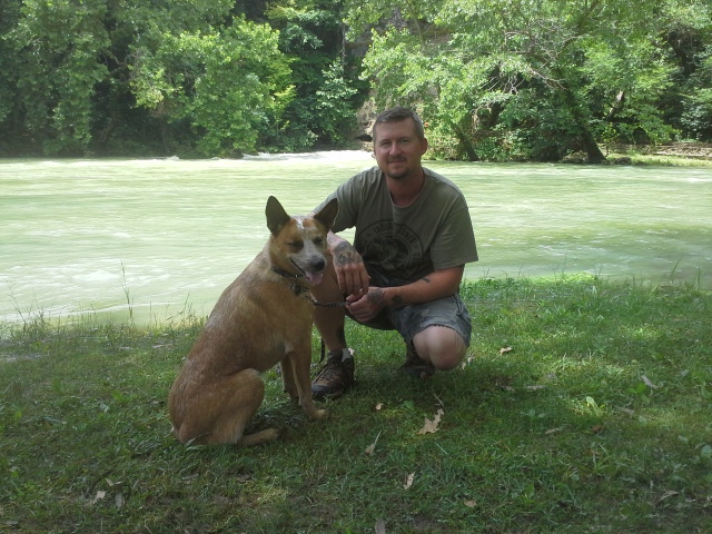 I had never seen such a powerful exiting of water from under the surface of the earth, and I could have spent all day sitting on a rock at the edge of the spring. It has a hypnotic and soothing effect, and if you are listening closely, it plays a natural symphony that spoke very deeply to something within me. The power of this place will stay in my mind for some time, and you should give yourself the chance to experience it as well. So much water, a river in fact, triumphantly springing from the ground. A force to be respected and appreciated.
Silent Determination. Blue Spring, along the Current River. Ozark National Scenic Riverways 7/4/2014
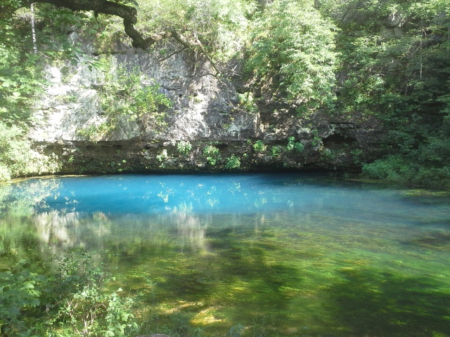 This past 4th of July weekend, we were lucky enough to spend it in the Ozark National Scenic Riverways, at the campground at Round Spring. We had a few hours to spare that Friday afternoon, with our tent set up and an itching to get out to see something cool, so we headed over to Powder Mill to hike the 1.3 mile trail to Blue Spring. What we found there was something really remarkable to see, on the beginning of this holiday weekend.
 How to get there:
(Eminence, MO, in the heart of the ONSR is about 3 hours from St. Louis, and you can take various routes to get there. The directions here are from the intersection of Highway 19 and Highway 106, in the middle of Eminence. Also, this particular spot is close to Ellington, MO, if you happen to come west on 106 from 21.)
Head east on 106 for about 14 miles toward Ellington, MO, and turn right (south) on the road to the Powder Mill campground. Make a left into the parking area/campground just before the river access. The trailhead to the 1.3 mile Blue Spring Trail will be to your left, and is not really marked (from what I could see).
The trail heads into the woods under the bluffs for a bit, and then comes out of the flood plain and heads along the north side of the Current River, allowing for some pretty scenery. It then turns back into the woods for a bit, eventually meeting up with the trail from the Blue Springs parking lot, which heads to the spring.
OR…you can forego the trail, and just head another 2 miles down 106 to the gravel road which will take you to the Blue Spring parking lot. It is a right turn (south) off of 106, with signs for Blue Spring on the side of the highway. A little bit down the gravel road you make a right at the fork, and head down the hill and through the bottoms to the Blue Spring parking lot. Just a couple miles in total.
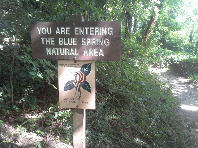 What I like about this area:
The trail from the parking lot was pretty short, and you get to walk along the branch for Blue Spring, which eventually reveals itself, flowing silently out from under the rock face. It is kind of a secret little magical place, hidden away in the forest, unlike some of the bigger and more popular springs in the Ozark National Scenic Riverways.
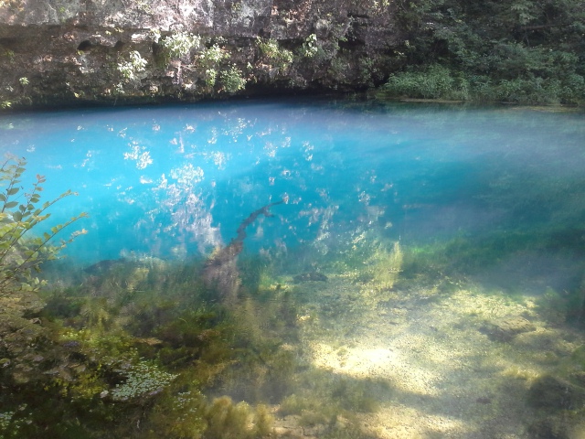 Blue Spring produces an average daily flow of 87 million gallons of water, and as well as being the deepest (300 feet), it also has some of the bluest color of all Missouri springs. It is considered to be part of the ONSR, but it is actually owned by the Missouri Department of Conservation, and lies within a designated 17 acre Missouri Natural Area.
The fact that you can hike along the river to get there is nice if you’re feeling up for it. It gives you a chance to immerse yourself in the beauty of the area, especially hiking along the Current River. However, the fact that you can drive to the Blue Spring parking lot is nice to be able to do, in case you’re more inclined to focus on the relaxing aspects of your weekend excursions.
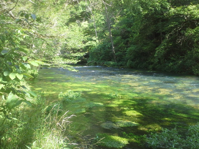 What you need to know:
The trail from Powder Mill isn’t very long, but I would consider it to be a moderate trail. Some of the sections are pretty narrow, either because of the lack of river bank, or the overgrowth along the sides. Towards the end, where the grasses and plants were leaning in pretty closely, there was some Poison Ivy, lurking around ankle height waiting to strike.
The gravel road in isn’t one for the RV. The hill that you descend on the way in, and go back up on the way out, has a pretty respectable grade. And when we were going to try to visit back in April, there was a decent tree laying across the road right on that hill, blocking the way. Best to take a regular car if you’re going to drive into the parking lot.
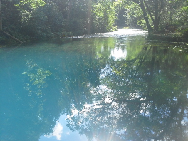 As with all springs, they support more specific plant and animal life, due to the content and temperature of the water. Please please please, out of respect to these beautiful and important places, fight the urge to get in the water. It is magical, but can be disruptive to the localized ecosystem.
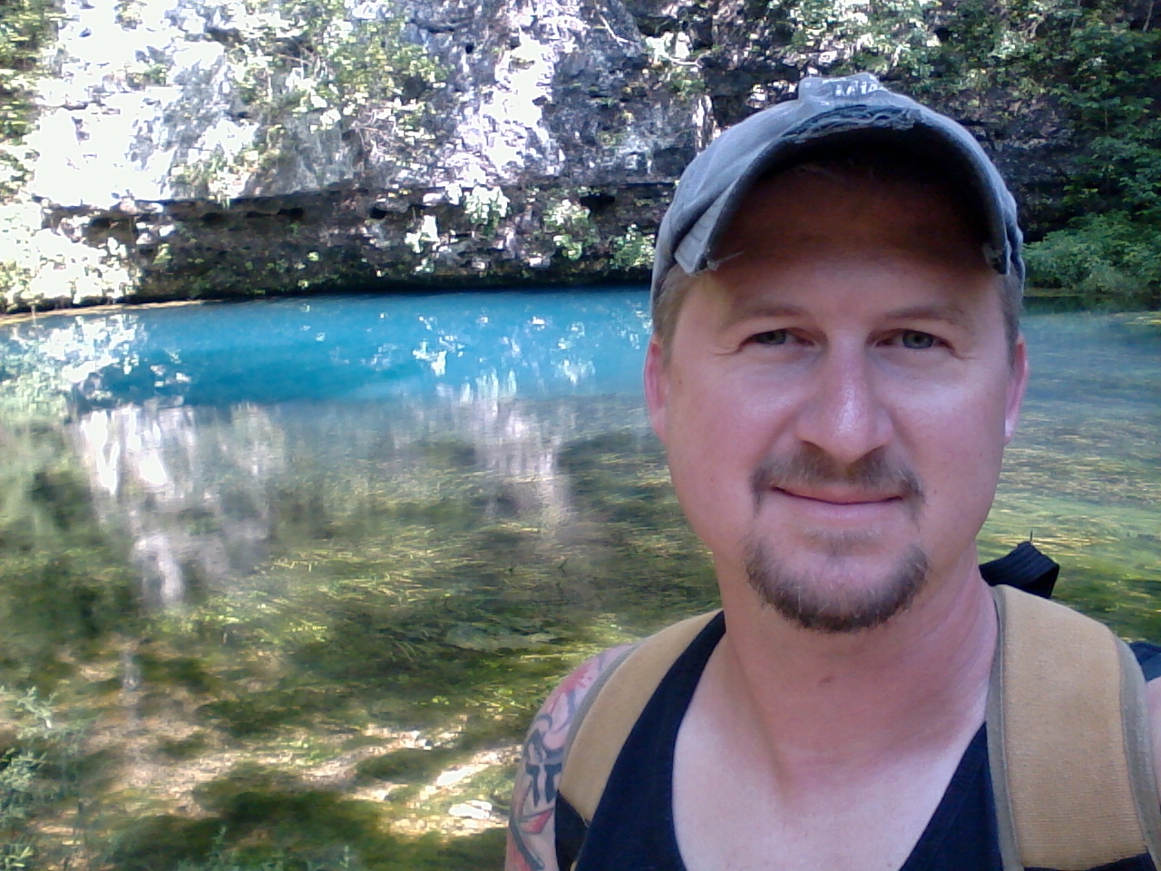 We had a weekend to spend exploring the amazing places within the Ozark National Scenic Riverways, and this was our first excursion. An afternoon hike along the Current River. A few moments of peaceful observation of some of the deepest blue water I have ever seen. A conscious appreciation for this life giving substance, quietly and determinedly coming forth from the ground, to meet up with and add to the gorgeousness that is the Current River. Blue Spring is a little place off the beaten path that is definitely worth the trip. Make it a point to get there next time you visit the ONSR, to see one of the lessor frequented springs in the area. You will undoubtedly have a moment or two all to yourself there. Use that moment to give thanks for all the natural beauty that you have immersed yourself in.
 It had already been a pleasant day of hiking, as Max and I had already done a couple trails out at Greensfelder with some friends of ours. The total mileage to that point was probably just over 3 miles, and there was one more trail that I wanted to check out to finish with thorough satisfaction. So we said our goodbyes, drove to the other side of the park, ate our sandwich that we had brought for lunch, and headed down the Mustang Trail.
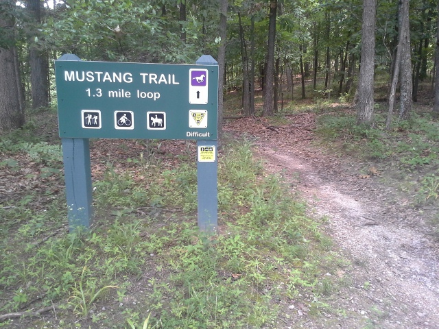 How to get there:
From the interchange of Interstate 44 and 270, take 44 west for about 14 miles, to exit 261 (Allenton Road/Six Flags). Make a right onto Allenton Road, and follow it past Six Flags and into Greensfelder Park. Take it past the scenic park loop road, past the visitors center, and to the parking lot on the right that has the bathrooms, equestrian area, and campsite rules signs. At the far end of this parking lot, where the gravel drive empties back out onto Allenton Road, is the trailhead for the Mustang Trail.
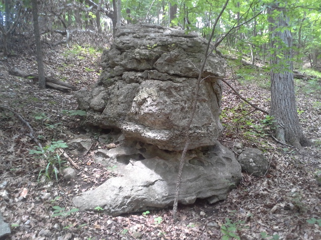 The Mustang Trail heads into the woods to the right, eventually arriving at fork. We chose to go left (clockwise) and very quickly headed down the hill and into the ravine. The trail takes a left and heads along the watershed on the right, eventually crossing it and making its way up the opposing hill to follow the road for a bit. It flattens out for a little while, up at the top, and then turns to the right and goes sharply down another hill to the creek at the bottom. At this point you pass the connector on the left to the Eagle Valley Trail, and then you walk with the creek on your left for a bit. After some relatively flat trail along the side of the creek, you then start back up the hill to the fork, and out to the car.
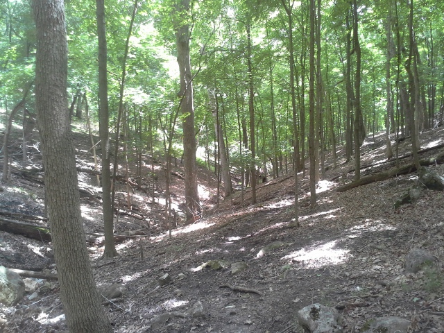 Why I like this trail:
I have hiked through a lot of Greensfelder Park, and it was a different looking area than I was used to. Steep, open hillsides seemed to be the regular fare, leading into deeper and darker wet weather ravines.
The creek along the final ravine floor was a neat little find. It is one that you end up having to cross a few times along the Eagle Valley Trail. It was kind of cool to see where it begins, and I can’t imagine how alive this area must be during and after a rain storm. Pretty scenic little secret.
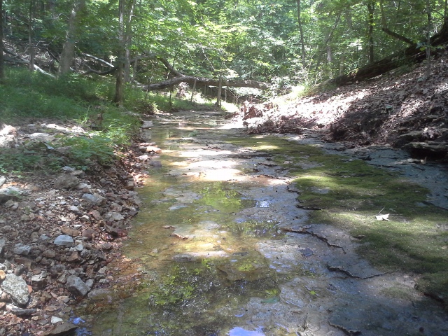 Along the course of this trail, Max and I saw four deer in different spots. Three of them were fawns! I think this directly speaks to the isolation and lack of traffic that this trail must get.
What you need to know:
If you are looking for the steepest trail in Greensfelder, this is it. Severe descents and leg burning climbs. There were sections that could probably use a couple of switchbacks, but they were nowhere to be found. Get ready for a workout.
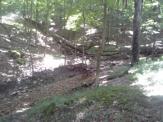 The parking for this trail is very lacking, and you will most likely have to park back by the bathroom/picnic area, and walk an 8th of a mile or so to the trailhead.
The sign at the trailhead says that it is 1.3 miles. The online map says that it is 1.7 miles. Even though we were a little less energetic from the earlier trails that day, Max and I agreed that it was the longer of the two distances.
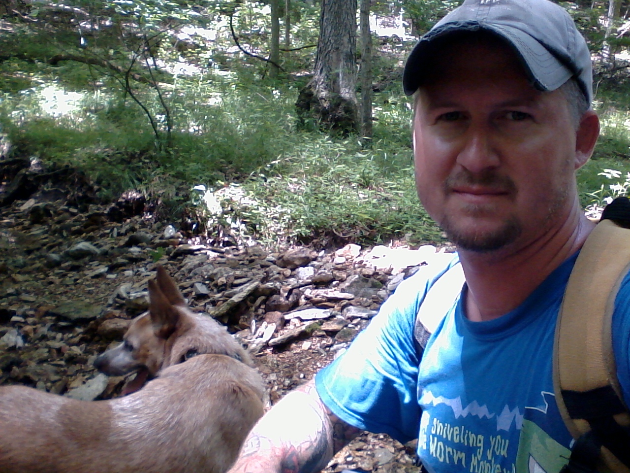 It really is a neat trail, with a different feel to it than the other trails in Greensfelder. A little darker, a little steeper, a little more wild, and a good workout all around. I had never hiked it before, and I was glad I did. It seemed to contain what I would describe as some of the more secretive and special little areas of the park, down there at the bottom of the ravine along the creek.
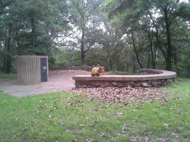 85 degrees and overcast. Not bad for a Sunday afternoon in late June. Max and I knew that we had to get out to the woods and take advantage of this optimal hiking weather. Okay, I knew that we had to. Max doesn’t care either way, as long as we are walking through the forest somewhere, looking for deer to stare at and squirrels to chase. I had never been to Rockwoods Range Conservation Area, other than from the Greensfelder County Park side, and I felt that it was a good destination. The Round House Loop Trail within it seemed like the perfect distance for a satisfying hike, so I filled up the water bottles, grabbed my day pack, and we headed down the road.
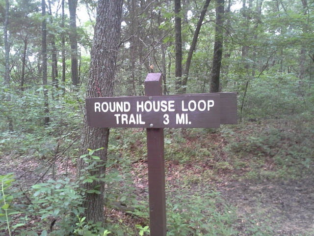 How to get there:
From the interchange of Interstate 44 and 270, head west on 44 for about 14 miles to exit 261 (Allenton Road/Six Flags). Make a right onto Allenton Road, and then an almost immediate left onto Fox Creek. Take Fox Creek for about 2 miles, and the parking lot for the conservation area will be around the bend on your left. There are 2 trailheads here, across the road from the parking lot. The trailhead on the left is for the Green Rock Trail, and the one on the right, with a slightly less visible sign is for the Fox Creek Spur, which takes you to the Round House Loop Trail.
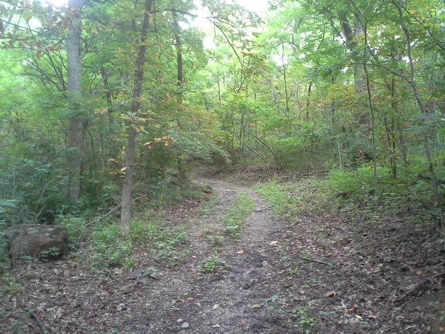 After crossing the road and stepping into the woods, it is a steady ascent for probably a quarter of a mile. It kind of levels off, and after a little bit further you arrive at the Round House Loop. Max and I took the trail clockwise (left), and it was a pretty straight hike along an expansive ridge for probably about a mile, to the Round House Memorial for Blanche and Albert Greensfelder, who had a home built on this spot in 1928.
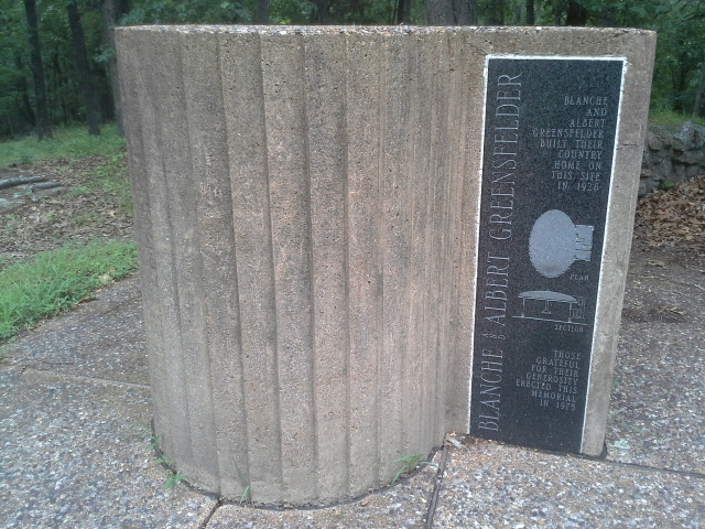 The loop continues from the Round House Memorial back in the direction of the parking lot, and heads downhill for a while until you reach the creek bottoms and follow the limestone carved creek on your left for a bit. Then it is all the way back up the hill to the Fox Creek Spur, and back to the car. In total it is almost 4 miles.
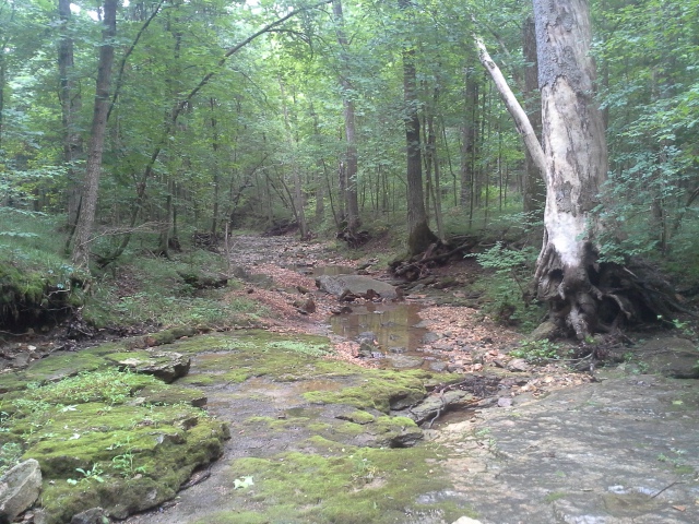 What I like about this trail:
Albert Greensfelder was a local instrumental force for land conservation in the St. Louis area in the early to mid 20th century. He was a vice chairman for the Missouri Conservation Commission, and when he died in 1955, he was the chairman of the St. Louis County Park Board, among other positions in local organizations. In 1963, the land that is now Greensfelder County Park was donated to St. Louis County by the St. Louis Regional Planning and Construction Foundation, an organization that Mr. Greensfelder had founded in 1939. On the spot of the Round House Memorial, is where he and his wife had a home constructed in 1928. Not a bad place for such a deserving guy to have a backyard.
The creek that parallels the trail for a bit is a watershed creek, and I would imagine that it is dry most of the time. The exposed rock that lines the bottom is pretty scenic in areas, and definitely worth checking out.
The trail itself is wide and open. Spacious trails are always nice to hike, especially during the warmer months when the ticks are sitting at the ends of the grass blades along the sides of the trail.
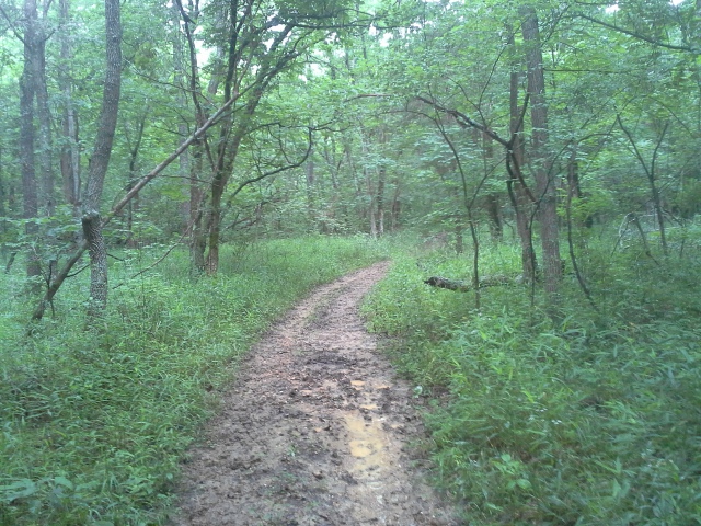 What you need to know:
I would probably refrain from hiking this trail after wet weather. I love that people get out into the woods, and I think that riding a horse while doing it is a perfectly wonderful way to do it. However, this trail was muddy and torn up for quite a bit of it. It would be a much more enjoyable hike after a week or two of dry weather.
The hills are steep and long. Going up on the Fox Creek Spur from the parking lot. Heading down to the creek bottoms, and then coming back up the hill. Expect to get a workout, and then enjoy the flat sections that much more.
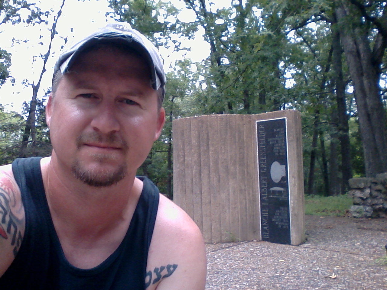 It was a challenging hike for Max and I, what with all the mud and horse hoof puddles, but it was a great area to be in. A little bit of a drizzle passed over on this wonderful Sunday afternoon, and I couldn’t help but feel some appreciation for the Greensfelders and what they have contributed to the St. Louis area in terms of great natural places to experience. Hiking along, listening to the raindrops spatter the leaves in the canopy up above our heads, I imagined them sitting on their porch up on top of the hill years ago, sipping coffee and listening to the same soundtrack that filled our adventure today.
 You are a hiker. The weekend comes, and you grab a water bottle and the dog and get out of the house and down the road for the woods. The trees and the rocks and the streams have been calling you, and you’ve spent all week not being able to pick up that phone to answer them. So here it is, Saturday morning, and you are on your way!
So what do you bring into the woods with you? Most of us usually stay within a close relative distance to our vehicles and civilization, but could something unplanned and potentially dangerous happen when you are heading into the woods? It is always a possibility. What would you need with you if you somehow got lost? What is it going to take for you to make it if you or someone with you gets injured? Even though I have been reading a lot of survival books lately, and I feel that I have a well-honed sense of direction, the possibility of having to spend an unplanned night or longer in the woods is a very real thing, and it can even happen within walking distance of your vehicle and civilization.
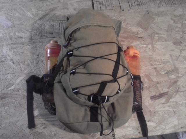 I think of 36 year old David Decareaux, an Air Force Veteran, and his two sons who were hiking a bit of the Ozark Trail in January of 2013. They were staying on this weekend trip with the rest of their family at a lodge in Black, Missouri, surrounded by the Mark Twain National Forest, and just about 2 hours from my front door here in St. Louis. When they started out early that afternoon, temperatures were in the 60s. Not typical for winter, but it does happen at least once a season for a few days. David and his two sons, (10 and 8) set out for an afternoon hike, no particular destination or distance, but just taking advantage of this beautiful day. It was soon after they had covered a bit of distance from where they were staying at that the weather started to move in.
Here in St. Louis on that day, it had been mid to upper 50s for most of the day. By noon however, it had begun to get colder. The temperature was below 40 degrees fahrenheit by 6 pm. At this point, David and the boys were still out in the woods, as they had simply missed the spur trail back to the lodge, where they would have found warmth and comfort. They were only wearing light outerwear, and it had already been raining for hours. The daylight was gone, and they had no way to start a fire or protect themselves from the conditions.
They were discovered the next day. Mr. Decareaux was already gone, and Grant and Dominic, two of his five children, died later at the hospital. Truly a tragedy. And one that could have been prevented, had they brought the proper gear.
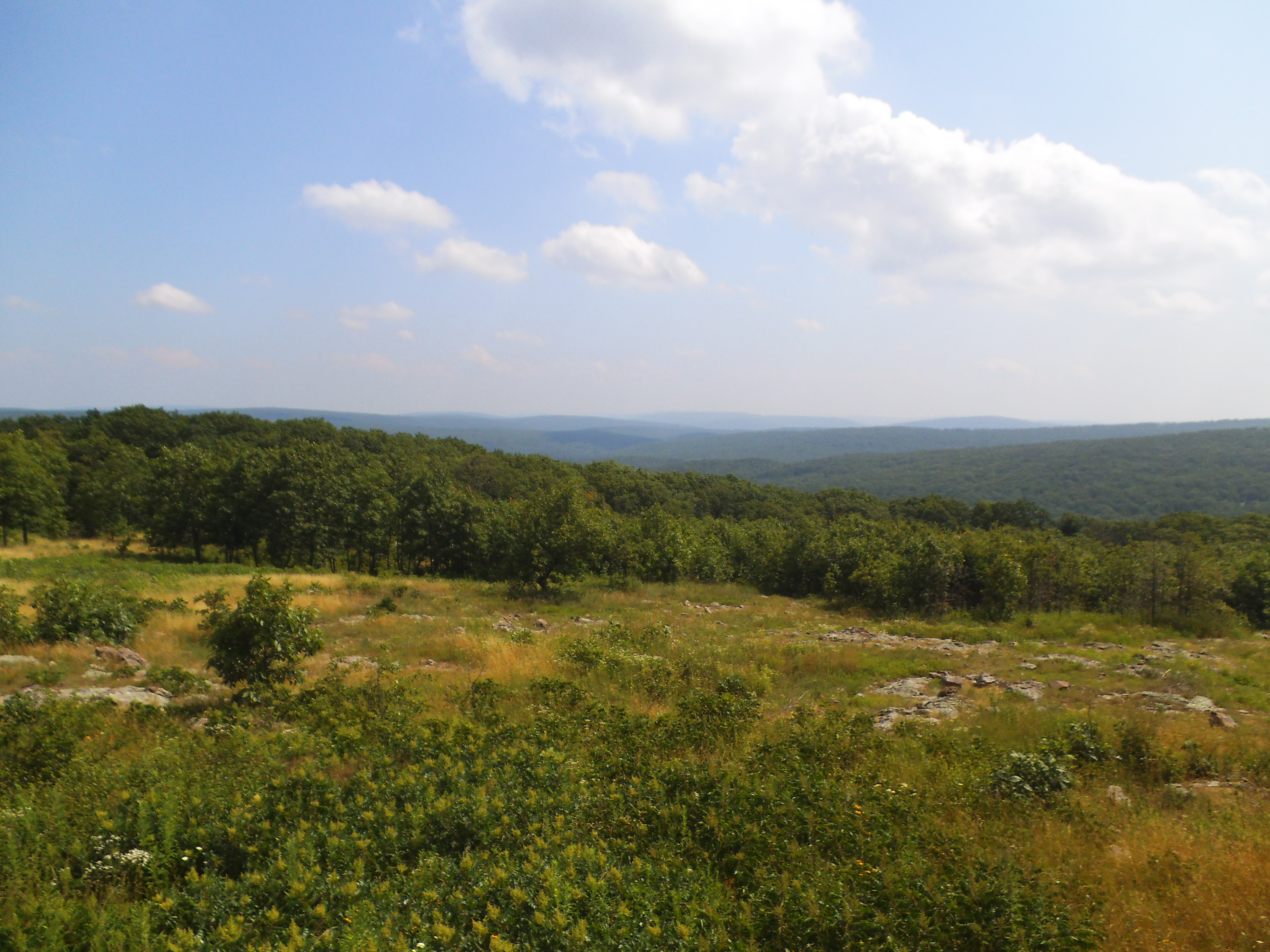 You need a day pack. Something that you always take with you when you are beyond the street signs of your own neighborhood. Something that carries the essential things for when the unexpected happens. Some reassurance that you will survive, in case you miss that spur trail back to safety.
This is what I carry in mine:
 First Aid kit. I actually have two separate ones. One is store bought, the other is supplemental and put together by me. Between the two of them I have:
-Band-Aids, sterilizing wipes, gauze, medical tape, burn gel, Alka-Seltzer, ibuprofen, sterile gloves, bandages, baby powder, moleskin, antibiotic ointment, moisturizing lotion, scissors, a small multi-tool, tweezers, lip balm, Pepto-Bismol, cigarette lighter, emergency whistle, and a safety pin. I also have an Ace Bandage in my pack.
Additionally in my pack:
 Antibacterial hand wipes
Toilet paper, and a hand shovel
A poncho
Paracord
A survival knife (Gerber LMF 2)
Trash bags
Plastic grocery bags
A small camp towel
In the very front section of the pack:
 Bug spray
Sunblock
A flashlight
A compass
Matches
Cigarette Lighter
Magnesium and flint
A small knife
An emergency whistle
Tick remover
Two bottles of water, one on each side
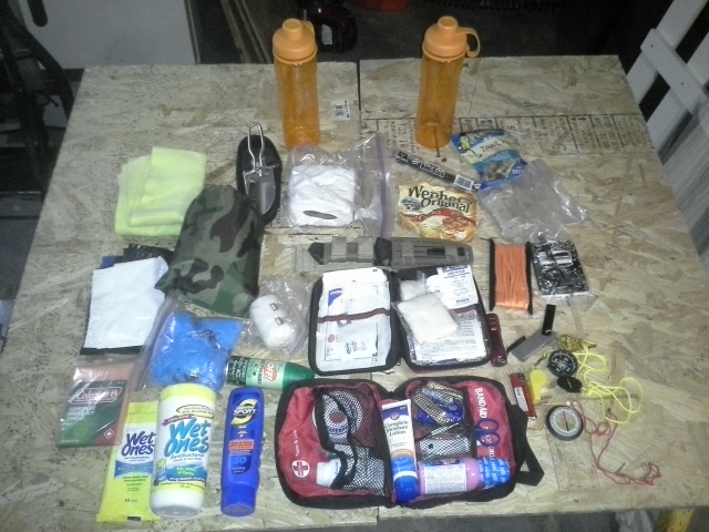 Snacks are something else that I will put in it, even if I have packed a lunch for the trail. Trail Mix, jerky, some biscuits for the dog. And another extra water bottle.
(Update) Something that has been suggested by various people since publishing this blog post, which I need to add to my pack, are some water purifying tablets. Some people even suggested filters or life-straws. What would happen if you were stranded and out of water? Good ideas all around.
And different conditions call for the ability to add to it. This is my warm weather pack setup. For hiking in the winter, beyond wearing a jacket, I would likely have some extra socks, a sweatshirt, a pair of gloves, and a knit hat.
What is essential here is that you have what you need to survive in the case that you aren’t going to make it back to your car that day, and you will have to spend an unexpected night or two out in the woods. You don’t have to take your fully loaded backpacking backpack, but you should carry at least these items on you.
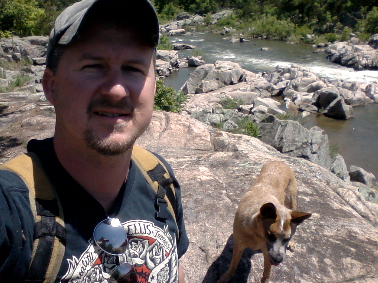 The hikers that are in the most danger out there are the ones who are only planning on being gone for a short time, and then something bad happens. Don’t be unprepared for surprise conditions. Don’t expect to be comfortable either, if you have to adapt your plan and sleep in the woods. But prepare so that you can still be alive when dawn breaks.
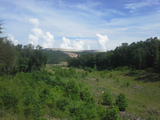 In the early morning of December 14th, 2005, the upper reservoir for the Taum Sauk hydroelectric power station breached its northern wall and sent a 20 foot tall wave of almost 1.5 billion gallons of water crashing down Proffit Mountain, through the forest toward the Black River, and into Johnson’s Shut-Ins State Park. At an estimated 150,000 cubic feet of water per second, it wiped away everything in its path, the entire forest, and left a field of boulders dotted throughout what was the campground for this popular summer destination. The Scour Trail takes you through the forest to the area where the water “scoured” away all the trees and plants and rocks and soil, between the site of the reservoir and the Black River.
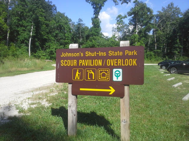 How to get there:
From the 55/270 interchange, take 55 south just about 23 miles to US-67 at exit 174B. Take US-67 36 miles south to Farmington, turn right onto MO-221. After about 7 miles, 221 turns to the left and you want to continue forward onto MO-NN for another 9 miles. Turn right on MO-21, and after half a mile, make a left onto state highway N. After about 13 miles on the curvy N, you will arrive at Johnson’s Shut-Ins State Park. The parking lot for the Scour Trail is on the left a quarter mile north of the park’s main entrance.
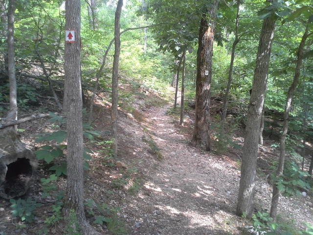 The sign states that this is a 1.5 mile trail, while the brochure says 2 miles. The trailhead is to the right, and there is an informational sign that you should check out. You cross a bridge, and make your way up the hill in front of you. It comes to a fork, and I decided to go left so that I would be hiking in the scour path in the same direction the water flowed. The trail winds around through an upper forest, filled with lizards and the occasional pine, and comes out above the scour, turning to the left and then eventually descending out of the trees and into the ravine.
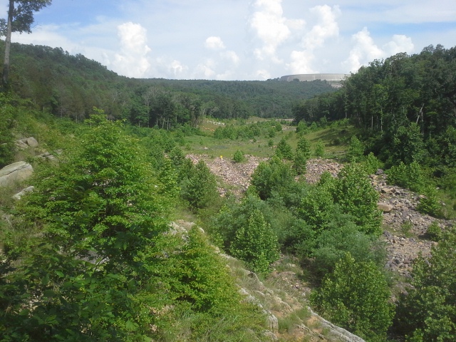 At this point it changes direction to the right, and you follow the path toward the Black River and the main area of the park. There is a small creek that travels with you, crossing back and forth before it eventually fills a large pool on the right, with a small trickle from that which continues to the river itself. The trail then turns right, goes through an observation pavilion, and then back up the hill into the forest, finally ending back out at the parking lot.
 Why I like this trail:
If there is any area in Missouri that I have been to that displays the strength of nature, and how the earth changes the look of a place by its own force, it is Johnson’s Shut-Ins State Park. The focal point of the park is the natural water slide playground that everyone goes to visit, where the Black River has spent its time carving “Shut-Ins” through the erosion resistant volcanic rock that makes up so much of the surrounding mountains. That a giant cascade of water could cut through the forest here and use its devastating strength, in a moments time, to change the look of the landscape, almost seems terrifyingly fitting for a park with such a beautiful and fun example of the power of water.
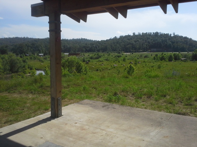 To see how it is now, in contrast with my memories of how it looked before, is a frightening and humbling vision. I remember driving down the road in this valley that was the park entrance, flanked by forest on both sides, with sights of the campground through the trees on the left. It was like a hallway, that wound through the park and eventually ended up at the parking lot for the river and the Shut-Ins. Now it is a open valley, dotted with sprouted sycamores, and boulders unearthed from the side of a mountain a mile away. It is nothing short of a miracle that the breach occurred in the winter. Had it been six months earlier or later, this would likely be a memorial trail to an awful tragedy.
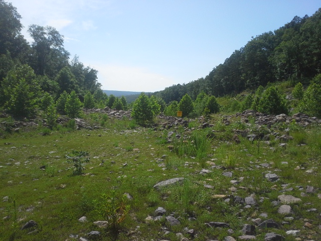 Walking along the scour path is kind of neat. It is a collection of accidental glades and sycamore groves with a little creek running through it, and it has a very different feel to it, compared to the forest you travel through to get out here. Take a minute to appreciate the other-worldly feel of this sparse, yet returning, landscape.
What you need to know:
This is kind of a rugged trail, but nothing a person can’t handle. In the scour path there are some spots that were inundated with the water from a small creek passing through the area, but with a clear direction to hike, it was easy to find an alternate path and keep my shoes dry.
There are probably more downed trees along this trail than most. In May of 2009, this whole region was hit with an “Inland Hurricane”. Winds in this area were hitting 60 to 70 miles per hour, with gusts up to 100. These uprooted trees are remnants of that storm, but the trail is well maintained and clear of debris.
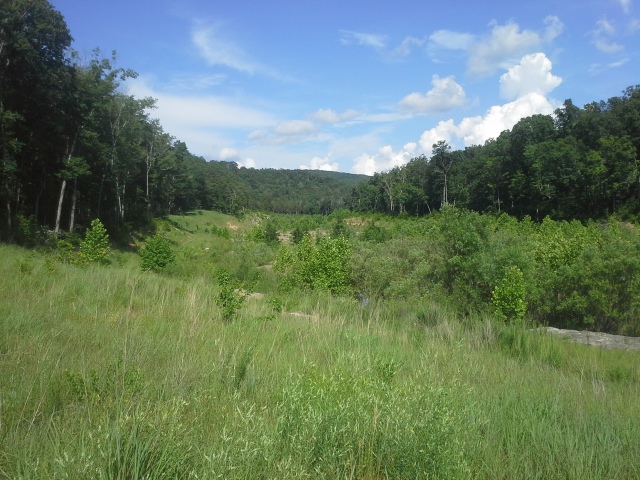 Take a look at the map of the trail, so that you can get an idea of the path. There is a white connector trail that keeps you out of the scour path, and makes it a shorter hike. Make sure to stay on the main path, because you shouldn’t miss out on hiking the whole thing.
At the far end of the trail, take a minute to look at the reservoir wall off to the southeast, and appreciate the forces that are held behind it. Sure, it was humans that created this massive pool of water, to use for our own energy production, but ponder the potential for natural force to act with a violence we can never truly tame.
 It is impressive. It is terrifying. The power of nature is something that deserves our respect. Take this moment to remember that we are small things in this gigantic system, and that we have no say in stopping a forest from being wiped away, if nature decides to do that. And then in that moment, have some gratitude for the timing of this catastrophe, that it didn’t end up worse.
 Down in the Ozark National Scenic Riverways there are a bunch of Springs. Water from the earth, flowing into the sunlight and filling the rivers as they run along their path. With each spring, rushing with their cold blue water, the depth of the rivers increases and the health of the waterway is replenished with the clean, life giving gallons exiting the earth. One such spring, about a hundred years ago, was seen as having the ability to heal people of their sickness as well. Welcome to Welch Spring.
 How to get there:
(Eminence, MO is about 3 hours from St. Louis, and you can take various routes to get there. The directions here are from the intersection of Highway 19 and Highway 106, in the middle of Eminence.)
From the intersection of Highway 19 and Highway 106, take 19 north for about 27 miles, to Route KK. Make a right onto KK, toward Akers, for about 6 miles. When you reach the Current River in Akers, make a right onto Route K, and take that up over the pass (stay on the road, but check out the incredible view) and into the woods for about 2 miles. Around that 2 miles, on the lefthand side of the road will be the turnoff for Welch Spring. About a mile down the hill toward the river, after you pass a couple old abandoned buildings, is the parking lot for the Welch Spring trail down to the right. The trail itself is an easy half mile along the Current River for a bit, entering the forest, and then reemerging at the spring.
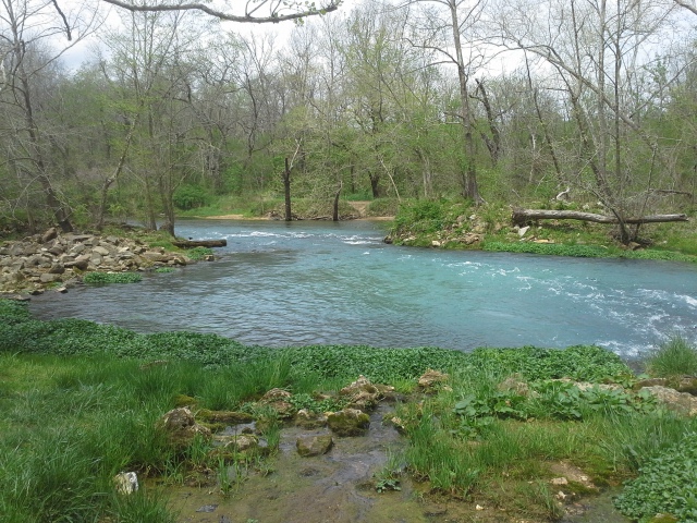 Why I like this place:
It is gorgeous! The water flowing out of the foot of the hill, flat and powerful, rushing to join the Current River is one of the reasons they call it the Ozark National SCENIC Riverways. Something about the liveliness of it as it propels sideways into the already moving current really creates a dynamic energy that can only be seen and felt by being there in person. This confluence, with its chilled and green foliage, is a beautiful example of the power held in these springs.
 This is the site of Welch Hospital. Across the mouth of the spring on the other side, are the ruins of the old little hospital that was built by Dr. C.H. Diehl, back in 1913. He believed the air and water coming from the earth had healing properties, and he had the opening of the spring dammed so that it would force more of the air in the cave to enter the hospital. This little institution, against the deep hills of the Current River valley, was believed to be a place that a person suffering from “consumption” (Tuberculosis, Asthma, etc.) could be cured of their ailments. Turns out though that due to its remote location, Welch Hospital did not become the success that Dr. Diehl had been envisioning, and after his death in 1940 the grounds became neglected, eventually becoming the ruins that we see today.
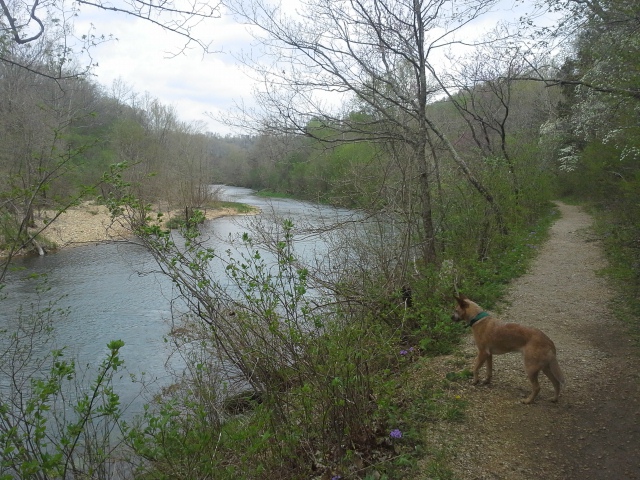 What you need to know:
The trail claims to be half a mile (and it very likely is) but it seemed a bit longer than that. Or maybe I was just excited to get there to see it, and my impatience was showing.
Like all springs, you should do your best to avoid getting in the water. Springs hold special elements of the surrounding ecosystem, due to the colder water, and everyone should be mindful to not disturb them.
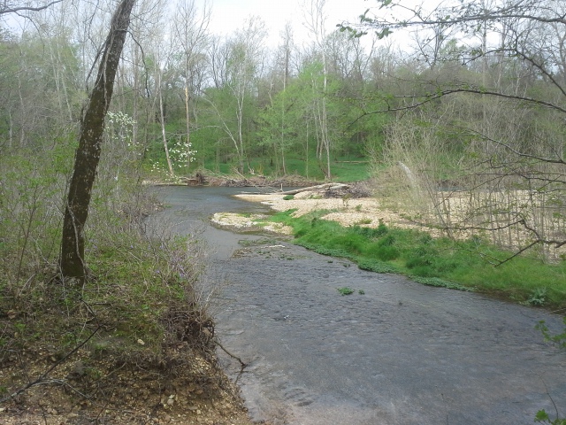 In line with not getting in the water, as far as I know, the only way to respectfully get to the ruins of the hospital is by taking a canoe (or your preferred mode of water travel) down the Current River, and get out on that side of the spring. I didn’t see any trails entering the area from that direction, so I guess you’re just gonna have to go on a float trip!
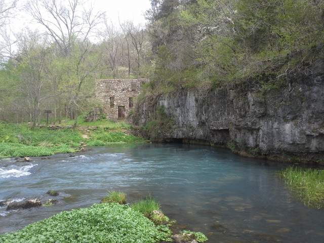 Dr. Diehl believed that the water and air coming from the spring had a healing quality to it. That breathing it in, absorbing the essence of the earth as it exits from deep in the ground holds a key to our well being, and that it can improve our lives. As a person who sees and experiences a wealth of benefits when it comes to being in nature and cultivating your own personal connection to the earth and the forests and the rivers, I fully agree with him. He was onto something, and I hope that the journey through the hills and down to the hospital along the river isn’t too remote for you, because you owe it to yourself to take a trip to Welch Spring.
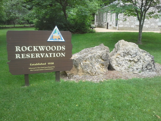 It was a Sunday morning with no plans on the agenda, other than the need to get out on a trail. Now I have been hiking at Rockwoods Reservation for a long time, but a trail that I have actually never been on is the Turkey Ridge Trail. After passing it so many times as I pulled into the main park, I thought that today needed to be the day to hike it. So I grabbed my backpack, put Max’s collar on him, and we headed out the door and down the road.
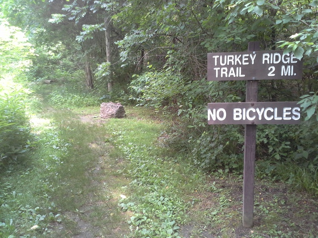
How to get there:
From 44 and 270, head West on 44 about 15 minutes to Eureka, and get off at Highway 109. Make a right (north) on 109 and take that about 4 miles to Woods Rd. You will know you are getting close when you pass LaSalle Springs Middle School on the right. When you see the Smoky the Bear fire danger sign, make a right on Woods Rd. The parking lot and trailhead will be immediately on your left.
 The Turkey Ridge Trail is a two mile loop, and it starts out from the trailhead and parallels 109 for probably almost a mile. It steadily climbs the hill, and then eventually goes along the ridge after turning to the right, and away from the road below. It meanders back behind the hill, travelling through a more quiet section of the woods, finally crossing over to the front again and switchbacking down and back to the parking lot.
What I like about this trail:
It is a good, middle-of-the-road distance, with a decent hill to climb. You get some blood flowing, but you don’t have to be on it all day if you are in the mood for a shorter hike.
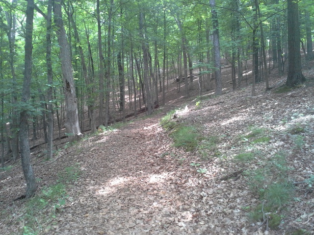 I would imagine that the main reason I have never hiked it is because it isn’t within the main Rockwoods area. Instead of turning left and crossing the creek and going into the entrance, this is a right turn off of 109. I would also guess that this allows for the trail to be relatively free from a lot of other traffic, so you get a more solitary experience.
I am not at all trying to say anything negative about bike and horse riders, but this trail has one of the nicest, most compact and level surfaces I have ever hiked. Even in the muddy spots where my shoes should have slid or squished down into it, it was solid and stable. Again, not trying to be negative to other enthusiasts…but there was a clear difference.
What you need to know:
The biggest negative I would give this trail is the traffic sound. I took it clockwise, and it goes alongside 109 for a bit, up the hill from it, and there is a noticeable amount of traffic noise that travels with you. Give this trail a chance though, because once you are on the ridge walking away from the road, the effect is that you notice the quiet of the woods even more. It kind of stood out as a pretty neat transition of environment.
(Here’s where I make amends) Unfortunately, this trail is restricted to foot traffic only, so if you are interested in taking your mountain bike or your horse, that dang Missouri Department of Conservation is gonna have a problem with that. Plan accordingly and spend your time on a different trail.
 I have turned the other way from this trail every time I have gone to Rockwoods Reservation for years, and I am glad that I finally hiked it. It was very enjoyable, especially the different types of forest you pass through, beginning with the tall pines at the parking lot. Max and I had a great time, and even saw some hummingbirds just before we got back to the car.
