
Pretty. Terrifying. The Scour Trail, Johnson’s Shut-Ins State Park 6/22/2014
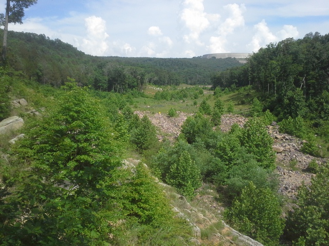
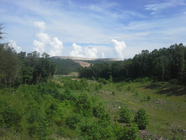 In the early morning of December 14th, 2005, the upper reservoir for the Taum Sauk hydroelectric power station breached its northern wall and sent a 20 foot tall wave of almost 1.5 billion gallons of water crashing down Proffit Mountain, through the forest toward the Black River, and into Johnson’s Shut-Ins State Park. At an estimated 150,000 cubic feet of water per second, it wiped away everything in its path, the entire forest, and left a field of boulders dotted throughout what was the campground for this popular summer destination. The Scour Trail takes you through the forest to the area where the water “scoured” away all the trees and plants and rocks and soil, between the site of the reservoir and the Black River.
 How to get there:
From the 55/270 interchange, take 55 south just about 23 miles to US-67 at exit 174B. Take US-67 36 miles south to Farmington, turn right onto MO-221. After about 7 miles, 221 turns to the left and you want to continue forward onto MO-NN for another 9 miles. Turn right on MO-21, and after half a mile, make a left onto state highway N. After about 13 miles on the curvy N, you will arrive at Johnson’s Shut-Ins State Park. The parking lot for the Scour Trail is on the left a quarter mile north of the park’s main entrance.
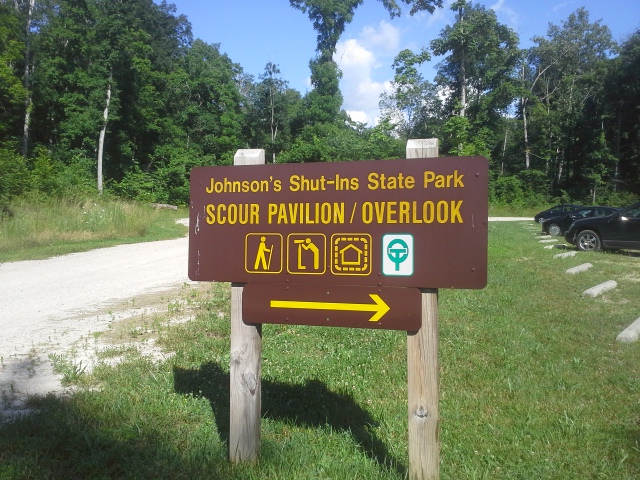
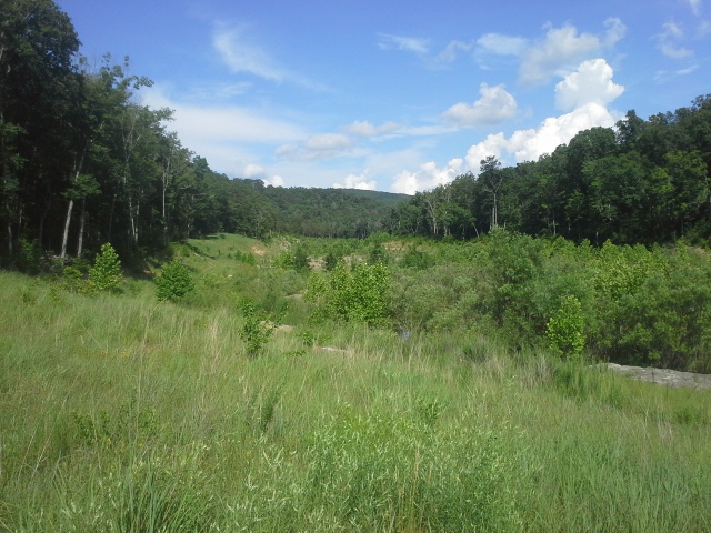
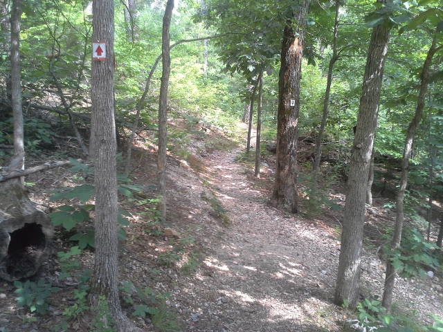 The sign states that this is a 1.5 mile trail, while the brochure says 2 miles. The trailhead is to the right, and there is an informational sign that you should check out. You cross a bridge, and make your way up the hill in front of you. It comes to a fork, and I decided to go left so that I would be hiking in the scour path in the same direction the water flowed. The trail winds around through an upper forest, filled with lizards and the occasional pine, and comes out above the scour, turning to the left and then eventually descending out of the trees and into the ravine.
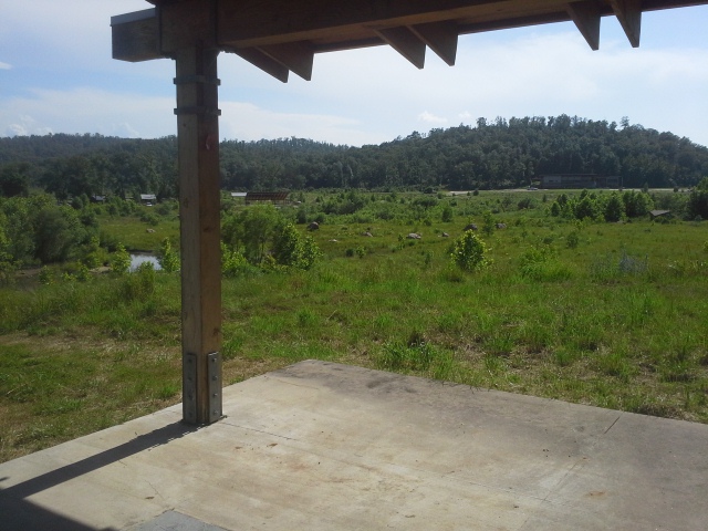
 At this point it changes direction to the right, and you follow the path toward the Black River and the main area of the park. There is a small creek that travels with you, crossing back and forth before it eventually fills a large pool on the right, with a small trickle from that which continues to the river itself. The trail then turns right, goes through an observation pavilion, and then back up the hill into the forest, finally ending back out at the parking lot.
 Why I like this trail:
If there is any area in Missouri that I have been to that displays the strength of nature, and how the earth changes the look of a place by its own force, it is Johnson’s Shut-Ins State Park. The focal point of the park is the natural water slide playground that everyone goes to visit, where the Black River has spent its time carving “Shut-Ins” through the erosion resistant volcanic rock that makes up so much of the surrounding mountains. That a giant cascade of water could cut through the forest here and use its devastating strength, in a moments time, to change the look of the landscape, almost seems terrifyingly fitting for a park with such a beautiful and fun example of the power of water.
 To see how it is now, in contrast with my memories of how it looked before, is a frightening and humbling vision. I remember driving down the road in this valley that was the park entrance, flanked by forest on both sides, with sights of the campground through the trees on the left. It was like a hallway, that wound through the park and eventually ended up at the parking lot for the river and the Shut-Ins. Now it is a open valley, dotted with sprouted sycamores, and boulders unearthed from the side of a mountain a mile away. It is nothing short of a miracle that the breach occurred in the winter. Had it been six months earlier or later, this would likely be a memorial trail to an awful tragedy.
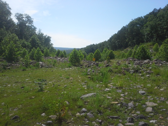 Walking along the scour path is kind of neat. It is a collection of accidental glades and sycamore groves with a little creek running through it, and it has a very different feel to it, compared to the forest you travel through to get out here. Take a minute to appreciate the other-worldly feel of this sparse, yet returning, landscape.
 What you need to know:
This is kind of a rugged trail, but nothing a person can’t handle. In the scour path there are some spots that were inundated with the water from a small creek passing through the area, but with a clear direction to hike, it was easy to find an alternate path and keep my shoes dry.
There are probably more downed trees along this trail than most. In May of 2009, this whole region was hit with an “Inland Hurricane”. Winds in this area were hitting 60 to 70 miles per hour, with gusts up to 100. These uprooted trees are remnants of that storm, but the trail is well maintained and clear of debris.
 Take a look at the map of the trail, so that you can get an idea of the path. There is a white connector trail that keeps you out of the scour path, and makes it a shorter hike. Make sure to stay on the main path, because you shouldn’t miss out on hiking the whole thing.
At the far end of the trail, take a minute to look at the reservoir wall off to the southeast, and appreciate the forces that are held behind it. Sure, it was humans that created this massive pool of water, to use for our own energy production, but ponder the potential for natural force to act with a violence we can never truly tame.
 It is impressive. It is terrifying. The power of nature is something that deserves our respect. Take this moment to remember that we are small things in this gigantic system, and that we have no say in stopping a forest from being wiped away, if nature decides to do that. And then in that moment, have some gratitude for the timing of this catastrophe, that it didn’t end up worse.

Trackbacks & Pingbacks