
I took a storytelling class over the winter, with the intent to be more comfortable with my own self and my experiences, sharing with an audience.
This is my humble moment, sharing how Taum Sauk Mountain is an important place in my life. Enjoy, and be kind.
https://www.buzzsprout.com/617929/2489307-advanced-storytelling-capstone-with-gabe-cotton
It has been too long since I’ve made writing a part of my routine. It has been too long since I’ve posted something on this little outdoor blog of mine. It has been too long since I expressed whimsically about the way the forest and rivers warm my soul and lift my spirit.
It was two years ago when I last published a post on here. I have been living my life, moving through major changes of location and relationships, and I find myself back here in suburban St. Louis with as fresh a set of eyes as 40 years of walking a path will allow. I have been working steadily, and as that is a good thing, it has kept me busy and worn out, filling my time and helping me to sleep at night. On the weekends these days, Max and I (along with occasional companions) have been heading out to adventure wherever the compass may point that morning, and it has been enriching and thought filled, and fun. But I haven’t made much time for sharing these adventures.
Somewhere along the line a few years back, the longtime relationship I was in came to an end, by my own choice. It ushered in a period of anxiety and negativity that I have been very contemplative about since. It has caused me to be less about receiving attention and more about paying attention. Maybe a little bit of getting older too.
So then I met a girl and ran away to the woods for a time…but as these things sometimes do, it fell to pieces. Every sign was showing me that the path I was on wasn’t the right one anymore, so I moved back to town to be closer to where my heart resides, with my children and my friends. And that is where I find myself now. A few months in, looking for rhythm and purpose, with my adventure dog roommate in a little two bedroom apartment in South County.
 And I have been hiking, more fervently and religiously than before. It has evolved from a practice of casual exploration and wonder to an emotional and physical need. Two and a half miles used to be all I wanted, to fill my cup and bring me peace of mind and body. An exploration of nearby forests to connect with and appreciate, and share with other people, has become at times a trek in search of satisfied exhaustion. I go to the forest for my own mental health, and I feel like this is a sign that either aspects of my personal situation are intensifying internally, or my stamina is outpacing my choice of path. Or maybe it’s just simplicity in…it is just in my nature to keep stepping forward.
 So I need to write again, as regular practice. What has primarily been stopping me these past few years is that I haven’t been inspired…driven…to write like I once had. Not that places I’ve visited don’t cause a sparkle in my eye and a grin of wonder across my face…but I just haven’t gotten home and thought “I need to tell people about this place!” These past few years I have been in search of balance between having my own experience, and all the other self imposed obligations that pull at me. Keeping the camera in my pocket and absorbing the hills through just my eyes and my shoes. I have spent more time observing and being solemnly grateful, and less time focusing on how I would tell YOU about it. Well I need to get back to that. I need to discover new places to share. I need to visit them with Max and take pictures and think about the things that cause them to stand out. I need to make myself sit down when I get home, on a regular basis, and put these places into words and images and tell you about them because they have an undefinable worth that I think YOU appreciate. I need to inspire you to go seek those woods out, that natural place I visited that I think you should too. I need to get back to doing something that satisfies a need in me, to express myself, through this little outdoor blog of mine.
 Looking for solace, especially as we gain rings on our trunks, has much more to do with the energy we absorb than the energy we expend…but the best place to do both for me and my adventure dog is in the forest, listening for birds and leaves and finding hills to climb and creeks to follow. And it has everything to do with spending our time doing things we love, like hiking and writing. I ran away for a while. I made new friends and cut ties with old ones. Some that I shouldn’t have, on both ends of that spectrum. I needed some time to be shown what is truly important to me. I hope I’m back. I hope I don’t forget the lessons these past few years have taught me. I hope the increased lines in my face and the pull in my ankle remind me. I hope to hold myself to a rededicated focus to share places with you that you ought to go see. Because Max and I have been there, and the experience inspired me to tell you about it.
Go find adventure, and through that find yourself, because this is your best chance to do it.
-Gabriel Cotton, Writer, Photographer, Explorer
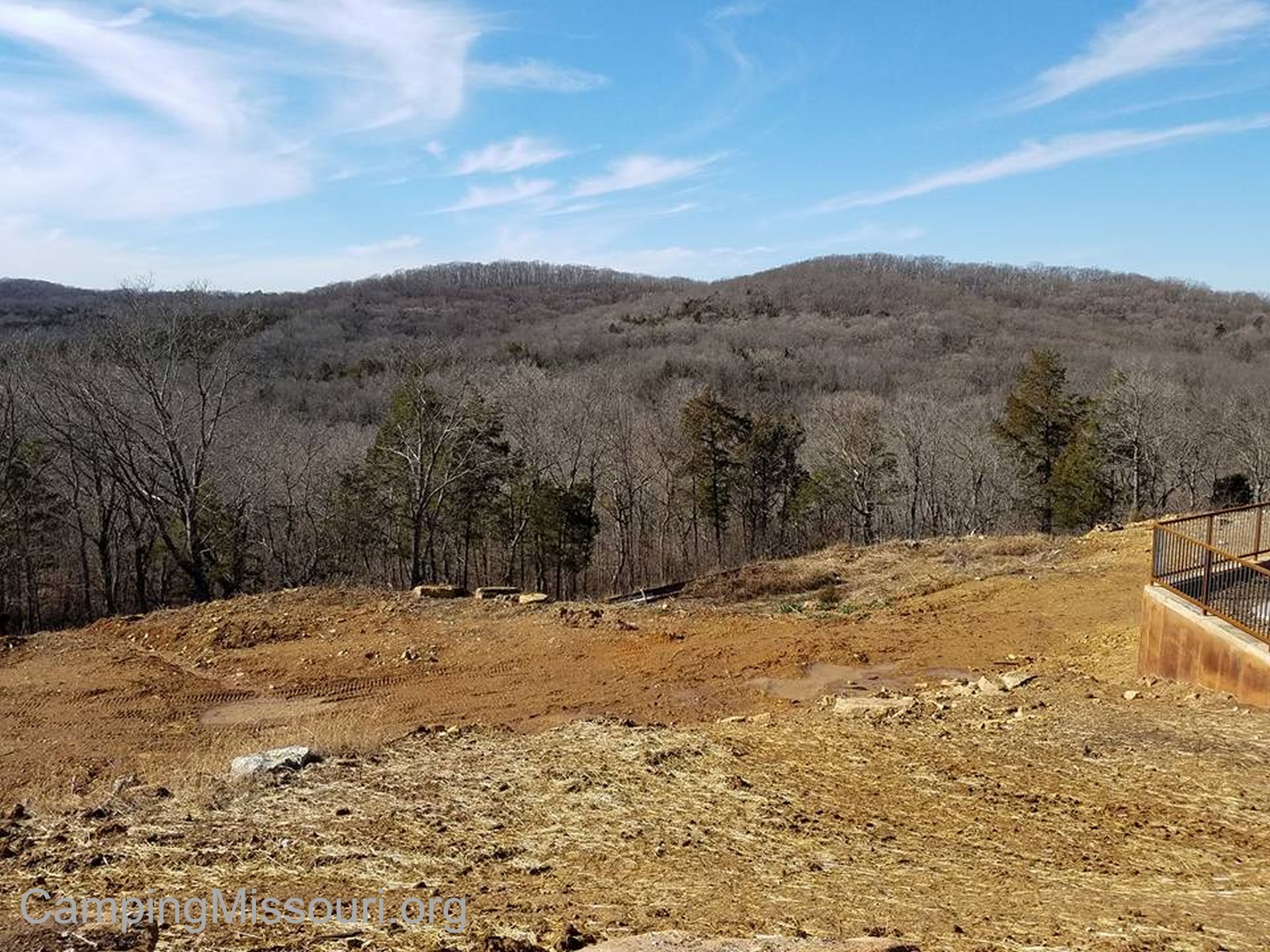 It was going to be a warm winter Saturday, and there was a new Missouri State Park that had recently opened up half an hour from our house. On the request of my gal to “spend some of her birthday in the forest”, we decided to go check out this newly developed Don Robinson State Park and see what was hiding in the hills and valleys in the upper Labarque Creek Watershed.
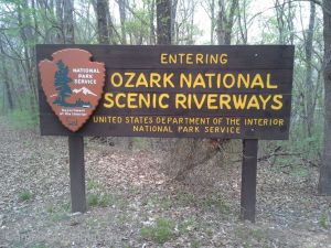
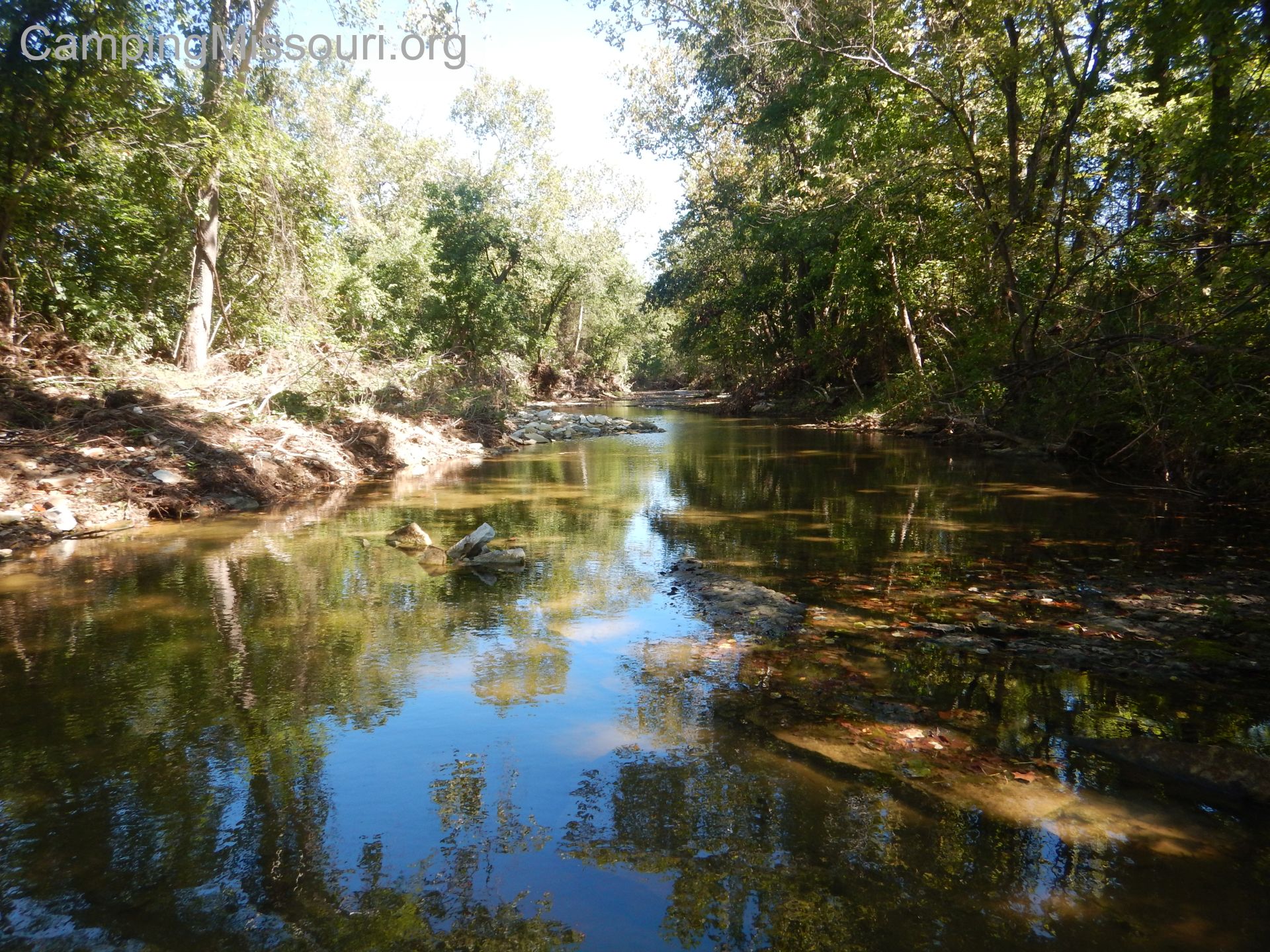
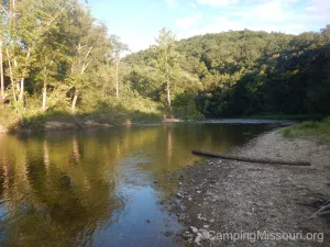 It was our first 3 day weekend in quite a while, and we wanted to do something adventurous and memorable. The idea had been discussed to go on a backpacking trip or just car camping somewhere, but we eventually settled on floating and camping overnight on the Current River, down in the Ozark National Scenic Riverways. The ONSR is comprised of just over 105 miles of the Current River and about 30 miles of the Jacks Fork River, and it is the first National Park in the United States whose specific purpose is to protect a river system. These clear and cold Ozark waterways are sparkling examples of the natural beauty that exists in Missouri, as well as holding the rugged history of the people that have made these steep and secluding hills their home for generations. Within these two rivers’ flows they also provide us with direct insight into the nature of the water cycle on this planet, and I am grateful for the protection and respect with which we have designated them. Yes, Missouri has a gorgeous and magical National Park, and we were going to take a canoe trip along 27 miles of its prettiest natural offerings. I couldn’t wait!
 How to get there:
The Ozark National Scenic Riverways is located in southern Missouri, laterally around the center of the state. Eminence, MO is the closest larger town to most points, directly on the Jacks Fork River and southwest of the Current River. You can get there from multiple directions, but if you are coming from the St. Louis area, this is how I get there: Take Interstate 44 west for about 80 miles to St. James, MO. Get off at exit 195 and take Highway 8 south for about 5 miles to Highway 68 south. Turn right on Highway 68 and take it about 22 miles to Salem, MO, where you will take Highway 19 down toward Eminence, and into the Ozark National Scenic Riverways.
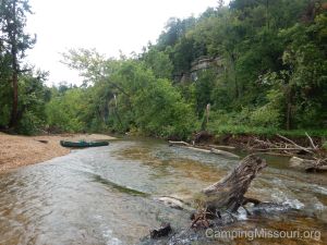
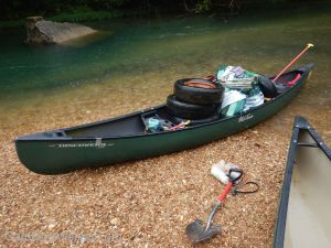
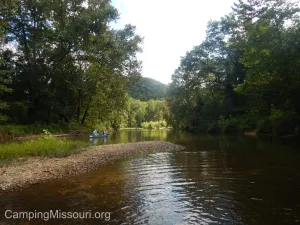 The first section we were floating on the Current River was Cedar Grove to Akers Ferry. It is an 8 mile stretch of river that holds a lot of adventure and beauty, and any outfitter you rent through will likely be shuttling you there. We rented with Carr’s Canoe Rental which is located at Round Spring, on Highway 19 about 16 miles north of Eminence. This is where we were ultimately floating to, so I wanted to have my car at the take out so that we could hit the road once we had said our goodbyes to this precious river. The great staff at Carr’s drove us and our rented canoe up to Cedar Grove, supplying us with the personal flotation devices and paddles and trash bag that every floater should have whenever they are out on any body of water.
To get to Cedar Grove on your own, take Highway 19 south out of Salem, MO about 5 miles to Route K. Make a right on Route K and take it almost 9 miles to Jadwin, MO. Make a right on Route ZZ and take that about 4 miles to the low water bridge where it crosses the Current River. Then transfer your gear to your boat, put some sunblock on, and say a prayer of thanks for the fun you’re about to have!
What you need to know about this section:
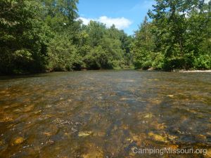
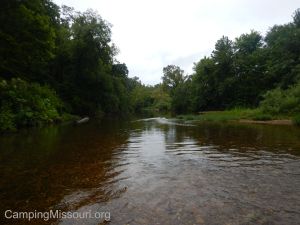
This is the uppermost section of the Current River that I have floated, and it is similar to a lot of upper river sections and creeks that you may be familiar with. It is shallow and calm in some spots, but it also has some quick turns and swift current, sometimes with a tree right in the middle of it waiting to roll your boat over and dunk you and all your stuff. When we set off that morning with our loaded down canoe, we negotiated the first couple of turns and made our way around some of the other traffic on the river. Recognizing a noticeable hazardous tree on its side up ahead, we made the choice to get out and walk the canoe. Just too much going on, and we didn’t want to dump all our gear. As we were making our way past the tree, a guy in a canoe behind us came barreling straight into it and instantly swamped his canoe. After helping him to shore and dumping the water he had collected, we carried on, on foot still, around another sudden curve filled with branches from the deep, passing another group on a gravel bar who were pumping water from a canoe they had rolled as well. Danger can happen quickly, so wear your life jacket and don’t be too prideful to get out and walk your boat past the fast and scary parts.
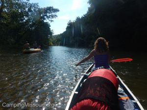 With it being a narrow section, it can get inundated with river traffic pretty quick. When we were taking off from Cedar Grove a lot of other people were too and that led to a bunch of extra navigation from the get go, avoiding obstacles and other boats. Be mindful of the other floaters around you, being as courteous and patient as possible. Rafts are slow, so canoes are good at passing rafts, and kayaks are better at passing everything. The thing that ties all of our experiences together is that we are all there to enjoy this beautiful river and the nature along it. Remember this when getting frustrated with the people in front of or behind you.
We experienced a couple short runs that had some healthy sized rocks just under the surface that were obscured by the choppy water. You will be rolling right through, seemingly in deep enough current, and BONK…run right into one of these under water obstructions. We prefer aluminum canoes, so that makes it even more dramatic, with all the scraping and churning. I’m sure that variances in river levels throughout the changing seasons and weather can alter each floater’s experience a lot, but always keep a keen eye on that wide and fast channel you are about to shoot through, and look for the nuance in the chaotic waves to avoid surprise boulders.
 What I like about this section:
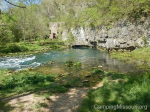
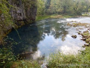
One of the neatest historical points of interest on the Current River is Welch Hospital. It is the ruins of a small medical institution, built in the early 1900s by Dr. C.H. Diehl. He was convinced that the air and water emrging from the spring there had healing qualities to it, so he created the hospital as a destination for those seeking relief from such ailments as Tuberculosis, Asthma, and other various respiratory conditions. The hospital was not a success, most likely due to its remote location, and after Dr. Diehl’s death in 1940 it became somewhat neglected, standing now as a reminder of the histories that surely color the crests and valleys of the Ozark hills. Something important to note is that you can’t actually get too near the hospital if you just drive there and walk the trail. Welch Spring flows between you and it. To get to see the hospital up close, you HAVE to float this section.
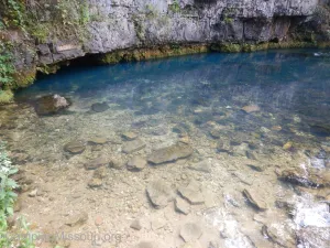 Welch Spring, which is next to the hospital ruins, is one of the prettiest springs in the Ozark National Scenic Riverways. It flows out of the foot of the hill, a wide mouth of blue and gray, heading quickly into the Current River over a plane of diminutive boulders, jagged and slippery under the freezing water. Its average daily discharge is 75 millions gallons of water, seemingly doubling the size of the river at this point. Make sure to stop there to take in the sights and the sounds of this life giving natural mechanism. Besides just the soothing melody of the rushing water, the hypnotic visual quality as it flows out through the spring branch is not only a pleasing experience but can be meditative as well. Surely there is magic here.
 Medlock Spring is also along this section, between Cedar Grove and Welch Spring. Look for it on the right, at the elbow of a left hand turn in the river. It flows in a shallow trickle into the river, splashing down the rocks on the hill from a cave up in the rock face. The first time I floated this section the kids and I stopped across the river from it. Swimming across to go see it, the temperature change was somewhat of a shock, coming through the already cool waters of the Current directly into the frigid outflow of Medlock Spring.
 Another point of interest is the Howell-Maggard Cabin, a restored log cabin that is on the right side of the river just past Welch Spring. Representative of the local history and the people who have inhabited these parts, it was built in the 1850s and then restored in the late 20th century by the National Park Service. Remote and secluded, it makes you consider the ruggedness it would surely take to live in such a place. Certainly worth the cost to be surrounded with such constant natural beauty, but definitely a step away from the established trappings of our modern American lives.
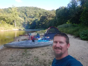 This was day one of our extended weekend adventure and we had gotten into our groove, floating down the Current through some of the hairier spots that we would see on this trip. Travelling a bit past Akers Ferry, our night was spent by a fire on a gravel bar with the stars above us, the hills around us, and this beautiful water flowing before us. Not another soul around, immersed in the sanctity and isolation of the Ozark wilds. A constant series of magical moments to be absorbed and remembered forever. And this was just day one.
 To be continued…
Click on this map to get directions:
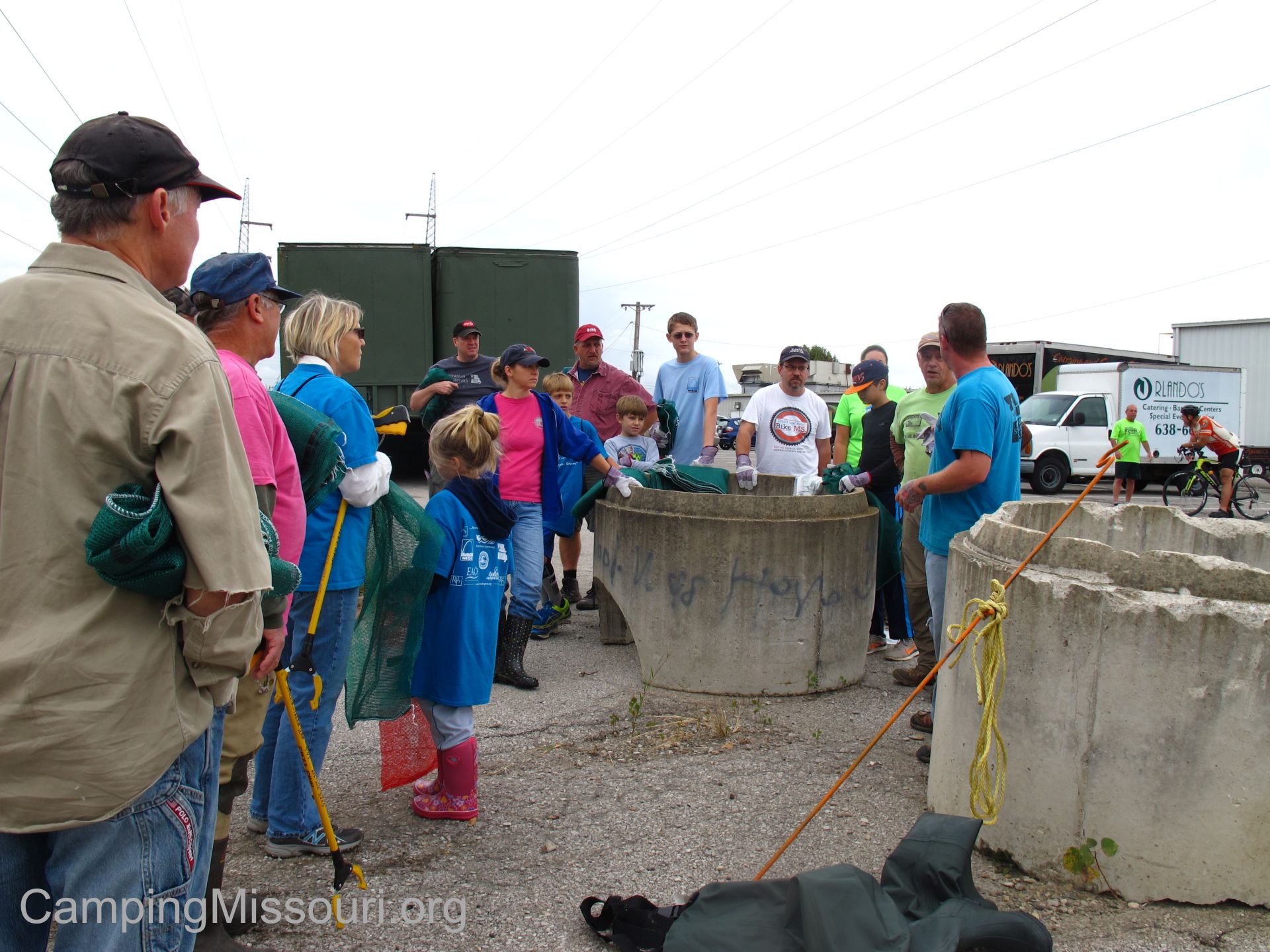
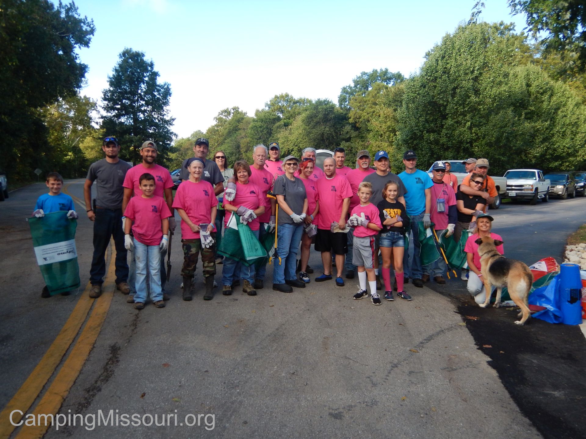
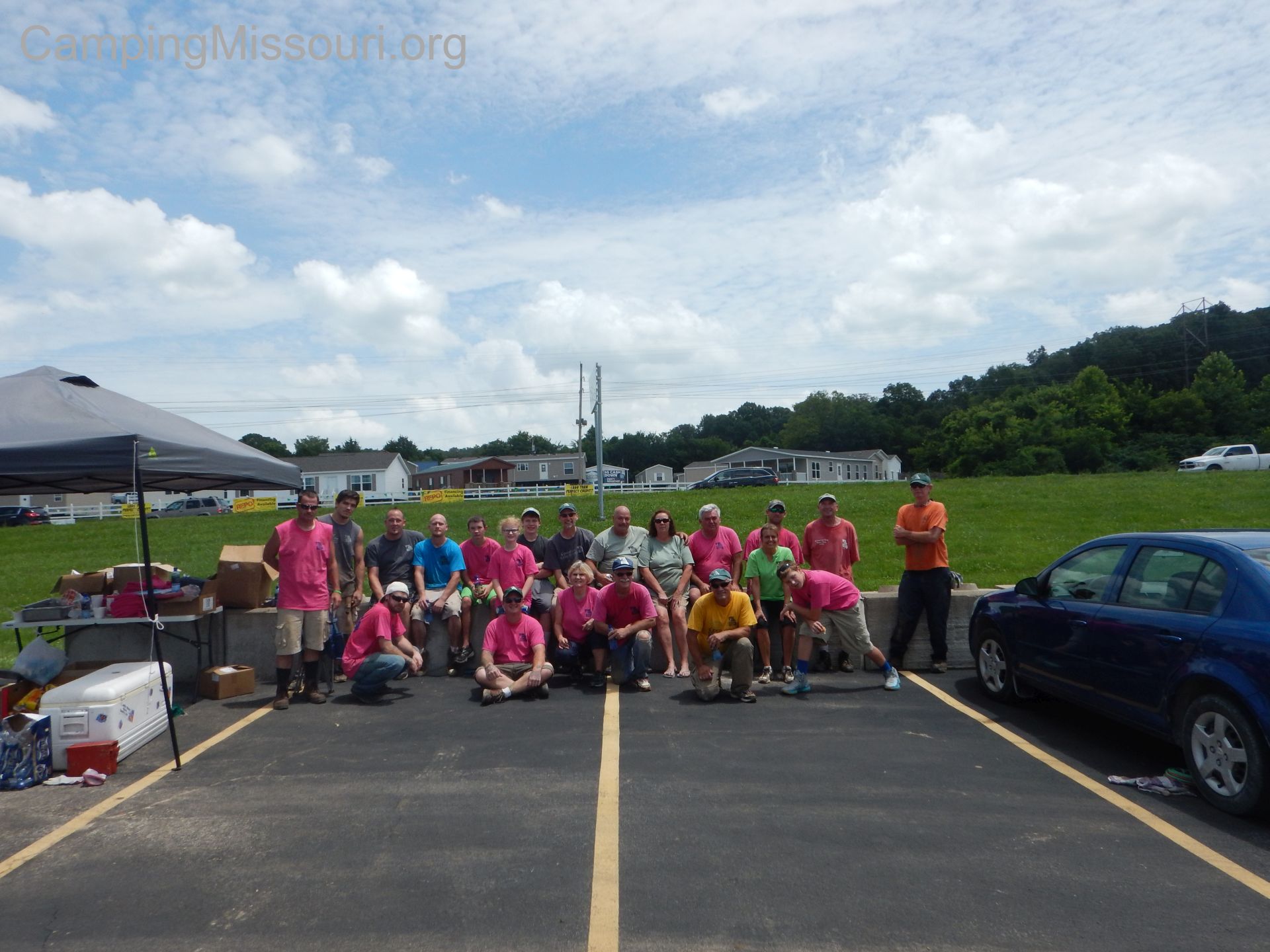
 It was a cool and drizzly Sunday morning as we headed to Leasburg, MO to attend an Operation Clean Stream cleanup event, put on by the Open Space Council for the St. Louis Region. Every August, late in the month, they coordinate a massive Missouri Stream Team cleanup along the Meramec River watershed, and this was somewhat of a pre-cleanup, being a couple weeks before. It was driven by Open Space, in partnership with Ozark Outdoors and Bass’ River Resort, two of the biggest campground/outfitters in Missouri. Three organizations that truly care about the well being of precious natural places and promoting recreation in them.
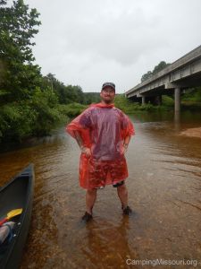
“Stream Team Rain Poncho”
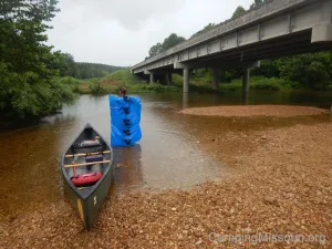
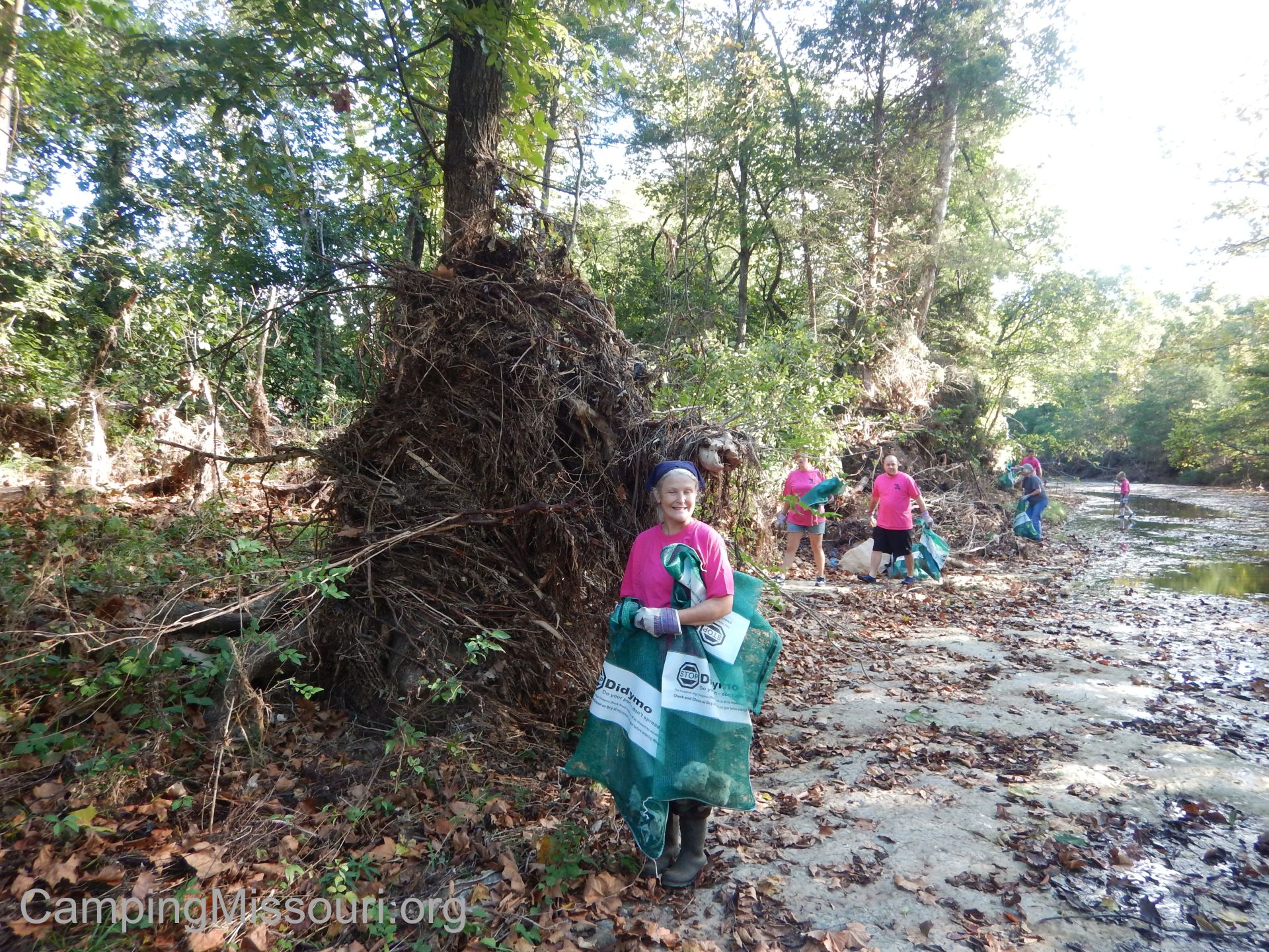
We had signed up online a few weeks back, reserving a canoe for whatever section they were going to need us on, and found out at Ozark Outdoors that we needed to drive over to Bass’ River as we had been assigned to a section on the Courtois Creek. A short drive there, and we were in the parking lot getting our cooler and Stream Team supplies loaded into a van to take us to our put-in. We were floating the Berryman section, from where the Courtois flows under Route 8, and winds its way 13 miles or so back to Bass’ River Resort. It was probably close to 10 am when we got to our canoe, and before we set off we took a few moments to survey the water and the landscape as the steady sprinkling convinced us to put on our rain ponchos. It is a shallow creek, certainly not a place for rafts, and other than the handful of kayakers heading out in front of us, it seemed we were going to get the water to ourselves for the day!
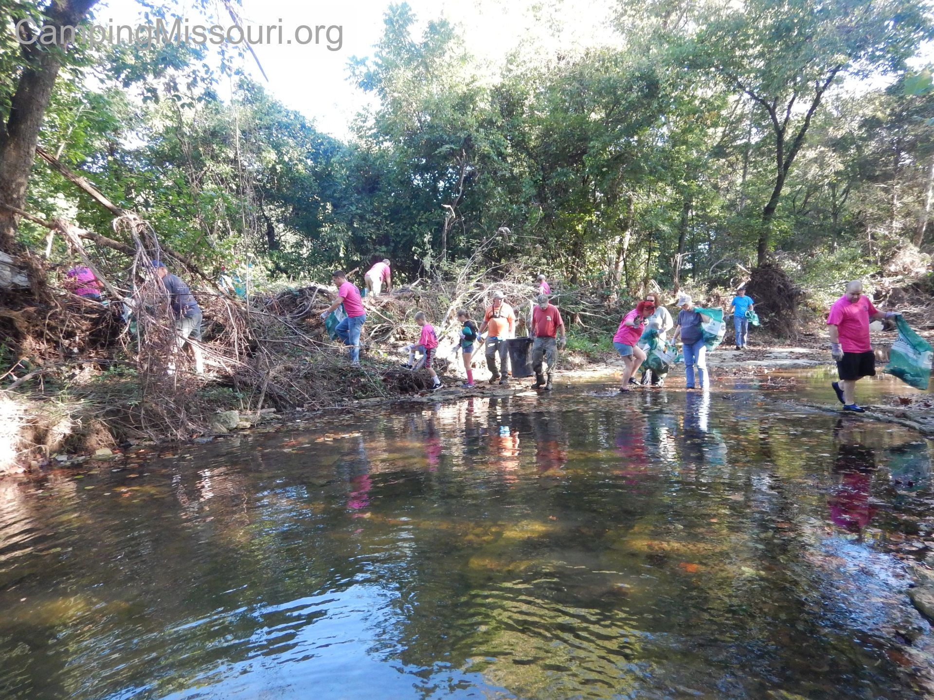
 So we set out, stopping here and there along our journey to remove trash from gravel bars and debris piles, filling our canoe with tires and garbage that don’t belong in or around such a pretty and lively creek. The rain stopped for some of the trip, and we got to spend a lot of it marveling at the natural beauty we were immersed in, as it twisted through floodplain valleys and against tall bluffs, past massive trees and around sweeping curves. Ultimately we only floated about 7 miles, taking the option to end early as the day had been getting long and our canoe was filled to the gunwales with trash we had collected.
How to get there:
Ozark Outdoors is off of Missouri Route H, right where it crosses the Meramec River, south of Leasburg, MO. A sure bet is to take Interstate 44 to Route H, between Cuba and Sullivan, and go south for 15 minutes until you hit the river. Onondaga Cave State Park is here also, as well as the Huzzah Conservation Area, both protected public land within which you can find all sorts of adventure and relaxing fun.
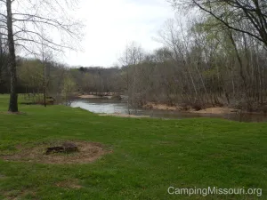
A campsite at Bass’ River Resort, taken April 2015.
Bass’ River Resort is south of the Huzzah Conservation Area, off of Route 8, about 10 miles east of Steelville, MO. Take Route 8 to Butts Rd., and then it’s just a mile and a half over the hill and down into the Courtois Creek valley to Bass’ River.
Both resorts offer float trips on the all three waterways in the area, but something to consider is that the Courtois Creek goes right past Bass’ River Resort, and Ozark Outdoors is on the Meramec River. Huzzah Valley Resort is also in the area, just east of Steelville and right on the Huzzah River. Please check out all their websites for more details about the adventures they can take you on!
 What you need to know about the Courtois Creek:
The first thing you have to get right is the pronunciation. It looks like you should say it “core-toe-is”, but it is actually pronounced “code-away”. I don’t know the reason behind it, but I would guess that it is probably something from a couple hundred years back, along the line of French settlers’ name for it versus the Native American name. If anyone knows for sure, I would love to hear the story.
This is NOT a rafting river. Even though it is deep and slow in spots, this is a creek. It is a winding, shallow, downed tree, tight curves, swift creek at times, and I would not recommend this upper section for anyone that has never been in a canoe or kayak before. Not that it has a bunch of rapids, but there are spots that require some tricky and cautious maneuvering. Especially with a canoe full of tires and trash bags, there were a number of times we walked our boat in the water around the curve and over the submerged tree trunk to keep from possibly dumping the canoe. If you are going on your first float ever, I would recommend one of the bigger rivers in the area.
 Like all rivers, sometimes there are people who spend time along them that don’t make the most responsible decisions. We picked up a lot of trash, filling four big Stream Team bags, as well as removing five tires and a couple other metal and styrofoam items. It is a shame and I see a lot of it, going on cleanup floats all the time…but I think the one thing that drives me up a wall the most is when I find broken glass. There wasn’t a whole lot of it, but any glass just makes me think of some little kid having the time of his life playing in the creek, and ending up at the emergency room to get stitches in his foot. Please pick up after yourself wherever you go, and especially don’t take glass to the river.
Photo Credit: Christy D.
Why I like this section of Courtois Creek:
The conditions were right for us to have the creek to ourselves. It was a cloudy and drizzly Sunday morning, keeping most river-goers in the house, but I would imagine that this part of the creek doesn’t get too much traffic during even the best weather. The sort of waterway that skirts around with twists and obstacles that give kayakers and canoers a fun day, but keeps the crowds downriver on some of the larger sections. I would think that if you want to go for some relative isolation, away from the majority of floaters in this part of Missouri, that the upper Courtois Creek is the place for you.
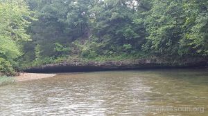
Photo Credit: Christy D.
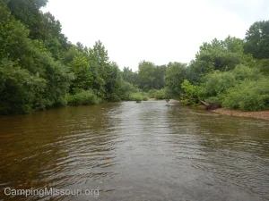
The topography and forest along it are very cool. You pass some immense bluffs at one point, float above deep pools that you can see all the way to the bottom of, and glide under forest tunnels of leaning trees. There was definitely a feeling at times as though we were floating down some jungle river somewhere, and this turned out to be one of the prettiest sections of river I have ever floated. A place we will certainly be heading back to visit again.
Five tires, four bags of trash, and various other items. It was a good haul!
What turned out to be of great benefit is that after 7 miles, if you have been rained on most of the day and your canoe handles like a barge because of all the garbage you have filled it with, you can cut your 13 mile trip short just after the low water bridge at Blunt’s Slab. There is a payphone at a pavilion there, if you just don’t want to struggle through another 6 miles, and Bass’ River can send someone to come get you. We were lucky enough to flag down a bus driver who gave us a ride back to our car, as we would have probably been on the river until sometime past sundown, dragging our canoe through the shallower spots and around the half submerged obstacles.
Ready for adventure?!? Photo Credit: Christy D.
All in all it was a great float on a gorgeous section of Missouri waterway, but I think something I love the most about visiting these places are the great people that you get to interact with, especially when they are not so busy and have the time to share some of their river stories. Truly a place filled with souls who have a love for the water they spend their time on, and a place you should get to know as well. We will definitely be heading back to the upper Courtois to play and relax on a little slice of the some of the prettiest creek I have ever been fortunate enough to traverse.
A special thank you to all the people involved in setting up and carrying out the cleanup we were a part of. Stewardship and care for these Missouri rivers starts with us, the people who enjoy them. For more information, go to http://www.mostreamteam.org/ to find out how YOU too can be a part of this great volunteer program. And if you want to be part of the 49th Annual Operation Clean Stream on August 27th, find out what you need to know and sign up at http://openspacestl.org/
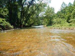
Courtois Creek in the Huzzah Conservation Area, on a sunny day!
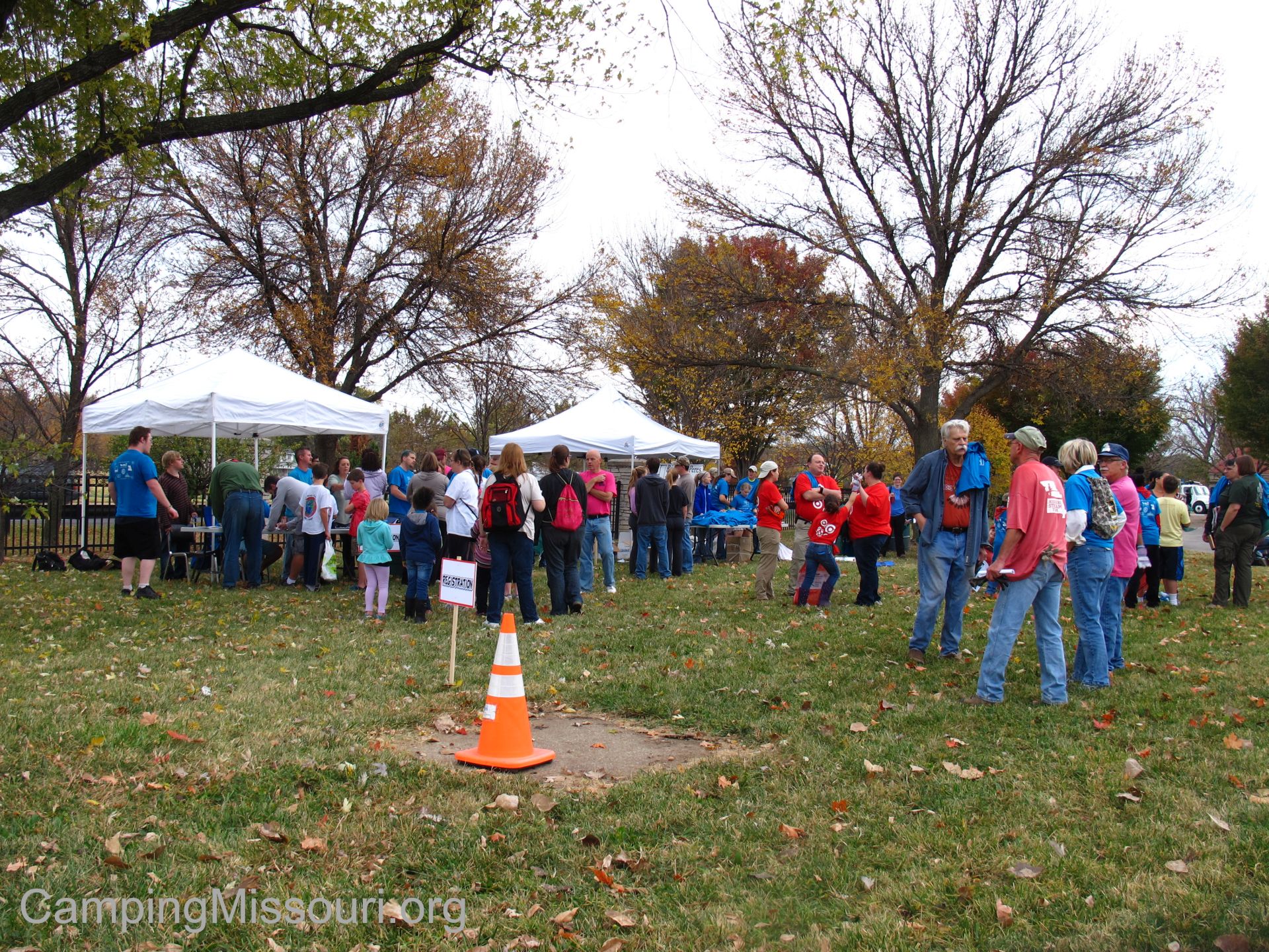
 It is the morning of Saturday, October 24th, and we are up early out at Fultz Field along the River des Peres at the border of St. Louis City and St. Louis County, just south of Gravois Road. It is a cool and cloudy dawn, and we have a mild but overcast outlook for the day, perfect for walking around the woods picking up trash. My son Eli and I are here, along with representatives from the Metropolitan Sewer District, Great Rivers Greenway, the River des Peres Watershed Coalition, and a number of dedicated Missouri Stream Team veterans, setting up for the 13th Annual River des Peres Trash Bash. This is a massive cleanup event here in the St. Louis area that the RdP Watershed Coalition puts on every year, and today is the big day!
 A lot of work was on all of our plates today for this event, but it really began months before. I was lucky enough to be one of the members of the planning committee for this Trash Bash, taking a few steps upward compared to my role last year as a tire diver in Gravois Creek. This year I got to be in on the meetings leading up to the cleanup, discussing and coordinating the plan for the day. We would consider and share our thoughts as to what we wanted it to look like and how we wanted all the wheels to turn, and it was something that I am honored to have been involved in. I look forward to doing it again in the future as I get quite a lot out of being a bigger part of cleanups, but what I was really looking forward to was getting into the muck and pulling out tires. THAT was my ultimate focus. All the rest was just logistical details that my more eloquent conspirators would be handling. I had a section of Gravois Creek riddled with muddy tires that was calling my name.
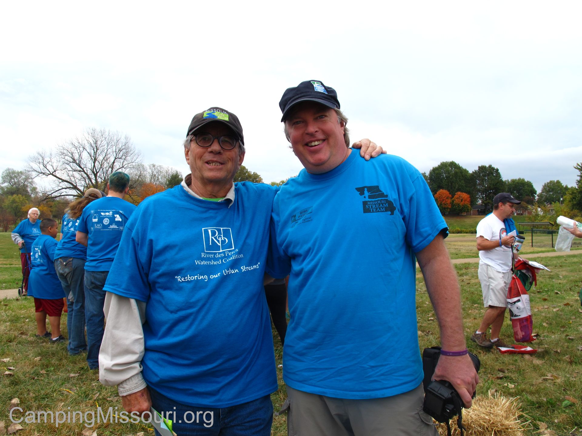
Steve Nagle and Brian Waldrop, the two masterminds who got me involved in this great event!
We spent the beginning of the morning getting the tables set up and the supplies and information set out. Piles of Stream Team T-shirts for all the people signing up to wear that day and keep as a souvenir, and boxes of gloves and bags for them to use when they were out doing the work. We had a table of binders that contained maps to all the cleanup areas, and volunteers started to slowly arrive and fill out waivers and get assigned to sites. Something we were trying this year was to have each site leader do a scout trip of their area a couple weeks before to familiarize themselves with it and the challenges it offered, and then be at the registration table on the big day to get recruits lined up for the adventures they had to choose from.
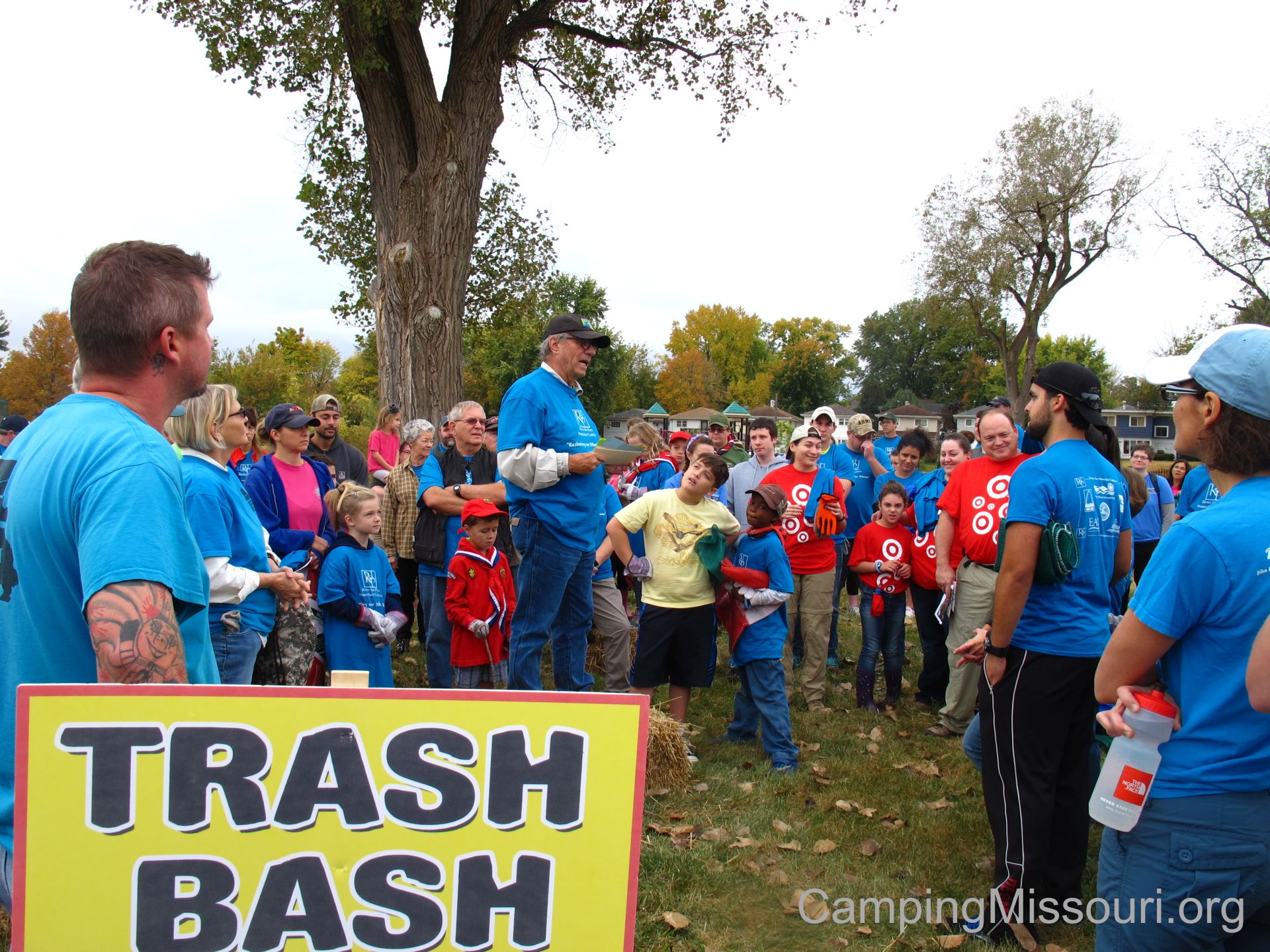
Steve, explaining the plan for the day.
So time passed and soon enough we had a large group of probably over 200 people, waiting to get out and get to work. Steve Nagle, the heart and voice behind the River des Peres Watershed Coalition stood up on a straw-bale podium and welcomed all the volunteers, discussing the plan for the day. Then he handed to reigns to me and I went over the safety checklist, setting into everyone’s mind that we need to practice caution and common sense so that we can all get back in good condition. Then we all posed for a group picture, and it was off to the cleanup sites!
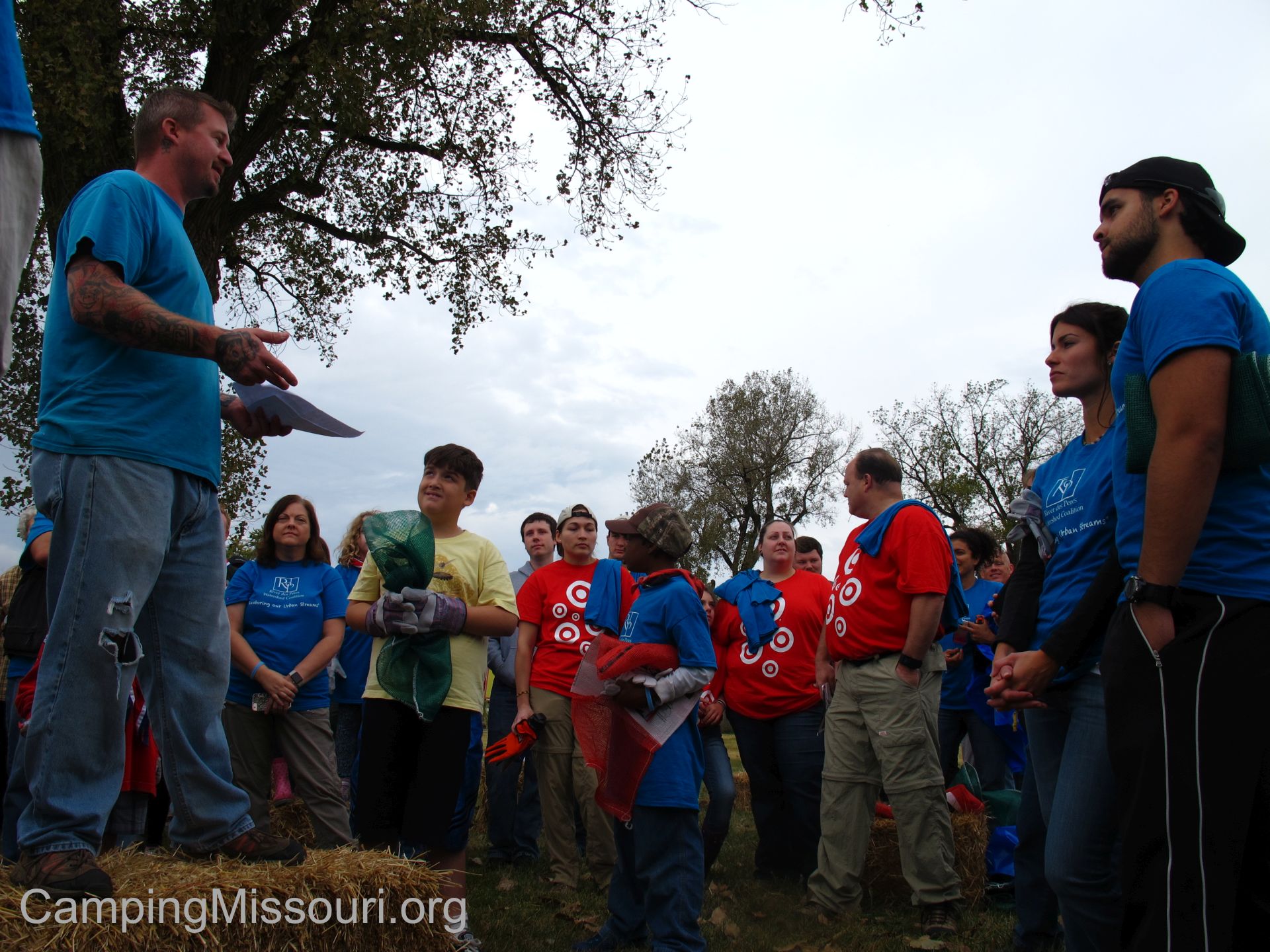
Me, talking to two hundred new friends!
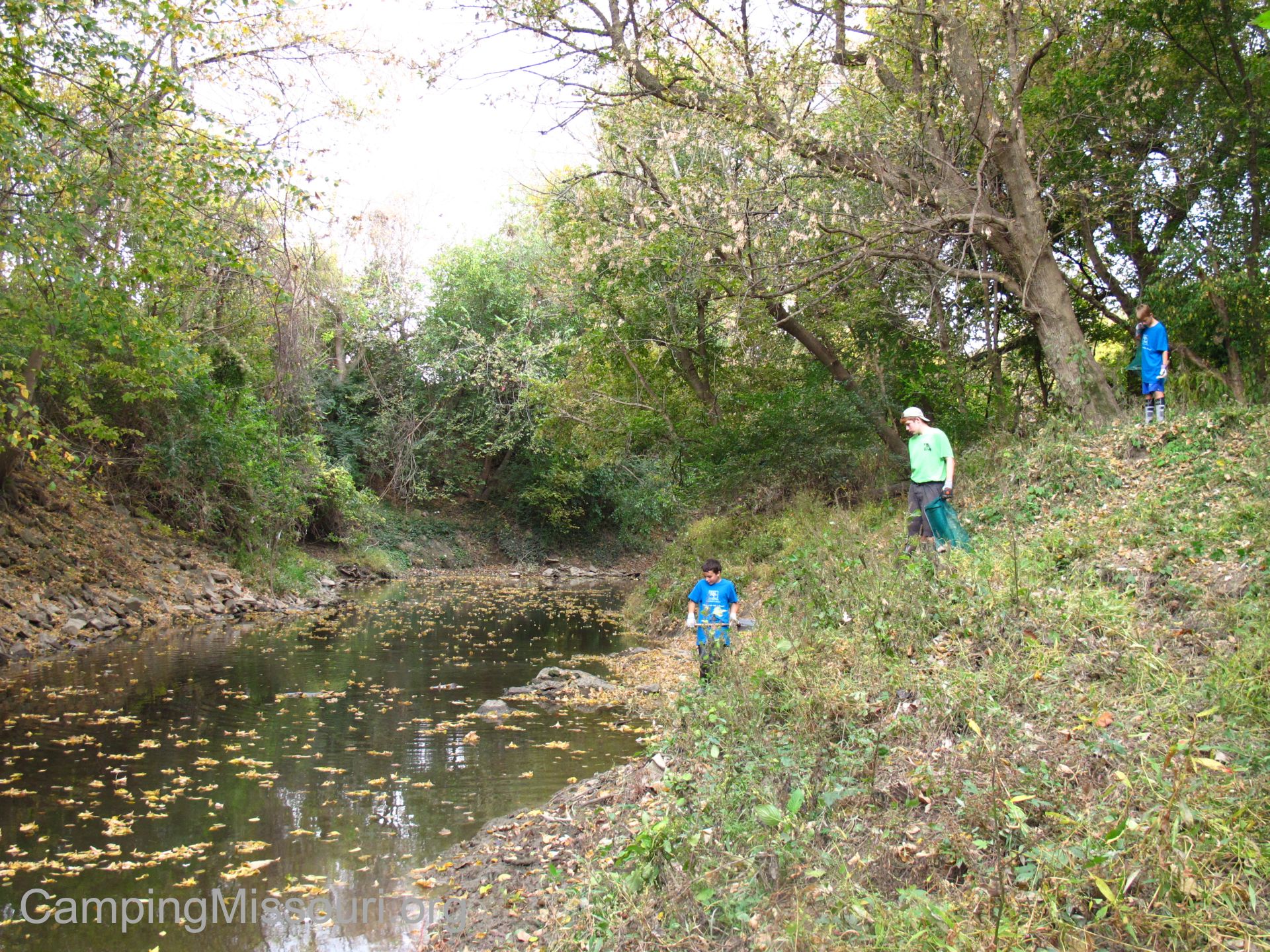
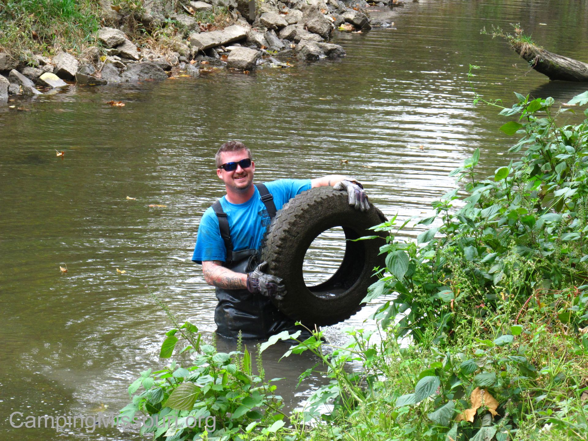
I was in charge of a site along Gravois Creek, a tributary of the River des Peres, in the Lemay area just east of Interstate 55. Gravois Creek is probably the biggest contributor of water to the River des Peres, adding its flow just a couple of miles before it joins the Mississippi River. It drains quite a large part of south St. Louis County, including being the creek that runs through Whitecliff Park and under the bridge at the entrance to Grant’s Farm, that thousands of people visit every year. We were going to be at a section of it that is near the easternmost access to Grant’s Trail, behind an old abandoned driving range that was now owned by Great Rivers Greenway. It wasn’t too far from the mouth of the creek, where it joins the River des Peres, so the water is deep and slow in spots, obscuring the abandoned tires and junk that people have dumped into it.
Bernie and I and our team of superstars!
When our team arrived at our site, we had a quick meeting to mention where we were going to focus our efforts, and how we were going to get the garbage out of the woods to where it could be piled up for the trash trucks to come and get. Bernie Arnold of the Mighty 211 Arnold Stream Team had brought his tractor and trailer, and had already made himself a reasonable path into and out of the forest. This area was in one the busier parts of the watershed, in the context of foot traffic and road crossings, and during our scout trip a few weeks before we had located a bit of the flood plain that contained a lot of waste. It was also right along a section of the creek that had a number of tires in it, so I had brought my waders and a hook to fish out every one of them that I could find.

My son Eli, demonstrating how much fun cleanups are!
Last year I had a pretty gross adventure, not being so prepared as far as equipment and having a sense of enthusiasm that lent itself to making rookie mistakes, so this year I had a wiser and safer approach. As our crew of volunteers got to work walking through the woods, I put my waders on and got down into the creek. From the bank, I had made a note of where in the water some of the tires were, so I spent my time walking through the waste deep water poking the bottom with my hook and feeling with my feet for the telltale squish of these misplaced rubbery bottom dwellers. Once I found a tire, I would hook the lip and give it some yanks until I had popped it from the muck. Then I would lift it to the surface, grab it with my hand, and carry it over to the bank where I would empty the mud and toss it up to the volunteers. I went through this process for most of the time we spent there, searching and hooking and cleaning and tossing, until I had removed a good 20+ tires from an eight of a mile of Gravois Creek. Not quite as many as I wanted to pull out, but a good number nonetheless. I suppose NOT finding any tires wouldn’t be the worst problem.
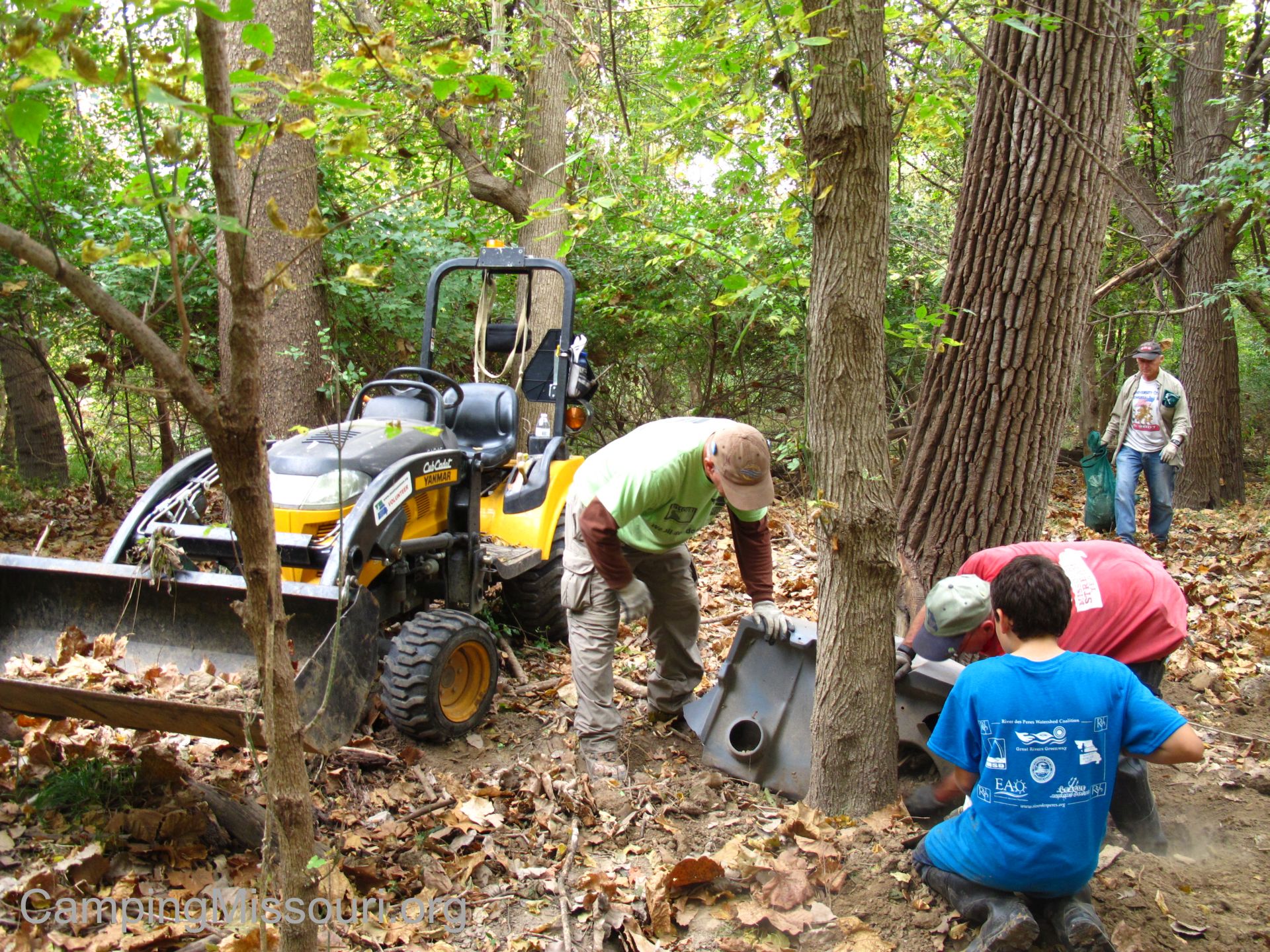 And so it went for the couple of hours we were there. A group of hard working volunteers scouring the woods along the creek for anything that didn’t belong there, Bernie transporting all the collected garbage out to the parking lot, and me “fishing” the creek for dumped “habitat”. By 11 am it was time to get wrapped up. We all made our way out of the woods, making sure to bring everything we had brought in with us back out, including a canoe that I hadn’t gotten around to even using. It was a good morning, and at the end of it we got around 30 tires and a big pile of debris and filled mesh trash bags. I was very happy with all the volunteers I had with me that day, and what we accomplished was certainly a feat to be proud of.
 So when all the trash had been loaded into the trucks, we went back to Fultz Field for lunch. An army of volunteers, famished from a morning of hard work making a waterway in the St. Louis area a prettier and healthier place. I have been on a lot of Missouri Stream Team cleanups already in my short span of being involved with this organization, and I have enjoyed it every time. With every experience, it has occurred to me that each river and creek has its own unique characteristics and need for attention, but Gravois Creek has become a special waterway for me personally. Besides the level of intimacy I have experienced in it, accidentally submerging a canoe full of tires on the grossest float trip ever, it is within just a few miles of where I live. I mostly grew up in the St. Louis area, having played in Gravois Creek out in Crestwood when I was in my early teens, and these days I walk Grant’s Trail along this section of it with Max on a regular basis. It is my neighborhood waterway, the creek that runs through my community, and with all the pollution and neglect it receives being an urban stream it deserves all the love I can afford it.
 People wouldn’t guess it just by looking down off a bridge while driving over it, but Gravois Creek is home to fish and turtles with the adjoining riparian corridor and forest beyond being home to deer and turkey, which I have personally seen on my scouting trips in the woods there. Between a highway and neighborhoods and flanked by industry and backyards, this green space is an example of the dwindling natural presence in our metropolitan communities; an island of Missouri forest, holding on to what health and beauty the life within it fights for. The water that passes through is a precious commodity, and we ought to protect it with every chance we get. That is what being involved in the Missouri Stream Team program and organizations like the River des Peres Watershed Coalition accomplishes. Stream Teams are doing great things all over our state in the protection of water and wildlife, and in the creeks that run through our urban neighborhoods, they need protection more than probably any other.
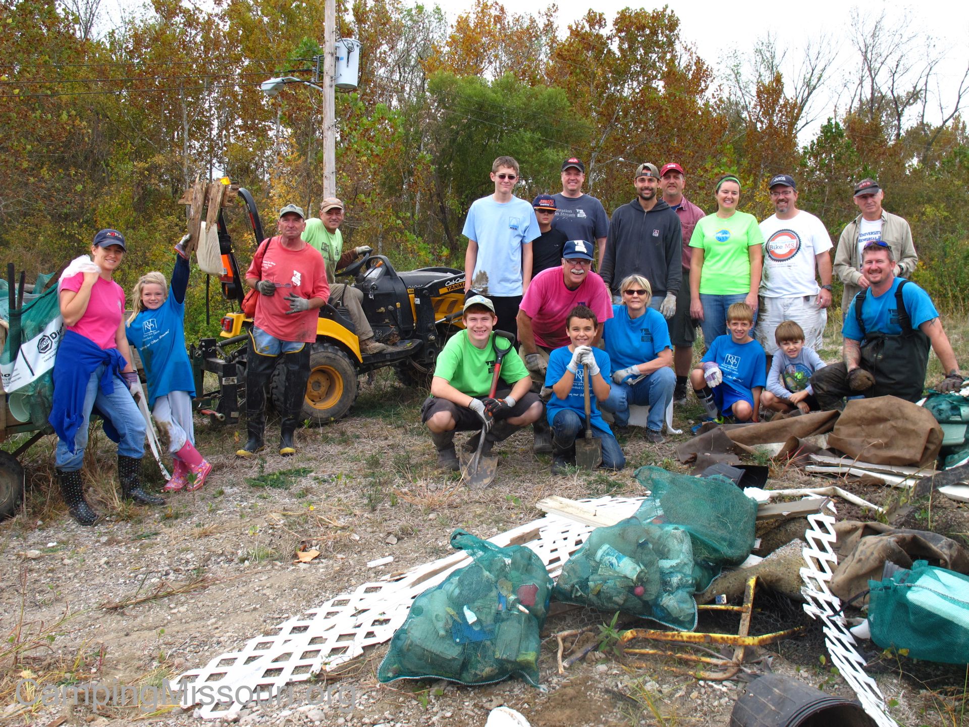
An awesome team of people at the Gravois Creek site behind Orlando Gardens!
The morning of Saturday, October 24th at different sites along the River des Peres Watershed, 330 volunteers removed 5.2 TONS of garbage, 5 cubic yards of recyclable bottles and cans, three quarters of a ton of metal, and 88 tires of which I am personally responsible for a good handful of. That’s what we did at the 13th Annual River des Peres Trash Bash. This result is something that everyone involved in this event needs to be super proud of. I know I am, and I can’t wait until we get to do it again next year. Until that eventual October morning about a year from now, I will continue to walk Grant’s Trail with Max and scout through the woods along Gravois Creek when I get the chance, appreciating this little spot of forest surrounded by city, that I personally feel charged to protect the well being of. The land in our communities can inspire an honorable sense of responsibility if we really allow ourselves to care about it. Thank you to everyone who showed up that morning. You all inspire me, and I hope to see every one of you at the next cleanup!
Grossest and most satisfying treasure hunt ever!
To find out how to get involved, go to the Missouri Stream Team website, visit the River des Peres Watershed Coalition website, and if you are on Facebook check out our page for “The League of Watershed Guardians”. We are always up to something fun and impactful, and looking for people to join in on the adventures!
Thank you to Melissa N. for taking pictures AND cleaning up trash that day!
MY Gravois Creek.
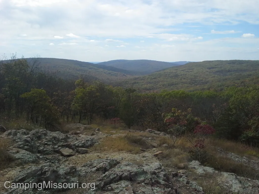
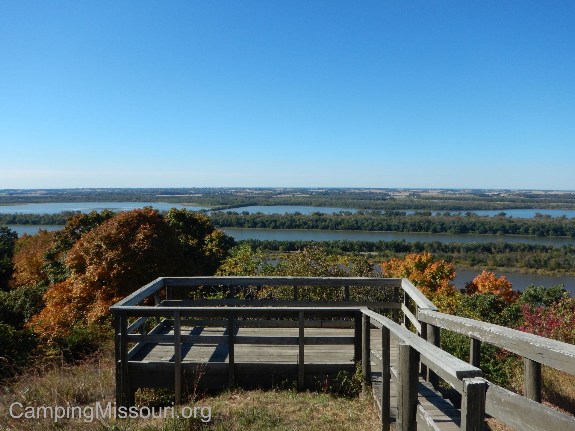
 So it was the couple of Autumn weeks when the leaves were on their way to displaying all sorts of brilliant colors. As the nights get cooler and the sunlight is more fleeting, the forest prepares for the slumber that comes with the coldest months; the trees sending their energy down to their roots and shedding their brilliantly colored adornment of solar collectors, to be regrown again when the northern hemisphere starts to warm in the Spring. Last year around this time, we made a trip to Taum Sauk Mountain State Park, down near the Arcadia Valley, and the highest point in Missouri to check out the brilliance of it. This year was no different in my wanting to get out and soak in the changing of the leaves, but this year was going to be a trip to a place I hadn’t been to in probably half my life, and even though it is close…it isn’t actually in Missouri. This year I was going to make a long overdue trip across a great river and a state line, and check out the steep hills and breathtaking overlooks of Pere Marquette State Park, just north of the beautiful river town of Grafton, IL.
 How to get there:
There are a few different options you have coming from south St. Louis County (where I live), but the point I will start from is the northern part of the 270 loop in north St. Louis County. You want to get to the interchange of 270 and MO-367/Lewis and Clark Blvd. Go north on 367 for about 3 and a half miles, and then continue north another 7 miles as it changes to US-67. After you cross the impressive Clark Bridge spanning the Mississippi River and land in Alton, IL on the other side, make a left and take IL-100 through Alton, and then about 20 miles northwest along the river through Grafton and eventually to Pere Marquette State Park.
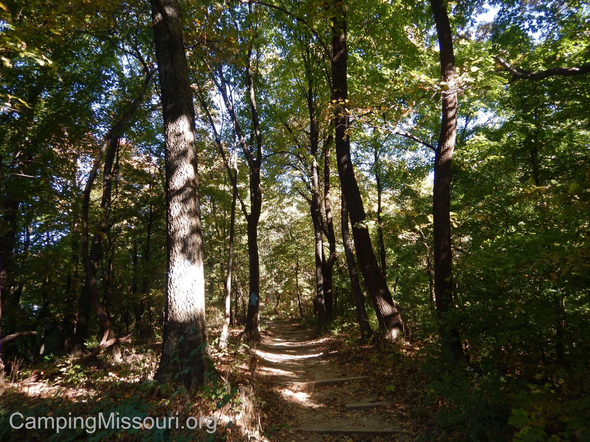
 The hiking trails at Pere Marquette are a trail system. An intertwined network of trails joining and crossing one another, over and through the hills along the Illinois River. There are 12 miles of trails, and I we probably hiked about 4 that day. Make sure to pick up a trail map from the trailhead or Visitor Center before heading into the woods.
Why I like this park:
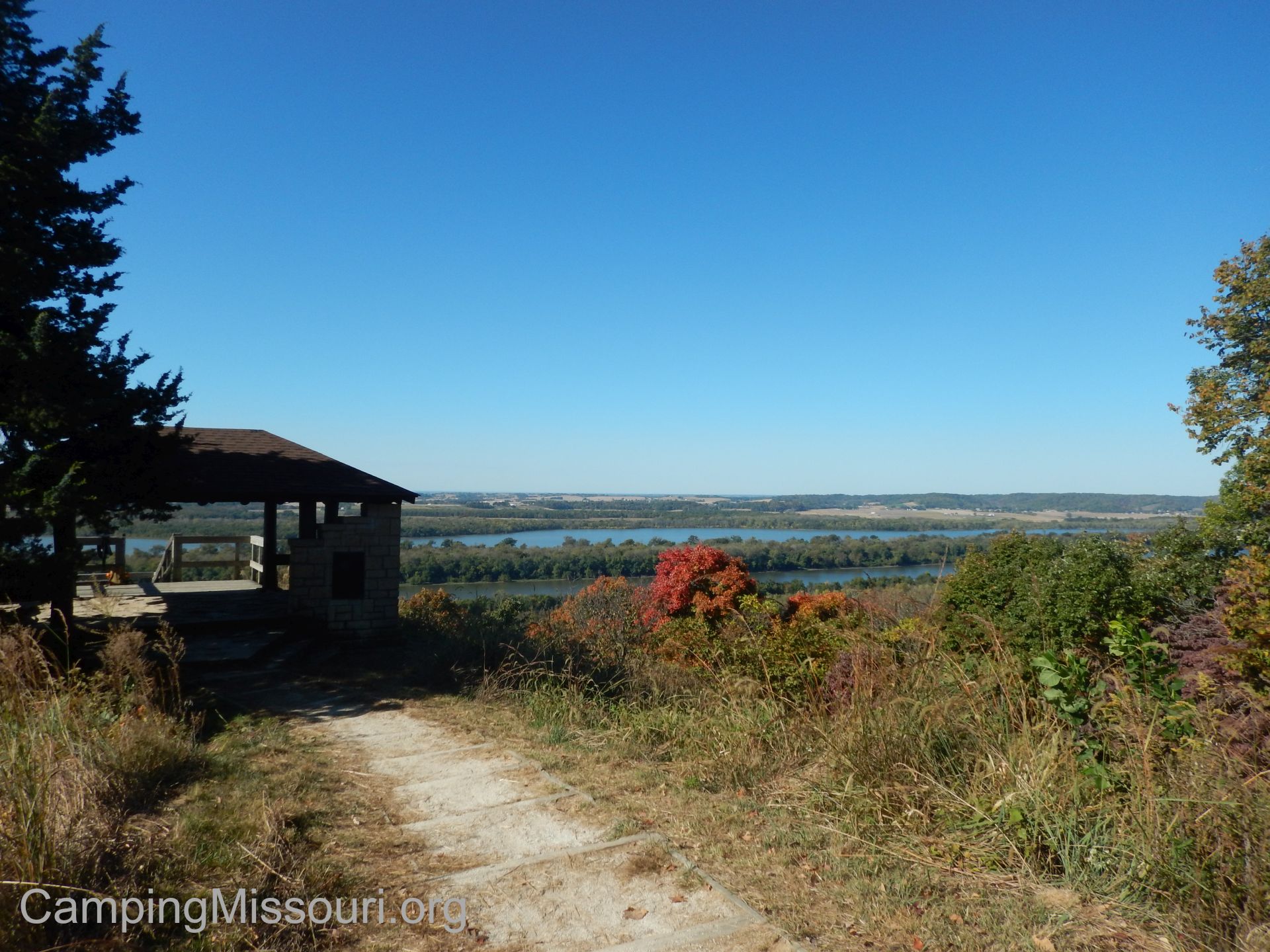
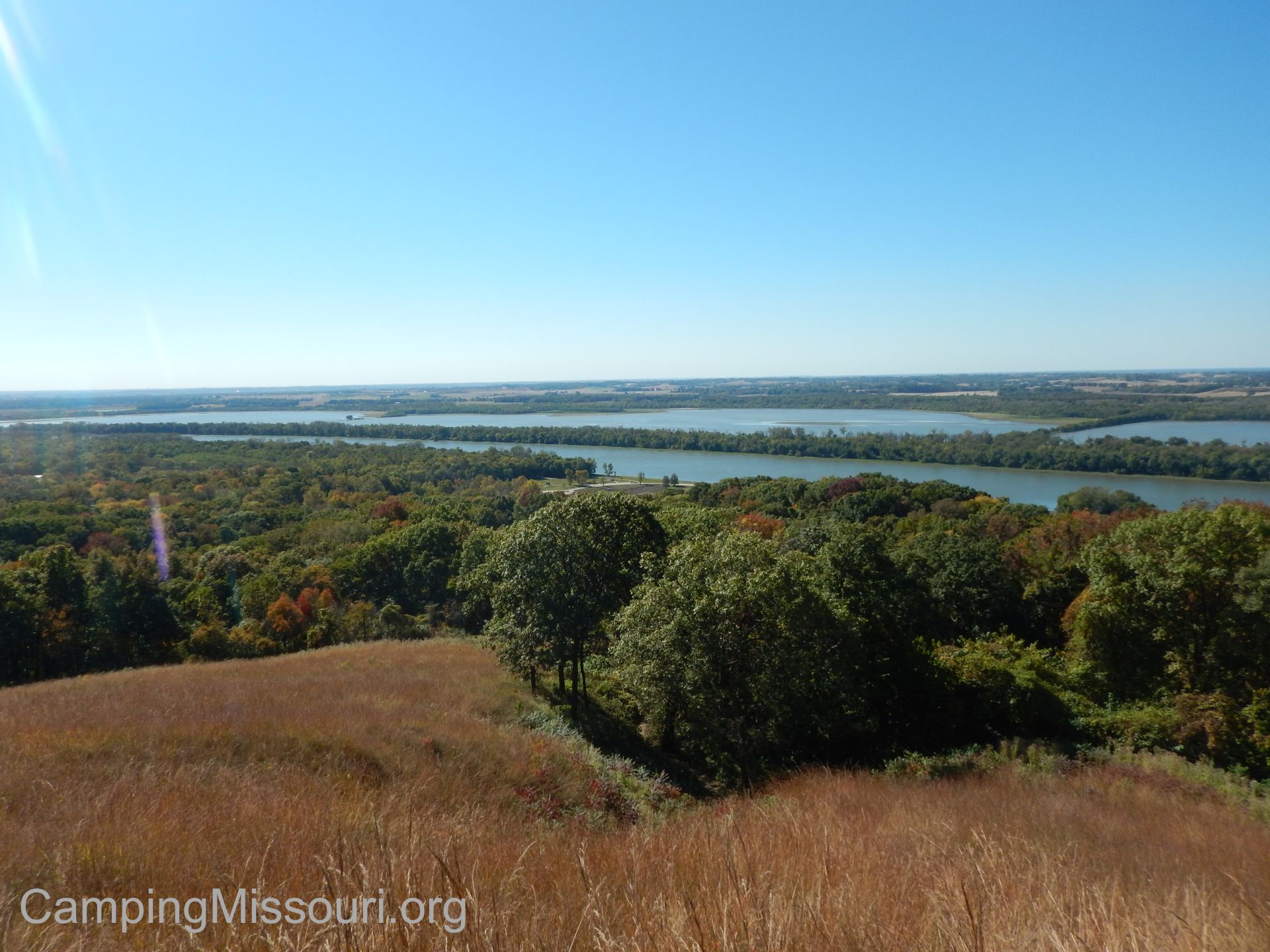 The views from the multiple overlooks makes this one of the most scenic places I have visited. Sure, the hills are steep and seem to go on forever, but you are rewarded equally with gorgeous views and perfect opportunities for taking a break when you finally get to the top. Yes, it’s a lot of work losing your breath up the hills just to have it taken as you crest the summits, but you will gladly give yourself as much time as you have available to soak it all in once you get up there. It really is worth noting how those of us from Missouri don’t think of Illinois as having any sort of severe and daunting topography, and the hills along the river here certainly obliterate any reference to the term “Flatlander”. Even I was huffing and puffing a little when I got to the plateau and looked out across the Illinois River. Phew.
 Pere Marquette State Park is another place on the huge list of beloved outdoor destinations that owes so much to the Civilian Conservation Corps. The CCC-built lodge and conference center there are practically a resort, and with over 70 rooms and cabins available along with all sorts of activities to spend your time enjoying, this is surely a getaway destination for thousands of visitors throughout the year. On top of that, they also have over 80 campsites in their campground. There is also a Visitor Center filled with displays and interpretive exhibits that teach you about the local wildlife, environment, and history of the Illinois River and the hills and sloughs that make up the area. Check out their website to see how YOU can fill up a fun weekend there!
 If for any other reason to go to Pere Marquette, the drive there is a stunning and relaxing venture northwest along some of the prettiest river highway that you will ever get to enjoy. With the shimmering surface of the Mississippi and Illinois Rivers as your companion on the left, and the steep hills and towering bluffs shouldering you in from the right, the “River Road” up to Grafton is nothing short of spectacular. Make a day of it and visit this little river town, filled with wineries, antique shops, artisan gift stores, and even a massive flea market that is open every 4th weekend of the month from April to October. Grafton is certainly a place to spend a fun weekend for just about anyone with an appreciation for the open air, and the history and creativity that makes up the finer AND more rustic points of this great land in which we live.
 What you need to know:
The hiking trails at Pere Marquette are just about all back up in the hills above the river, so don’t expect a soft and gentle wandering through river bottoms. I was very impressed with how tall the hills were, and the views are a beautiful reward…but the trail to get to them is long a steep and at some points seems to not want to end. Take your time and catch your breath when you need to, because getting to the top is totally worth it. I hadn’t driven it, but we did cross a road at one point that runs through the park and does stop at a couple overlooks. Consider that option in case you’re looking for less of a workout.
 This is a very busy park, and for good reason. If you are looking for a day of isolation in the woods, this might not be the place to find it. I am always happy to see more and more people enjoying the benefits of the outdoors, but this is not the place to go if you’re interested in a more solitary experience walking through the woods.
I can tell you one thing for sure, I need to go back and spend a lot more time at this park when I get the chance. There are more miles of trail to explore and a lot of history about the area to learn. It was a wonderful visit that we had, and the people of Illinois should be very proud of this gem within their borders, hidden in the steep hills along the Illinois River, right in the heart of this great and beautiful land. It may not have been something to see in Missouri, but this outdoors enthusiast certainly feels it was worth it to head in a slightly unfamiliar direction in order to get to see such a wonderful natural place.
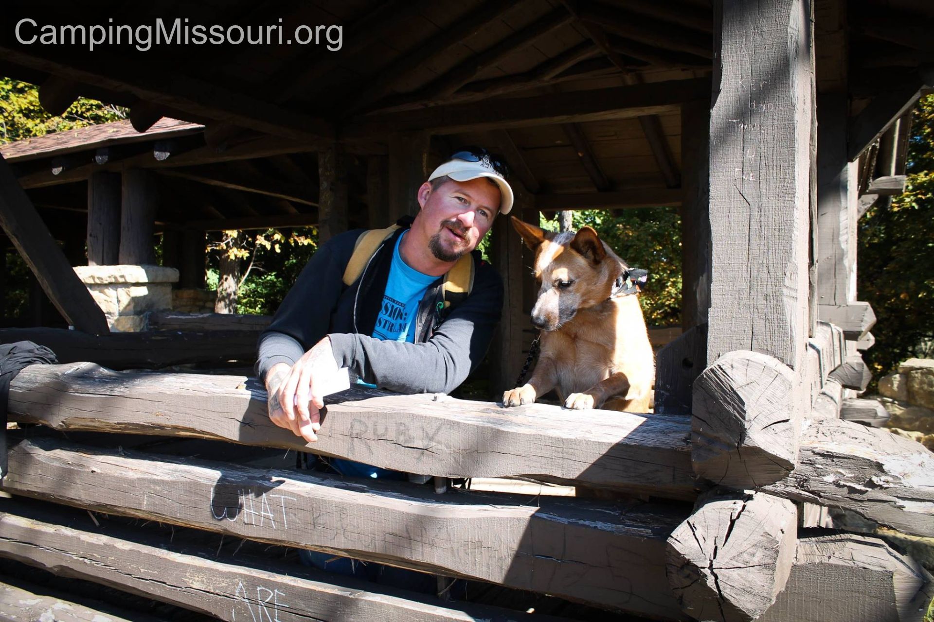
Max and I, discussing the differences between Missouri and Illinois State Parks.
 On the night of July 1st, 2015, the area along Buck Creek in Festus, Missouri received 5 inches of rain in a matter of hours. Around 60 residents along the creek valley were forced to evacuate, and two women lost their lives that night, their cars swept into the violent rush of water careening along the path of this quiet little waterway. Buck Creek is typically not any more exciting than a wet weather gurgle, trickling through the valley over the wide expanse of flat exposed bedrock, but with so much rain in such a short amount of time, it was transformed into a devastating and fatal torrent. The light of the sun the next morning revealed a place I drive past all the time to be one of uncontrolled elements, the power of nature reminding us that it can perform the unthinkable with little ability for us to stand in its way. The soft banks and relaxed demeanor of Buck Creek was replaced with a water-swept scene of broken trees and scattered human belongings. It had experienced a change in just a short period of time that would leave it wrecked and battered for quite a while.
 So the wheels of rehabilitation started to rotate, and with the actions of some of the members of The League of Watershed Guardians, we took it upon ourselves to help return this little waterway back to the look that nature intended. On July 11th, just ten days after the storm under the veteran lead of Ken Thomas and Christine Burrows-Endsley (Stream Team 4660), we conducted our first cleanup there, removing a massive pile of trash, destroyed pieces of furniture, and a handful of tires as well as three cars with the help of Pippin Towing, a local business in the area. The next month saw a few more minor cleanups and scouting trips in a couple of sections, and this past September 19th we had a larger cleanup off of Buck Creek Rd. which runs parallel with Highway 67 on the other side of the creek from it.
 It was in a section near the Stonegate subdivison, that we had scouted about a month earlier. At the head of this stretch there is a large pool in the creek that is sort of a natural impoundment, with massive amounts of gravel and debris dumped into this spot by the flood waters. Within the piles of rock, upside-down and buried, we discovered a red sedan, three tires exposed at the surface taunting us to try to remove it. This was just one bit of treasure that we were going to go after. There were also two dumpsters that had been swept within the banks of the creek, presumably from some of the businesses along Highway 67 that had been flooded out. Along with removing all the trash that had been deposited in about a half mile of Buck Creek, we were also determined to get the car and the dumpsters up and out so that they could be taken to a more proper resting place.
 So a few weeks later on a warm September morning, around 30 volunteers showed up to tackle the Stonegate section of Buck Creek. From seasoned veterans to enthusiastic new volunteers to people from the neighborhood, we worked our way upstream from the intersection of Buck Creek Rd. and Stonegate Rd. It was a quiet section, flowing subtly below a canopy of arching river bottom trees, shading us from the rising sun just over the hills to our east. We swarmed along, working both banks and crossing back and forth to pull all the trash and debris out onto piles along the road to be collected and taken over to the dumpster we had waiting to be filled. A mass of Missouri Stream Team volunteers, moving up the creek, collecting everything in our path that didn’t belong there.
The debris against the tree illustrates how high the water was!
As we worked, it was impressive to see the sticks and litter that had accumulated against some of the tree trunks along the creek, indicating how deep and scary the water actually had been. Rising to heights taller than most of us, it makes sense how a flash flood could be so immediately devastating. Weather events like this happen rarely, but they do happen, and they can transform the landscape and the lives of whatever resides there in just minutes, including people. To imagine the water flowing above your head and spanning the valley wider than you could ever think possible is a frightening thought…and it is exactly what happened here.
 We were spread out and working hard along the creek when we made it to the big gravel deposit just before the pool of water. Volunteers scattered all over, picking up trash and pulling out pieces of metal and plastic that were foreign to this natural setting. Bernie Arnold of Stream Team 211 had been in this spot all morning, working to pull out the dumpsters. Earlier in the week, he and Ken Thomas of Stream Team 4660 had dug up and and dragged out the red car, performing the herculean task with some shovels, a cable winch, and an unrelenting intent to get it out however they had to.
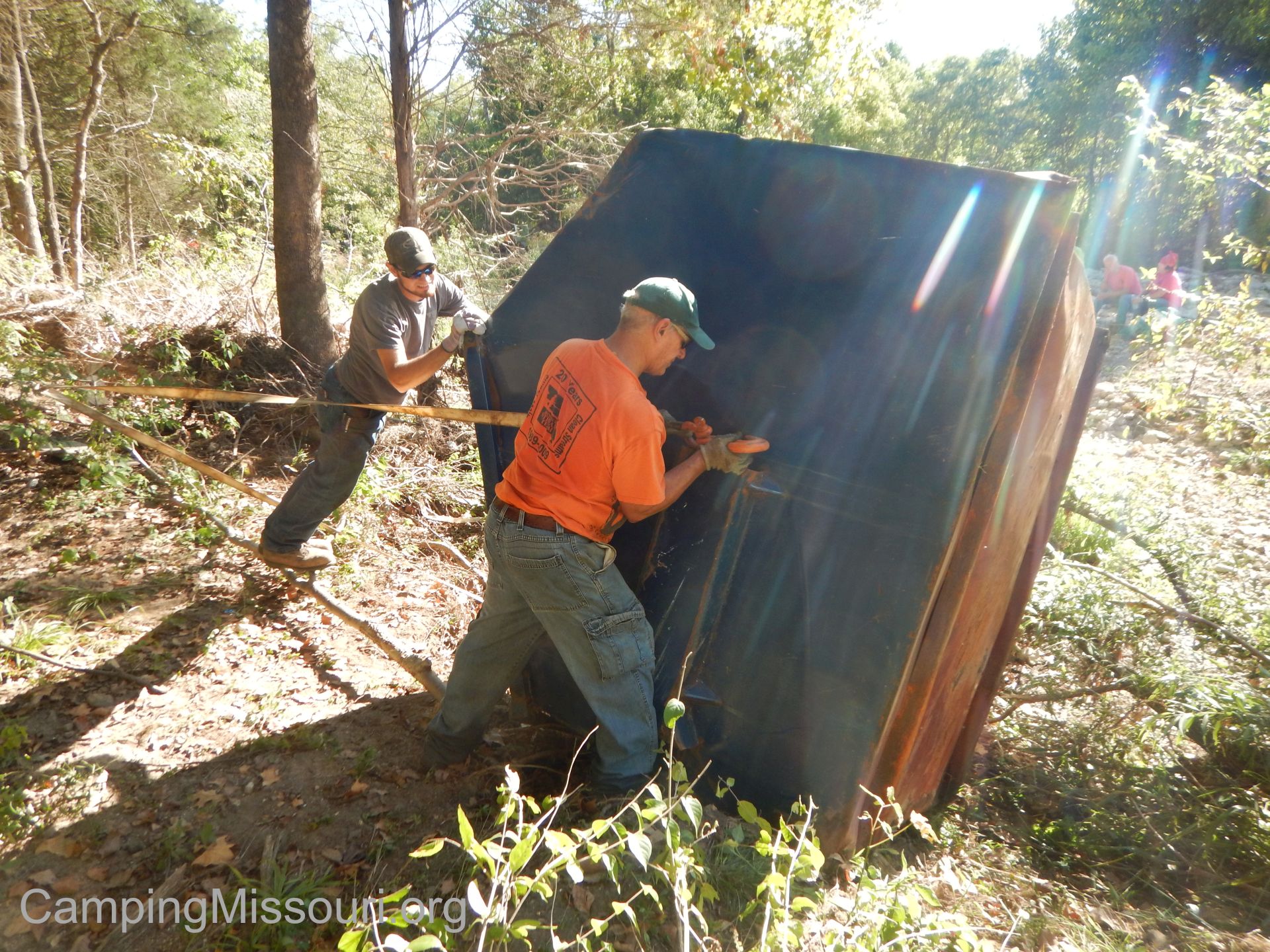 It’s not just about having the right tools, but also having the right person to use them, and Bernie is the man for any job when it requires pulling something gigantic from a creek. So as we got to where he was working this morning, some of us took a break and stood back to watch as he reeled in one of the big blue dumpsters, dragging it up the bank past the trees and out toward the road where one of the local residents with a Kubota tractor pulled it the rest of the way with a strap and moved it to the far side to be collected later. If there is a will, and Bernie is there with his equipment, then there is definitely a way.
 As the morning started winding down and it got closer to noon, we all made our way back to the entrance of Stonegate where the wonderful people who live on the corner along Buck Creek had fixed us hot dogs and hamburgers for lunch. It was a real treat to have this level of local involvement, and it was very nice of the people who live in the community for getting involved and supporting us doing what we do. Enough kind things can’t be said for all the great residents that come out and help at these events, especially the ones who want to feed us!
 The end result from this latest Buck Creek cleanup was 25 tires, 30 cubic yards of trash, more than a ton of metal, two roughed-up dumpsters, and an upside-down and buried car (earlier that week). Pretty impressive for a group of just 30+ volunteers on a Saturday morning. A lot of these Stream Team cleanups are because of the carelessness of people’s bad decisions and generally it seems that nature is the victim of human influence. This time it was more extreme in the other direction, with the elements taking on a larger role in how the garbage got there. Regardless of the cause, that is where we like to come in, banding together to remove the results of the devastation and let the creeks and rivers get back to the way they’re supposed to look.
Thank you to everyone who came out to help, especially those in the community that Buck Creek is a part of!
To follow the adventures of The League of Watershed Guardians, and even get involved, check out our Facebook page here!
The League of Watershed Guardians, an unstoppable force for good! Get involved!
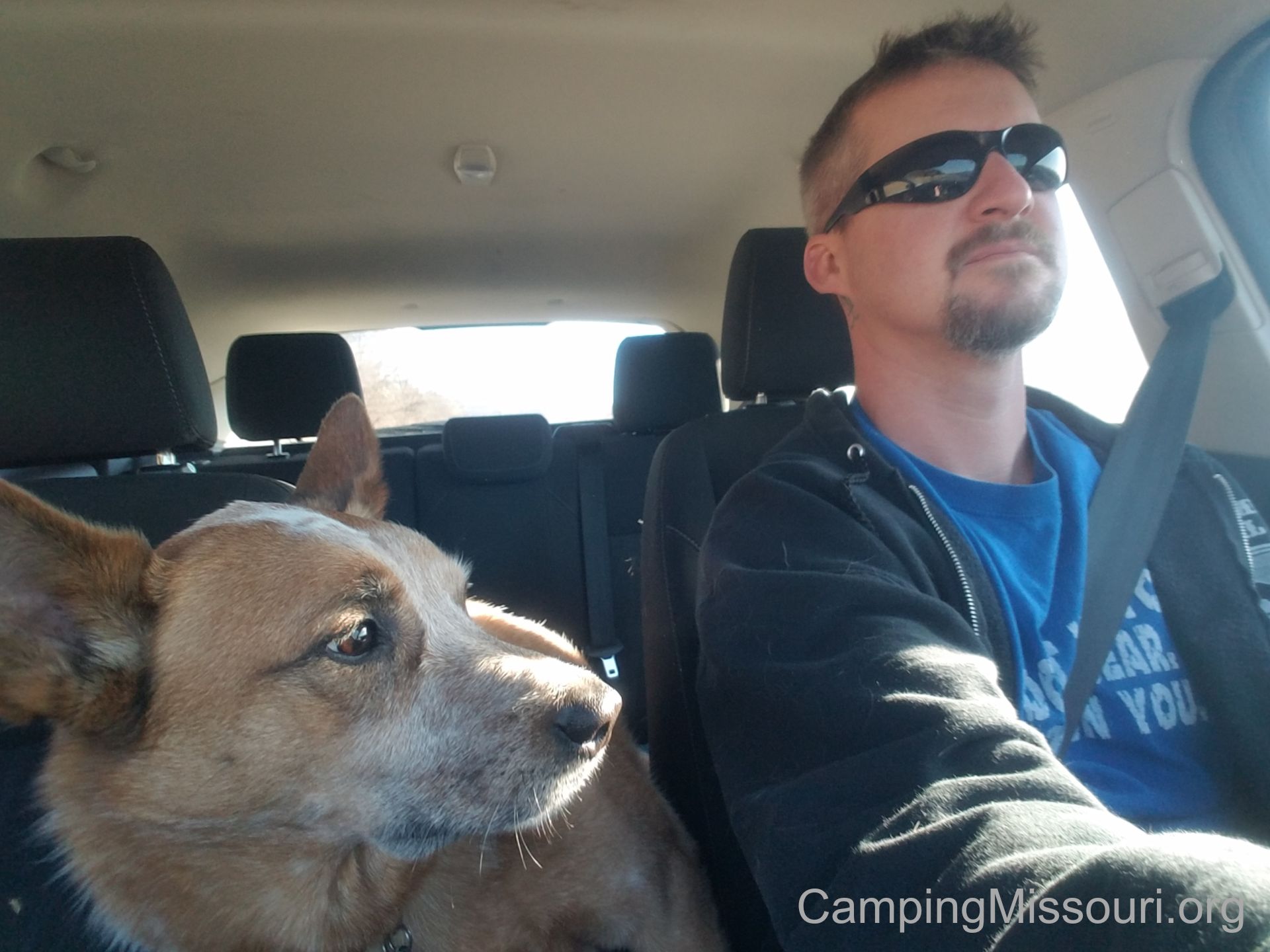
 It was a Monday morning off, after a weekend of camping and hiking in Madison County down at Marble Creek Recreation Area. The weather was going to be perfect, and Max and I had to take advantage of that and spend just a little more time out into nature. A trail that I had hiked with a group a couple weeks back was the Vilander Bluff Trail, but I hadn’t taken a lot of pictures or really allowed myself to get a good observant feel for the trail and the woods. I knew we had to get back there, and this day off would be the perfect opportunity. So I grabbed my day-hiking backpack, got my best hiking buddy in the car, and we headed down the road to Vilander Bluff Natural Area.
 How to get there:
From the interchange of Interstate 44 and 270, take 44 west almost 56 miles to Bourbon, MO. Get off of 44 at exit 218. Make a left onto Pine St. and take it about half a mile as it curves to the left and goes straight through downtown Bourbon. You then make a right onto Route N, and follow it around and out of town for about 8 miles. Soon after you pass Riverview Ranch on your left and cross the Meramec River, you will go up the hill to Thickety Ford Rd. Make a left on Thickety Ford Rd. and take that about a mile and a half where there will be a gravel parking lot on your left.
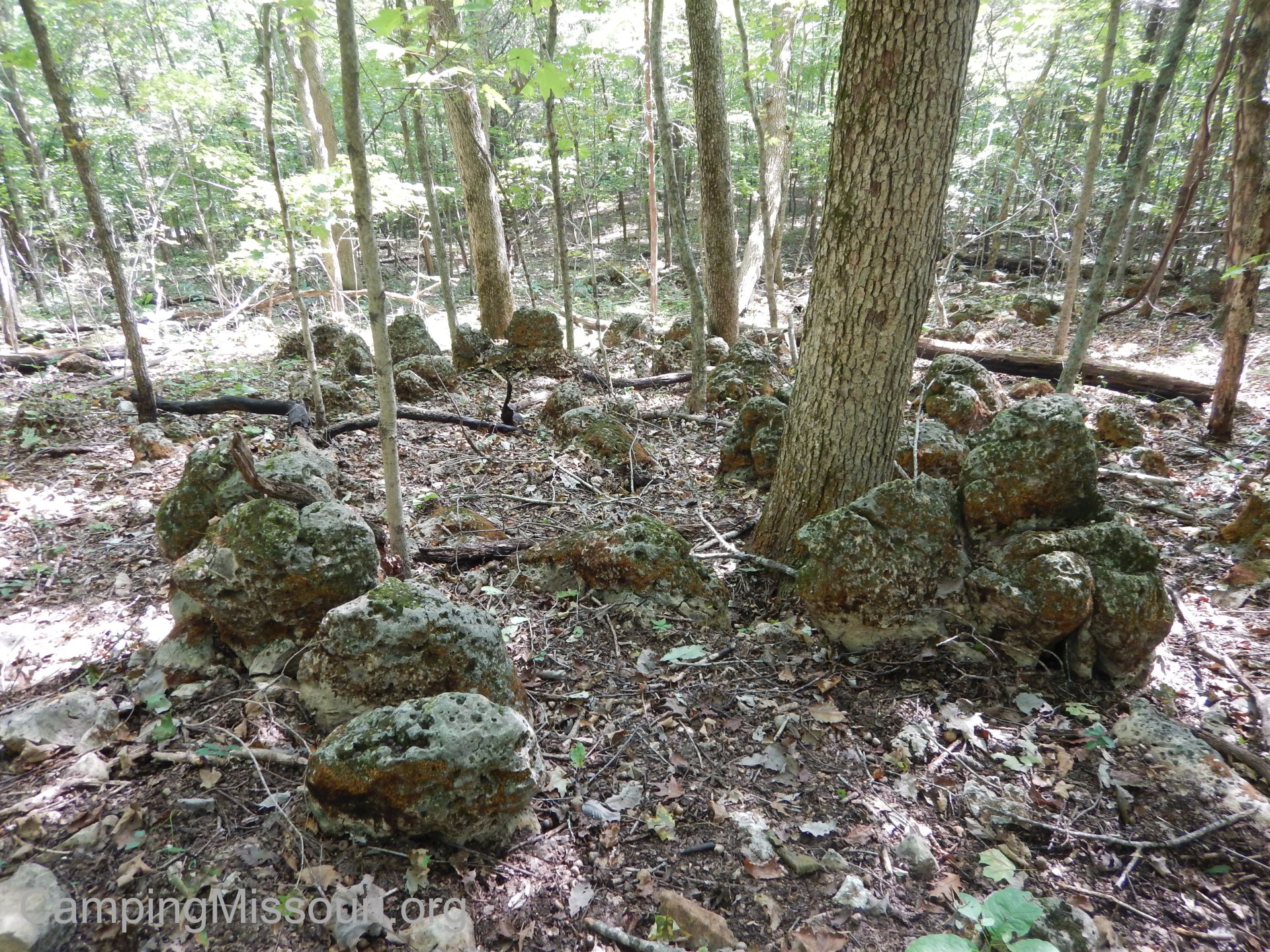
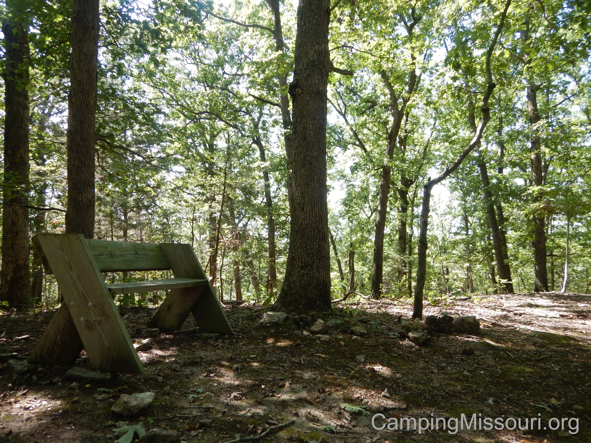 The trail is listed as 1.25 miles, and it heads out from the parking lot through some flat woods, across a power line clearing, and then starts up the hill. It then comes to the loop, where you can go right or left. Max and I turned to the right, and the trail works its way slowly along the hill, rising steadily as it takes you past some interesting rock formations. It then switch-backs and continues to work upward through a steeper section, eventually leveling out somewhat as you near the crest of the hill. At the top there is an Aldo Leopold memorial bench put there by the Missouri Master Naturalists. From here the trail goes back down the other side of the hill, switching back and forth as it moves into the deeper woods, and joins up again with the trail back to the parking lot.
 Why I like this trail:
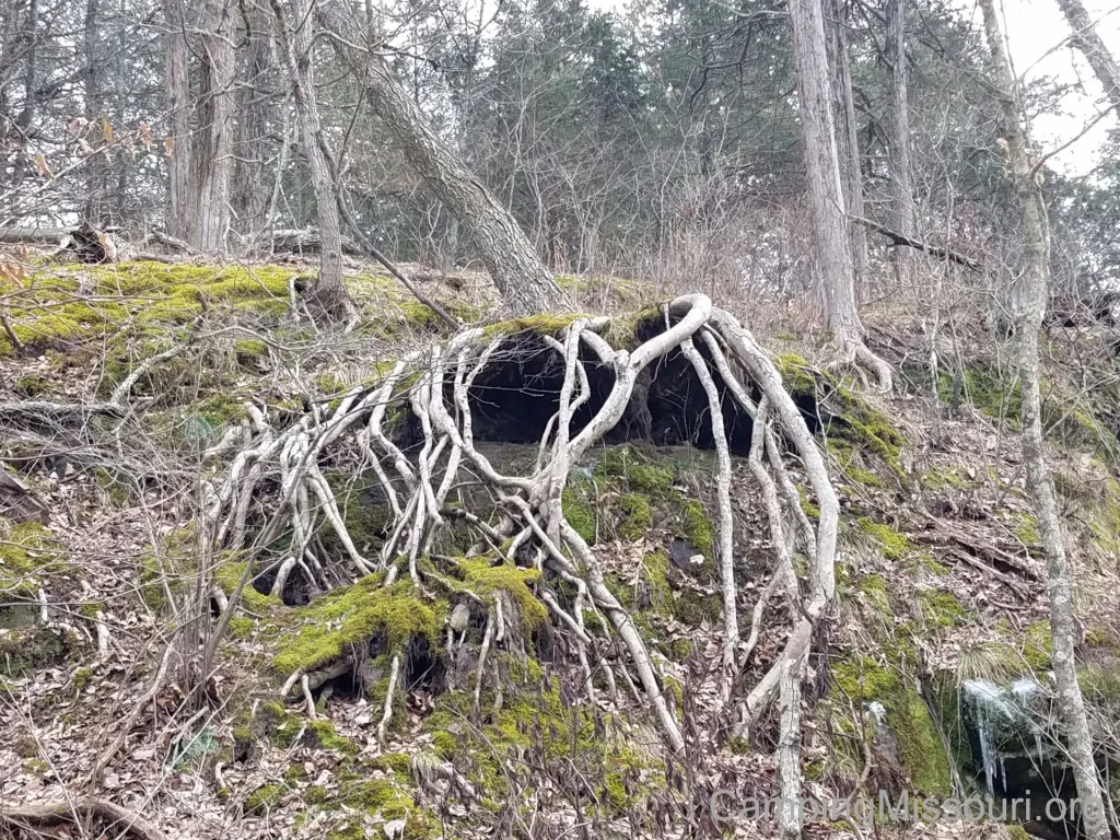
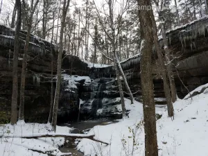
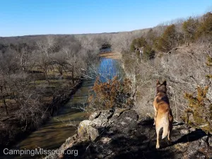
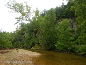
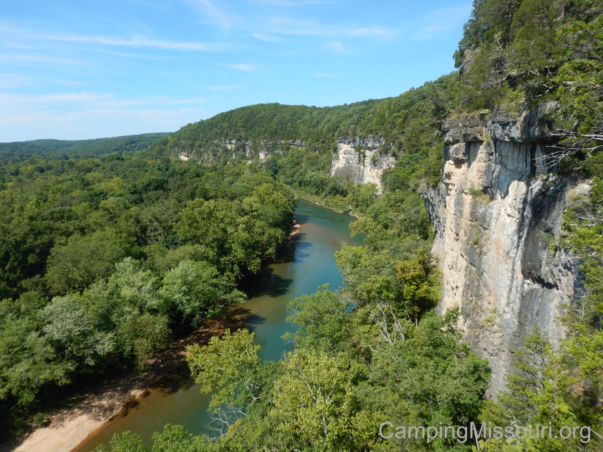
The biggest draw of this trail is Vilander Bluff, over the Meramec River. Rising up 200 feet, it is the tallest section of bluffs along this popular waterway, and is certainly an impressive sight to see from either above or below. Looking at a map of the area and the path of the river, it is a pretty tight curve that swings around. I appreciate imagining how over centuries the Meramec has been wearing away at the hillside, carving the rock face into the stoic vertical plane that it is today. Imagine a tall hill, missing one half, and that is what you will find at Vilander Bluff.
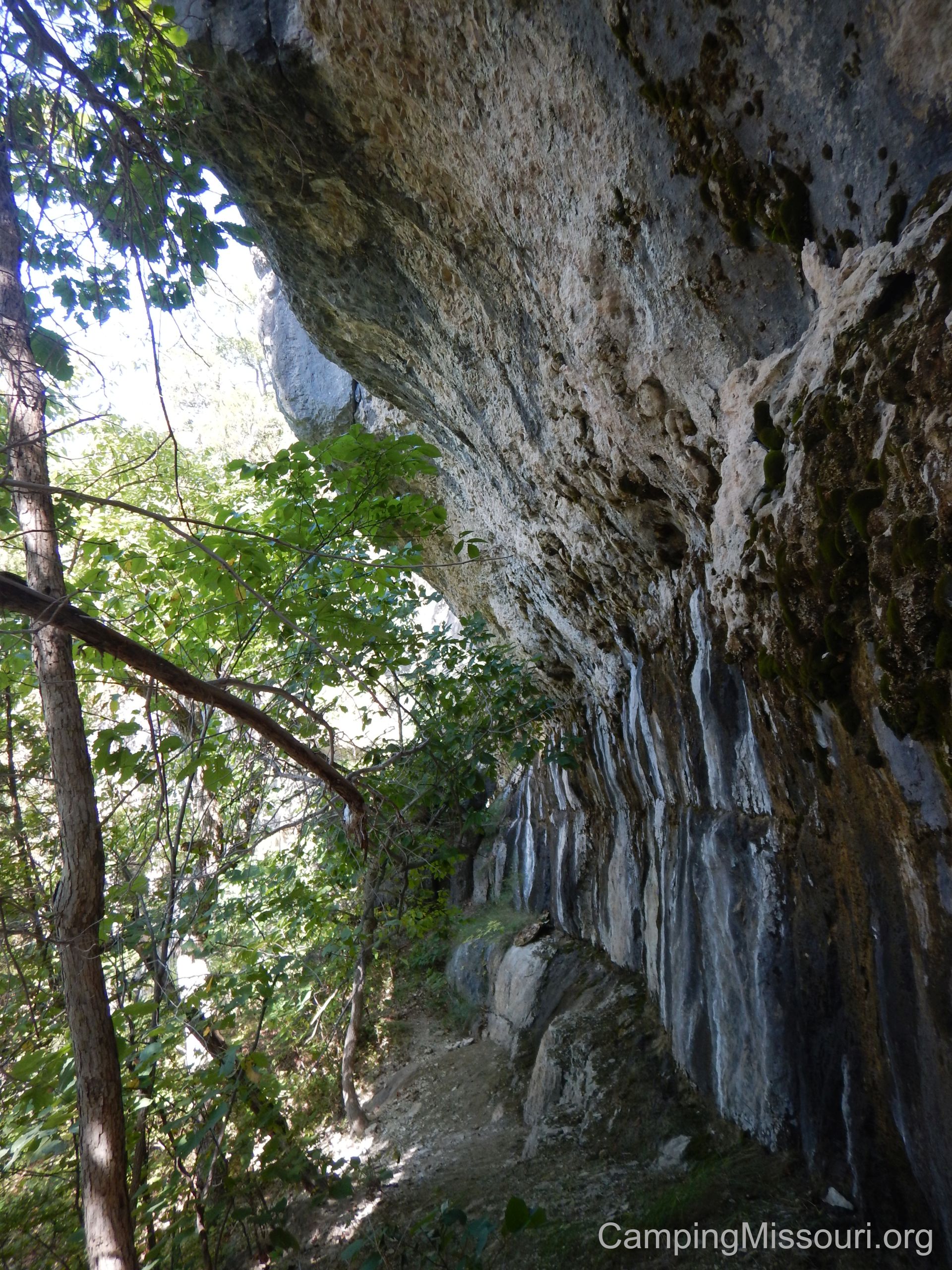 Up the hill just slightly from the primary overlook is what I can only describe as a mountain pass that goes along the face of the bluff. Curving around against the exposed rock, it takes you on a short and sweat inducing narrow path to a couple other scenic overlooks. Not for those without sure footing or anyone with a fear of heights, as it will really remind you that you are hiking against the face the tallest bluffs around, but worth the view if you can traverse it.
This area is actually under the jurisdiction of the Missouri State Parks system, and is a part of Onondaga Cave State Park. Situated between Onondaga and Meramec State Park (approximately), it is a worthwhile day trip for anyone visiting the area. This trail is also maintained by a group of Missouri Master Naturalists, an organization filled with people who take pride and care learning about and tending to the plants and ecosystems across our state. Certainly a group that I appreciate for what they do and inspire in the outdoors of Missouri.
 What you need to know:
The loop trail does NOT take you to the bluff! It takes you near the bluff, up the hill from the bluff…but it doesn’t take you to it. My suggestion should you like to see it is to have a good map and a compass (and know how to use them) so that you can find your way out if you are off the loop trail for a while, wandering around the hillside. Either that, or go with someone who has been there before and knows where it is in relation to the trail. The first time I hiked this trail just recently, a friend of mine who came along with us knew where it was from previous experience, so he was able to show the rest of us. I would not recommend going down the hill from the bench without knowing your destination AND knowing how to get back to the trail.
 It isn’t a long trail, but just about the entire thing is pretty rugged. Taking you along a path naturally embedded with rocks and tree roots, it certainly reminds you that you are traversing a hill that has seen the wear and tear of the elements, washing away some of its layers of soil over time as it stands above the other nearby topography. Just think of it as “getting your money’s worth” in a short distance.
I would be foolish to not mention that in this area, as well as any overlooks, use EXTREME CAUTION when near the edge of any drop-off. The distance to the ground and river below is something that a person would not walk away from, where the worst to happen. Please be careful when hiking and exploring in this area.
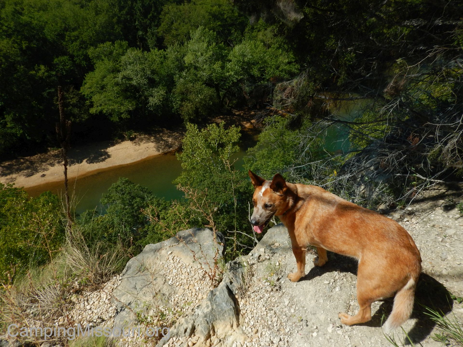 It had been a pretty adventurous weekend, but Max and I needed to spend more time out in the forest. Vilander Bluff was a great choice, and a place that I will have to return to in the later months, as I am sure the spectacular view that exists there will be even more amazing when the leaves are changing and the canopy that shrouds the hillside is opening up to allow an even more impressive panorama. Put this one on your list, learn what you need to know about the area, and make a trip out to the tallest bluffs over the beautiful Meramec River!

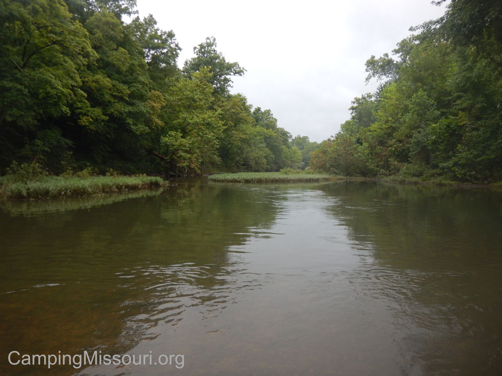 It was the weekend of the 48th Annual Operation Clean Stream (Yes, FORTY EIGHT YEARS) put on by the Open Space Council for the St. Louis Region. They are a powerhouse non-profit that organizes a massive cleanup of the Meramec River watershed every August, along with other conservation and restoration projects in the St. Louis area. The main cleanup of the weekend is held on Saturday, spanning the length of this popular river and the tributaries that feed it, with volunteers at multiple sites spending their morning picking up trash and pulling tires out of the mud of miles of riverbank. We were on the Lower Meramec, with our main base of operations at Arnold City Park, working with the Mighty Arnold #211 Stream Team. My crew was cleaning a site near Interstate 55 at the Lower Meramec Trails, in St. Louis County just off of Meramec Bottom Rd. It turned out to be a very successful day for my little handful of enthusiastic volunteers, spending a couple hours filling up the back of a full size truck with green mesh bags of trash, four tires, two plastic 50 gallon drums, two coolers, and a couple other large pieces of debris.

Arnold City Park, on Saturday. (Picture courtesy the Mighty Arnold Stream Team #211)
It was a Saturday that saw a couple thousand volunteers take to the forests along the Meramec River to improve the health and beauty that it flows through, improving the quality of life for us and our local environment. Thank you to everyone that is involved with this incredible event!
But THIS post is about the the day after…
Early the next day on Sunday morning, we found ourselves in the parking lot of a local bank in the little Missouri town of Irondale. A spot on the map along Highway M in Washington County, Irondale is home to just under 500 people, spread out through the hills to the east of the Big River. The Big River itself is a tributary of the Meramec River, joining its waters south of Eureka, MO, and having the distinct quality of being a northward moving waterway. It starts in Council Bluff Lake, and drains a watershed of 955 square miles along its 145 miles of flow. A good friend of mine kayaked the length of it earlier this year and documented his journey. You should check it out here, at Big River Traverse.
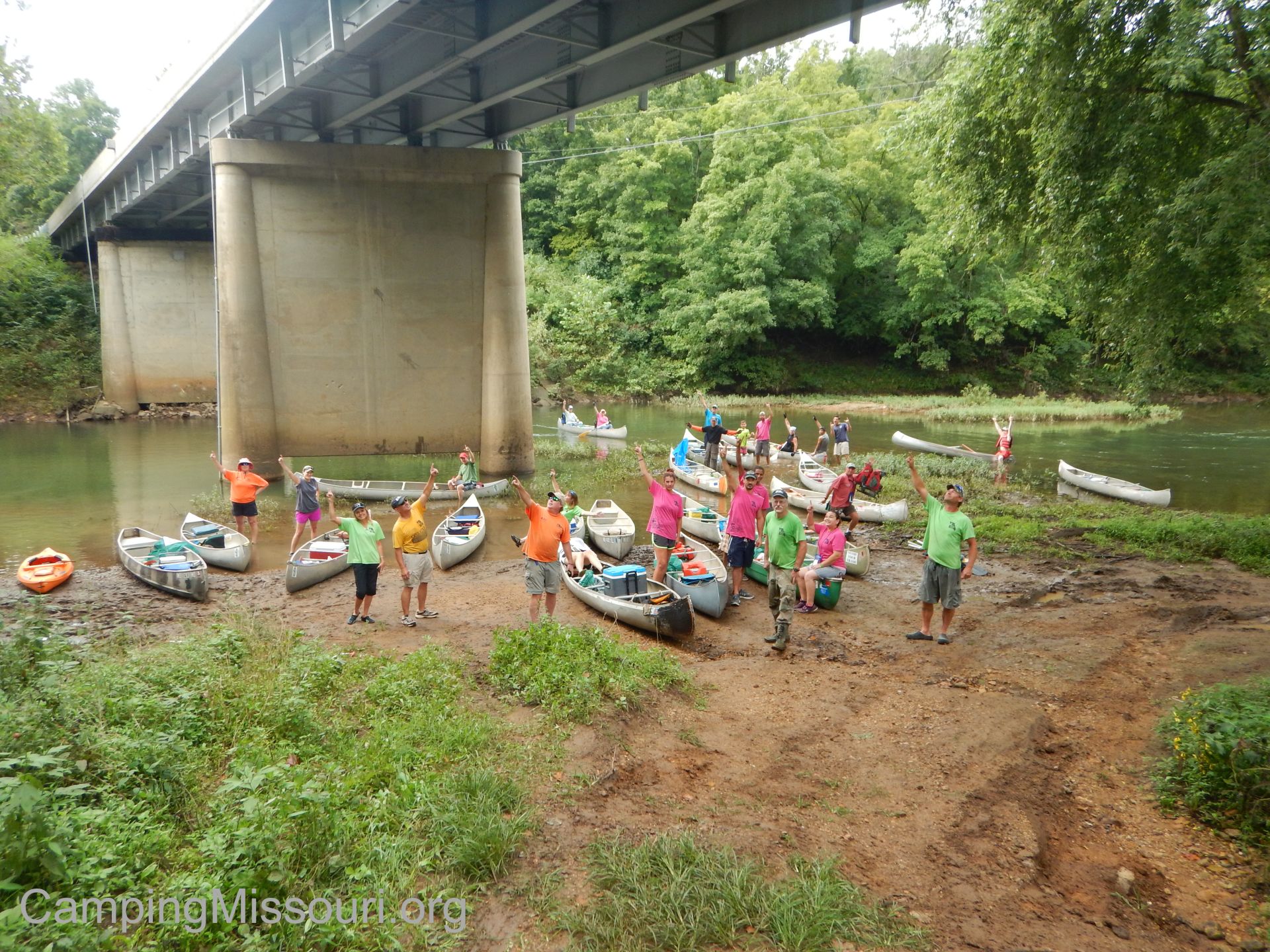
Rockstars, every one of them!
So after all the invited Stream Teamers arrived that would be floating on about 7 miles of the Big River, we shuttled a few vehicles, and then drove to the access off of Highway U just to the west, and start loading canoes and gear into the water. We ended up with 20 canoes and a kayak, and our mission today was to remove as many tires as we possibly could from this waterway. This river tends to be somewhat ignored by your typical recreational floaters, besides the places closer to Washington State Park and beyond, but it is a special river to those that live within its reach and we planned on showing it some love over the next few hours.
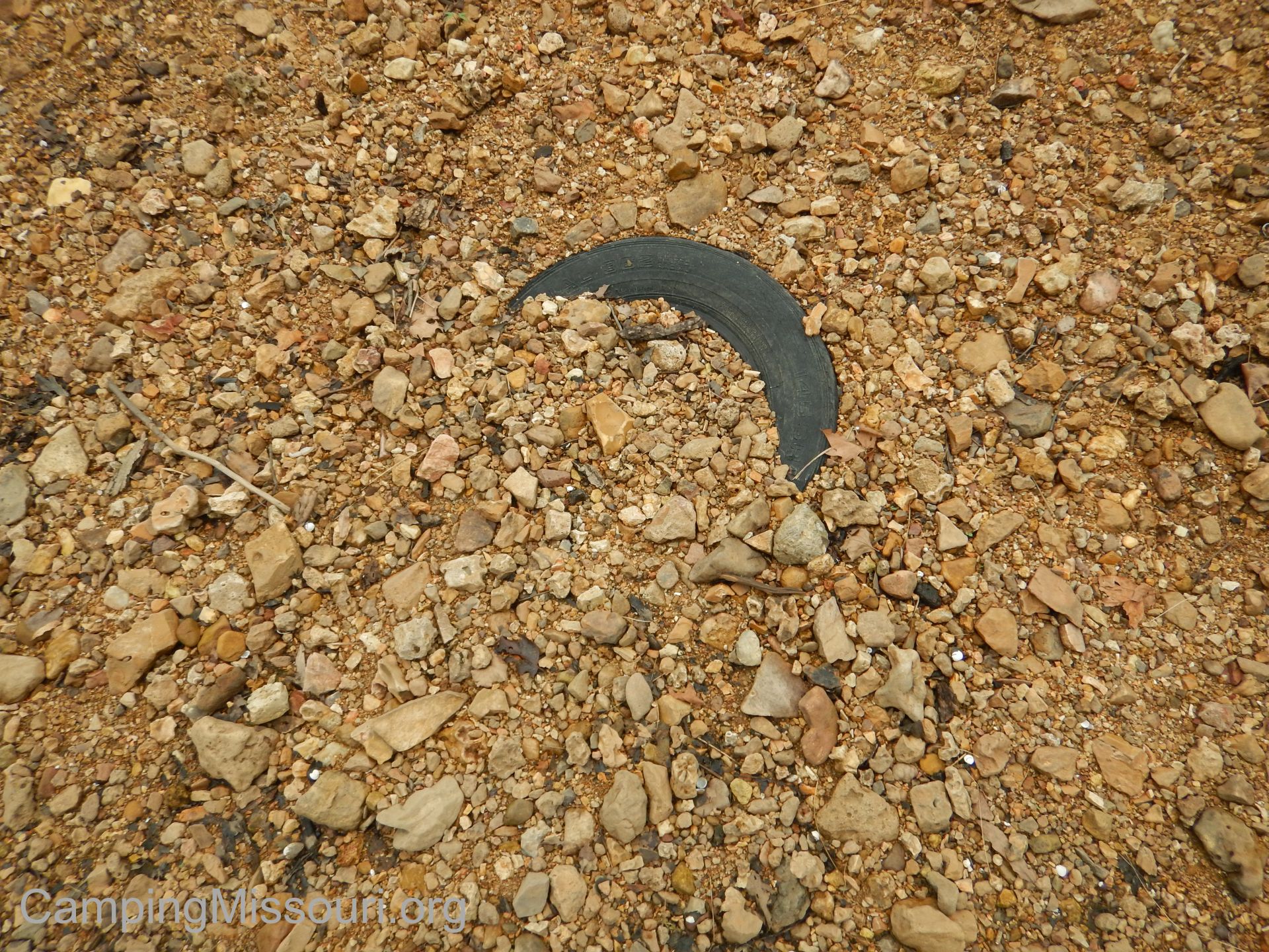 We finally got ready to go, having shuffled some more vehicles back to the center of town, and set off. 21 boats, heading down this narrow and lively river. It wasn’t long before we started to find the remnants of human influence, stopping to remove embedded tires and random pieces of metal and textiles from the gravel bars along the way. It was overcast and cool, but not too frigid, with the sun peeking through minor openings in the clouds now and again to remind us that somewhere on this 75 degree day it was actually still August in Missouri.
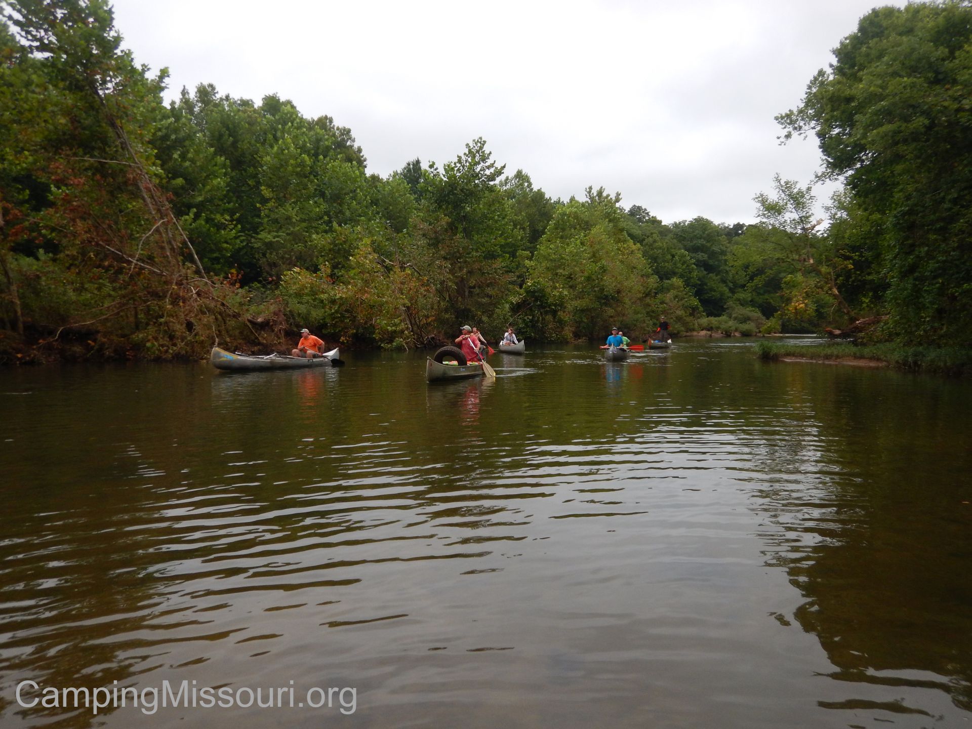 We made our way downriver, spreading out as we each stopped along the bank to gather whatever debris we spied, or to float above the pools that hid moss covered tires in their depths, dropping a hook to grab it or jumping straight into the water to pull it from the mud and put it into a canoe. We even came across a couple tractor tires and worked as a group to get them up and out, these giant abandoned behemoths of rubber and steel, sleeping away their days in a place they don’t really belong.
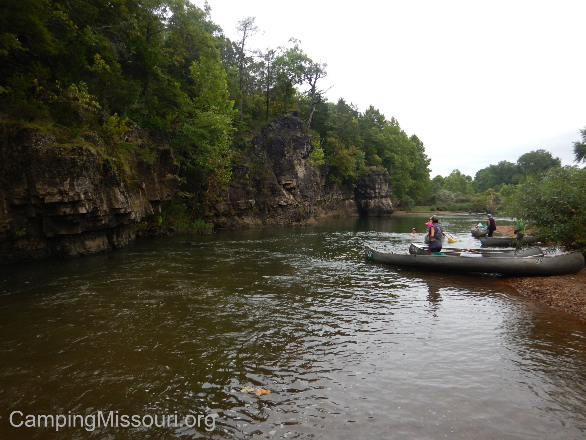 After a few hours and a few miles we were working our way to capacity, tires and metal mounding up in unique piles within the gunwales of our boats, so we stopped for lunch on a gravel bar just across the river from some low lying bluffs where the water has been carving its elbow into the rock face for possibly centuries already. With elderly cedars clinging to the ledges, and pools below them likely filled with boulders and mammoth fish, these cracked and weathered bluffs are surely a testament to the power and importance of the water, and to the relationship of the natural materials that make up everything around us. For just a short while, we were witness to a place that is rarely seen by that many people, and I think there is a sacredness in that. The rivers and forests unseen is one of my favorite motivators to go into the outdoors of Missouri. The natural world along the river down in the woods, surrounding this gravel bar that we happened to decide to have a picnic on during this cleanup float, reminds us all in our shared moment of beauty the reason why we are here and what we are here to do.
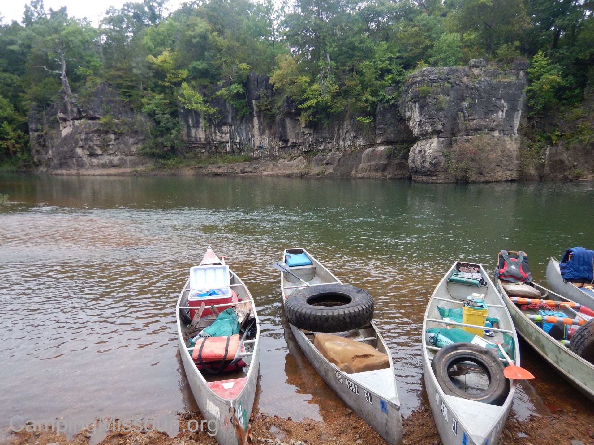 So we finish lunch and we carry on, looking still for the things that don’t belong so that we can take them with us from this river to put it back to how it should look. We finally get to a low water bridge probably about 5 miles from where we started, unloaded all our tires and trash, and portaged our watercraft to the far edge on the other side of the road. With the canoes emptied we started out again, after a couple pictures of our pile of treasure and the worn but satisfied faces that collected it. The pile would be removed and taken to where everything can be properly disposed of in the next few days, so we carried on down the river with our now empty boats, searching for more bounty.
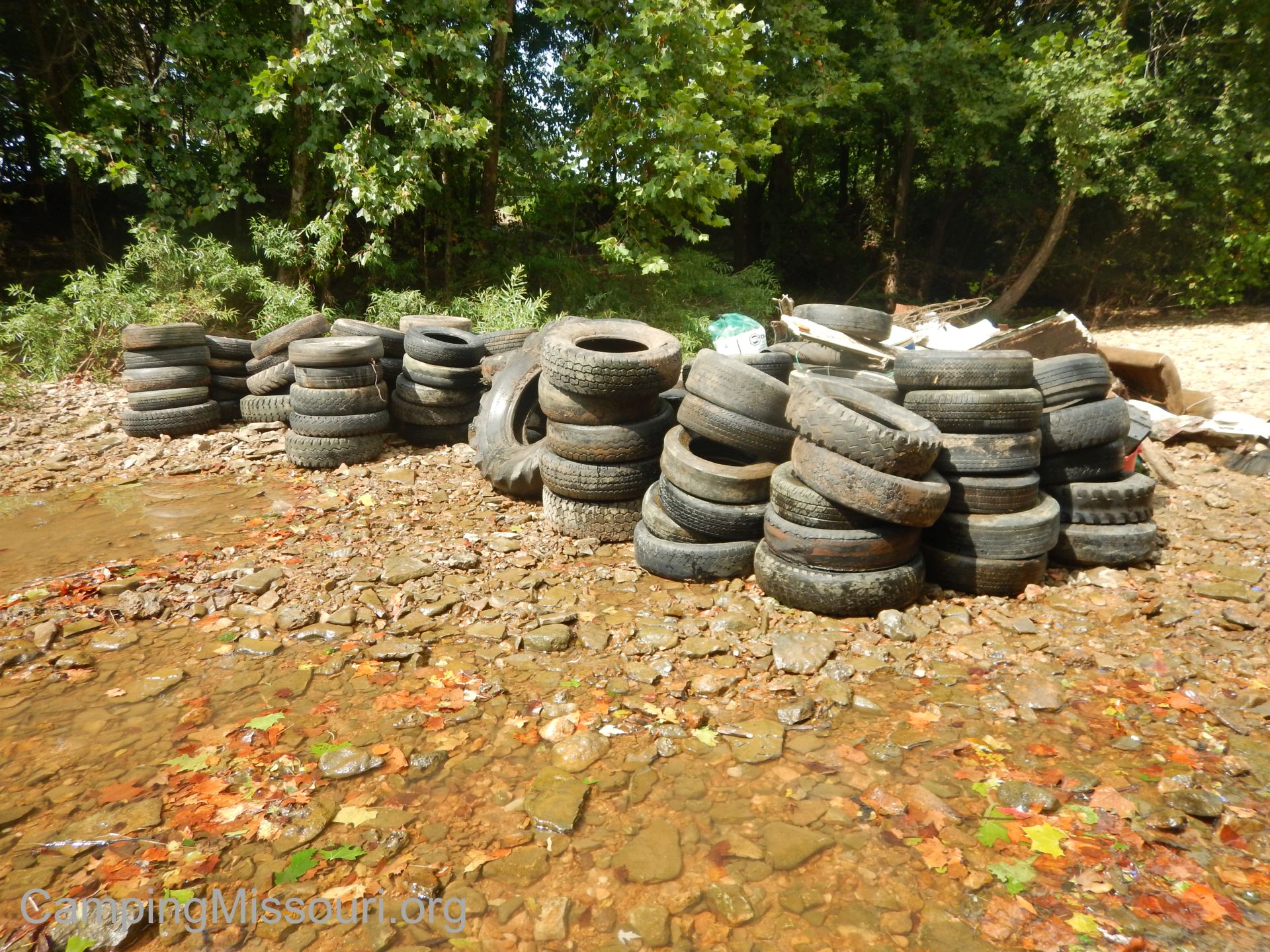 With just a couple miles left, we found a few more tires and pieces of trash, collecting what we could as we neared our take-out spot. Coming closer to Washington County 511, way ahead of us after a wide turn in the river, we stopped paddling for the most part, drifting slowly toward the end. It is late in the day, near 5 pm and at least 7 hours since we got on the water, but we find ourselves wanting to absorb as much of the beauty of this place before our journey is over and we are heading back to the asphalt and buildings and congestion of the city. Here there is subtle movement of all things, swaying and flowing in the direction of the breeze and whichever way is downstream, and there is a quiet that can’t be found in more populated places. This last short stretch of river is burned into our memories so that we can hear the peace that it holds, and remember the natural wealth of energy it inspires, during the days and weeks until we get to visit again.

My son, Eli, the canoe pilot!
All in all we removed over 150 tires and a ton of random debris from about 7 miles of the Big River, between 20 canoes and a kayak. 20 canoes and a kayak piloted by some of the best people I have ever met, including my own son, who at 14 years old and full of independence, rode by himself in his own canoe the entire length of the float, filling it as he traveled with tires and trash and proclaiming his spot among these great river rats that we are lucky enough to get to spend occasional weekends with. Thank you to all the Stream Teamers that were a part of this great trip, including Kallan from Planned Spontaneity, a hiking blog that YOU should definitely check out! I can’t wait until the next one!
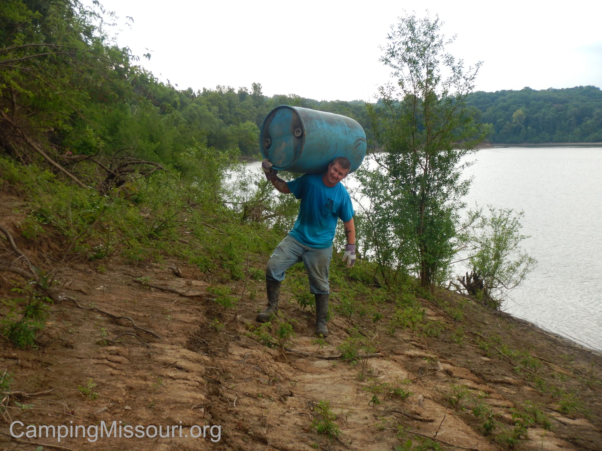
Me, on Saturday, along the Meramec River.
 Well as you probably know, I live in the St. Louis area. It is where I spend most of my time, and the place that all my adventures extend from. A lot of those adventures happen in St. Louis County Parks, as I am limited by distance and time and gas money most days in how far out into Missouri I can get. So on a Monday off, Max and I agreed that it was time to hit a new trail, just recently completed, out in the southwest corner of St. Louis County. We were headed out to the Al Foster Trail, in Wildwood, MO, to check out the Bluffview Trail!
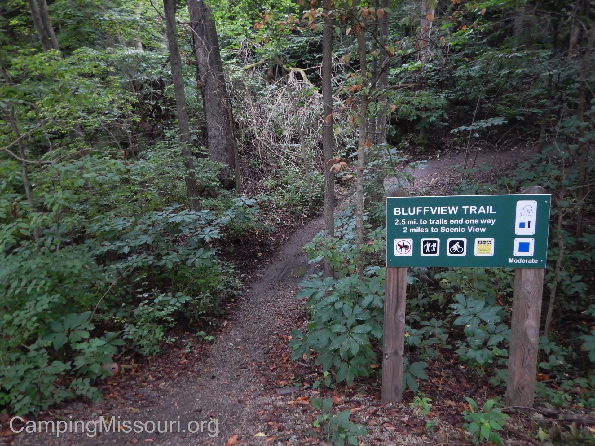 The Al Foster Trail is a multi-use, flat, point to point path in Wildwood that is a favorite of bikers, joggers, and walkers. It runs from Glencoe through Sherman Beach, along the Meramec River, and is connected to a few different trails along its length, just west of Castlewood State Park. The Bluffview Trail starts about half a mile east down the Al Foster Trail from the Glencoe trailhead at Grand Ave. It is a 2.5 mile point to point trail that goes to an upper parking lot at the top of a hill above the Al Foster Trail and the Meramec River.
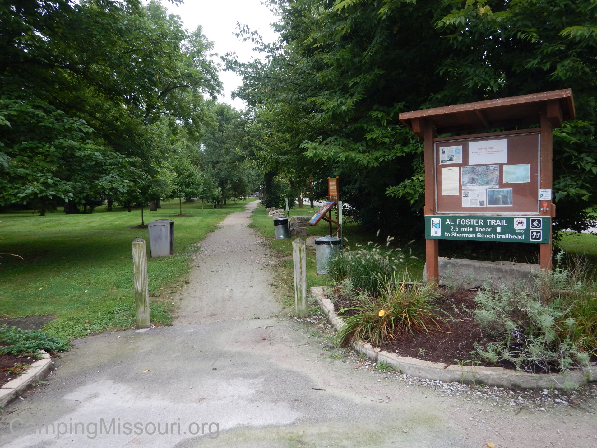 How to get there:
From the interchange of Interstate 44 and 270, take 44 west for about 11 miles to Highway 109 (exit 264). Make a right and take Highway 109 north about 3 miles to Old State Rd. Make a right onto Old State Rd., and then the first right after that onto Washington Avenue. Washington Ave. turns to the right a little ways down, and becomes Grand Ave. The parking lot for the Meramec Greenway and the Al Foster Trail will be ahead on your left.
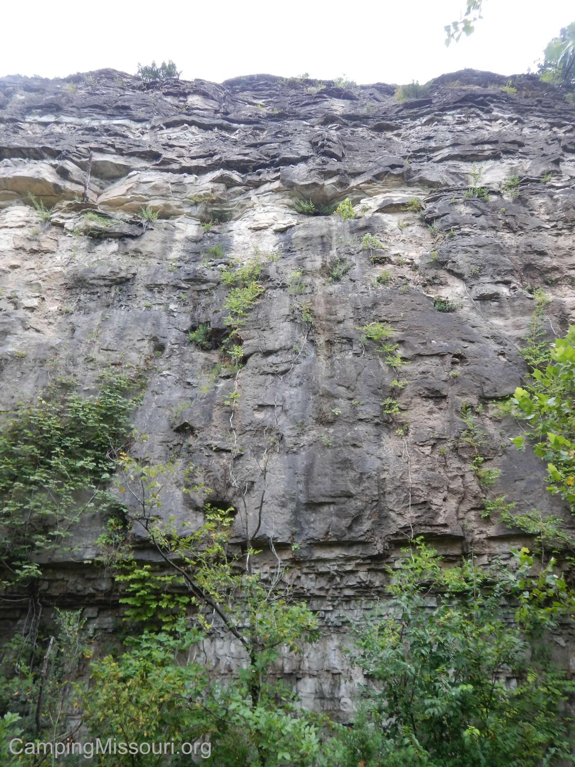 The trail from the parking lot continues down Grand Ave toward the Meramec River. When it splits off, take the fork to the left. The starting of the Bluffview Trail is probably not even half a mile down on the left hand side. You will know you are almost there when you pass the tall bluff face on your left.
The Bluffview Trail splits off into the woods, heading north away from the Meramec River into the Packwood area, and follows the edge of the hill. It eventually goes down into the river bottom woods through paw paw trees, young maples, and giant oaks and cottonwoods before pulling a U-turn and meandering its way up the hill and through a drier and more cedar filled upper forest, and eventually to the scenic overlook. There is then a half mile of trail on top of the hill to the upper parking lot. From the lower parking off of Grand Ave, it is 2.66 miles one way. My total hike there and back came to 5.3 miles or so.
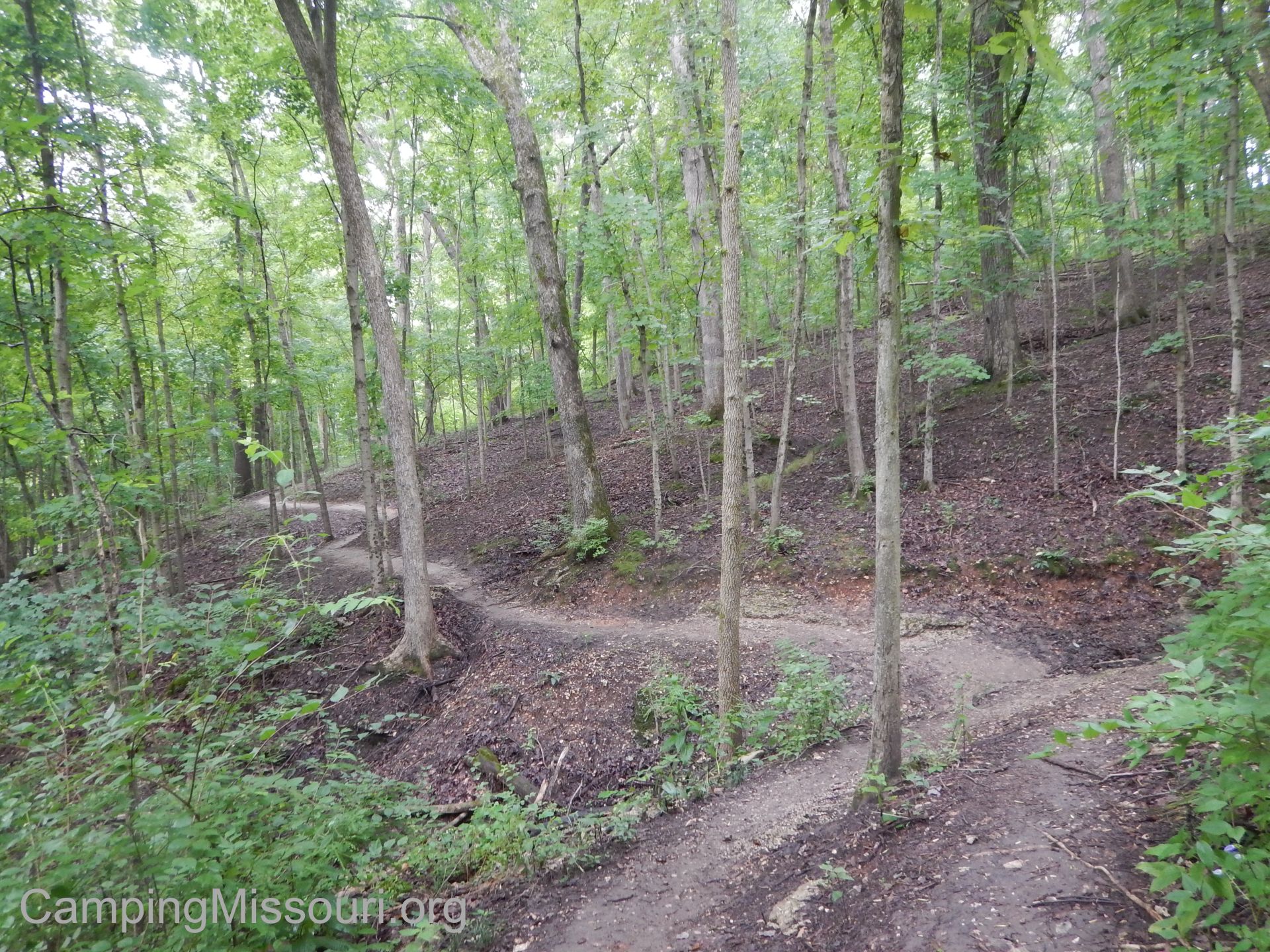 What I like about this trail:
It is always fun to hike a new trail, and this one is special because it is new to all of us! Having just recently been completed by enthusiastic and dedicated St. Louis County Parks workers, with additional labor provided by Americorp, this 2.5 mile stretch of path takes you through a section of woods that none of us are familiar with yet. Probably the newest trail in St. Louis County, it had the the feel of other favorite nearby areas, especially some of the trails in Rockwoods Reservation.
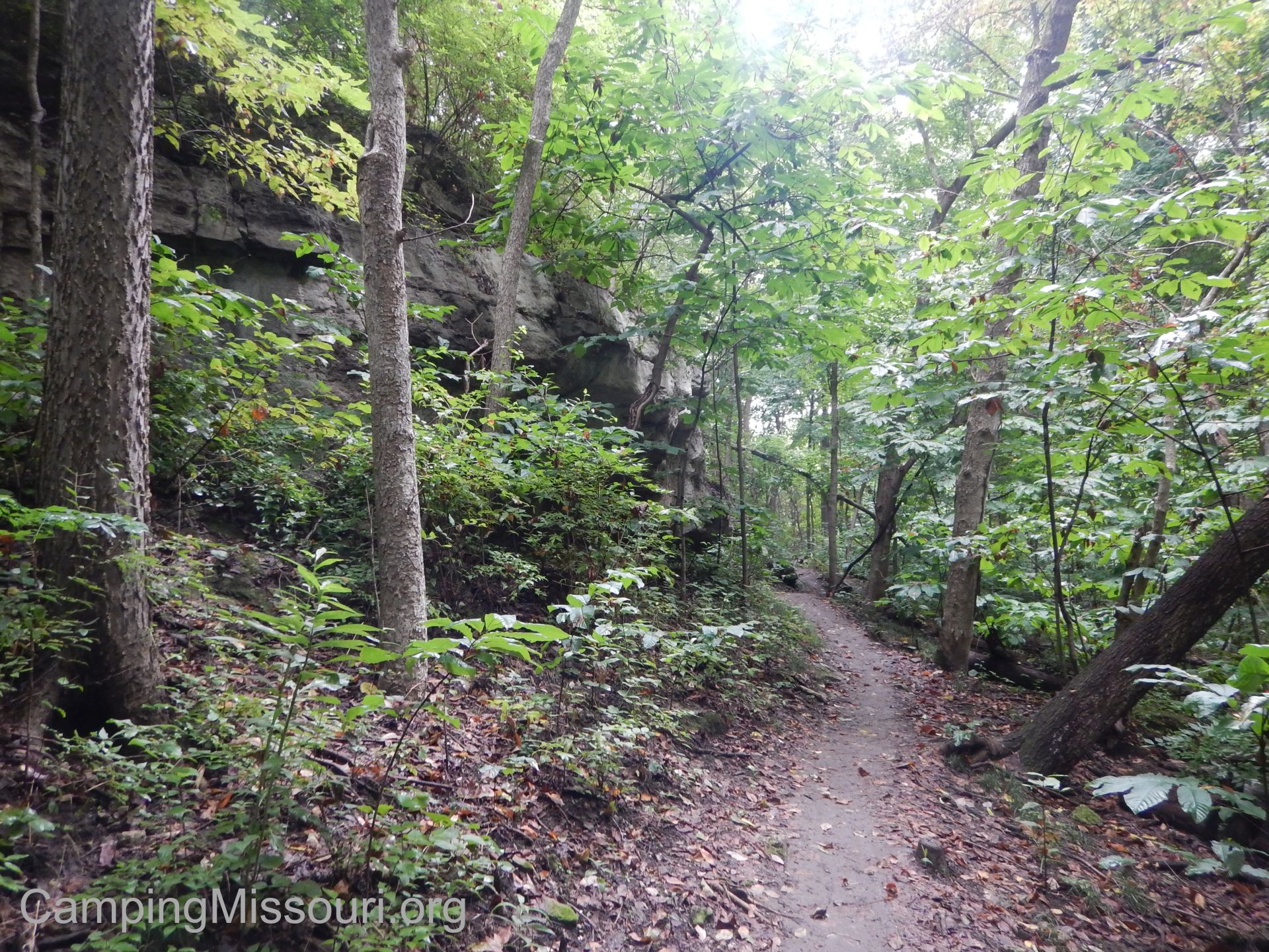 The path was in great shape, even after the rain we had the evening before. Hard packed earth single file trail cut into the hillside, it was solid and clear for the most part, beyond exposed rocky sections here and there and the occasional tree root. And even though it goes up the hill, it didn’t really have any noticeably steep parts, meandering its way slowly along toward the top.
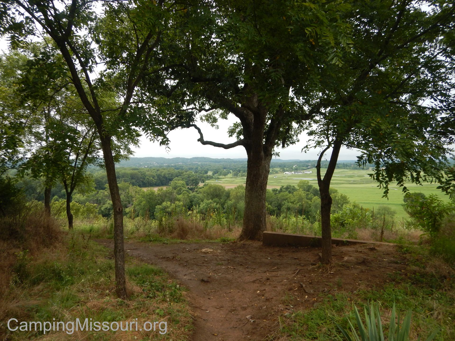 There are a handful of scenic places along the Meramec River in this area, and this one is no exception. Up on top of the bluff, it looks out into the river valley below to a golf course and private land between the surrounding hills. Quite a serene spot, up on top there, under a giant oak. There are also remnants of the former property owner’s home, with concrete fence posts and foundations throughout the woods along the ridge to the upper parking lot, including what I can imagine is what used to be their driveway. What a nice place to be able to have called home!
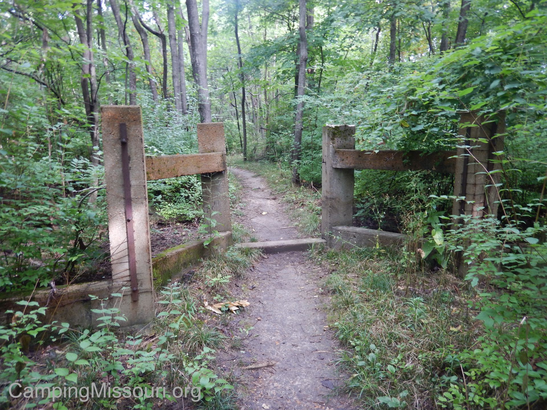 What you need to know:
This is a multi-use trail. Be prepared for mountain bikers zipping along, especially on the downhill run. Keep an eye out and yield accordingly to avoid any accidents. We all have different ways that we like to enjoy the outdoors, and it is best to work together to accommodate those different ways.
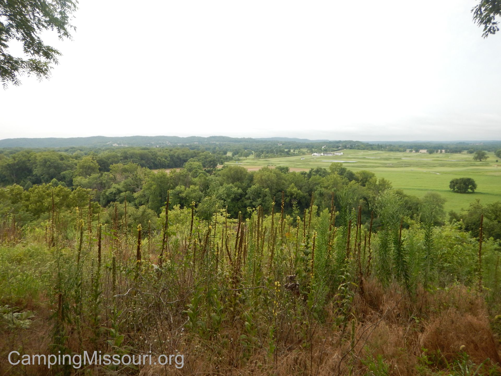 I would call this a moderate trail. The path was in pretty good shape, but there were a few rugged spots with exposed rocks and some muddy dips from water running down the hill and over the trail. Also, at just over 5 miles round trip, it has enough length to qualify for more challenging than “easy”. Bring some water and a snack, and prepare for a couple hours on the trail.
If 5+ miles is too far for your tastes, you can get a friend to go with you and shuttle one car to a parking lot on one end of the trail and start hiking from the other end. This gives you a 2.66 mile hike. I don’t actually know how to get to the upper parking lot, but I would imagine that it is farther down Old State Rd. Make an adventure out of it, and go find it for me!
 Any time spent on a trail new to me is a cool experience, immersing myself in a section of woods that I hadn’t been to before. The fact that this is a newly finished trail made it even more special. Max and I had a great morning hiking it, even surprising a raccoon playing on a fallen tree, spying a deer standing a bit up the hill from us, and passing a couple of turtles on our trip. The Bluffview Trail is one that you ought to check out if you haven’t already, taking you up to the overlook above the Al Foster Trail, down in a the Meramec River valley just north of Eureka, Missouri. A great addition to an area already blessed with a lot of enriching paths through the forest, that you should get familiar with!
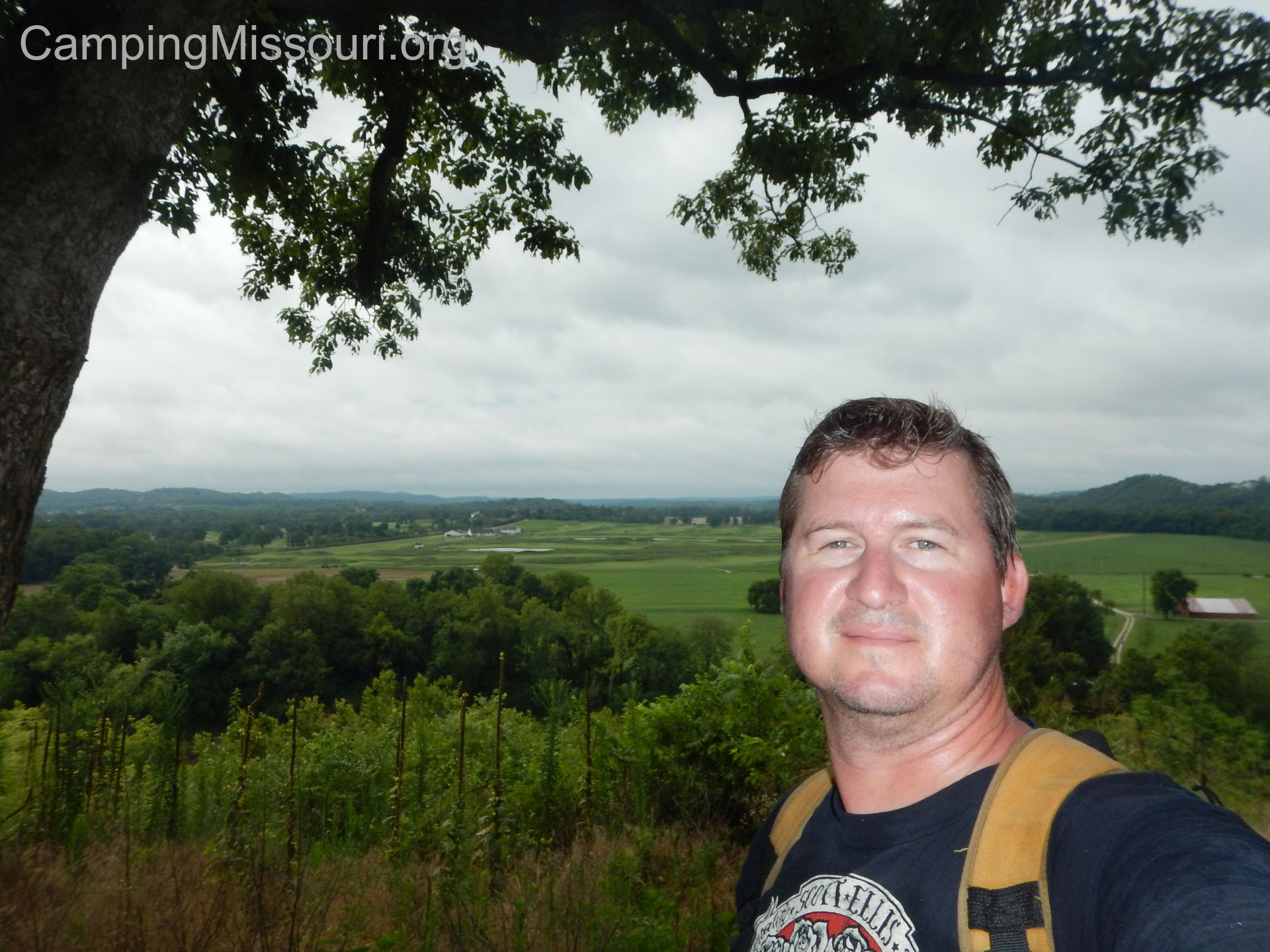
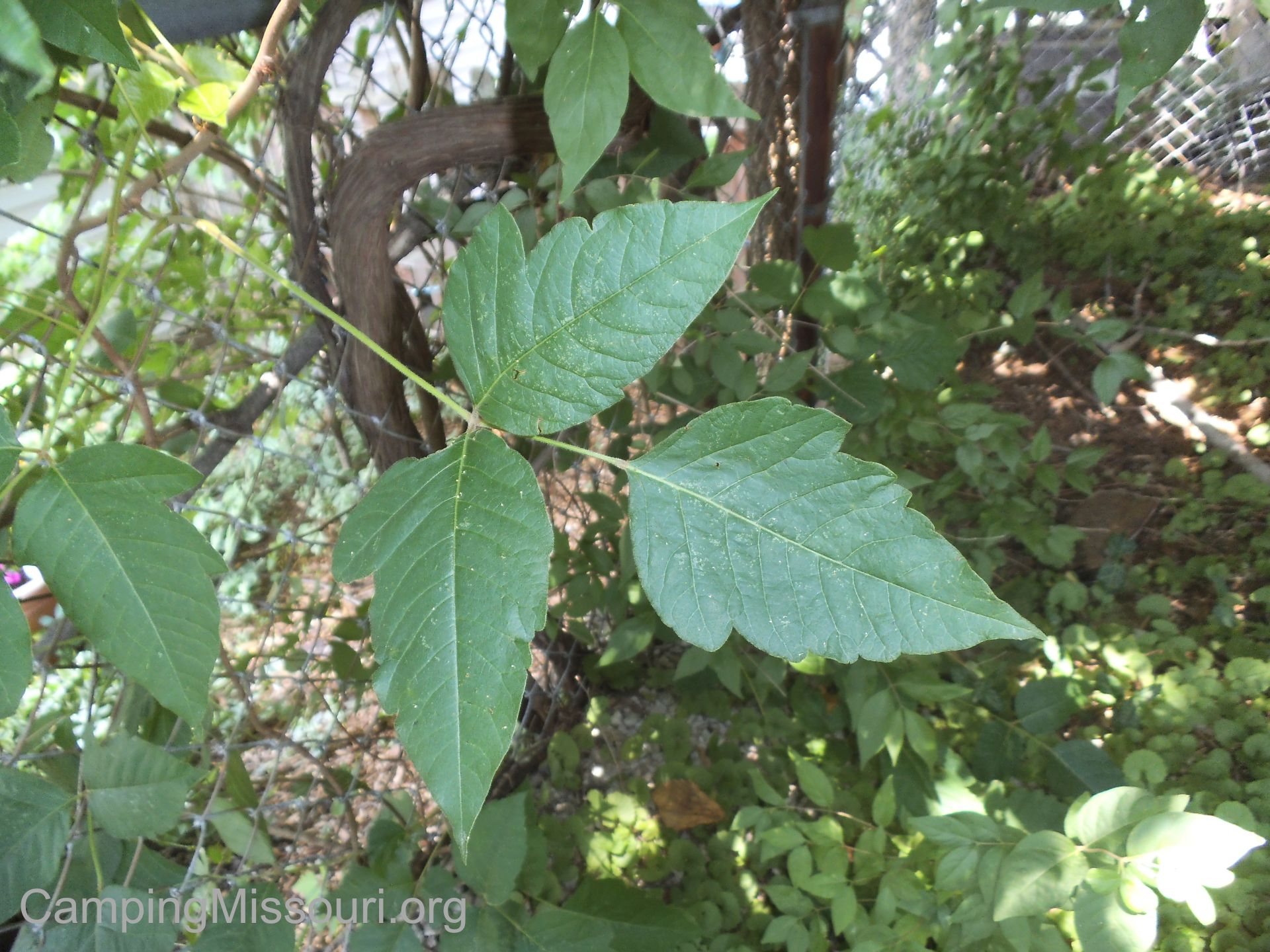 In recent years on this blog, I have written about how to identify Poison Ivy and some of the myths surrounding it. Now I am no expert by any means regarding the flora and fauna out there; no Missouri Master Naturalist…but I am particularly aware of the traits and habits of this native of Missouri woods and waterways because I have a very real sensitivity to the oil it produces. We have a regular and storied history…this three-leaved nemesis of mine. It is a rare summer for me to not get at least a line of rash on my leg or a couple of spots on a forearm, but thanks to some carelessness on my part a week and a half ago, I am currently suffering from the most severe case of Poison Ivy rash that I have had since I was a kid. “What a great opportunity to share a real experience of getting exposed and having a reaction to it!!!“, I thought…as I grasp for a silver lining thanks to my recent “luck”.
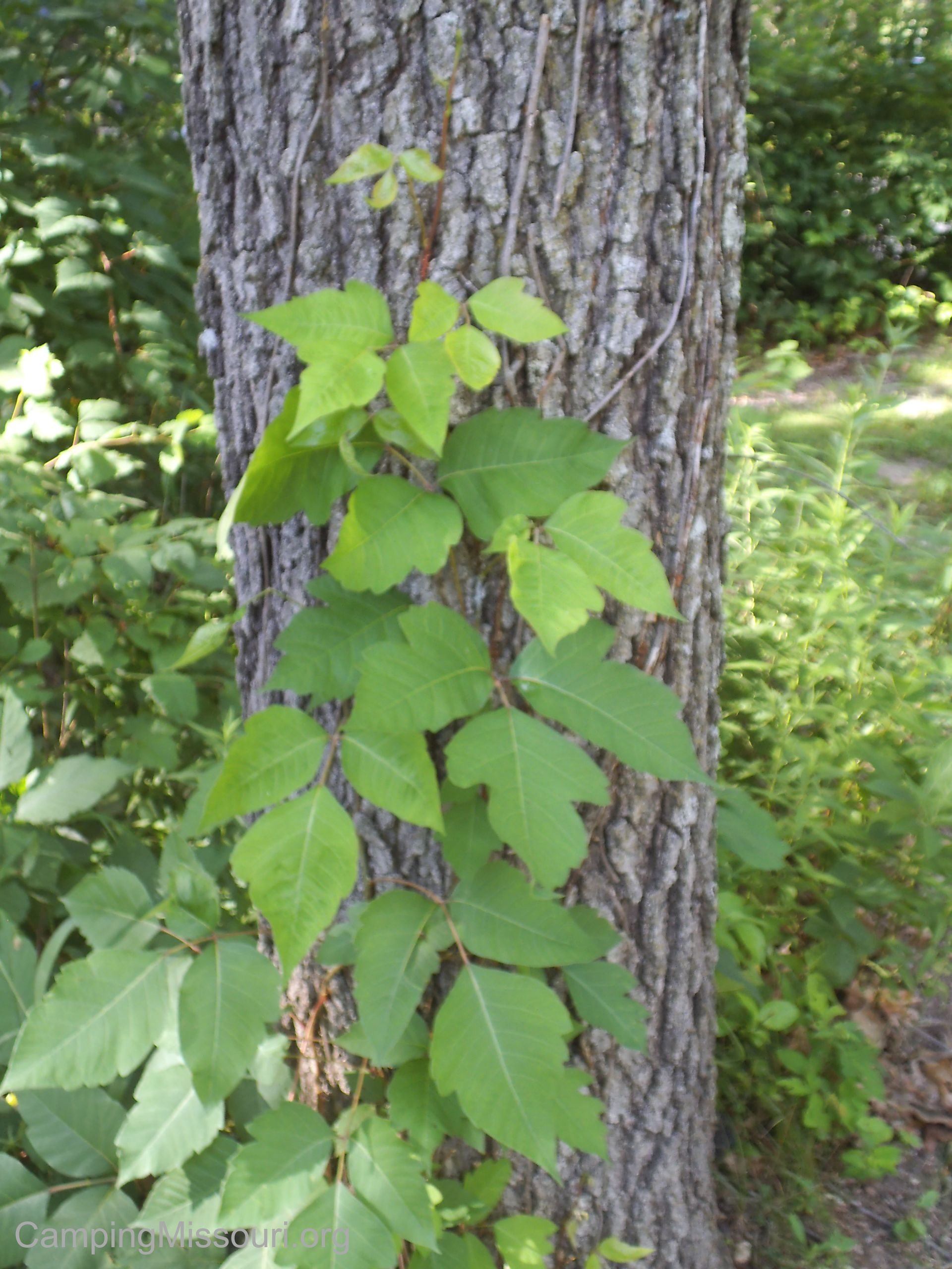 So Poison Ivy sucks…but it isn’t some sort of forest ninja that strikes without warning and leaves without a trace. Whenever I have gotten it, I usually have a pretty good idea of how it happened. It just takes a little cognitive examination about the last time I was in the woods and where I most likely got exposed. “Oh yeah, that patch of brush that I walked through around that fallen tree. Hmmm…gonna have to remember to scrub better after hikes.”
Now if you look up any medical website, you can come up with all sorts of information regarding how soon a person can start to see a rash from the Urishiol Oil exposure on their skin. Most of them say between one and four days. I would guess that it has a lot to do with the amount of exposure and other personal physiological factors at the time; metabolic rate, immune function and such. For me, because I pay attention to this aggravating plant, I find that it usually takes a good five days to see any reaction to it…sometimes less, sometimes more…but for the most part about five days. Other people have different reaction times and usually get it sooner, but I could probably mark it on the calendar as experienced as I am with this. Five days or so…and then the little red bumps start to appear…
 On this latest exposure, it happened during our camping trip over the 4th of July weekend. We had a great experience overall, getting to see the Castor River Shut-Ins and spending a relatively quiet and peaceful few days camping along the Castor River near Marquand, MO. (Poison Ivy is EVERYWHERE in Missouri! Don’t let this in any way deter you from visiting this gorgeous corner of our beautiful state!) I am always pretty diligent in keeping an eye out for Poison Ivy and keeping track of what part of me or those around me it may have touched. My aversion to it is so strong that generally I will establish a mental list of where I might need to scrub the most intensely when I hopefully soon get to a shower. This time however…I was careless and lazy.
Norton loves a good couch nap.
This is how I know it happened this time. One of our dogs, Norton (who never means any harm and just wants to be a good puppy), always feels the need to lift his leg when he pees. He sidles up to whatever vertical object may be nearby, raises that leg high in the air as if holding a karate kick, and then urinates fervently…as if to say, “I don’t care that my testicles are removed, because look what I can do!” So on this particular excursion, he was making a habit of walking slightly into the brush between our campsite and the river to leave his mark. Within that brush were sporadic amounts of Posion Ivy, hiding there among the tall grass blades and scattered plants. He was spending his bathroom breaks with the Urushiol randomly brushing onto the hair on his legs, and because he is a dog who appreciates comfort, he happened to lay down on my side of the bed at night before I got into the tent. All innocent and unaware, I then spent the next couple nights sleeping soundly with no idea that I had my arm across the outside of a sleeping bag that was dotted with the toxic oil, all the while moving around in my sleep and further exposing myself by spreading it all over me as I went through the motions of waking and preparing for the day. (Thank goodness I didn’t have it on my fingertips while putting my contacts in!)
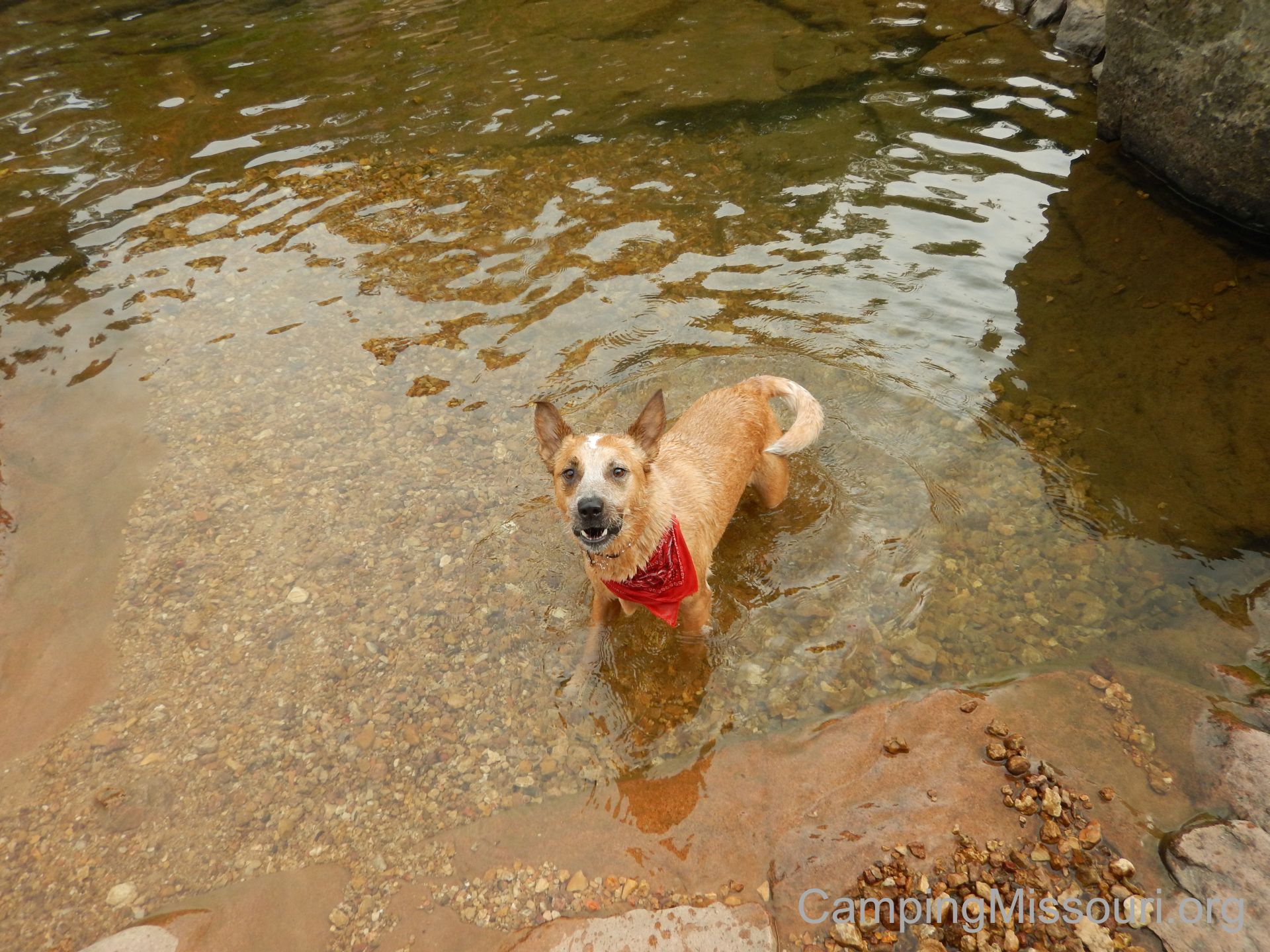
Max gives me attitude when I tell him “play time” in the river is over.
So in my thinking about this whole irritating period of time and trying to recount it to you, I thought that I would try to create somewhat of a timeline, starting with the day of exposure. Something that sort of describes what I and a lot of other unfortunate people go through, and maybe an opportunity to learn from if you have never been unfortunate enough to experience this sort of thing. Or maybe you can just appreciate the gross-out human experience that an allergic reaction to Poison Ivy can be.
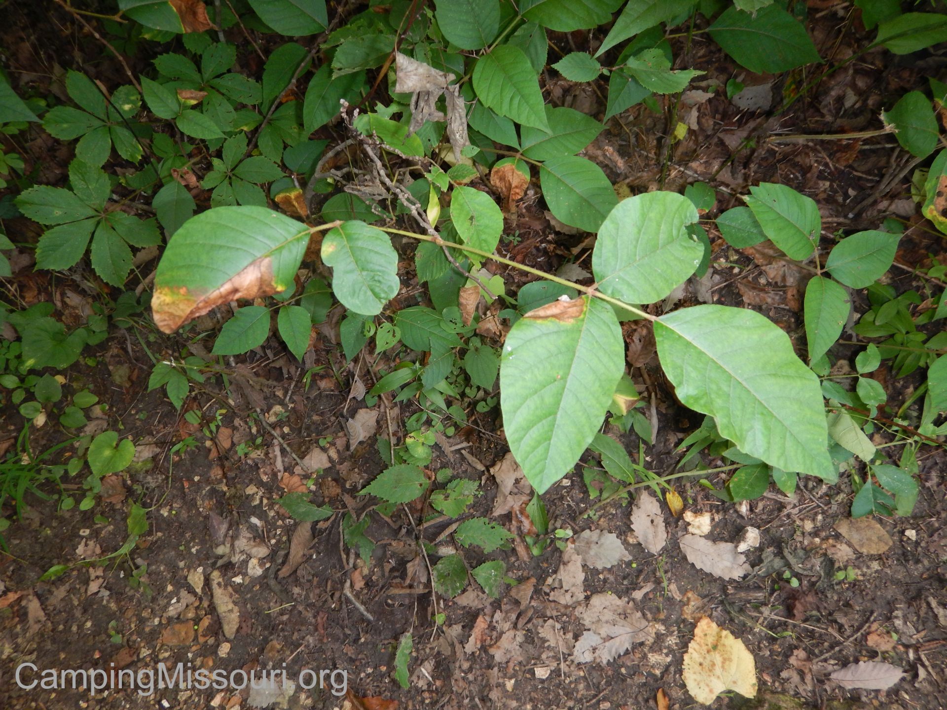 Day Zero would have probably been Friday night, the 3rd of July. It likely already had been tromped onto my side of the bed in the tent, and I went to sleep that night with no fear of what may be on my sleeping bag, in paw prints, waiting to get my immune system all angry a week later.
Day 1, Saturday, the 4th of July. A fun day full of adventure and relaxation and even fireworks from the next campground down the river that night, with no awareness of the irritation lurking silently around the corner. Slept in the same bed as the night before, likely increasing my exposure.
The next few days were spent returning home and going through the usual routines of life, getting up, going to work, coming home, going to bed, etc.
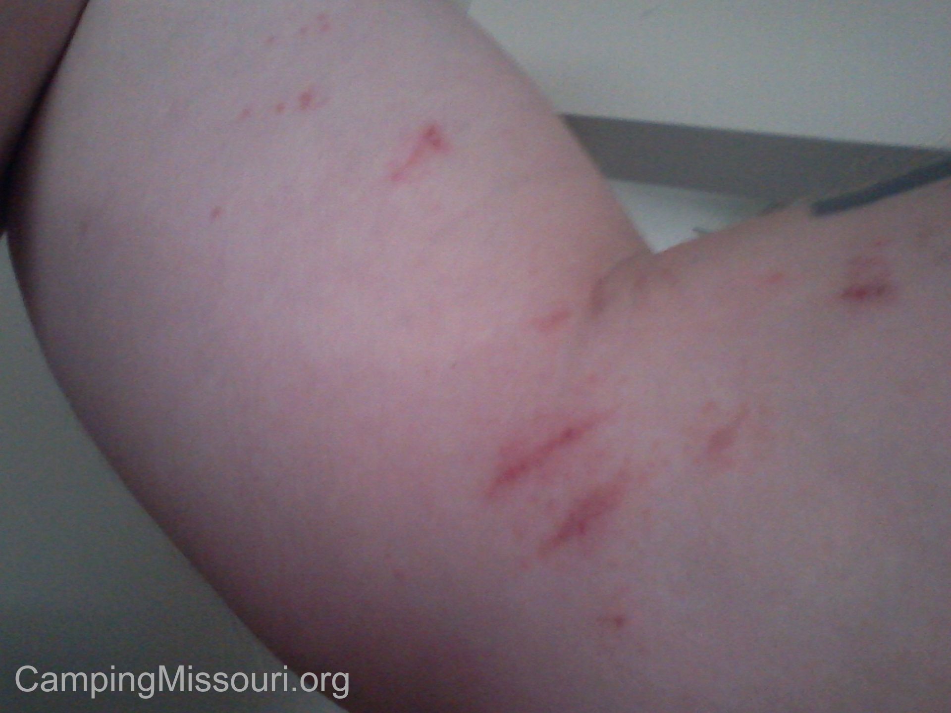
This is actually a picture from last summer, but very similar to how bad I get it about once a year.
It was on Day 5, Wednesday the 8th, that I happened to notice a couple of spots on my side and arms. Nothing too noticeable, just little red dots the size of pinheads rising from my skin in various places. “Great.” I thought, recognizing the signs, hoping that I wasn’t in for anything too terrible. I just resigned myself to keeping an eye on them and hope that they didn’t get worse. By this point the dogs had both been washed.
Day 6, random itchiness with little red dots showing up in more areas.
Day 7, Friday. That evening I noticed a more of a collectiveness to the red dots, like they were coming together in groups to form a rash. “The little jerks were working together!” Nothing too severe I thought, as by now the height of exposure should be apparent. If this is the worst it will get, then I can surely handle it.
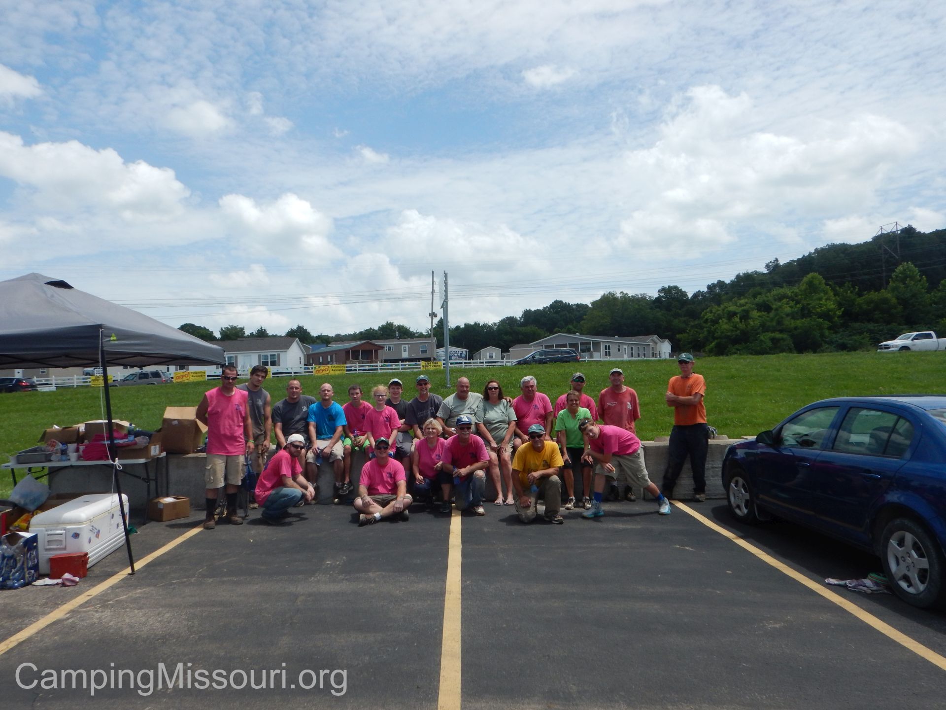 Day 8 and 9. Saturday and Sunday weren’t too bad in the way of increased rash. Saturday morning was spent at a Missouri Stream Team Cleanup in Festus, MO. I may have exposed myself to some there, but I didn’t see a lot of Poison Ivy along the creek we were working in and did a good job of cleaning myself off in the shower when we got home. By Sunday afternoon into the evening however, I could tell that it was getting worse. My stomach on the right side just above my waist was breaking into an obvious rash, and I was having increased itchiness and dots on both of my forearms.

Another picture from last summer. Makes me itch just looking at it.
Day 10, Monday. I woke up with a full blown rash on the right side of my stomach and collections of itchy rash on my forearms with just specks still on my upper arms. Today was going to suck, as it was forecasted to be in the upper nineties and we would be working outside. I smeared some Caladryl on the rash and went to work. Through the course of the work day, the stuff on my arms continued to itch, and the rash on my stomach through sweating and the abrasiveness of my shirt, started to blister and ooze. After my sweat soaked shirt had dried later in the work day, I could tell that the fluid weeping out of the rash on my stomach was saturating my shirt, leaving dried crustiness marking the fabric. Gross.
So surely this was going to be the worst of it, right? Surely it was going to dry up and start healing. Surely I would wake up Tuesday morning with a sense that I was on the mend. We can always hope for the best…but that wasn’t going to be the case this time at all…
To be continued.
 It was the weekend of Independence Day, and there I was with two extra days off and no real plan to do anything other than probably hike a trail each day and sit on the couch and watch TV in the evenings. I knew that I needed to take advantage of the long weekend, come up with a destination, and pack up the car and the dogs and hit the road for a couple days out in nature. I am a big fan of the creeks and rivers near Fredericktown, MO, as they are all gorgeous and rugged, and I knew that there were a couple campgrounds down along the Castor River that I had never been to before. So I picked one at random Friday morning, made a phone call, and by that afternoon we were headed out to Marquand, MO and the Castor River Ranch Campground.
 How to get there:
From South St. Louis County, take Interstate 55 south for about 22 miles to exit 174b which is US-67 South to Bonne Terre/Farmington. Take US-67 south for about 57 miles, through Farmington and then through Fredericktown. A couple of miles South of Fredericktown, make a left on State Highway A. Take State Highway A for almost 10 miles to State Highway M, just south of Marquand, MO. Make a right on State Highway M, and then after a very short distance, make a left on State Highway DD at the top of the hill. After about a 2 miles on State Highway DD you will cross the Castor River. Castor River Ranch Campground will be just after the river on your left. Another option is the DD Highway Campground on the right, which is a campground I plan to eventually visit.
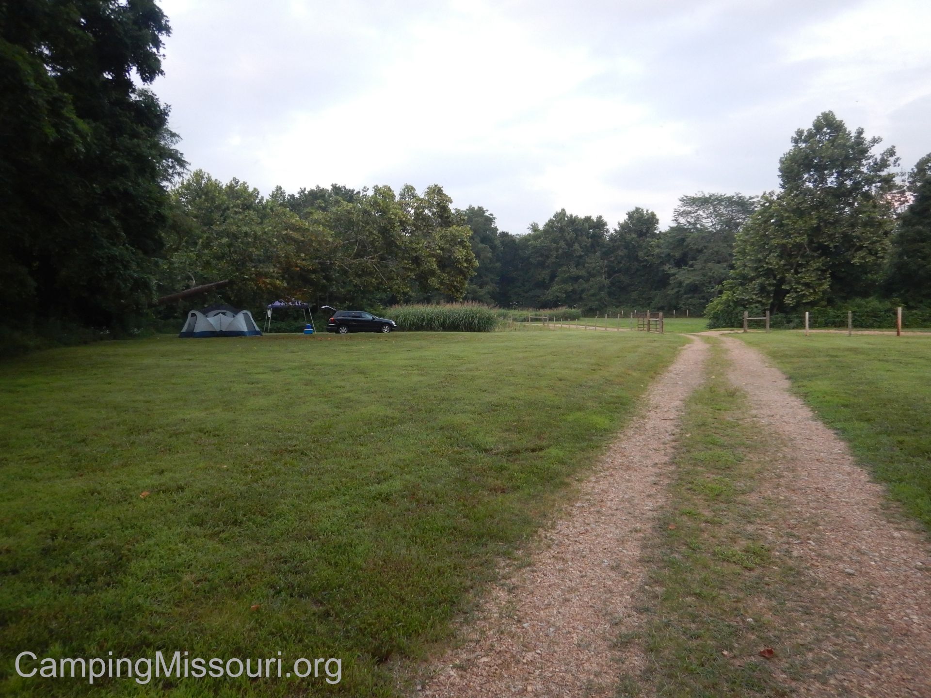 What I like about this campground:
I think what really stood out to me was the relaxed style of hospitality that Jon and Mary projected in the handful of interactions I had with them. Like innkeepers at a bed and breakfast, they had a flexibility and welcoming spirit, and seemed experienced and enthusiastic at finding ways to accommodate the people that chose to stay at their little campground next to the Castor River. They even allowed us to pitch our tent at the far end of a field, giving us a bit of privacy and quiet away from the main campground area that might be hard to get from some of the bigger resort campgrounds or the state parks. A personal touch, and we appreciated the pleasant attitude with which they conducted their business.
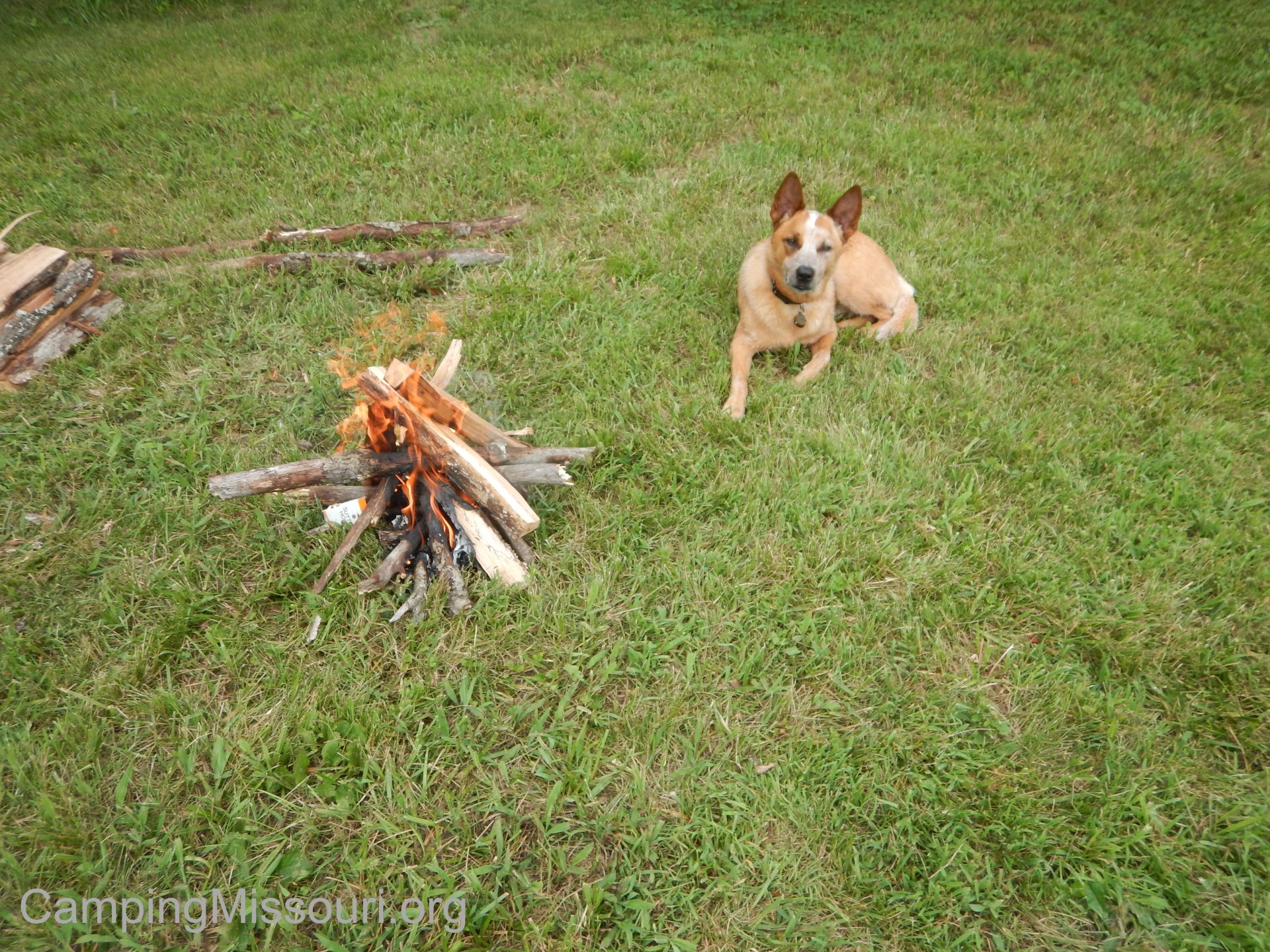 This is a family and dog friendly campground. With kids playing all day in the river off the gravel bar next to the campground and dogs roaming around off leash, this is a destination for you if you want a relaxed family weekend enjoying the sun and the river. Max and Norton (our dogs) both enjoyed the lack of being tied up, and freely wandered our site, appreciating their ability to lay in the grass wherever they wanted. It was also nice to be in a campground where once the sun went down, so did the volume. Not much of a party crowd, other than the crickets and frogs singing away the evening, which is the way I find I prefer.
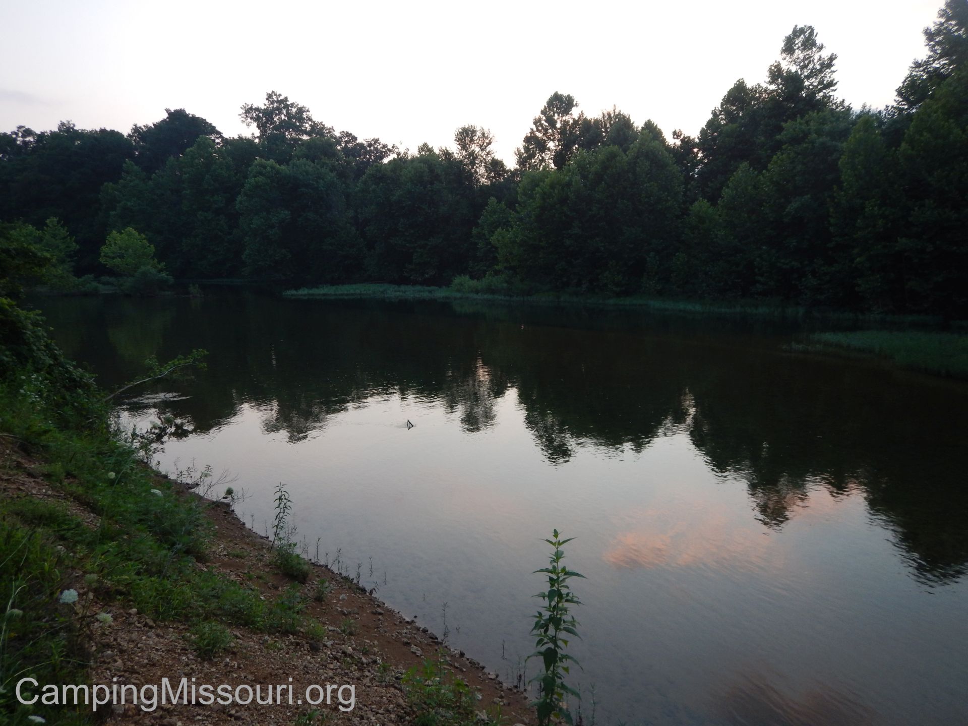 I think you can tell a lot about an outdoor enthusiast’s character through their willingness to give back to nature on a regular basis. Jon and Mary are active Missouri Stream Team members (Castor River Ranch Stream Team #3506) who hold regular cleanups along their beloved river, and are also participants in the Missouri Adopt-A-Highway program. Being advocates for the natural beauty and health all around them, their care for nature shows in the look and atmosphere of their little river front campground.
 What you need to know:
As this is a very dog friendly campground, you should be aware that you may get a visitor from another campsite once in a while, investigating what the tasty smell is wafting through the air from the grill over your campfire. Any pups that we encountered were friendly and kept a good distance, but just keep in mind that if you aren’t a dog person, then maybe this isn’t the campground for you (How could you NOT be a dog person?!?).
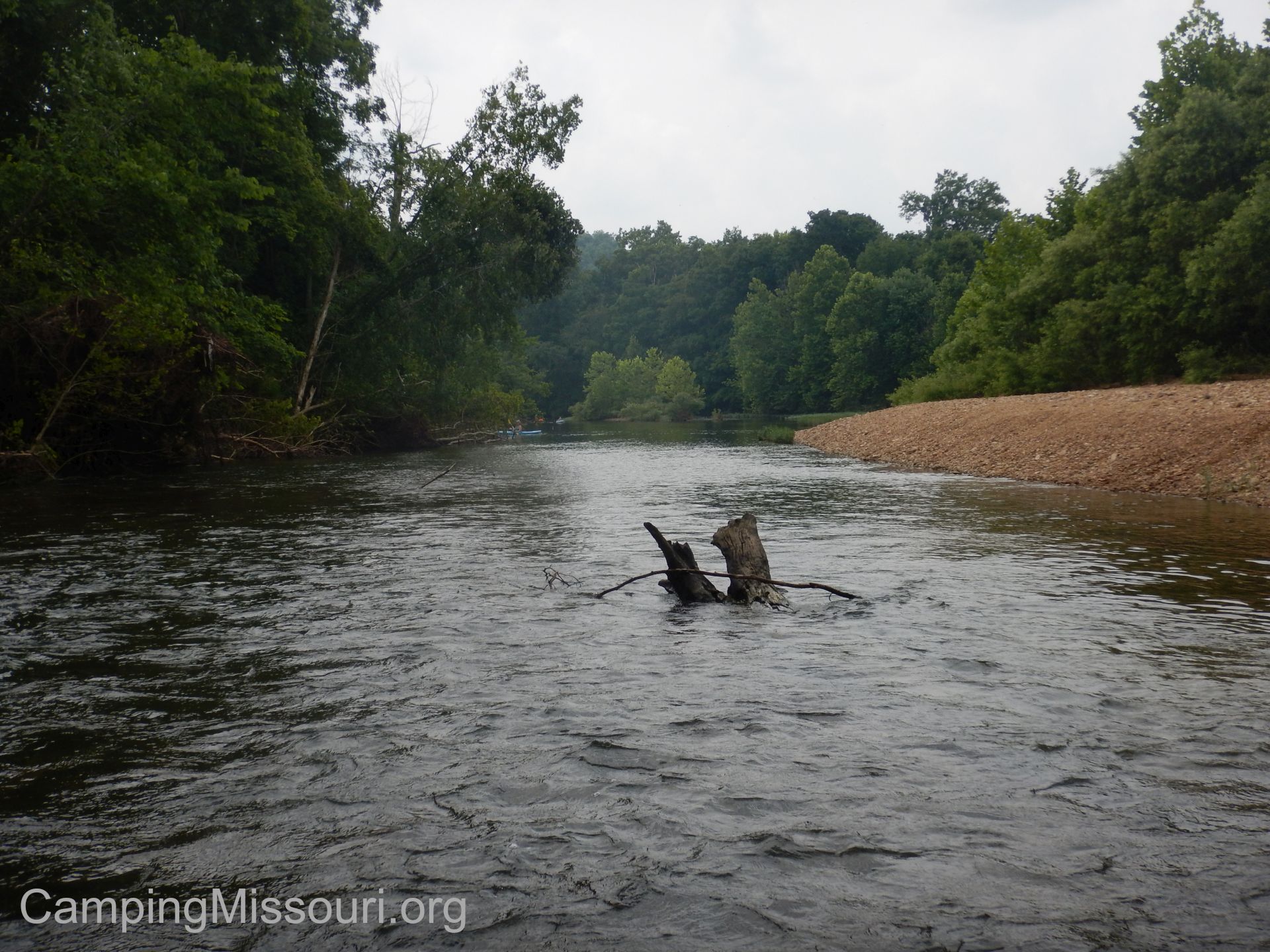 In the main campground area, I believe there was only one bathroom/shower house. As we were on the far end of the place, closer to their cabin, Jon and Mary were kind enough to let us use the bathroom/shower house adjacent to where they stay. I don’t know if that was a regular practice, but it was very kind of them. Just be aware that you may have to wait for someone else to be done brushing their teeth before you get to use the facilities in the morning. When nature calls, practice a patience that is reflective of the relaxing you will be doing most of the time anyway.
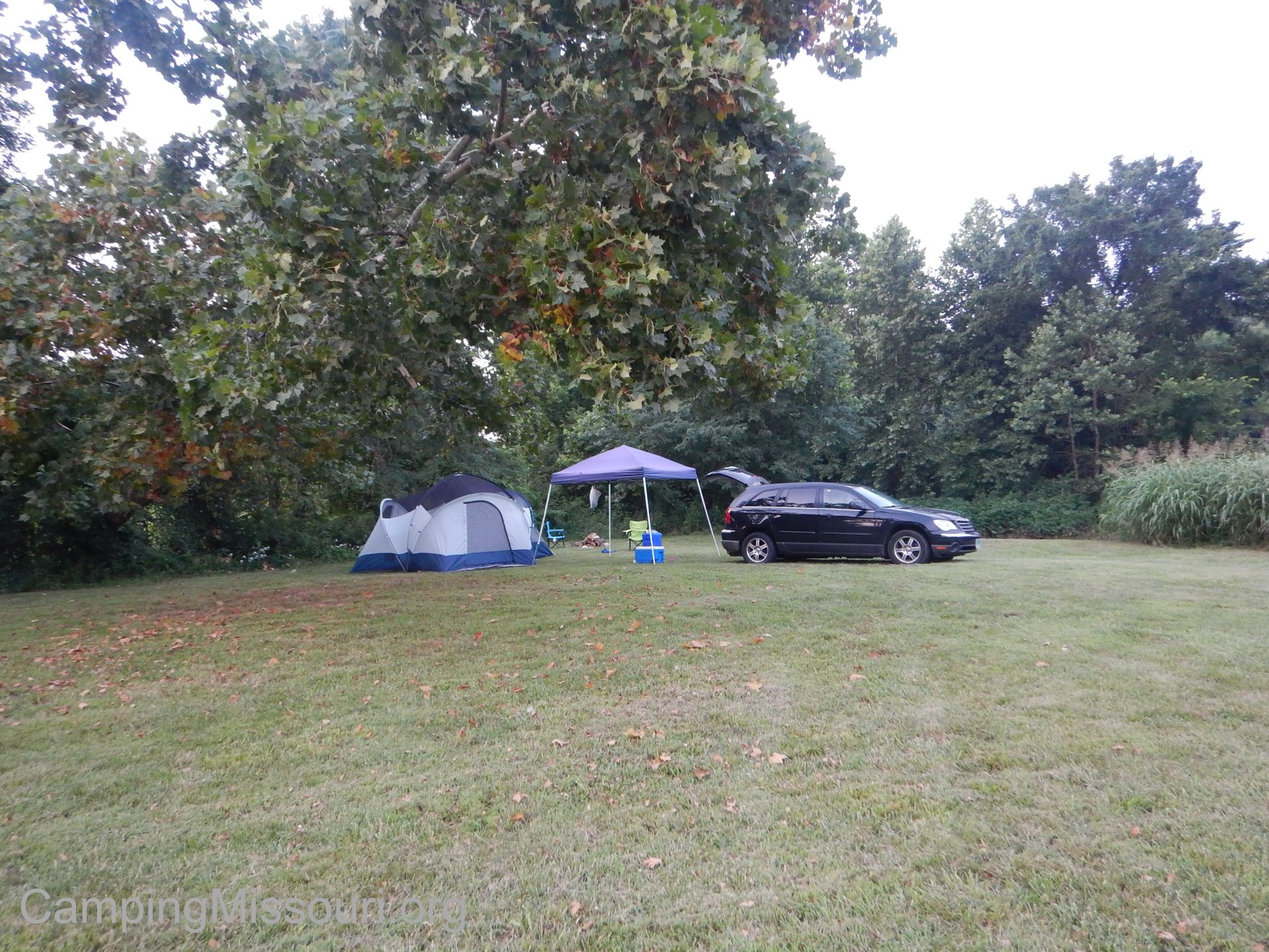 It is a smaller private campground, so I would certainly recommend calling them on the phone in advance of your visit to set up your accommodations. Also let them know what you prefer when it comes to a campsite. Where we were set up in the field was a very primitive spot, lacking a picnic table and a fire ring with a grill. Had we needed either of those, I am sure that Jon and Mary would have found a way to accommodate us. Think about your needs as campers and see what they have to offer. They also only take cash or check, so make sure to have that form of payment on hand. The closest ATM is at the Great Southern Bank nearby in Marquand. It is worth checking out simply for its very unique drive-thru!
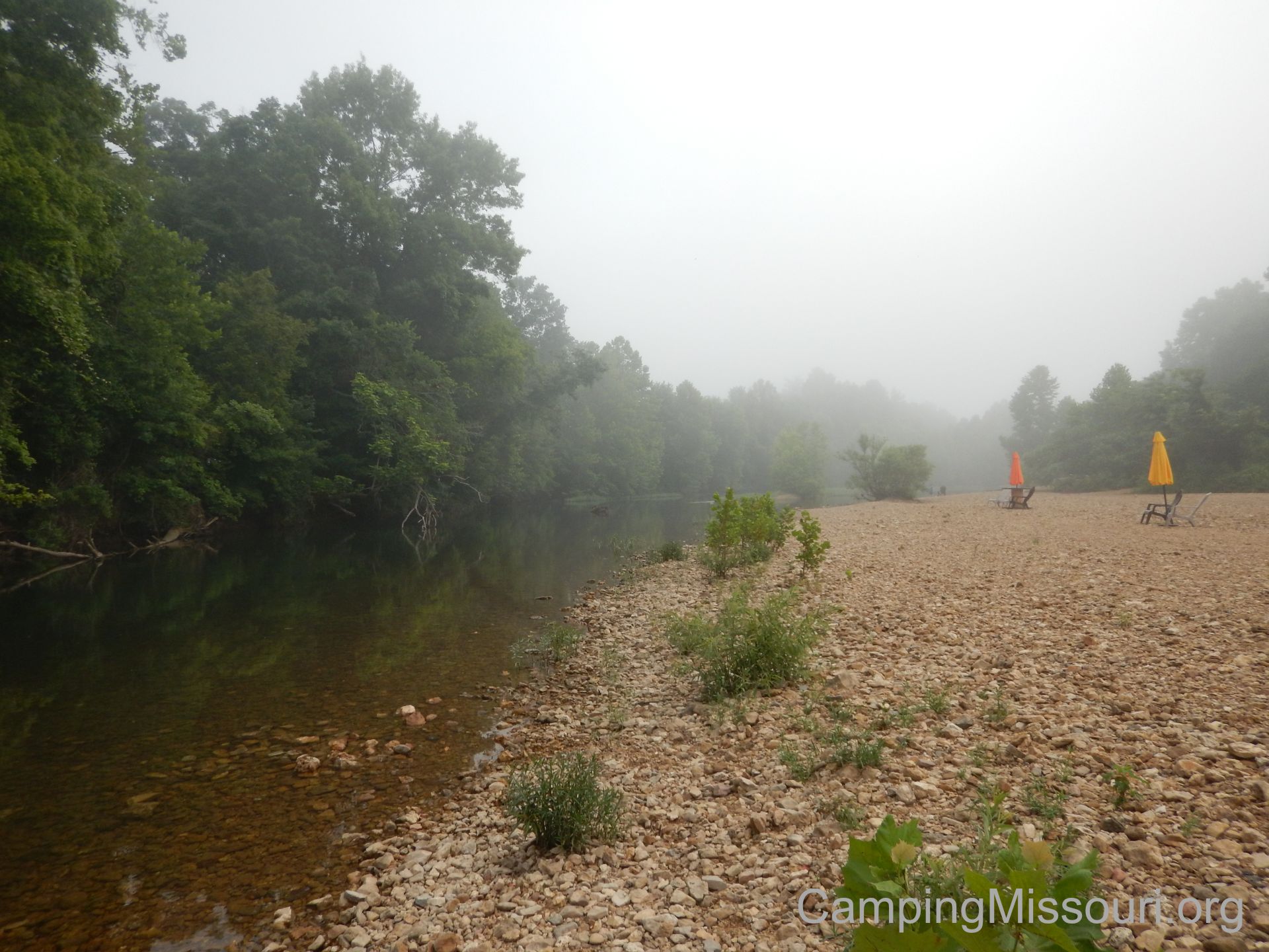 It was a last minute plan that ended up working out great. We spent two gorgeous days and nights in the misty river valley south of Marquand, MO along the Castor River. Drove up to see the Castor River Shut-ins and do some exploring of the countryside in the morning, played in the river during the afternoon, and then relaxed by the fire in the evening. It is certainly a quieter part of the Missouri woods to camp in next to a vibrant and life filled river, and I look forward to our next chance to go down and visit the pretty little campground with some of the friendliest and accommodating owners I have met so far, at the Castor River Ranch.
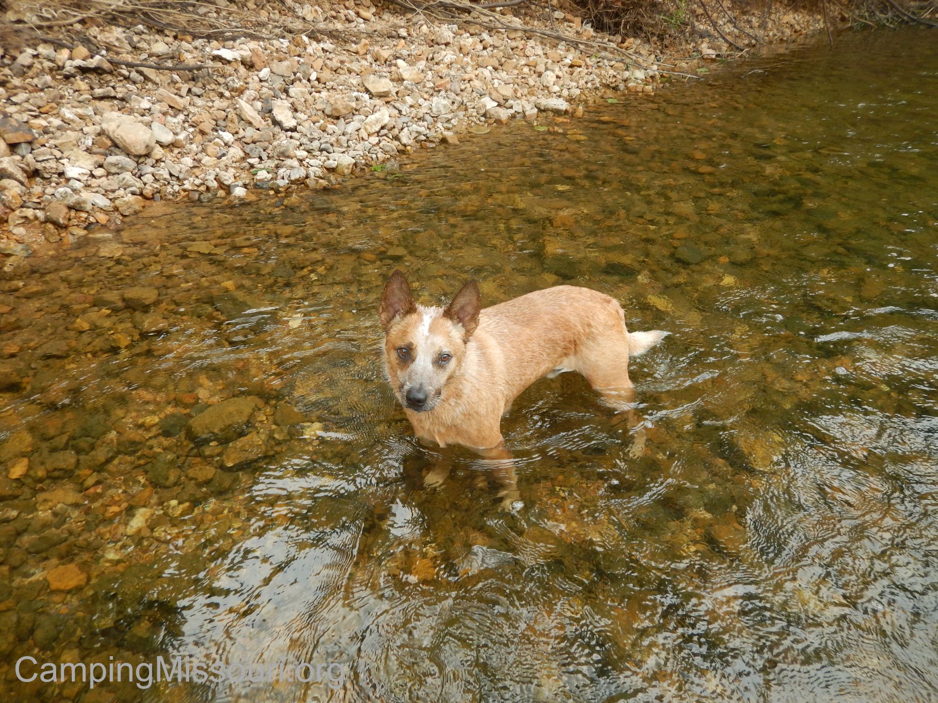
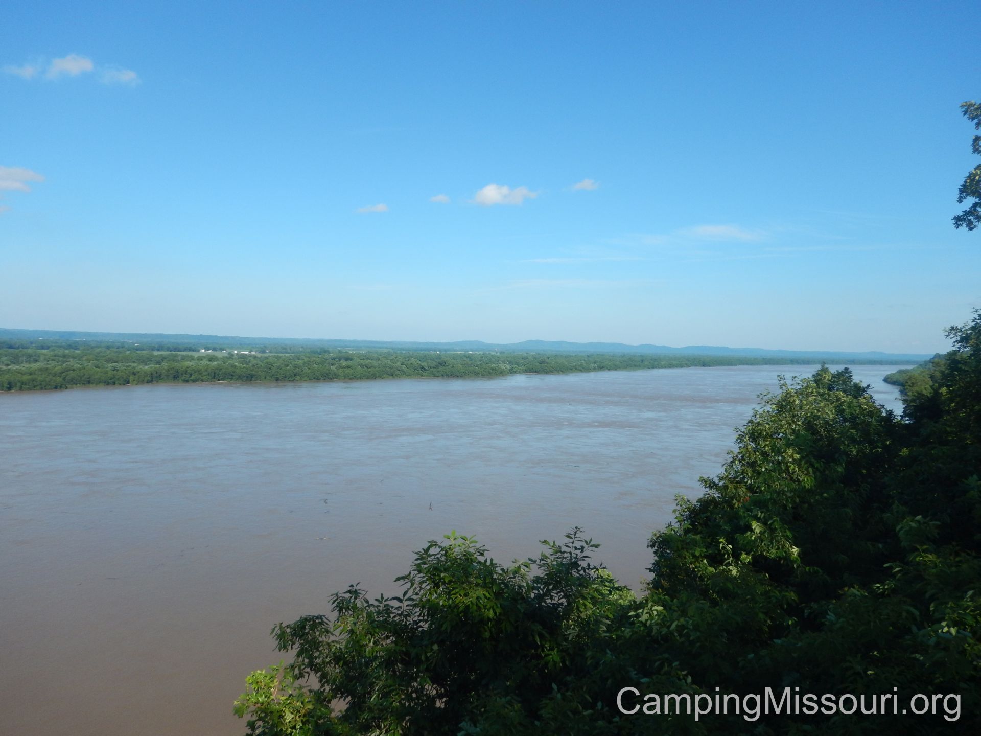 It was Father’s Day weekend, and I was determined to spend some time on an adventure with my kids, Eli and Sophie. We had the opportunity to help out with a Missouri Stream Team event down in the Missouri Bootheel, and as it was the closest Missouri State Park with camping to where we were going that Saturday, we decided that we would be staying for the weekend at Trail of Tears State Park, just north of Cape Girardeau, MO, along the currently overflowing Mississippi River.
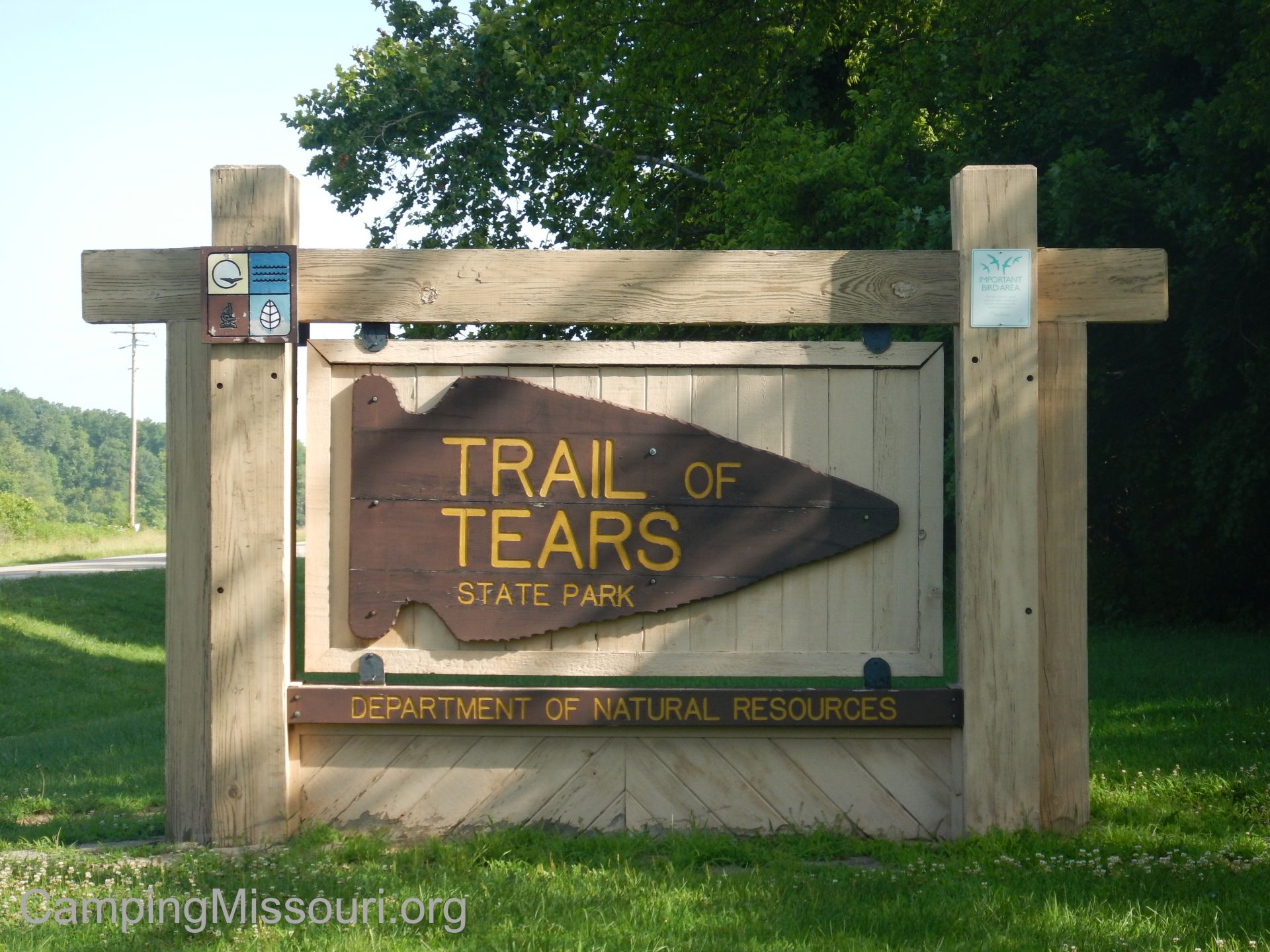 How to get there:
From South St. Louis County, take Interstate 55 south for just about 91 miles to exit 105 which is US-61 to Fruitland/Jackson. Make a left on US-61 and go under the interstate toward Fruitland. After about a mile, make a right on MO-177. Stay on MO-177 all the way to the Proctor and Gamble facility, and follow MO-177 where it turns to the right. After about 4 more miles heading south on MO-177, the Trail of Tears State Park entrance will be on your left. Probably half a mile into the park is the Visitors Center, where there is a very friendly staff that can get you any information you need.
 They have two campgrounds at Trail of Tears State Park. The lower one is the Mississippi River Campground, which has 17 sites, all with electric hookups and some additionally with sewer and water, and is open and reservable all year. This campground was actually closed the weekend we visited due to flooding, so we didn’t get a chance to see what it looked like. The second campground is deeper in the park, up in the hills along some of the ridges. It is the Lake Boutin Campground, and it has 35 sites, all primitive tent sites with fire rings and picnic tables. This campground is open and reservable May through October. There is also a special use camping area, which is for larger groups. I don’t know what the qualifying rules are, but you can call the park office to find out more about that site if you have a big group. Also, check the Missouri State Park Camping Reservation webpage for more information.
 Trail of Tears State Park also features almost 15 miles of hiking trails, 9 of which are part of the Peewah Trail, which is available for day hiking AND overnight backpacking. We hiked a good amount of the Sheppard Point Trail, but ended up having to turn back due to the Mississippi River expanding into the forest. I can assure you that this is not usually the case. Check out the Trail of Tears hiking webpage for information about all 4 trails within the park.
 What I like about this Missouri State Park:
I think one of the things that the kids and I enjoyed and got a lot out of was the Visitor Center. There is a lot to be learned about the local region, and especially concerning the solemn history of the Trail of Tears. Within the Visitor Center were interpretive displays, a room for presentations where you can also watch a short film about the Trail of Tears, and a trained and friendly staff to answer all your questions. This moment in United States history is a sad and difficult one, but certainly a reality that we should be aware of so that we keep from repeating the terrible actions we carried out as a nation…driving the native Cherokee from their land and their homes and marching them across the country on a dismal and heartbreaking path, decimating their tribes the entire way. Sobering history to know, but important to remember. Stop in and learn a little something while you’re there.
 Lake Boutin is a 20 acre lake toward the north end of the park, and is stocked with bass, catfish, and bluegill for fishing. There is also a beach and swimming area which is open from May through September, and is the perfect antidote for a hot summer afternoon. Make sure to take your fishing rod and your swim trunks, and spend the day at Lake Boutin!
I have camped at this state park twice, and both times it was quiet and relaxing. I get the sense that it isn’t a very busy campground most of the time, and certainly one that gives you the opportunity to enjoy Missouri nature in relative peace and quiet. The campground host that we met said that her and her husband had been volunteering there for years, and were very pleasant, welcoming, and accommodating.
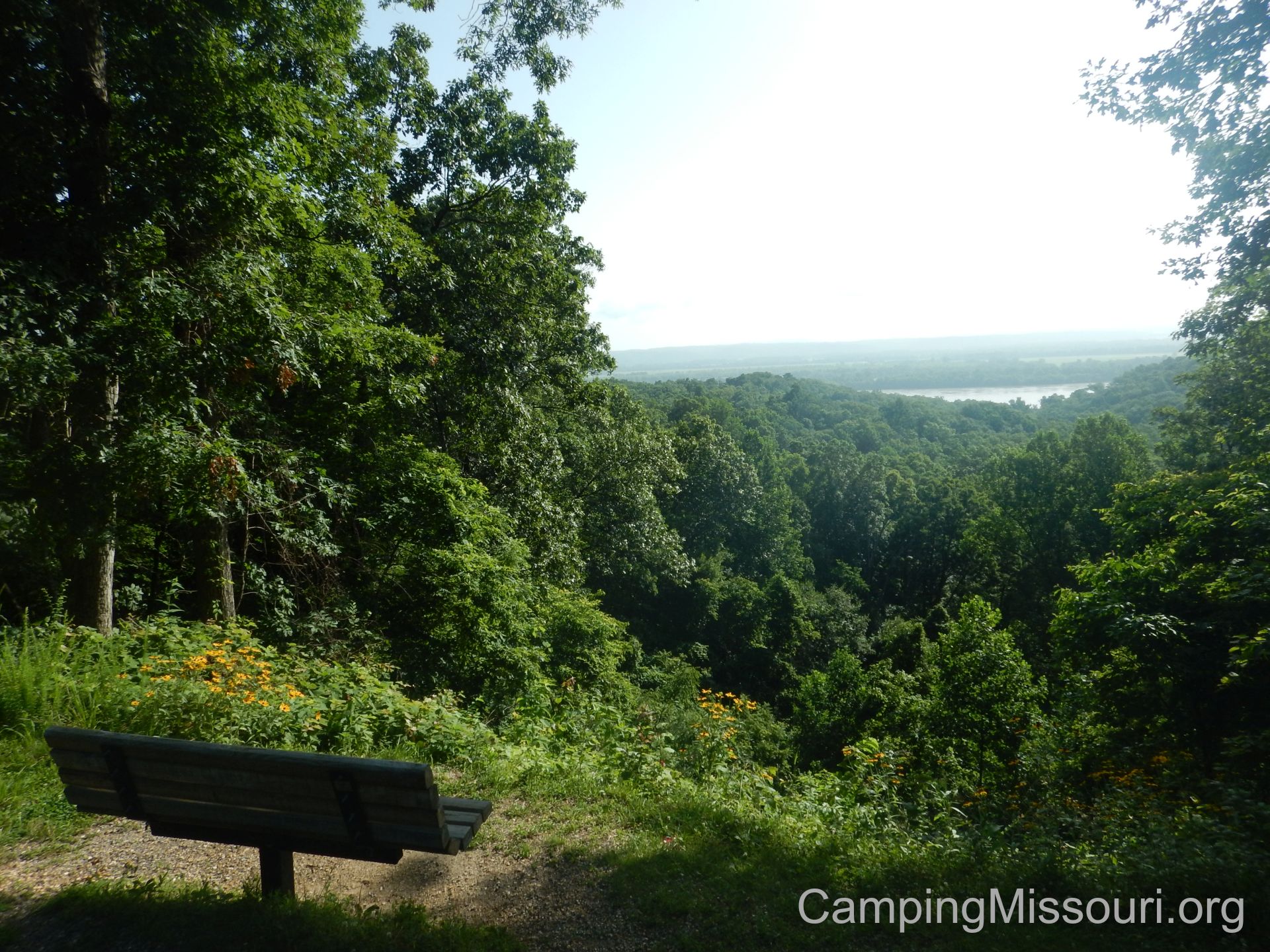 What you need to know:
In the Lake Boutin campground, the roads for the campground are along ridges up on top of the hills, so some of the campsites have a bit of an incline and don’t feature a whole lot of room for bigger tents. Make sure to check the “slope” and the “pad length” if reserving a site. As it isn’t a very busy campground though, this is one that you also may be able to get away with NOT reserving a site. That way you could tour the campground when you get there and pick the best one for your needs.
 There was a decent amount of Poison Ivy in the brush in some areas of the park. Make sure to know what it looks like and how to identify it if you are allergic, and do your best to avoid it when you are out on a trail or walking around the campground.
As I mentioned previously, the Mississippi River campground was flooded out when we visited. Make sure to check the Trail of Tears Advisories webpage to keep up to date on conditions that you need to know about.
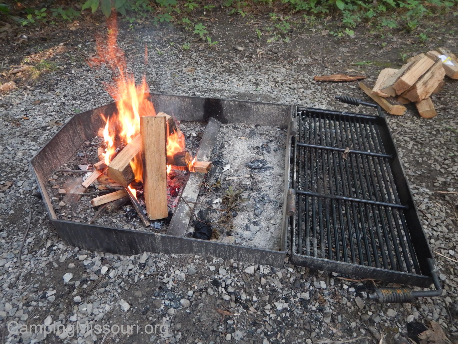 All in all we had a great Father’s Day weekend at Trail of Tears State Park. Cape Girardeau is just south of there with a lot of history to learn about and modern day attractions to see. Check out the VisitCape website to find out everything you need to know. There is also a Missouri Department of Conservation Nature Center that you need to check out with all sorts of informative and interactive exhibits. Ultimately though, between the Visitor Center, the hiking trails, Lake Boutin, and the scenic overlook, we could have stayed within the park all weekend and not run out of things to do. If you haven’t visited Trail of Tears State Park yet, put it on your list. There is a lot of history to learn and relaxing fun to be had in the forests along the Mighty Mississippi River, just north of Cape Girardeau, MO.
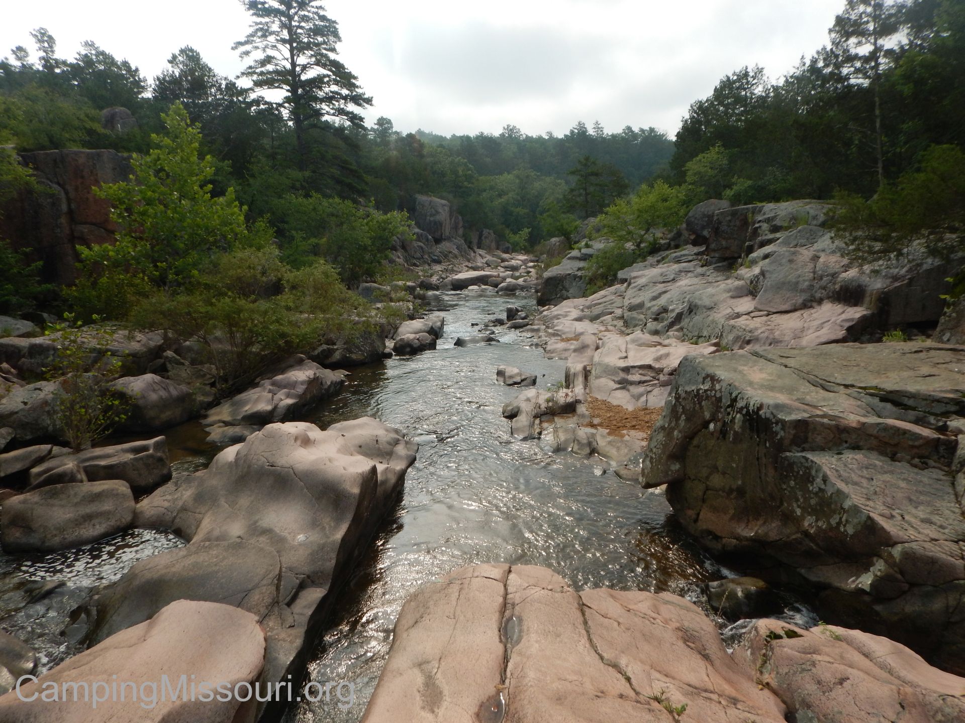 I have said it before and I will say it again: You can head just about any direction out of Fredericktown, MO and come across a beautiful waterway. From Lower Rock Creek to Marble Creek to the Castor River to the St. Francois River running through Millstream Gardens and Silver Mines Recreation Area, you just can’t beat the rugged, lively, exposed granite waterways that splash and churn and babble throughout Madison County, Missouri. Among my favorite natural places to spend my time, one that I had visited a while back but hadn’t really explored a whole lot is the Castor River Shut-Ins in the Amidon Memorial Conservation Area. Well that got remedied this past weekend when we camped at Castor River Ranch Campground, and spent Saturday morning driving up to Amidon to check out this water carved collection of granite sculptures, within the walls of a canyon flanking this quick moving river as it cuts its way through the solid terrain.
 How to get there:
From South St. Louis County, take Interstate 55 south to exit 174b, which is US-67. Take US-67 south almost 52 miles to Fredericktown, MO. In Fredericktown, exit at MO-72, and make a left and go over the highway. In about half a mile there is a roundabout. Take the third exit in the roundabout, and follow MO-72 around the north outskirts of Fredericktown to where it joins State Highway OO in Junction City. Make a right to stay on MO-72, and take it east out of town a couple miles to State Highway J. Make a left onto State Highway J, and take that for about 4 miles to State Highway W. Make a right on State Highway W, take that for about a mile to where the road curves to the left and becomes Madison County Road 208. At this point you should also be seeing signs for “Castor River Shut-Ins“. Stay on 208 for about a mile to where it splits off with County Road 253. Make a left on 253, and after about a mile the parking lot for the Castor River Shut-Ins will be on your right.
 The Cedar Glade Trail is a mile long and is pretty flat from the parking lot to the Shut-Ins. It then curves to the right up the hill and travels through some glades up above the river canyon. It then continues to curve to the right and turns down into the woods, looping back toward the beginning of the trail near the parking lot.
What I like about this place:
 The Castor River Shut-Ins, without a doubt, is the draw of this conservation area. The pink granite that makes up the natural sculptures throughout the area was formed by volcanic activity 1.5 billion years ago, where magma cooled underneath the surface of the ground, and was later exposed and shaped by the flowing water of the Castor River. It is a narrow canyon, cut out of the hills, that is home to water slides and shoots, showing off some of the prettiest and most unique geological formations Missouri has to offer. The kind of place you could spend a day exploring the hillsides and playing in the water, and a night sleeping soundly next to with the gurgling and splashing playing a constant natural rhythm.
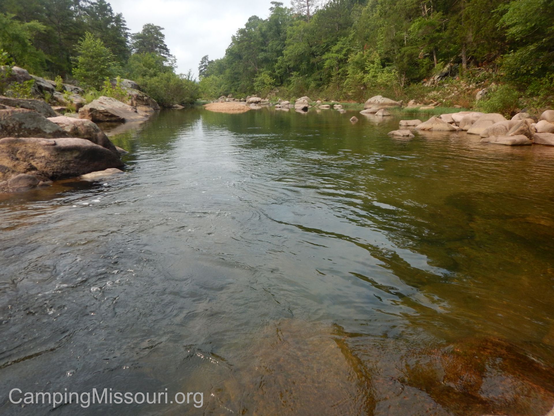 You CAN camp here. According to the brochure, “Primitive camping is permitted in designated areas and on a walk-in basis with seasonal restrictions”. When we pulled into the parking lot for the Shut-Ins, there was a tent set up far off in the field that was visible, and when we were exploring the river, there were a couple of tents in the forest along it. Please check with the Missouri Department of Conservation for further rules and regulations regarding the Amidon Memorial Conservation Area, and camp with a sense of preservation and respect for the natural place you are in.
 The Cedar Glade Trail gives you a good look at the topography of the area, and takes you through the diversity of ecosystems that occur in exposed granite natural areas. From the lower forest along the river to the glades on the upper parts of the hill, the ruggedness of life in these areas is something I always find impressive and inspiring. That trees and brush and grasses could thrive in places with a diminished amount of soil, and provide cover and food for all the animals that call these glades home is a testament to the determination of life on this planet. Appreciate the environment when you hike here. You are in the home of some of the tougher creatures that live in Missouri, among the exposed solid rock landscape.
 What you need to know:
The one thing that disappointed me about this area was the amount of human evidence throughout. From cans tossed into the forest along the trail, to a styrofoam cup floating in one of the pools along the bank of the river, it was clear that some of the visitors (a small minority, I’m sure) to this place have less of a regard for nature than they ought to. Please, please, please…take your trash with you when you leave so that other visitors can see it all in its natural glory too, without the colorful and distracting waste that doesn’t belong there at all.
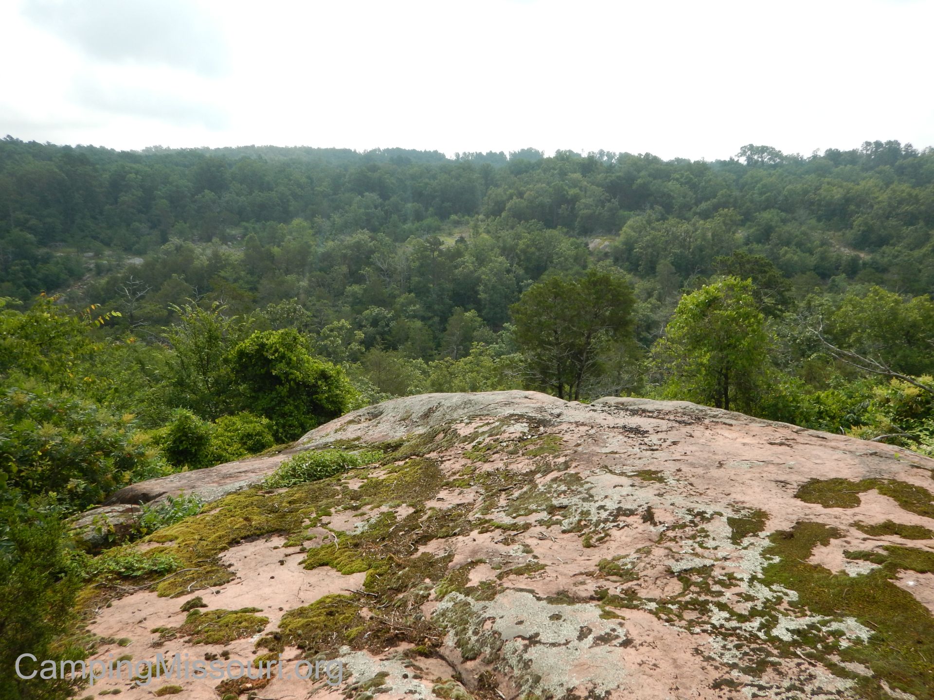 The Cedar Glade Trail isn’t very long, and it doesn’t stray too far off into the wilderness…but after the Shut-Ins where it turns to the right and goes up the hill, it isn’t very well marked. Make sure that you have an idea of the direction of the river and the parking lot, and you should be able to follow the trail through the glades and back into the forest and down the hill. Just take your time, and if you feel like you might not know where the trail ahead of you is, don’t be ashamed to turn back and hike where you’ve already been. Hey, you will get to visit the Shut-Ins twice!
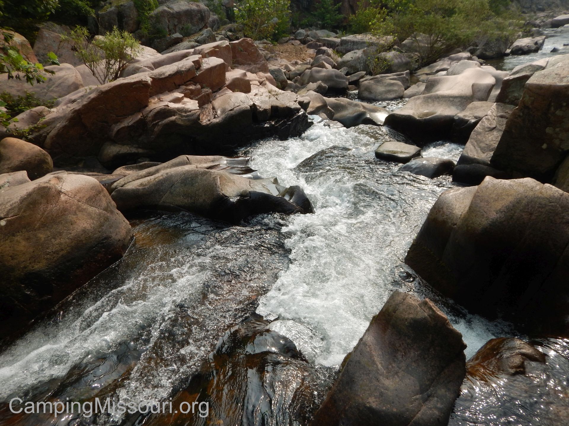 Be careful on the rocky areas along the river. This whole place is rugged, but where the exposed granite gets wet, it can be very slippery. Watch your step and be mindful of how quickly you could be on your back with a head injury, from just one misplaced foot. Nobody wants to have to carry anyone back to the car, so take your time.
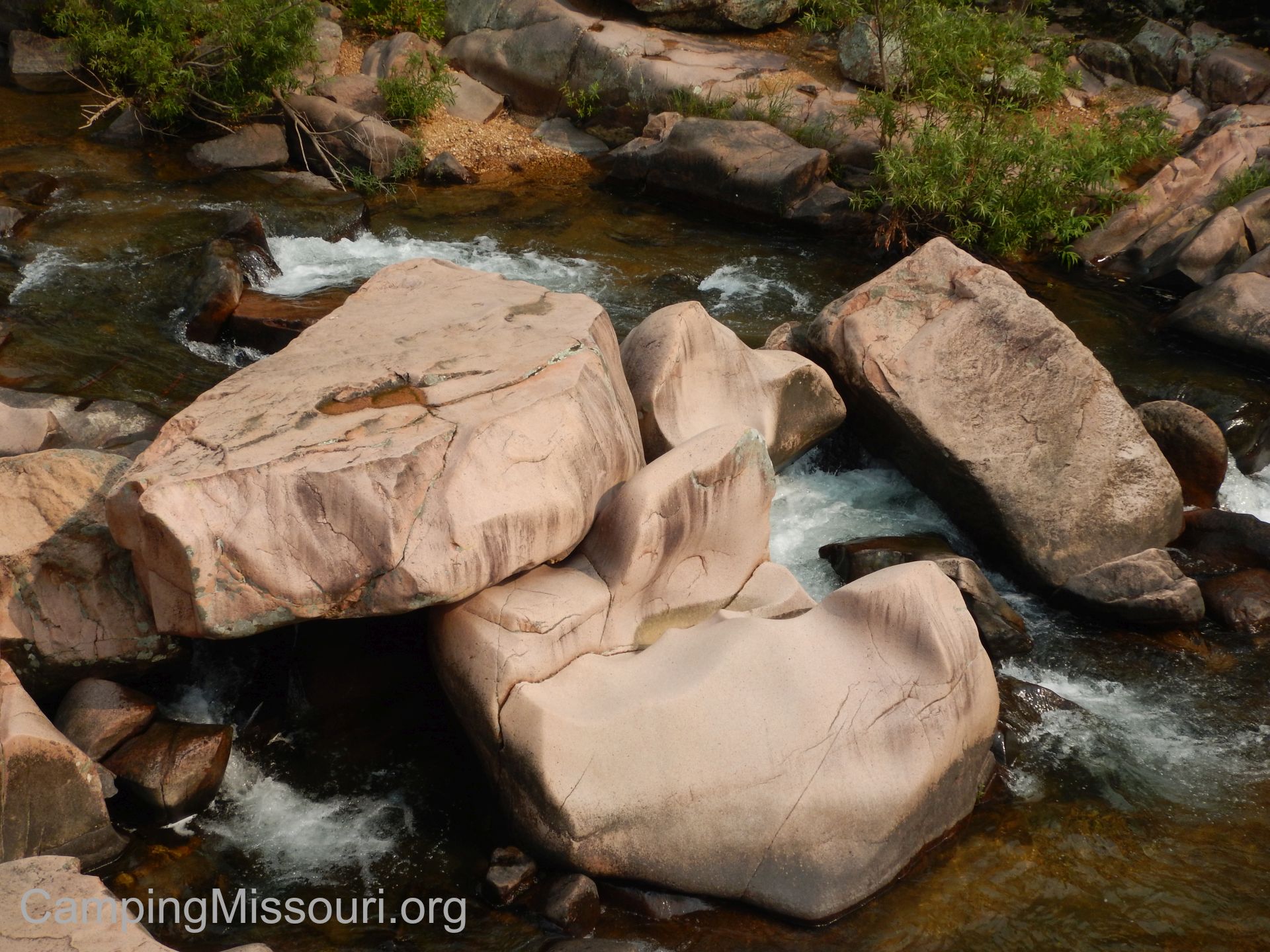 This really is a place that you have to see if you want to know how beautiful and fascinating the forests and waterways of Missouri can be. The way that a river can carve a canyon through a hill side, splashing and flowing and falling around boulders and bedrock, and down around a bend through a narrow shoot to change into a calmer, more peaceful habitat for all the animals that live in the area, is really a great example of the power and strength of the elements at play here in our beautiful state. Make sure your next trip out into the forests of Missouri includes a day spent exploring the hillsides of the Amidon Memorial Conservation Area, and playing in the rocks and water of the Castor River Shut-Ins.

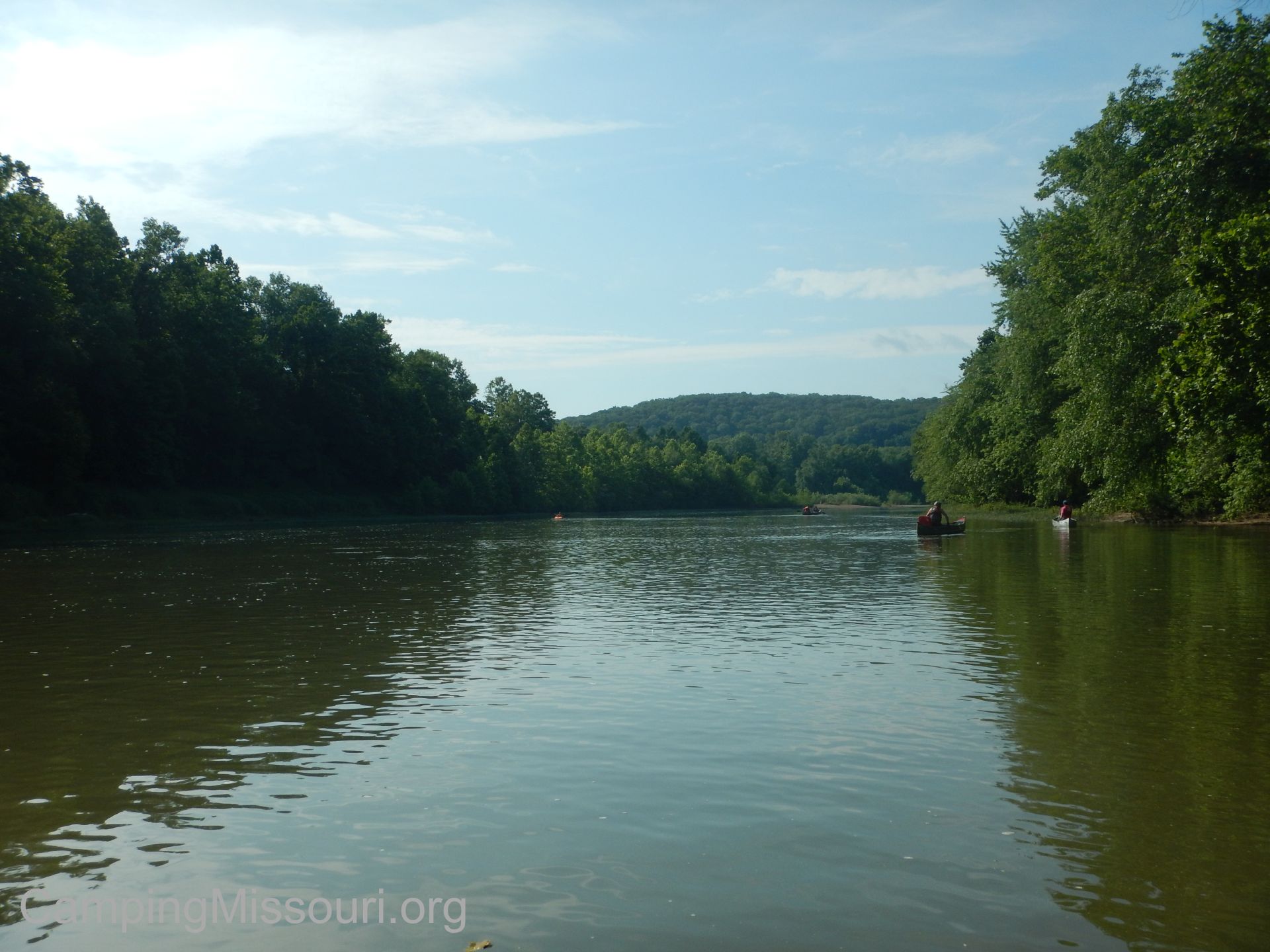 So we find ourselves early on the morning of Saturday, June 13th in a canoe on the waters of the Meramec River. We are at the river access of the Pacific Palisades Conservation Area in Pacific, MO, and we are here for a cleanup float organized by a Boy Scout named Michael Jadwisiak. He is here to carry out his Eagle Scout Service Project, with a touch of stewardship and adventure, and today we are floating 7 miles to the Allenton Access to haul whatever debris and garbage we can find out of the water and riparian corridor along the way.
 Now I am going to bet that some of you are Boy Scouts or know a person involved in Scouts. In the steps that a Scout must take on the long journey to becoming an Eagle Scout, the “Eagle Scout Service Project” is a big and important one. It is a project that the Scout comes up with that must meet the following requirements: “While a Life Scout (the rank below Eagle Scout), plan, develop, and give leadership to others in a service project helpful to any religious institution, any school, or your community. (The project must benefit an organization other than Boy Scouting.) The project proposal must be approved by the organization benefiting from the effort, your unit leader and unit committee, and the council or district before you start.”
 The Project Purpose is stated as: “In addition to providing service and fulfilling the part of the Scout Oath, ‘To help other people at all times,’ one of the primary purposes of the Eagle Scout service project is to learn leadership skills, or to improve or demonstrate leadership skills you already have. Related to this are important lessons in project management and taking responsibility for a significant accomplishment.” An opportunity for them to lead the helm in service of those around them in a big project, with an emphasis on their role as the leader throughout.
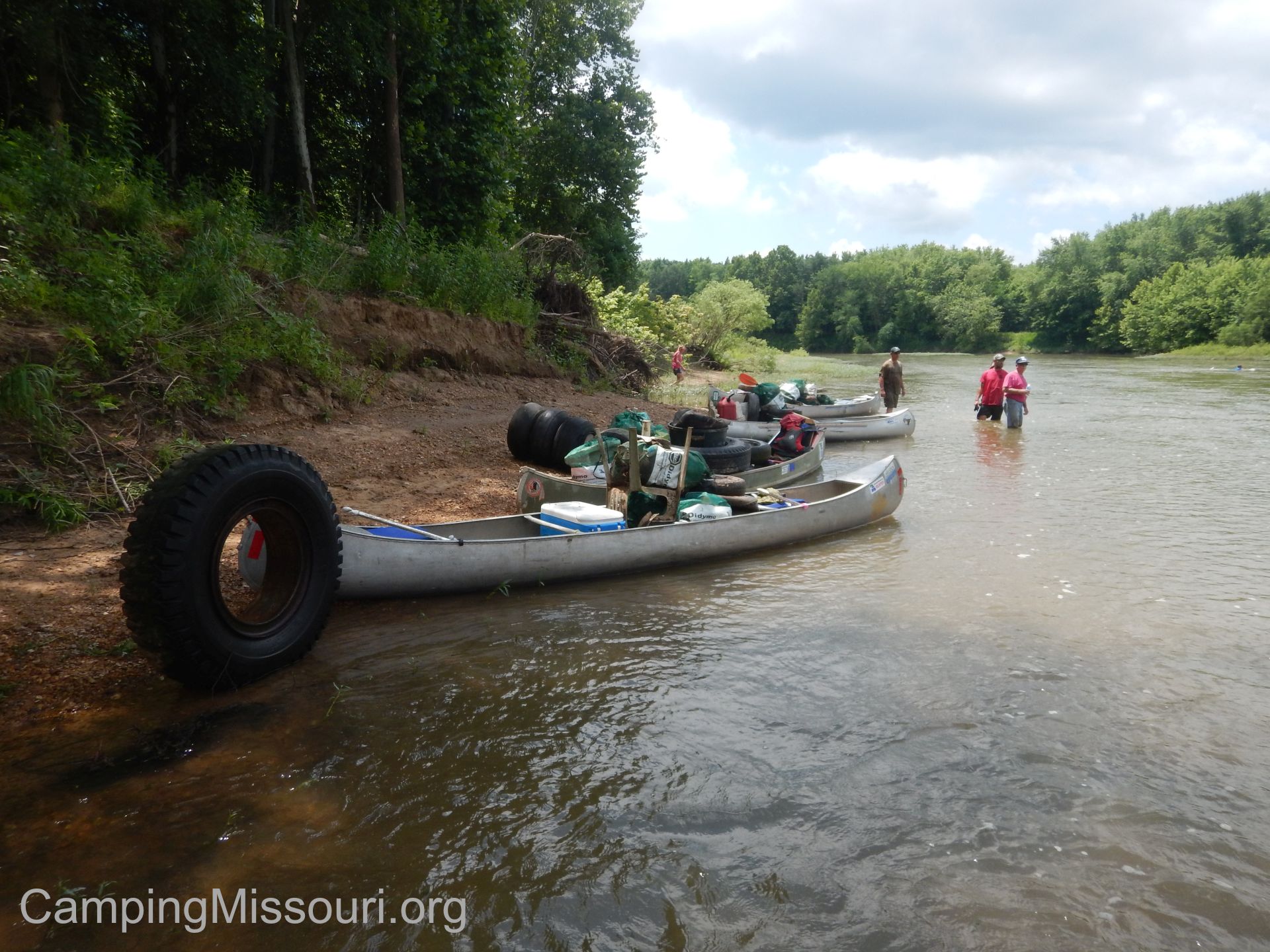 Mike started as a Cub Scout in 2004, and then the Boy Scouts in 2009. He told me has been in Scouts for about 11 years, and in the summers he works on the Meramec River for his uncle at Forest 44 Canoe Rental. He would see Missouri Stream Teams out on the river occasionally, conducting cleanups and making a difference, and he was inspired to focus his project on taking care of a community that is very much a part of his life, as well as so many of the rest of us. He got in contact with Stream Team headquarters, and then went about planning this exciting and impactful day.
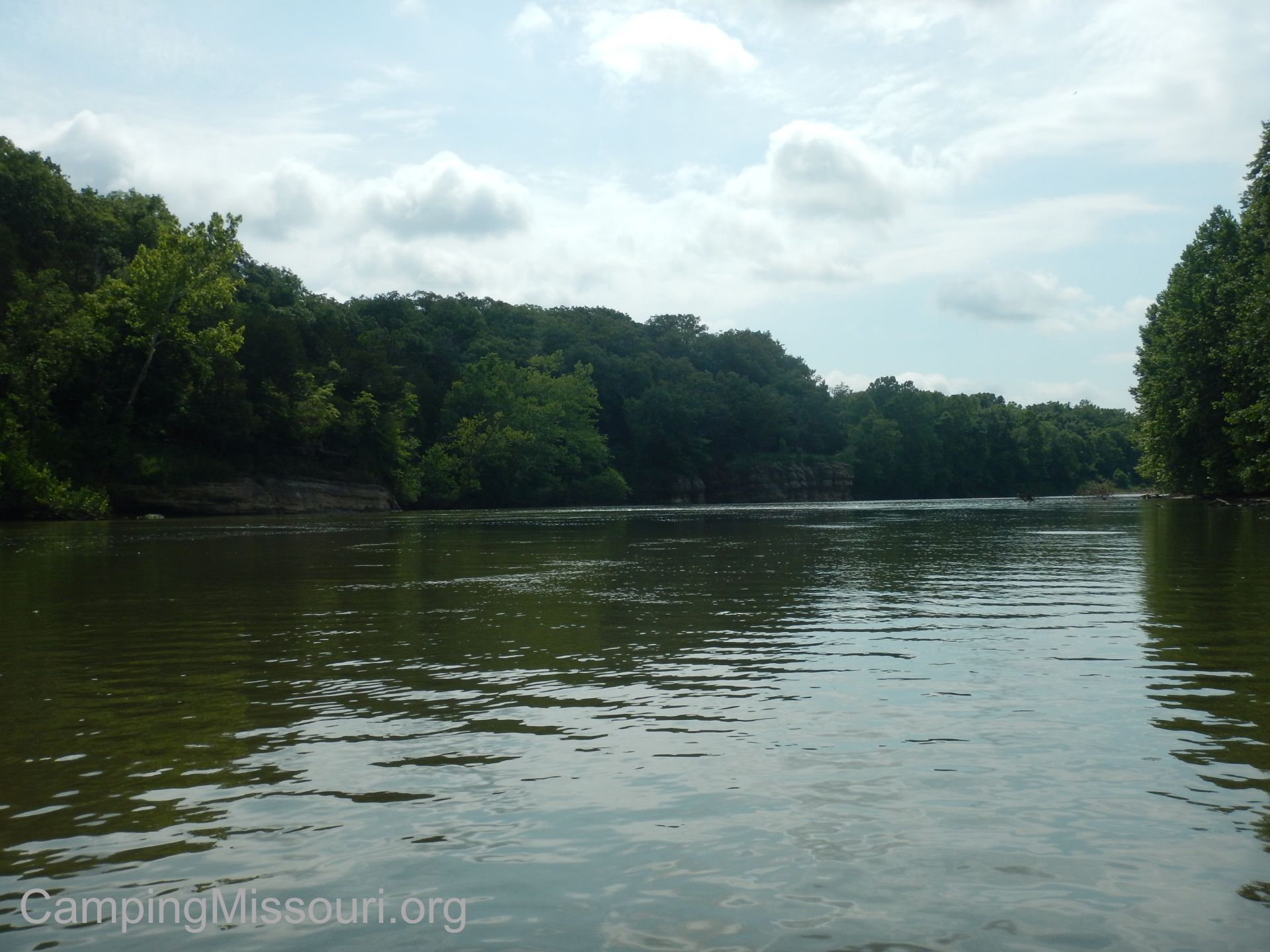 So we left Pacific Palisades with the Scouts ahead of us, cruising down the river in our flotilla of canoes (and a jon boat) looking to sweep up whatever they didn’t get. For the most part they were doing a great job of clearing the trash ahead of us, so we rolled along on the current, appreciating the opportunity to be on the water in the warming morning air. Passing gravel bars and short statured bluffs, working our way over submerged sycamores and around sweeping curves, it was turning out to be a perfect day to be on the water.
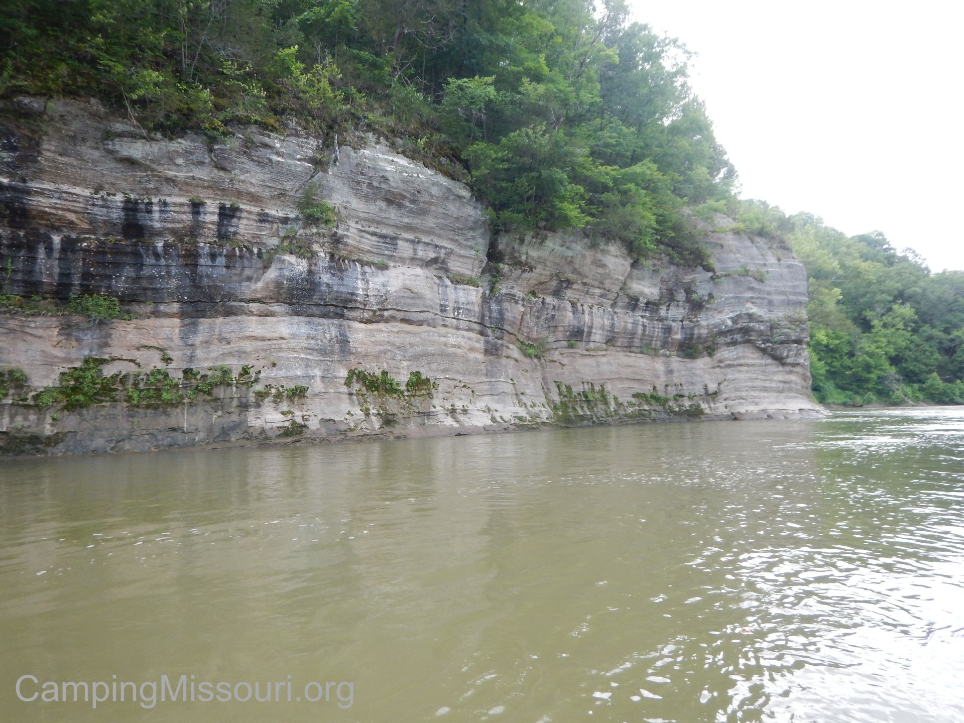 But if there is one thing that I’ve learned from my past Stream Team experiences…if there isn’t trash ON the river…there is usually some in the woods along it. You get an eye for the signs; a random handful of cans, an obscured tire in the brush, or that telltale pile of river debris from past floods that is always a sure bet to contain plastic and styrofoam. Somewhat minuscule “interventions”, if I can expand on a term my friend Jay has coined for the presence of human infrastructure in nature, which I find more and more appropriate every time I see anything that doesn’t belong. So we would land the boats, make our way into the brush, and spend some time and energy dragging tires and other various objects out of the woods to take back with us to properly dispose of. We ended up removing quite a bit of garbage as we made our way down 7 miles of beautiful Meramec River; a caravan of canoes loaded up with tires and trash.
 We had spent a good amount of time on land, but the most dramatic find of the day was when a few of the more determined members of our crew (James, Brian, and Rachel) worked to remove a 20 foot long 18″ diameter plastic culvert pipe from a log jam in some swift water. Freeing this mammoth corrugated straw and dragging its floating bulk down the current for a ways, we worked at the edge of a gravel bar to strap the monster piece of trash to the top of James’ boat. It was at that moment when a bald eagle circled a few times overhead, just above the treetops, as if it was raising a wingtip in thanks for our work there that day.
 Overall, the result of Michael’s Eagle Scout Service Project was the removal of 22 tires (including 12 rims), 20 red mesh bags and 30 big green mesh bags of garbage, and one 20 foot section of rigid plastic corrugated pipe from 7 miles of this very loved and appreciated river in eastern Missouri. Everyone put forth their best effort on the water, especially James, paddling his jon boat more than half the length of this stretch to get that pipe out of the waterway where it doesn’t belong.

Mike and some of the volunteers with our pile of treasure!
Among organizations that do a lot for the communities they are a part of, the Boy Scouts of America are some of the most dedicated and thorough. Go to any Missouri Stream Team cleanup event, and you are sure to see a troop there, getting into the woods and making it a prettier and healthier place. As one of the 20 or so volunteers that got to be a part of this adventure, I want to personally thank everybody that came along, especially soon-to-be-Eagle-Scout Michael Jadwisiak. Because of your efforts, Mike, coming up with the project and leading the way on this productive Saturday, a piece of river that may otherwise be neglected and trashed has been given new life and health. It is young men like you taking it upon themselves to improve the world around them, that will lead us all in the right direction, and are surely an inspiration for all scouts and advocates to come.

My son and I, making our way along the Meramec River.
 So it was the weekend of the 17th Annual Jacks Fork Cleanup, put on by the legendary Ted and Pat Haviland, down along the Jacks Fork River near Eminence, MO. This is a cleanup that is held every year on the first Saturday in June, and Stream Team volunteers from all over Missouri come down to float different sections of the Jacks Fork, removing garbage as they go. After the float they have a BBQ dinner at the picnic shelter near Alley Mill, and prize drawings for everyone who helped clean the river that day. They also had a couple of the group sites at the Alley Spring Campground reserved for volunteers for Friday and Saturday night, so we loaded up the dogs and the tent, strapped a canoe to the top of the car, and headed down to the Ozark National Scenic Riverways to spend the weekend in one of the prettiest areas in Missouri.
How to get there:
 (Eminence, MO in the heart of the Ozark National Scenic Riverways is about 3 hours from St. Louis, and you can take various routes to get there. The directions here are from the intersection of Highway 19 and Highway 106, in the middle of Eminence.)
The cleanup was organized into multiple sections that could be floated during the weekend, and we decided we were going to do the section from Bay Creek to the Alley Spring Campground. From the intersection of 19 and 106, take 106 West for about 6 miles, and make a left just before the Jacks Fork River into the Alley Spring Campground. Look for the National Park Service sign. This is where the river access for Alley Spring is. If you continue on 106, crossing the Jacks Fork, Alley Spring and Alley Mill will be on your right. Make sure to visit them while you are in the area.
 To get to Bay Creek, you continue on 106 past the Alley Spring Campground, cross the Jacks Fork, and drive about 5 miles to County Road 106-425. Make a left onto County Road 106-425, and take that a couple miles down to the river. The section of the Jacks Fork River from Bay Creek to Alley Spring Campground is listed as 7 miles by a couple canoe outfitters.
What I like about this section:
 Gorgeous. Picturesque. They don’t call the Jacks Fork and the Current River the “Scenic Rivers” because somebody simply trademarked the term. These really are the tops when it comes to floating in Missouri. Wide and shallow in a lot of spots, deep and full in others, with forests along a bank of gravel bars that are continually flanked by impressive bluffs, and crystal clear the entire trip. We have some great rivers to float in Missouri, and I am convinced that these are the most beautiful.
 Something that I noticed is that the Jacks Fork didn’t seem as cold as the Current River can sometimes be, at least comparing the sections I have floated. These spring fed Ozark streams tend to be chilly, making it perfect for a hot day…but if the clouds have moved in, the water can seem to be too cold at times. The temperature of the water below Bay Creek and down to Alley Spring Campground was just right for cooling off the entire trip, but never too cold. After some discussion with a friend, we surmised that it might be due to the shallowness in a lot of spots, giving the water a chance to warm more in the sunlight.
 Now I am sure that a lot of people get on this river on Saturdays in the summer months, especially going downstream from the gravel bar at Alley Spring Campground. I know I am hooked, so I can’t blame them. That is why Bay Creek section above Alley Spring is a great option. The same water with most likely a little less traffic. Don’t expect to get the river to yourself, but appreciate that maybe you are on one of the less floated sections, and you just might have only the birds and the fish and the turtles and the snakes and the water as company every so often. Sounds good to me!
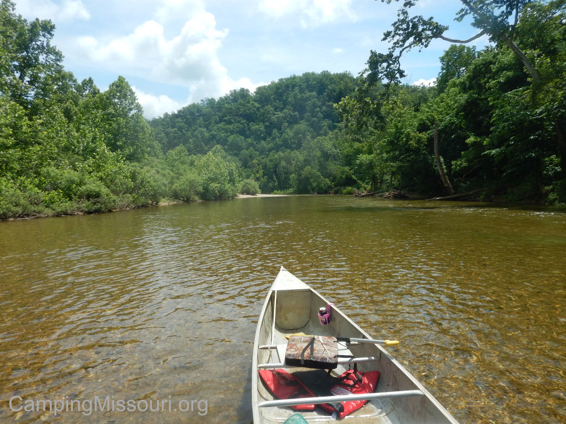 What you need to know:
The Jacks Fork is a lively river when it wants to be. Where it narrows in spots, it can get a bit tricky and fast. Take your time and pull off to the side and scout your path or jump out and walk the canoe if you are feeling unsure. Anxiety about what you are about to be getting into will only amplify any danger, and nobody likes to chase paddles and coolers and fishing rods down the creek on foot. Remember, you are there to have a fun time.
 If the majority of your floating experience is on the Meramec or Black Rivers, among others, expect water a bit chillier than you are used to. Not a big deal, but if you jump in without knowing, it might cause you to jump right back out. Pure…clear…chilly spring water.
In dryer months, the water level may be pretty low. Check with your outfitter or the ONSR Park Rangers to determine if the river is at a good height for floating this section. Dragging a lot of the way makes what should be a fun adventure into an exhausting experience that you will never want to do again.
 I spent some time thinking about how to put into words what I thought really defined this section of the Jacks Fork River, and I found myself coming back to: “It was a perfect section of Ozark stream”. Nothing really stood out because it was all beautiful. A spring fed waterway through a narrow valley cut through the hills of the Ozarks, filled with life and movement and energy. A perfect place to spend a day or longer out in Missouri nature. I am envious of people that get to see this all the time, because the minute we pulled that canoe out of the water for the last time that Saturday, I know that my heart sank having to say goodbye. There is something very special about these rivers, and I can’t wait to float them again. They renew that energy in me that I go to the forest and the streams for. That connection that reminds me that this existence is a pretty wonderful thing to get to experience. Get yourself down to the Ozark National Scenic Riverways and experience it for yourself. And until next time, Jacks Fork, you will be pulling at my heart.
 To check out some of the other places I have visited in the Ozark National Scenic Riverways, click this link.
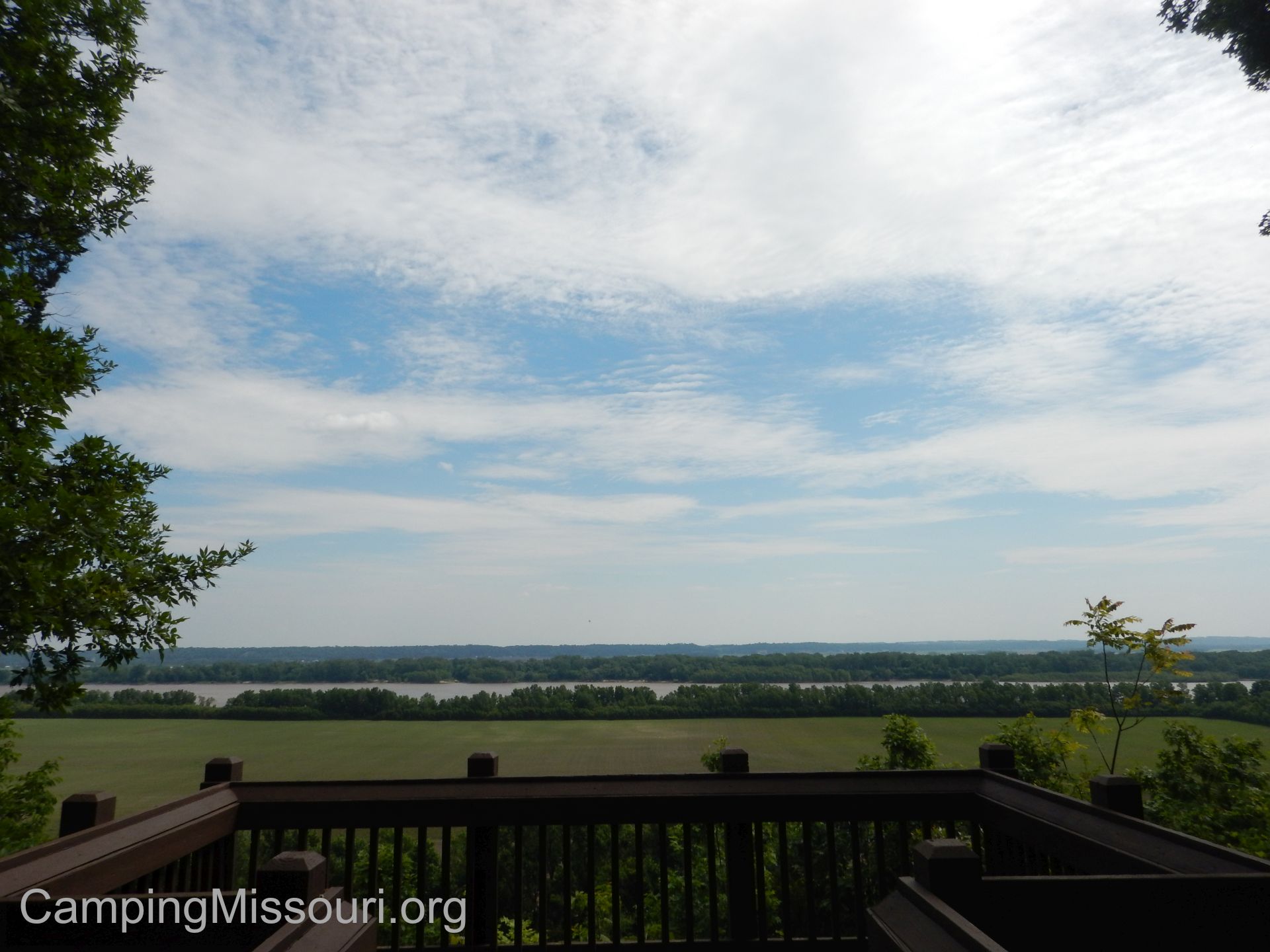 On a breezy Spring morning, Max and I were looking for a place to go hike at that we had never been to before. A coworker of mine had mentioned a place just north of St. Genevieve, MO near the Mississippi River that he is familiar with called Magnolia Hollow Conservation Area. It has over 1700 acres bordered on its north edge by Establishment Creek, and is home to the Brickey Hills Natural Area, a great example of the hardy timber species that can make their home in the sharp hills along the Mississippi River. I grabbed my hiking pack, and Max and I headed down the road to check out the view.
 How to get there:
From the interchange of 270 and 55 in south St. Louis County, take Interstate 55 south about 40 miles to Bloomsdale, MO. At Bloomsdale, take exit 157 and make a left (east) onto Route Y, crossing the bridge over the interstate. After just half a mile, make a right (south) onto US-61, and take that for about a mile and a half to Bodine Rd/Route V. Make a left (east) on Bodine Rd/Route V and go down across the valley about a mile to North White Sands Rd. Make a left (north) onto N. White Sands Rd., and take it about 6 miles through the valley, winding around the hills and up into Magnolia Hollow Conservation Area.
 Stay on the gravel road all the way to the parking lot at the end, and that is where the trail to the overlook is. It is paved and probably just over an eighth of a mile to the deck on the edge of the bluff. From the overlook is the trailhead of a 1 mile hiking loop. The hiking loop heads southeast along the bluffs toward the Mississippi, eventually turning a bit to the right and heading down into the hollow. Near the bottom, a trail heads to the left toward Establishment Creek, but the main trail continues to the right and down to the wet weather creek bottom. For a very short stretch it follows the creek bottom, and then quickly starts to climb back up the hill. There is a steep section, transitioning quickly to a more subtle ascent, which eventually takes you back up to the overlook trail and out to the parking lot.
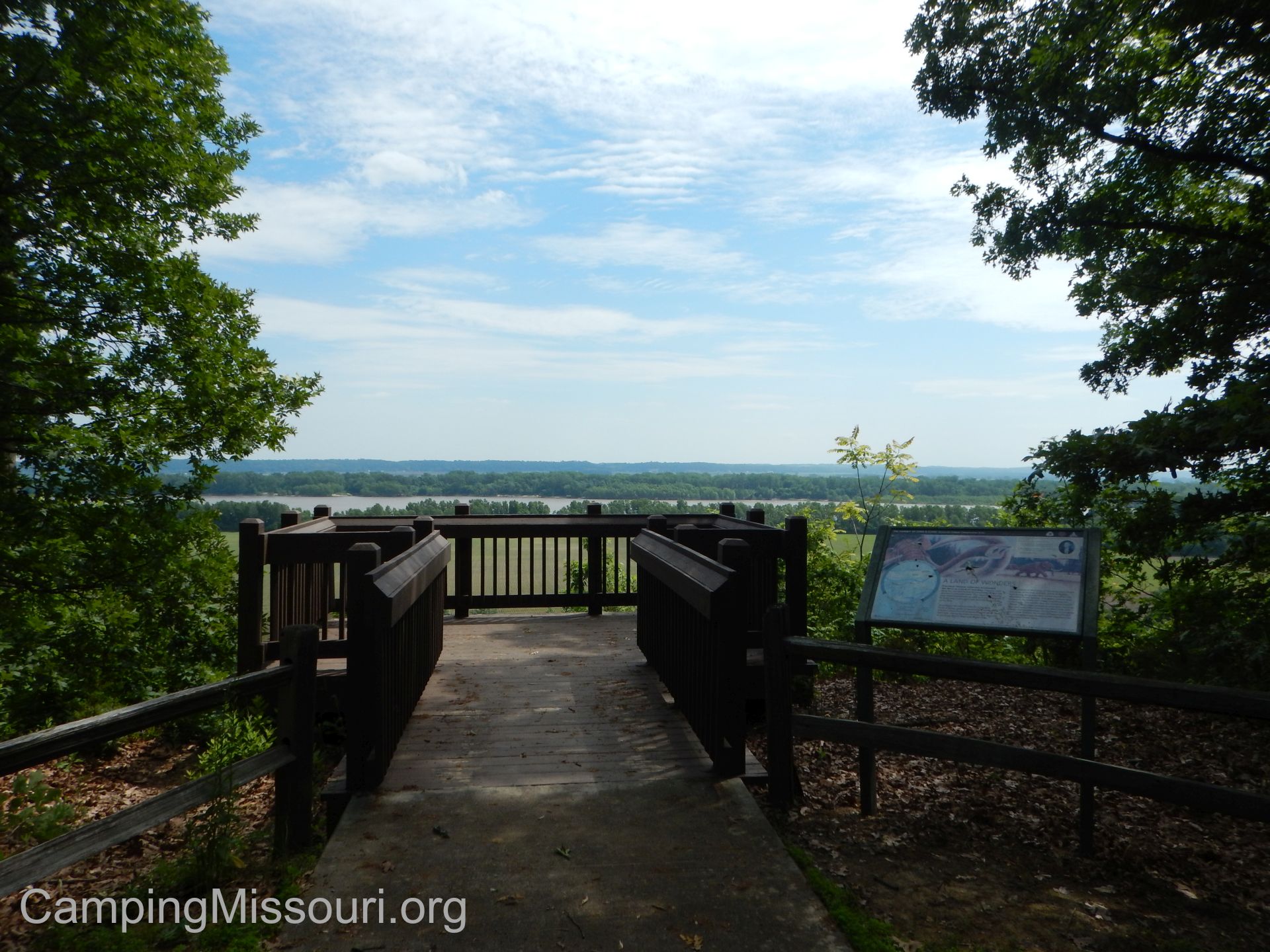 What I like about this area:
Living within a short car ride from the mighty Mississippi for years now, I always appreciate a new bluff overlook to check out. This one is set back a bit, but still offers a wide view of the great river and the landscape it has spent millennia smoothing over. Below the bluff is Establishment Creek, which is deep and green, and I would imagine that in the winter the view is even more spectacular, once the leaves and brush have fallen and the bluff is opened up a bit more.
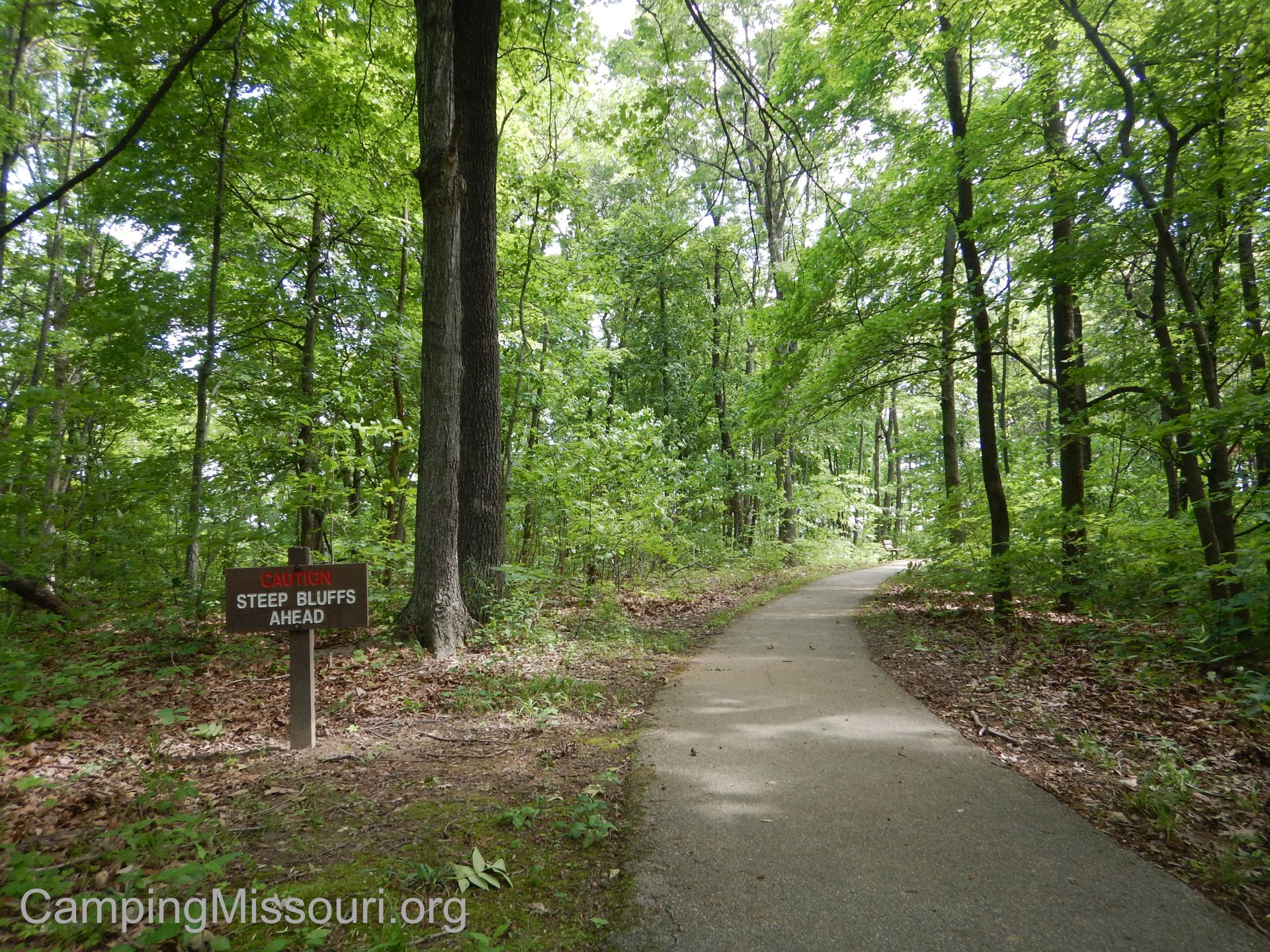 The overlook is handicap accessible from the parking lot to the guardrail on the deck itself, including the park bench at the overlook, which makes this a great spot for anyone to bring a picnic lunch to enjoy on top of the bluff. Thank you to the Missouri Department of Conservation and their willingness to accommodate nature enthusiasts and hikers of all stripes.
Something that I really enjoyed was the drive in along White Sands Rd. It follows the base of the hills on the southern edge of this creek valley, dipping in and out of the forest as it parallels Establishment Creek here and there, passing along expansive farm fields as it makes its way out to join the Mississippi River. A journey that is really picturesque, where I find myself asking how these people got so lucky that they get to live in such a beautiful place. The sort of road that you feel some disappointment when you reach the end, wishing that it would cut around another curve and you could continue further on this gorgeous little country trip.
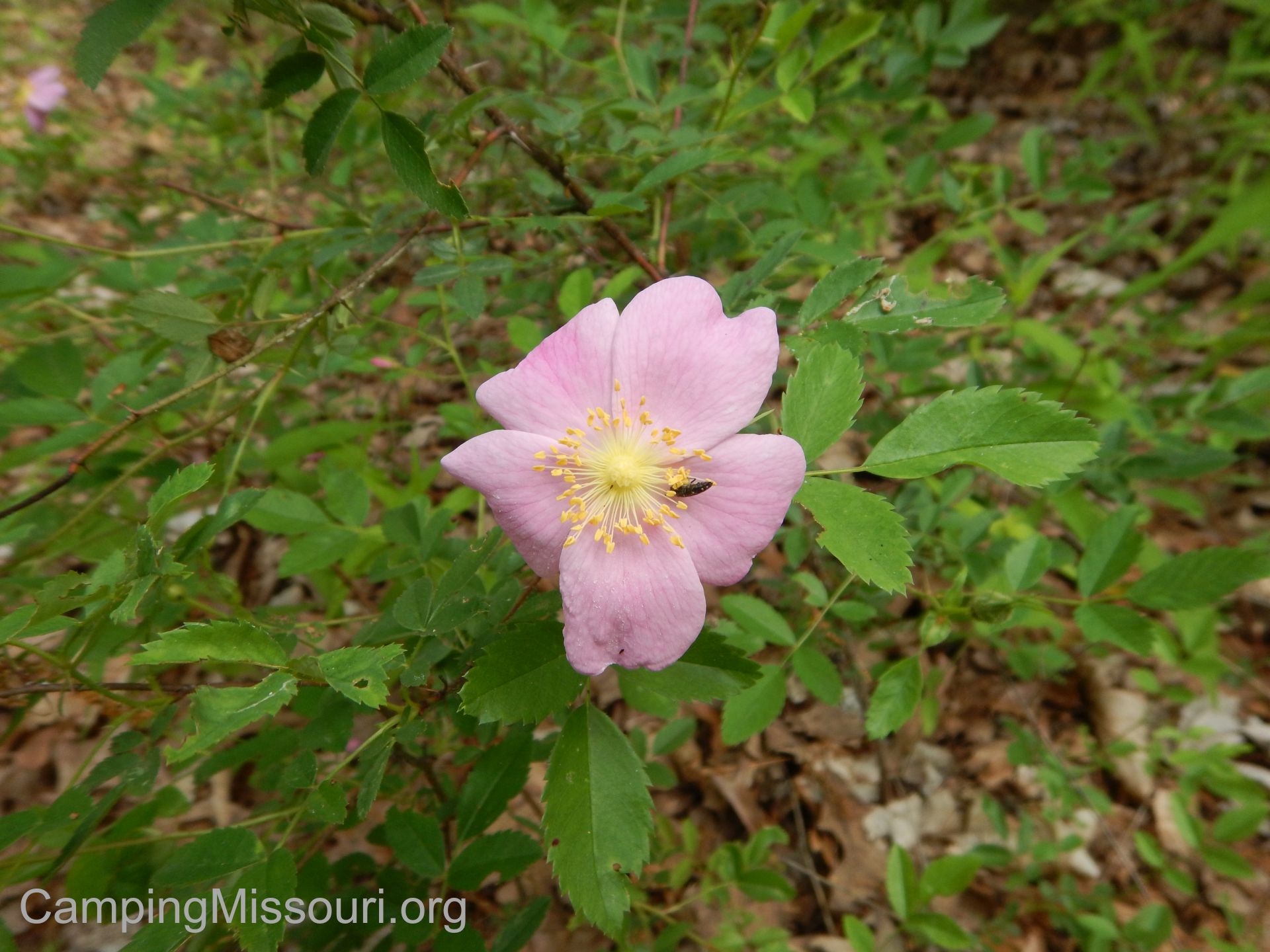 What you need to know:
This seems like the area that gets busier during deer season. With trails that access the acreage beyond just the overlook trail, it has a lot to explore. Please be mindful of when popular hunting seasons are so that those who partake may be able to do so without hikers walking through, spooking the game.
 I was really hoping for a chance to get near Establishment Creek, but there wasn’t any reasonable access to it. At the bottom of the trail there was a spur trail that had been cut through, but it was inundated with Poison Ivy, so I wasn’t about to go tromping through.
The loop trail coming off of the overlook that we hiked is an established trail, but it wasn’t very well marked in a couple spots. Most notably toward the creek bottom, I could see someone going over to the dry gravel waterway to explore a bit, and then having a hard time finding the path back up the hill. Keep your eyes peeled and don’t stray too far.
 All in all, this was a nice little excursion, introducing us to a tributary of the Mississippi River that we hadn’t known already, and giving us another view of the massive waterway, after a very pleasant drive to it. There is surely much more to explore there, and I know that Max and I will return to see what other adventures live within the depths between the river hills of the Magnolia Hollow Conservation Area.
 The Joachim Creek is a little waterway that runs from St. Francois County, through Jefferson County, and out to the Mississippi River. It starts in Valles Mines, MO, gains water from the hills it runs between in Desoto, and then widens out in the valley through Hematite before curving northward at Festus and heading toward Herculaneum. A lively ribbon of water that travels through a handful of eastern Missouri communities. If you didn’t live near it, you may not even know that it is there until it crosses under Interstate 55 and heads toward the mighty river that it adds its flow to. The little Joachim Creek, quiet and sparkling for most of its length.
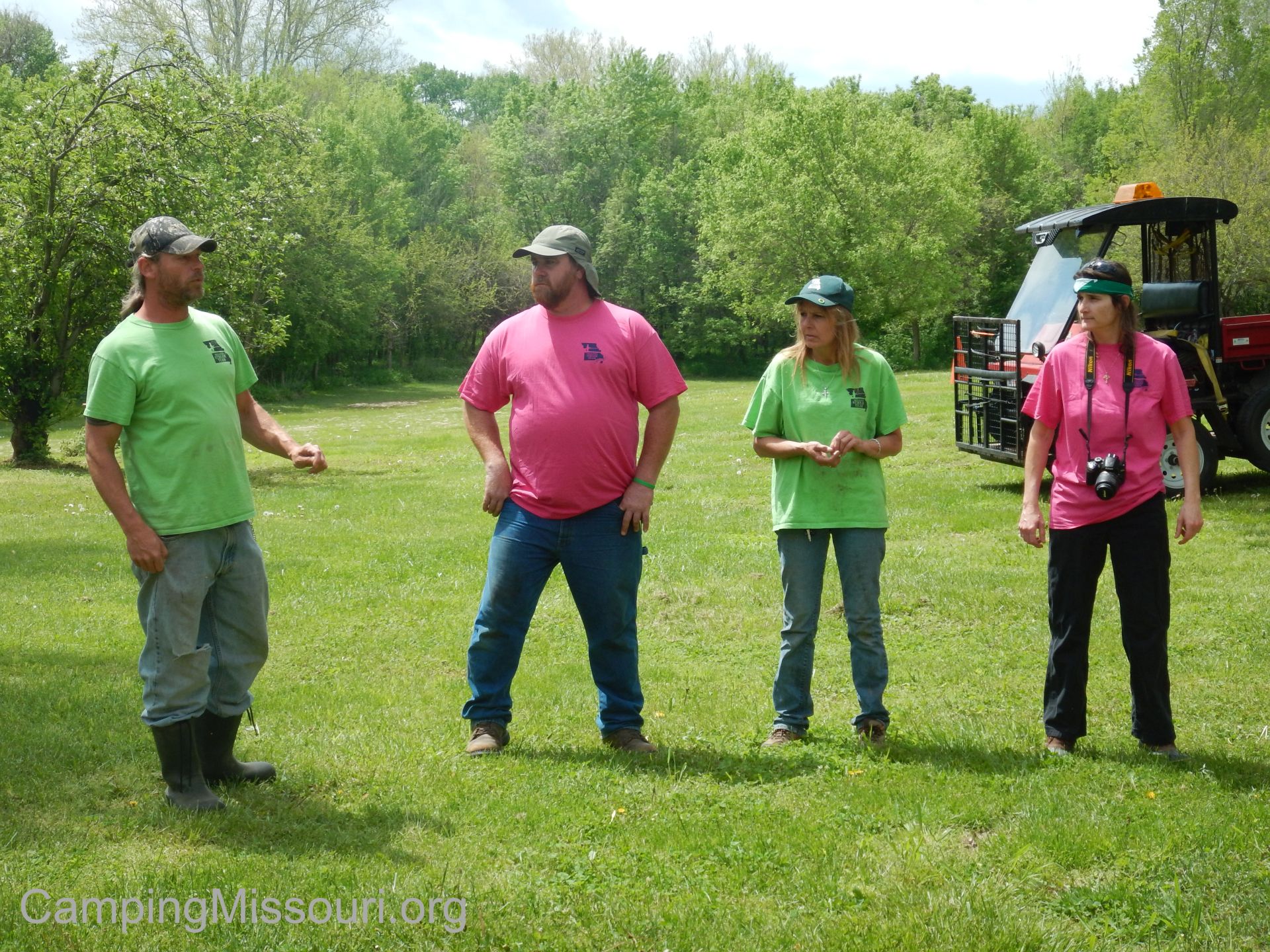
(left to right) Ken, Erik, Christine, and Leeann.
Today we were headed to Hematite, MO to clean up a section of it, with the unstoppable Stream Team #4660! Ken Thomas and Christine Endsley are just about the two hardest working, most dedicated-to-this-cause Stream Teamers that I have had the pleasure of knowing and volunteering alongside, and this was the day of their annual Spring cleanup. The forecast had called for a chance of thunderstorms and it had already rained a little during the morning, but it looked like we might have a window of dry weather in the early afternoon. We arrived a little before noon at the home of Erik and Leeann, who were kind enough to let us use their property for the event. We said our hellos to all the great Stream Teamers that were there that day, signed in, and spent a few minutes socializing. By the time everybody arrived, we headed across the lawn to an old stone barn on the property, to get our safety talk and the plan for the day.
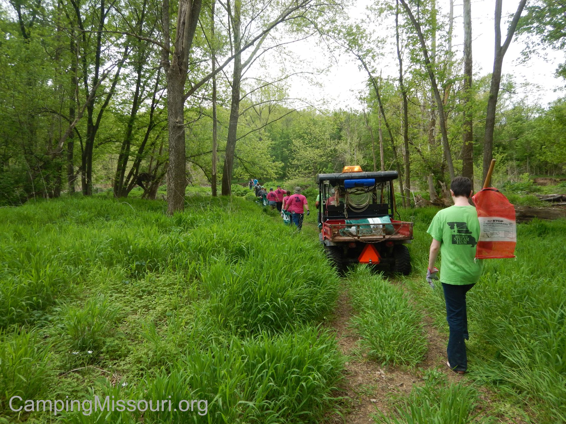 Now the Joachim runs right past the property we were on, at the bottom of a slope to the south, and some of the kids were going to stay behind and clean up what they could find around there and plant some trees as well. Most of us however were going to be heading down the road about a mile upstream to focus on a section of the Joachim on the other side of some old farmland. We consolidated vehicles and drove down the road in a big caravan, pulled off to the left and into a field, and parked near what looked like an old stone silo. It was then a hike through a field, across some train tracks and down into the floodplain, and then out to the gravel bar along the creek.
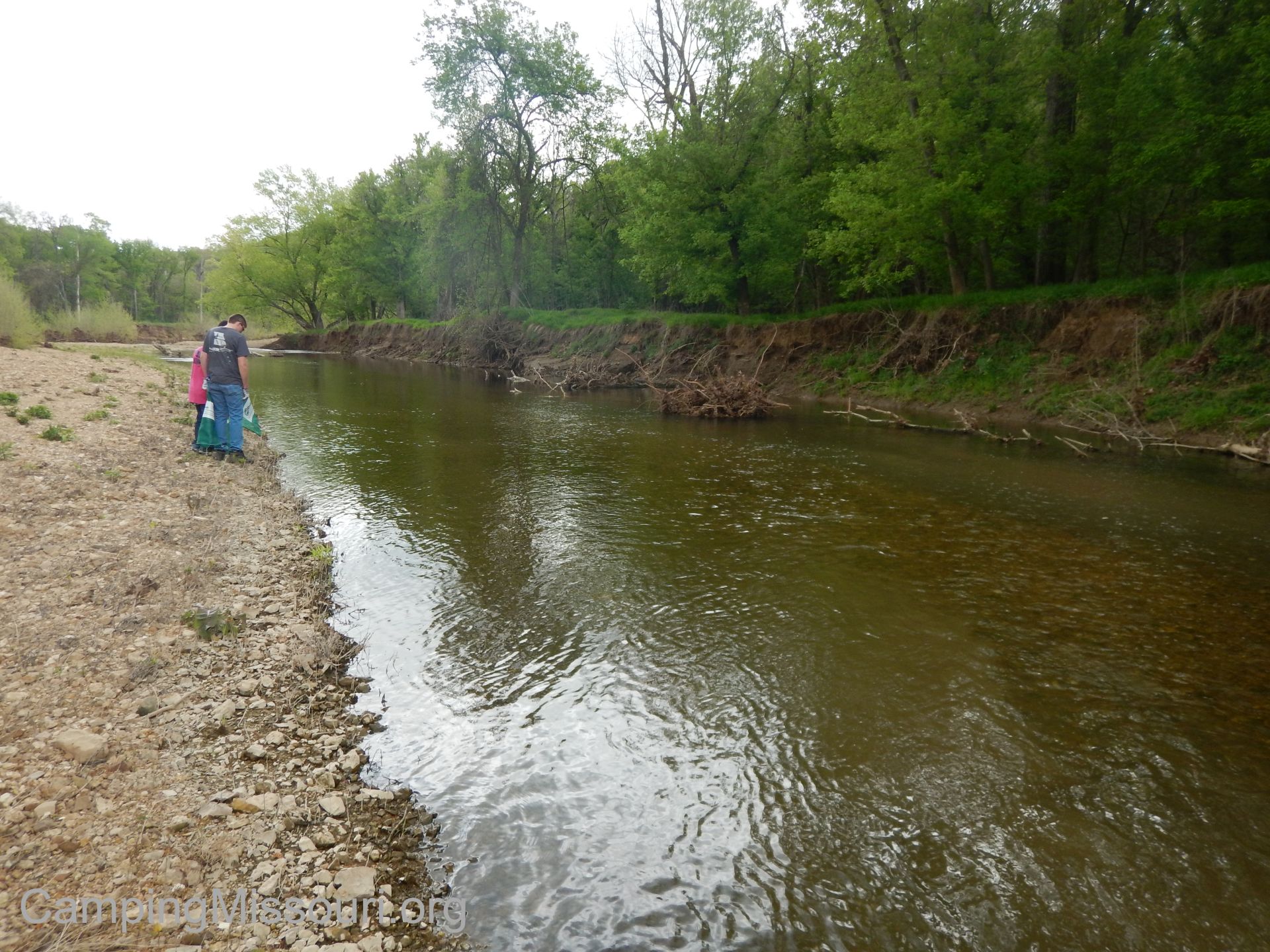 There was a good amount of area to cover, so when we arrived at the creek we each grabbed a green bag or two and spread out. I chose to climb through a pile of collected logs that had been swarmed by vines the previous year, and was now draped in dry, dusty tendrils of wood, hiding all the garbage that had collected there. It was kind of a treasure hunt, climbing around on this pile, spying the trash within and pulling the logs and sticks and vines out of my way to reach in and get it. One thing I have found is that where wood and debris collects due to floods, the garbage does too. After just a couple of minutes I had nearly filled my bag, fighting my way through to the other side.
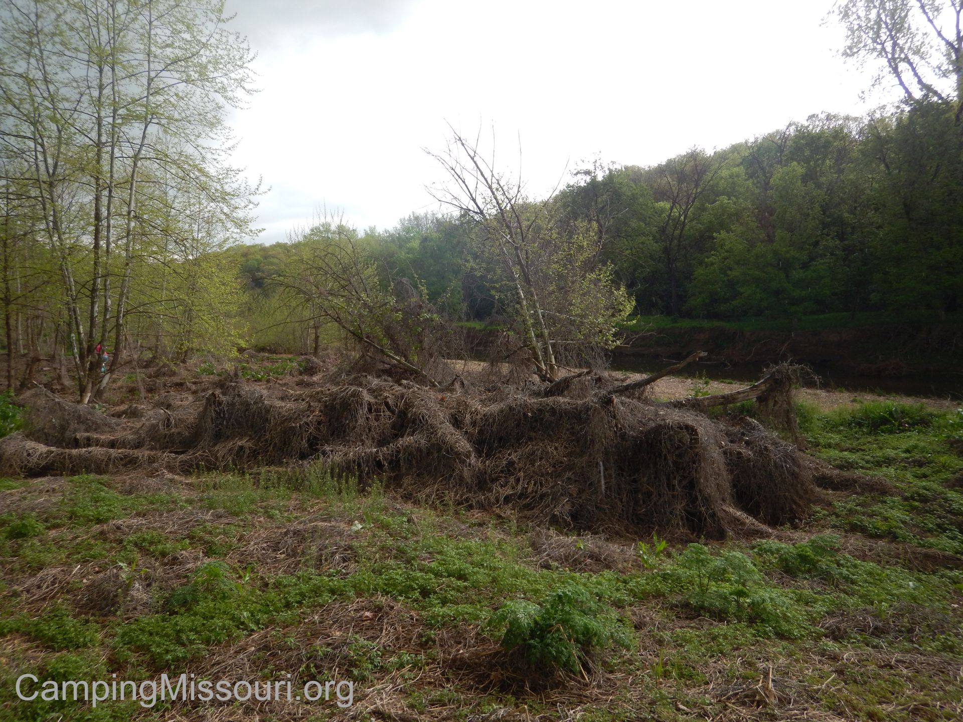 After getting an empty bag and scouring the backside, I felt satisfied that the woodpile was now empty. I turned and headed into the low sandy bottomland forest next to it, a small hollow of leafy green plants amid a layer of naturally gathered sticks and glass and plastic. Quite a few people were already working in the area, so I joined them and we made our way to the far side, filling our bags with all the items we could find that didn’t belong in the woods.
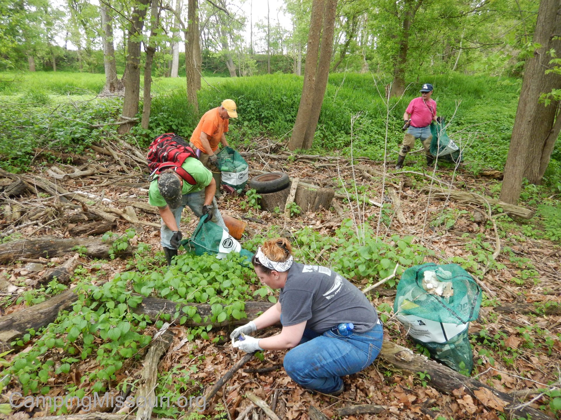 After we had found all the trash in the area, we split off for a bit and made our way toward the Joachim, walking down next to a beaver slough, filled by a trickle coming down from the woods and field above it. It was a mucky reflective pool that was home to all sorts of frogs, sitting silently in the mud before hopping into the water without even a chance to be noticed until they were already submerged and swimming to safety on the far side. We walked out onto the beach where the trickle met the creek, and soaked in the charm of the Joachim. It was clear and full of life, splashing along in the shallows over its collection of pebbles laid across it by the current, between the deeper pools that were home to fish and the bugs they like to eat. It had a sense of purity to it, and is a much different waterway than the one I had been introduced to out in Herculanem a few months earlier, near where it meets the Mississippi. A gorgeous creek that moves unnoticed through the landscape, except by the good people in the communities it touches, that work to keep it healthy and beautiful.
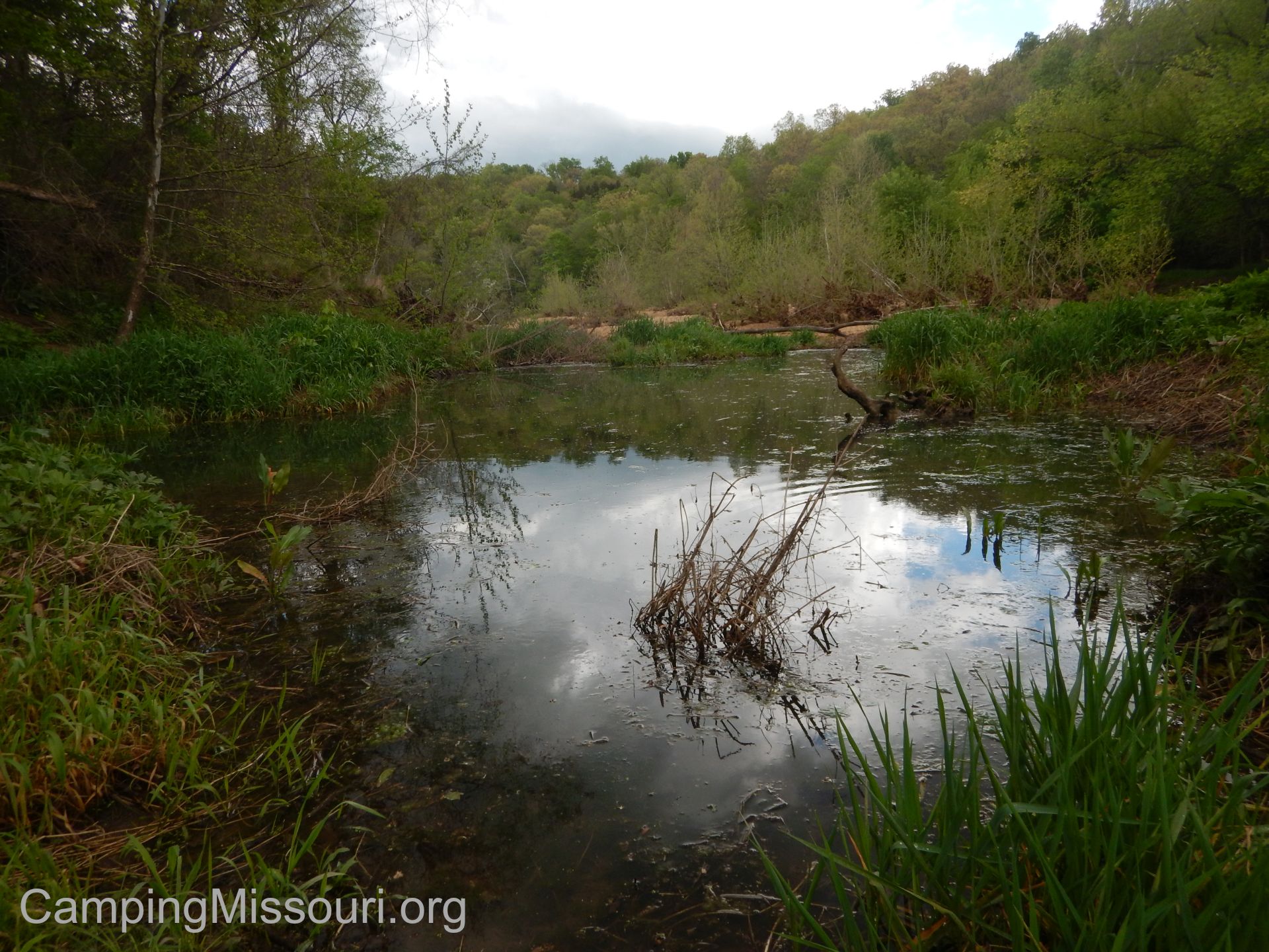 After getting to all the areas we had wanted that day, we all started to make our way back out to the cars, turning into the brush a couple more times to search for trash that might be hidden. Once back at the silo, we helped to separate the tires out and load them onto a trailer to be turned into Dobbs Tire and Auto. Last year, Ken Thomas had brokered a sponsorship/deal with them for all Stream Teams within the scope of their stores, in which they would help out to properly dispose of the tires we collected. A pretty amazing feat that has been very beneficial to the cause, giving us an outlet for re-homing the abandoned and wrongfully discarded tires we find along these waterways.
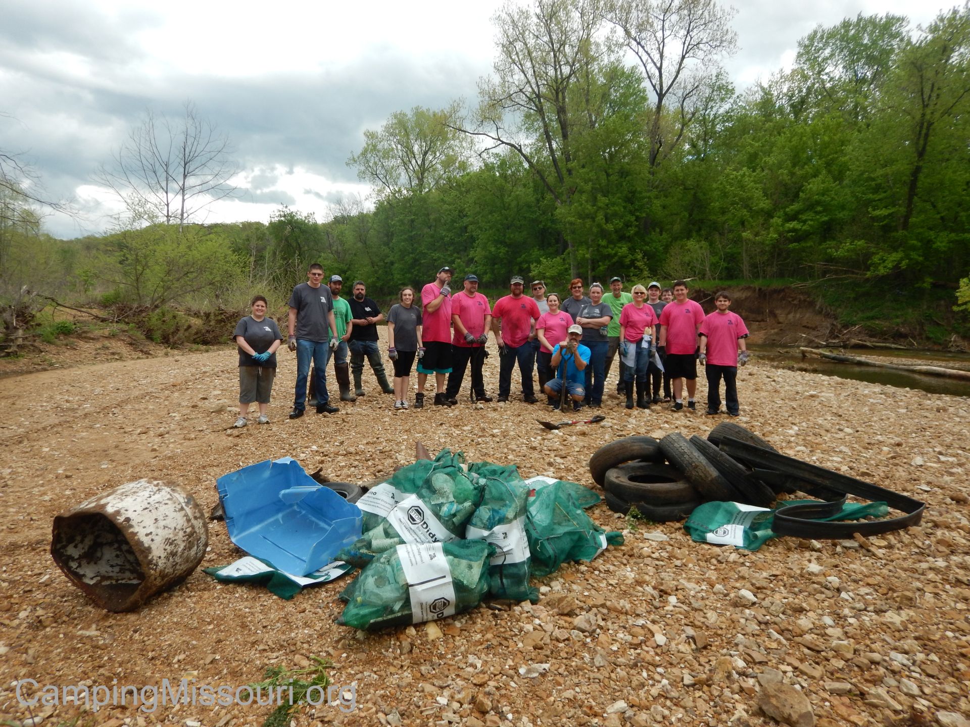 We got back to the house and it was time for food. We all socialized for a bit as we watched the rain moved in, telling us that our time was up and nature wasn’t going to wait any longer. It had been a great day, and as a group the #4660 had removed 64 tires, 200 pounds of metal, and 55 green mesh bags of garbage from the scope of about a quarter mile of the Joachim Creek and its floodplain. Quite an achievement!
 The best part of the event for me though, beyond working alongside some truly inspiring and dedicated people, was that it was the day of my 37th birthday. If there were two things that I wanted to be doing on that day, it was to be surrounded by friends and doing some good in the world, and I got both! The really special moment was after the safety talk when Christine brought out a cupcake with a candle in it, and the whole group sang “Happy Birthday” to me. I really am just about the luckiest guy!
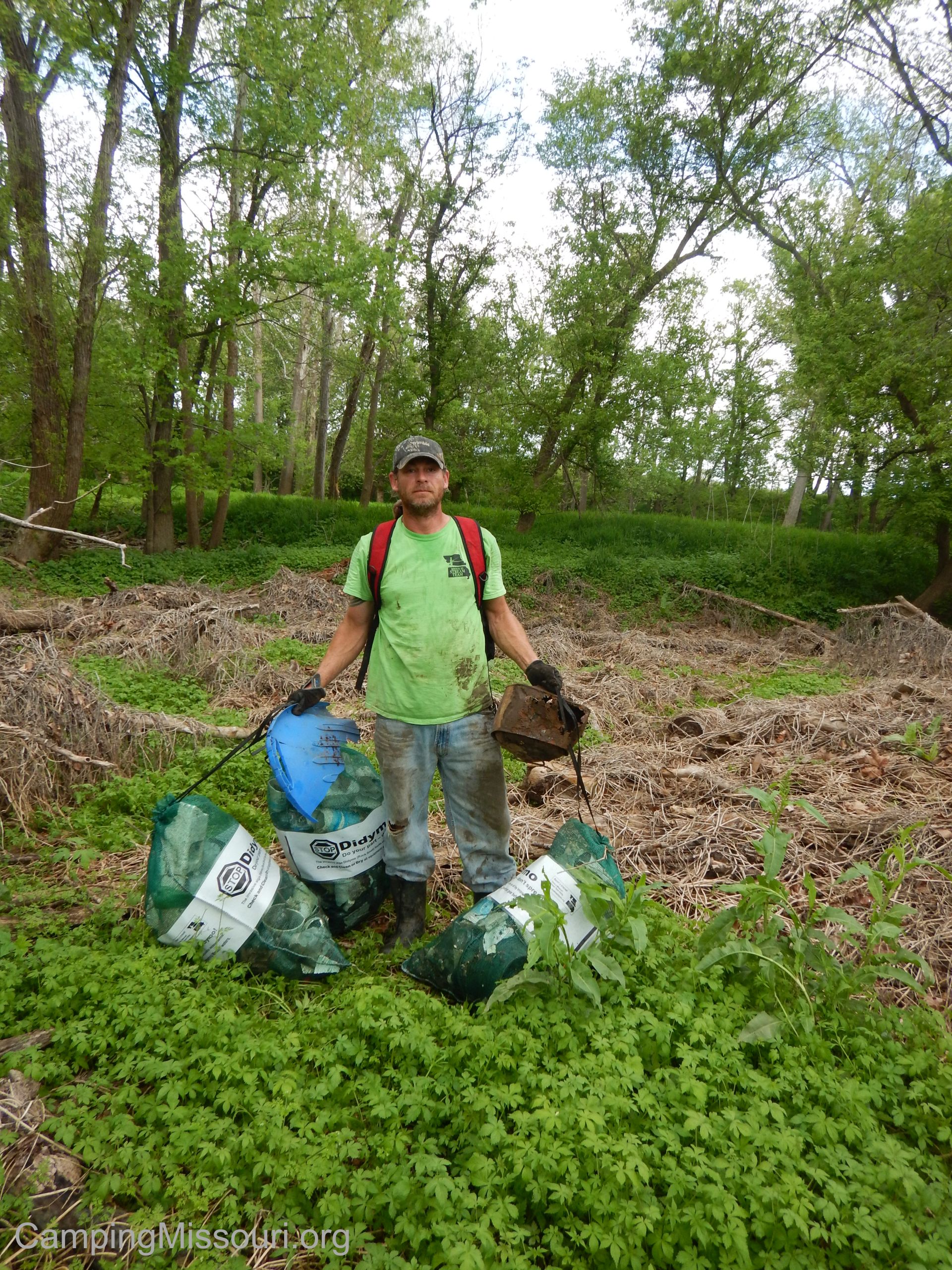
Ken Thomas, showing everyone how it’s done!
The first time I met Ken Thomas and Christine Endsley was back on a freezing Saturday morning a little over a year ago on a floodplain along the Meramec River in St. Louis County, the ground solid and covered with a light layer of snow, making my first Stream Team cleanup a challenging experience. Something that Ken had said, that I see more true with every new experience being a part of this stewardship program, is that “if I was crazy enough to be out in this weather…I may just be crazy enough to be a Stream Teamer.” It does take a little craziness, but it also shows the overwhelming passion that those two have, which inspires so many others to accomplish some pretty amazing things! The two of them are the definition of what Steam Teams are all about, and I am proud to know them.

Rock stars, every one of them!
So I hear tell that somewhere below Hematite, the Joachim Creek is home to a lot of tires that need to be pulled out. Ken, Christine, and a handful of other people just recently went on a scouting trip along it, and they have reported that it needs some attention. I know for sure that as long as the #4660 is leading the charge when they head back to remove the tires, I will gladly be there in a canoe right behind them. They are an unstoppable force, improving the health of Missouri creeks just about every weekend, showing all of us how it ought to be done. I wouldn’t miss that action for the world!
 Get involved with being part of this great program and go on your own Missouri Stream Team adventures with great people at their website!

Deer Creek, flowing past Deer Creek Park (the Rocketship Park) in Maplewood, MO.
Well it has been a busy Spring of volunteering just about every weekend on some natural restoration project (with a little camping and hiking throughout), be it at Missouri Stream Team cleanups, the Ozark Trail Mega Event, or this past Saturday in Deer Creek Park in Maplewood, MO removing a TON of honeysuckle growth along the creek bank with the Open Space Council for the St. Louis Region. I have posted about invasive species in Missouri before, as an overall problem that needs our attention, and this morning we were part of the laborious action that it takes to work toward the solution to that problem.

Typical Operation Clean Stream float trip!
The Open Space Council is an organization whose mission is “to independently and collaboratively conserve and sustain land, water and other natural resources throughout the St. Louis region“. They have been around since 1965 and according to their website, they “have played an integral role in restoring and supporting a clean and healthy Meramec River, helping to establish Castlewood State Park, Forest 44 Conservation Area and Beetree County Park, restoring more than three thousand acres of land and almost 500 miles of river, permanently conserving an urban organic farm (which Earthdance Farms now owns & operates), and helping to thwart efforts to dam the Meramec River” (back in the sixties and seventies). They are also the organizers who put on an annual cleanup along the Meramec watershed called Operation Clean Stream, in which August of 2014, over 2200 volunteers in a single weekend removed 2481 tires and 250 cubic yards of trash from this beloved eastern Missouri waterway!

You wouldn’t even know there was a creek back there!
They do a lot in the St. Louis region for people that enjoy the outdoors right in our own communities, and today we were at the “Rocketship Park” in Maplewood to tackle the rampant honeysuckle growth along Deer Creek. The kids and I pulled up a little early and spent a few minutes at one of the picnic shelters discussing the day’s plan along with the effect of invasive species in our local ecosystem. A bright Saturday morning with Jay Doty, the Open Space Council representative running this event (and personal friend of mine), Bernie Arnold of the Arnold #211 Stream Team (another friend, who has removed honeysuckle and volunteered at cleanups along Deer Creek before) and a handful of other volunteers. Jay gave us a safety talk, we each grabbed either hand saws or loppers that were provided, and then walked along the asphalt path to the section we would be working on today.

Working alongside two of the awesome volunteers who showed up that day!
When we arrived at the section of stream bank where the honeysuckle had not yet been removed at past events, we spread out and started cutting plants at the base, dragging them out of the woods, and piling them on the grassy area between the path and the riparian corridor. The visionaries of this project from the OSC and the city of Maplewood had concerns about bank erosion, so our goal was to leave the roots in the ground where it sloped toward the creek, to later be carefully and locally treated with herbicide at the cut. The next step would then be the planting of native species in the areas where it is needed.
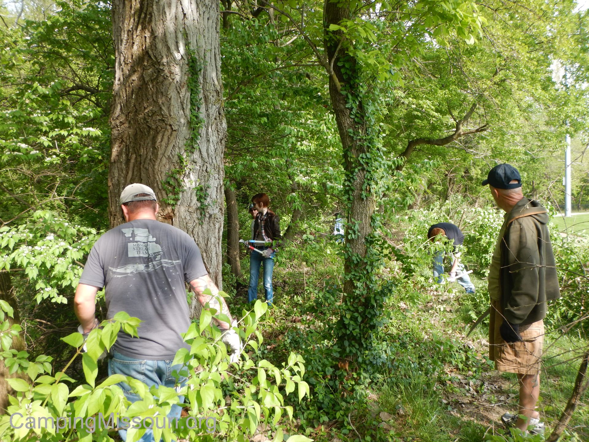 It was some hard work, but the weather was pleasant and everyone moved along in the same direction, working together cutting, dragging, and piling; doing our best to not harm each other in this flurry of moving decapitated honeysuckle. The piles were to be processed by Maplewood park workers within the next week, and we were building an impressive green levy of removed brush, flanking the asphalt walking path. Many bushes were narrow enough in diameter to slice off with the loppers, but a good amount had to be cut through with the handsaws, and then pulled up the bank to the collection above. The teamwork of everyone, standing solidly on the bank and passing the felled honeysuckle limbs up to the next person above in the chain made it a swift and encouraging process.

Closer to how Deer Creek ought to look.
Something that I appreciated the most as we were working was the change in the look of the creek bank as we made our way along it. We would move into the next section, shaded and secluded by the arching branches and multiple green leaves blocking any view and cut them out, allowing the sunlight in. It opened up the creek bank along the edge of the park, and changed what some might consider a rather ignored stormwater pathway into the picturesque urban creek that it is, flowing past little league fields and families enjoying their community green space. That change, similar to looking back after a Stream Team cleanup, created an immediate sense of satisfaction. To see the young maple trees and cottonwoods and box elders bordering this rocky waterway standing proudly, freed from the choking brush that had been overtaking the scenery gave us all a feeling of accomplishment, opening up this little neighborhood waterway to how it ought to look.

Below the sub-canopy.
But this is what I really do it for:
These invasive species weren’t brought into our regional ecosystems to destroy our forests and waterways. They were brought here with a lack of knowledge of the full scope of their effect. Honeysuckle isn’t a terrible plant. It just takes advantage of our environment in this spot on the globe, sucking up the resources and crowding out the plants that have always lived in balance with one another here in Missouri. It struck a chord in me a few months back when through my job I was able to attend an invasive species class, put on by the intelligent and articulate Tom Schweiss and the kind-hearted and knowledgeable Yvette Luedde, both of whom work for St. Louis County Parks.
 Standing in a closed-in porch at the end of an old building in Jefferson Barracks County Park, gazing out through the line of glass windows to the forest on the other side of the road, Tom brought to our attention that when the trees just yards away from us live out their lives and eventually fall to the forest floor, the honeysuckle that surrounds their feet will keep all the young trees from having a chance to take their place in the canopy. The natural cycle of the forest will be changed completely, and these massive giants that are so representative of Missouri river woods will not grow again, their descendants not even being given the opportunity to grow through the tangle of sub-canopy that has been established by the invasive honeysuckle throughout our region. It will change the shape and look of our landscape, the habitat for the animals that live within it, and the open spaces that we like to spend our free time in. It is already on its way, and it will take the community to set things right.
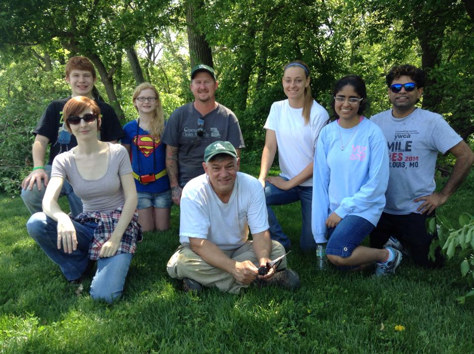
The great volunteers who worked until the very end!
To get involved and volunteer to stop it, check out the Open Space Council’s volunteer page. Spend a Saturday morning with some great people, protecting the woods right in your own community. Be part of the solution to the problem of invasive species in Missouri.
Note: Most of the pictures on this post were taken by my adventurous daughter Sophie, which allows me to get into the work that I am there for. She is getting pretty awesome at it!

Sophie, taking a break from behind the lens, and Eli hard at work right next to us. I couldn’t be more proud of the two of them.
