
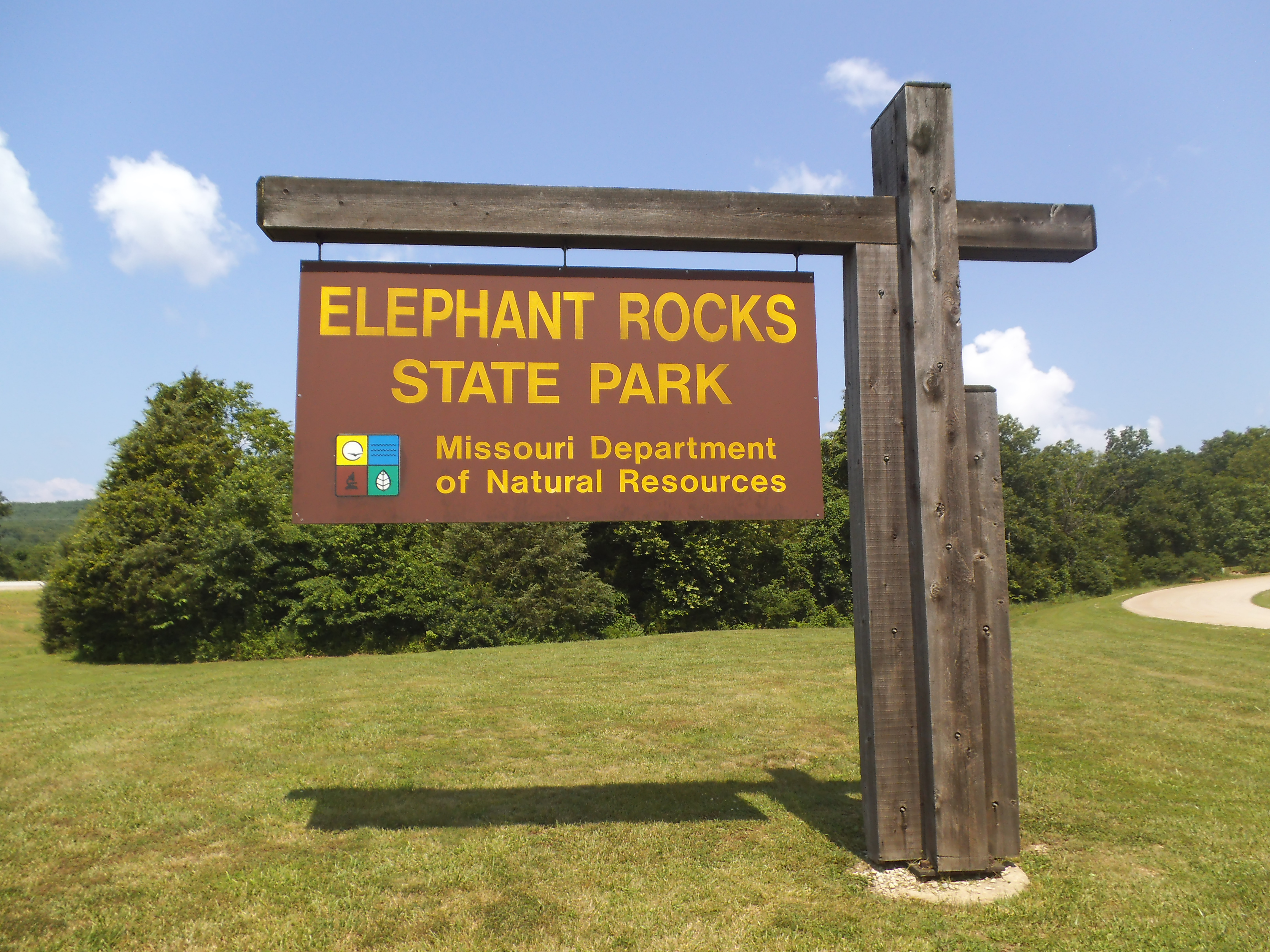
 If there is one place in Missouri that you need to see at least once, it is Elephant Rocks State Park. Located off of highway 21, just down the road from Graniteville, MO, it is home to some of the coolest geological formations in the state. Sitting atop an exposed red granite hill, are giant weather-rounded boulders that look somewhat like huge stone elephants standing in a line. However, at 162 pounds per cubic foot, they are much heavier and dense, and they don’t seem to mind when little kids and adults are climbing all over them.
The process that caused these formations (and all the other spots in the surrounding area) started over a billion years ago! Erosion, water, wind, the sun and the seasons have all contributed to the exposure of these rocks, along with a bit of human influence. Back in the late 1800s, this area was quarried to pull the rich Missouri Red Granite from the ground and send it off to be used in buildings and roadways. Many of the streets in downtown St. Louis are filled with paving blocks from this very area. Some of the red granite still exists today as part of the Eads bridge that spans the Mississippi, built back in the 1870s. Established as a state park in 1967, this is one of the coolest places to spend the day, exploring all the crevices and rock piles in this awesome, natural playground.
 How to get there:
From the 270/55 interchange in South St. Louis County, it is about an hour and a half. Take 55 south to US-67 at exit 174b. Stay on 67 for just around 35 miles, until you get into Farmington. In Farmington you want to take MO-221 southwest (right) toward Doe Run (also, be aware that some road atlases refer to 221 as W. This is a recent change). After about 7 miles, 221 merges with NN. Turn left onto NN and stay headed in the same direction for about another 9 miles, until you hit highway 21. Make a right on 21, and after about a mile and a half Elephant Rocks State Park will be on your right.
 From the St. Louis area you can also take highway 21 (Tesson Ferry) all the way down there. This is the more scenic route that is a bit more curvy, with a bit more in the way of Missouri charm in the small towns you pass through, especially Caledonia. It also takes slightly longer due to the more restricted speed limits, but it is worth taking this route at least once if you get the chance. I usually return this way because I enjoy the drive and the scenery.
 What I like about this park:
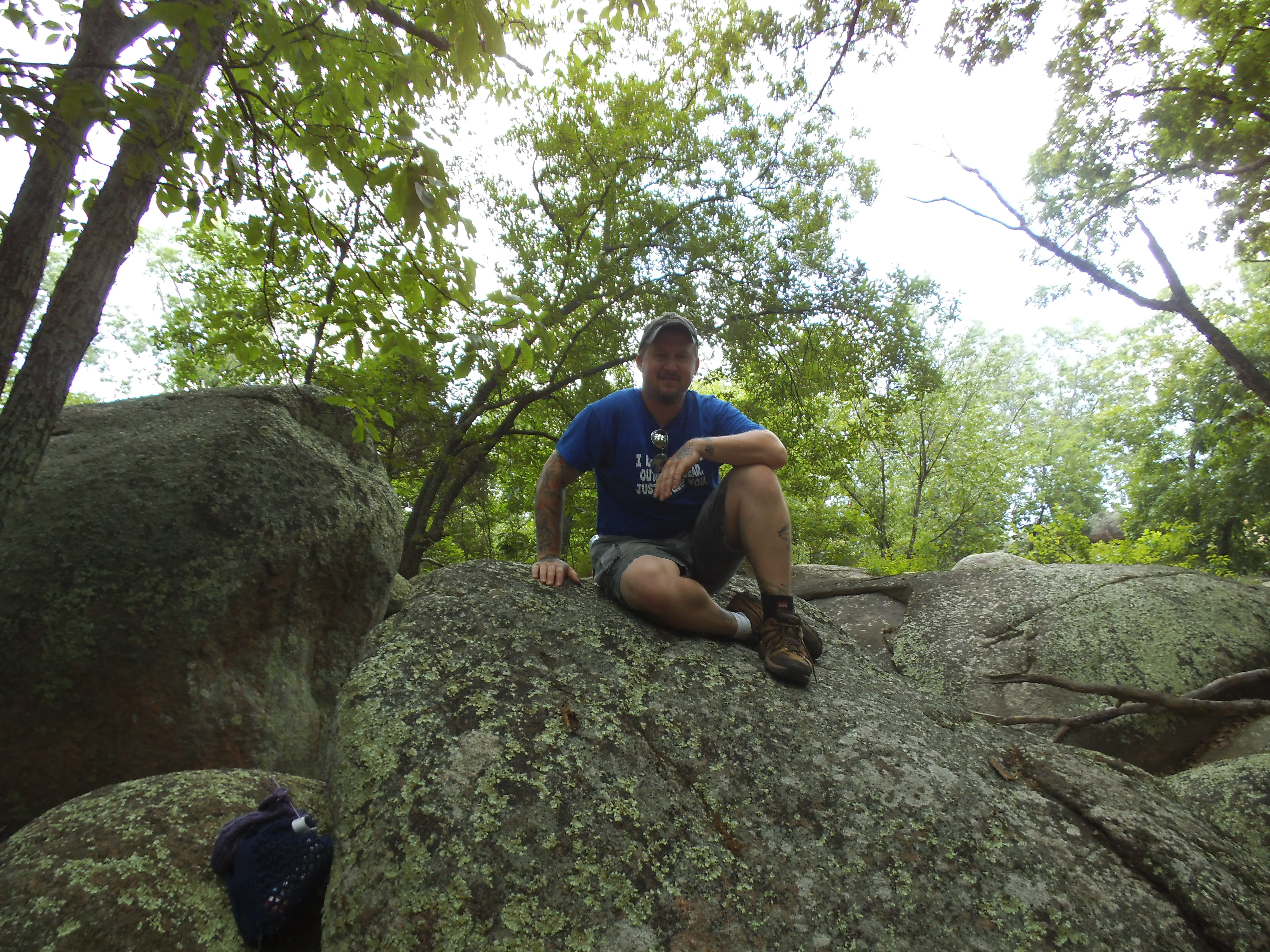
It is a giant playground. When you first walk up the short trail from the parking lot to the interpretive loop, you haven’t even begun to see the majestic unearthliness of this amazingly beautiful place. At the junction in front of you, you need to just keep going forward up the rocks to emerge through the trees to see the striking and unfamiliar landscape in all its glory. No matter how much older I get, I am always instantly filled with the energy and desire to scramble, jump, climb and crawl, every time I come to this park. It is so fun, especially now that the kids are at a good age for it. We just pick a leader, and get to exploring!
 The history of the area. If it is your first time here, make sure to walk the 1 mile Interpretive Trail around the park. This trail has signs along the length of it that are all about the granite, how the rocks formed, and how humans influenced the place. Who put all these rubble piles here?!?
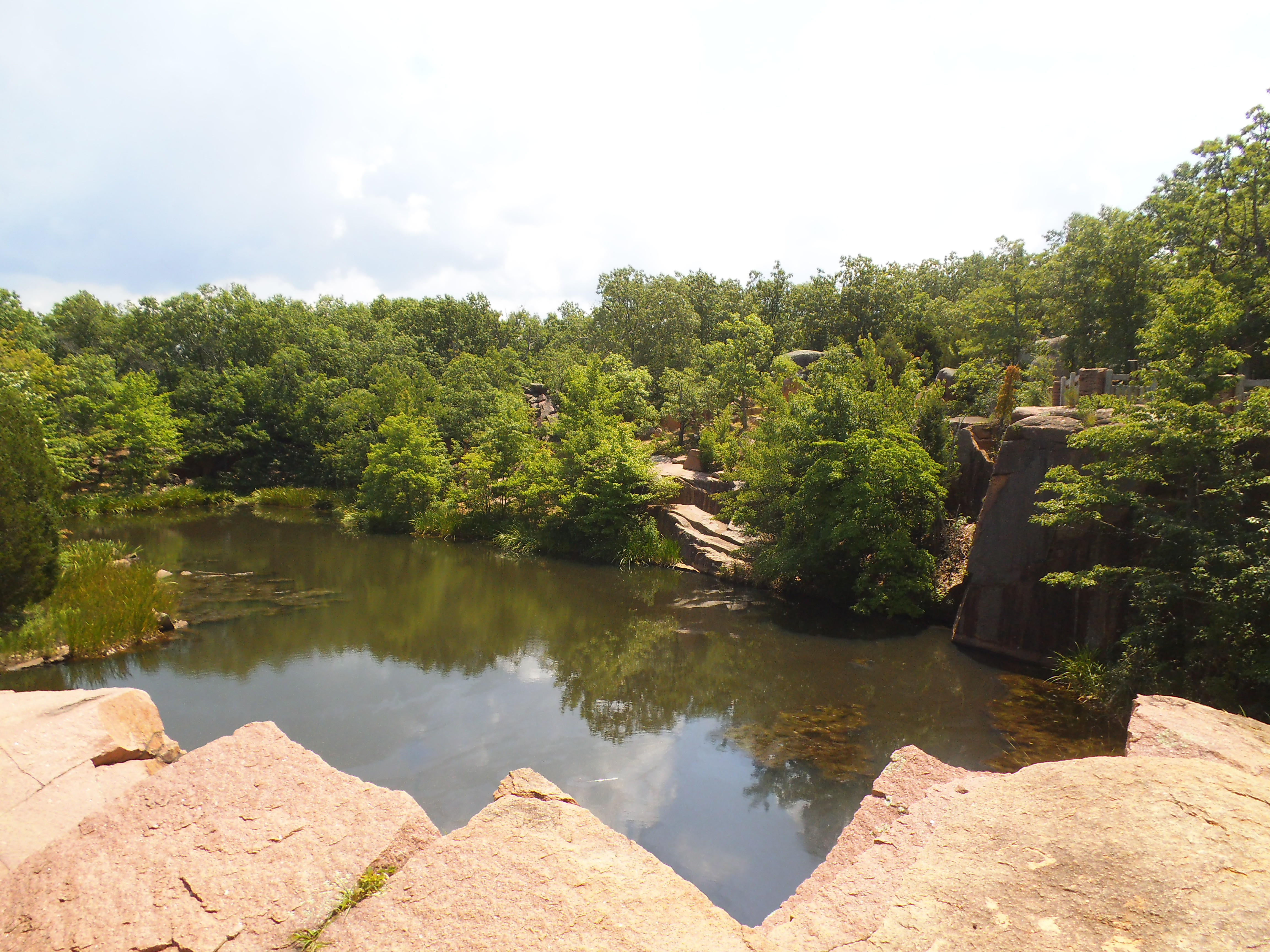
There are also the ruins of an old engine house that you need to go check out. The beautiful Missouri Red Granite walls are a great example of the striking and sturdy character of this area’s biggest star, the rocks themselves. The engine house was built as a service garage for the trains that would carry the granite out from the quarry to larger depots, and then eventually all across the country. Take the short spur trail to it, or hike along the slightly longer Engine House Ruins Trail that takes you back around one of the quarries which is now a deep pond.
 There are a good amount of picnic areas out near the parking lot, so pack a lunch and something to drink, and make a day out of it.
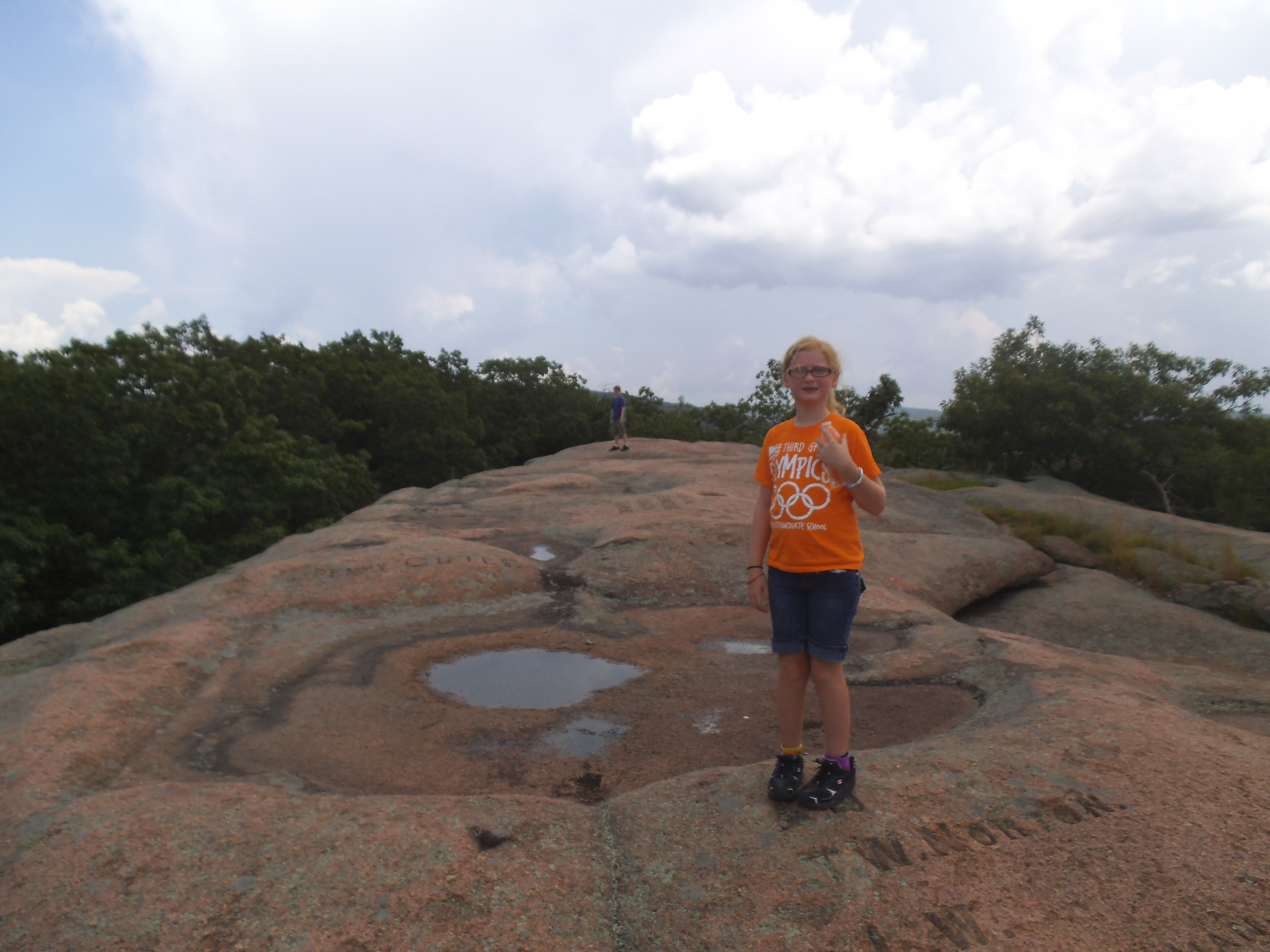
The top of the hill. There are great views from here, and great opportunities for pictures. The landscape seems like a place from another planet, and it is filled with all sorts scenery that you have to see. Don’t forget your camera!
 What you need to know:
As wonderful as this place is, it can also be a dangerous place. Some of the slopes on the rocks can be unexpectedly smooth and slippery. Be prepared for a couple bruises and scrapes. If you don’t come out with at least one mild injury, you probably weren’t playing and exploring to your full potential.
 Come to terms with the fact that you are probably going to get a little sweaty and a little dirty, especially on a warmer day. I have often thought, after crawling through some opening between the bottom of two giant boulders, that knee pads and gloves would be a good idea. Prepare to spend some time feeling like you’re an eight year old again, and remember that everything is washable. If you can have that as your mindset, you will have a lot more fun.
 Sometimes, especially in the summer, the place can fill up quick. There is a lot of parking available, but you might have to wait a couple of minutes to sit at that picnic table you’ve got your eye on. Plus you will also probably have to wait in line for the bathroom. Pay attention and head over to use the facilities when no one is waiting.
Have patience. Sometimes the route you want to take is being traversed by a toddler and his wide eyed Dad. Be a good park patron and accommodate the ability level of everyone around you. And hey, maybe this is the part where you take a chance to explore new routes!
Don’t forget to bring some water. There is a drinking fountain on the western curve of the Interpretive Trail, but staying hydrated is important while you’re active and you might not be on that side of the hill. Plus a lot of the activity here is in direct sunlight, so on THAT note, bring sunblock too.
 I cannot emphasize how much you need to check out this incredible place. It is so much fun, and we make it a point to head there at least once a summer. I am also going to try to visit in the winter to see how it looks with no leaves on the trees. I would imagine too, that it looks incredible in the rain. I think watching the water fill up the eroded pools and cascade down the rocks, sharing the ancient secret to how this place was formed, would be a pretty beautiful experience. Elephant Rocks State Park is one of my favorite places, and pictures on the internet will never convey how amazing it really is. I loved it back when I had more spring in my step, and you can bet that I will still be climbing and jumping and scrambling around it long past the point where my body says it’s okay.
 Continued from Part Four
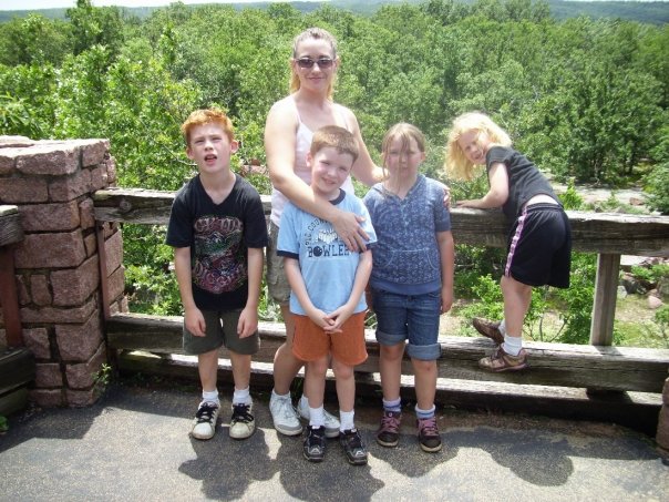
It is late spring in 2009, and I just turned thirty one. My son Eli is the energetic age of eight, and my daughter Sophia will be six a little later in the year. The gal in my life that I have been seeing for a handful of months is divorced and a parent too. Her name is Melissa, and her daughter is a creative ten year old named Veronica. Her son Logan is a thick haired, scrawny kid, just around the corner from turning eight. We are on our first camping trip together as one unit, at St. Francois State Park near Bonne Terre, MO. It is about ten o’clock at night, and it is storming like mad. Melissa and I are standing on either side of the picnic table, holding down the canopy we had set up, while the rain blows sideways through us. The lightning strikes close by, and the kids shriek in the nearby two-room tent as the thunder almost immediately cracks after it. This is definitely the adventure part.
 Melissa and I look across the table at each other as the flashes of lightning illuminate our faces. Both of us are soaked to the bone. The terrified children are off to the side in their tent, with their flashlights nervously dancing on the other side of the nylon walls. The whole scene conjures up images in my mind of the deck of a boat, rolling through a storm as water crashes over the bow. The rain blows across my face and a pool of water from the canopy splashes down on my head. She looks at me with a smile and a shrug, and in the cacophony of the wind and rain and noise, I can’t help but laugh. She laughs too, and the weather soon begins to ease off a little. The wind dies a bit and allows the rain to head to the ground in a more standard, vertical direction. The lightning and all its yelling has moved out slightly away from us toward the northeast. The canopy is saved from blowing into the forest, and we have all survived. This was the point that I knew I had found a lady sturdy and adventurous enough to keep up with my unkempt and wild need to spend time in the woods, regardless of the challenges along the way. And it has been a handful of years since that first camping trip together.

 Our children are that much older now too, and a bit more weathered and independent than they were that dark and stormy night. They are all taller and more active. They now set up their own tents for the most part, though it can still be a challenge when it comes to working with each other as their diverse personalities dictate each one’s vision of how the process should go. They are more willing to hike the trails, that I the outdoor dictator, choose to have us hike together on our camping trips throughout the year. Either they have come to enjoy the excursions through the forest more than in the past, or they have gotten to where they realize that any increased amount of whining from them will almost always result in a longer hike. They continue to make sure that they stay within the campground when the night creeps in, but have also been afforded further boundaries to roam as the years pass. And they know to keep quiet in the morning, unlike many campground children, so that their mildly hungover Dad can ease into the dawn from the campfire communion the night before.
 And I truly, really, powerfully cherish the time I get to spend in the woods with them, especially now that they are getting older. The hikes are more fun and exploratory. The setup and take down of equipment is less time consuming. The relaxing by the fire these days is with the best companions in the world. And it is those moments by the fire, when I see and hear my children talking about the hike we went on earlier that day, recounting the animals and plants and creeks and trees and mushrooms we saw…that I think back to those days long ago, hiking through the woods with my sisters and parents, canteen strapped to my belt, going up and down the bluffs along some river that is still out there flowing as it has for centuries. Those are the moments when I recall and cherish the memories my parents guided me to earn as a child. The experiences that sparked my love for all this stuff. The opportunities they gave me to make the connections to the natural world that I have, and that I now experience through the joy I feel as I see the continuation of that practice through my own kids, in these modern days.


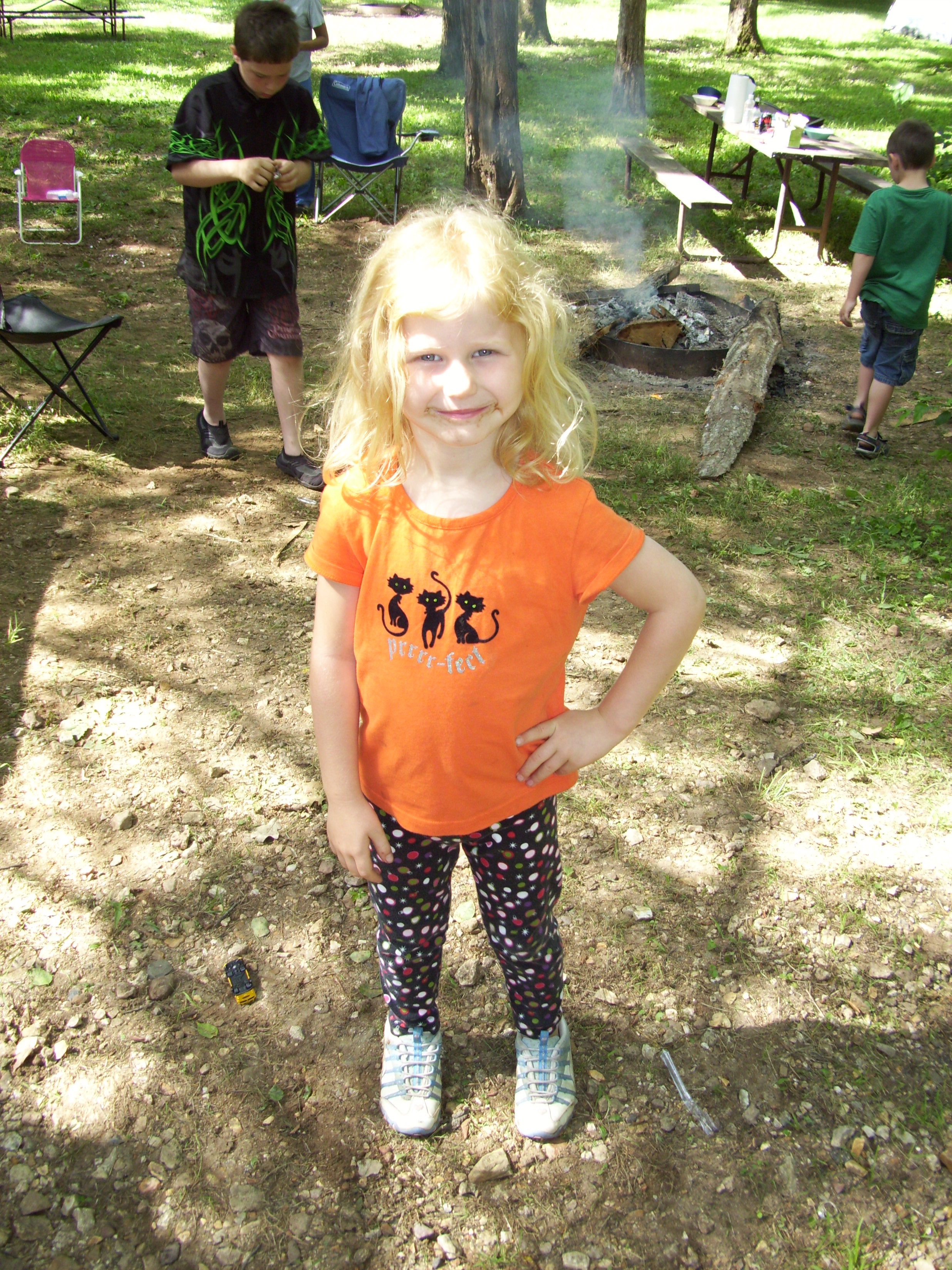
In the past four and a half years, we have been camping more and more frequently, a lot of which is due to my employment situation. Lack of a job creates a lot of free time, and camping isn’t a big expenditure if you already own the gear you need. We have, as a family and as just a couple, camped in a lot of the Missouri State Parks, centered mainly on the St. Louis area, and some of the other public and private campgrounds that are out there as well. The campgrounds that we have camped at in the State Park system are: St. Francois, Washington, St. Joe, Sam A. Baker, Hawn, Graham Cave, Meramec, Finger Lakes, Mark Twain, Cuivre River, Ha Ha Tonka, Onondaga Cave, Robertsville, and Trail of Tears. And those are only fourteen of the forty or so that have campgrounds in our Missouri State Park system. Some of the other campgrounds we have stayed at are Twin Rivers Landing, Ozark Outdoors, Highway K Park, Marble Creek, Lower Rock Creek, and Jerktail Landing along the Current River.


In total, that list is just a small amount of all the places to go spend a night out in the woods in our beautiful state of Missouri. I live in the St. Louis area, and other than on a rare occasion, I usually keep my drive time to about two hours. It’s at about that point I am ready to be out of the car and among the trees, setting up the tent and gathering firewood. It occurred to me on a recent trip that the invention of the automobile was really what has made the ability to camp away from the house in some scenic location a leisurely practice. As I drive through the edge of the Ozark Mountains or on the curvy roads down through the Arcadia Valley, the lessening of true distance is something to be appreciated. That these places are as accessible as they are. That it isn’t beyond our reach to be in them. That it is something we can do as recreation instead of survival. That the waterfalls and rivers and mountaintops and deep woods aren’t THAT far away, is truly a blessing that we all need to plunge ourselves into from time to time. We live in an amazing age, and for those of us in Missouri, we live in a gorgeous state. I have said it before and I will continue to say it…that as we don’t have majestic mountains or exotic forests or breathtaking deserts that occur in some of the other states in our union, we have anything and everything else that the natural world and the earth and creation have to offer in the way of beauty and wonder and charm, here in Missouri.
 And this story isn’t nearly over. Before I know it, these kids are going to be asking to borrow a tent and heading out on their own spur trail. Jeremiah sent me a message recently after a lapse in our contact with each other, to let me know that he was changing jobs and is going to have weekends off from now on. Last summer, while camping at Sam A. Baker State Park with family and friends, I asked Melissa to marry me and she said yes. The trail still has many sections ahead, they just aren’t mapped yet, and I am always looking forward to the next adventure. If it is the weekend, you can bet that I will probably be out in the woods somewhere at some point. It is where I like to spend my time, because the forest is in me as much as I allow myself to be a part of it, and the river is where my path always leads to.
 So I hike to the ridge and I stand for a moment, taking in the heavy bouquet of earth and wildflowers mixed with the moisture in the air. I listen to the breathing of the trees and the messages from the birds and the hymns sung by the wind. I feel the warm soil and the cushion of leaves beneath my feet. I ease my weight against a determined cedar, clutching with its exposed roots to the rain carved sandstone on the side of the path. And I look forward down the trail, accepting that I can never know where it will end up, but that I will be thankful for every step I am blessed to take upon it.
Thank you for reading. Go spend some time in the woods.
 So in the first part of this series, I brought up the different lookalikes for Poison Ivy. Along with identifying it, knowing the truths vs the myths of Poison Ivy is important too. Some of these following quotes are well known thoughts or old wives tales. Some of them are things I’ve witnessed people discussing. Either way, some of the things that are thought to be true about Poison Ivy are not true at all. I will attempt to cover the ones that I know about.
This is where I put the disclaimer that says I am in no way a science or medical expert, but I do know what is real and what isn’t when it comes to MY experiences with this demon of the plant world, so hopefully we all can learn a thing or two.
The most important part of understanding why Poison Ivy can ruin your fortnight is getting familiar with Urushiol Oil. This stuff is the oil that gets on your skin and causes the rash and blisters.This is the fuel that makes Poison Ivy the menace that it is, along with Poison Oak and Poison Sumac. Luckily for us in Missouri, Poison Oak is rare and Poison Sumac has never been documented. Unluckily for us, Poison Ivy is everywhere in Missouri.
Lower Rock Creek, a few years ago.
“You can only get Poison Ivy if you touch a Poison Ivy leaf.”
This is false. It is in and on every part of the plant, in every season and under every weather condition. The leaves, the stems, the roots, probably the leaf litter it is growing out of. I have been backpacking in the winter, when there weren’t any leaves on anything. The weather had warmed up enough that weekend so I was scrambling all over the hills around Lower Rock Creek in shorts. Wouldn’t you know it, a couple of days after being back home, the rash showed up in a couple narrow swipes across the sides of my lower legs. I had apparently come in contact with the plants or stems from a vine and had no way of knowing I was in it because of the LACK of leaves.
Fragrant Sumac hiding in the top right corner.
“Poison Ivy can spread.”
ONLY if you still have the Urushiol Oil on your skin. It is a very potent oil and there are crazy statistics that claim that just a pinhead’s worth of the stuff could get an allergic reaction from hundreds of people. Generally however, by the time the rash shows up, you have washed it off of your skin. The weeping blisters seem ominous in all there oozing grossness, but that is simply clear liquid that your body is producing. And will continue to produce, until the reaction is over and the rash begins to heal.
There are a couple situations that can occur that can make it seem like the rash is spreading. One example is that it could still be on your clothes or your shoes or your dog, and you could be re-exposing yourself, causing a secondary allergic reaction days later. Or maybe you touched the plant again (Aaaauuggghhh!!!) without knowing it, and you end up getting staggered reactions making it seem like it is spreading
Turns out I have been taking pictures of Poison Ivy for over twenty years.
“I have never gotten Poison Ivy, so I must not be allergic to it.”
According to the American Academy of Dermatology, about 85% of people are allergic to Poison Ivy…so yeah, 15% are not allergic. I will tell you though, I have had enough people tell me that they aren’t allergic, that statistically some of you are in for a nasty surprise if you tread through the wrong patch in the woods. So as most of us are allergic, some of us are lucky enough to have not yet come in direct contact with this evil plant. And like in a lot of cases with allergic reactions, your first exposure is free. The first time you touch Poison Ivy, you may not have a reaction. This is just the priming exposure. Your immune system has now been exposed to Urushiol Oil and has recognized it as a bad substance, and is ready to freak out the next time it comes around. It’s the second and third exposures that are gonna cost ya’. So you may have knowingly walked through an area with Poison Ivy in it, and not have gotten any reaction. Just don’t do it again.
 “If you aren’t itching right away, that wasn’t Poison Ivy you JUST touched.”
If you are itching right away, you touched some other jerk of the plant world. Reaction to the Urushiol Oil typically takes between at least 12 hours and a couple of days. I know based on my own experience that I usually get the start of a reaction between three and five days from when I touched it, which just gets progressively worse for a couple more days before it settles into around two weeks of general suckiness. When your skin comes in contact with it, it begins to absorb the Urushiol Oil, and then reacts to it in time. But you won’t start itching immediately. This is part of the Poison Ivy’s terror…that you won’t really know for a day or two if you win or lose. I have also heard that you do have time to wash the oil off…but you should do it right away. I would think that HOW MUCH time depends on how quickly your skin can absorb the Urushiol Oil, and I would imagine that it varies from person to person. And wash all the clothes you were wearing. And the dog.
 “My Grandmother used to eat a young Poison Ivy leaf in the springtime to build up her immunity.”
Now I have heard from a couple Park Ranger/Forestry types that they had built up immunity to having a reaction through continual exposure, and I am sure that it could happen based on the way that the body changes at times concerning allergies…but, EATING a Poison Ivy leaf?!? That just sounds like a recipe for disaster. Much like how you can get it in your lungs from burning the plant and getting the oil into the air, I would imagine that an allergic reaction in the mouth and throat and possibly digestive tract would warrant a visit to the hospital as well. Just don’t do it.
 “That can’t be Poison Ivy…it isn’t growing on a vine.”
Poison Ivy grows as a shrub AND a vine. I think the vine gets more notice however because the leaves always seem to be bigger and more menacing. But it does grow as a little sneaky shrub too, just lurking in the underbrush, waiting for YOU to come strolling innocently past. Learn to identify both versions.
I have heard other things about Poison Ivy concerning treating it, but maybe I will leave that for another part in this series. I guess I’m gonna have to go out and get some Urushiol Oil on me so that I can get some pictures of the gruesome reaction. Or maybe expose someone else to it, y’know, for education. Any volunteers?
 So we were going to camp Friday night at Cuivre (Quiver) River State Park in Troy, MO and go to the Missouri Mycological Society foray the next morning, and we had gotten up there with enough time to set up camp and go hit a trail before dinner time. We were in the mushroom hunting mode so I figured that we didn’t need to hit the longest trail, but I also didn’t want to hike some little loop that was going to put us back at the car in twenty minutes. I consulted my “Trails of Missouri State Parks” book (this thing is massive and is definitely one that every Missouri hiker needs to add to their collection!) and found out that Cuivre River has ELEVEN trails total! The 1.5 mile Frenchman’s Bluff Trail had a great description and we decided that it sounded like the perfect length.
 How to get there:
From the 44/270 interchange take 270 north to 64/40. Go west on 64/40 for about 25 miles. When you hit the interchange with interstate 70, just continue north on 61 for about 15 more miles. When you get up into Troy, MO you will come to MO-47. Get off the highway at 47 and head east (right). After about 3 miles, the entrance into Cuivre River State Park will be on your left. This is MO-147 and you will stay on this for a couple of miles, crossing a one lane bridge, passing the visitor’s center on your left, and then over another bridge, up a hill and to a parking lot/picnic area that is also the location of the Frenchman’s Bluff Trailhead.
 From the trailhead, it is a steady downward incline into the Geode Creek bottoms area. After following the creek for just a bit, you cross it and start to make your way up the hill to the fork. We opted to go right (counter clockwise) and walked along the side of the hill as it led us up and to the bluff area at the top. When you get there, you step out onto the gravel parking lot along Cheatham Road, and just in front of you is Frenchman’s Bluff, with a great view of the farmland of Troy spreading out just on the other side of the Cuivre River. The trail then turns left and takes you through a series of overlooks as it descends down into the river bottom. Toward the lower area, it turns left and soon crosses back over Cheatham Road, and back toward the fork in the trail. You then cross the creek, and hike back up to the picnic area from which you started.
 What I like about this trail:
The bluffs have a great view to the west over the local farmland/flood plain. It is the centerpiece of this trail and definitely worth checking out.
It wasn’t too long and none of the inclines were that severe at all.
This would be a great trail to hike and then have a picnic lunch afterward. The picnic area also has a playground, for those kids who still have energy to run around after the hike.
 What you need to know:
It hadn’t rained that recently, so the creek was empty and the trail was dry. The lower part of the trail gets a bit of horse traffic, as another trail shares that section, so I would imagine it could be pretty muddy after a storm.
Also, during times of flood it looks as if Cheatham Road and the lower parts of the trail get a bit of river backwater action. There was that telltale dust covering a lot of the underbrush to a very clear elevation, where the river had recently filled up to.
Pay attention to the trail “blazes”. For the Frenchman’s Bluff trail it is blue, and this trail joins up for quite a bit of its length with some of the longer trails in the area. Make sure you keep an eye on the trees ahead for that little blue plastic square to keep you on track.
 For being one of the shorter hikes I have gone on recently, the view was very impressive and it filled out the afternoon with a great chance to see the area. The kids and I found a decent amount of different mushrooms and they got to play on the playground for just a bit before we headed back to the campsite to start the fire and eventually get dinner going. A perfect afternoon hike with some great kids!
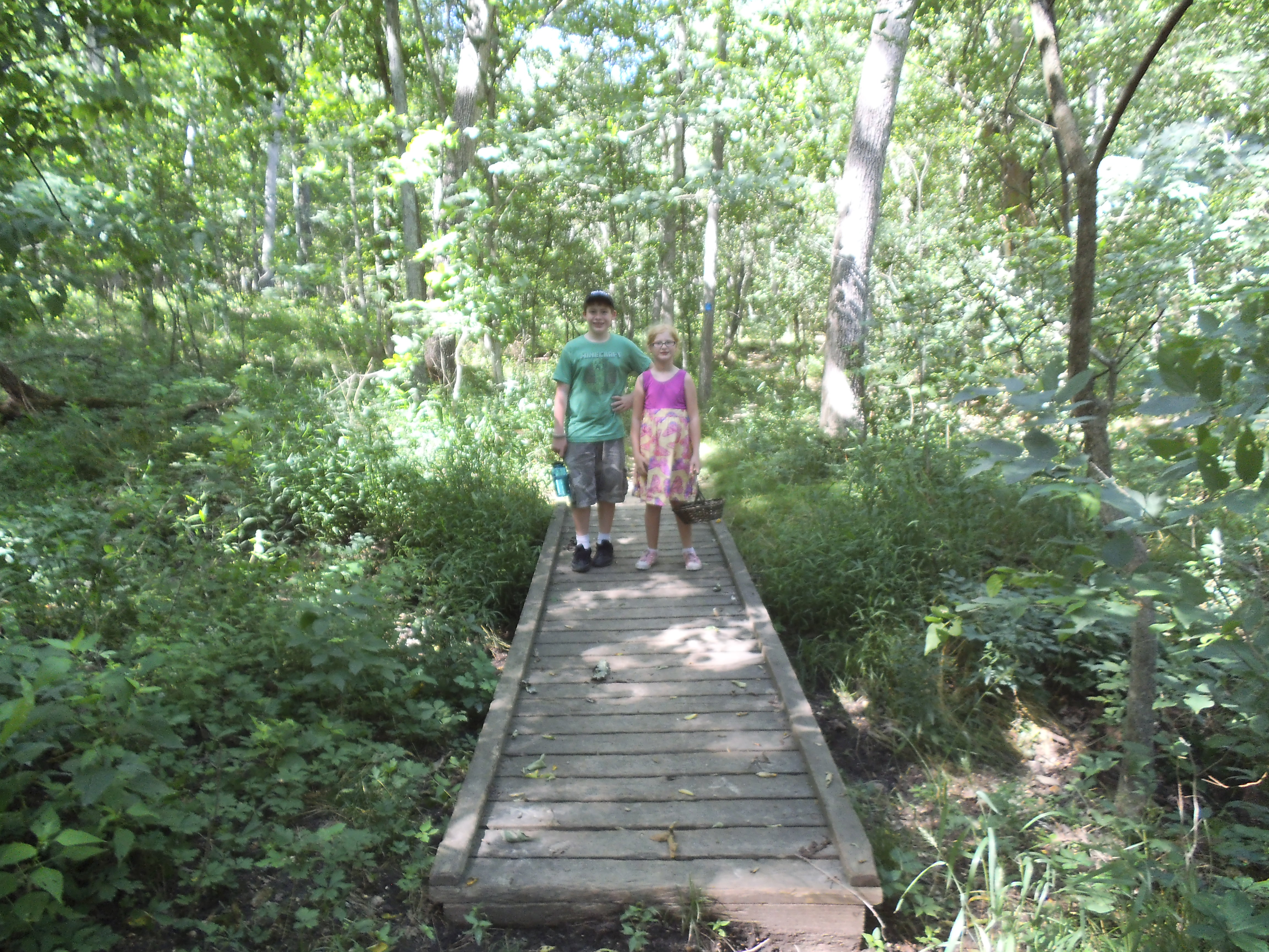
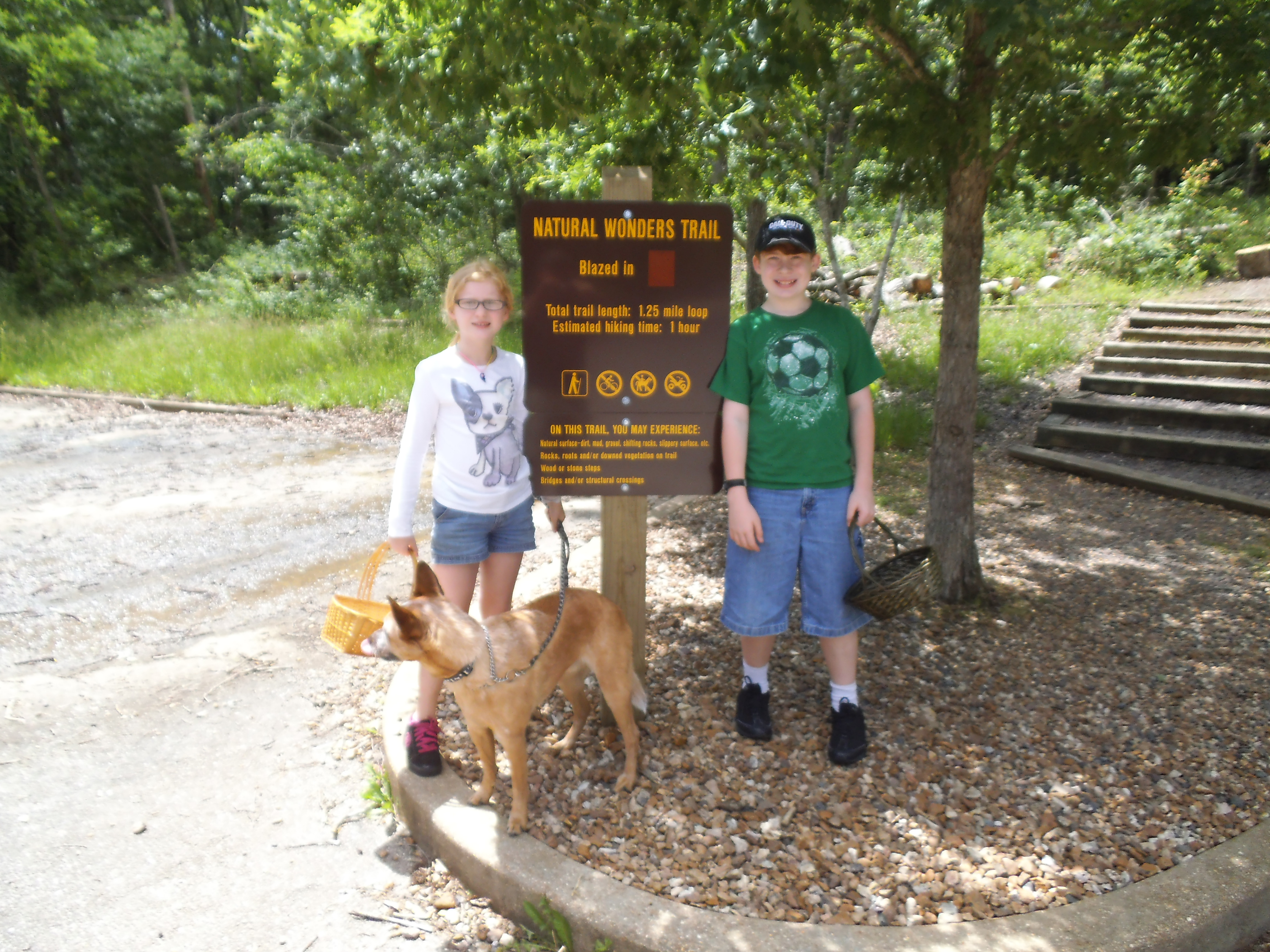 Almost a month ago, inspired by the need to take advantage of the day and get a little farther out than we might normally, the kids and I headed out to Meramec State Park to hike the Natural Wonders Trail. It isn’t a long trail, but the previous weekend we had gone to a “Common Mushrooms” class at Babler State Park with the Missouri Mycological Society, so a short hike seemed like a great idea, as we knew we were going to be spending some time off of the trail hunting wild mushrooms.
 How to get there:
Meramec State Park is in Sullivan, MO, just about one hour southwest on 44 from the 44/270 interchange. Get off at exit 226 in Sullivan, and make a left (south) on 185. In about 3 or 4 miles, the park entrance and visitor’s center will be on your right. That is also the parking lot where the trailhead for the Natural Wonders Trail is as well.
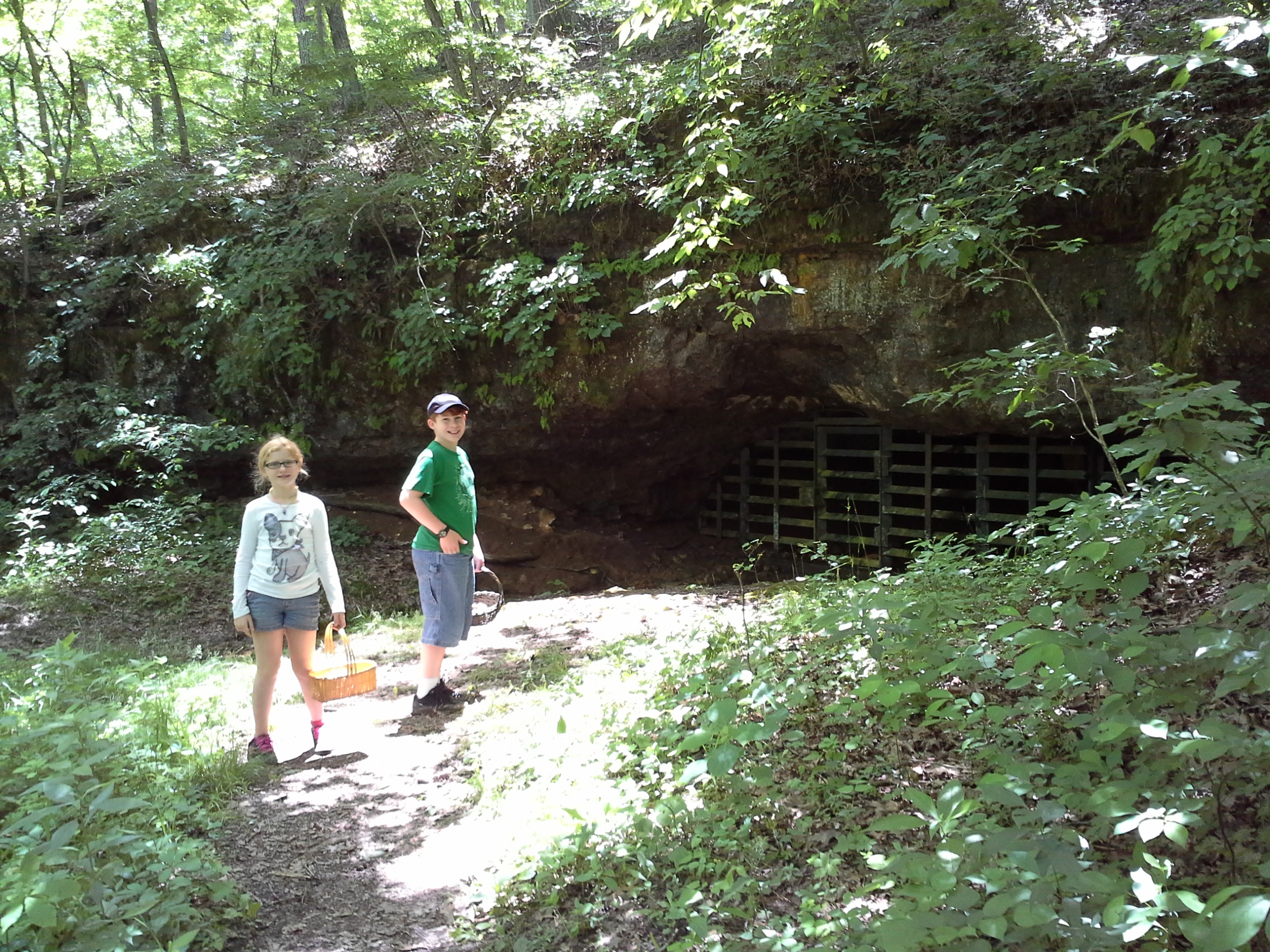 At just 1.25 miles, it is a pretty short trail, but it turns out there is a lot to see. From the parking lot you head straight into the woods, for not even a quarter mile, where you quickly come to the fork which is the beginning and ending point for the trail loop. We opted to turn right, and we followed the trail through the bottoms along the creek and past the first of three caves. The trail then turns to the left, and you ascend the hill and end up on the bluff above the cave. The trail moves along past a decent sized glade, and then back into the woods and to the second cave. It then makes another left turn, and you hike along the edge of the hill and around to the third cave on your right. Another quarter mile and you are back to the fork, and the trail out to the parking lot.
 What I like about this trail:
It’s quick and easy. No incline too steep, no need to bring a lunch or extra water. If you were camping at Meramec, this would be one to hike when you’ve got half an hour to kill.
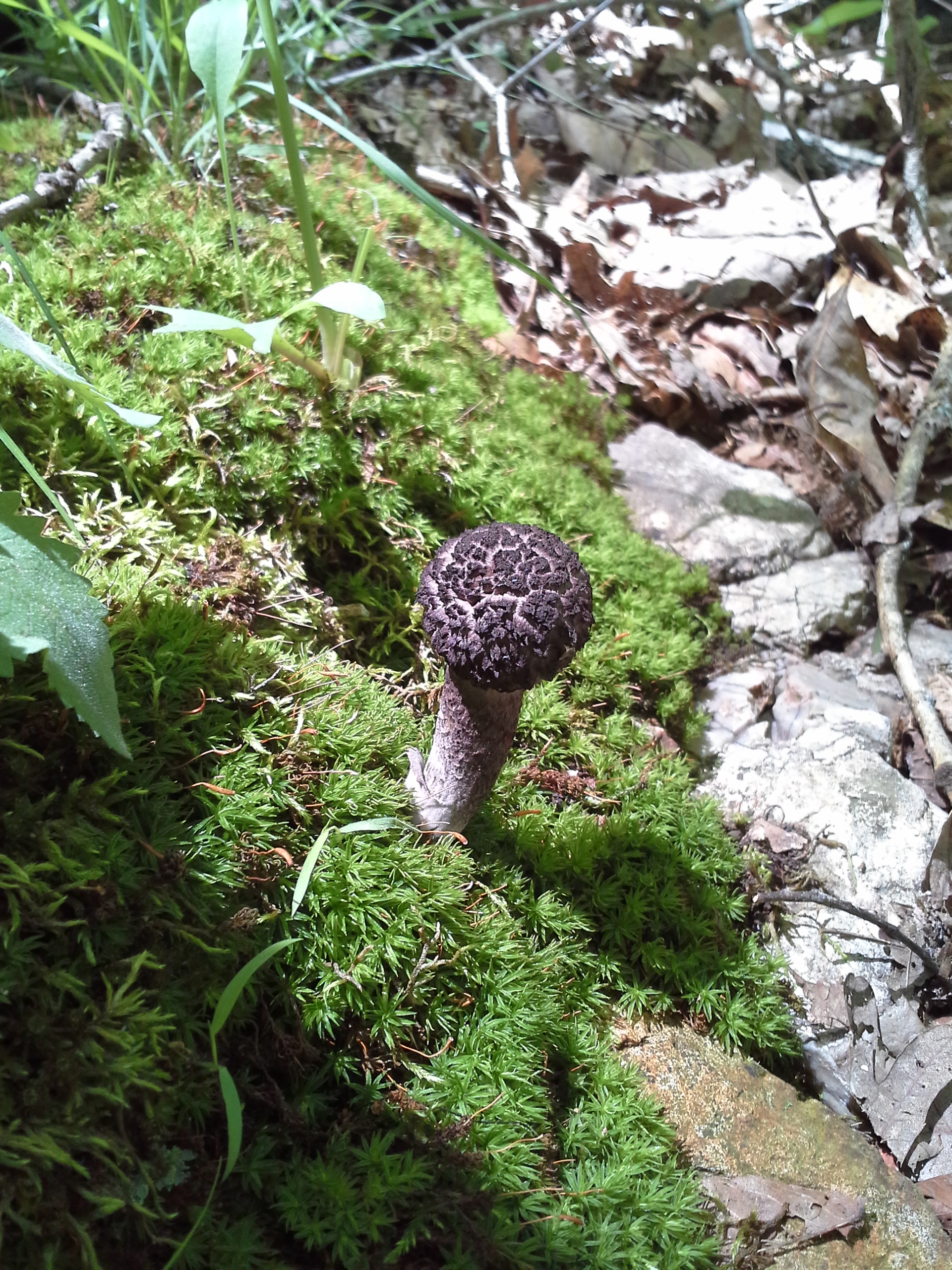
There is a lot to see! The first section along the stream, the three caves, the big glade. Not to mention all the mushrooms we found and attempted to identify.
It’s right there by the visitor’s center, and it’s worth it to take a little time and go in and check it out and learn something new about the area and Missouri forests.
 What you need to know:
It was a little muddy down in the creek bottom. Dress your feet accordingly. Other than that, there weren’t any notable “challenges” to be aware of.
Overall, this is a simple, quick trail that has a density of natural wonders in it. A significant amount more than some trails three times as long. Plus, with the shortness of it, it allows for a more leisurely exploration. We got to take our time and look all over to see what we could find. And I have to give a shout out to my two mushroom hunters, Eli and Sophia! Especially Soph, who insisted on spending the car ride home consulting the mushroom books to identify the ones we had found that day. It was a great time, and I am a lucky Dad! 
“Hi! I’m Poison Ivy and I want to make your life suck!”
When I was around ten years old and we were living in Florida, my mother and my sisters and I would spend a day every week or two helping to maintain some of the trails at the Merritt Island National Wildlife Refuge, just outside the town of Titusville where we lived. It was pretty simple stuff. Clear any sticks and branches off of the trail. Dump a wheelbarrow of shale on the muddier sections and spread it out for a cleaner walking surface. It was hot and heavy work at times, for a scrawny little kid like I was, but it always made me feel a little bit taller and a little bit more important. And it was good for us kids to be outside, volunteering, and learning to appreciate nature and the benefits of hard work.
Don’t lean on this tree.
However, it also gave me my first experience with Poison Ivy. I can’t recall any real details of what led up to it, but I must have been pulling some vines down or dragging a branch through a patch of it, and through the sweat from exertion and the practice of wiping it from my brow, I must have spread the evil Urushiol all over my upper body. Whatever the exposure, I hadn’t yet known what the plant looked like, or had any idea about the terrible itching and rashes and blisters to come.
And they did come. I remember first getting it on my forearms. Then a little rash appeared on the side of my temple. Then it started to come up my right shoulder. It continued to get more severe, and within a week I had it all over my arms and shoulders and neck and face. It was awful. For two weeks I couldn’t sleep, as the weeping sores would itch and ooze. I went to the local public pool down by the elementary school a couple of times to get in the chlorinated water to try to dry out the reaction. The water made it feel better, but having to endure the stares and comments from all the people there without a massive allergic horror all over THEIR upper bodies was almost too much for this shy little ten year old to handle. I couldn’t stand it. It was so uncomfortable and so humiliating.

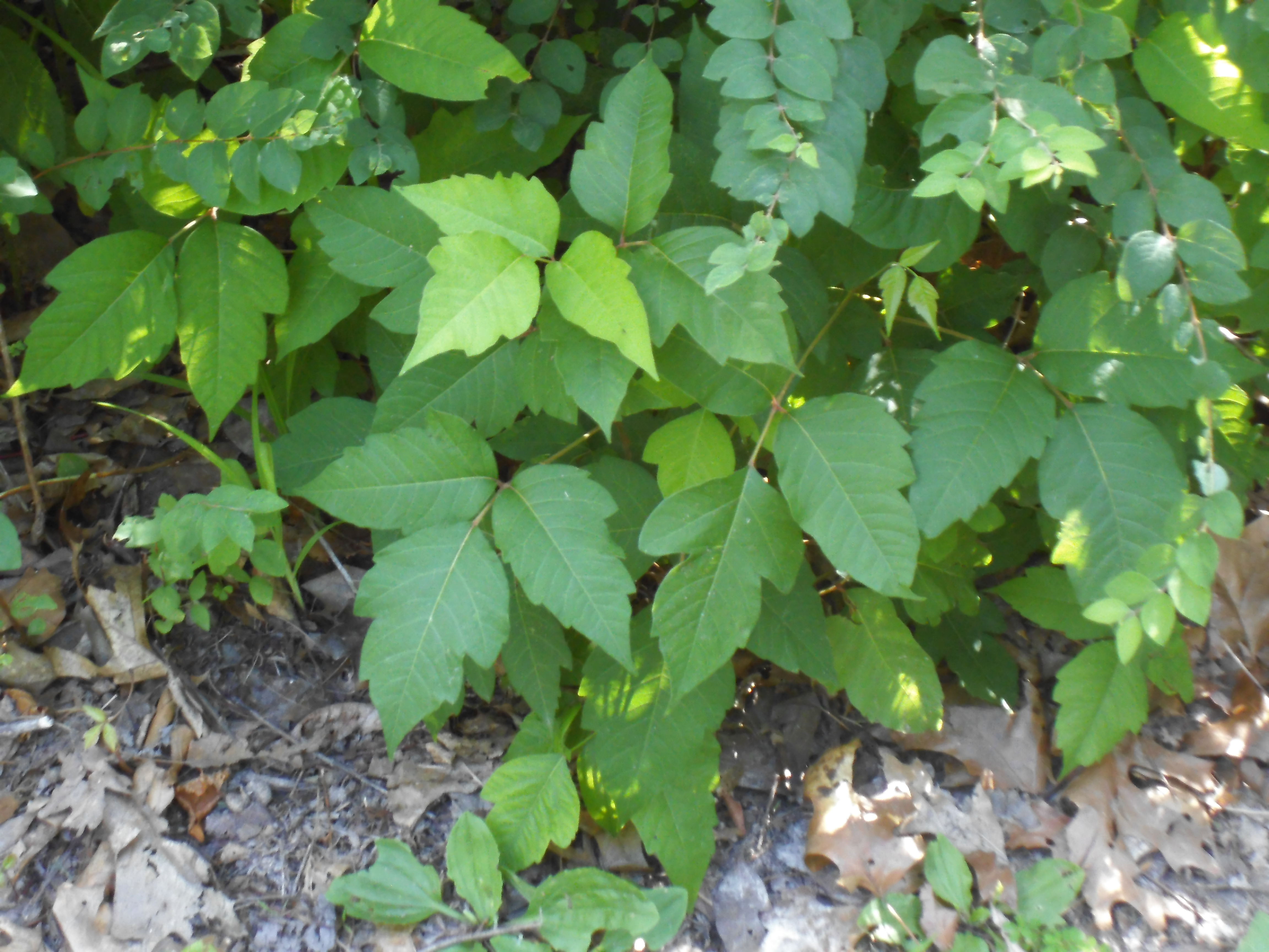
Whether as a bush or a vine, Poison Ivy just looks like a mess.
Finally after about three weeks since it had started, it had improved and was beginning to clear up. The trauma has never left me however, and there is nothing in the woods that I have so far come across that will shoot my anxiety through the roof more than the sight of it. I can spot Poison Ivy from a mile away, and you can ask anyone who has had the pleasure of being there with me when I’ve come across some. I can just sense that it’s out there, lurking in the forest, waiting.
This is growing behind my house. Evil.
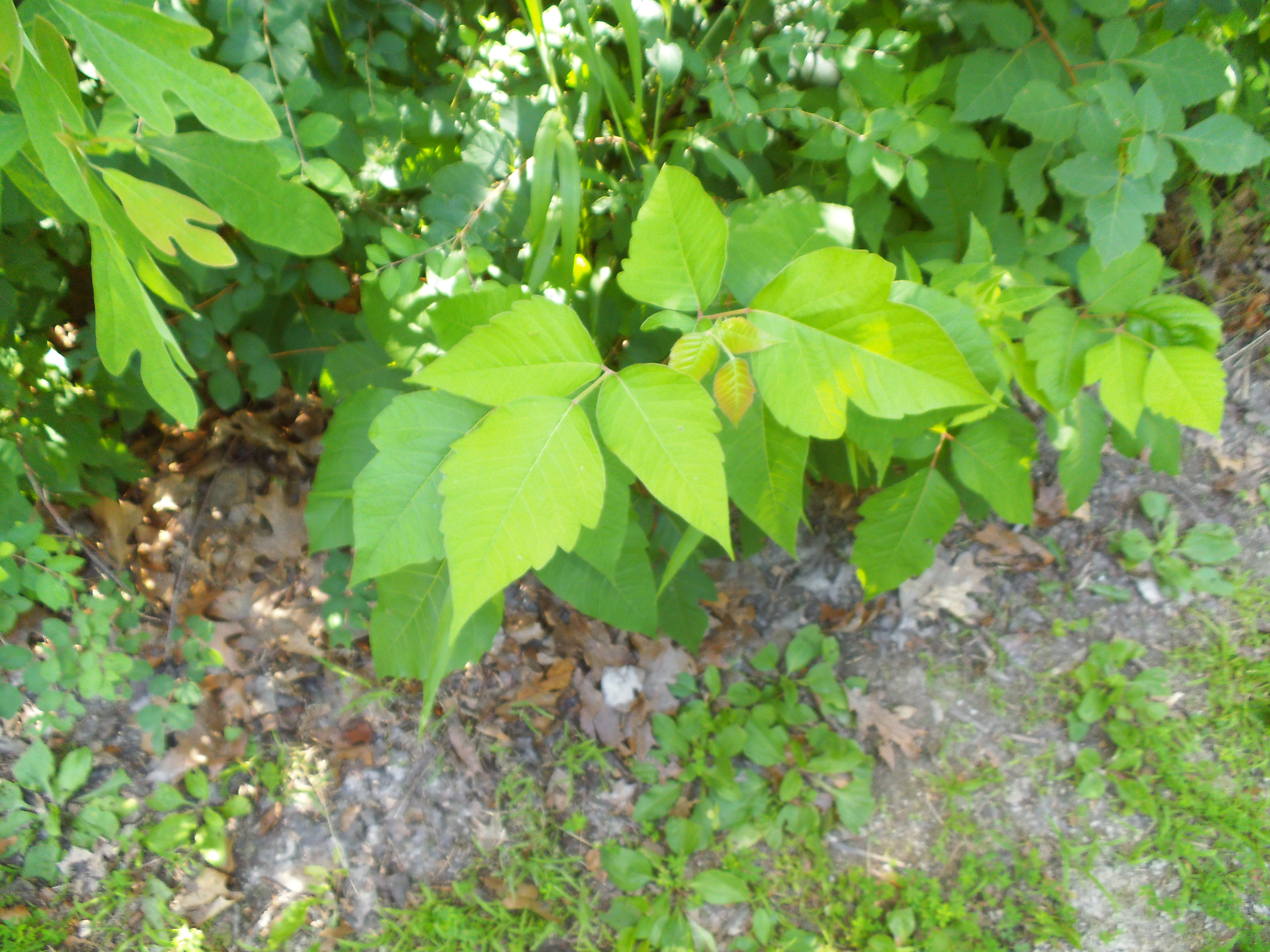
So with all that being recounted, I have come to the realization that there are other plants out there in the forest that look a lot like Poison Ivy, but have no widespread allergic capabilities. There are also a couple things that many people believe to be true about Poison Ivy that just aren’t. I have been avoiding harmless plants and I have been fearing certain things for no reason, and I wanted to share my discoveries about it with you.
First of all, Poison Ivy lookalikes.
Poison Ivy itself is a pretty obnoxious thing. It can grow into a big gangly heavy handed bush, or a giant creeping hairy vine. It takes these two forms, and through a lot of experience, I am really good it picking it out of a lineup. The question is, how do we tell the lookalikes apart from it?
Raspberry and Blackberry leaves have a lot more teeth around the edges. Also, look for thorns on the stems.
The easiest ones to identify as NOT Poison Ivy are Raspberry or Blackberry bushes, and Virginia Creeper.
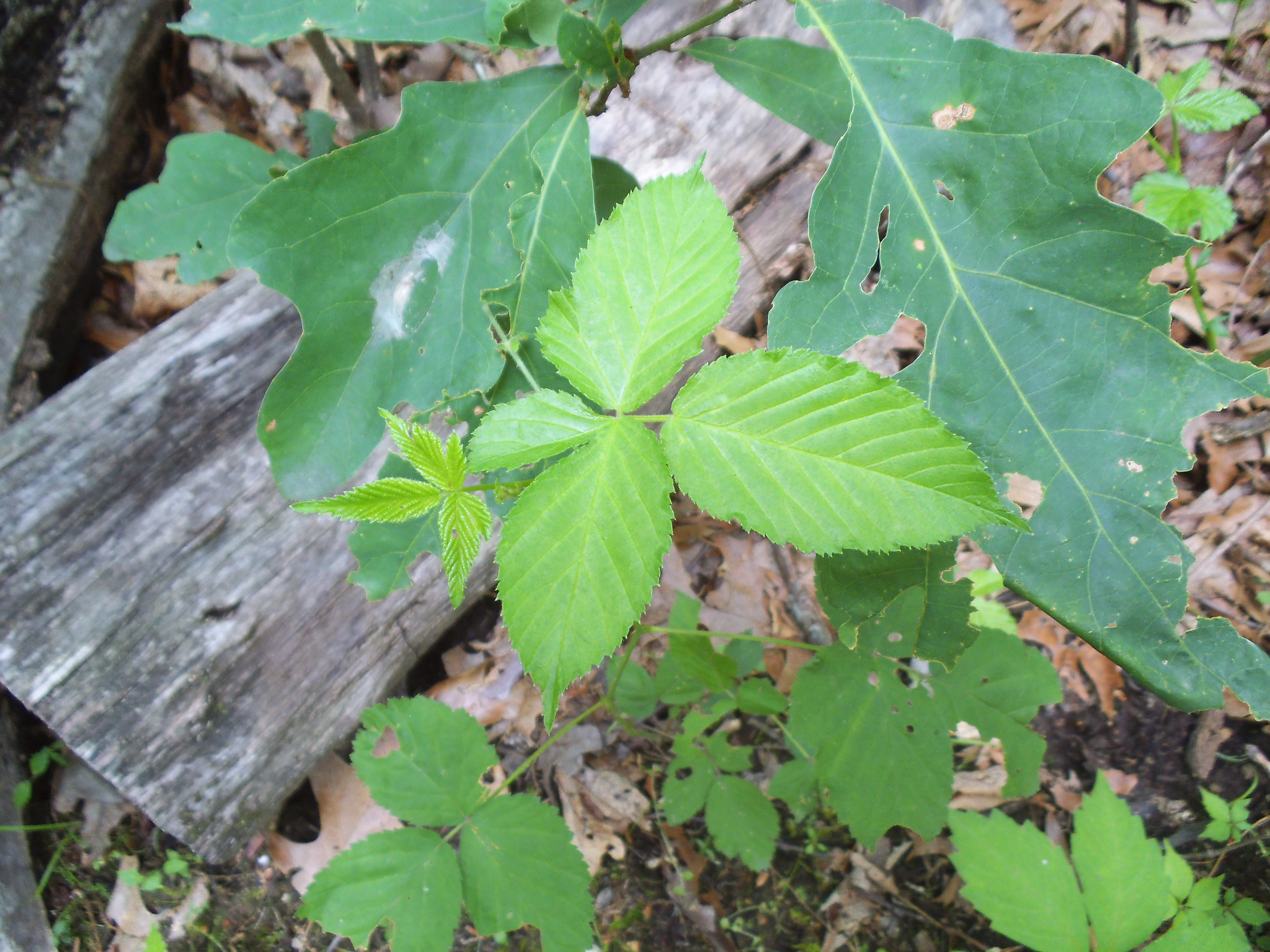
In the case of the Raspberry or Blackberry bushes, it stands out because of the thorns on its stems and canes. If it has three questionable looking leaves, but it also has thorns, you are safe. In fact, if you come back around mid to late summer, you will probably be able to harvest some dessert.
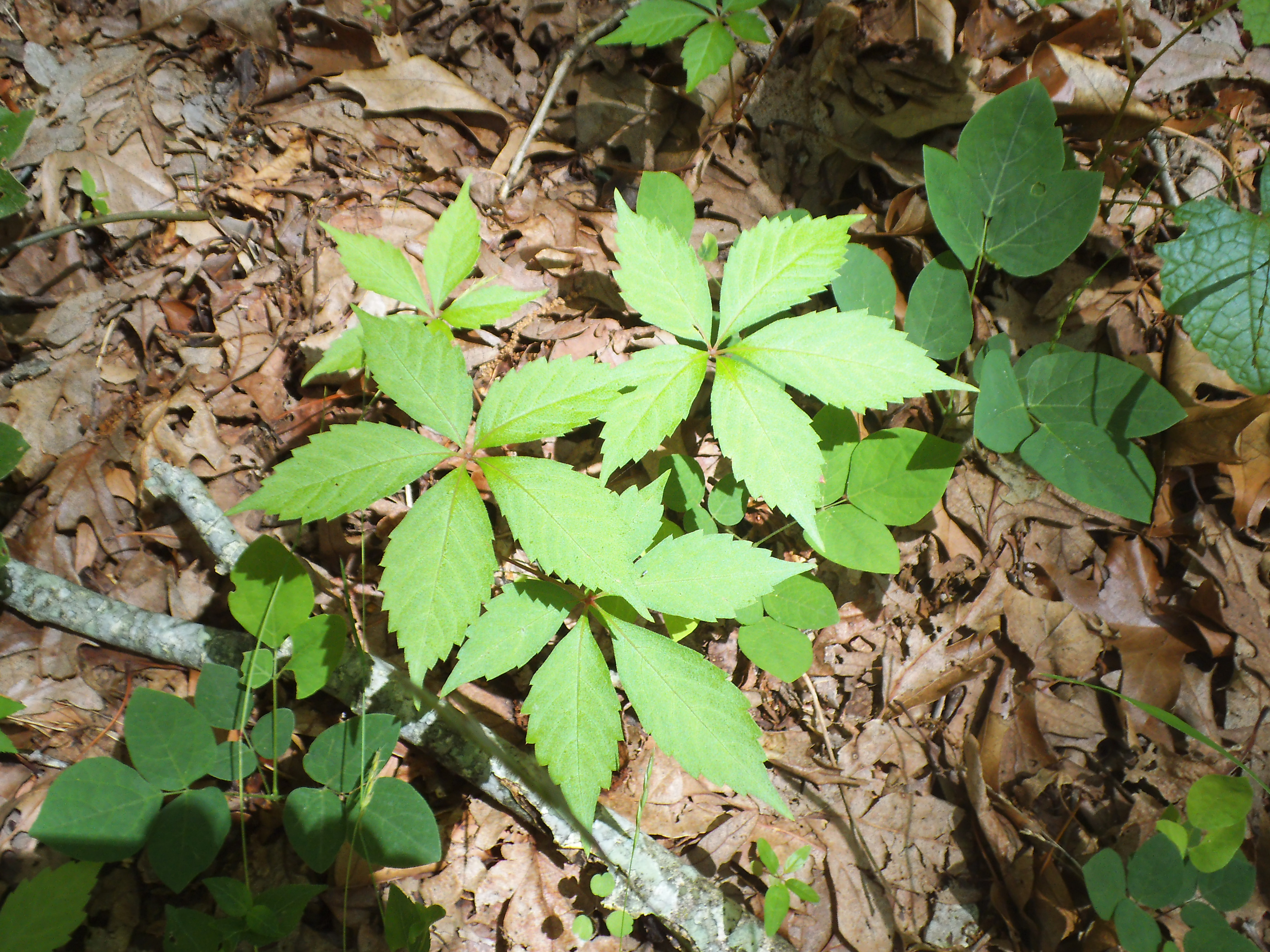
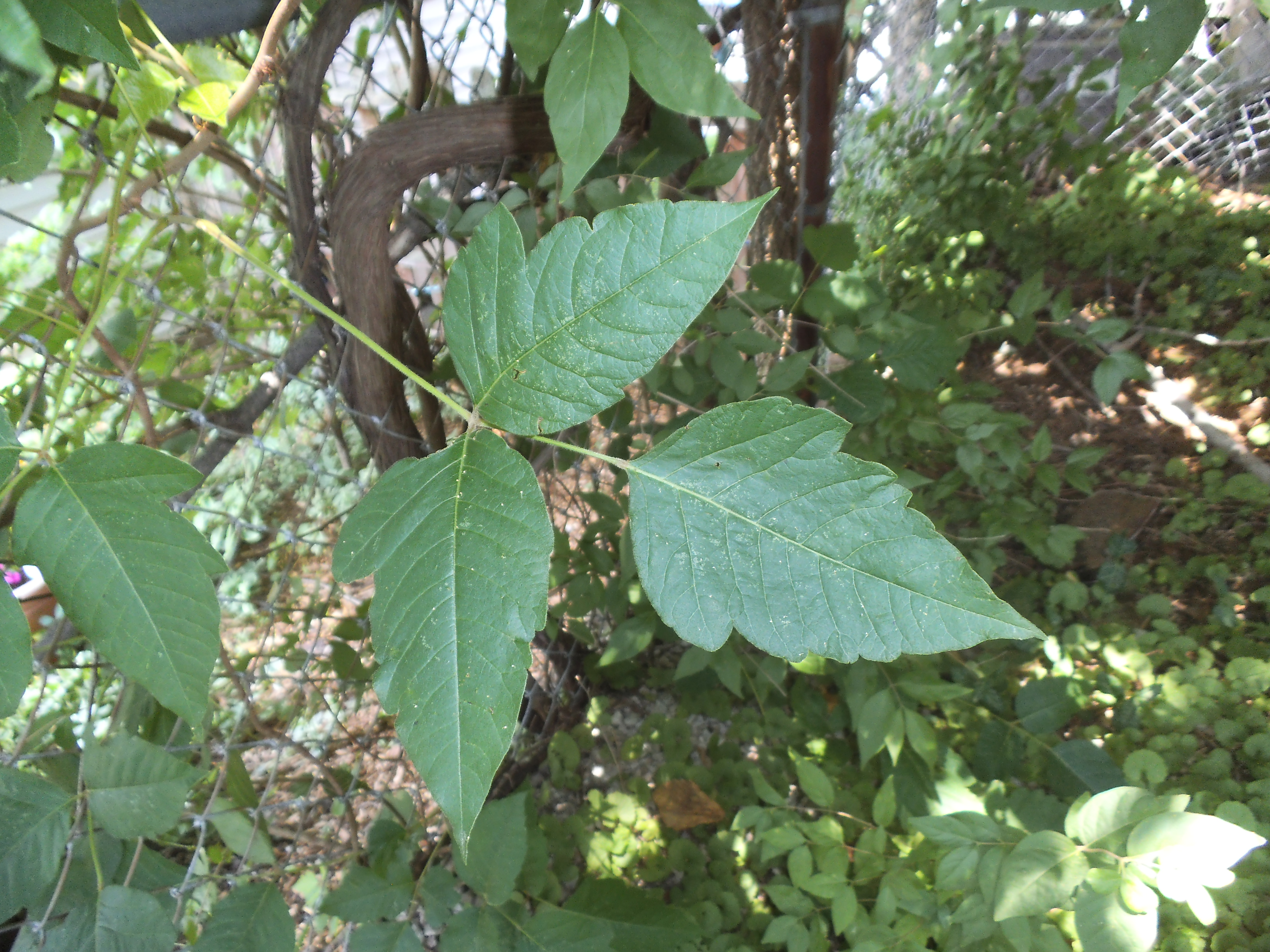
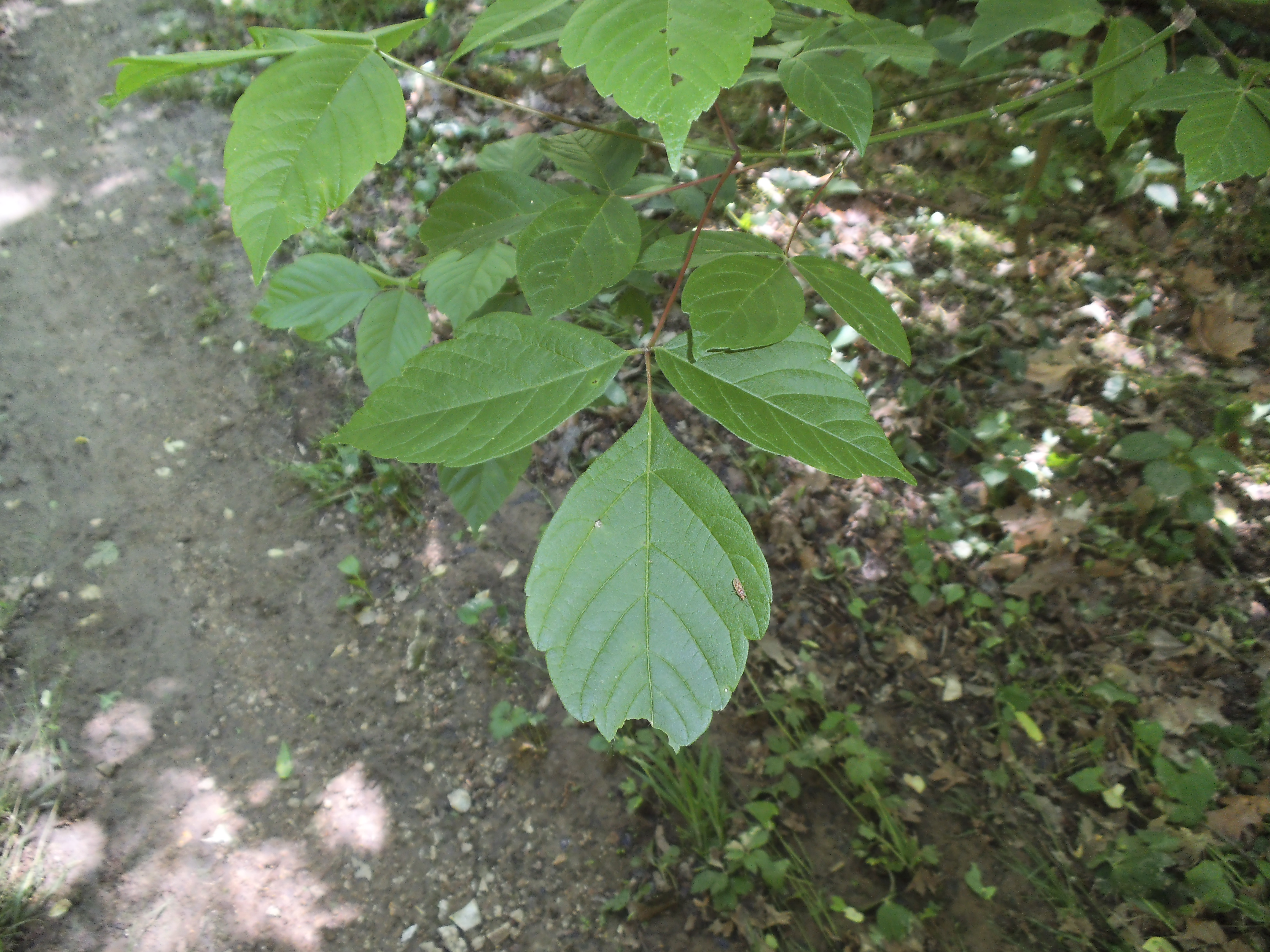
Virginia Creeper has pointy, threatening looking leaves, especially when it is growing up a tree on a vine, but it has five leaves, not three.
Virginia Creeper is another one that regularly gets mistaken for it, and it too grows up as a vine all over trees. It has leaves that look a lot like Poison Ivy, pointy and toothy, but the difference is the number of leaves. Follow the vine with your eyes, and if at any point it has stems that have five leaves sprouting from them, you have got yourself Virginia Creeper. This is a very obvious difference, but people still misidentify it (in fact, as I was surfing for links to add to this post, a Discovery Health page about Poison Ivy has a picture of Virginia Creeper instead). Be warned though, the two vines can surely grow on the same tree, so it is a good idea to avoid trees with vines on them.
Boxelder is a tree and has woodier stems and branches.
Another lookalike that I have only recently learned about is the Boxelder Tree. This tree is in the Maple family, and the first distinguishing characteristic is that as a tree, it gets a lot bigger than Poison Ivy bushes. However, the challenge is when it isn’t full grown, and maybe just recently sprouting from the soil. The leaves of the Boxelder look very similar to Poison Ivy when they are young and a couple ways to tell them apart are that the larger Poison Ivy leaves tend to droop under their own weight, and the smaller ones can have a reddish tint. The Boxelder tends to have lighter, more rigid leaves. Also as it grows, if it has woody stems but is not a vine, you should be in the clear.

Fragrant Sumac, tryin’ to look scary.
I think the most difficult for me has been the Fragrant Sumac. This is a bush that if you have spent ANY time in a Missouri forest, I know you have seen it. It has three leaves and berries and it grows all over the place. One of the things that I always notice about them that helps me to tell them apart from Poison Ivy is that Fragrant Sumac plants just look more uniform. They will grow in patterns that look very similar, when it comes to size and shape, and their leaves are usually more rounded. Poison Ivy on the other hand tends to grow more erratically when it is in its shrub form, reaching out with a sense of chaos, flinging about very different sized and pointy leaves, this way and that. It just looks like it’s trying to get attention, whereas the Fragrant Sumac just has a look of being more calm and patient. Another way to tell them apart is that Fragrant Sumac has red fuzzy berries, and Poison Ivy has white hairless berries.

Fragrant Sumac just tends to look more symmetrical and better organized than Poison Ivy.
For the most part, it is a safe bet to just avoid everything with three pointy leaves, but there are a lot of three-pointy-leafed plants out there that are completely harmless and won’t cause you to itch all over. I am no expert, and there are probably other ways to be able to tell all of these apart that I am not aware of, but I’ve found that in my experience, a lot of the key to knowing which is which is to just spend time in the forest getting familiar with the different plants so that eventually you can just tell by the way they look as a whole.

Sometimes it’s just too difficult for to tell. Three leaves? Just avoid it when you’re not sure.
Are you itchy yet? Something else to remember is that the possibility exists for plants to have variations in the way they look depending on what type of environment they are in. The majority of what I know comes primarily from my experience hiking through Missouri forests. Please don’t hold it against me if the Poison Ivy where you live is more of a shape shifter or ninja assassin than our ugly, evil, fire-spittin’ mid-western version. Just a thought. Be careful out there.
In the next part of this I will be tackling the myths vs the truths concerning Poison Ivy.
…but right now I just feel gross and itchy, and probably need to go take a shower or something…ugh…
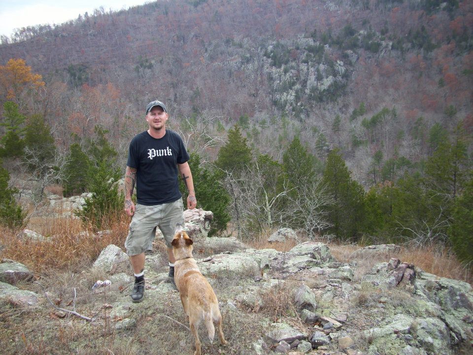
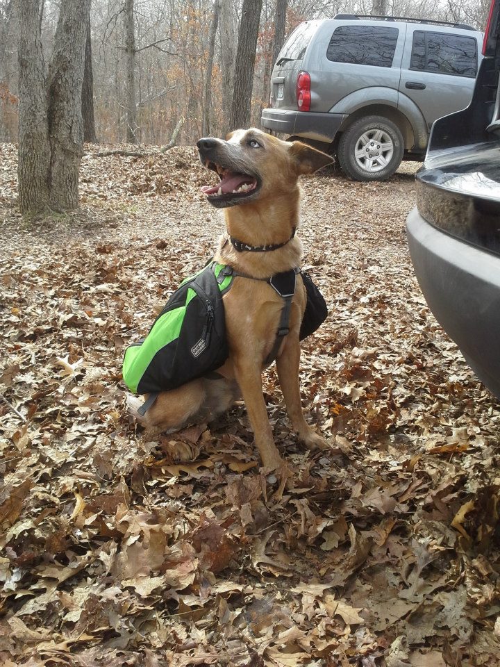
 So the Wilderness Trail is one that I have had on my list ever since I bought the book “60 Hikes within 60 Miles: St. Louis”. It is an 8.5 mile trail with about a 1 mile connector (if you want to vary your trip), and eight designated backpacking campsites along its route. It is long and rugged, and it heads out into the more remote parts of Meramec State Park. I had been debating whether or not to make it an overnight, but after discussing it with Max (the hiking dog) we just decided to make it a day hike. Eight and a half miles? Ain’t nuthin’ but nuthin’!
How to get there:
 Meramec State Park is in Sullivan, MO, just about one hour southwest on 44 from the 44/270 interchange. Get off at exit 226 in Sullivan, and make a left (south) on 185. In about 3 or 4 miles, the park entrance and visitor’s center will be on your right. Make it a point to stop and check out the visitor’s center and the helpful people inside, and pick yourself up a Map for the Wilderness Trail while you’re in there.
When you head out from the trailhead, you will cross the creek there and hike about a third of a mile past the park cabins. Along this section there is a registration box. Due to the length of this trail and the remoteness that it takes you through, I can’t emphasize enough that you should fill out a card, just in case something unthinkable happens while you are out there.
 A little further down the trail after you hike through a small glade, you come to the fork. I took the path to the right (counter-clockwise), though I think it is traditionally hiked the other direction. The trail treads gently upward until you reach a gravel access road along the top of a ridge. You cross the road, and the trail makes its way down to the bottom on the other side into Deer Hollow and along a creek that was surprisingly dry considering the rain we had recently gotten. It is along this section that you eventually pass the spur to the first backpack camp, just a little ways past a mile from the trailhead, but I must confess that I somehow hiked right past it without seeing it. However, it was around this point that my GPS crapped out on me, so I was a bit distracted.
 You cross the creek and start hiking up the hill, where in about another three quarters of a mile, you get to the 185 spur that the trail crosses twice. If you were to walk down the 185 spur to the right about a quarter mile, there is a gravel spot in a curve on the road that makes a good parking area if you don’t feel like hiking the whole trail. After you cross the spur road, you move through a pine grove and the trail starts to wind its way down to another creek bottom between the hills. You will pass the connector trail on your left, and then it crosses the creek and hikes along the hillsides to the east. The forest opens up a bit, and you make your way through a series of glades, one of which was filled with about 1000 echinacea flowers.
At around three and a half miles, the trails turns to the left around the end of the ridge and you head back west along the north side of the hill. It is at this point, as the trail heads down to the creek, that you get the closest you will to the Meramec River. If you were to hike this trail in the winter, you would probably be able to see it through the trees, but today there was just too much underbrush. You can tell which direction it is though, due to the playful sounds of families and boats down the hill to the right.
Copper Hollow Spring is at the bottom of this giant rock face.
Once you get to the bottom, the trail crosses a few watersheds and eventually another creek. Along this section you will come to Copper Hollow Spring, which gushes out of the bottom of the cliff and into the creek. It’s worth checking out, but the area around it is pretty slippery so watch your step. Returning to the trail, you will wander through Copper Hollow until you come across the next backpacking campsite spur. You are pretty close to the five mile point, and this is a good spot to stop and have some lunch.
Along this section, the trail turns widely to the left and travels past two more campsite spurs, and starts to slowly climb the hill in front of you. Toward the end of your ascent, you will hit the steepest spot on the trail, and get up on top of the hill. This upper forest is more open with pines here and there, and it is also where you will pass the spurs to the fifth and sixth backpack campsites, on your right. About another quarter mile along and you hit the other end of the connector trail on your left. Then a half mile or so beyond that down the hill, you hit the 185 spur for the second time. You cross the road and follow the creek through Campbell Hollow for most of this section, hiking across it a number of times as the trail darts back and forth. Just before the eight mile point, you will pass the spurs to the last two campsites, and its just around a half mile back to the trailhead.
Why I like this trail:
 It is remote. Sure, you put in a couple of miles to get back in there and you are still pretty well surrounded by civilization in the region, but there is a distinct sense of isolation that can be very satisfying depending on your frame of mind.
The backpack camps. What other trail nearby has so many established campsites with fire rings right there for use? This trail is a great choice for anyone wanting to get into backpacking.
I haven’t yet spent a night out there, but I would bet that the forest comes alive with animals. Max and I were there during the day, and we saw five deer. Two of which were bedded down not twenty feet from the trail and got spooked and ran off when we hiked by.
It’s so close to home. Just about one hour from my front door. You can’t beat that!
What you need to know:
 Ticks, ticks, and more ticks. Ticks all over Missouri are super bad this year and we “interacted” with quite a few of them on this trail. Make sure you bring your bug spray and your dog has some sort of tick treatment or collar.
Like any remote trail, the underbrush causes the trail to be really narrow and short at times. There is very little Poison Ivy and quite a lot of its harmless lookalike Fragrant Sumac, so know your three leaved plants so as not to freak out. I like to hike in shorts so I can feel the ticks to pick them off. I can also pretty much instantly spot Poison Ivy so as to avoid it, and I don’t get as hot…but maybe wearing long pants would be a good idea. Also, be prepared to duck from time to time. It’s a great trail to hike, but be ready for the potential challenges.
It doesn’t have the most rugged pathway, but due to its length, the amount of fallen-tree-obstructions, and its narrowness at times, I would call this trail difficult.
 Max and I had a lot of fun and we thoroughly enjoyed the challenge of this trail. I think a late fall backpacking overnight is in order, once the ticks have tapered off and the brush has thinned out. It took us around five and a half hours to complete, but we were stopping a lot to hunt mushrooms and take pictures and just take in all the beautiful wilderness around us. I’m definitely looking forward to the next time I get to hike this trail.
Continued from Part Three

Who put THAT GUY in charge?!?
So I had gotten caught up in my “career” as the manager of a music retail store, and was working more now than I had ever worked. “Real Life”, living in the St. Louis area and working and driving in traffic and doing typical civilized things had taken the forefront in my world, and time for getting out to the forest had been getting pretty scarce. Things were moving in the direction that they naturally should at the time, and I found myself involved with a wonderful young lady who I had known for a while already. Yeah, I wasn’t waking up to the sounds of birds chirping and the sunrise on my face that often, like I would if I was camping, but things were moving along and life was good. I didn’t even notice how domesticated I was becoming, or that the trees were off in the distance somewhere, instead of right in front of me. I was growing up.
So I was at work one unsuspecting morning after we had gotten back from visiting her sister for a week in San Diego. I was getting ready to open the store…putting cash in the drawers…checking paperwork from the night before…flipping lights and music on…re-vacuuming that one area on the stained commercial carpet that that part-timer obviously hadn’t gone over the previous night. It was a typical morning, and it was playing out like all the ones before it.
And then the phone rang.
“Thank you for calling Sam Goody. This is Gabe, can I help you?”
“Hey Gabe, it’s Vickie…y’got a minute.”
“Yeah, sure…’s everything okay?”
“…No…I don’t know…………I’m pregnant.”
…Boom…Woosh…A mental explosion, followed by all the air being sucked out of the room like an open door at 30,000 feet.
“Wow…how do you know?”
“Well I knew something was up, y’know, like how I was getting sick really easily when we were drinking the other night? Stuff like that…so I took a test…”
“Wow.”
“Yeah, I’m going to make a doctor’s appointment…get checked out.”
“Wow…yeah, that’s a good idea. Call me after you do so that I can make sure to be able to go with you.”
“I will. Sorry to start out your day with news like this…”
“It’s alright…this is a good thing. Wow.”
A week later I went and got my first tattoo. Screw it, I was gonna be somebody’s DAD…might as well really impress my parents.
 On January 20th of 2001, my son Elias James was born. A new light brought into the world to illuminate all our lives. Things would be much different from here on out.
Needless to say, we didn’t camp that much for a couple of years. Spending time in the forest had already become a rare occasion, but lots of other things were keeping us in town…odd work schedules and the like. Plus the procedures involved in camping with a baby were more immense. Not impossible…but more technical and gear dependent than normal. A trip into the woods was also exaggerated of course by the fear of taking this little guy out into big, mean, and nasty nature that was full of all sorts of places to drown, trip, fall…and be eaten. We stayed in the St. Louis area for the most part.
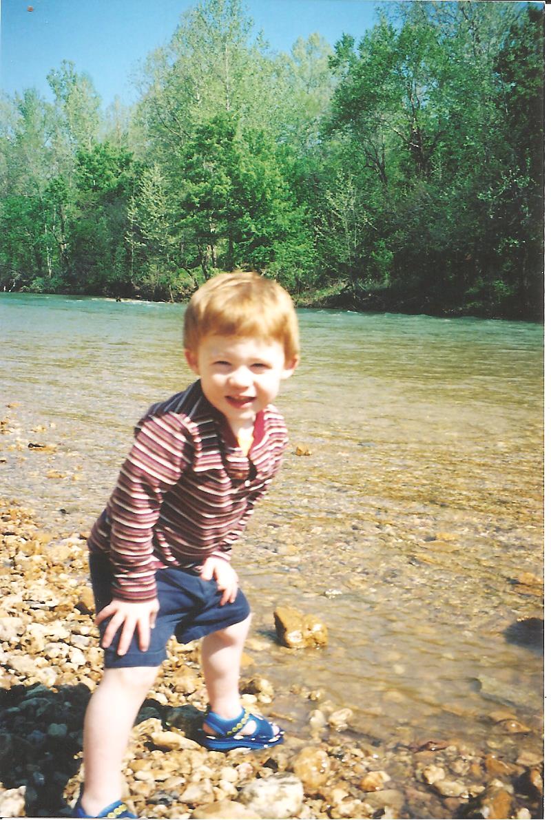
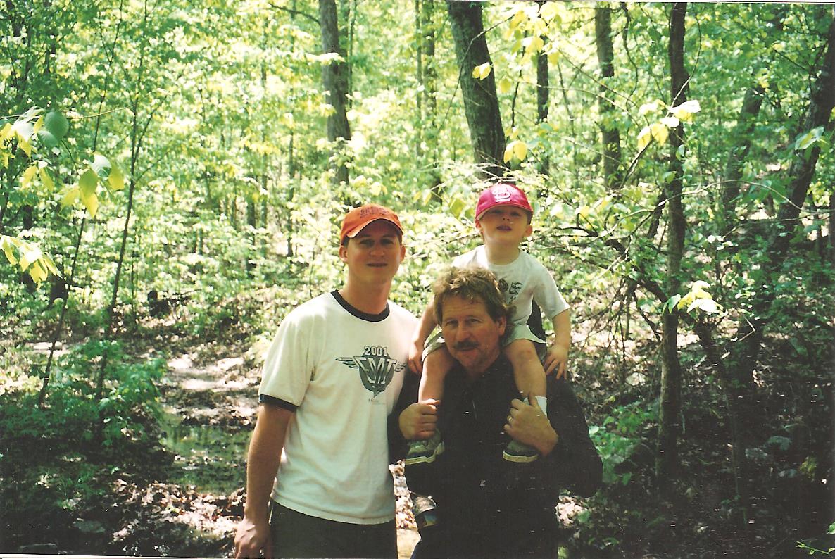 There were a couple trips though, including one with my folks to Sam A. Baker, and excursions here and there out as far as half a day could take us, or to the point where he couldn’t ride in the car any longer. Most of my exposure to the forest was usually at a local park somewhere, watching this new little human learn to climb and run and interact with the world. What an astounding thing to witness. And an astounding thing also to realize that we were all at that developmental stage at one point, many years before. We start out so small and seemingly fragile…but the resiliency and ability to bounce off of things that toddlers possess is surprising. And he took full advantage of that ability, careening many times into whatever the nearest obstruction was. Even if it wasn’t a straight line, his drunken toddler walk usually homed in perfectly to what was sure to end up as a red-faced, crying episode. He didn’t do it on purpose. Like all kids, he was just drawn to clumsy accidents. That’s the best time to learn…when we can still bounce off of stuff.
 There was another incident that sticks in my mind as one of his first moments of making a connection with the animal world. I remember taking Eli over to the pond in our apartment complex one day, after carrying laundry to be done to the little building beyond the boardwalk that was on the east bank of the water. There were Canadian Geese wandering around, and I thought it would be fun for him to go see them. As we walked toward them, my little guy with his deliberate upturned-toe steps, the geese started to move toward us, hissing and spitting. A parents ability to snatch their child up in a flash must be up there on the list with hummingbird wing flapping and supersonic flight. He was in my arms, and in an instant we were back on our way to the apartment with NO intention of ever trying to make friends with geese again.
A few years passed as I settled into our domestic life, eventually moving into a house in the Affton area, where she grew up. Affton is nice. It’s a somewhat quiet community in South St. Louis County (just “South County” if you’re from here), and the end of it we were in backed up to the River Des Peres and St. Louis City itself. Right down the street from one of the old, vast city graveyards, adjacent to a tiny urban forest area that after a couple of walks confessed itself to be the home of a handful of deer. Who could imagine that? City Deer.
 After six years of working for Sam Goody though, I was becoming weary of fighting the same battle every day in my job. The opportunity came up to pursue a career as a carpenter, and I took the steps to do it. Goodbye selling CDs…hello actually creating something, learning a skill, and having a more satisfying day at work. So I joined the Carpenters District Council here in St. Louis and went to work as an apprentice carpenter. Without going into it too much, it was a very different environment than the one I was accustomed to, but it also put me among people who were also fans of spending time outdoors, in a way that I was very much NOT familiar with. Most of these guys were hunters, and during deer and turkey season, lunches would be spent with my mouth shut and my ears open, listening to stories of prizes bagged from years past after a morning in the woods in some place not too far off. It was a new reason (for me) to head to the woods, but I have yet to navigate THAT road. The idea of harvesting meat from nature strikes me as just another aspect of the woods that makes complete sense. This is the world we live in, and given an understanding of the part responsibility takes in the practice, how could it not be how we are supposed to live? Food provided from the land. Sounds right to me. Just do it with gratitude and humility, to honor the sacrifice you have received.
 And then, on September 21st of 2003, I was blessed with one of the greatest gifts I have ever gotten. Sophia Leslie was born. I was given a daughter. As an apprentice carpenter, for two weeks out of every six months, we were required to attend the carpenter’s training center to take classes on all sorts of things, from framing to drywall to concrete to blueprint reading to forklift driving and everything in between. She was born on a Sunday, and the next day I was required to be in class. I skipped that day and stayed with my wife and our new little girl, and in the history of the St. Louis District Council’s Carpenter Training Program, it is probably one of only about five excused absences. They were pretty strict when it came to following the program’s rules, but I could see that knowing twinkle in the eyes of my rough, weather beaten instructors that following Tuesday as they looked back somewhere to a moment that THEY were greeted by a new voice in their world.
 Within a year however, my marriage was failing, due in large part to my lack of understanding what it takes to be a good husband. With reasonable discussion and very little conflict, we separated and eventually divorced. Life now was filled with scheduling as the obstacle and children as the focus, but I was lucky enough to be working it out with a woman who had the same goal as myself: make it work for the kids. Things were scattered for a while, and negativity has reared its head from time to time, but looking back it was the right choice and we are both better people for it, and I truly believe that it has been a benefit for Eli and Soph as well. The ability to see their parents make the difficult decision to part ways, because living in the pursuit of happiness in our separate live was a better choice than being miserable together. (Thank you, Victoria, for all that you do for these angels, and for working with me for all these years)
 So here I was, eventually coming up on my 30th birthday. I had a job. I had a place to live. My kids were getting more and more independent and adventurous with every sunrise. We were getting into the fun part.
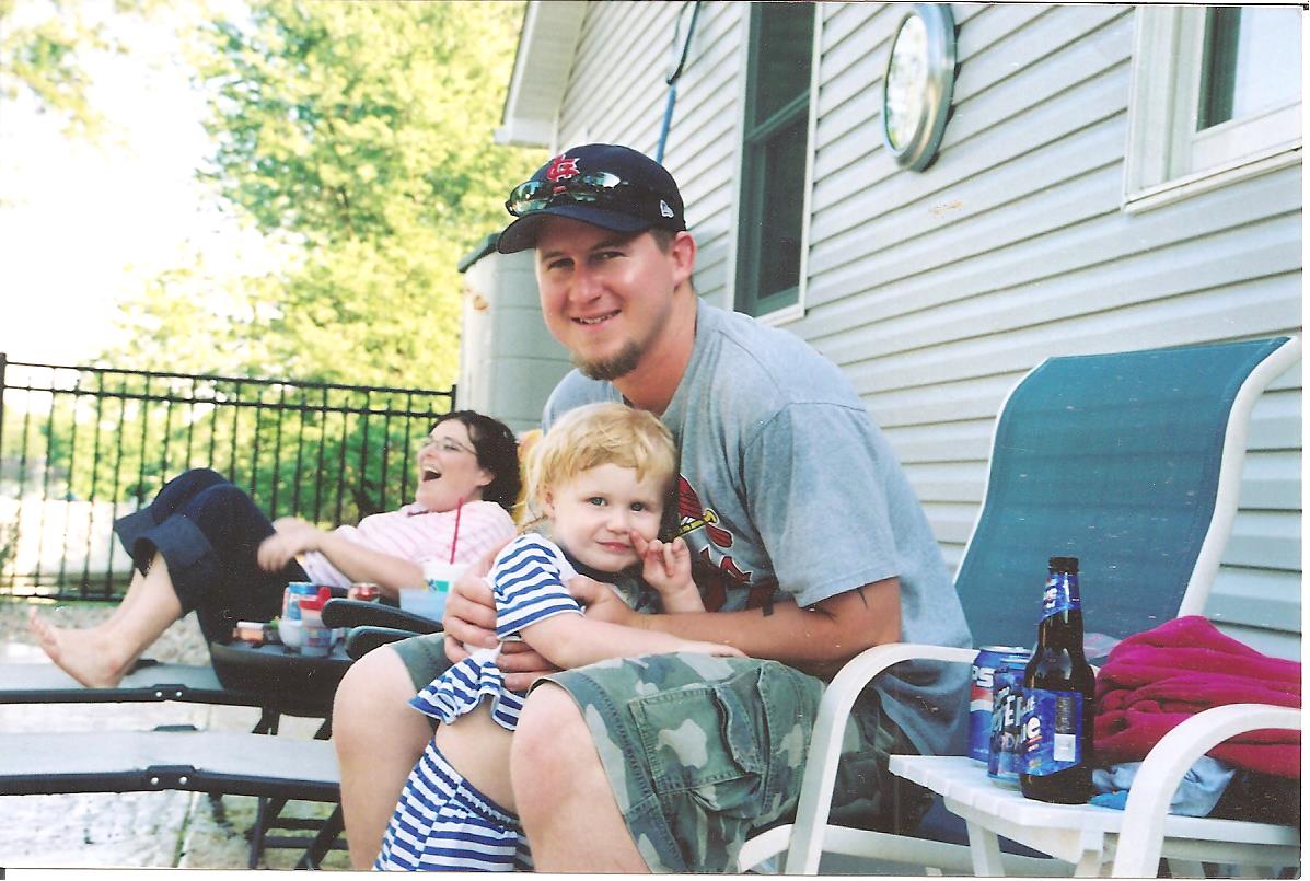
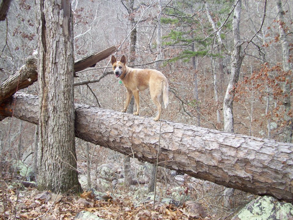
 Do you take YOUR dog camping? That question has been on my mind, and this past weekend at a busy Sam A. Baker State Park, I realized that there are dogs everywhere! Probably every other campsite had at least one dog, and I don’t think I had ever noticed how many there were before. So do you take your best friend with you when you head to the woods?

He used to be soooo cute…
I have been camping a lot, and up until the past couple of years, I was “Dog-Less”. We got Max in November of 2010, and like any Australian Cattle Dog (Red Heeler), he is not the kind of dog that we can leave at home. For one, he would go nuts cooped up in the house all by himself. Within two minutes he would have already eaten the pile of food in his bowl that we left for the entire weekend. After that, he would proceed to locate most of the dirty laundry and unprotected food items in the house, and spread them around/eat them, depending on how he felt at the time. And then he would spend the next couple days being generally nervous and impulsive. He isn’t the type of dog to be left home alone unsupervised.
But I also couldn’t leave him at home because I couldn’t bear to experience any camping trip without him. He is so loyal and I love having him around. Following me all over the campsite while I’m setting up gear or making food, bringing me his ball to throw every time I sit down to relax, deciding he’s a lap dog later in the evening while we enjoy the fire, and panting with the biggest grin whenever we hit some trail through the woods somewhere. The one time so far that I have left him at home was when I went to Lower Rock Creek this past March, but that was a decision that was made based on the freezing temperatures, and that somebody would be home to watch him. Camp life without him around is still fun, but he is part of the family, and he is MY best friend.
 But he isn’t perfect though. He doesn’t like anybody but me for the most part, and certainly not anyone he doesn’t live with. I like to say that it is the price I have to pay for him being such a loyal dog, but I have no illusions about how much of a jerk he can be at times. In fact, he has earned the nickname “Grumbles”. He growls at people that stick there hand out to give a sniff. He brings his tennis ball back to ME after ANYONE else has thrown it. He spikes up his ridge and barks at anyone that walks directly toward him. You can give him handouts from dinner all night, and he will still bark at you when you’re coming back to the fire from going to the bathroom. No matter how cute EVERYONE says he is, he still refuses to make friends. He isn’t trying to be mean and dangerous, but he is a nervous dog and is more scared of people than anything. So he acts like a jerk.
 Now he doesn’t bark that much (anymore), but that is because we are conscientious about it and we have a bark collar that corrects him when he is getting mouthy. A barking dog can really make a trip suck for more than just those at your campsite and whoever happens to walk past on the way to the shower house. There was a time that we were camping with friends who own dogs, before we got Max. It was Saturday morning and we were in our tent right behind their RV. The sun had already come up and we were slowly preparing to exit the tent and greet the beautiful new day. At least we would have been, had it not been for the fact that at least three (of the five!!!) dogs they had brought were barking all morning at anything and everything that happened to make any move within the general vicinity. It was awful, and in my irritation that was developing for the forty-five minutes I laid there before I got up, I also thought about how ALL the other people in the campground were probably rudely awakened too. Eventually security even stopped by and had to talk to them. Bad Dog Owner! Bad!
 So you need to be aware of how your dog affects the experience for other people. If your dog is a loudmouth, you need to be able to leave him home or be able to take steps to control it. You may not even hear the baying of your beagle anymore because you are desensitized to it, but that cat person two sites down is going to be pretty angry when your little pup starts going off at the crack of dawn. I would be too (don’t even get me started on unruly kids making noise BEFORE quiet hours). Get a bark collar. Kennel the dog for the weekend. Something. And realize that the person aggravated at your cute little pooch is just there to have a fun time too…but YOU’RE responsible for ruining it. Be a conscientious dog owner.
You may love your best friend like I love mine. So as their master, do your best to show everyone around why he’s such a lovable guy, by having the awareness and understanding to take the steps to make it a positive experience for everyone, including him.
No matter how much the part of him that is Dingo tries to fight it.
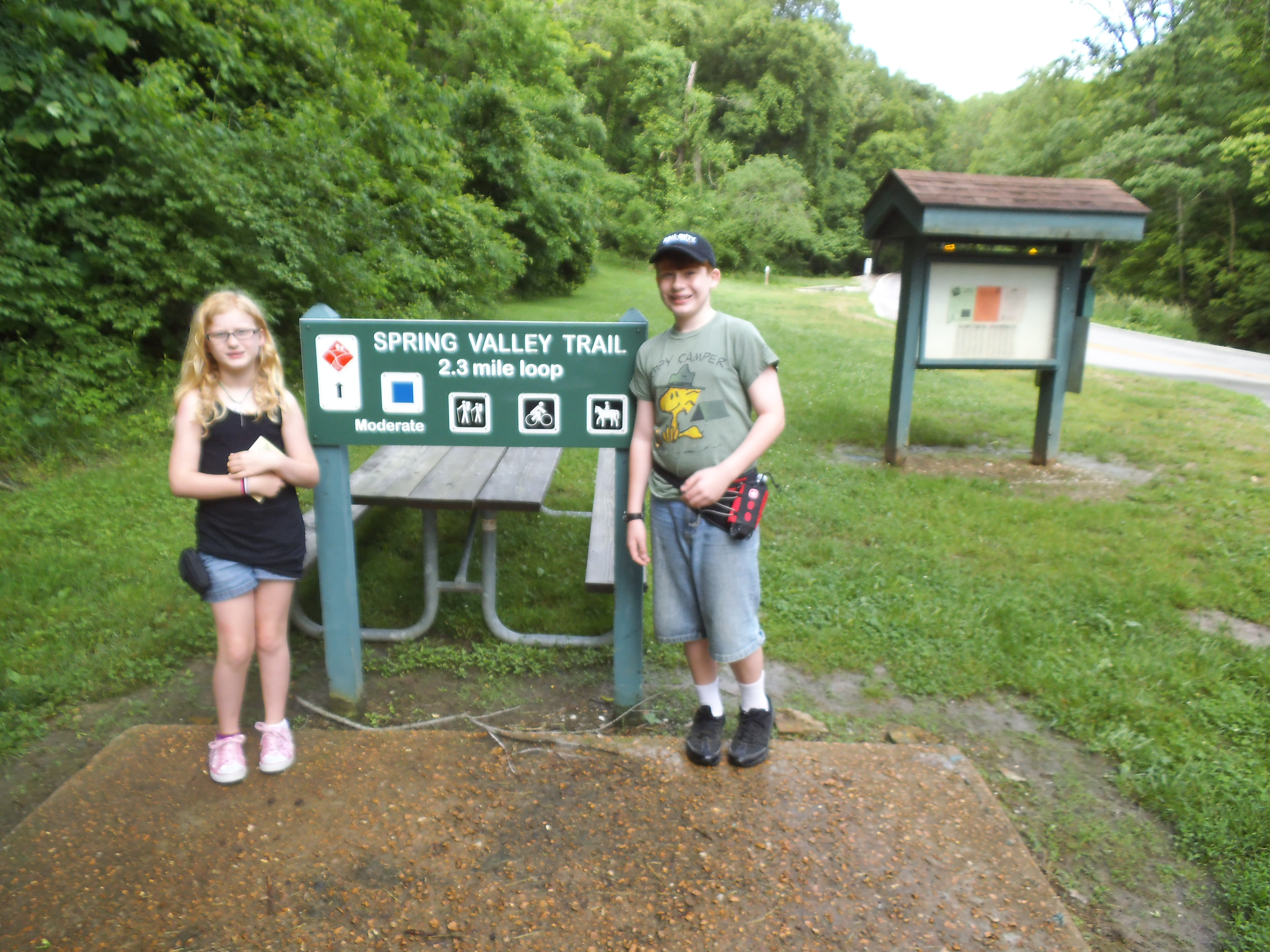 So summer vacation had begun, and I had all day to entertain these kids of mine. Bad weather was just a few hours out, and I wanted an adventure that was going to be memorable on the pleasant side, so an all day hike was out of the question. Deciding to stay somewhat close to home, I realized that I hadn’t been to Cliff Cave Park in a while, and I was sure there had to be a lot to see along the Spring Branch Trail. So we headed out!
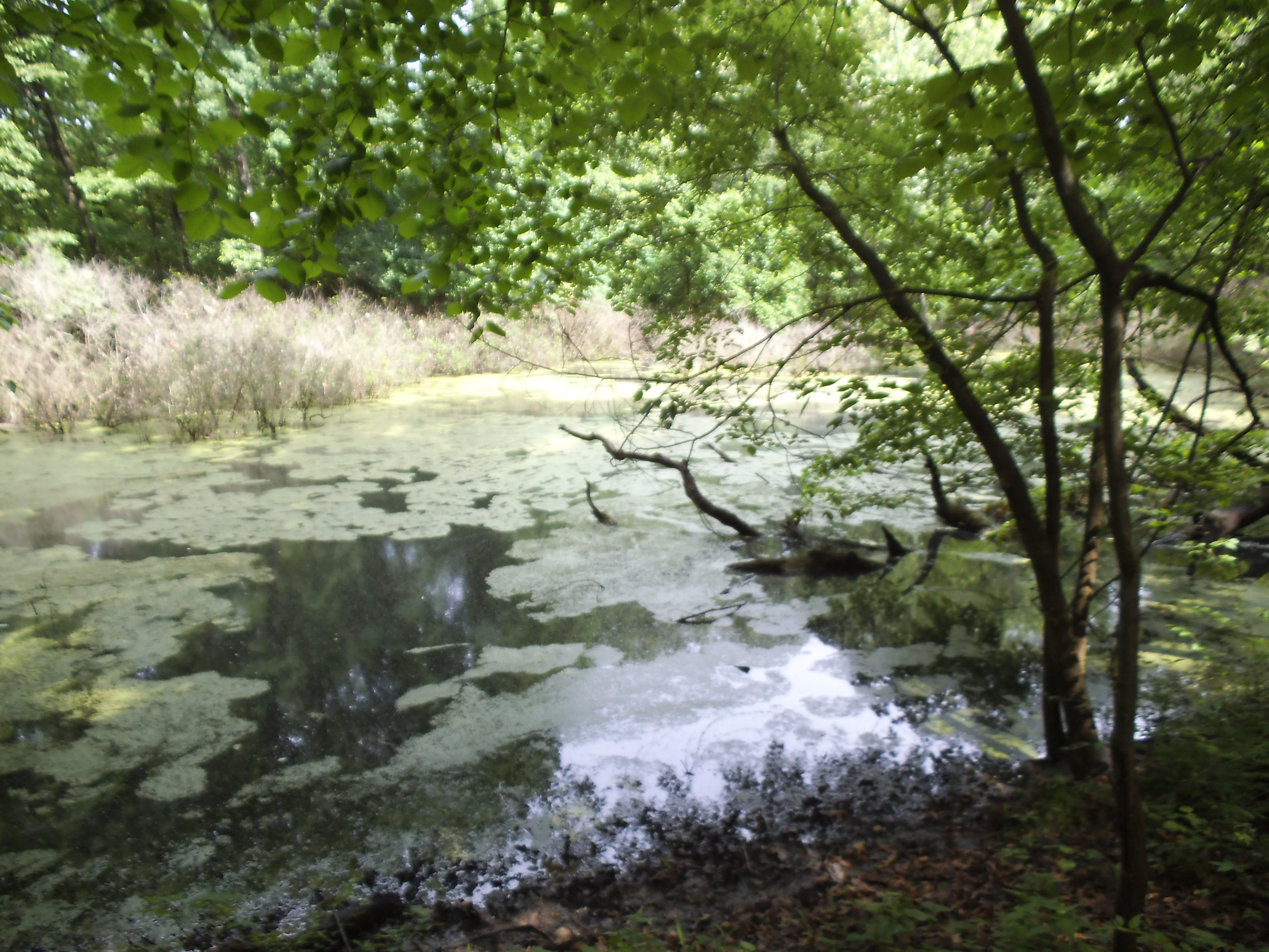 How to get there:
Cliff Cave Park is in the South St. Louis County area, off of Telegraph Road. From the 55/270(255) interchange, take 255 south toward the Mississippi River to Telegraph Road. Make a right (south) onto Telegraph, and take that about 2 miles to Cliff Cave Road. Make a left onto Cliff Cave Road. After about a mile and a half of winding your way through the neighborhood, you will come to the park entrance, go down the long hill, and around the curve to the left. The parking lot for the Spring Valley Trail will be in front of you on your right.
 The trailhead is back toward the curve in the road, and it begins with a choice to walk up the stream to the cave or cross the stream and start working your way up the hill to the loop above the cave. IF you decide to go check out the cave (which you should), there is a trail from there that scurries up the hill to the loop at the top also.
So once you get to the loop, I like to head to the right (counter-clockwise). The trail pretty much stays on the same level for the most part, with just slight up and down changes in elevation all the way around until you get the end and head back down the hill to the parking lot. It’s about 2 miles, and it slowly makes its way through this forest tucked within the surrounding neighborhoods. Along the way, there are sinkholes to look down into if the underbrush isn’t too thick, and a big swampy lagoon with a bank that will explode with frog excitement if you approach it on a warm day. We were lucky this day to see a fawn bedded down momentarily, just about 10 feet off the trail. Of course, it was up and gone before I could even pull my camera out.
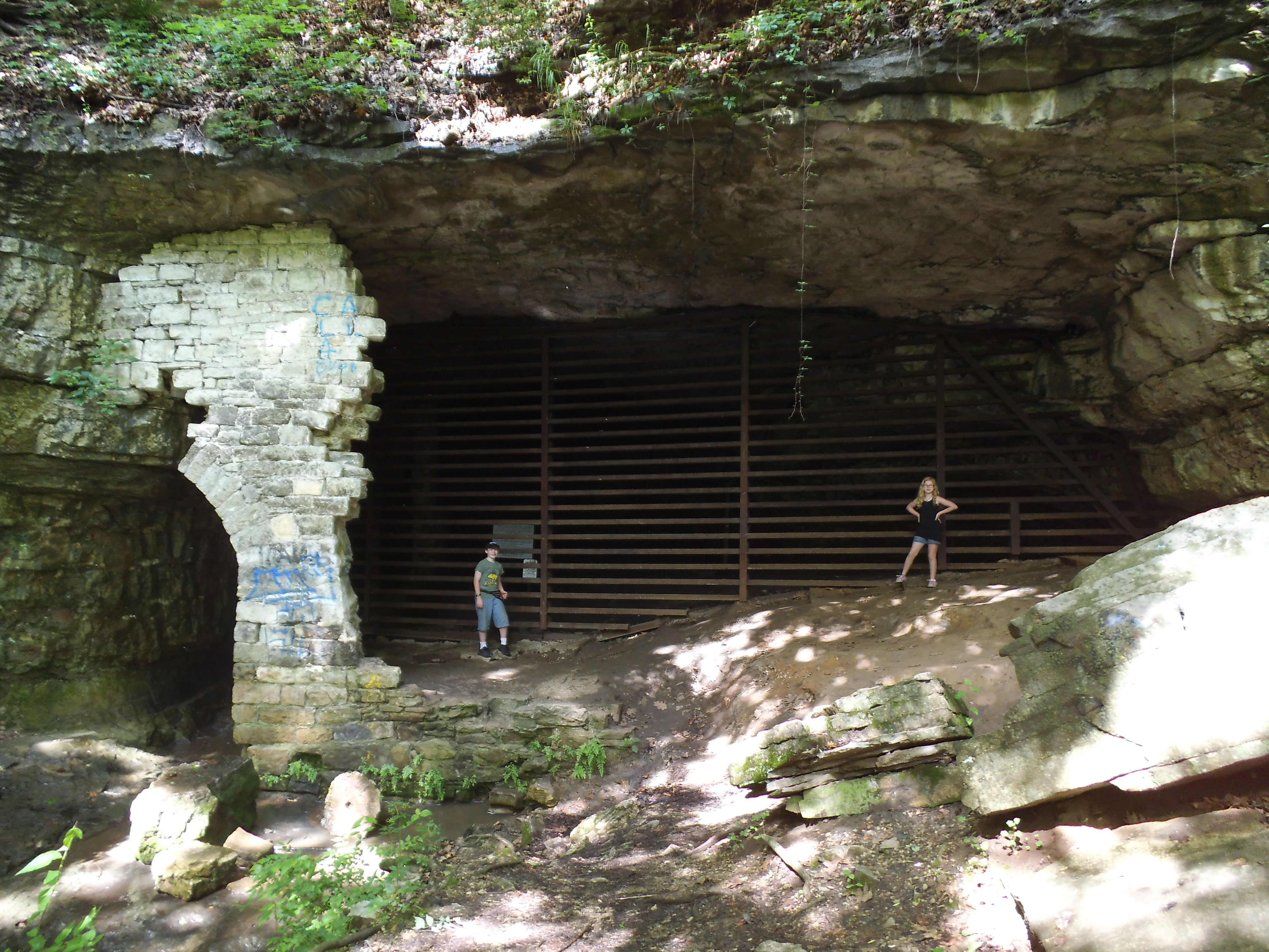 What I like about this trail:
Go check out the cave! It’s fenced off, of course, and it’s kinda muddy near the opening…but it’s neat to see and the stream pouring out of it is cool.
It’s close, and even though it is surrounded by residential areas, there are times on the trail where you can forget that civilization is so close by.
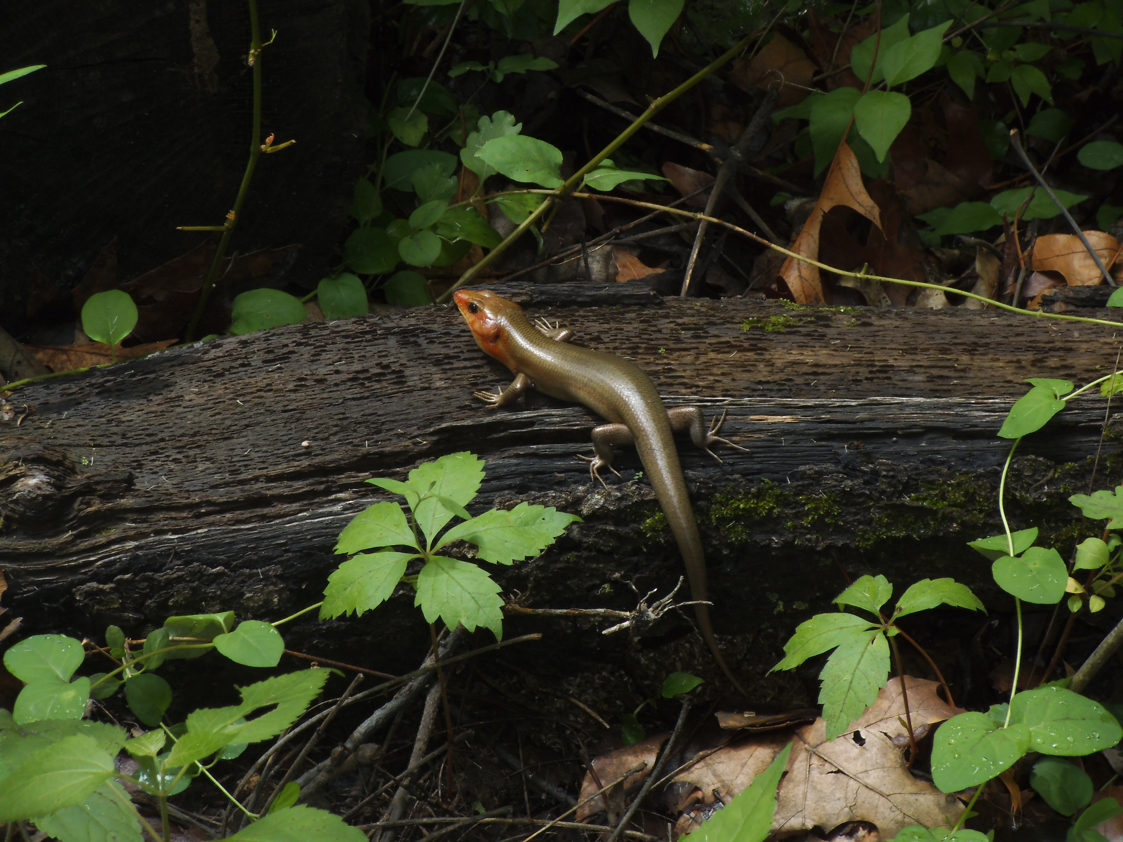 We always see some sort of animal life. Usually it’s just frogs, but just like this time, there is always the potential to see a deer. Tracks are everywhere!
It’s a pretty easy, low impact trail once you’re up the hill and on the loop.
I have yet to meet a rude hiker on this trail. I have probably hiked this trail 10 times in my life, and every time someone passes, they are always pleasant and courteous, including the mountain bikers.
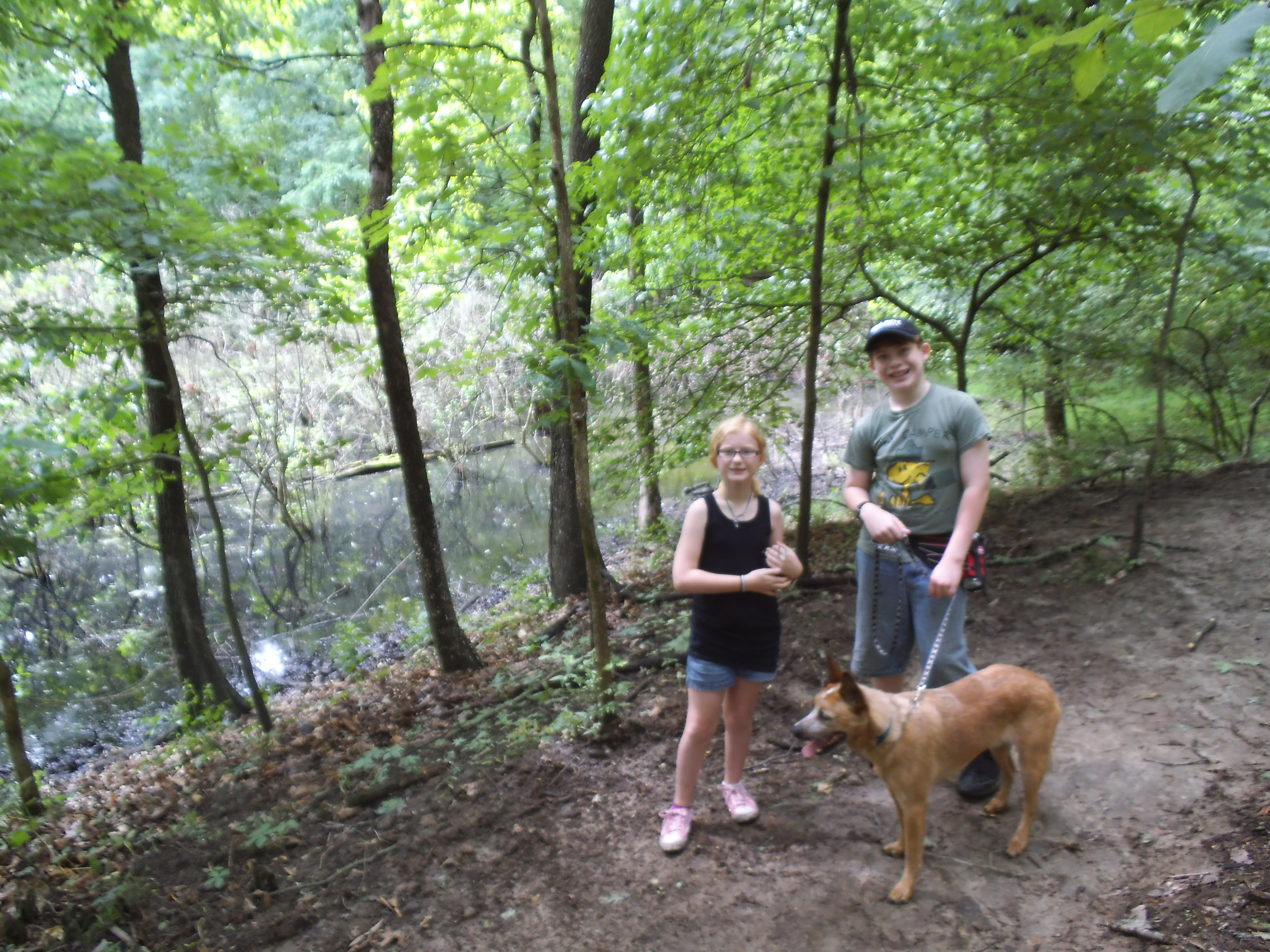 What you need to know:
Take your time with the beginning of the trail as you head up the hill. Parts of it can be rocky and other parts can be slippery. Watch your step!
Check at the sign for the trailhead for a trail map. If it’s your first time hiking it, it is good to have one. There are little cutoffs and intersections that aren’t always clearly marked. It would be a shame to see you standing in some strangers backyard, confused and scratching your head.
At the beginning of the trail, you will have to cross the stream. Usually it is low enough for you to just step on the rocks to cross it, but after a rain it might be a little more challenging.
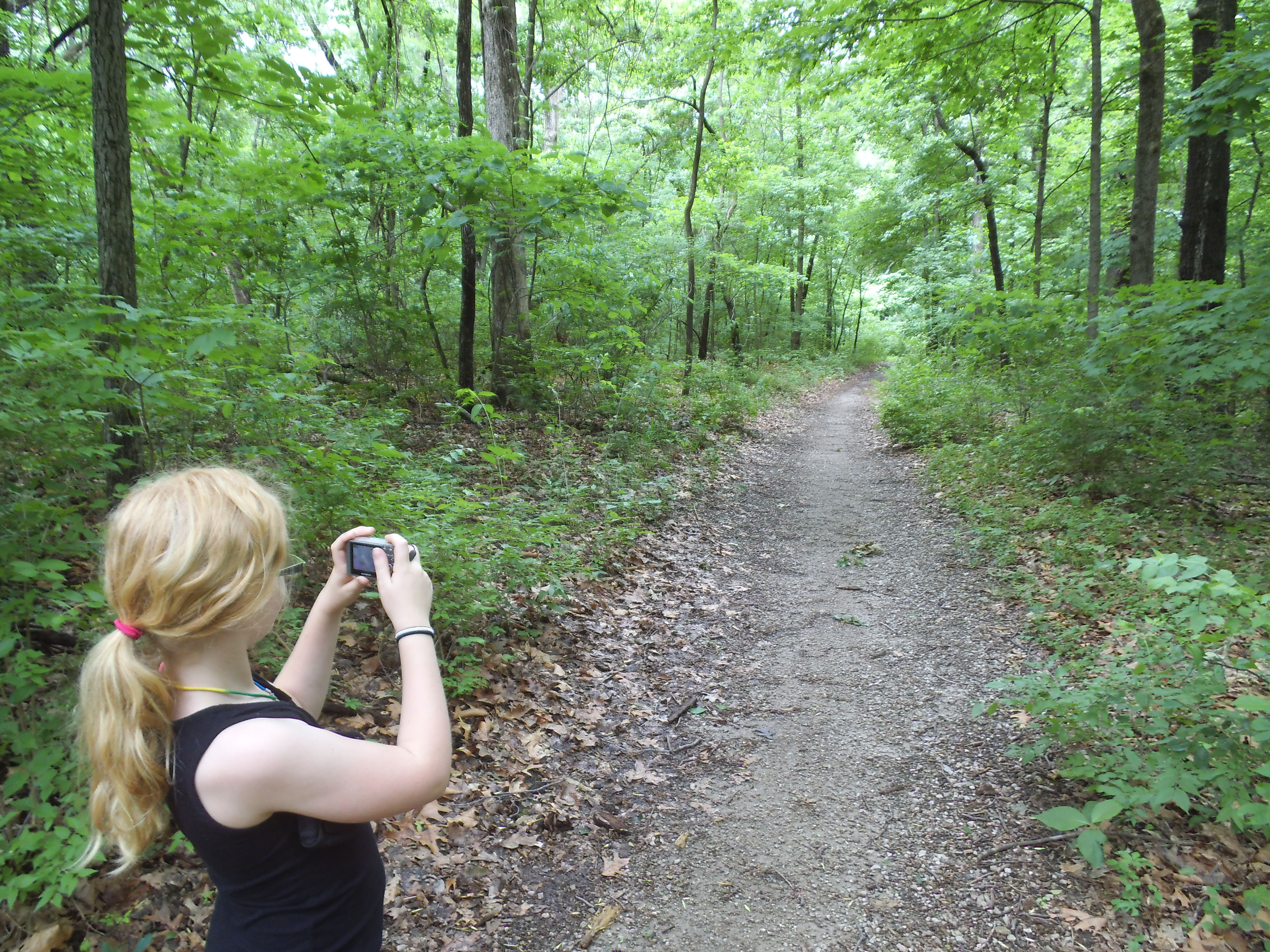 This trail is great one because it is so close to home, and because it has a lot of life in the woods in which it dwells. It is a trail I am very familiar with, and I remember hiking it years ago after a storm with damaging winds had rolled through, a week or two before. I was struck by all the downed trees, and by all the new life springing up on the forest floor from the openings in the canopy. This time however, the storm was on its way. But the kids and I got in there and had a nice hike, and were back at home before the first raindrops fell.
Continued from Part Two:
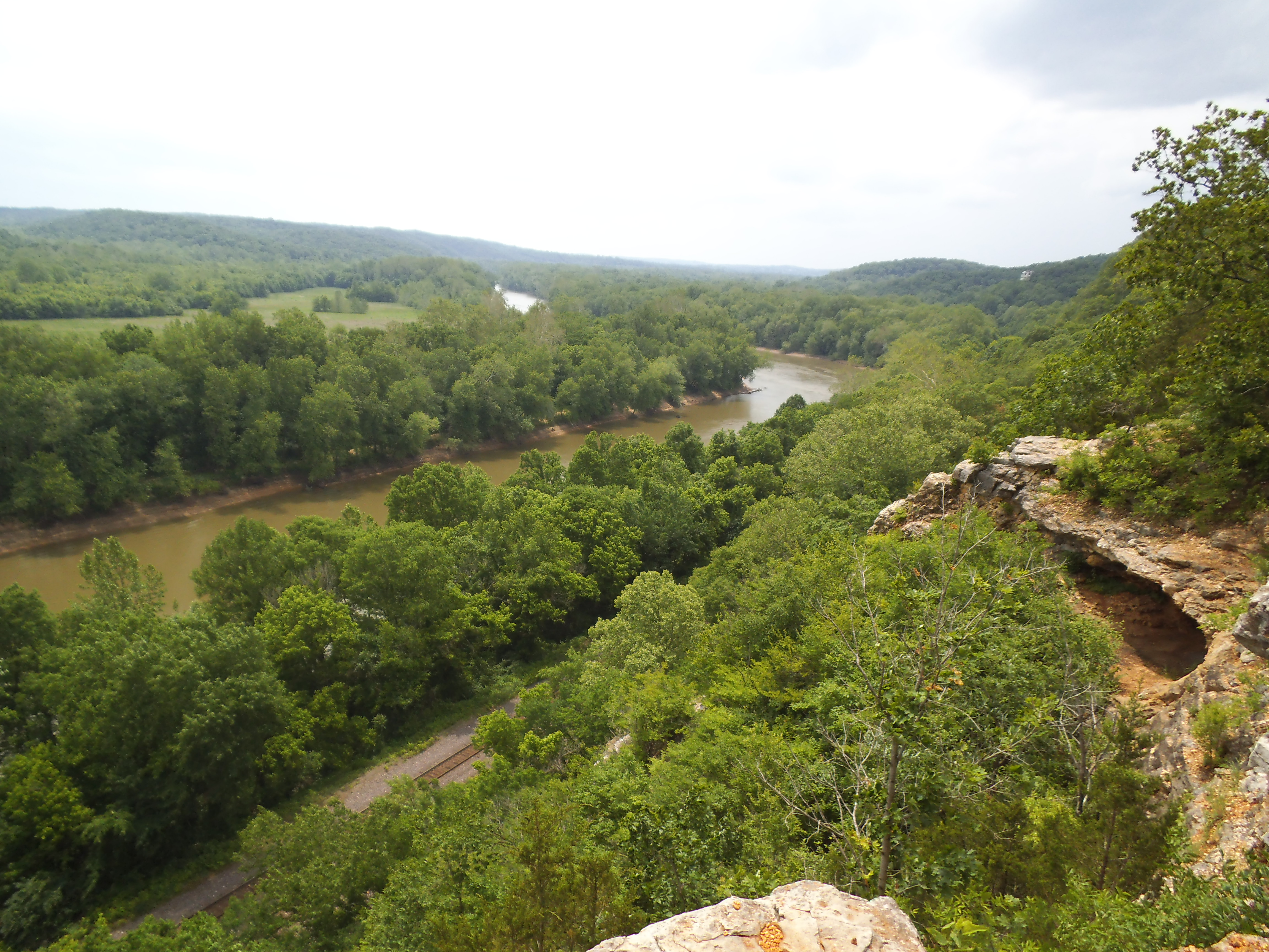 It is 10:34 pm, on some random weekday in 1997. I just got home from work at Sam Goody to my apartment in Ballwin, MO. My roommate Jeremiah, who works as a server at Chevy’s Mexican Restaurant in Crestwood Plaza is sitting on his bed reading as I walk past his room.
“Hey, whatcha doing tomorrow?” he yells.
“Nothing yet, I have the day off.” I say as I stick my head through the open door.
“You feel like heading down to Sam A. Baker and hiking the Mudlick Trail?”
“Sure…when do you want to head out?”
“How soon can you be ready?”
“Let me get a shower, and then we’ll get going.”
10:35 pm
We would be packed up and on the road by eleven that night, and would get to wherever we were going by probably twelve thirty. Last minute and completely spontaneous. All you really needed was a lighter, a pack of hotdogs, some water, and a sleeping bag. Extra socks were a luxury.
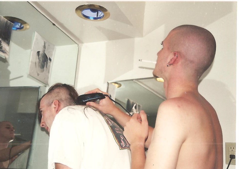
Piercings, cigarette hangin’ out of my mouth, shavin’ my buddy’s head? Look at me expressing myself.
This was the typical level of planning that went into my excursions to the woods in my late teens. I had moved out of my parents house when I was 18, and even before that I had already been going out hiking and camping whenever I could, thanks to the freedom afforded by a driver’s license and a distinct lack of responsibility. I had met Jeremiah while I worked at Exhilarama, the arcade in Crestwood Plaza. He was a year older, had a blue Ford Tempo, and was more of wanderer amongst the trees than I was. As I was homeschooled and he had finished high school, we both worked Monday and Friday mornings, with the middle of the week free for getting into trouble. That usually meant hiking through the forest somewhere, half the time off the trail. I can remember warm mornings, tearing down highway 44 on our days off, listening to Ministry and having no idea where we were headed. Sometimes we had a destination in mind, but sometimes we would just drive until we found something new.
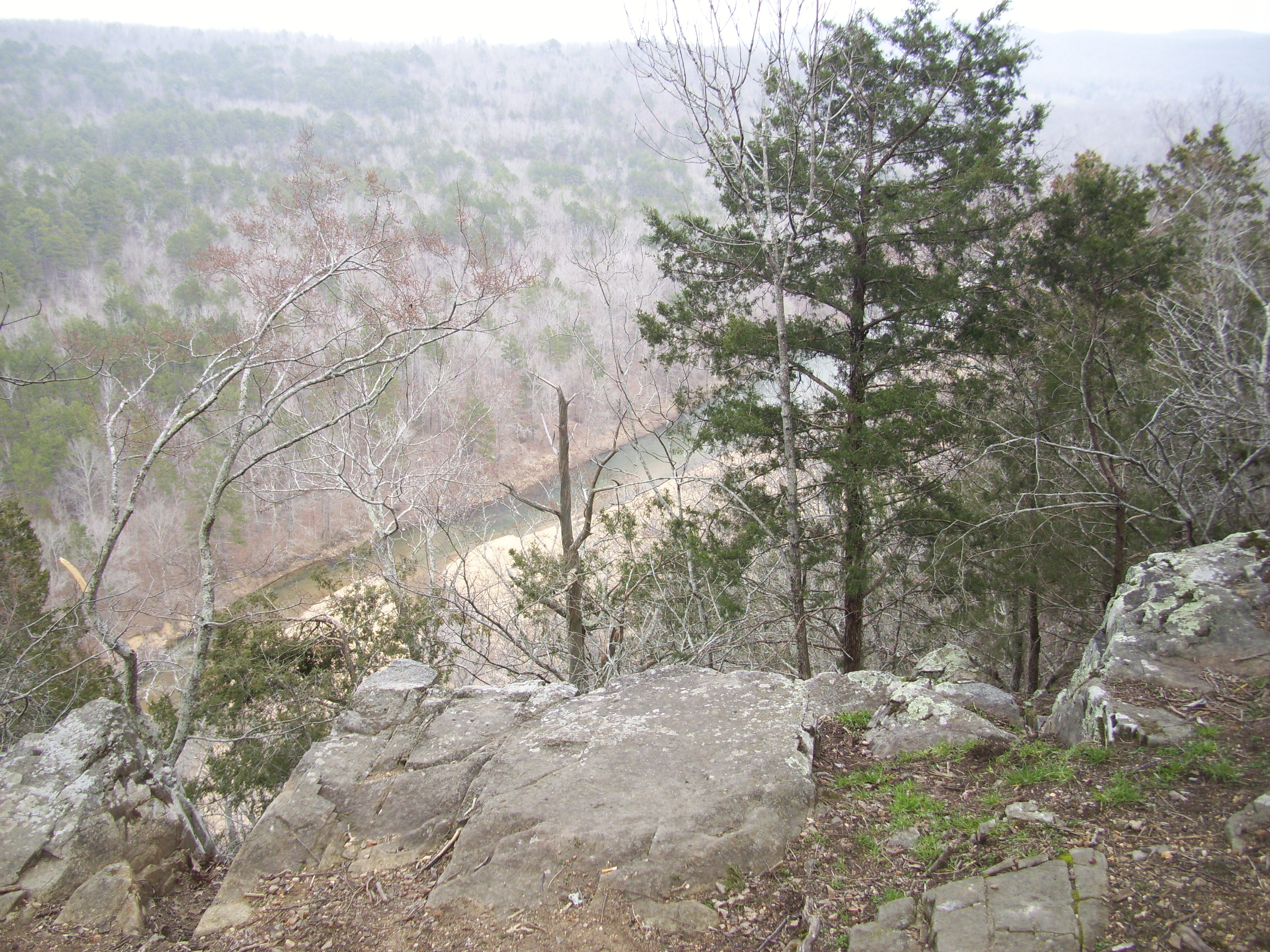
I remember nights sitting on this bluff, overlooking the Big Creek, listening to Skinny Puppy on my cassette walkman, watching the stars.
One of our frequent destinations were the hiking shelters on Mudlick Mountain in Sam A. Baker State Park. We probably went there more than anywhere else, and it was one of my favorite places to be in the woods. Driving south on 67, listening to Frank Zappa and conversing about how we hoped “the girls were gonna show up”. The first time down there for me was April of 1996, right before my 18th birthday. We went down on a Friday morning and stayed up there until Sunday. Gathering wood from the hill above the shelter and exploring the forest on the mountain, as we waited for friends to show up later that evening. We got to know that mountain pretty well and it was a regular thing to hike up to the firetower at the top, long after the sun went down, to hop the fence and climb the stairs to check out the view late at night with the wind whipping through us. And then there was the prospect of “your firewood is limited to how much you can gather”. If you’ve spent time with me around a camp fire, and the conversation has ever turned to Sam A. Baker, then you have very likely heard me tell of the Thursday we stayed at the shelter gathering wood all day long until we had a stack 5 feet high. There weren’t any more logs left to drag down the hill.
If time travel existed, I would go back in time to punch myself right in the face at least once.
It was because of Jeremiah that I became familiar with the floating capital of the world, Eminence, MO. It is home to the Jacks Fork River and the Current River, which jointly make up the Ozark National Scenic Riverways. They are two of the most pleasant and beautiful waterways in America, and his mom had been bringing him on trips there since he was little. I have no recollection of the name of the outfitter or the section of river, but on one trip there we floated over the course of three days a 52 mile stretch. It was unreal, floating half the day and then camping on the beach at night. Isolation. Independence. Freedom. I can’t think about it without wishing I was on the river right now.
And then there is the Ozark Trail. At one time in my life, we were determined to eventually hike the whole thing, but the only section that I have actually completed was when he and I hiked the Eleven Point Section. This was a story in itself, but the summary would start along the lines of: “Two young adventurers, completely unprepared for the wilderness ahead…” It was an undertaking of inexperience and over-packing, and I will never forget the valuable lessons from that trip. It is still on my list to hike the rest of the Ozark Trail one day.

My parents and I, at our home on Oregon Ave.
These were a few of the more momentous trips. For the most part however, we would usually just drive to some trailhead out in west St. Louis County, probably adjacent to Greensfelder, and just hike down a hill in the evening to a creek at the bottom, find a flat spot and set up camp for the night. We weren’t following all the rules, but I don’t know that we should have. We were young and irresponsible and I think everyone, including my own kids, has to go through a time in their lives like this, and it is usually the teenage years. Pushing the boundaries of freedom and going against rules like “Operating Hours”. We came out of it pretty unscathed and more weathered and experienced.
 There were the occasional bottles of booze, but for the most part we kept it pretty clean, usually from the fact that we didn’t have anyone to buy it for us. We would head out into the woods with maybe a bottle of cheap vodka in one of our packs, to be passed between us as we sat in front of the fire before sleep, and I think the inability for excess probably benefited us. We weren’t offered drunken opportunities to make stupid decisions out in the wilderness that could have gotten us hurt. Plus, in our eyes at the time, a case of beer was just extra weight we didn’t want to carry.
 The beer and pot would always show up when more people were involved. I remember a night out at Babler State Park when I was probably 20 that could have turned out worse than it did. My girlfriend at the time and some of her friends were staying out there and I was joining them after I got off of work that night. They had set up camp at the end of the easternmost section of the campground, and by the time I got there they were all well on their way to having a good time. I cracked a beer and took a swig of whatever bottle was the being passed around, and proceeded to turn the music up louder. With no idea what the time was, we were eventually visited by the park ranger. He asked us for our IDs and took a look at the cans of beer littered around. “You kids know I ought to call the police in here to haul you away for “minors in possession”, don’t you?” None of us made any real statements. We were just a chorus of mumble. He told us to open the cooler and then had us pour out all the beer into the leaf litter on the edge of the site. He then gave us our IDs back and informed us that if he has to visit again, we would be arrested. After he left, we pulled the hidden bottles of booze back out that we had stashed, and refrained from turning the radio back on. Yeah, those days were a long time ago. Nowadays I would be the one calling the ranger on the obnoxious punks at this point. If you’re going to be in a campground, it is best to observe all the rules, respect your neighbors, and just NOT turn the radio up when you’re drinking while underage.
I would like to think that compared to other kids I was relatively good, but I think an important distinction is that I just never really got caught. Probably because I was in the middle of nowhere at the time and I was tired from bushwacking through the forest for half of the day, so the desire for unruly drunken behavior was overpowered by my preference to just sit and mellow out.
 I still fondly remember the shimmer of the street lights late one night when we were sitting in the Steak ‘n Shake at Elm and Watson Rd, drinking coffee and discussing the book “Into the Wild”. I was probably 17, and the handful of us there had all read it and we were convinced that maybe sometime in the next month, we were going to each leave our homes (except for Shaun) and spend the next few years walking across America, eating rice and sleeping in the bushes on the side of the road. As much of a life changing adventure as that would have been for my scrawny, introverted, inexperienced self, I don’t regret not doing it. That was almost 18 years ago now, and the path I was currently traveling on was the right one, for in about five years it would change my life in a rather dynamic way. Events not too far down the trail were going to force me to grow up at a pace I was not yet familiar with.
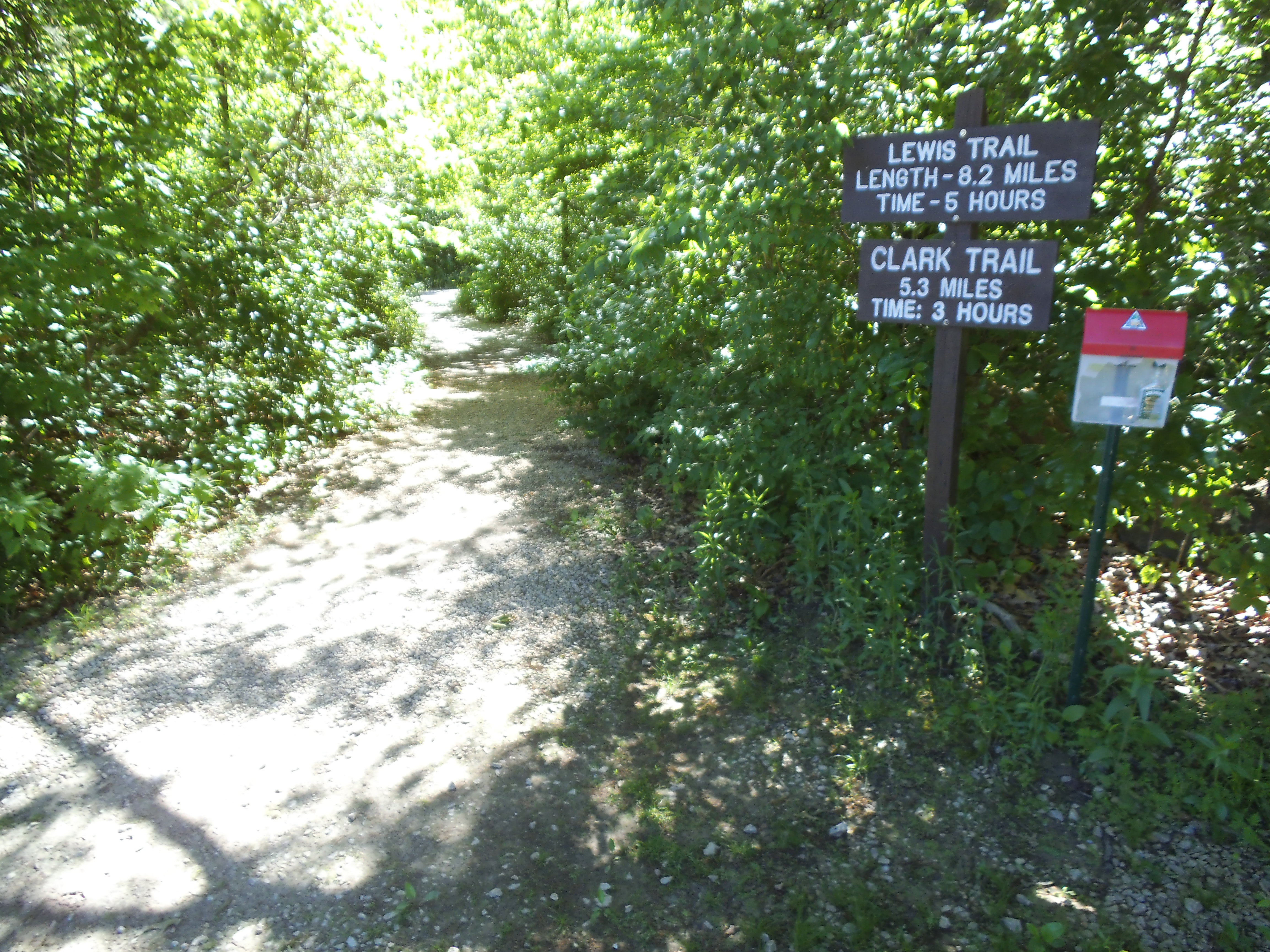 Due to recent news (to me) about an old friend, it had been an emotional week. The hiking that I had been able to get out and do was less about taking pictures and sharing the experience with other people…and more about solitude and conversations with the things that haunt the woods and myself. However on one of those days, motivated with inspiration by the work of the the people at North American Educational Explorers, I decided that I needed to head out to St. Charles County to the Weldon Spring Conservation Area and check out the Lewis and Clark Trails. They are broken up into two loops with the Lewis Trail being 8.2 miles and the Clark Trail at 5.3 miles. Sure, I had brought enough water and a lunch for Max and I, but I didn’t feel like spending ALL day on the trail…at least not this time. So we kept it light and decided to hike the shorter Clark Trail.
 How to get there:
From 270 and 44, go North on 270 until you hit 64/40. Take 64/40 West, out through the Chesterfield Valley, across the Missouri River at the Boone Bridge, and around to 94. Go South (Left) on 94 and take that about…let’s say 5 or 6 miles, to the trailhead for both trails. It is a gravel parking lot on the left side of the road as you go into a right hand curve, and there is a conservation area sign at the roadside. In total, it’s probably about 28 miles from point to point…and not too bad of a drive if the traffic on the interstates is moving smoothly.
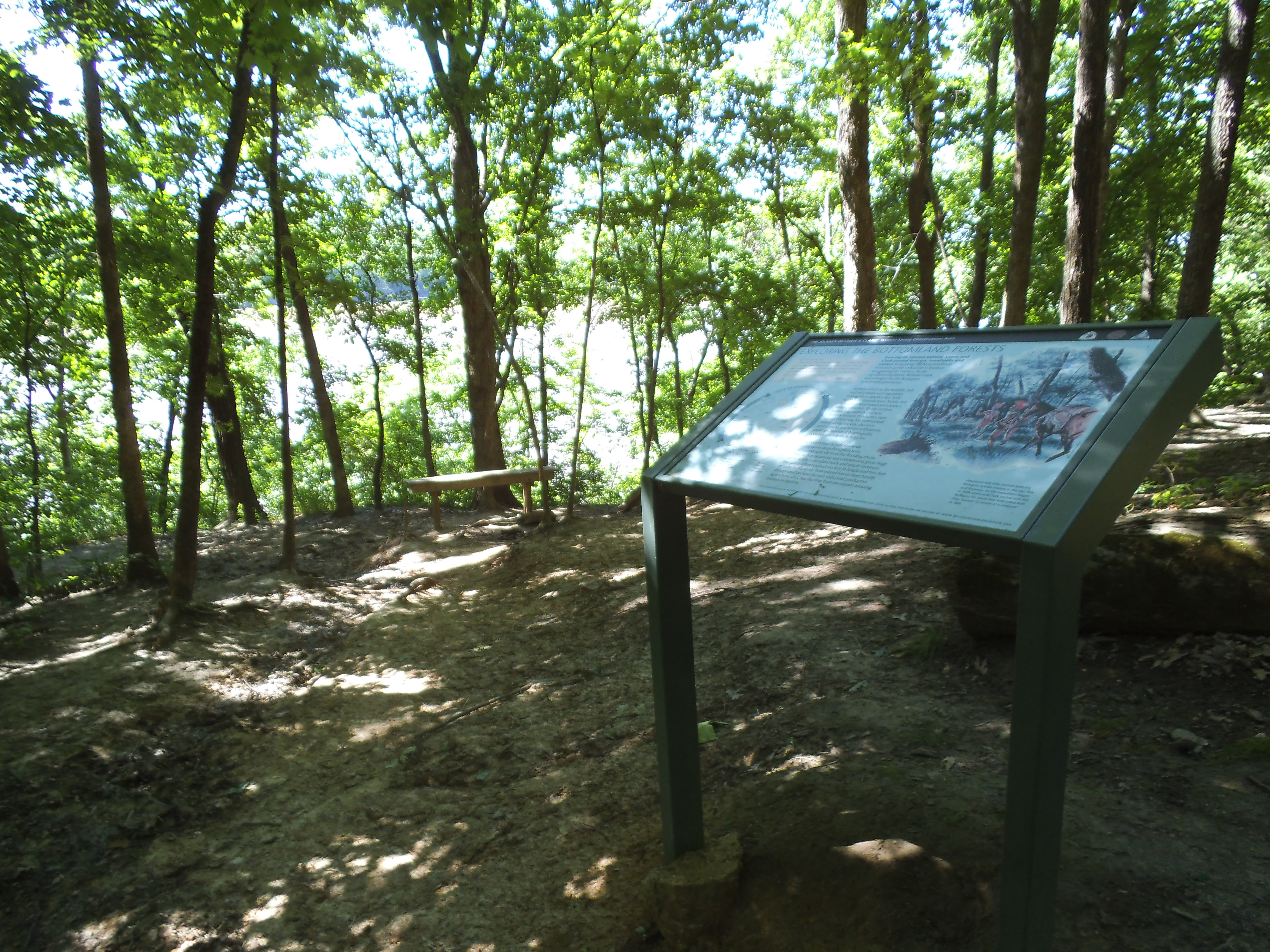
The trail starts out pretty flat and open for the about the first mile or so, but as you leisurely stroll through the woods, appreciating the Maple trees and (gulp) Poison Ivy, you will soon realize that you are walking on an ever narrowing ridge that very soon starts to head downward to the river. Before you a chance to descend that far, at around a mile and a half, you come to an informational sign that tells you about some of the conditions that the Lewis and Clark expedition faced at this point in their journey west. There is a bench here, but you won’t need to rest…yet. The trail takes a sharp left and heads even further down, and into the gulch away from the direction of the river. Just about when you hit its lowest point on this section, it turns to the right and reverses direction again, and you spend the next mile or so heading along the bluffs over the river, ducking in and out of the deeper woods on occasion. At around two and a half miles however, the trail makes its final turn away from the river, and you descend into one of the more prominent creek bottoms in the area. This is a place to pay attention to the trail blazes, as at one point I started to follow the trail to the right and soon realized that Max and I were headed off in the the wrong direction and back out to the river again along the Lewis Trail.
 So I turned around and got back to where the two trails join up, and sat on the bench and had a snack. As you continue the hike, it follows the creek upstream for about half a mile before it climbs steadily up the hill on the right. After you get to the top, the trail is a continuous series of mostly slight inclines up and down, wandering through the woods around curves and over relatively dry watersheds and creek beds, getting closer and closer to the sound of traffic on 94, until you emerge from the woods nearer to the other end of the parking lot from where you set out.
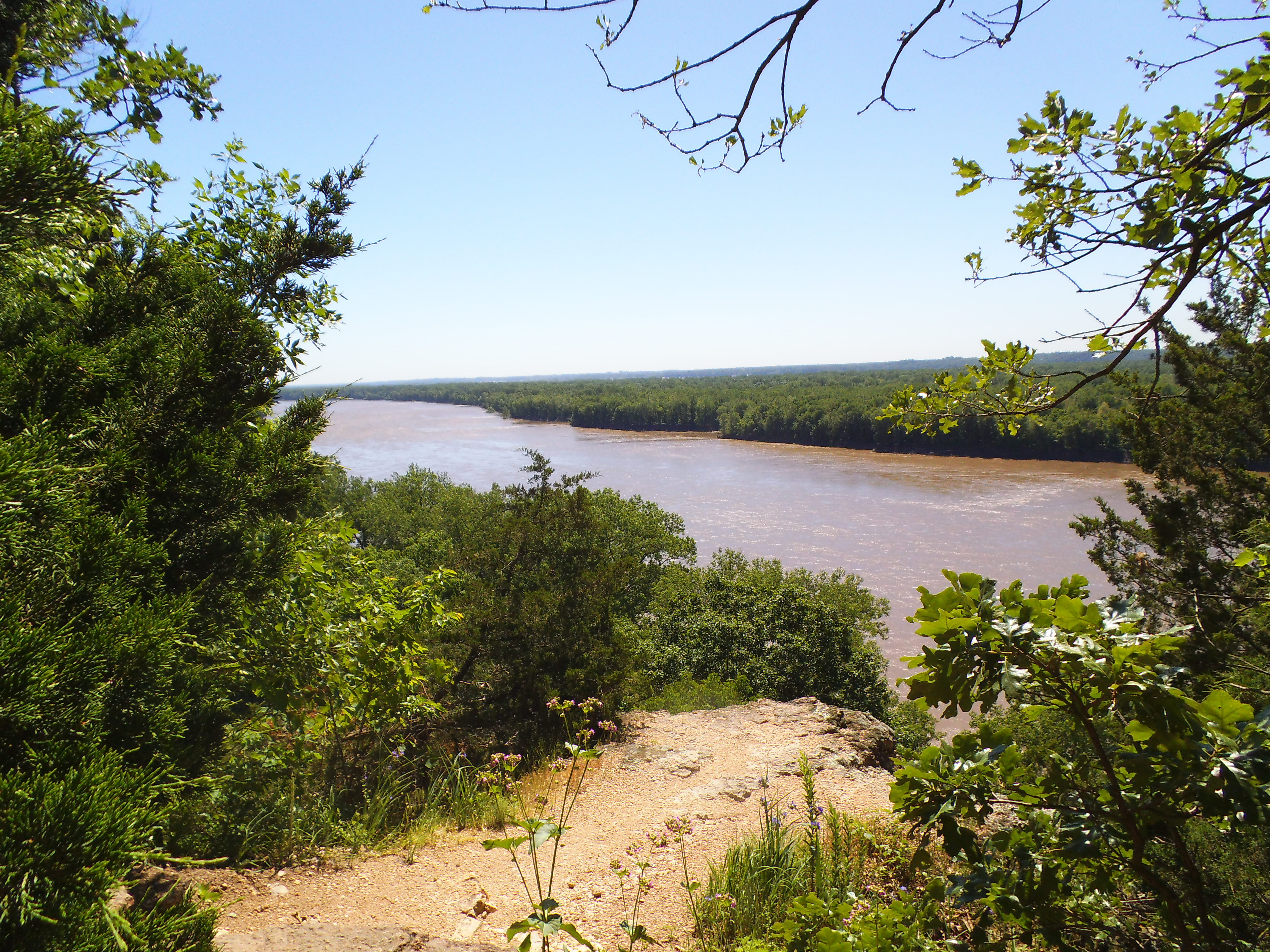 Why I like this trail:
The Bluffs over the Missouri River. I’m sure there are impressive views over impressive rivers all over the place, but these may be some of the closest to where I live. Definitely worth seeing at least once.
It holds a lot of history for the area and for America in general, as it celebrates the adventure that Captain Meriwether Lewis and Second Lieutenant William Clark, along with their band of selected men, embarked on from the St. Charles area right down the river from there, just over 200 years ago.
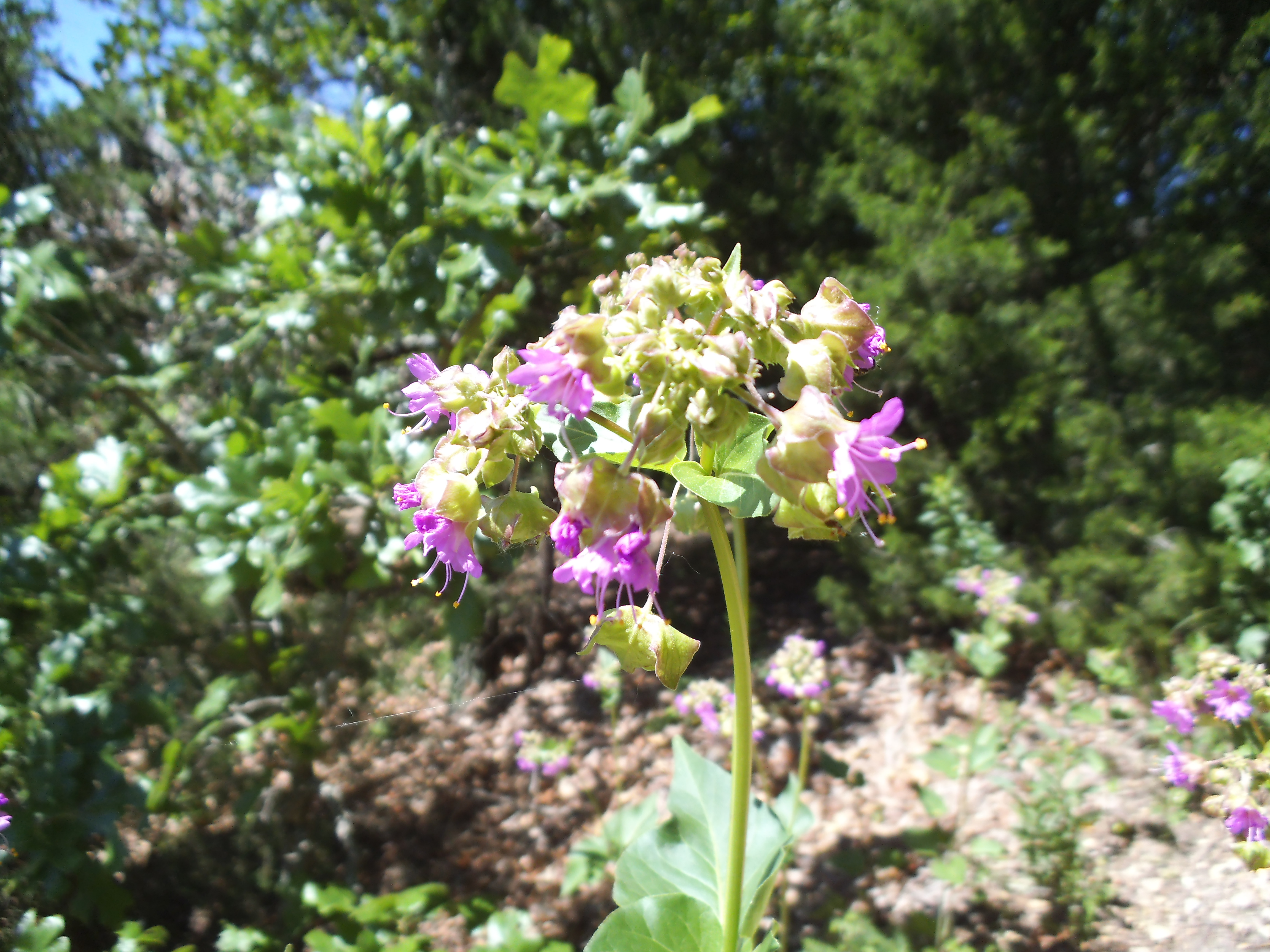 What you should know:
I would call this trail Difficult. It isn’t just a stroll through the woods, what with its length and elevation changes. Bring a snack and something to drink on a day without plans, and really take your time to enjoy the area.
I saw a lot of Poison Ivy out there. Now, I have been learning to identify Box Elder and Fragrant Sumac, both of which I also saw along the trail…but there was a lot of Poison Ivy. Between that and the bluffs, make sure you keep your dog (and your kids if they are squirrel chasers too) on a leash.
 Overall, this was a good, strenuous, and satisfying hike, and it helped to get my mind to a more positive and optimistic place. There were other people on the trail, and I got the impression that it was a regularly enjoyed conservation area by all sorts. Plus, it was about time that I headed a little farther north to hike in the woods. I am looking forward to getting back there to do the longer Lewis Trail someday.
I just wanted to take a moment to throw it out there that I have started writing about more than just the outdoors, here on WordPress. I want to maintain Camping Missouri as a place where I do not interject any of my potentially disagreeable opinions, but I realized that I have other things I feel driven to express. I will warn you that at times it may be overly opinionated, and I apologize if I offend you in some way. I just needed an outlet to be able to express my other thoughts, outside the realm of the forest.
So, if you find yourself appreciating the way I write, I invite you to check out my other blog, “Cerebrally Cursed“. If you like what you read there, please feel free to follow it and share it with others
Thank you.
Gabe
Continued from Part One:
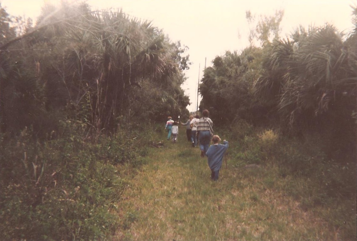 So the next year, just before my 7th birthday, we moved to Florida. It was my father’s dream to be involved in the space program and he had gotten the chance. We ended up in the central part of the state on the east coast, in a little town called Titusville, on the Indian River (think “Grapefruit”) right near the Kennedy Space Center.
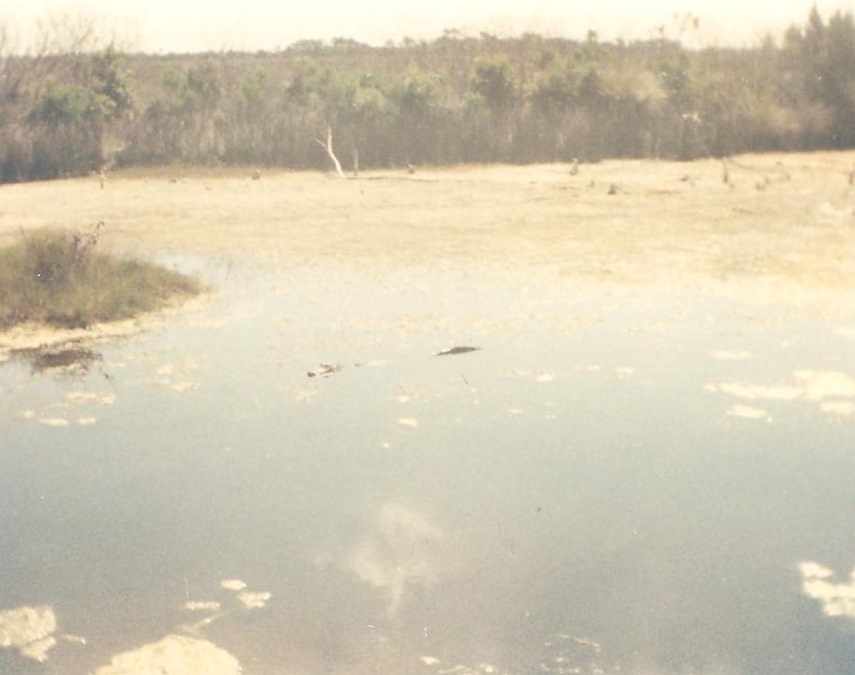
Alligator, in the water, RIGHT next to the trail.
As there was still forest nearby, it was of a more exotic type than I had been previously introduced to. Most of the trees were palm trees, and there were beasts out there that were more fantastical than the deer and raccoons and horseflies of the Missouri hardwood forests. Florida wildlife consisted of alligators, super-sized insects, wild boar, horseshoe crabs, and giant snakes. A typical trip down any highway was another chance to play “Count the Gators” as we drove along the canals that flanked just about every major road down there. And there were a LOT of gators. You would be struck by a subtly increasing sense of distress when you were walking on a trail along a waterway, and look over to realize that the log that has been following you in the currentless canal has eyes, nose, and a mouth and a quiet way about it as it stalks your movement on the path next to it’s territory.
 I remember being on a trail in the Merritt Island National Wildlife Refuge, and coming to an area where the underbrush of young cabbage palms suddenly exploded with violence and destruction. We ran to the nearest boardwalk on the trail, climbed the steps as fast as we could, and looked back from the platform to see 2 giant hairy boars duking it out at the expense of every poor defenseless plant around them. They were definitely monsters, especially to a kid.
 It was at the visitor’s center there that I got to see an Eastern Indigo Snake. They are a threatened species due to our expansion into their habitats with our concrete and strip malls, and they are a magnificent example of the beauty of wildlife. A rich smoky black along their back and sides, fading to a smooth cream color along their belly. Growing to over 7 feet long, they are the longest native snake in the United States. And I have one tattooed on the top of my left foot.
I know that I can clearly say that it was in this place that a real sense of conservation and protection of nature first sparked. At the direction of my mother, we would spend a day every week or two spreading shale and moving debris out of the way on some of the trails there, to get in some activity outdoors and to help maintain a more pleasant path for other people wanting to enjoy the forest as well. And it was on these trails that I first learned the real cost of effort. I was around 10 at the time, and a wheelbarrow of shale is a heavy thing for a child on a hot Florida afternoon. It sure wasn’t how I really wanted to spend my day. Back and forth down the trail, from the giant shale pile to the next section of muddy path. The only thing worse is digging holes for a living.
This is a picture of Poison Ivy I took when I was 10 so that I could always know what it looked like.
It was also on these trails that I had my first real exposure to poison ivy. Unknowingly, I got it all over my arms and shoulders and face, and it was those two weeks of uncomfortable horror that has created an irrational fear in me that I have been learning to overcome ever since. As these experiences were difficult, punishing at the stage of life I was in at the time, I am thankful for them and the way they are bricks in the internal monument to creation within me that I have been building my entire life.
I also remember hopping from rock to rock along the bank of the sulfur-odored Indian River, at Sand Point Park. They were big jagged things, lined up at the water’s edge to diffuse the power of the crashing waves. I could spend hours going back and forth from rock to rock, on some pirate adventure in my mind. When I see my own son, following a Missouri stream in the same way, from rock to rock, it puts a grin on my face as I remember that same feeling.
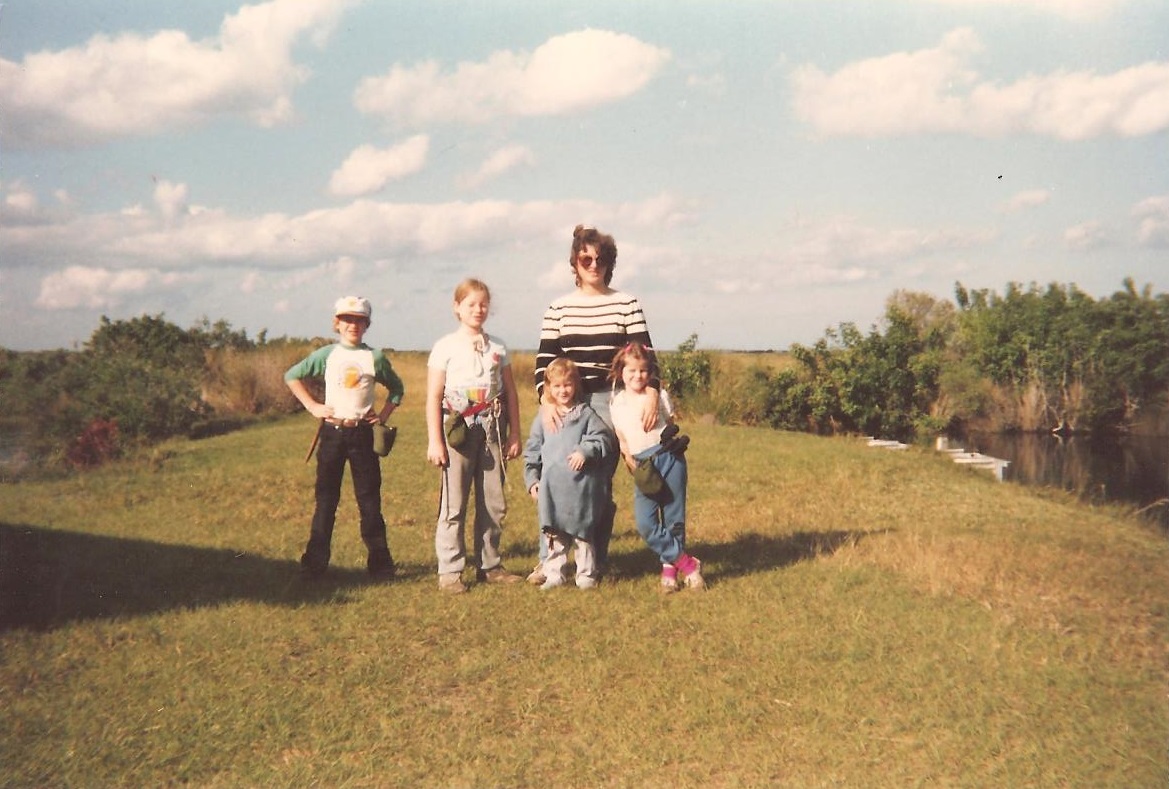
So, who’s ready for a hike?!?
It was also at this park that I made my first connections with fishing. There were many people that would come out to cast a line into the river, and my parents had provided me with a cast net, in an attempt to instill in me a sense of compassion for the creature that I was soon to yank from it’s home and parade around as it suffocated in my hands. I still miss that net and all the cool things, living and inanimate, that I would pull from the river with it.
1979 Ford Fairmont Station Wagon: My Dream Car.
So after years of adventure on the east coast, we made our way back to the St. Louis area when I was 13, in 1991. Looking back now, with almost 22 years of experiences here, I know that it truly was a homecoming. We were coming back to the place we were supposed to be.
Faced with more difficult economic hurdles, camping had become a rare occurrence, but again my mother made it a point to get us out into the woods whenever the opportunity presented itself. I think the most memorable place in the area for me from that time would have to be Rockwoods Reservation. She would take us there on some homeschool group outing, to learn about raccoons or caves or whatever the visitor’s center was teaching school groups about at the time.
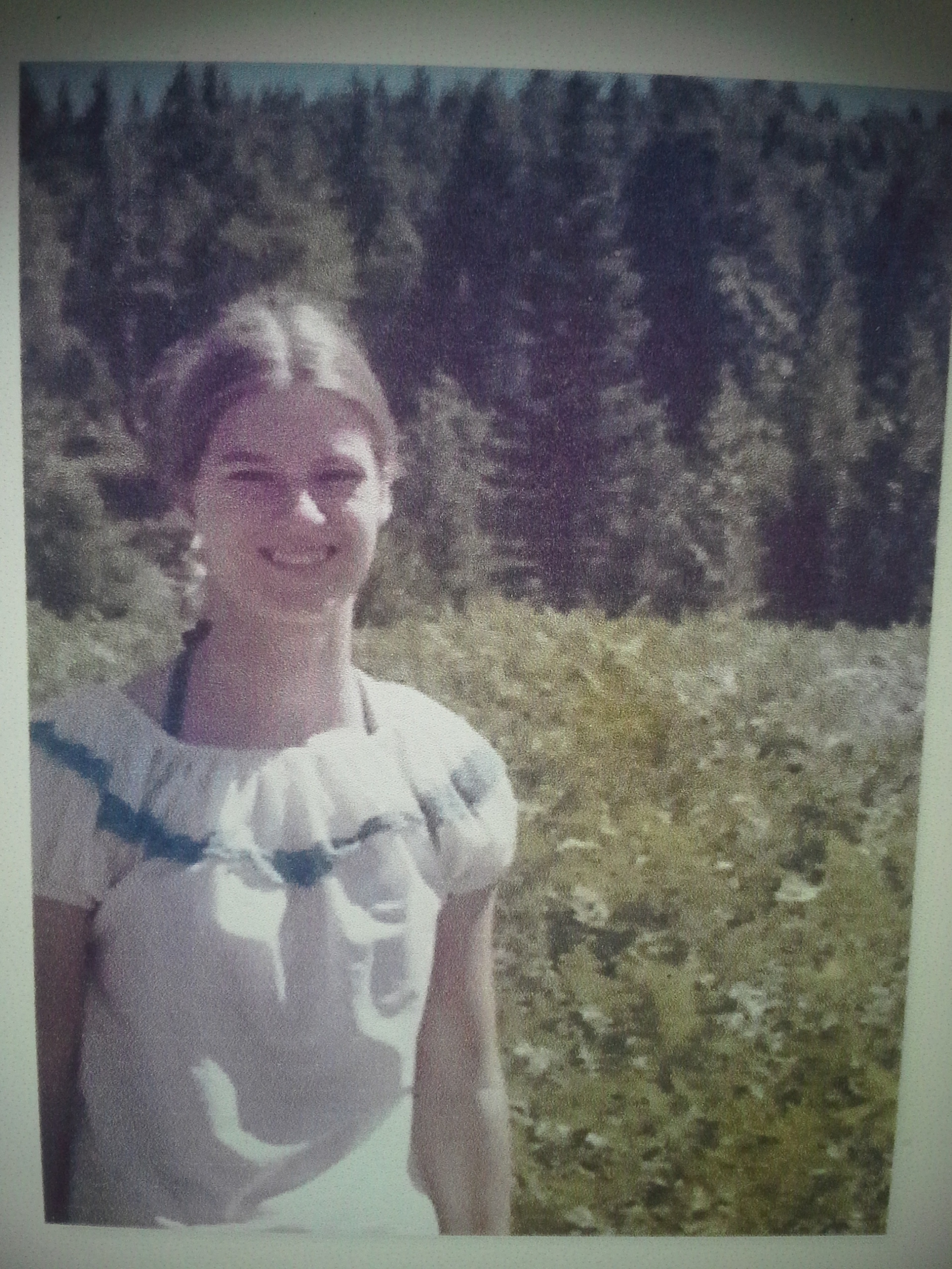
My Beautiful Mother.
It was there, hiking on the Lime Kiln Trail, that I painfully and stubbornly learned the endurance that only hills can teach. It was at Rockwoods, in the now fenced off giant cavern, that I experienced a sense of wonder at the way nature can make a person feel in it’s amazingly varied environments. And there are the forests along the Rock Quarry Trail, shaded and mysterious, hiding the remnants of human influence and our trails of the past with it’s overgrowth.
There is a lot of my childhood that was spent creating a connection with nature, and I will always be thankful to my parents for their instilling the spark within me to appreciate the forest and all of creation. Without the opportunities they gave me, I would not have the desire to embrace the beauty and life that is just a hike away.
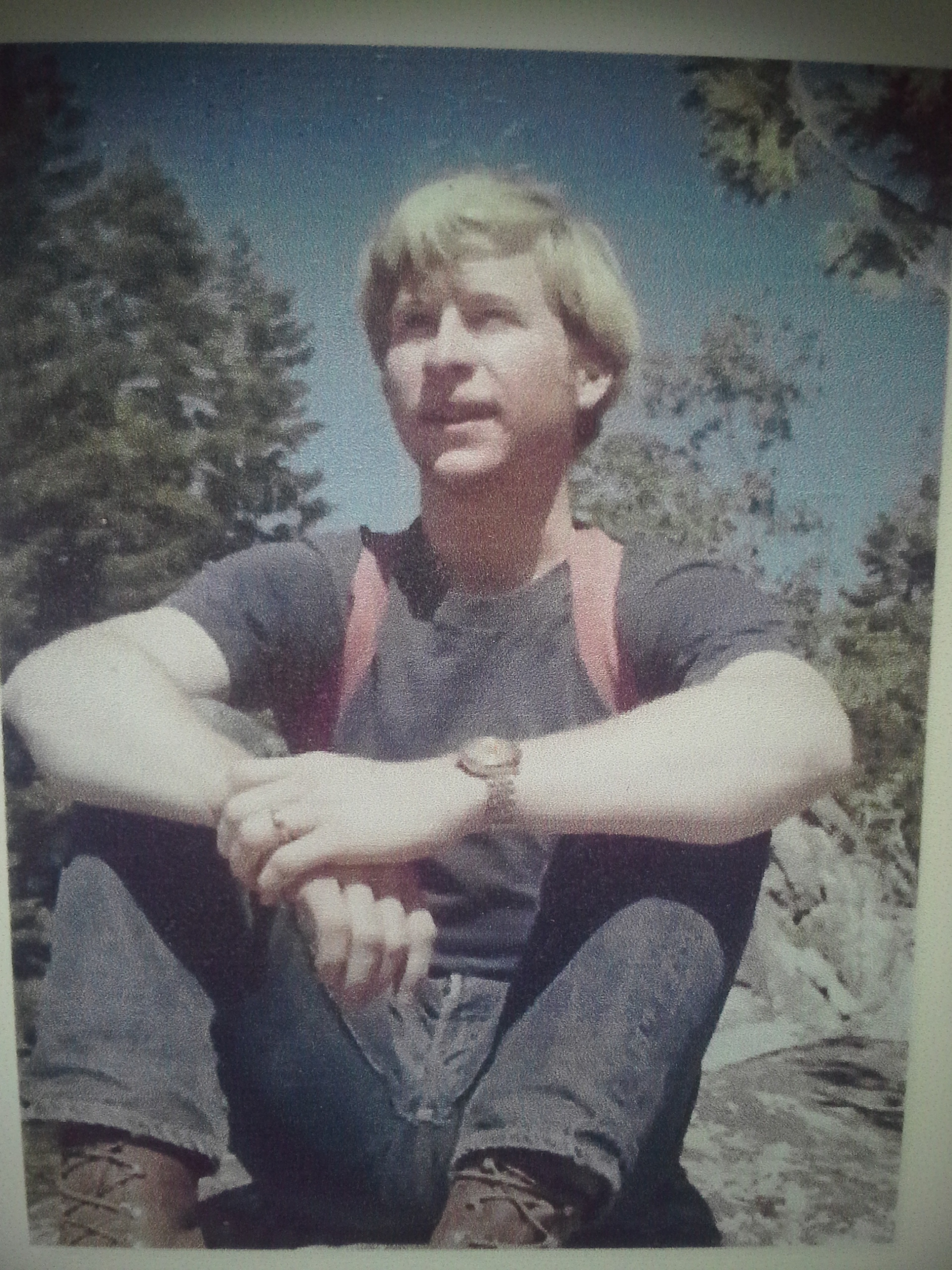
My Rugged Father.
However, this story is not over. It goes on as I gained independence in my early adulthood. A freedom that has sometimes taken me beyond the fence lines or hours of operation, in the forests just past the river down the road.
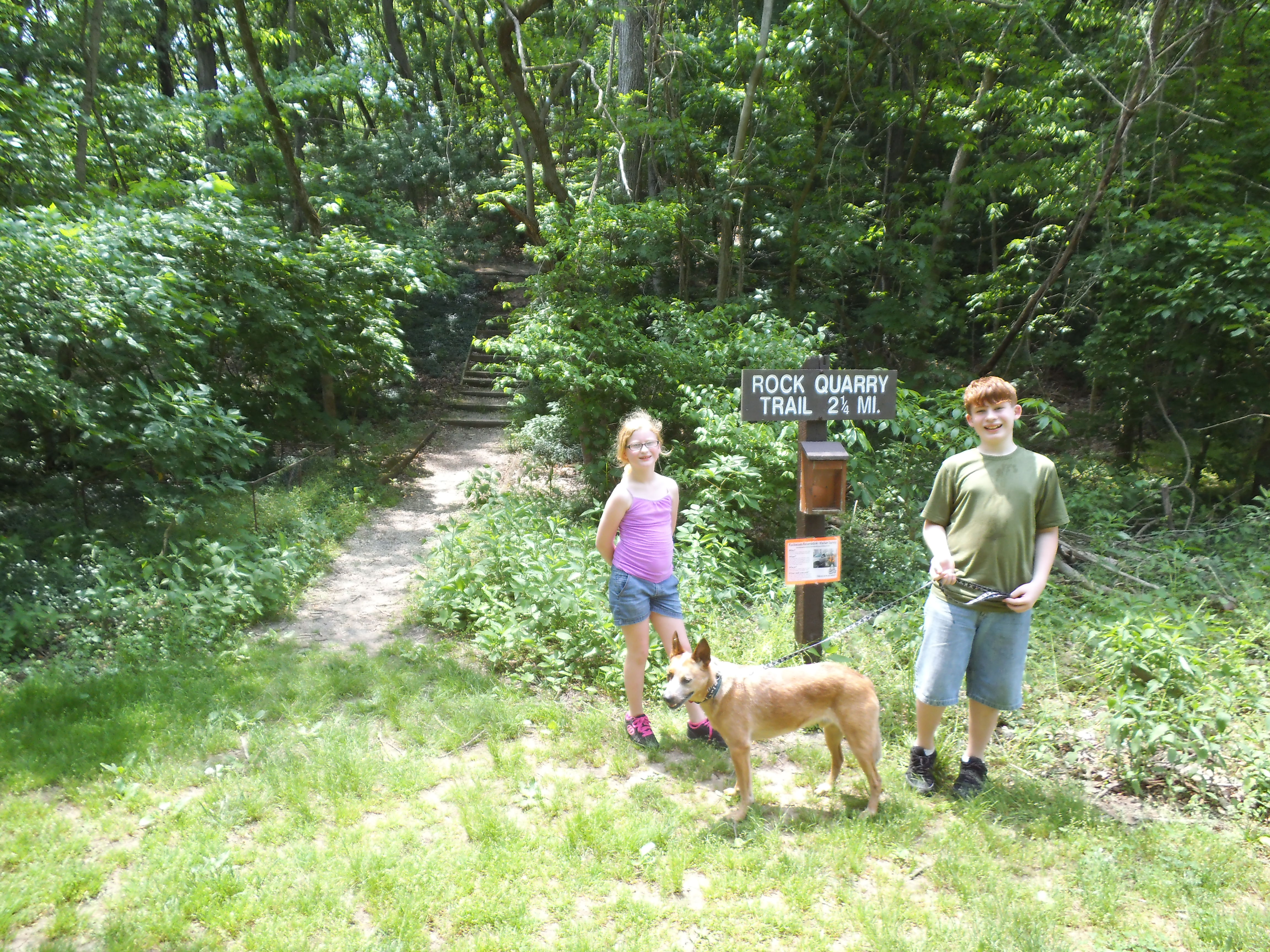 It was going to be a hot Sunday in the St. Louis area, getting up into the low 90s as it tends to do this time of year. You could already see the moisture in the air starting to thicken to a balmy haze as we drove down 44 to Eureka, MO on our way to Rockwoods Reservation. The heat was definitely moving in, proclaiming the beginning of what will probably be another intensely warm mid-western summer, but we were going to spend some time today hiking a couple miles in the shade of the tall, broad, tree canopy along the Rock Quarry Trail.
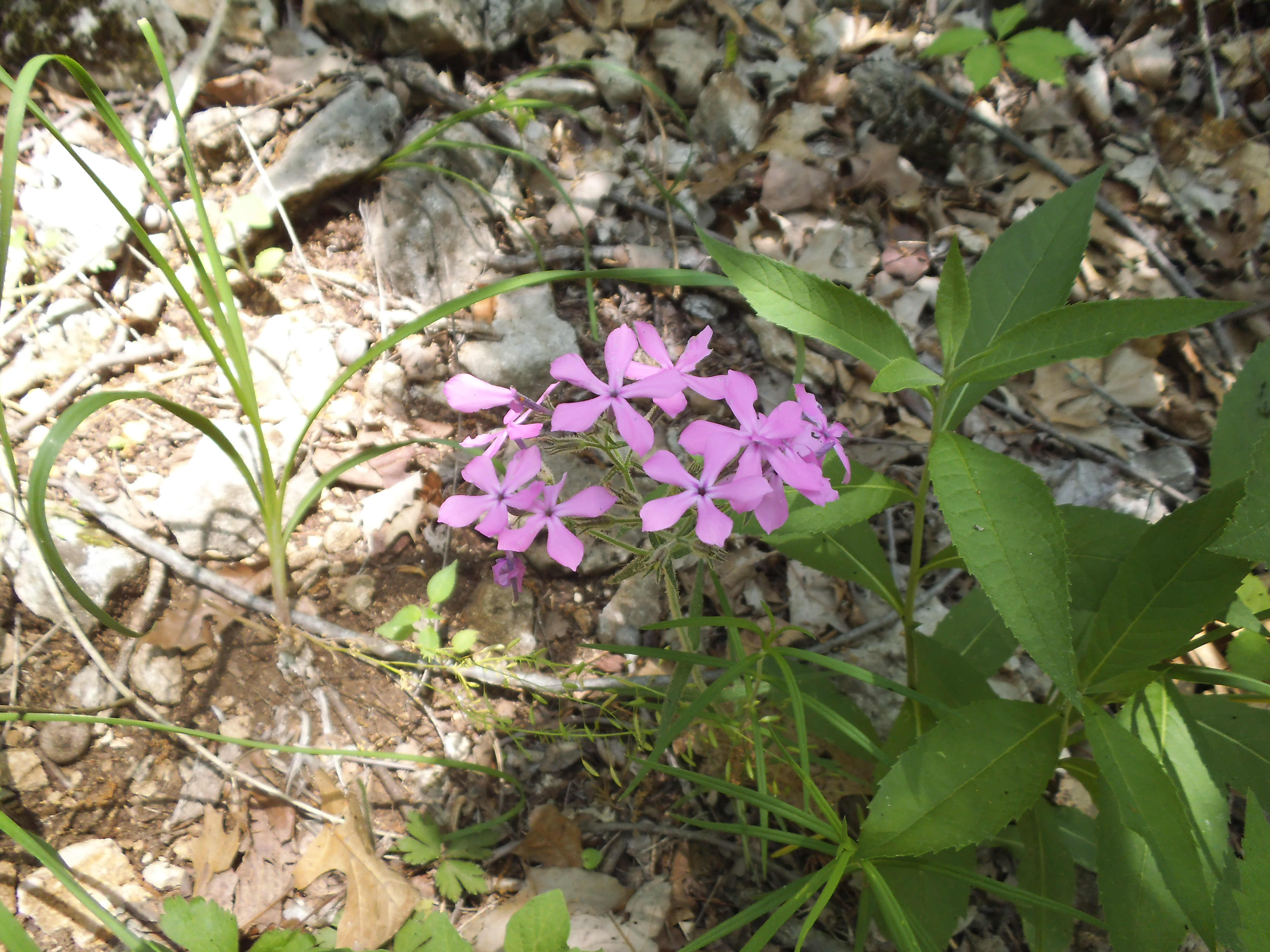 How to get there:
From 44 and 270, head West on 44 about 15 minutes to Eureka, and get off at 109. Make a right (north) on 109 and take that about 4 miles to Woods Rd. You will know you are getting close to Woods Rd. when you pass LaSalle Springs Middle School on the right. When you see the Smoky the Bear fire danger sign, make a left on Woods Rd, cross the creek bridge, and then turn right on Glencoe Rd and into the park. As you drive along the single road through the park, you will eventually get to the long parking lot at the nature center. You will want to park at the south end (the first spots you come to), and the trail head will be almost directly in front of you across the field, just to the right of the fenced off maintenance area.
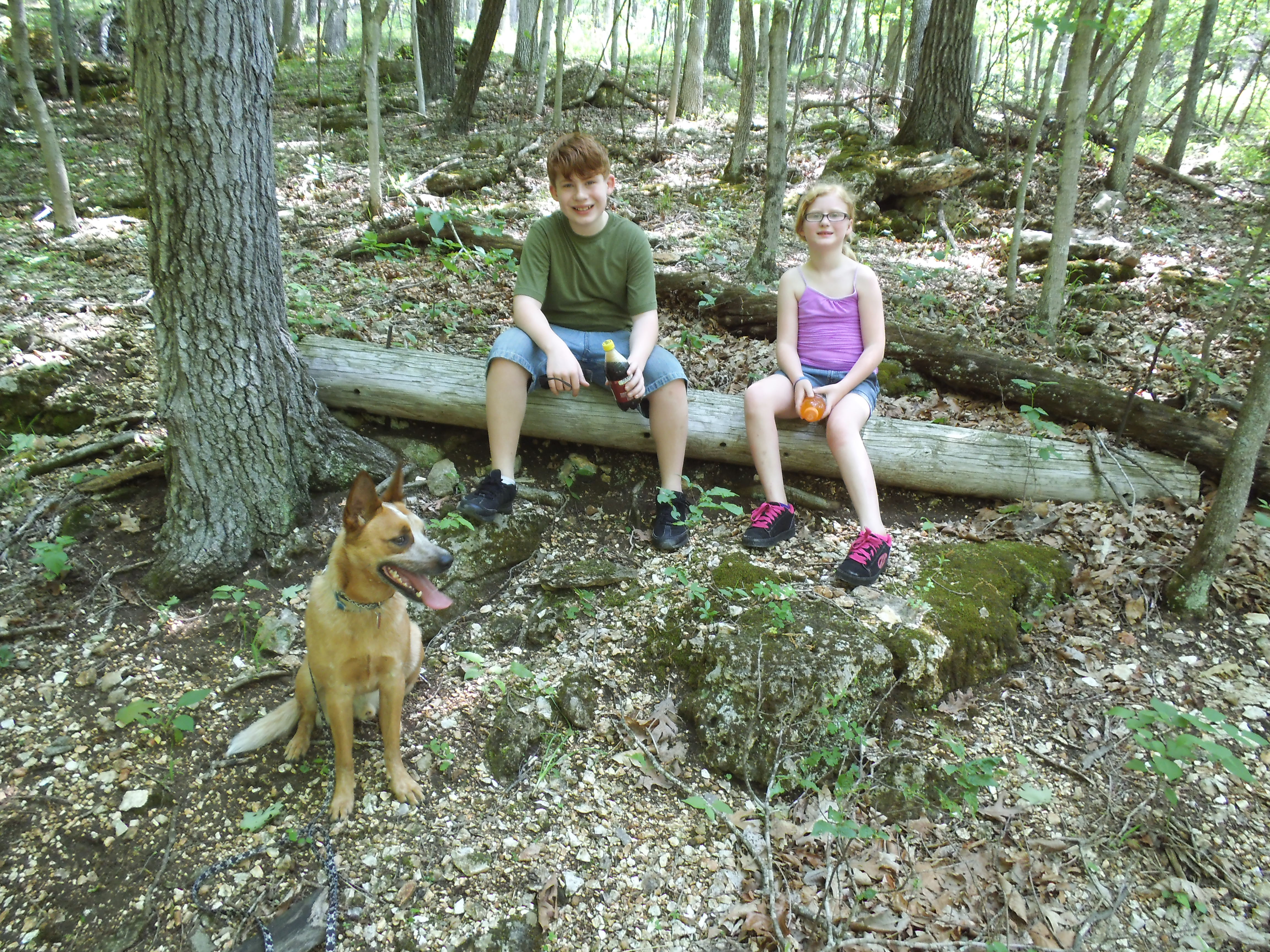 The trail has a few access points, but in my opinion this trailhead is the best place to start at, hiking in a clockwise direction, as you will be getting the challenging part of the trail out of the way while you are still fresh and motivated. From the trailhead, you immediately start climbing the hills, hiking up most of the way for the first half mile or so. When you get to the top of the hill, there is a bench which is a nice place to stop and rest a bit after the steepness you just hiked up. This is also where the short loop cutoff is. It’s a right turn back down the hill to the back of the nature center, if you don’t want to hike the whole thing.
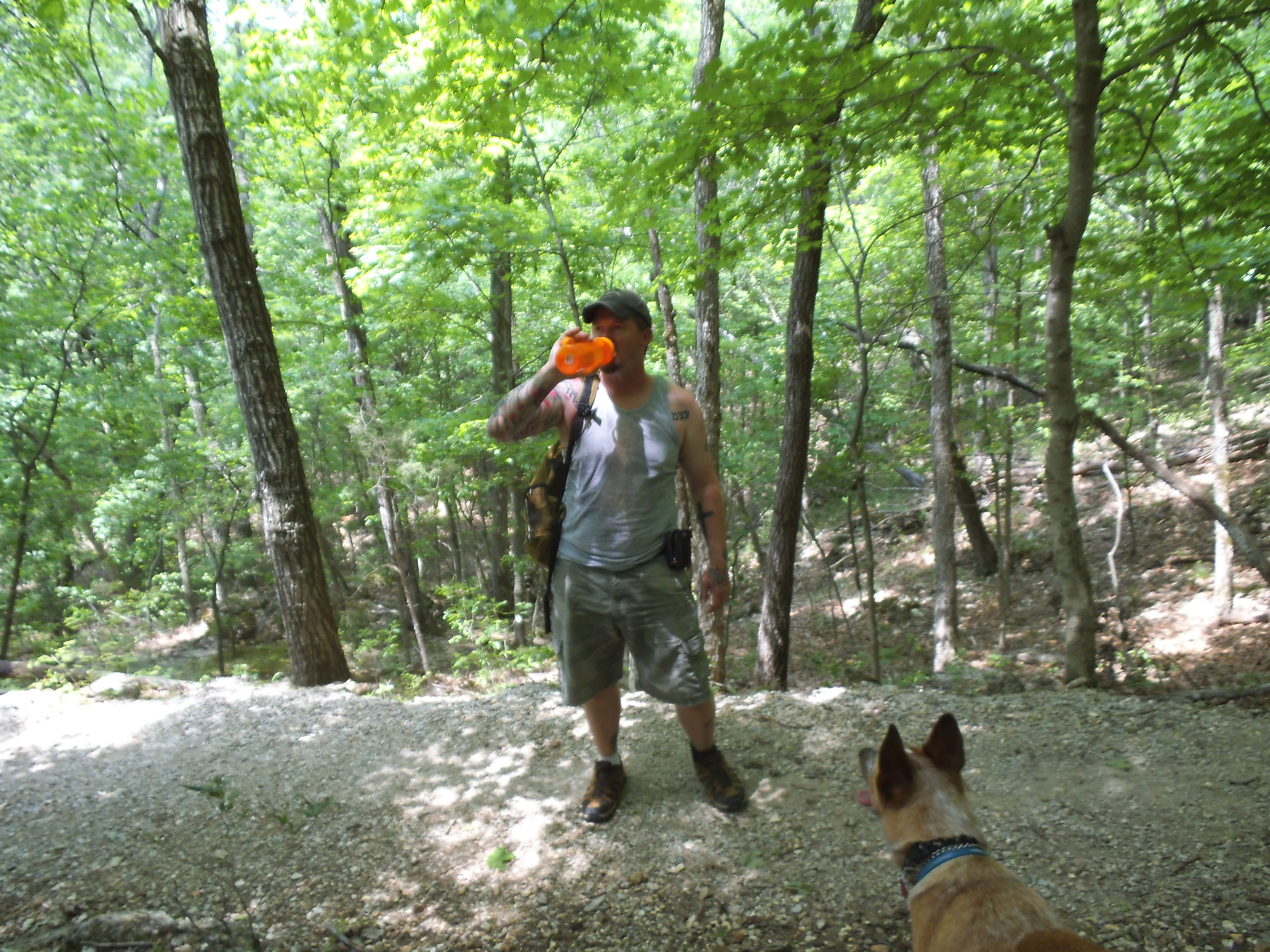 But you do want to hike the whole thing, so stay on the trail as it follows the ridge through the tall forest toward the west. After a couple big swooping turns, you come to some steps that take you down into the watershed hollow that you will follow out through the forest, across a dry creek bridge, around to the right, and eventually back out to the road. The last quarter mile or so walks beside the road and back to the parking lot and nature center.
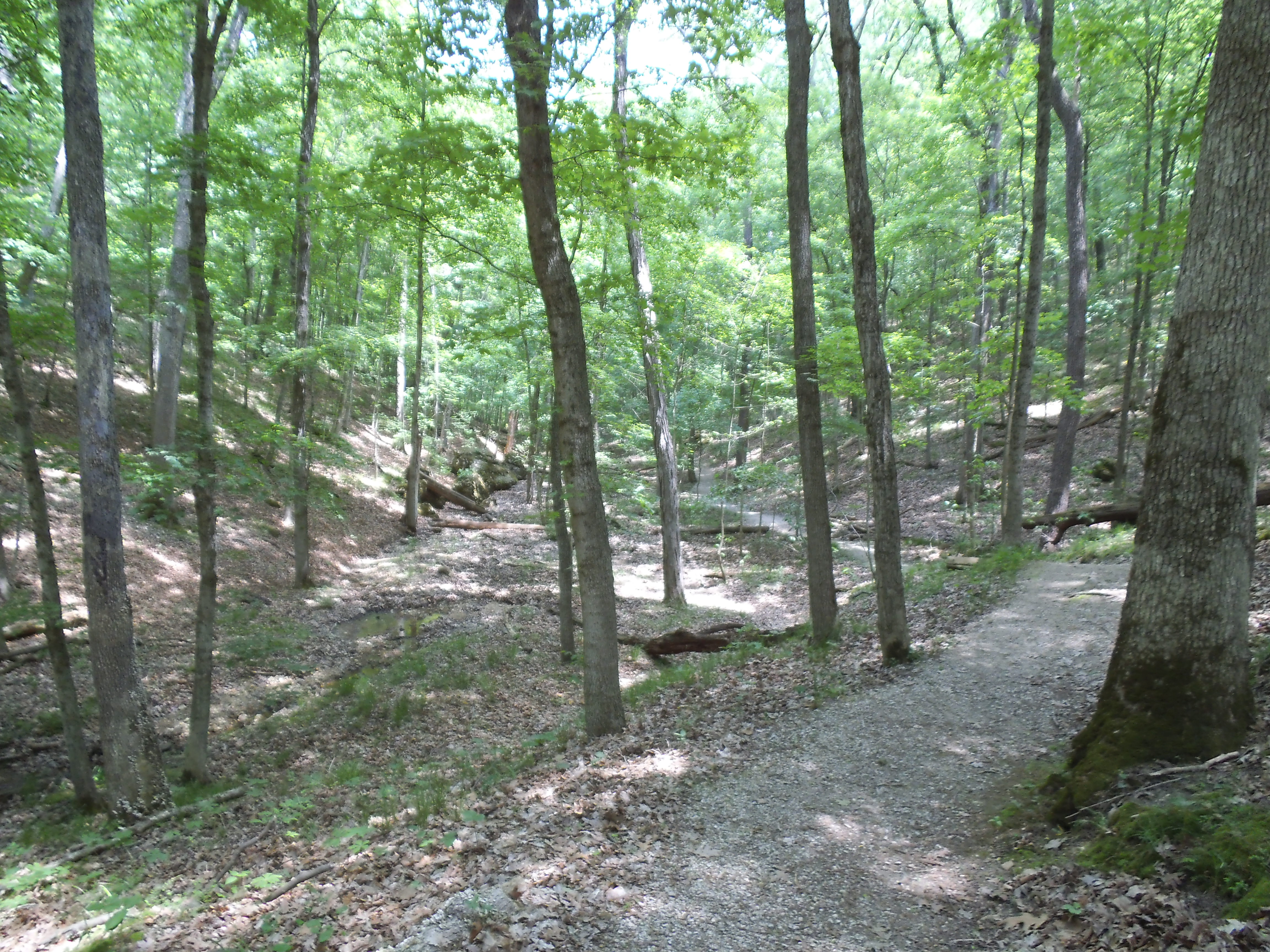 Why I like this trail:
One of the distinct qualities that I have always noticed about this area of Rockwoods, is that it is a very shaded trail. It has a thick canopy way up above your head that allows for a comfortable hike out of the punishing gaze of the sun on a hot Missouri afternoon. That alone should put it on your list.
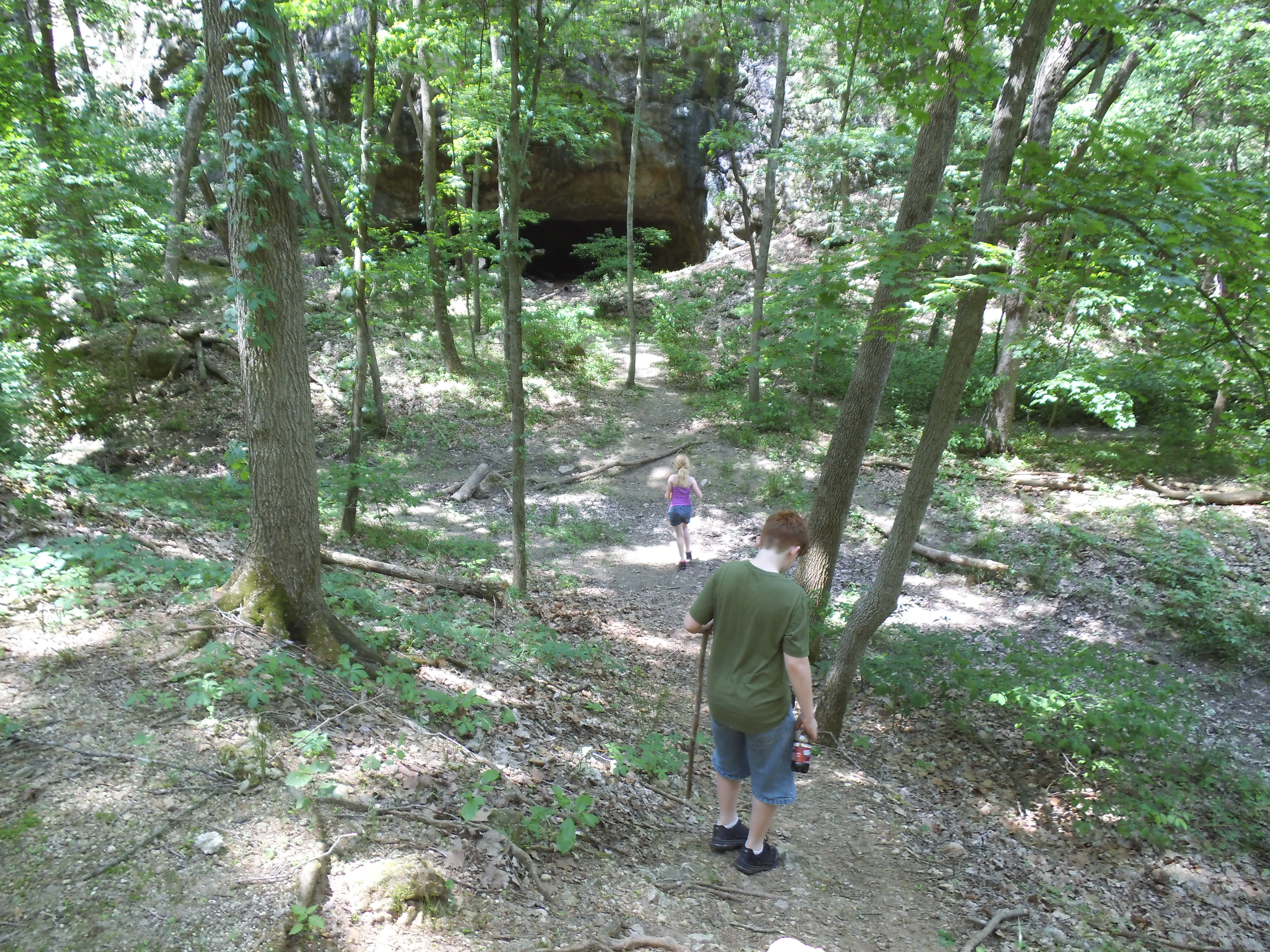
There are areas that have remnants of the limestone quarrying that took place in the past. When you get to the bottom of the hills, back in the hollow, you will pass some cutouts in the cliffs on the left hand side that contain some of the discarded ties from the tracks that used to exist along there for the mining operations. It is hard these days to see it as an open area filled with the sounds of human industry and labor, as it has been years and the forest has reclaimed the land, but if you look closely enough you can imagine another time where this place was valued more for what was beneath the trees and leaf litter, than the forest itself. I am respectful of the history, but I am glad it has been returned to it’s natural state.
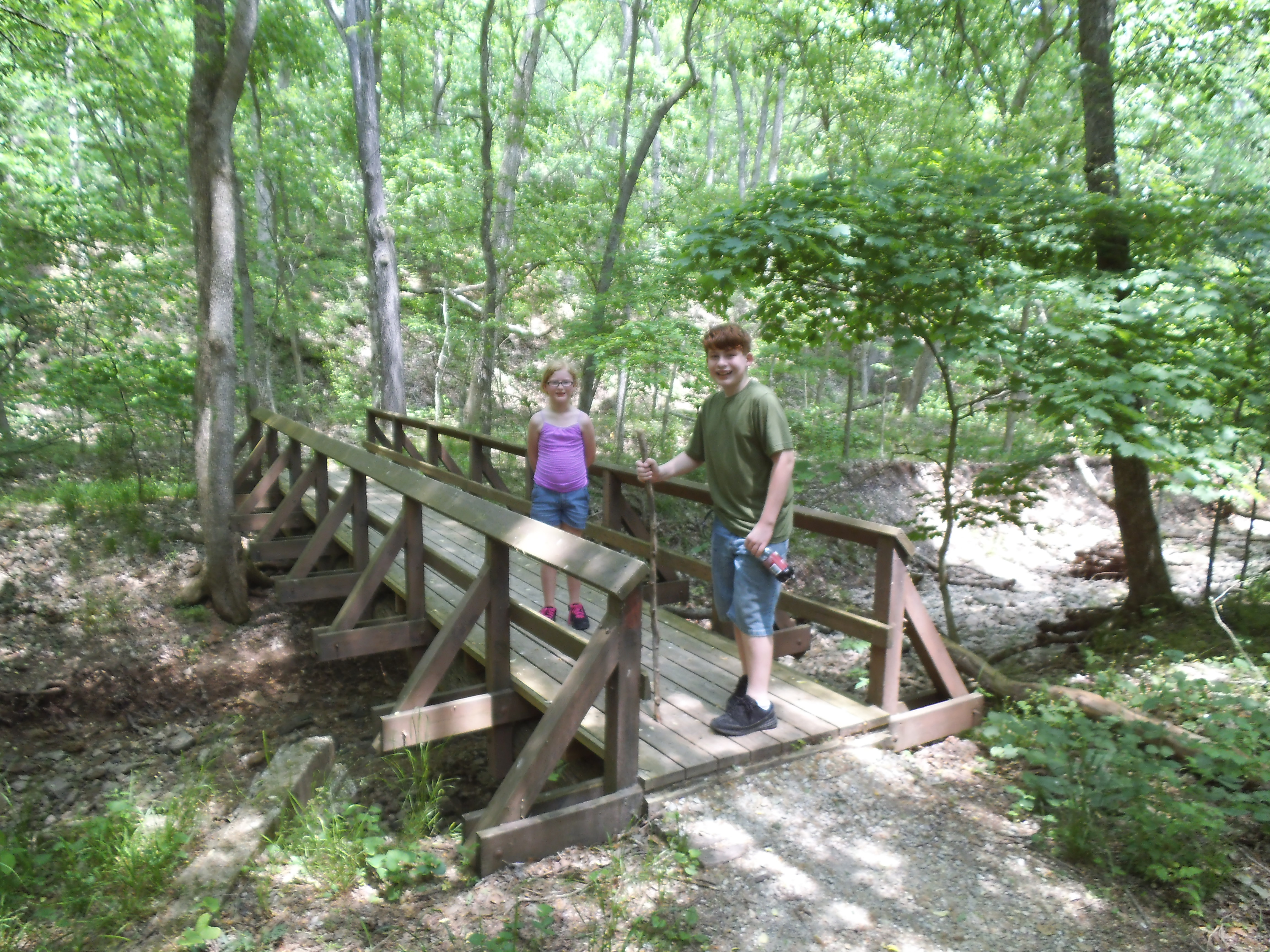 As I said, if you take the trail clockwise like I do, you will get the hard part out of the way and enjoy the last mile or so of level strolling through the forest. This is also a rather wide and well maintained trail, with much of the walking surface being weathered gravel.
I would call this one moderate simply due to the sustained climb, but it is only just over 2 miles of pretty easy trail.
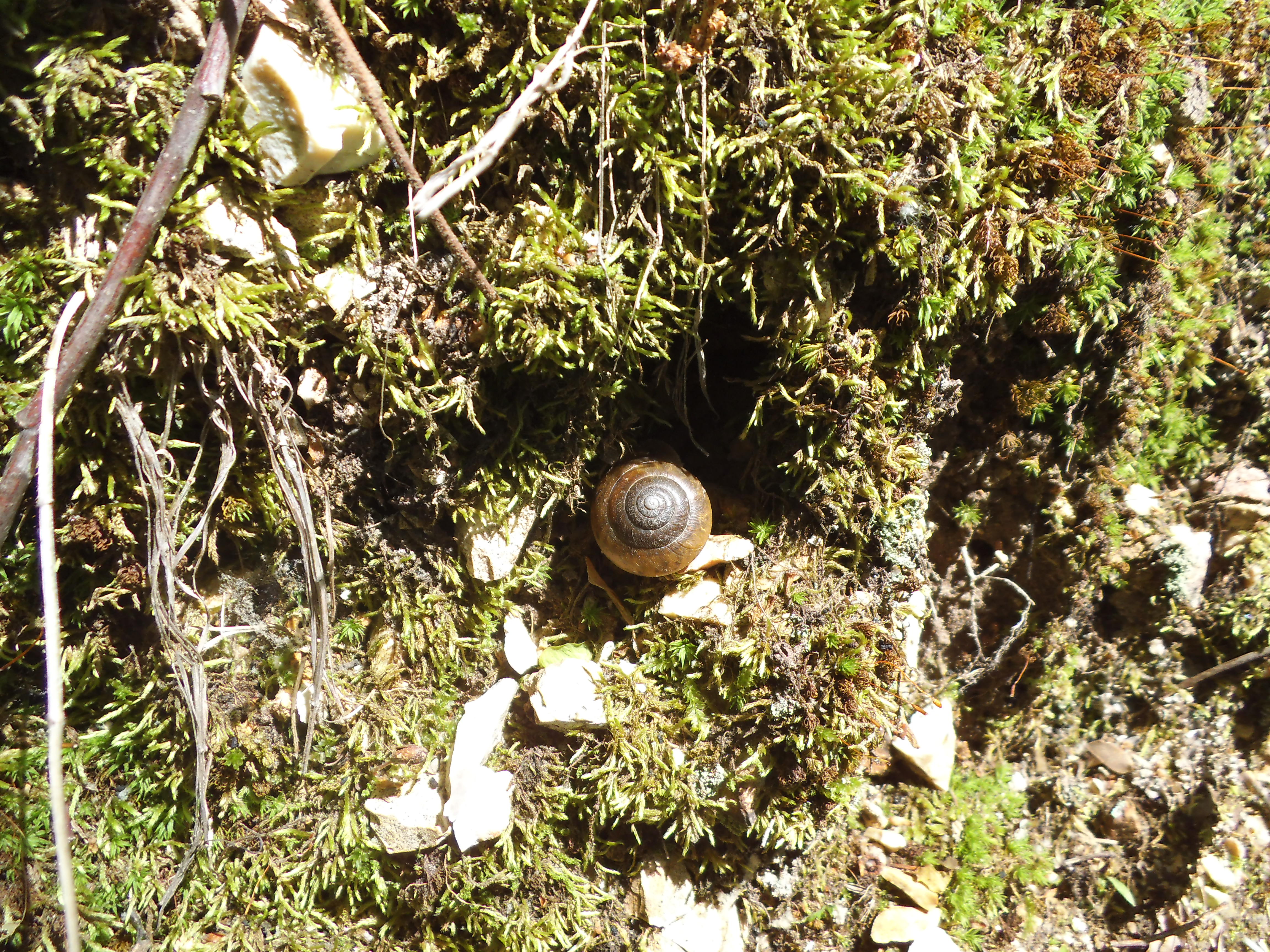 What you need to know:
I had a hard time trying to consider what about this trail might be a challenge or should be warned about, and I can’t come up with much other than that first long climb up the hill. It hadn’t rained in a few days so we didn’t get to see how muddy or wet it might get, but it really didn’t look like there was much evidence that it would. I would imagine that the lower part on the way out might be a little soggy after a downpour, but that was about it.
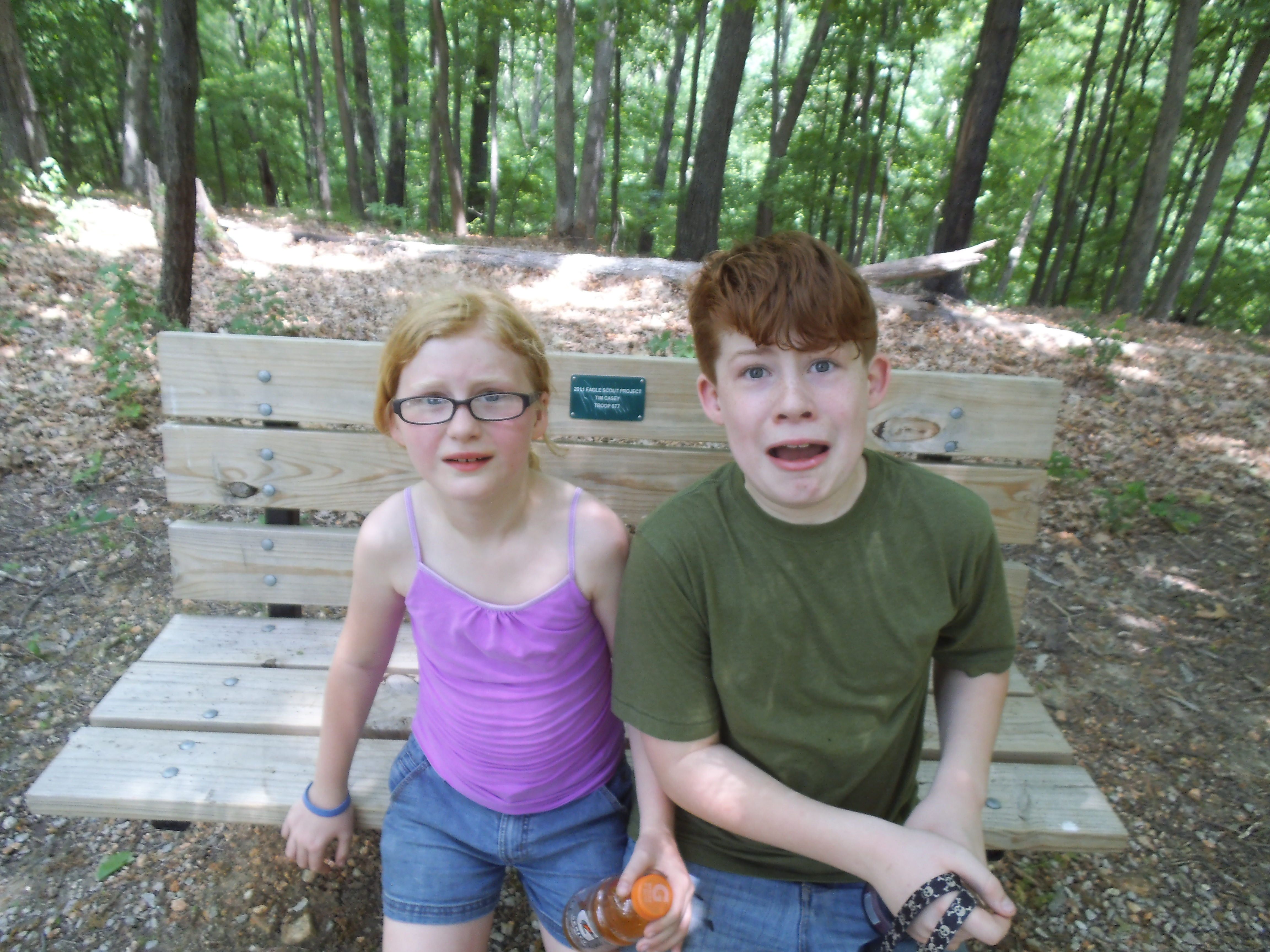
“What do you mean, we have ten more miles to go?!?”
I tell ya, the more and more that I hike with my kids, the more I realize that it brings us closer. The communication and sharing that happens between us as we move forward together through the forest is becoming one of my favorite aspects of hiking, and a very cherished thing overall. With that in mind, the Rock Quarry Trail is a wonderful place for strengthening this connection with them, as I got to hike this trail for the first time with MY mother way back when I was a young person, caught in that time of personal history where I was trying as hard as possible to grow up too.
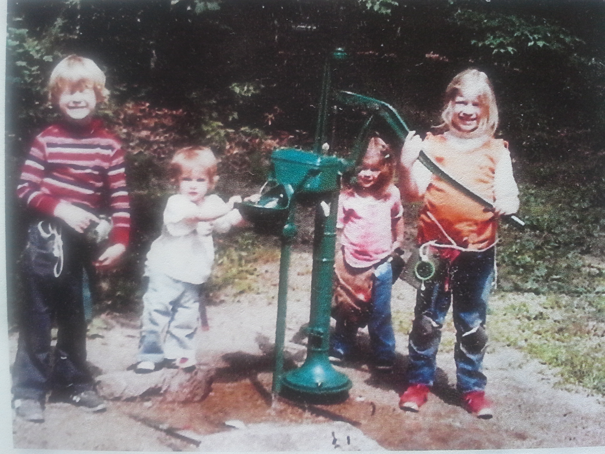 I’m the blonde mop head on the left, with my eyes squinted shut in the sunlight, and some rope and a canteen wrapped around my waist. Next to me are my little sisters, Katye and Jenna, and my older sister, Analyssa. This is some of the earliest physical evidence of my excursions in the forest. This picture was probably taken when I was about 6 years old, at some Missouri campground southwest of St. Louis somewhere. The year was 1984, and as I don’t remember how often we headed out to the woods, I do know that I loved it. In a search through a couple boxes at my parent’s house in Barnhart, I was able to find pictures from us camping at Bass River Resort along the Cortois Creek that year. Turns out we also went to Onondaga Cave State Park and Lane Spring Recreation Area during that summer, and then another trip to the shores of Lake Michigan somewhere near Chicago in the fall. I remember that trip as my first cold weather camping experience.
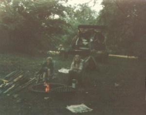
Who knew I would still like sittin’ around by a fire almost 30 years later?
Though it wasn’t any longer than what seems like a lifetime ago, I still have faint memories of the rolling hills along interstate 44, up and down for miles and miles. I was just a little kid looking out the car window, watching the forest fly by as we drove down the highway toward some adventure filled destination in our brown Mercury Zephyr station wagon. Every time we head down the highway these days to go camping, with my kids in the car with me, I still feel that same sense of excitement as I watch the hills go by. The only change is my the perspective from the driver’s seat now, as opposed to the back.
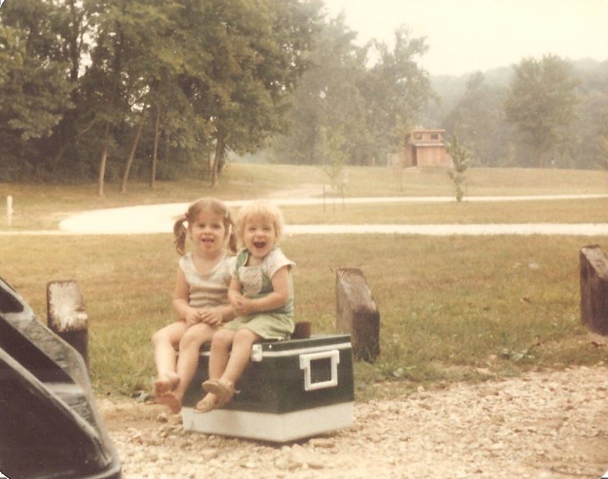
Jenna and Katye hangin’ out on the old green Coleman cooler.
I remember the tent that our family had. It was a big heavy canvas thing with about 1000 aluminum poles that had to go together just right, usually with missing instructions that wouldn’t have helped anyway because the poles weren’t labeled. Yeah, that thing was gigantic and confusing, but that one room temporary house is where all six of us somehow fit at night on camp-outs. Looking back, I guess because we were little there was room for the whole family. In fact, it seems to make a lot of sense that tent manufacturers must use the size of children to determine how many people a tent can be rated for. To see that tent now, it would probably be much smaller and less monolithic than I remember, for obvious reasons. I think about it with a grin on my face every time that I set up some lightweight, 4 man, 2 bungee-pole tent…in a matter of 5 minutes.

Jenna and Analyssa
Though I wouldn’t have been able to conceptualize it as a 6 year old, I had my first real experience with death on one of those rivers. Were you to look into a Missouri waterway back then, you would be appalled at the amount of crawdads flitting about under every stone in the water. They were all over the place, and to a little kid, they were enticing and frightening at the same time. They were like tiny lobsters. Miniature versions of the ones in the tank at the grocery store, and you knew they just really wanted to pinch your toes with their little claws. They also shot backwards faster than you could follow with your eyes, due to their powerful little tails. They were elusive and dangerous…but I had an empty yogurt container. I would slowly wade through the shallow area, just off the beach, and scan the water for the little guys. I learned that once I found one, if I carefully held the yogurt container about six inches behind it, I could get it to shoot back and right into it if I put the lid in front the little guy. After a few hours I ended up with a whole bucket full of the tiny claw snapping, crazy looking water dwellers. However, being six, I had no idea about the importance of a creature’s environment in it’s ability to survive. The next morning I discovered that crawdads need the river and the rocks, and that I was responsible for their deaths. These days when I stand on the bank of a creek, sometimes I will scan the water for crawdads, and ponder the impact that lifeless bucket has had on me. The only environment that can sustain us is a healthy one, and we need to make sure that we understand the factors necessary so that life can continue.

Playin’ in the river.
I remember my first canoe trip, down the river at Onondaga Cave State Park. So afraid of tipping, as it was the most pressing danger according to my distressed and anxious parents, and sitting in the front holding a paddle with which I had no idea what to do. How we survived that trip, 2 kids and 1 parent to a boat, can only be a testament of my Mom and Dad’s shared ability to overcome ANY adversity to protect their children. I know the anxiety from the other side now, every time we are coming to a sharp turn ahead and all I see is the tiny frame of my daughter in the seat in front of me. The danger involved is real, but it is magnified by our protectiveness of these little extensions of ourselves.
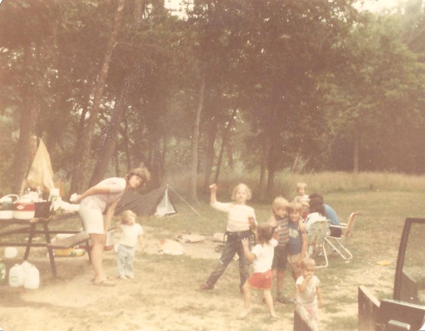 That summer of 1984 camping in the forests of Missouri was a notable experience and somewhat self-defining, that I look back to fondly, if not a bit cloudy after almost 30 years. There is a wonderful charm to the nature we have in our state, and years of human connection to it. The way the rivers and creeks shape the land and the way we have always been drawn to them is more than just a tradition of being close to a water source. It is a powerful force in the history of us, and so much life is there, in the valleys and hollows where the water is. If you can look across the broadness of time, you can see that we are all drawn to the rivers, and it flows in our spirits as it does through the mountains and hills from which it springs.
It turns out though, that sometimes things must change, and that would be my last summer in Missouri for about 6 years. Our family’s path was about to take a right turn and head to the southeast. The forests we would experience soon would have a different look and feel to them, and a bit more of an exotic nature. We were about to trade sycamore and limestone for palm and shale, not to mention the more sinister wildlife. To see a deer in the forest is beautiful, but to see an alligator is another thing altogether.
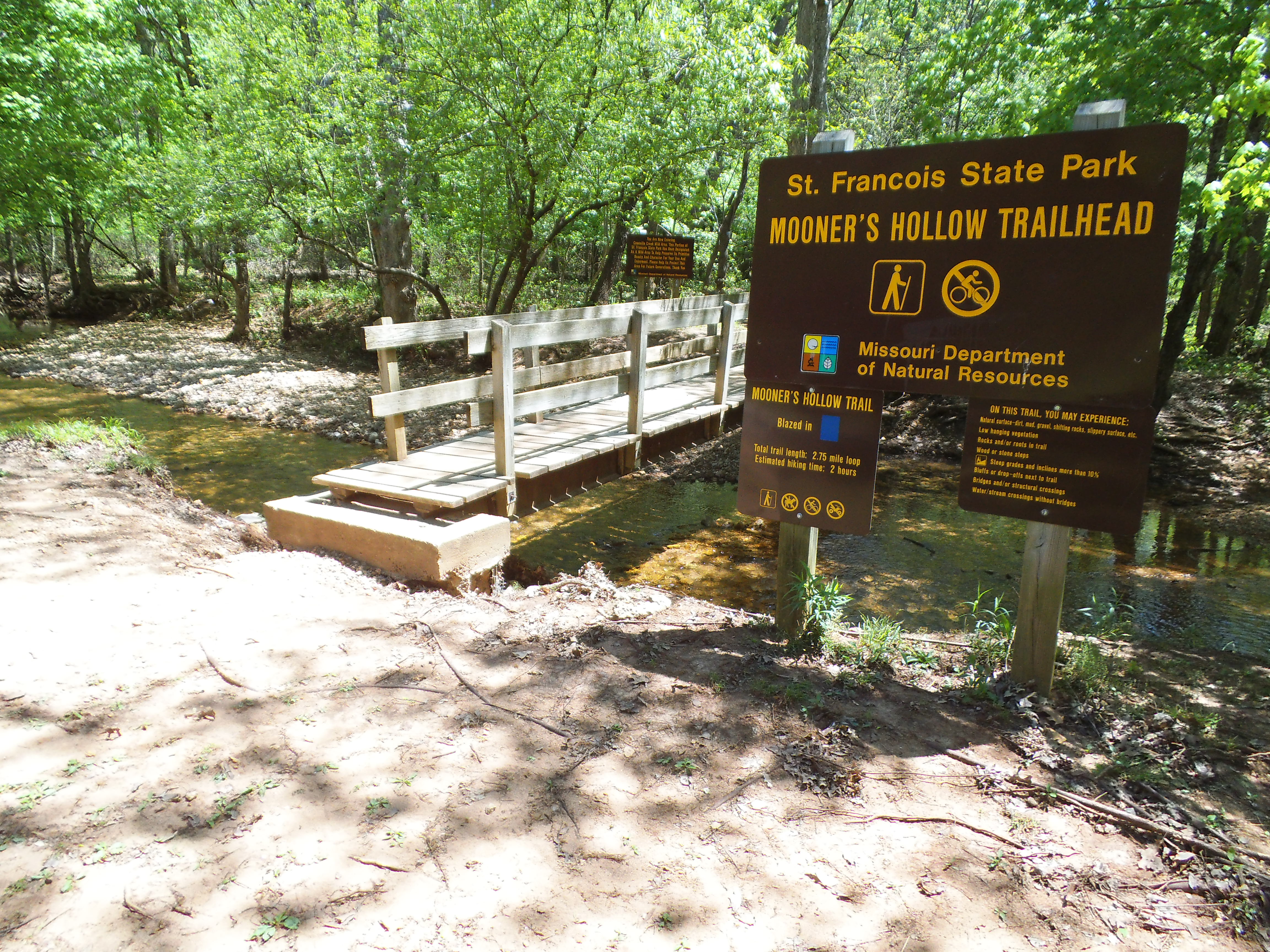 It had been a warming Saturday morning of fishing and playing with the dog on the bank of the Big River, and after no luck with the inhabitants in the fast moving water, we opted for a different activity. Luckily for us, we were in the park that is home to probably my favorite hiking trail out of all the trails I’ve been on in Missouri. It was time to enter the Coonville Creek Wild Area and hike the Mooner’s Hollow Trail!
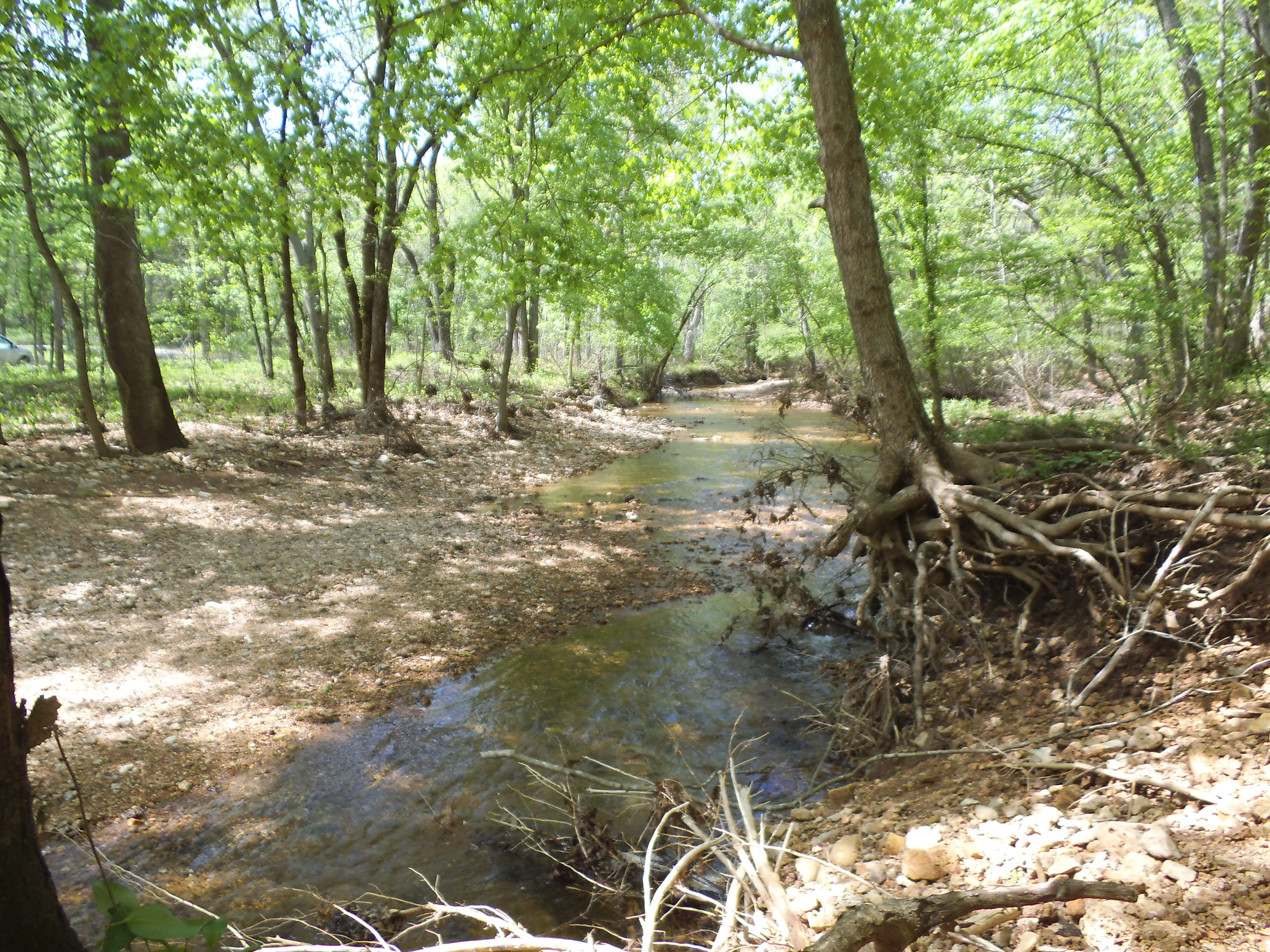 How to get there:
From south St. Louis County at the 55/270 interchange, take 55 south around 20 miles to 67 south at exit 174B. Then stay on 67 south for about another 20 miles. It will be a left turn across the divided highway to get into St. Francois State Park, probably 5 miles before you hit Bonne Terre, MO. Once you’re in the park, just follow the main road down into the valley, and the trailhead will be in the picnic area on your left.
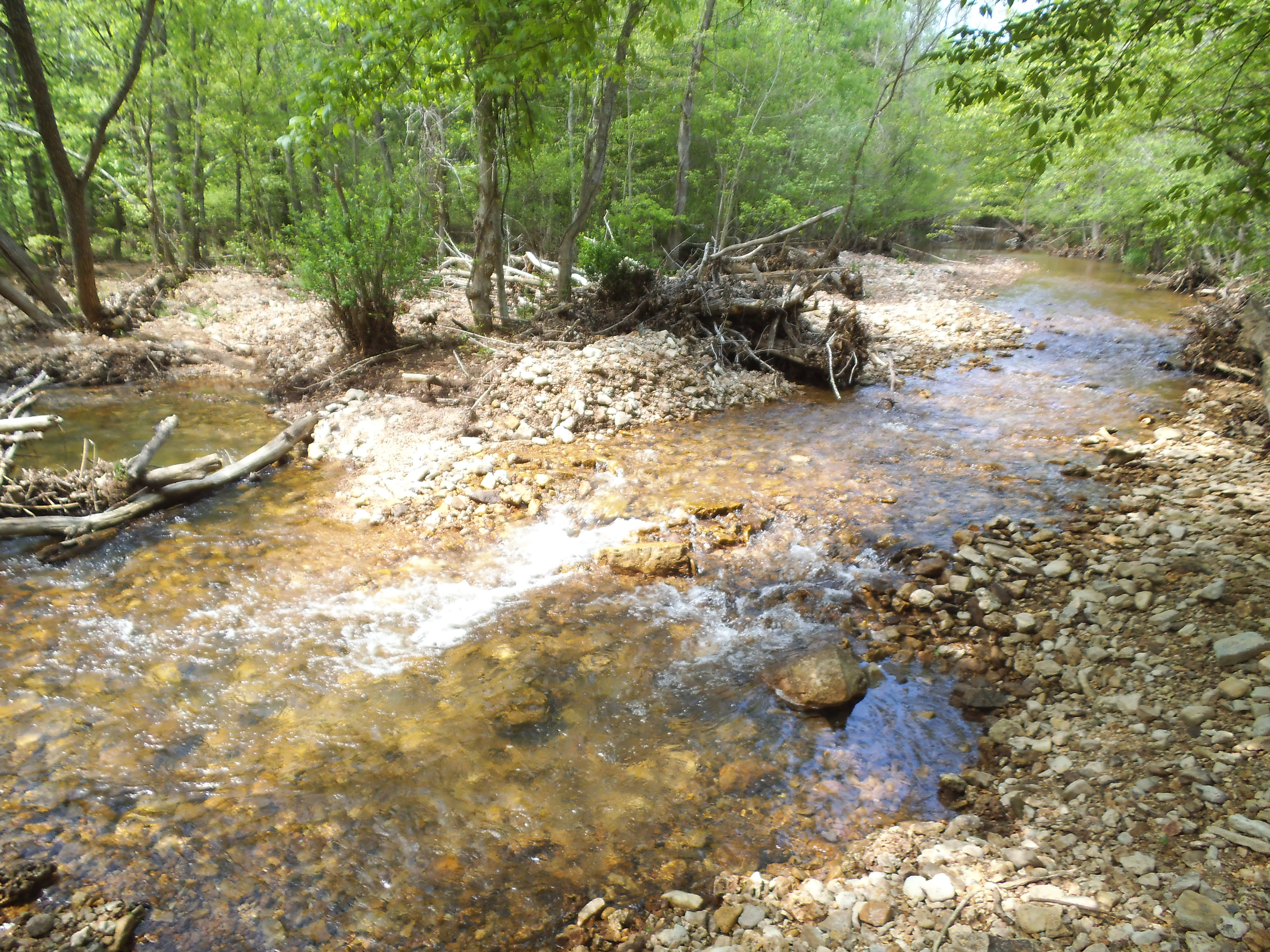 The trail starts out with a wooden bridge that crosses Coonville Creek, and then turns to the left and follows it northeast into the woods through the hollow. This first part of the trail pretty much stays on the same heading, going up and down the hills on your right, as it parallels the creek for just over a mile.

Along this path, Coonville Creek snakes away and then back to the trail a couple of times, allowing for scenic moments to stop and look down from the slightly elevated bluffs, or along the large-pebbled banks that the trail takes you over. At one point it turns slightly to the right and takes a bit of a steep incline up to a glade that allows for views of the hills on the west side of the hollow. It eventually returns to the creek bottom, and the gurgling and splashing of the playful water is a welcome auditory companion as you head toward the creek crossing at the farthest point it takes you into the woods.

When you do get to the crossing, take a few moments to look up the creek to the waterfall just to your right. There is a little muddy spur trail on the other side that will take you to it, despite the best efforts of a small wooden roadblock. Sitting on the rocks next to the waterfall, as you watch the water spread out and flow over the stone that makes up the cascading steps down, is the perfect spot to stop and have a snack and a take a rest. This would be my ideal place for a backpacking campsite, if I had the authority. To spend the night just up the rise from the moving water would make for a wonderful backpacking experience, in my opinion.
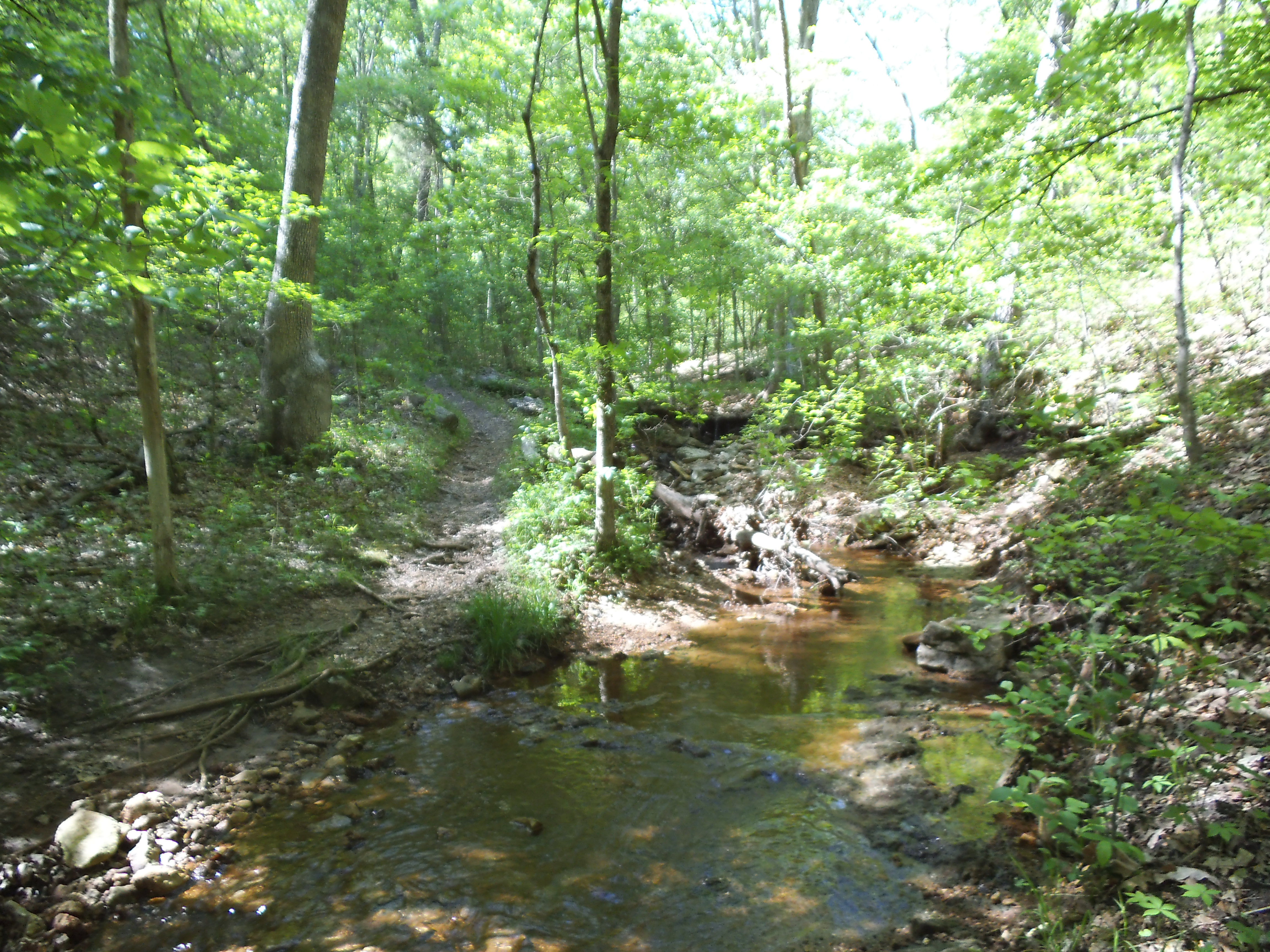 So after you return to the trail from your snack break, it turns back toward the direction of the picnic area, but you still have over a mile and a half to get back. It comes up out of the creek bottom and starts to head up into the hills toward 67. You have a couple of climbs and a few creek crossings, including what is probably the steepest part of the trail, before it makes it’s way through a recently cleared glade that has some really interesting looking plant life. Take some time to observe the contrasting environments you are hiking through, the hardwoods and the glades, just before you start through a more cedar rich forest that eventually takes you back to the creek and out to the picnic area.
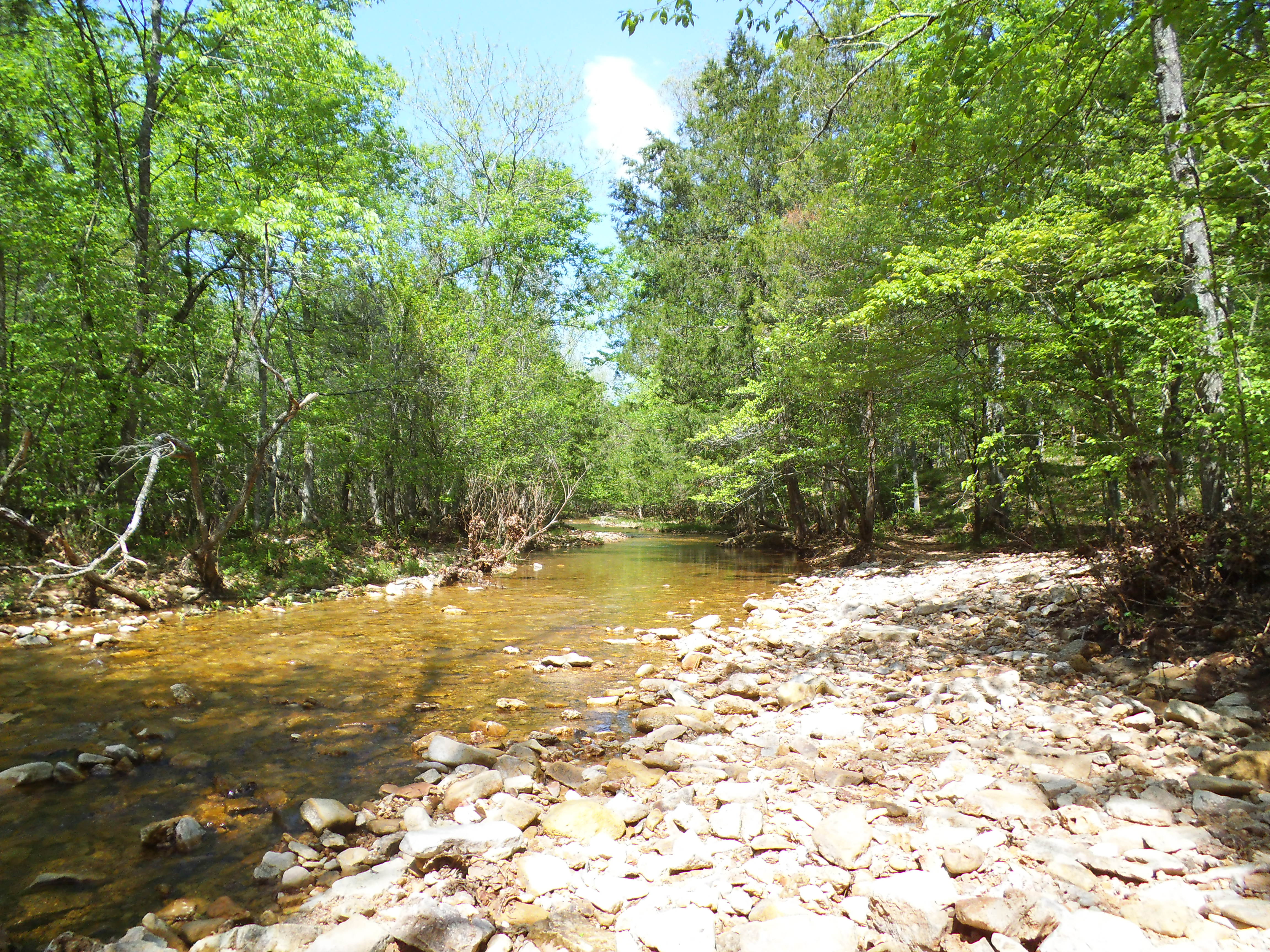 Why I like this trail:
Like I said, this is probably my favorite trail to hike. It is just under three miles so it is just right for a good family hike, and there is a lot to see. From the hardwood trees to the cedar creek bottoms to the warm sunny glades to exposed boulders dotting the hillsides with vegetation popping from their soiled crevices, it is exemplary of the diversity within Missouri forests.
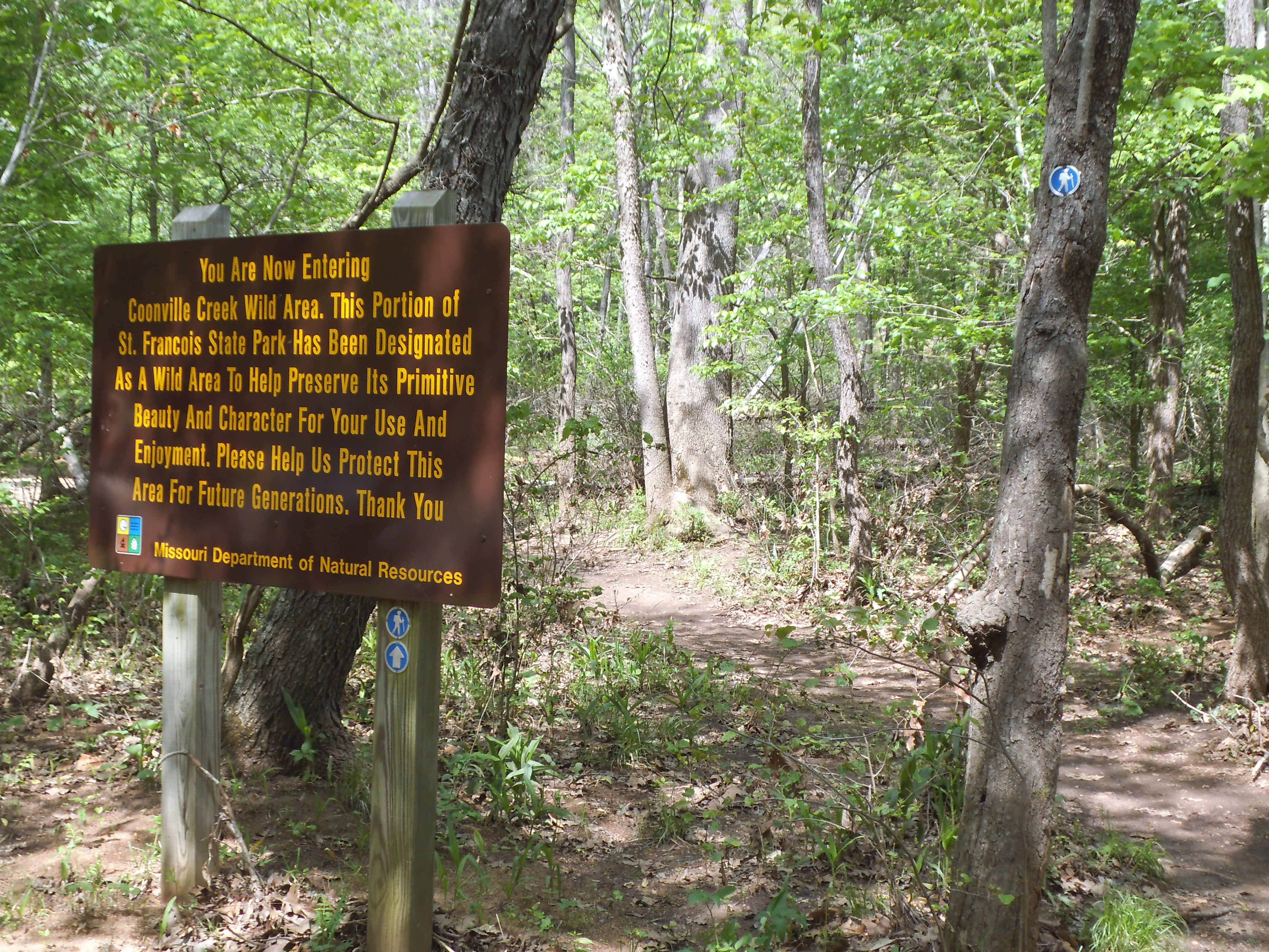 The cultural history is something to be learned of as well. Along with it’s connections to the Civil War through the families that lived in the area at the time, Mooner’s Hollow is named after the distilling operations that used to take place in the the forest along this clear water creek, back in the days of the moonshiners.
It is relatively close to home. I can make it to the trailhead from my front door in 45 minutes, given ideal conditions. I know this because I hike it enough, and it never seems to be too far of a drive if I haven’t been there in a couple months.
 What you need to know:
I wouldn’t consider this trail difficult by any means, but along with creek crossings, it does have some areas that tend to hold the rain water and create some muddy spots, so dress your feet appropriately.
There is also one hill on the way back that can be a bit of a workout, if you take the trail counter-clockwise like I do. I call this “the bad part”. Take your time and appreciate the almost panicked feeling of life within your lungs and legs.
As cool as I think they look, there are some spots along the trail that are home to a bunch of exposed roots. Step carefully to avoid tripping or getting a twisted ankle.
 I can’t emphasize how much I personally love this trail. At the risk of getting overly dramatic, there is a magical life energy that flows through the hollow and within Coonville Creek, at least from my experience with it. I have hiked it in the punishing humidity of summer, when it has been covered with ice and mud, and everywhere in between, and even in the extremes of our seasons here in the midwest I still enjoy every minute on this trail. If you haven’t been there, you need to check it out. This is definitely a place to be preserved and kept safe so that everyone gets a chance to experience it. The Mooner’s Hollow Trail, without a doubt the best trail close to home.

Getting ready to head out for the weekend into the forest. Going to shed the shingled roof above and adopt a home of nylon. The floor at dinner will be a dirt one, and the days activities will be lit by the sun. So what do I need to bring?
 When I was a younger man, all I really needed was a sleeping bag, a flashlight, a pack of hot dogs, something to start a fire, and something to drink. Not so anymore. I have learned that there are luxuries worth bringing. I know there is a lot of essential gear, but I thought that I would point out some of the stuff that may not be so essential, but is very welcome. This is some of the stuff that I bring with me these days. Still roughin’ it, but with a level of comfortability.
The handful of things that have changed the way I camp (for the better as far as I’m concerned.) are as follows. Don’t be afraid to call me “Old”, I’m happier having this stuff with me.
 First of all, get a couple of big plastic totes. And then get a few medium sized ones. I have two that I always bring, one of which contains all my kitchen stuff (plates, plasticwear, cooking implements, etc.), and the other which has most of my other possibly-needed gear and items (bug spray, sunblock, a hammer, etc.). Plus, the lid of a tote is awesome for fanning a stubborn fire. The smaller ones are for when you need a place to put extra stuff you’re bringing, or for taking up less room in your vehicle when you realize you can’t fill the one of the big ones, on occasion. The amount of gear I bring varies widely between backpacking trips and campground trips. Thaaaat, and when we are bringing the kids, or it’s just her, me, and the dog.
Secondly, introduce yourself to an air mattress and an electric air pump. I don’t know how I did it when I was younger…all I would usually have was a cheap sleeping bag with a jacket for a pillow. Maybe it’s climate change…the ground is more dense than it used to be somehow? I don’t know, I just know that I can’t sleep right on the ground anymore. I guess that’s kinda snooty of me? Who cares, I want to get some rest!
 Thirdly, my big water jug with a faucet. Some people say that I am a bit of a germ-a-phobe, but I have no problem getting gritty and dirty out at a camp site. The thing I like is that after I’ve put that raw chicken on the grate over the coals, I can step over to the picnic table and wash my hands. Plus when you go to wash your dishes and pans, you don’t have to hunch over at some water spout next to some other guy’s site. That other guy doesn’t really like the looks of you anyway, so avoid conflict and use your own water source, you tattooed weirdo!
And a chair. It should take only one experience of sitting on a log or a rock or the ground to convince you of this. Nothing beats having a place to sit that isn’t jagged or moist, including when backpacking. You don’t have to buy the most expensive one…just buy one. And find yourself a light little backpacking chair too, if you do that sort of thing. It is a luxury worth carrying.
Another item is a decent propane stove. Now in the past, I used to eat a bag of melted chocolate donuts for breakfast, or maybe a box of Pop Tarts. “But Gabe, that stuff is quick!” I used to try to tell myself. Yeah, sure…but it’s crap too. I like to make some bacon and eggs and wrap it in a tortilla with some cheese for breakfast nowadays. It just makes for a better day overall. The problem with cooking a decent breakfast is waiting on the fire in the pit to be ready. A propane stove will change your life and get your day started two hours earlier, I promise. Get one. And always have a propane canister, plus a spare. Nothing ruins the saliva inducing bacon sizzle than it not being cooked properly. And everyone waiting on it will be mad at you. Don’t put yourself through that.
 So beyond that stuff, these are the lists that I made up a few years ago. I would print one of each of these out and then check them off as I packed up so that I wouldn’t forget anything. I stopped using the lists the past year and you know what? I always forget at least one thing every time now. And don’t be afraid to store some of this stuff in ziploc bags. I had a can of bug spray leak once and when I arrived at the site, the inside of the tote was in rough shape, albeit bug repellent.
My personal exhaustive lists are as follows, but are not limited to:
Main Gear:
Air Mattress
-Air Mattress Pump (Charged? Fresh Batteries?)
Bedding
-Sleeping Bag
-Blankets
-Pillows
Camera
Camp Chairs
Canopy
Clothesline
Dog Stake
Dog Ties
Fishing Equipment
-Cleaning Tools
-Rods
-Tackle Boxes
Flashlights
 Grocery Store Bags (you never know when you will need them, but they come in handy)
Hand Broom (for sweeping the dirt out of the tent and the wood chips and bark out of your vehicle)
Hammer
Hatchet
Ipod
-Headphones
Lighter
Lighter Fluid
Matches
Missouri Atlas (Or the atlas for wherever you are)
Multi-Tool
Newspaper (Bring a book for reading. This is for kindling)
Radio (And try to like country music…because you will most likely only be able to pick up a country station)
Saw
Tarp(s) (They can come in really handy for other things, but I always have one to put under the tent. It’s a lot easier to spray off a tarp with the hose than it is to spray off the bottom of a tent)
Tent(s)
Toilet Paper (‘Cause you never know…)
Trash Bags
Umbrella
Water Jug
Ziploc Bags
-Gallon
-Sandwich
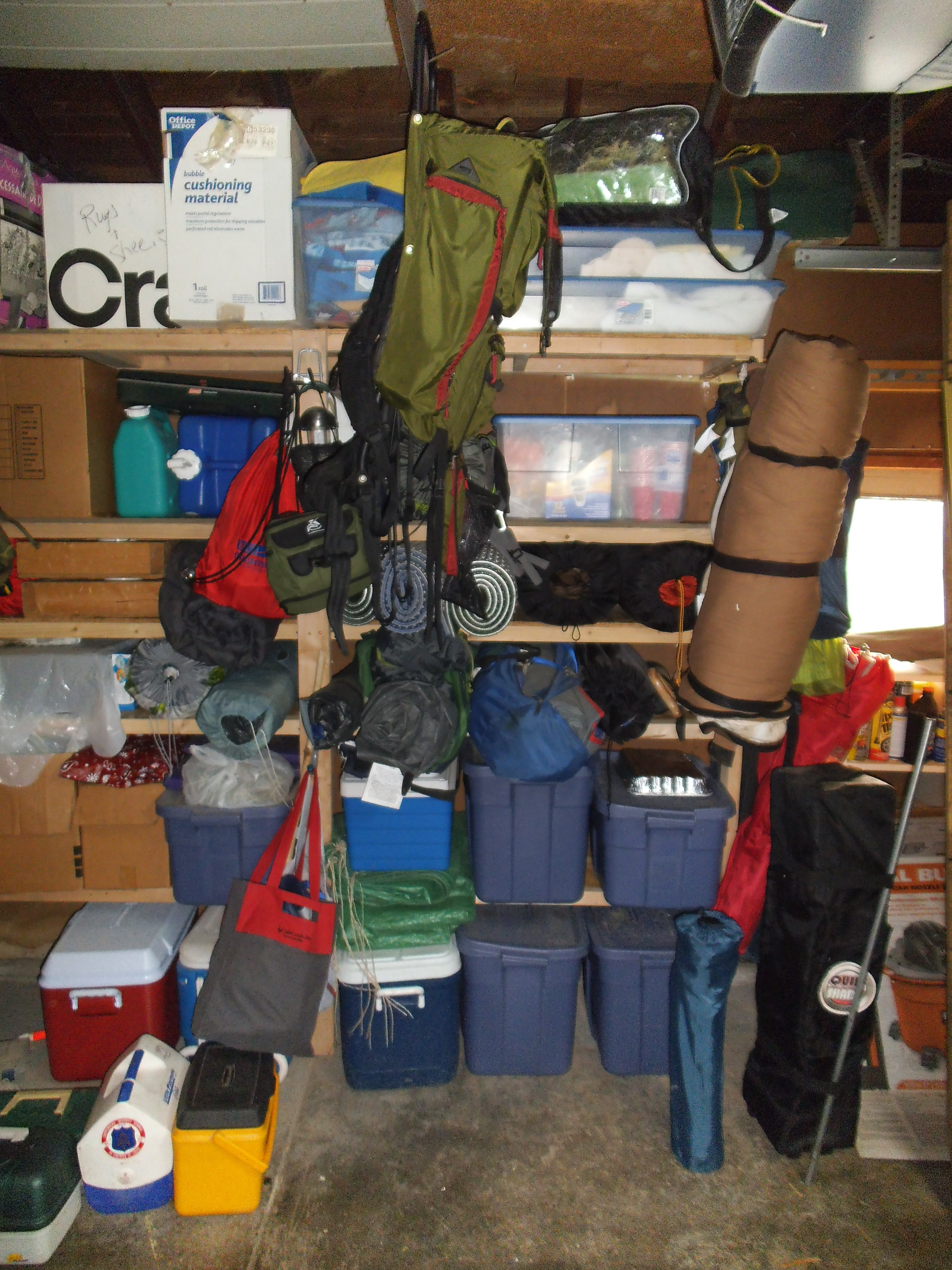 Toiletries/Medical:
Alka-Seltzer
Body Wash
Bug Deterrent (Incense, Candles)
Bug Spray
Contact Lens Case (If you are blind like me and wear contacts)
Contact Lens Solution
Deodorant
First Aid Kit (Do some research and either put one together or buy one. I have a couple for different purposes.)
Glasses (In case you lose a contact. That is my reoccurring nightmare…losing a contact and then having to drive two hours home through a blur of movement.)
Hand Soap (Two words: Raw Chicken.)
Hand Wipes (Crap, I forgot the hand soap!)
Ibuprofen (The cure-all for us older people.)
Laundry Bag (By the end of a trip I will usually have one empty cooler. That’s where my stinky clothes ride on the voyage home.)
Shampoo
Soap
Sunblock
Toothbrushes
Toothpaste
Towels
 Cooking Supplies:
Camp Stove
-Fuel (Propane Canister, White Gas, Etc.)
Can Holder (They are referred to sometimes as pan or pot handles. They also work great for cans of beans, stew, whatever you are cooking in a can over the fire.)
Can Opener (Heh heh heh…don’t bring any canned food without one.)
Coffee Cups
Coffee Pot (I have an aluminum percolator that goes on the stove first thing every morning. Best coffee in the world!)
Cups
Dish Soap
-Sponge (Buy a multi-pack. These can get gross after a few trips)
Foil (Heavy duty, unless you want to get yelled at again!)
Forks
Knives
Paper Plates (And get the sturdy kind…I can’t stand a flimsy plate of beans.)
Paper Towels
Pot Holders
Sharp Knife (Or knives. I like to keep a couple steak knives in the tote, beyond just my pocket knife.)
Skillet
Spatula
Spoons
Table Cloth
-Thumbtacks
Tongs
Wet Wipes
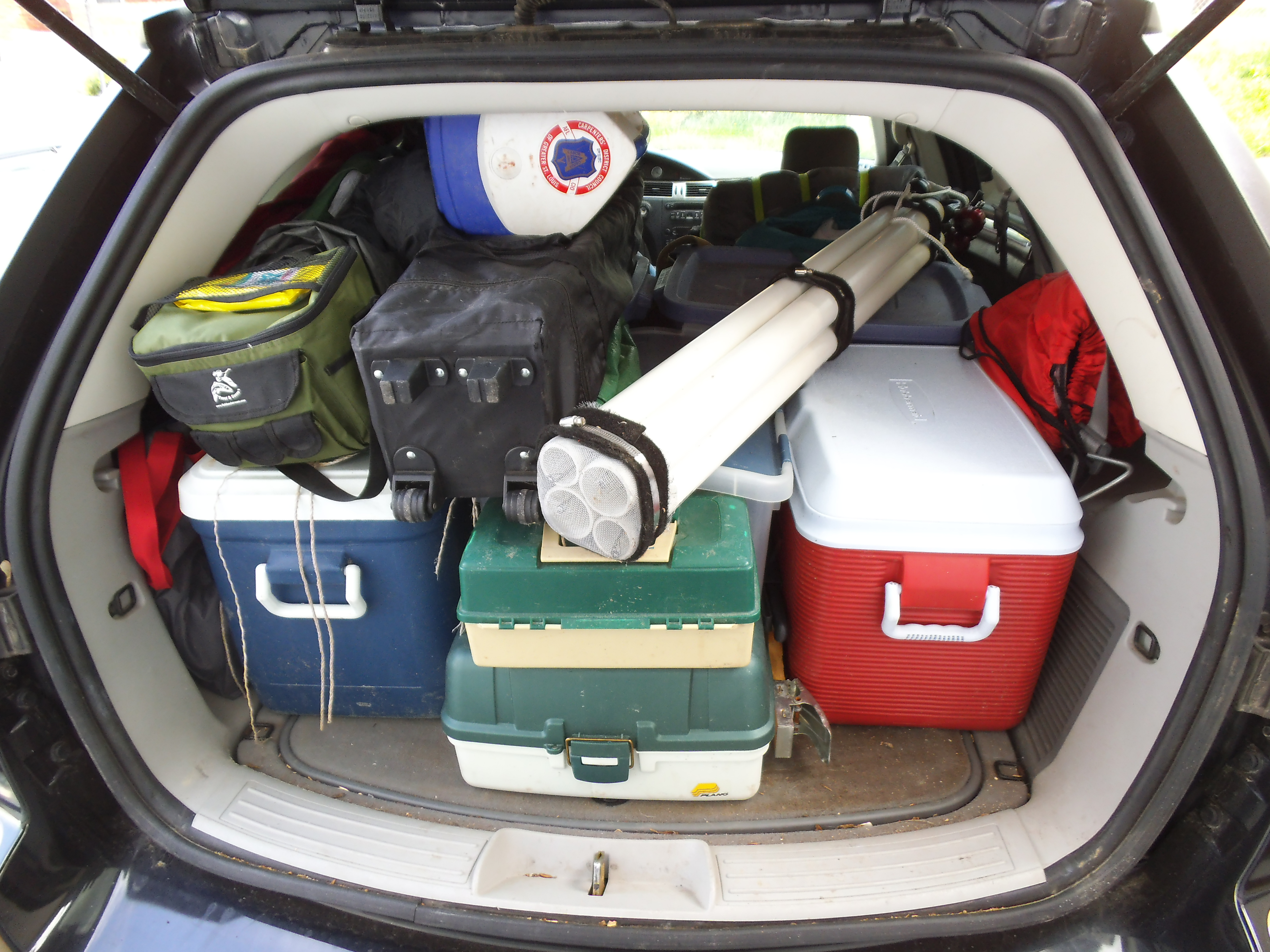 There are a million other things that can be needed, some of them trip specific, and I encourage you to let me know what you would add. For the most part, anytime I am camping at a campground, I will have all this stuff with me. I don’t always need everything, but it’s better to have it just in case. But don’t worry, you WILL forget something. Sometimes it can be a lot of fun playing the “What did I forget this time?” game as you drive down the road to the woods. But it’s all part of the adventure. Have a great weekend, everybody!
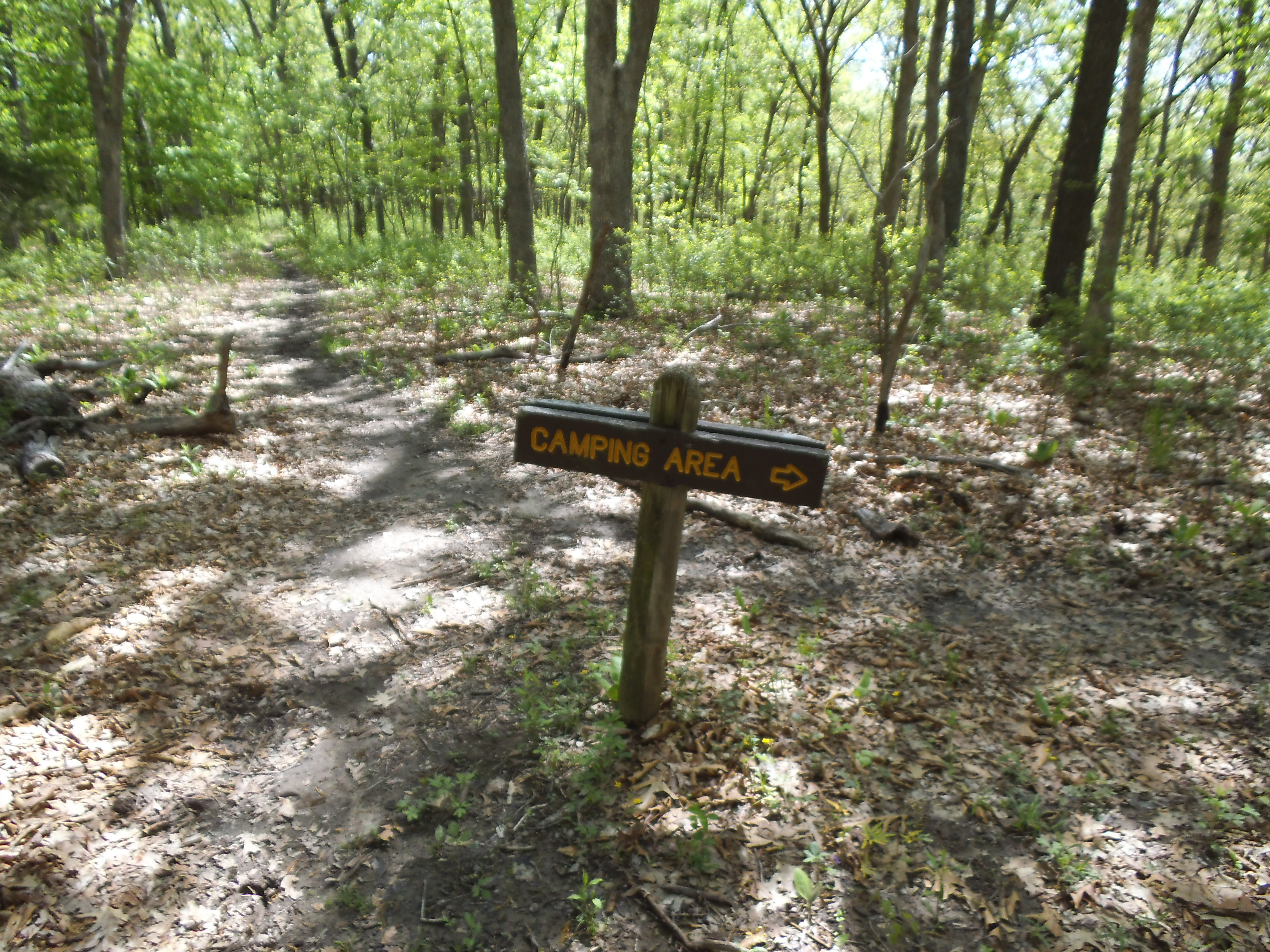 So it has been a couple months or so since I started this, and as I have been writing and taking pictures and writing and sharing, I have been struggling with the term “Blog”. I can’t really put my finger on it. Blog. Not particularly irritating or uninteresting, regardless of it’s similarity to Blah. I just don’t like the term and I think it is because of MY view of what I believe it implies and invokes.
Now, the common definition after an instantaneous google search comes up as:
“Blog”
“Noun: A web site on which an individual or group of users record opinions, information, etc. on a regular basis. Verb: Add new material to or regularly update a blog.”
That is exactly what this really is. It is a record of experiences…on a web site…that I regularly update.
I spend a night in the woods. I take Max (the hiking dog) out to a trail to exercise and explore for a couple hours. It’s stuff that I would normally do, only these days with this Blog, I just take more pictures than I might usually and really try to put some thought to what there is to know about the setting of the latest excursion. I type up a description, try to add some personal elements to it, throw in some pictures, and then post it to share it with all of you. It is a web site…that is a record of opinions, information, etc…and I regularly update it.
It is a Blog.
And then I ask a friend “Hey, have you checked out my Blog?”
And they cringe.
“Yeah, I checked it out a couple weeks ago.”
“OH, so then you haven’t seen the latest post?”
Of course I haven’t seen the latest post. I care about the things in your life, but I don’t spend my time keeping track of it as you share it on the internet. You have a lot of free time to go hiking and camping and be on the computer. Why don’t you just tell me NOW about the last trail you hiked?
“…no…I haven’t seen your latest post.”
 This isn’t really the typical response, but it is how it goes in my head. For some reason it seems to me that there is a negative stigma among the people about blogs, at least from my kiddie pool perspective. And that negative stigma seems to manifest itself in the facial expressions of people that I have just asked “Hey, have you checked out my blog?”
So is this really what happens or am I just nuts?
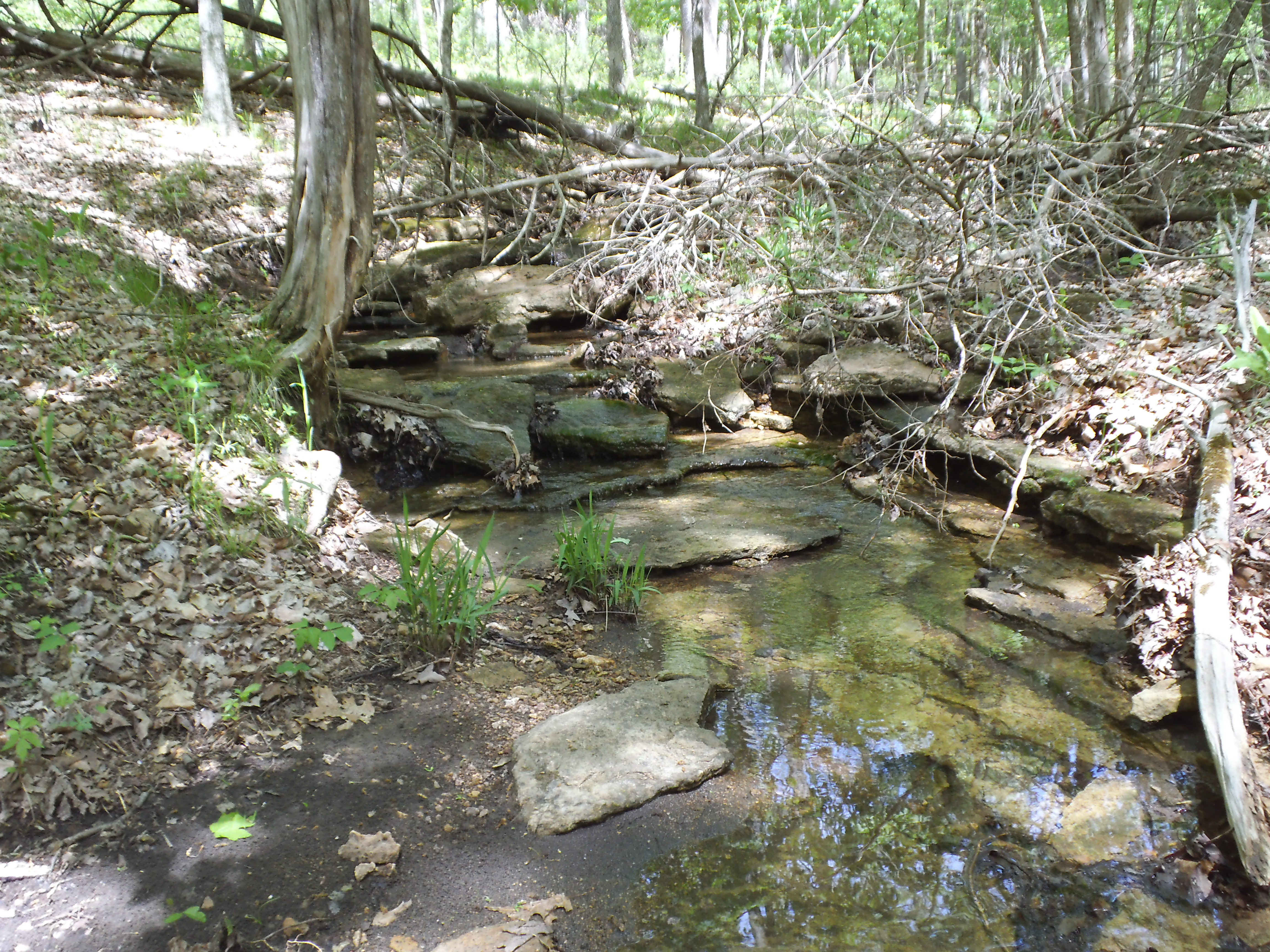 Maybe I have answered my own question, at least in the context of the situation above. This theoretical conversation would have happened with a person, more likely than not, in my life already. If I am personally somewhere with YOU, YOU probably have a lot bigger window into who I am already and what is going on with me these days than the average “Blog Reader”. You, my friend, are getting the news direct from the source than from some outdoors websi…er, blog. So can I even determine value of what I write and share from the responses of friends? There are two answers to that, and they are “yes” and “probably not”. Of course I value the opinions of my friends and am open to positive reinforcement and criticism. I welcome you wonderful people with your wonderful ideas! BUT…I have actually avoided bringing the blog up because I am sheepish about making a casual conversation on a patio over a couple of beers about my egotistical self. So in this instance, I don’t WANT to count on friends. I love you all and I will bring up the blog on occasion, but if you let me go off on a tangent I’m just going to cause you to avoid hurting my feelings. And I don’t want that. “Here, have another beer…you look thirsty. So let me tell ya about my (air quotes) outdoors website…”
 So then does it have value for somebody? That’s the real question. And then to further THAT question, does it have value for somebody other than myself? I know what I get out of this. For me, the process of writing is a therapeutic and meditative experience. It is the taking of thoughts in my head and solidifying them in a way. It forces me to focus and be creative, and that is psychologically pleasurable for me. Making something. Projecting energy. Exercising my fingers as I hunt and peck (shoulda learned to type!!!).
Yeah, it obviously has value for me. As I have written things for myself that are NOT about the outdoors, I realized that if I want to discipline myself to regularly write, I ought to follow the idea of “write what you love”. And I love the outdoors. Through that, I have found that I enjoy documenting my time in nature and (at least) feel that sharing it holds the genuine value that I outwardly see in this endeavor. Maybe through my love of it and my enjoyment in writing, that something is created with a value that can be shared with others. My friends. YOU, ya “reader”.
 So maybe you can find, and possibly already have found, some value in it. I really hope you do. I really love being in the forest, and I think you should to. Our connection with nature is something that really is part of every aspect of our life cycle. The way in which we live. The way that we treat other living things. Fundamentally we are just animals that decided to come inside somewhere along the way. And I hope that at some point, something I have said will inspire somebody to get outside for a bit. Get your shoes dirty. Get some exercise. That’s the hope.
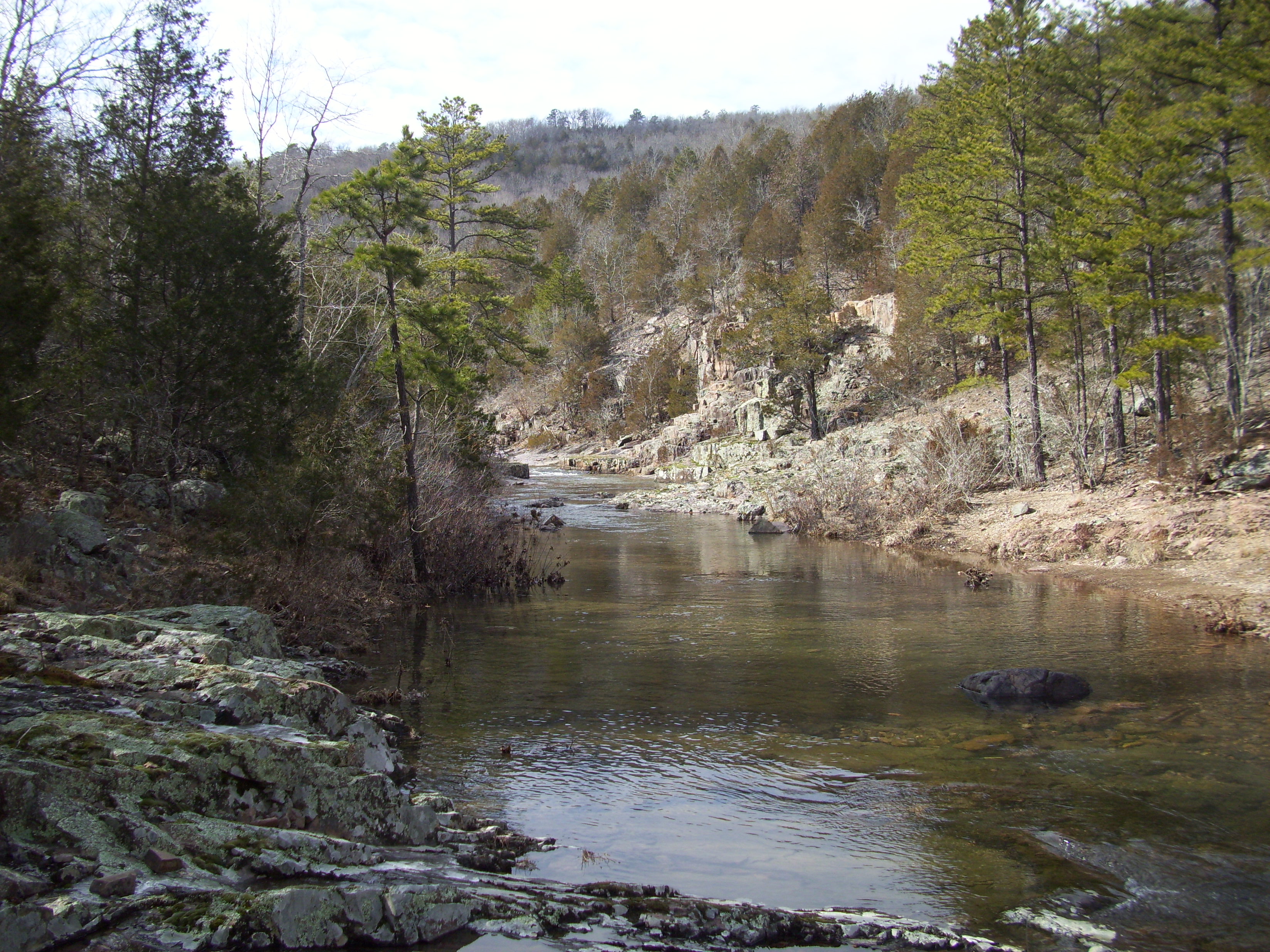
And as much as I will try to convince myself to refer to it as an “outdoor site”, it is a Blog. It isn’t the online catalog for anything. It isn’t an officially sanctioned website for information. It’s just me and my dog, and sometimes family and friends, getting out into the forest and taking a few more pictures than I normally would and then writing about where we went and putting it on here. It’s a Blog.
And I hope that you find value in it. I tell you one thing…it’s an odd thrill when you get a Facebook notification that your Mom likes your Blog’s Facebook page. That made me grin.
And be warned, that if you are ever out in the forest with me and I’m taking pictures, you can expect to see yourself up on here eventually.
So give me a smile, ya stinky, sweaty, outdoorsy-person. Thanks for reading!
|
|
 It had been a disappointing weekend of attempting to camp with adversity, so after the rain had finally stopped and I had a day to be alone, I felt the need to take the dog out somewhere and spend a little time in the woods. I decided to check out another trail at Greensfelder Park. This time it was going to be the Deer Run Trail.
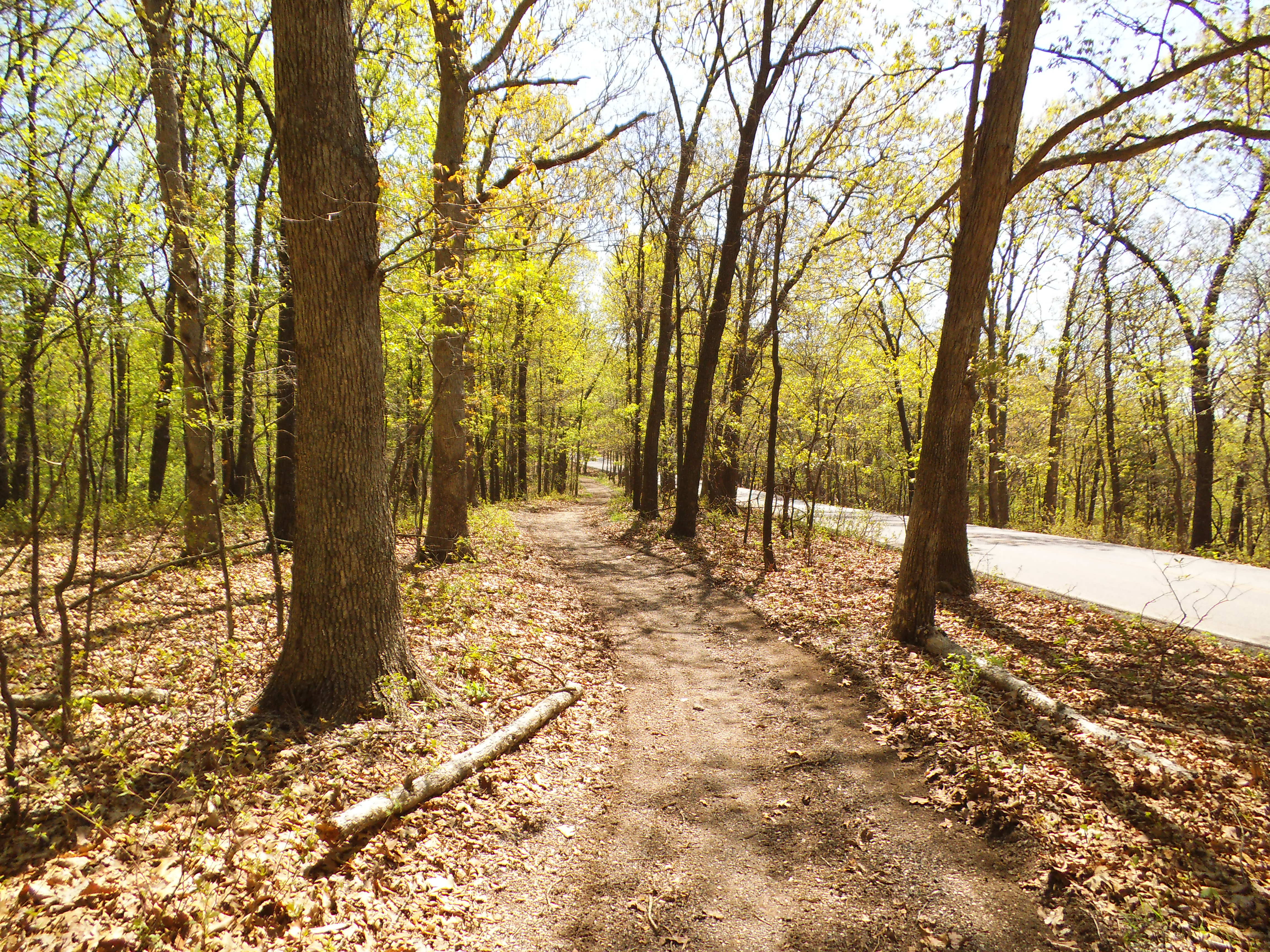
Now the Deer Run Trail isn’t as long as the Eagle Valley Trail, and I found myself a little confused about halfway into the hike when they join up together in the valley. It turns out that the Deer Run Trail crosses it, but I had seen a map online that shows it following the Eagle Valley Trail back out. Either way, they both start at the same parking lot, and I’m sure I will get another chance to explore it and finish it correctly. There is just something mystical about that valley with the stream running through it that can compound the distraction of a person with a lot of weight on his mind.

From the trail head, it goes to the right and follows the road pretty consistently, even after it turns left at the road that runs through the park and follows that along the ridge and down a bit. It then breaks off and switches back and forth a couple times down the hill and away from the road. Following the hill, it turns to the left slightly and then bears down toward the valley, through a bit of rocky trail, and then switches back until you are at the valley floor. This is where it hits the Eagle Valley Trail. As I look at the pictures I took, you can see that it either crosses or turns to the left. This is where I just decided to turn right and head back to the parking lot along the trail that my inattentive self had assumed was the right path. I had a lot on my mind this week…
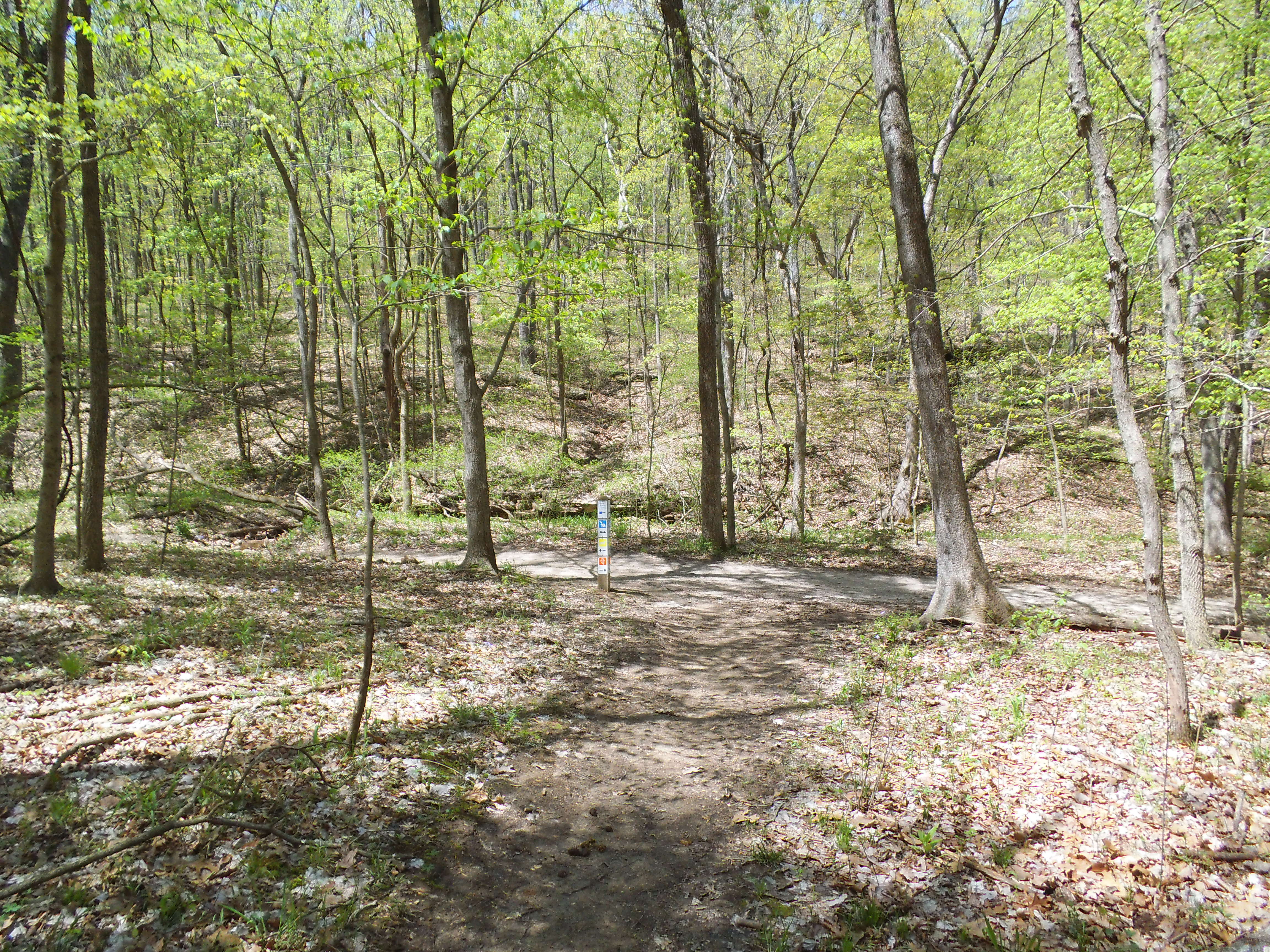
How to get there:
It’s probably 20-30 minutes from 44/270. Take highway 44 west to the Six Flags/Allenton exit #261, make a right towards the Six Flags entrance, and follow the road that goes around the left side of Six Flags. As you head into the park you will pass a couple of trail-head parking lots and the entrance for the park loop road. A little further on your right you will come to the visitor’s center and you want to turn into this parking lot. At the far end on the right is the trail-head for the Eagle Valley and Deer Run Trails.
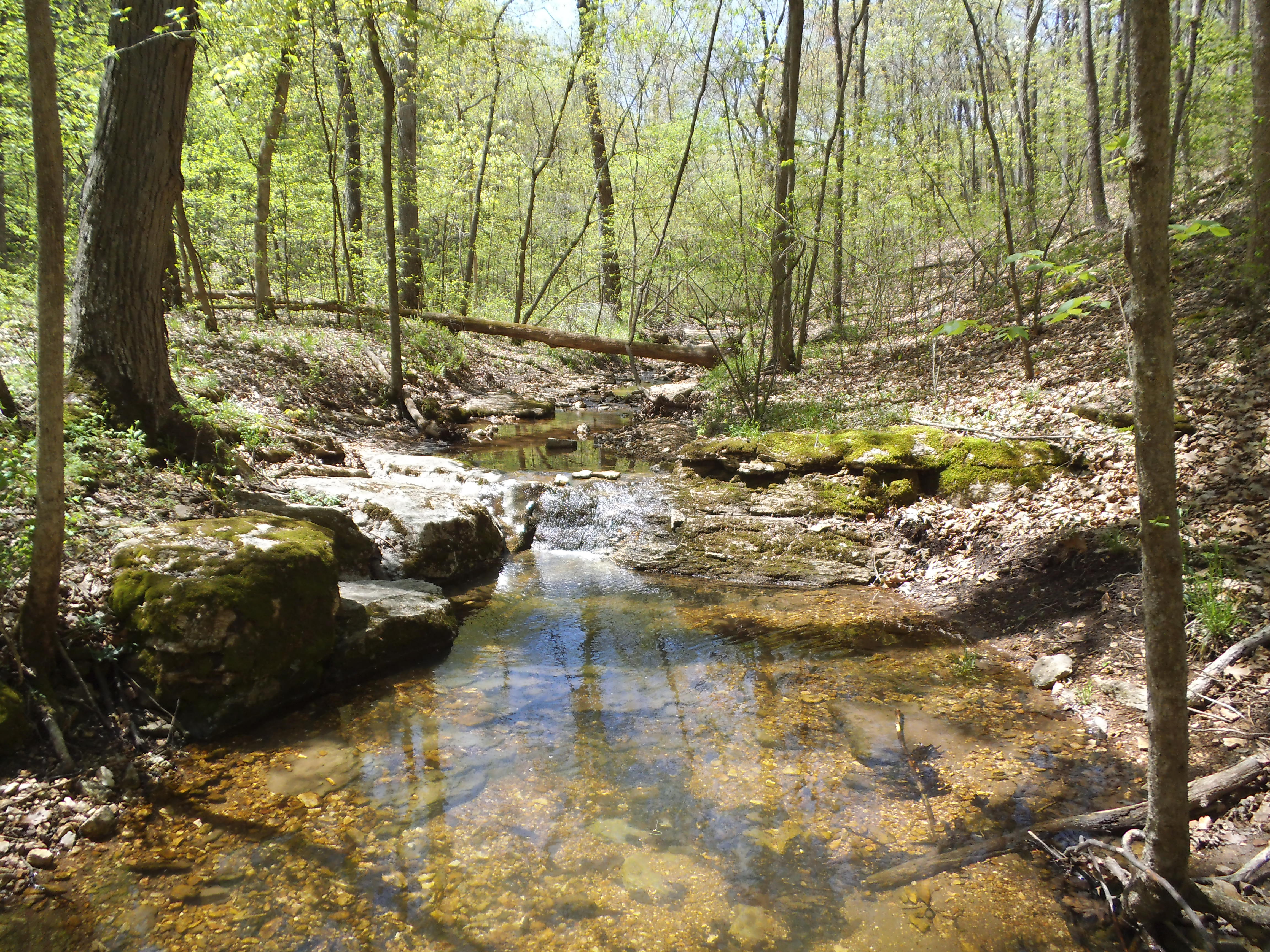
What I like about this trail:
It isn’t too long, and it heads through what has become some of my favorite woods in the St. Louis area.
Almost every time I hike through Greensfelder I see a couple of deer. Sure, they are a ways off down the hill, but it is always neat to see. There is a lot of wildlife in this area.
What you need to know:
There were some spots on the upper part of the trail that had some decent mud that was plowed through by horse hooves, so you will encounter some spots that require walking alongside the trail. The fortunate thing is that others have done this too and there is an established path alongside. One for horses, one for hikers?
Pay attention, as online maps and a distracted mind might change your direction and you will find yourself on a different path. I should have just followed the signposts right in front of me at each intersection, instead of absentmindedly following what I thought I knew to be correct.
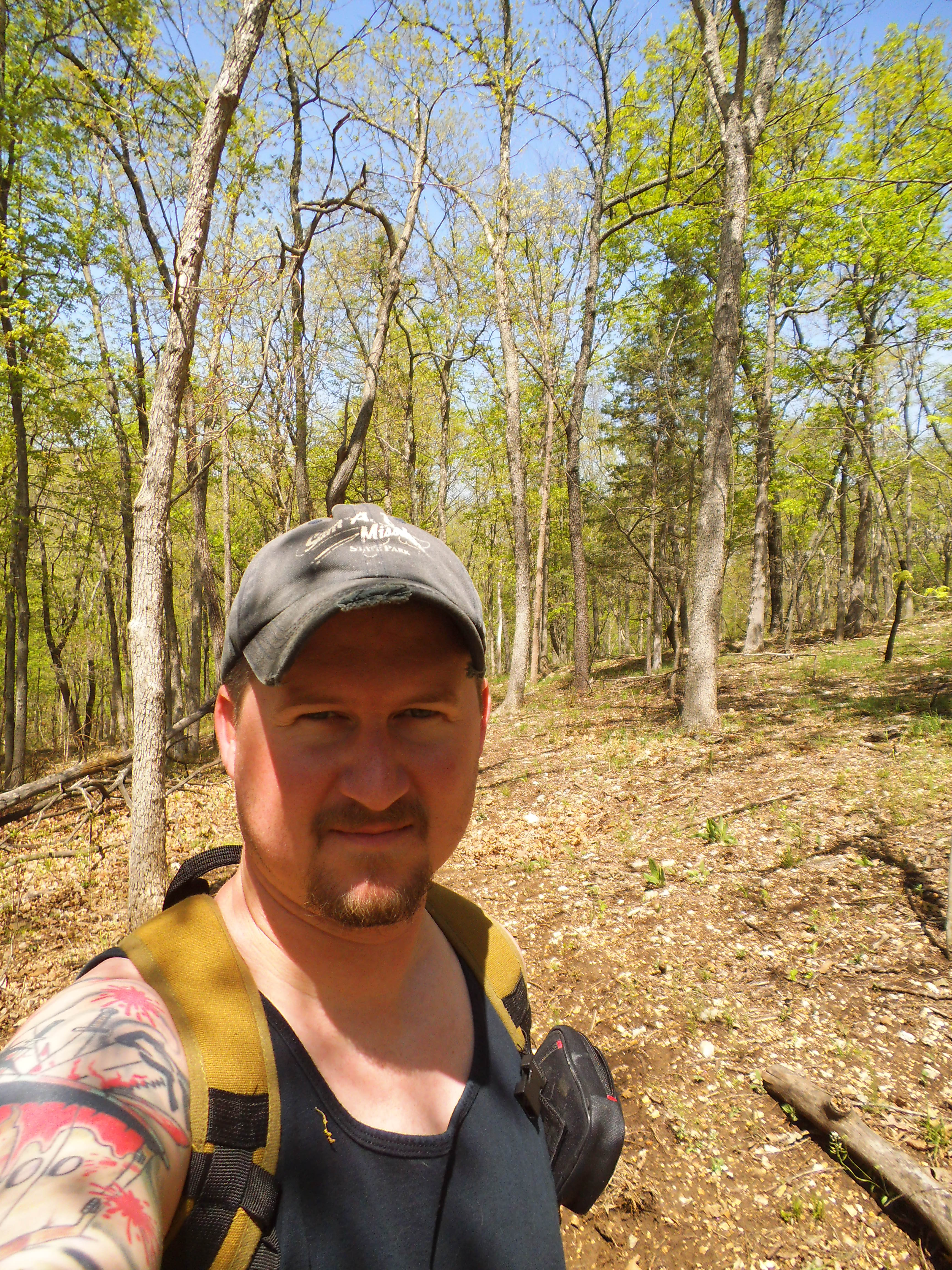
I will hike this one again sometime this year and get a better impression of it. I like to go to the woods to spend time away from the stresses of life, but it isn’t always that simple to shake them from one’s mind. Maybe I just needed to find a longer trail.
