
Through the Hills to the Lake! Marble Creek Section of the Ozark Trail 3/14/2015
 It was just about 9 am on a late winter Saturday morning as I was pulling into the parking lot at Crane Lake Recreation Area. The day before had been a nonstop drizzle, and it was still sprinkling a bit as I parked and met up with the hikers from the “Let’s Hike” Meetup group that would be joining me today. We were going to check out the Marble Creek Section of the Ozark Trail and we all were excited about the trip, but looked to the sky in the hopes that the clouds would part and that our 9 mile hike was going to be only slightly muddy and sloppy. Consolidating cars, we left two in the parking lot for shuttles at the end, and then headed over to Marble Creek Recreation Area to start our day’s adventure. I was pretty excited!
 How to get there:
To Crane Lake Recreation Area, take Interstate 55 south about 22 miles to exit 174B which is US-67 south toward Bonne Terre/Farmington. Stay on US-67 south, all the way to MO-E just south of Fredericktown. Turn right (west) on MO-E and take that about 19 miles to County Road 124, on the left side of the road very soon AFTER County Road 134. Make a left (the only option) onto County Road 124, and take that about three miles to County Road 131. Make a left onto County Road 131, and after about two miles it ends in the Crane Lake Recreation Area.
To Marble Creek Recreation Area, take Interstate 55 south about 22 miles to exit 174B which is US-67 south toward Bonne Terre/Farmington. Stay on US-67 south, all the way to MO-E just south of Fredericktown. Turn right (west) on MO-E and take it about 15 miles. It will eventually be on your right with a clear and visible entrance sign. The trailhead at Marble Creek is just across E from the entrance parking lot. Look for the Ozark Trail “OT” blaze to know which way to go.
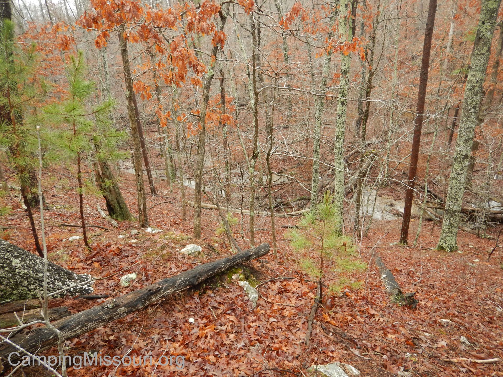 It starts out with a slow and steady ascent up into the hills and along a ridge for quite a bit, cutting down into a slight ravine, and then back up and across a forest road with a small pond next to it at about 2.5 miles. It then spends the next couple miles going through a series of minor elevation changes, follows an old jeep trail for a while, and then down into a deeper ravine which almost immediately starts to climb up another very tall hillside to a ridge. Passing through a hilltop glade, it then goes back down steeply into a lower forest and winds along through another section of slight up and down topography.
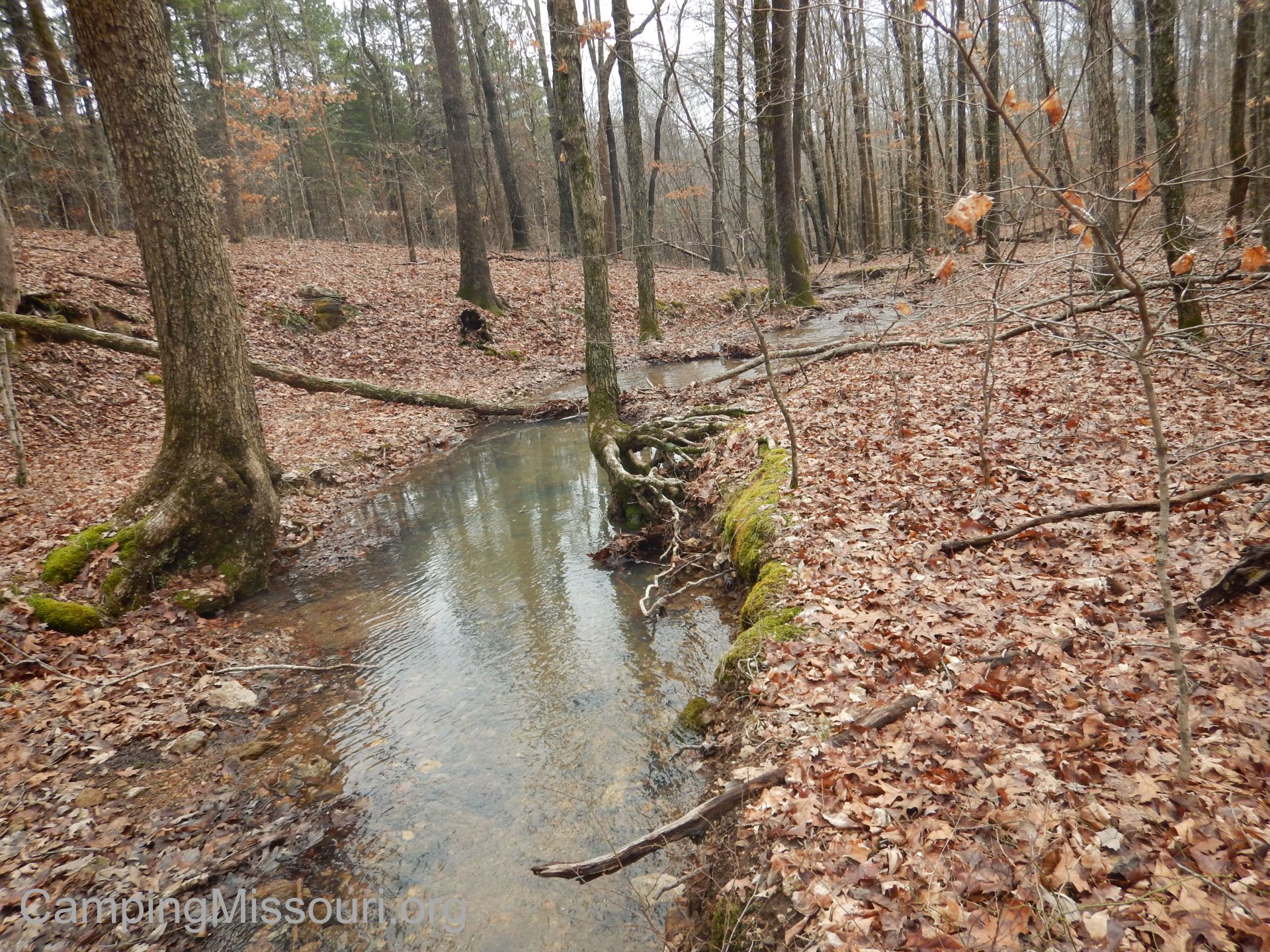 At about the six mile point it then descends into a creek bottom where you end up having to cross a wide creek, make a left, and then head along the bottoms to the southern Crane Lake loop. When you reach the intersection at the Crane Lake loop, going forward will take you to another water crossing and northward around the western side of Crane Lake. Making a right at the intersection will take you northward on the east side along the outflow from the lake, a powerful and impressive display of determined ozark water, and then sharply up the hill to a glade above the dam. It is then another mile of ducking in and out of the woods next to the lake as you make your way to the parking lot at Crane Lake Recreation Area.
 Why I like this trail:
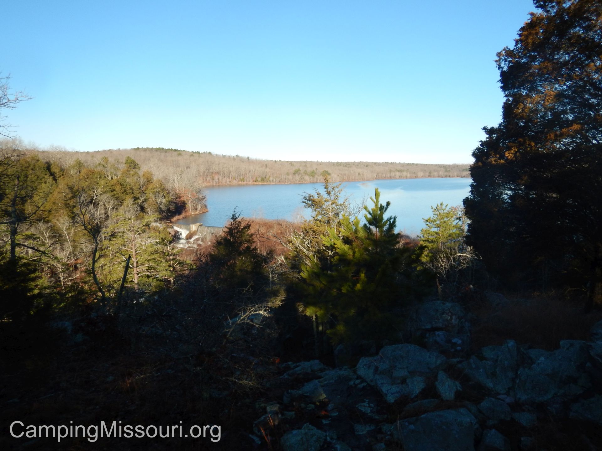
It is a very pretty section of woods, and a great example of eastern Missouri forests. Traveling along ridges dotted by the natural sensibilities of upper hardwood stands, through wet weather bottoms with all their deep and moist charm, to the occasional glade with its sandy warmth and exposed rock, you get a great look at the diversity of life that dwells in the hills throughout the St. Francois Mountain Range. And then there is the beauty of Crane Lake itself. You can hear the rushing of the water out of the spillway as you get closer to the dam, and then when you climb that steep hill to the glade above it, it is a profound natural emergence to be witness to the pristine glass surface of Crane Lake, from the backwoods that you just spent the past few hours traveling through. I think starting at Marble Creek to end up at the lake is the perfect way to save the best for last.
 We were lucky enough to get to see the trail just after a full day and a half of rain, and the liveliness of the waterways on it was a really neat experience to have. Certainly our boots were wet at the end, but it was a unique experience getting to see and hear so much fluid movement on our hike.
As far as I am aware, this trail is adopted and maintained by the great people over at the St. Louis Adventure Group “SLAG”. You can tell that they do an excellent job of it, keeping the path in good condition and clear of debris. Thank you to all their members that spend the hours of hard work keeping such a great section of trail in top shape so that enthusiasts like myself can have an enjoyable hike.
 What you need to know:
As we were lucky enough to get to hike the trail with all the water flowing from the recent rain, this was a feature that all hikers need to be prepared for, at least mentally. There were quite a few water crossings, most of which were just wide enough to hop over, albeit sometimes from rock to log to rock. I’m sure in the drier months it is even less of an obstacle, but the creek near the lake caused us all to actually have to remove our socks and shoes and cross barefoot, as it was just too wide to jump. Expect water to stand in your way at times.
 9 miles is pretty good for a long day hike in my experience. You can also overnight backpack this as it is part of the Ozark Trail. Whatever timeline you choose, know what you’re getting into. Work up to it if you are used to hikes that are just a few miles, and be prepared to stop and eat something for lunch so that you have continuous energy to get you to the end.

I took this the next morning, near the dam.
Make sure to take a map with you. The trail is pretty well marked, but there are road crossings and intersections that could be confusing if you don’t know where to go. And remember that this is a point to point trail, so you will need to have a vehicle at the end to get you back to the starting point, if you aren’t planning on hiking another 9 miles back.
 It has been a while since I have hiked that far in one day, and I have to say that I was very satisfied with the time it took and the things I got to see. Thank you to the enthusiastic and good-natured companions that hiked with me on this adventure. It made it so much better being able to share it with you. Of all there is on this trail, Crane Lake especially is a very picturesque place, and to see its spillway swollen with the water from a soaking rain the day and night before, rolling over the lip of the dam and down through the rocks below was almost as magical to witness in person as it was powerful. Can’t wait to visit it again soon!

Hi thanks for sharing thiss